Day 15 - Ait Ibriren (Dades Gorge) / Marrakech
Journal Notes
General
The last stage of a journey through southern Morocco crosses the High Atlas, leaving the upper Dadès valley and descending to Marrakesh. The valley belongs to the Tinghir province in the region of Drâa-Tafilalet; the destination is a prefecture of its own within the region of Marrakesh-Safi, and the two are joined by a single great road over the mountains, the Tizi n’Tichka. The pass links the semi-arid south east, and with it Ouarzazate and the routes to the Sahara, with the fertile plains on the Atlantic side of the range, and it lies above the wide Marrakesh plain. The modern road, part of National Route 9, follows the line of the old caravan trail over the mountains. The distance is deceptive: the city lies only a few hours from the mountains, yet climate, vegetation and architecture change completely on the two sides of the pass.
Marrakesh, or Marrakech, is the fourth largest city in Morocco and one of the country’s four imperial cities, alongside Meknès, Fès and Rabat. It covers 230 square kilometres at an altitude of about 450 metres, and the 2024 census recorded 996,643 inhabitants in the city, 1,255,265 in the urban area and roughly 1.56 million in the wider agglomeration. The city owes its nickname, the red or ochre city, to the colour of the earth used for most of its buildings, and it has been called Bahja, the beautiful, for the warmth of its welcome. Tourism is the mainstay of its economy: its airport, Marrakesh-Ménara, is the second busiest in the country, and in 2019 the city received close to three million visitors.
The two ends of the route differ sharply. The south east, around the Dadès valley, is dry mountain country of terraced fields, earthen villages and spring-fed oases, where Central Atlas Tamazight is the everyday language. The north side opens onto the Haouz, the alluvial plain that lies between the High Atlas and the small Jbilet massif and is drained by the Tensift. The word haouz means an enclosure, and by extension the back country that belongs to a capital city; every Moroccan city once had one, but only the plain of Marrakesh has kept the name. The plain is irrigated from the Tensift and its tributaries and from the groundwater beneath it, and under the protectorate it was turned towards citrus growing and market gardening. Between the two worlds lies the mountain barrier, crossed in a few hours of driving but a world away in way of life.
History
The route over the Atlas is old. In 1058 the Almoravids crossed the mountains and took Aghmat, a prosperous trading town at the foot of the range, and made it their capital before moving to the plain. Marrakesh was founded in 1070, the work begun on the site chosen by Abu Bakr ibn Umar and continued under Yusuf ibn Tashfin, who reigned from about 1061 until 1106; historical sources give dates between 1062 and 1078, and modern historians usually settle on 1070. From this base the Almoravids built an empire that reached across the western Maghreb and into al-Andalus, and Marrakesh remained its capital until the dynasty fell.
The city’s walls were raised under Ali ibn Yusuf, and its water supply was enlarged by the underground channels known as khettara. In 1125 the preacher Ibn Tumart settled at Tin Mal in the mountains south of the city and founded the Almohad movement there; his successor Abd al-Mu’min took Marrakesh in 1147 after a siege of several months, ending Almoravid rule, and began the Kutubiyya mosque in the same year. Marrakesh served as a capital again under the Almohads and later under the Saadians, and once more under the Alawi sultan Mohammed ben Abdallah. Two and a half centuries after the Almohad conquest the Saadian sultan Ahmad al-Mansur, who ruled from 1578 to 1603, started a monumental Friday mosque in the middle of what is now Jemaa el-Fnaa; it was never finished, and its traces are still in the square. Towards 1695 Moulay Ismail stripped decorative elements from the city’s palaces for reuse in his own capital at Meknès.
The modern history of the city is one of restoration and of conservation under pressure. The medina was inscribed on the UNESCO World Heritage list in 1985, and the road over the mountains, built on the caravan trail, was laid out by the French military in 1936 as the route that is now National Route 9. The earthquake of 8 September 2023, which struck southern Morocco, damaged the medina and collapsed the minaret of the Kharbouch mosque that overlooked Jemaa el-Fnaa, adding a further task to the long record of repair that every earthen city carries with it.
Geology
The High Atlas is the highest part of the Atlas system, a range that runs through Morocco, Algeria and Tunisia and separates the Sahara from the Mediterranean and Atlantic zones. Its rocks rest on a basement formed in the Precambrian, and the mountains themselves were raised in three later phases of the earth’s history. The Tizi n’Tichka crosses the range between two massifs of very different character: the M’Goun, whose forms are soft and, in the words of French geographers, Jurassic in style, and the Toubkal massif, which is thoroughly alpine. The pass itself cuts through the Tichka massif, a plutonic complex of Palaeozoic age in which acidic and basic magmas were emplaced at much the same time, an association studied in detail by Vogel and Walker (1975). These are among the oldest rocks exposed along the route, brought up from the core of the range.
Above them lies the sedimentary cover of the Central and Eastern High Atlas, whose Jurassic carbonate facies record the rift setting in which the limestones and dolomites accumulated (Warme). The weathering of the sandstones of the range, and the way the resulting debris shapes the slopes, was described by Robinson and Williams (1992). The pass lies at the head of the great Marrakesh plains and acts as a gateway to the Sahara. Its summit has long been signposted as 2,260 metres, but a GPS measurement taken on 30 November 2022 indicated a height of about 2,205 metres, a figure confirmed by satellite terrain data; even so it remains the highest major mountain pass in North Africa. Snow falls frequently on the pass between November and March, while the sun can be warm there throughout the year.
Water is what makes the northern side habitable. The Tensift rises in the eastern High Atlas, collects a great number of tributaries, passes close to Marrakesh and reaches the Atlantic at the old fortress of Souira Qedima, about 40 kilometres south of Safi. Its discharge varies with the rainfall, and although it is one of the ten major rivers of Morocco it can often be waded even near its outlet. Beneath the Haouz plain lies the aquifer on which the city and its gardens depend; the plain’s groundwater has been assessed as vulnerable to pollution (Sinan and Razack, 2008), and the pattern of land cover across the plain changed markedly between 1984 and 2018 (Simonneaux and others, 2020). Marrakesh itself has been supplied since the twelfth century through the khettara, gently sloping underground channels that tap the water table of the plain without pumps.
Climate and biology follow the same division. The south east of the range is semi-arid, the northern slopes catch the Atlantic air, and the pass marks the line between them. In the mountains the old transhumance economy still sets the rhythm of the year, the flocks moving up to the high pastures generally after Easter because mules and donkeys cope badly with the snow that lies at the pass from November onwards. The Barbary macaque, the only primate of the region, survives in a single valley of the High Atlas, and the last known wild Barbary lion in Morocco was shot near the Tizi n’Tichka in 1942.
Things to See
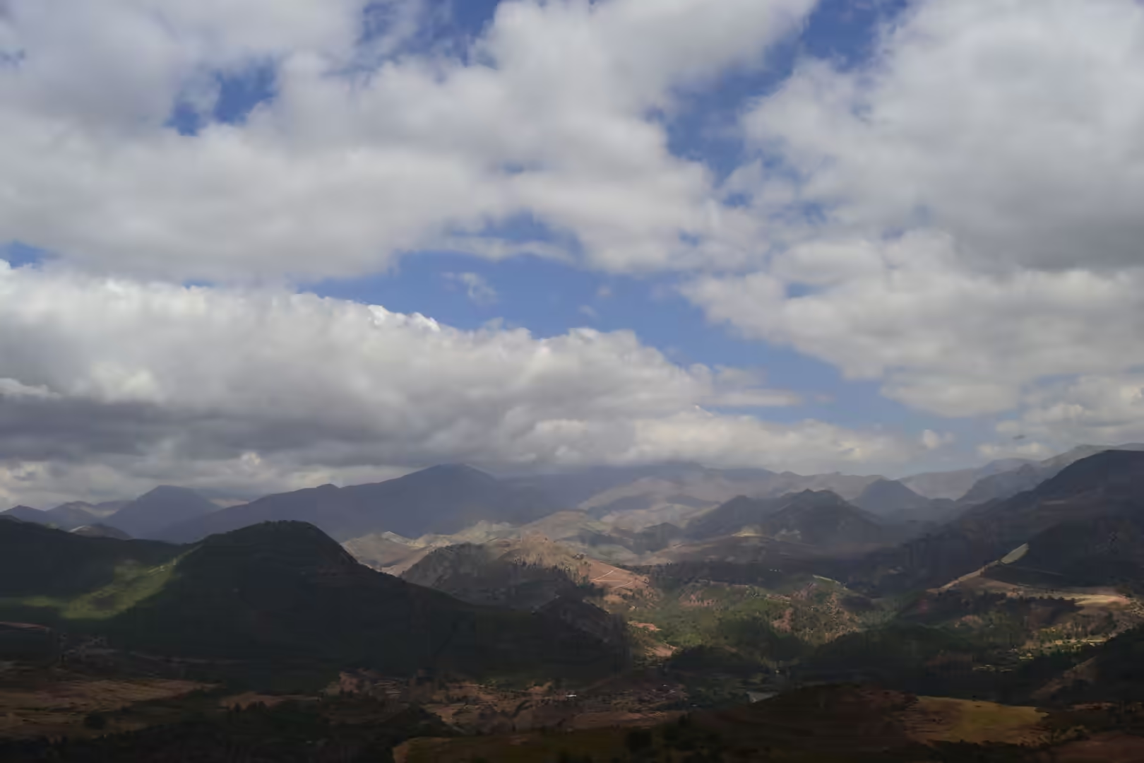
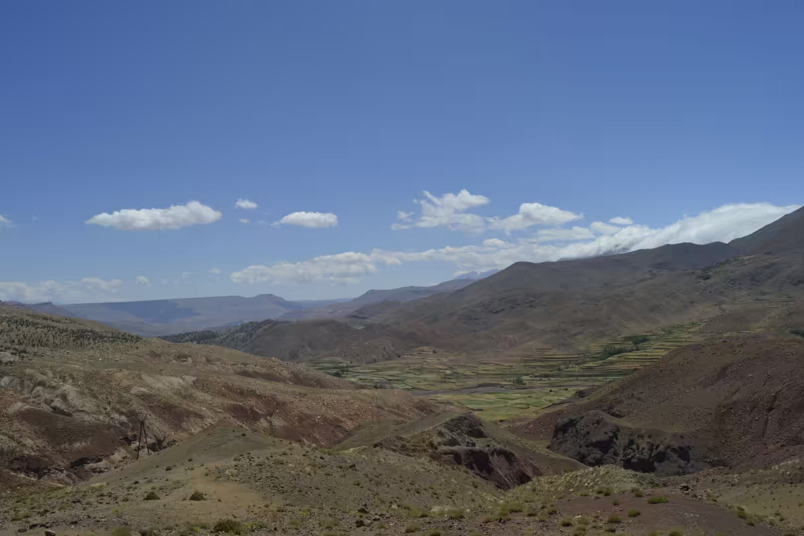
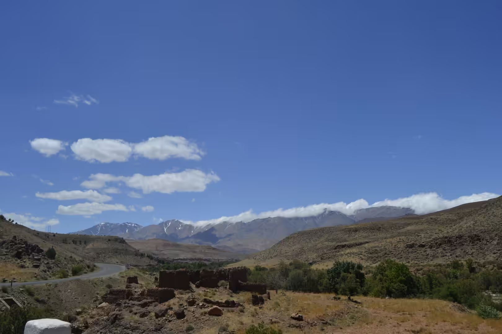
The drive out of the Dadès valley is the last stretch of mountain road of the journey. The terraced fields of the upper valley, watered by channels taken off the river, give way as the road climbs to juniper slopes and bare rock; the fields themselves are a study in mountain agriculture, worked by hand and supported by traditional ecological knowledge that has been shown to be essential to the survival of farming in the High Atlas (Montanari, 2012). Near the top of the pass the road swings through long bends, and the view opens over ridges on both sides before the descent begins towards the plain.
Marrakesh repays days rather than hours. The medina, inscribed by UNESCO in 1985, is a dense quarter of lanes, workshops and souks enclosed by ramparts and pierced by gates, among them Bab Agnaou, the Almohad gate of the kasbah. Its landmark is the Kutubiyya, the largest mosque in the city, founded by Abd al-Mu’min in 1147 and rebuilt from about 1158, with the minaret completed towards 1195 under Ya’qub al-Mansur; it remains the symbol of Marrakesh and one of the principal monuments of Almohad architecture. A rose garden lies to the west and south of the mosque, and across the avenue stands the small mausoleum of the Almoravid emir Yusuf ibn Tashfin. The heritage status of the medina has been studied for its effects on the city, which have not followed a single simple course (Rezaei and others, 2023).
At the heart of the old city lies Jemaa el-Fnaa, the main square, used by residents and visitors alike. Its name is usually explained as the assembly ground in front of a vanished mosque, and it has been a market and gathering place since the city was founded; the square was given a thorough renovation from May 2025. A short walk away is the Bahia Palace, begun in the 1860s by Si Musa, grand vizier to Sultan Muhammad ibn Abd al-Rahman, and greatly expanded between 1894 and 1900 by his son Si Ba Ahmed ibn Musa; its roughly 150 rooms are arranged around courtyards and riad gardens, and it reopened to visitors in October 2023. On the newer side of the city the Majorelle Garden, laid out by the French painter Jacques Majorelle from 1923 and dominated by the Cubist villa that Paul Sinoir designed for him in the 1930s, was restored from the 1980s by Yves Saint Laurent and Pierre Bergé; the villa now houses the Berber Museum, and a museum devoted to the couturier opened beside the garden in 2017.
The country around Marrakesh can be reached in a morning and complements the city. The Ourika valley, about 30 kilometres away, climbs into the High Atlas past Berber villages and salt pans, and it is the only place in the whole range where the endangered Barbary macaque is still found. The plain itself, with its orchards and market gardens, offers a gentler landscape before the mountains begin again. For anyone travelling on from the city, the road back over the pass towards Ouarzazate and the desert starts on the same doorstep, and the cultural life of the city, from its crafts to its festivals, has been recognised as intangible heritage in its own right (Skounti and Sadki, 2023).
References
- Montanari, B. (2012). The Future of Agriculture in the High Atlas Mountains of Morocco: The Need to Integrate Traditional Ecological Knowledge. In: The Future of Mountain Agriculture. Berlin: Springer, 51-72. doi.org/10.1007/978-3-642-33584-6_5
- Rezaei, N., Nofre, J. & Ghaderi, Z. (2023). World heritage classification and tourism: divergent trajectories in Marrakech Medina (Morocco) and M’Zab Valley (Algeria). Journal of Heritage Tourism 19, 111-128. doi.org/10.1080/1743873X.2023.2259509
- Robinson, D. A. & Williams, R. B. G. (1992). Sandstone weathering in the High Atlas, Morocco. Zeitschrift für Geomorphologie 36, 413-429. doi.org/10.1127/zfg/36/1992/413
- Simonneaux, V., Baby, P. & Kharrou, M. H. (2020). Yearly land cover mapping between 1984 and 2018 in the Haouz plain (Marrakech, Morocco) using robust decision trees approaches. EGU General Assembly 2020, EGU2020-10631. doi.org/10.5194/egusphere-egu2020-10631
- Sinan, M. & Razack, M. (2008). An extension to the DRASTIC model to assess groundwater vulnerability to pollution: application to the Haouz aquifer of Marrakech (Morocco). Environmental Geology 57, 349-363. doi.org/10.1007/s00254-008-1304-2
- Skounti, A. & Sadki, A. (2023). Intangible Cultural Heritage, Sustainability, and the COVID-19 in Marrakech. In: Intangible Cultural Heritage and Sustainable Development. London: Routledge, 176-190. doi.org/10.4324/9781003244158-15
- Vogel, T. A. & Walker, B. M. (1975). The Tichka Massif, Morocco: an example of contemporaneous acidic and basic plutonism. Lithos 8, 29-38. doi.org/10.1016/0024-4937(75)90028-6
- Warme, J. E. Jurassic carbonate facies of the Central and Eastern High Atlas rift, Morocco. Lecture Notes in Earth Sciences. Berlin: Springer, 169-199. doi.org/10.1007/BFb0011593
- UNESCO World Heritage Centre (1985). Medina of Marrakesh. World Heritage List, ref. 331. whc.unesco.org/en/list/331
- Moroccan National Tourist Office. Visit Morocco. visitmorocco.com/en
- Wikipedia contributors (2026). Marrakesh. en.wikipedia.org/wiki/Marrakesh
- Wikipedia contributors (2026). Medina of Marrakesh. en.wikipedia.org/wiki/Medina_of_Marrakesh
- Wikipedia contributors (2026). Jemaa el-Fnaa. en.wikipedia.org/wiki/Jemaa_el-Fnaa
- Wikipedia contributors (2026). Koutoubia Mosque. en.wikipedia.org/wiki/Koutoubia_Mosque
- Wikipedia contributors (2026). Tizi n’Tichka. en.wikipedia.org/wiki/Tizi_n%27Tichka
- Wikipedia contributors (2026). Almoravid dynasty. en.wikipedia.org/wiki/Almoravid_dynasty
- Wikipedia contributors (2026). Bahia Palace. en.wikipedia.org/wiki/Bahia_Palace
- Wikipedia contributors (2026). Majorelle Garden. en.wikipedia.org/wiki/Majorelle_Garden
- Wikipedia contributors (2026). Tensift River. en.wikipedia.org/wiki/Tensift_River
- Wikipedia contributors (2026). Ourika River. en.wikipedia.org/wiki/Ourika_River
- Wikipedia contributors (2026). Atlas Mountains. en.wikipedia.org/wiki/Atlas_Mountains