Day 14 - Ait Ibriren (Dades Gorge)
Journal Notes
General
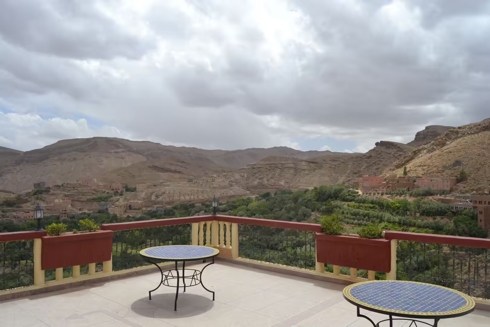
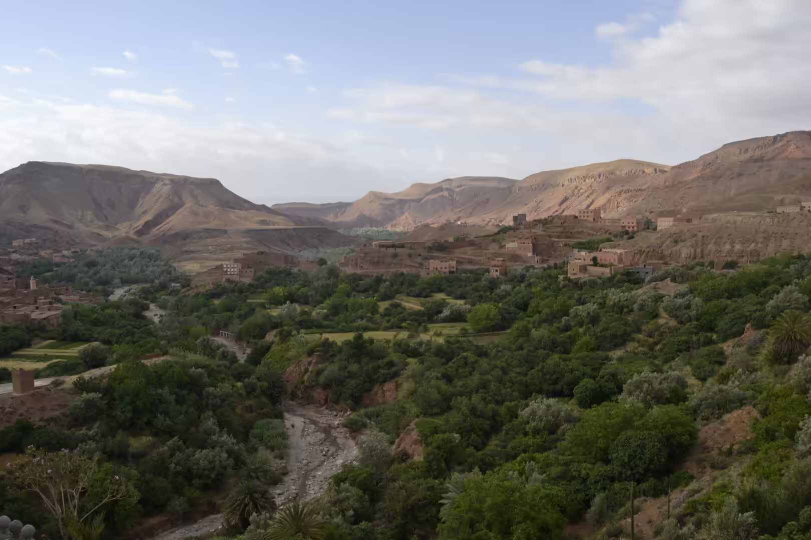
Aït Ibriren is a village in the upper Dadès valley in the Tinghir province of the Drâa-Tafilalet region of Morocco. It stands close to Boumalne Dadès, the small town at the mouth of the upper valley, on the road that follows the Assif Dadès upstream towards the gorges. The valley lies in the Central High Atlas, between the main massif of the High Atlas to the north and the Jbel Saghro to the south east, and the village belongs to the chain of oasis settlements that line the river between Boumalne Dadès and M’semrir. Boumalne itself sits at more than 1,500 metres above sea level at the edge of a desert plateau, and downstream from it the built-up strip along the river continues through the rural commune of Souk Lakhmis Dadès towards Kelaat M’Gouna, about 25 kilometres away.
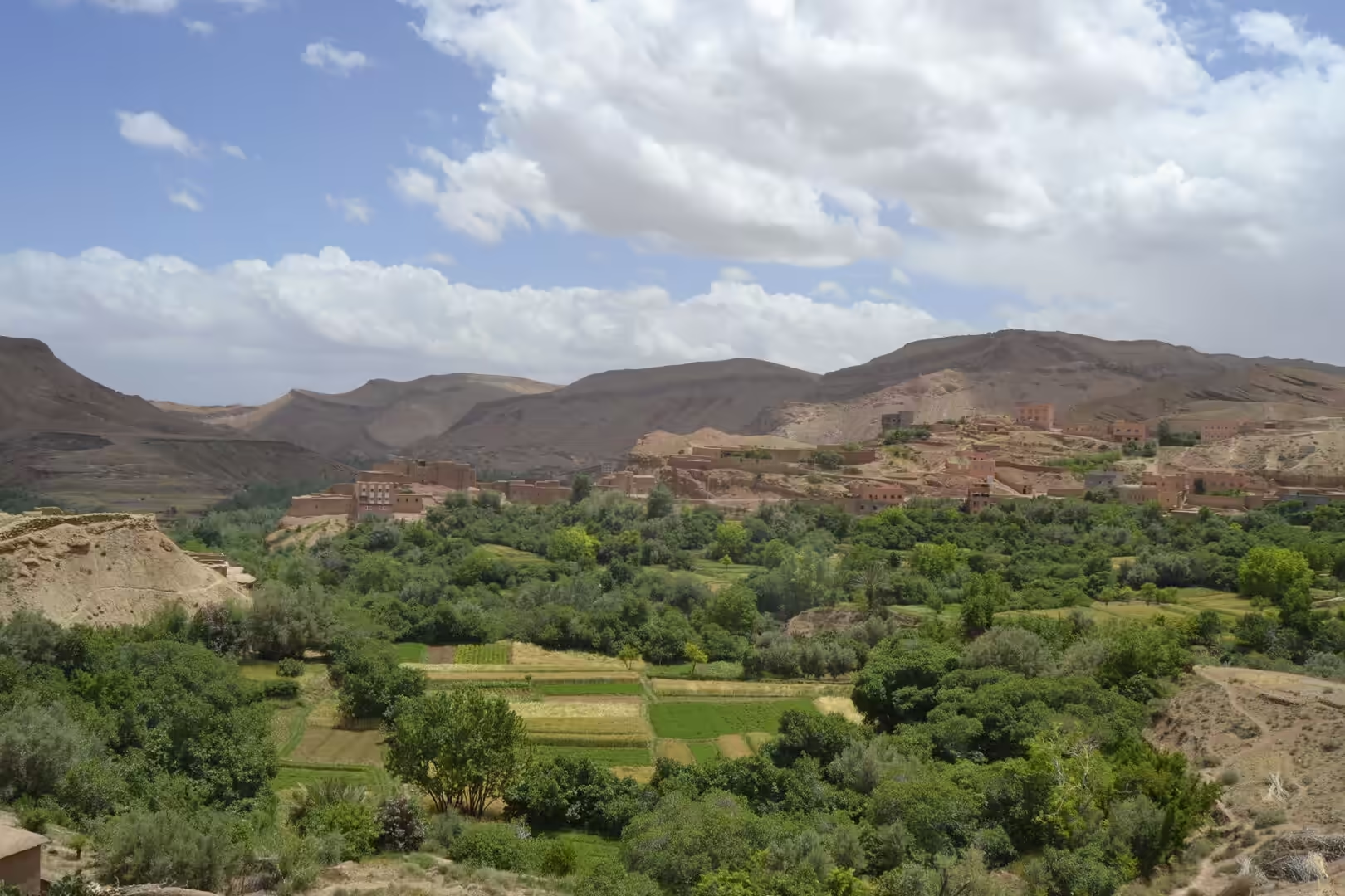
The Dadès is a river of nearly 200 kilometres, roughly half of it in mountain country. It rises in the High Atlas, turns south and cuts through the gorges, then swings west between the High Atlas and the Anti-Atlas, meets the Ouarzazate river and reaches the Draa, which continues towards the Atlantic. The valley floor carries the palm and almond groves and the irrigated terraces on which the villages depend, while the slopes above remain bare rock and scree. The province is predominantly rural: the 2014 census counted 322,412 inhabitants in the Tinghir province, whose area is 13,007 square kilometres and whose only municipalities are Tinghir, Boumalne Dadès and Kelaat M’Gouna. Tinghir, the provincial capital, had 42,044 residents in the same count. The region of Drâa-Tafilalet, formed in September 2015 from provinces of the former Souss-Massa-Drâa and Meknès-Tafilalet regions, covers 88,836 square kilometres and has its capital at Errachidia.
The everyday language of the villages is Central Atlas Tamazight, one of the Amazigh (Berber) languages of Morocco; the 2024 census recorded it as the mother tongue of 7.4 per cent of the population, with Tashelhit and Tarifit accounting for most of the remainder. Arabic and French are used in administration, in schools and in the tourist trade. The local economy rests on irrigated oasis farming and on small livestock, and increasingly on visitors who come for the gorges, the kasbahs and the walking. Cultivation is organised in terraces fed by channels taken off the river, a system that has supported the valley for centuries and that still determines the pattern of settlement. The rose fields and the distillation of rose water further down the valley at Kelaat M’Gouna belong to the same oasis economy.
History
The upper Dadès valley has always been a corridor for movement. Boumalne Dadès grew out of an old transhumance passage that was controlled by the Aït Atta of the Jbel Saghro and used by the neighbouring Mgouna, Aït Sedrate, Aït Hdiddou and Aït Merghad tribes on their way between the summer pastures of the High Atlas and the winter grazing of the Saghro. The kasbahs of the valley are the fortified earthen houses that grew out of this world of tribes, caravan traffic and scarce water. The word kasbah, or qasaba, denotes a fortress or a fortified quarter, and in practice the term covered watchtowers, refuges and the seat of a local family as much as a citadel.
The ksour and ighrem of southern Morocco are built of earth and straw, a material that is easy to work and easily damaged by rain. The best known example of this architecture lies west of the valley on the former caravan route between the Sahara and Marrakesh. At Aït Benhaddou the site has been fortified since the eleventh century, in the Almoravid period, although none of the buildings that stand today is thought to be older than the seventeenth century; the ksar was inscribed on the UNESCO World Heritage list in 1987, a pedestrian bridge was added in 2011 to reconnect the old settlement with the modern village, and the fabric suffered damage in the earthquake of September 2023. The towers and walls of the Dades valley, ruined or still in use, belong to the same tradition of earthen construction.
The French protectorate, established by the Treaty of Fes on 30 March 1912 and ended by independence in 1956, changed the administrative geography of the south. Towns such as Ouarzazate expanded considerably in that period as garrison towns, administrative centres and customs posts, and a church was built there in 1931. Roads were pushed along the valleys, and the route that carries the traffic through the Dadès valley follows the river in the same way as the N10 does downstream of Boumalne. The modern institutional framework is recent: Tinghir became an administrative centre with the approval given on 21 January 2009, and the province of Tinghir itself was created in 2009 by decree, out of territory taken from the provinces of Ouarzazate and Errachidia. The tourist trade that shapes the valley today developed in the second half of the twentieth century, and the gorges have been a frequented destination for several decades.
Geology
The rocks of the Dades valley are sedimentary, laid down in a marine environment over a long interval that runs from the Jurassic to the Eocene. They were raised above sea level during the Alpine orogeny in the Oligocene, and the Dadès cut its way down through them while they were still being lifted. The river therefore cuts across the structures rather than around them, and the result is a canyon system in marls, sandstones and limestones whose walls are young in geological terms and still unstable.
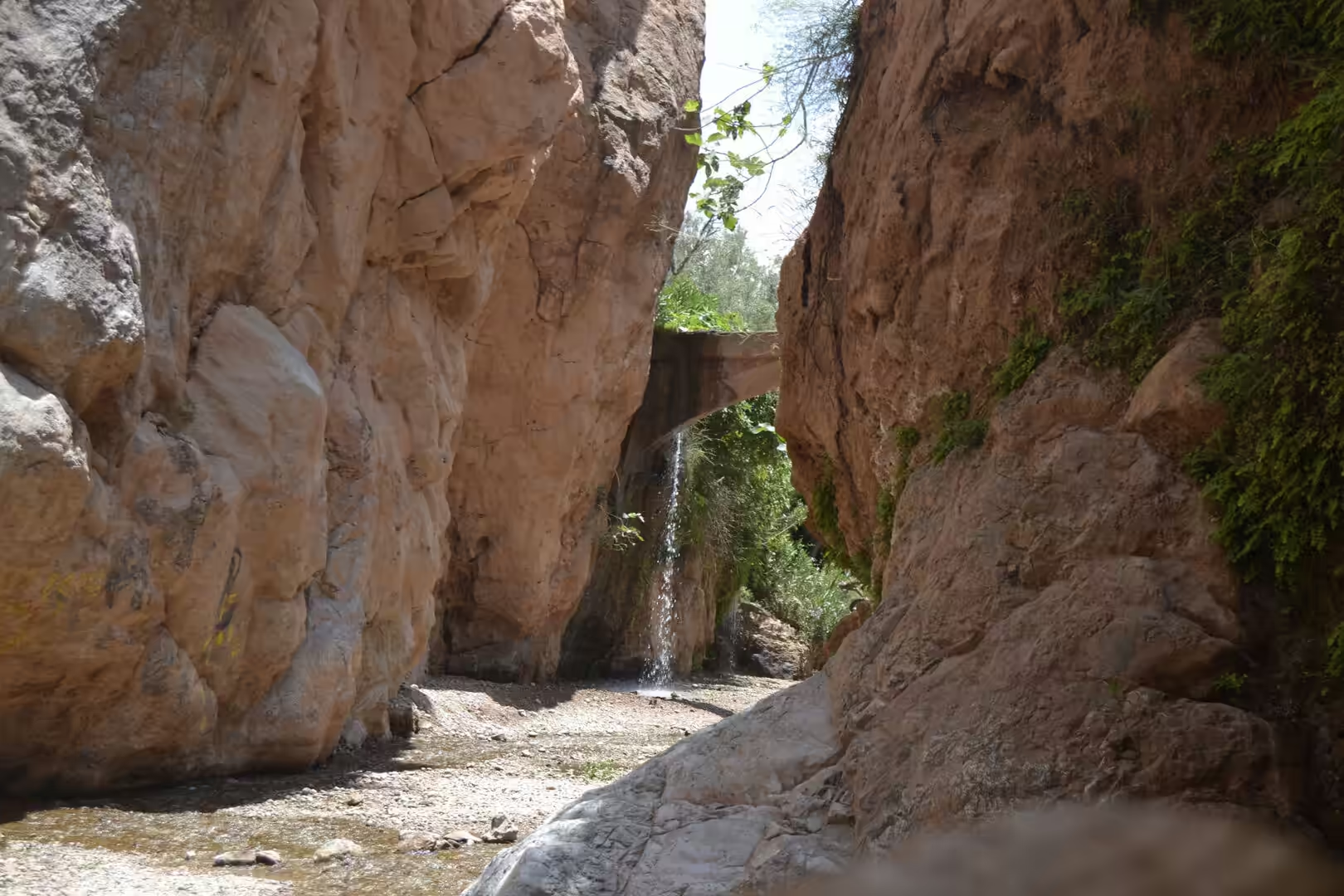
Along the course of the river four successive series of gorges and defiles follow one another, between 200 and 500 metres deep. The first series lies in ochre limestones of Dogger age, that is to say the Middle Jurassic, and has cut about 300 metres into them; over a stretch of more than 500 metres the stream has forced a passage only a few metres wide with walls some 400 metres high. Drainage of this kind, cutting directly across a rising mountain belt, is known as transverse drainage, and the Dades Gorges have been studied as an example of it. The present relief has been attributed to a combination of active tectonic controls and inherited structures (Stokes and others, 2008), while the weathering of the sandstones and its morphotectonic effects were described in detail by Akdim (1996). The Jurassic limestones of the Central High Atlas, examined in the neighbouring Ziz valley, show a long history of diagenesis and dolomitization in successive stages (Railsback and Hood, 2001).
The most conspicuous forms in the valley are towers of resistant rock that stand clear of the softer beds once surrounding them. The group best known to visitors is the formation called the Monkey Fingers, also known locally as the cliffs of Tamnalt and in French as les Doigts de Singe: elongated pillars of sandstone left standing while the surrounding material was removed by water and wind. The same process, working over long periods on layers of different hardness, has produced the castellated ridges and the knobbly slopes that border the road. Erosion is not only slow. The wadis of the upper Dades are small high mountain streams with an extremely irregular discharge, dry for much of the year and capable of sudden, sediment-laden floods; their morphology and the flood risk in the catchment have been the subject of recent work (Dłużewski and others, 2013; Aichi and others, 2024). The hydrology of the main river is equally seasonal, with peak flows between January and April following rain and snowmelt. Its water is alkaline, summer temperatures range between 23 and 28 degrees Celsius, and its electrical conductivity is relatively high.
The valley also marks a climatic and biological boundary. To the south east the Jbel Saghro, the eastern prolongation of the Anti-Atlas and separated from it by the Draa, is the driest mountain area of the whole Atlas system, with annual rainfall of about 100 millimetres on its southern slopes and 300 millimetres at the summits. Its Tamazight name means drought. North of the Saghro the valley of the Dadès separates the massif from the High Atlas, whose snow feeds the river and whose northern faces hold snow well into late spring. The contrast produces a corridor of moisture in an arid country, and the water supports a species found nowhere else: the Dades trout, Salmo multipunctatus, is known to spawn in a spring of the High Atlas. The geological interest of the area has been formally assessed: a survey has identified 25 sites of geological interest in the area between Tinghir, the Dades valley and Imilchil (El Ouali and others, 2024).
Things to See
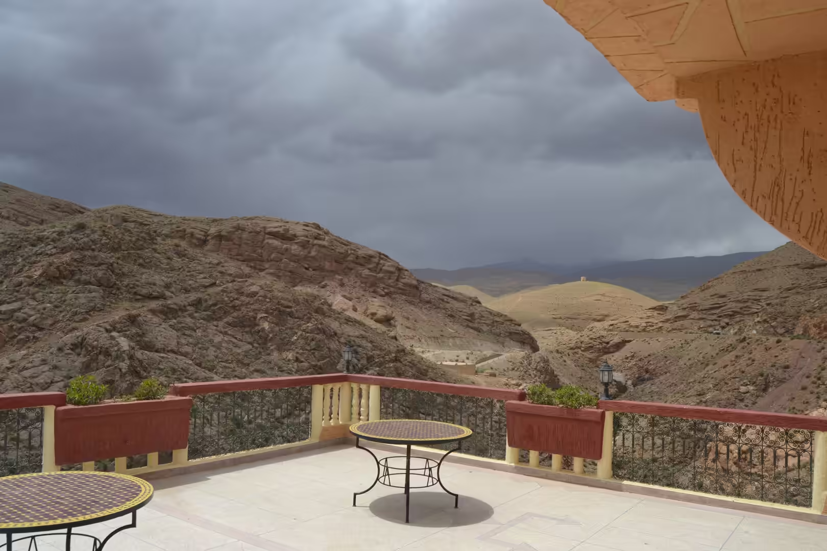
The classic drive from Boumalne Dadès towards M’semrir climbs through the gorges in a series of bends, with wide views back over the ochre cliffs and the green ribbon of the valley below. The route follows the old transhumance path of the valley, it is narrow in places, and it should be driven with attention. The hills of Tamnalt above the road carry the formation of standing rock pillars known as the Monkey Fingers, best seen in the late afternoon when the light falls sideways across them.
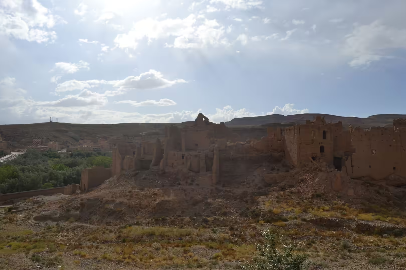
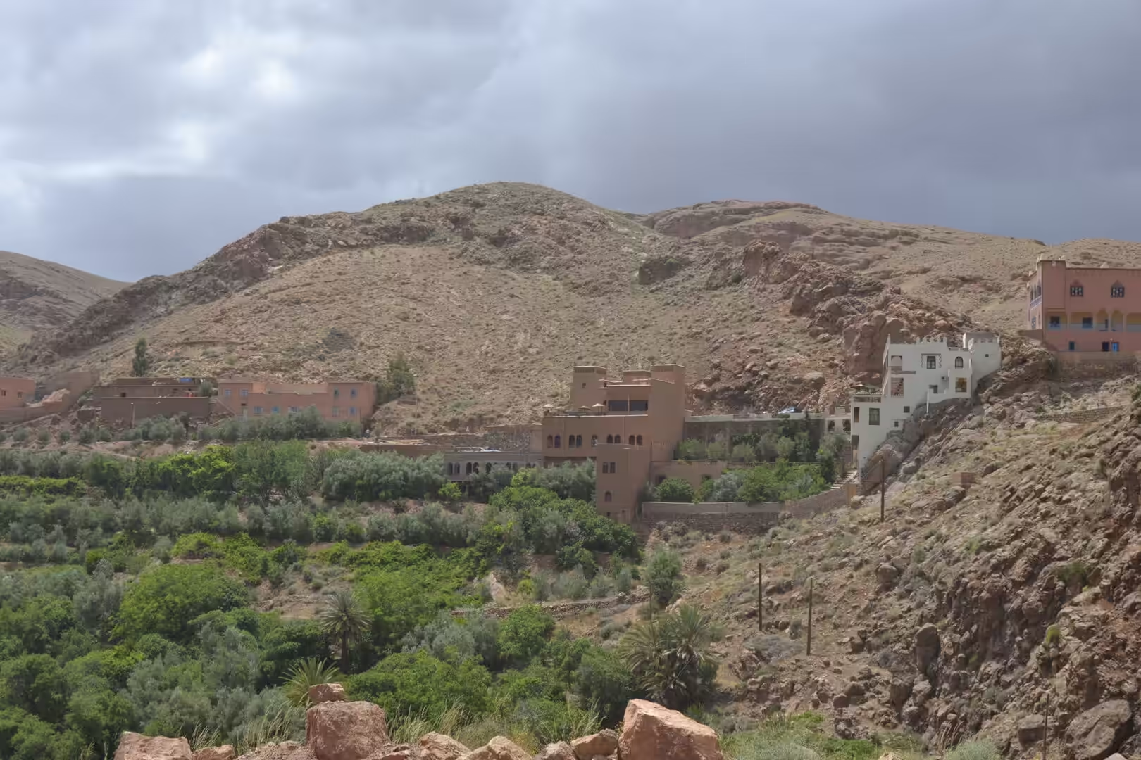
Above and below the road stand the kasbahs and the older earthen houses of the villages. Some are still occupied and repaired with fresh mud, others are abandoned shells open to the rain. This architecture, built of earth mixed with straw, is the same tradition that produced the ksar of Aït Benhaddou, and its decay is part of the appearance of the valley. The province counts the kasbah of the Glaoui among its sites, and the ruined towers above the villages remain the most characteristic landmarks of the upper valley.
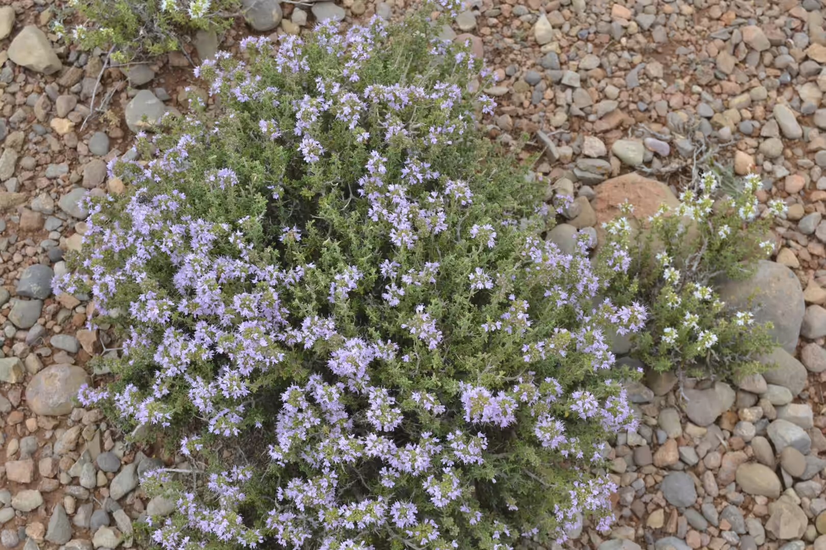
The oasis itself rewards walking. Palm groves and almond orchards occupy the valley floor, watered by channels taken off the river, and the fields are worked in small terraces that follow the shape of the ground. Paths run between the plots and along the watercourses, past stone bridges where the side streams cross, and small waterfalls form where a stream drops over a lip of harder rock. The dry slopes above the cultivation carry aromatic plants, among them wild thyme, which flowers in spring and early summer. The villages of the valley, including Aït Ibriren itself, can be visited on foot, and the walking is best in the cooler months.
Further afield, the region offers several objectives that are easily reached from the valley. Kelaat M’Gouna, about 25 kilometres downstream, lies in the valley of the roses: the cultivation of Rosa damascena and the distillation of rose water and rose oil are a mainstay of the local economy, a distillery works in the town, and the harvest is celebrated with a festival. The town holds two weekly markets, one for livestock on Tuesdays and one for goods and food on Wednesdays. Tinghir, the provincial capital, has a large palm oasis along the Wadi Todgha and the Todgha gorges near at hand, where limestone walls close in on a stony track; the town also has its own festival, dedicated to the gorges. West of the valley, Aït Benhaddou and Ouarzazate lie within a day’s drive: the fortified village is on the UNESCO World Heritage list, and Ouarzazate, with the principal film studios of Morocco and a cinema museum, is the usual starting point for the Draa valley and the desert. Walkers use Boumalne Dadès as a base for the trekking routes of the Saghro and of the High Atlas, and the traverse of the Jbel Saghro in particular is a classical itinerary.
References
- Akdim, B. (1996). The sandstone geomorphic aspects in Southern Morocco (Dades Valley, Ouarzazate): weathering and morphotectonic effects. Zeitschrift für Geomorphologie 40, 85-95. doi.org/10.1127/zfg/40/1996/85
- Aichi, A., Ikirri, M., Ait Haddou, M. & Quesada-Román, A. (2024). Integrated GIS and analytic hierarchy process for flood risk assessment in the Dades Wadi watershed (Central High Atlas, Morocco). Results in Earth Sciences 2, 100019. doi.org/10.1016/j.rines.2024.100019
- Dłużewski, M., Krzemień, K., Rojan, E. & Biejat, K. (2013). Morphodynamics of small high-mountain wadis in arid zones (on the examples of the tributaries of the upper Dades River, High Atlas Mountains, Morocco). Landform Analysis 22, 9-19. doi.org/10.12657/landfana.022.002
- El Ouali, M., Kabiri, L., Essafraoui, B. & Ben Bammou, M. (2024). Quantitative assessment and value of 25 sites of geological interest of the Tinghir-Dades-Imilchil area (Central High Atlas, Morocco). SSRN Electronic Journal. doi.org/10.2139/ssrn.4667741
- Esteve, M. (2021). Preliminary observations of Dades trout (Salmo multipunctatus) spawning in a High Atlas mountain spring. Ichthyological Research 69, 287-290. doi.org/10.1007/s10228-021-00834-1
- Railsback, L. B. & Hood, E. C. (2001). A survey of multi-stage diagenesis and dolomitization of Jurassic limestones along a regional shelf-to-basin transect in the Ziz Valley, Central High Atlas Mountains, Morocco. Sedimentary Geology 139, 285-317. doi.org/10.1016/S0037-0738(00)00164-0
- Stokes, M., Mather, A. E., Belfoul, A. & Farik, F. (2008). Active and passive tectonic controls for transverse drainage and river gorge development in a collisional mountain belt (Dades Gorges, High Atlas Mountains, Morocco). Geomorphology 102, 2-20. doi.org/10.1016/j.geomorph.2007.06.015
- UNESCO World Heritage Centre (1987). Ksar of Ait-Ben-Haddou. World Heritage List, ref. 444. whc.unesco.org/en/list/444
- Hertz Maroc. The Monkey Fingers of the Dades Valley. en.hertz.ma/morocco/discover-morocco/destinations-e2f/monkey-fingers-dades-valley
- Moroccan National Tourist Office. Visit Morocco. visitmorocco.com/en
- Wikipedia contributors (2026). Dadès Gorge. en.wikipedia.org/wiki/Dad%C3%A8s_Gorge
- Wikipedia contributors (2026). Dadès River. en.wikipedia.org/wiki/Dad%C3%A8s_River
- Wikipedia contributors (2026). Gorges du Dadès. fr.wikipedia.org/wiki/Gorges_du_Dad%C3%A8s
- Wikipedia contributors (2026). Boumalne-Dadès. fr.wikipedia.org/wiki/Boumalne_Dad%C3%A8s
- Wikipedia contributors (2026). Kelaat M’Gouna. fr.wikipedia.org/wiki/Kelaat_M%27Gouna
- Wikipedia contributors (2026). Tinghir. en.wikipedia.org/wiki/Tinghir
- Wikipedia contributors (2026). Tinghir Province. en.wikipedia.org/wiki/Tinghir_Province
- Wikipedia contributors (2026). Jbel Saghro. en.wikipedia.org/wiki/Jbel_Saghro
- Wikipedia contributors (2026). Todgha Gorge. en.wikipedia.org/wiki/Todgha_Gorge
- Wikipedia contributors (2026). Aït Benhaddou. en.wikipedia.org/wiki/A%C3%AFt_Benhaddou