2015 Morocco - Analogue Pictures 6
Journal Notes
General
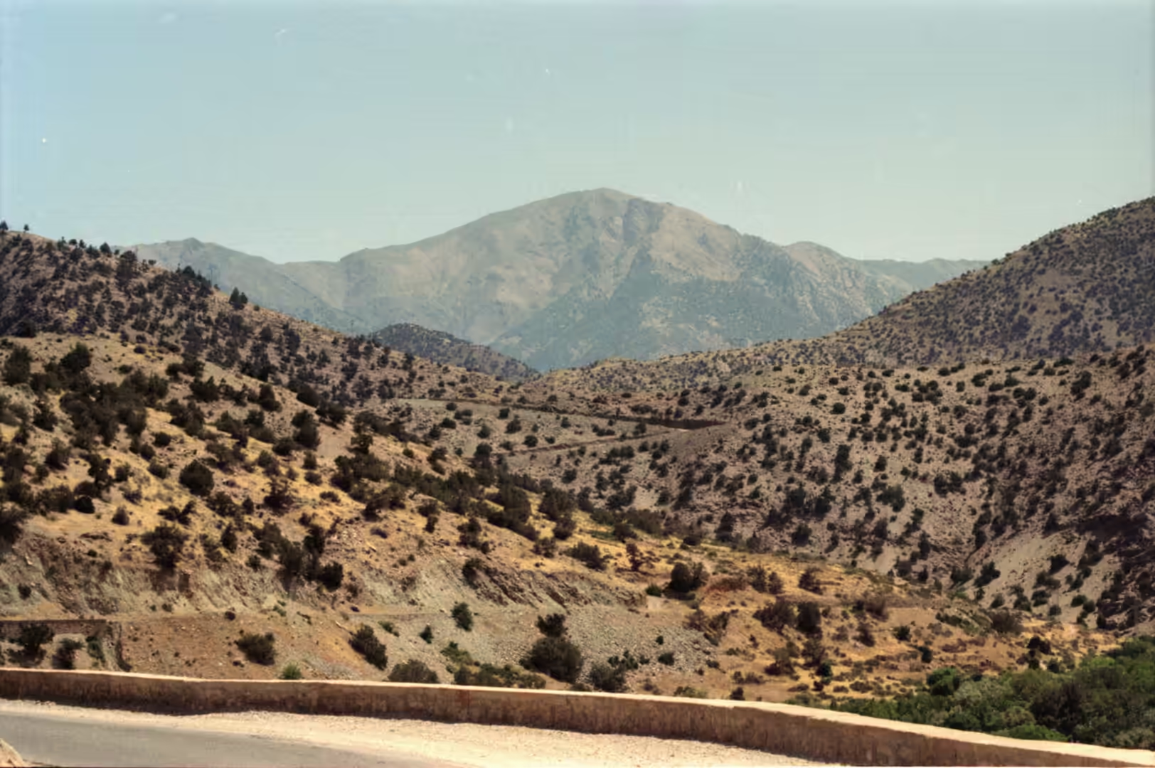
This last set of pictures belongs to the two landscapes that end a journey through southern Morocco: the valleys of the High Atlas and the city of Marrakesh below them. The range runs east to west across the country and separates the Sahara from the Mediterranean and the Atlantic, and its villages stand on slopes and terraces where water can be led to the fields. Marrakesh lies at the foot of the mountains on the northern side, on the wide plain of the Haouz, at an altitude of about 450 metres; from the city the wall of the Atlas rises abruptly, and on clear days the snow on its summits is visible from the rooftops.
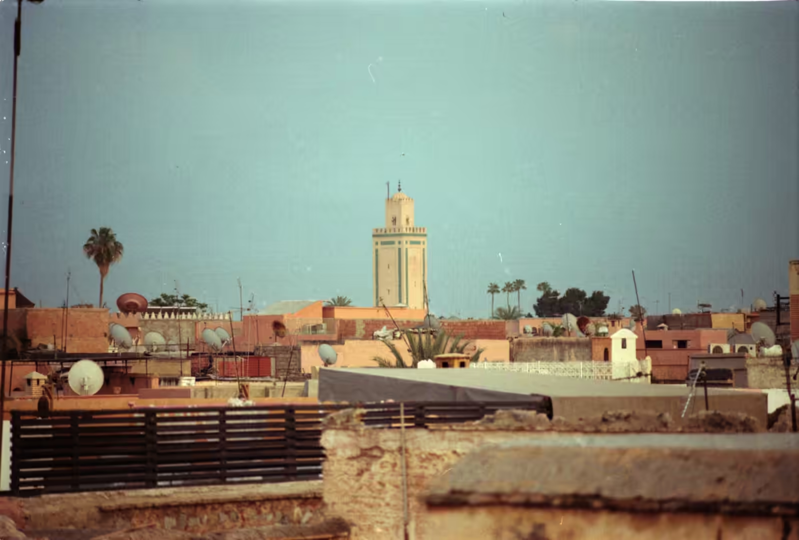
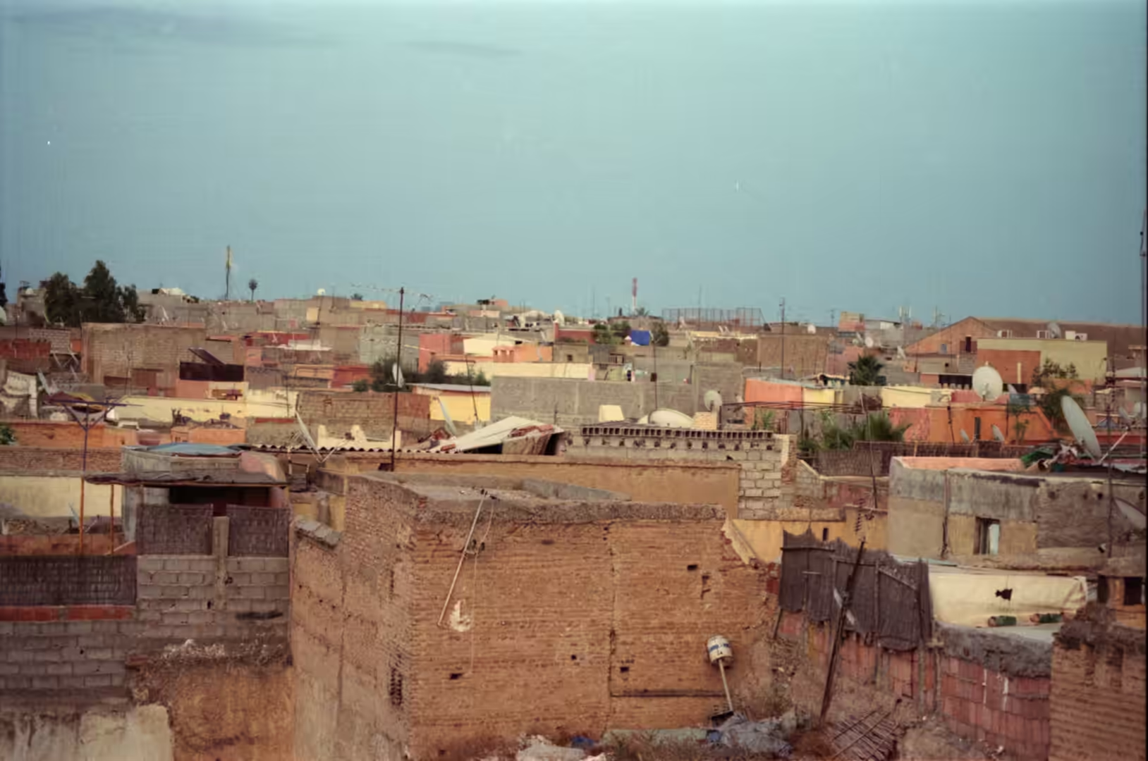
Marrakesh is the fourth largest city in Morocco and one of the country’s four imperial cities, together with Meknès, Fès and Rabat. The 2024 census counted 996,643 inhabitants within the city, 1,255,265 in the urban area and roughly 1.56 million in the wider agglomeration, spread over 230 square kilometres. The city is known as the red or ochre city because of the colour of the earth used in most of its buildings. The city has long been called Bahja, the beautiful, for the warmth of its welcome. Tourism is a mainstay of its economy, and its airport, Marrakesh-Ménara, is the second busiest in the country: in 2019 the city received close to three million visitors. Its medina is densely built, and the flat roofs of its houses, crowded with satellite dishes and water tanks, form a landscape of their own, broken here and there by the square shaft of a minaret.
The mountain side of the set is the country of Amazigh (Berber) villages, where Central Atlas Tamazight is the everyday language and where farming depends on terraces, on channels taken off the streams and on herds that move with the seasons. Between the two worlds lies the plain: the Haouz, the alluvial flat between the High Atlas and the small Jbilet massif to the north, drained by the Tensift and irrigated from that river, from its tributaries and from the groundwater beneath. The word haouz means an enclosure, and by extension the back country that belongs to a capital city, and of all the Moroccan cities only Marrakesh has kept the name for its hinterland.
History
The city at the foot of the mountains is older than its present appearance suggests. Marrakesh was founded in 1070, on a site chosen by the Almoravid leader Abu Bakr ibn Umar, and the work was continued under Yusuf ibn Tashfin, who reigned from about 1061 to 1106; the sources give dates between 1062 and 1078, but modern historians generally settle on 1070. The Almoravids had crossed the High Atlas in 1058, taking the trading town of Aghmat at the foot of the range before moving out onto the plain, and from Marrakesh they governed an empire that stretched across the western Maghreb and into al-Andalus.
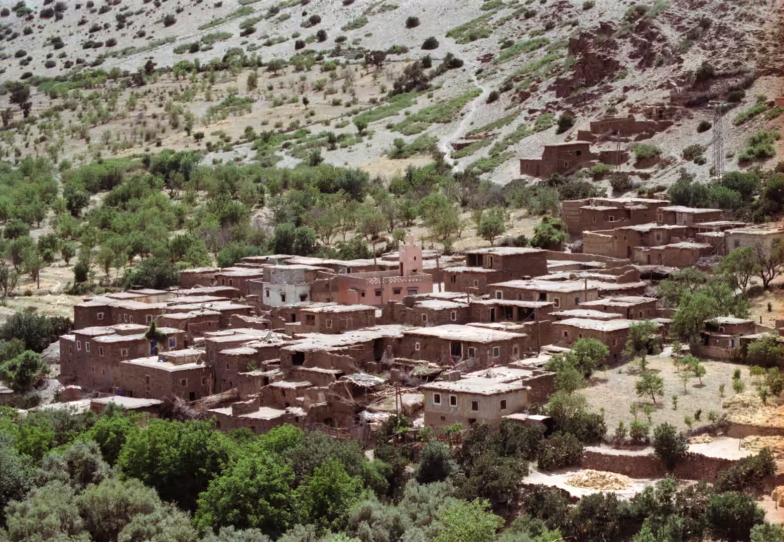
The city walls were raised under Ali ibn Yusuf, and the same period saw the creation of the khettara, the gently sloping underground channels that still supply part of the city’s water without pumps. The Almohad movement had been founded in 1125 by the preacher Ibn Tumart, who settled at Tin Mal in the mountains south of the city, and it was his successor Abd al-Mu’min who took Marrakesh in 1147 after a siege of several months; the Kutubiyya mosque was begun in that same year. Marrakesh served as a capital again under the Almohads and later under the Saadians, and once more under the Alawi sultan Mohammed ben Abdallah. In the mountains the older economy survived these changes: the earthen houses and kasbahs, built of earth mixed with straw, are the same tradition that produced the great ksar of Aït Benhaddou, and the herds continued to move between the high summer pastures and the lowland grazing.
Two later interventions shaped the modern landscape on both sides of the range. Towards 1695 Moulay Ismail stripped decorative elements from the palaces of Marrakesh for reuse in his own capital at Meknès, while under the French protectorate, which lasted from 1912 to 1956, the Haouz plain was turned towards citrus growing and market gardening and the road over the mountains was laid out: the route across the Tizi n’Tichka, built along the old caravan trail by the French military in 1936, is the road that carries the traffic today as National Route 9. The medina of Marrakesh was inscribed on the UNESCO World Heritage list in 1985, and the earthquake of 8 September 2023, which struck southern Morocco, reminded the city of how much repair its earthen fabric constantly requires.
Geology
The High Atlas is the highest part of the Atlas system, formed on a basement of Precambrian rock and raised in three later phases of the earth’s history, and it separates the Sahara from the Mediterranean and Atlantic zones. Its core is exposed in places along the roads that cross the range: the Tichka massif, for example, is a plutonic complex of Palaeozoic age in which acidic and basic magmas were emplaced at much the same time (Vogel and Walker, 1975). Above that core lie thick sedimentary successions, including the Jurassic limestones and dolomites that accumulated in the rift which ran through the central and eastern High Atlas, and sandstones whose weathering has shaped the slopes of the range (Robinson and Williams, 1992).
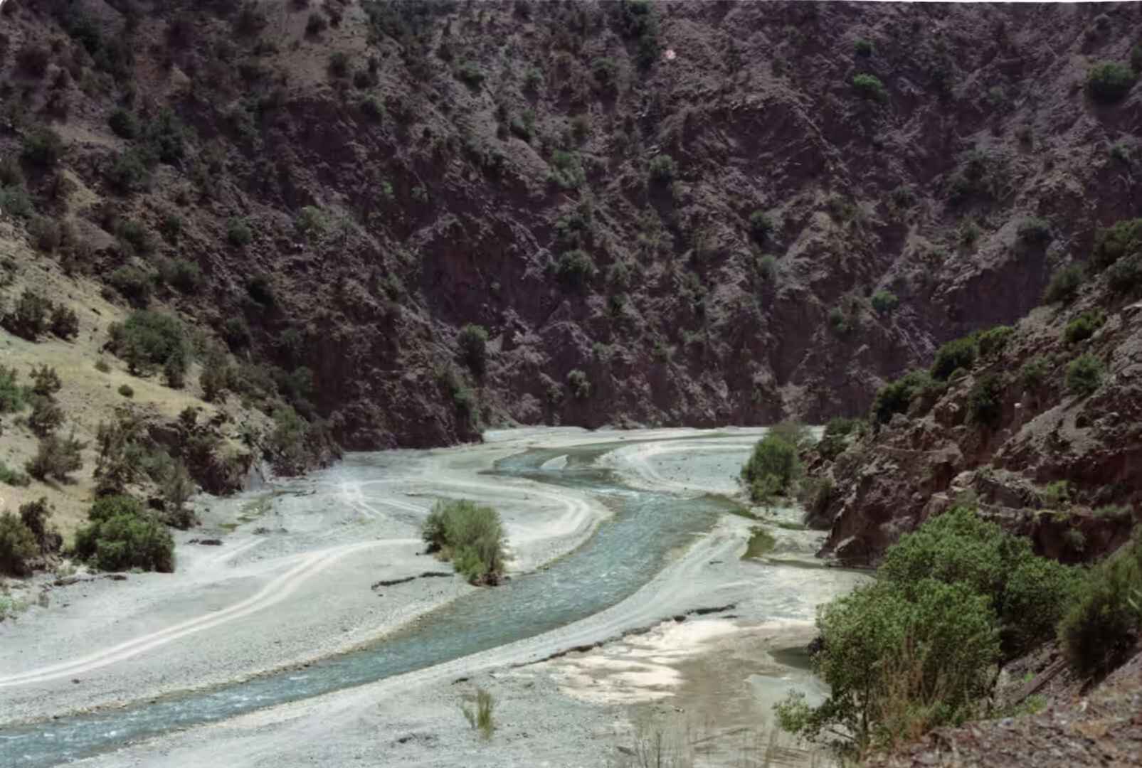
The mountain streams are the reason for the villages in the valleys. They rise in the High Atlas, gather in the catchments above Marrakesh and feed, on the one hand, the rivers of the plain and, on the other, the aquifer that lies beneath it: the watersheds of the Marrakech High Atlas are the principal source of recharge for the Plioquaternary aquifer of the Haouz, a relationship studied by Izarif and others (2022). The plain’s groundwater is vulnerable to pollution, and its protection has been assessed in detail (Sinan and Razack, 2008). The largest of the rivers, the Tensift, collects a great number of tributaries, passes close to Marrakesh and reaches the Atlantic at the old fortress of Souira Qedima, about 40 kilometres south of Safi; its discharge follows the rainfall, and it is one of the ten major rivers of Morocco, though it can often be waded even near its outlet.
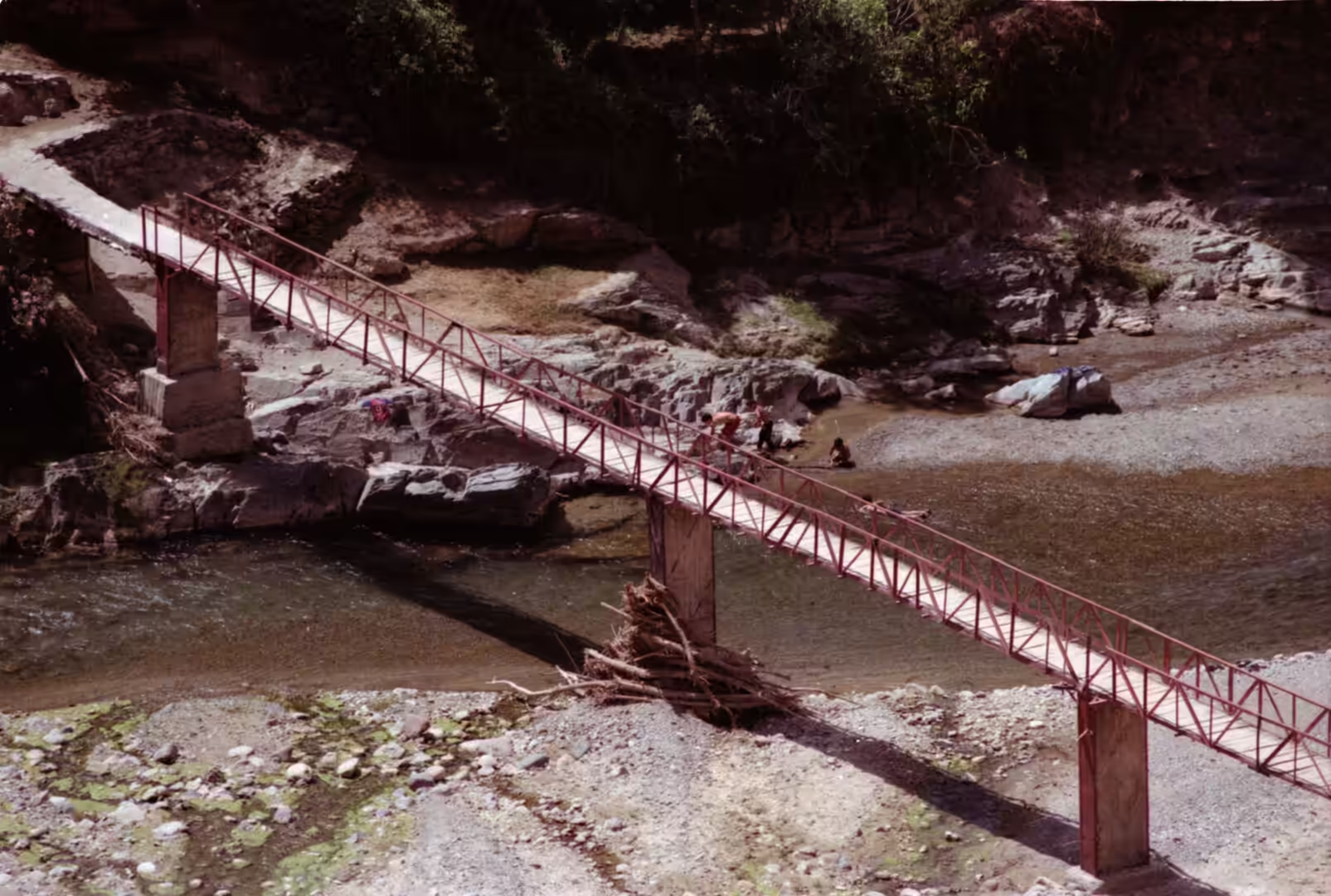
The climate of the range is written into its vegetation. Snow lies on the higher slopes from November into spring, and the northern faces hold it longest; the streams that draw on the meltwater run through narrow rocky beds, crossed in the villages by simple footbridges, and their flow is irregular, high in spring and low or absent in late summer. Where the slopes are gentle enough the villages have built terraces and carried water to them in channels, a form of mountain farming that has been shown to depend on traditional ecological knowledge as much as on the water itself (Montanari, 2012). Between the dry south east and the Atlantic side of the range the difference in rainfall is considerable, and the mountains act as a barrier that wrings moisture out of the air coming in from the ocean.
The fauna of the range has been reduced over the last century. The Barbary macaque, an endangered primate and the only one of the region, survives in a single valley of the High Atlas, the Ourika above Marrakesh, where it lives among the villages and the terraced fields. Larger animals have gone altogether: the last known wild Barbary lion in Morocco was shot near the Tizi n’Tichka in 1942, in the mountains that the road now crosses in an afternoon.
Things to See
In Marrakesh the interest begins at roof level. The medina, inscribed by UNESCO in 1985, is a dense quarter of lanes, workshops, souks and courtyard houses within a circuit of ramparts pierced by gates, among them Bab Agnaou, the Almohad gate of the kasbah. Walking it above the streets, on the flat roofs, gives the clearest impression of how tightly the city is packed, and of the minaret of the Kutubiyya rising above the houses. The mosque was founded by Abd al-Mu’min in 1147 and rebuilt from about 1158, with the minaret completed towards 1195 under Ya’qub al-Mansur; it is the landmark of the city and one of the principal monuments of Almohad architecture, with a rose garden beside it and the small mausoleum of the Almoravid emir Yusuf ibn Tashfin across the avenue. The heritage status of the medina has been studied for its effects on the city, which have not followed a single simple course (Rezaei and others, 2023).
The old city has other set pieces within walking distance. Jemaa el-Fnaa, the main square, has been a market and meeting place since the city was founded, and its name is usually explained as the assembly ground in front of a vanished mosque; it was given a thorough renovation from May 2025. The Bahia Palace, begun in the 1860s by the grand vizier Si Musa and greatly expanded between 1894 and 1900 by his son Si Ba Ahmed ibn Musa, contains roughly 150 rooms arranged around courtyards and riad gardens, and reopened to visitors in October 2023. On the newer side of the city the Majorelle Garden, laid out by the painter Jacques Majorelle from 1923 and dominated by the Cubist villa that Paul Sinoir designed for him in the 1930s, was restored from the 1980s by Yves Saint Laurent and Pierre Bergé; the villa now houses the Berber Museum, and a museum devoted to the couturier opened beside the garden in 2017. The cultural life of the city, from its crafts to its festivals, is recognised as intangible heritage in its own right (Skounti and Sadki, 2023).
The valleys above the plain offer the other half of the programme. The Ourika, about 30 kilometres from Marrakesh, is the easiest to reach: the road follows the river past Berber villages and salt pans, and the valley is the only place in the whole High Atlas where the endangered Barbary macaque is still found. To the west, the fortified ksar of Aït Benhaddou, on the old caravan route and on the UNESCO World Heritage list since 1987, adds a further excursion of half a day. Further on, the Tizi n’Tichka crosses the range at its summit signposted as 2,260 metres, a figure that a GPS measurement in 2022 put closer to 2,205 metres; it remains the highest major mountain pass in North Africa and the gateway between the plain and the pre-Sahara.
Walking in these valleys is a matter of following water. Paths run beside the streams, crossing them on footbridges between the terraces, and the villages themselves, built of earth and stone, sit where the ground allows a secure footing above the flood line. The fields are worked by hand, the channels are maintained by the communities that use them, and the flocks still move up to the high pastures after Easter, when the snow has withdrawn far enough for the herds to follow. Guides and mountain guesthouses in the larger villages make the higher paths accessible to visitors, and the combination of an afternoon on the roofs of Marrakesh with a morning in the valleys behind the city is one of the pleasures of the region.
References
- Izarif, Y., Laftouhi, N.-E., El ghazali, F. and others (2022). Preliminary results of the contribution of Marrakech High Atlas watersheds to the Plioquaternary aquifer of the Haouz plain recharge. EGU General Assembly 2022, EGU22-10233. doi.org/10.5194/egusphere-egu22-10233
- Montanari, B. (2012). The Future of Agriculture in the High Atlas Mountains of Morocco: The Need to Integrate Traditional Ecological Knowledge. In: The Future of Mountain Agriculture. Berlin: Springer, 51-72. doi.org/10.1007/978-3-642-33584-6_5
- Rezaei, N., Nofre, J. & Ghaderi, Z. (2023). World heritage classification and tourism: divergent trajectories in Marrakech Medina (Morocco) and M’Zab Valley (Algeria). Journal of Heritage Tourism 19, 111-128. doi.org/10.1080/1743873X.2023.2259509
- Robinson, D. A. & Williams, R. B. G. (1992). Sandstone weathering in the High Atlas, Morocco. Zeitschrift für Geomorphologie 36, 413-429. doi.org/10.1127/zfg/36/1992/413
- Sinan, M. & Razack, M. (2008). An extension to the DRASTIC model to assess groundwater vulnerability to pollution: application to the Haouz aquifer of Marrakech (Morocco). Environmental Geology 57, 349-363. doi.org/10.1007/s00254-008-1304-2
- Skounti, A. & Sadki, A. (2023). Intangible Cultural Heritage, Sustainability, and the COVID-19 in Marrakech. In: Intangible Cultural Heritage and Sustainable Development. London: Routledge, 176-190. doi.org/10.4324/9781003244158-15
- Vogel, T. A. & Walker, B. M. (1975). The Tichka Massif, Morocco: an example of contemporaneous acidic and basic plutonism. Lithos 8, 29-38. doi.org/10.1016/0024-4937(75)90028-6
- UNESCO World Heritage Centre (1985). Medina of Marrakesh. World Heritage List, ref. 331. whc.unesco.org/en/list/331
- Moroccan National Tourist Office. Visit Morocco. visitmorocco.com/en
- Wikipedia contributors (2026). Marrakesh. en.wikipedia.org/wiki/Marrakesh
- Wikipedia contributors (2026). Medina of Marrakesh. en.wikipedia.org/wiki/Medina_of_Marrakesh
- Wikipedia contributors (2026). Koutoubia Mosque. en.wikipedia.org/wiki/Koutoubia_Mosque
- Wikipedia contributors (2026). Jemaa el-Fnaa. en.wikipedia.org/wiki/Jemaa_el-Fnaa
- Wikipedia contributors (2026). Atlas Mountains. en.wikipedia.org/wiki/Atlas_Mountains
- Wikipedia contributors (2026). High Atlas. en.wikipedia.org/wiki/High_Atlas
- Wikipedia contributors (2026). Ourika River. en.wikipedia.org/wiki/Ourika_River
- Wikipedia contributors (2026). Tensift River. en.wikipedia.org/wiki/Tensift_River
- Wikipedia contributors (2026). Tizi n’Tichka. en.wikipedia.org/wiki/Tizi_n%27Tichka
- Wikipedia contributors (2026). Bahia Palace. en.wikipedia.org/wiki/Bahia_Palace
- Wikipedia contributors (2026). Majorelle Garden. en.wikipedia.org/wiki/Majorelle_Garden