Day 1 - Germany / Rome Italy
Journal Notes
General
The journey begins with the long drive south, and the first day of it belongs to the Alps. The route runs from Germany through Austria towards Italy along one of the main transit corridors of the continent, past rest areas with signs in German, through valleys flanked by steep rock walls, and over passes where the summits are white and the roadsides are piled with snow. The Alps are the highest and most extensive mountain range in Europe, stretching approximately 1,200 kilometres across eight countries from Monaco, France, Switzerland and Italy to Liechtenstein, Germany, Austria and Slovenia, with an area of about 200,000 square kilometres and a width of up to 250 kilometres.
The range is high enough to decide the weather and the traffic of half the continent. Its highest summit is Mont Blanc at 4,808.73 metres, and the Alpine region contains 82 peaks higher than 4,000 metres, with the Dufourspitze of the Monte Rosa massif and the Ortler among the others at the top of the list; the arch extends from Nice on the western Mediterranean to Trieste on the Adriatic and to Vienna at the beginning of the Pannonian Basin, which is why a single road can carry a driver from the North Sea coast to the Mediterranean in two days. In winter the altitude and the size of the range produce distinct climatic zones and large differences in precipitation over short distances.
The crossing of the Alps on this route is made over the Brenner Pass, at 1,370 metres the lowest of the Alpine passes in this part of the chain and therefore the most important. It lies on the border of Austria and Italy and is traversed by the E45 motorway, which is one of the most heavily used transit routes between northern and southern Europe: the central section carries a four-lane motorway and a railway corridor connecting Bozen and Bolzano in the south with Innsbruck in the north, and the village of Brenner at the top consists of an outlet centre, supermarkets, fruit shops, restaurants, cafes, hotels and a filling station, with a population of between 400 and 600.
A day of driving through this country is therefore a day of moving from one climatic zone to another. The morning is spent on snow covered ground with the temperature below freezing, the middle of the day in valleys where the rock is bare and the sun reaches the road, and the evening on the southern side where the air is warmer and the trees are still in leaf; by night the road has left the mountains and is running through the plains of northern Italy towards the city that ends the day.
The corridor is busy for a reason that is easy to see from the road. The Alpine region has been inhabited and crossed for so long that the modern infrastructure sits on top of older routes: railways follow the valleys that mule tracks used, the motorway runs beside the railway, and the service areas are placed where a post station or a coaching inn once stood. In winter the volume of goods traffic is visible in the long lines of lorries, and the fact that a single pass carries most of it explains why the tunnel projects under the Brenner are treated as matters of national interest.
History
The passes of the Alps have been used for as long as people have moved across Europe. Human habitation in the range goes back to the Palaeolithic era, and a mummified man known as Ötzi, determined to be about 5,000 years old, was discovered on a glacier at the Austrian and Italian border in 1991; by the sixth century BCE the Celtic La Tène culture was well established in the region, and Hannibal famously crossed the Alps with a herd of elephants during his campaign against Rome. The Romans built roads over several of the passes and used them to move legions, goods and officials between Italy and the provinces.
The Brenner has been the most reliable of those crossings for the same reason it is used today, which is its height. Being the lowest pass in the area, it is the one that can be kept open for most of the year, and it has consequently carried the traffic of every century: mule trains and pack horses in the Middle Ages, the post roads of the Habsburg monarchy, the railway line built in the nineteenth century, and since the middle of the twentieth the motorway that is being used in these pictures. Its modern construction has continued for decades: work on a base tunnel for the railway began in 2011, and funding issues delayed its scheduled completion from 2022 to no earlier than 2032.
The direction of travel also has a history. Journeys from northern Europe towards Italy and beyond were the grand tours of the eighteenth century, the pilgrim routes of the Middle Ages and the migrations of peoples in late antiquity; in the twentieth century they became the family holiday drive, and the motorway service area with its restaurant, fuel pumps and shop is the modern equivalent of the post station that once stood at the same point on the road. The pictures of this day, a car park beside a sign and a valley seen through a windscreen, are the ordinary record of that.
Rome, where the day ends, is a place whose own history makes the arrival feel like a change of period rather than of country. The city is regarded as one of the cradles of Western civilisation and was the capital successively of the Roman Kingdom, the Roman Republic and the Roman Empire; it was first called the Eternal City by the poet Tibullus in the first century BCE, and the phrase was taken up by Ovid, Virgil and Livy. Its historic centre, together with the properties of the Holy See in the city, has been a UNESCO World Heritage Site since 1980.
The Alps have also been a cultural boundary for most of the period in which they have been crossed. The Romance, Germanic and Slavic languages meet along the arc, the watershed between the Mediterranean and the Black Sea runs along the ridge, and the difference between the northern and southern sides of the same pass in architecture, food and farming begins within a few kilometres of the summit. Driving over the Brenner, the change is visible in the churches, the roofs and the vineyards before any sign announces the border.
Geology
The mountains the road crosses were made by collision. The Alps belong to the Tertiary period and were formed by the Alpine orogeny, the process in which the African plate moved northwards into the Eurasian plate and the sedimentary rocks that had accumulated between them were folded, thrust upwards and stacked into a chain. The result is a range whose internal structure is a series of great sheets of rock pushed over one another, which is why the same rocks can be found high on one side of a valley and low on the other, and it is the reason the mountains are still rising slowly today.
Ice has since done as much work as the collision. Valleys in the Alps have the characteristic U-shaped profile of glacial erosion, with steep sides and a flat floor, and the sharp peaks and ridges above them are the remains of rock that the ice did not remove; moraines, boulders and gravel terraces along the road are the material the glaciers left behind when they retreated. In winter the snow line moves down the slopes and covers the evidence, but the shape of the land beneath it is entirely the work of ice.
Water and frost continue the process on a smaller scale. Freezing water expands in the joints of the rock and prises blocks loose, meltwater carries the debris down the valleys, and the streams that run beside the road carry gravel and silt into the rivers of the northern plains. Rockfall and avalanche are the consequences that matter to the road, which is why the passes are closed, protected by galleries or controlled with barriers according to the conditions, and why a winter crossing of the Alps is a matter of weather as much as of distance.
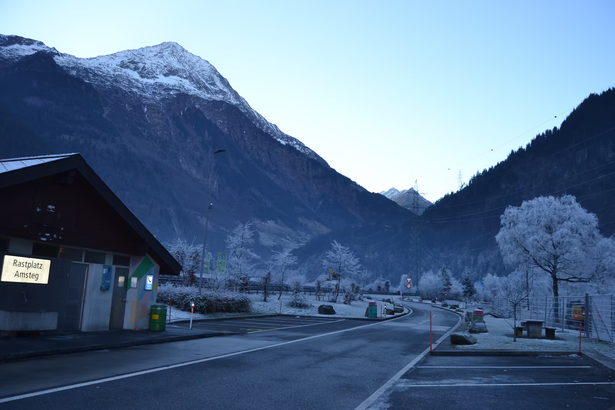
For a traveller the geology is legible from the car. The motorway follows a valley because that is where the ice went, it crosses the watershed at the lowest point available because that is what the pass is, and it descends on the southern side through the same sequence of zones in reverse, from snow and rock to forest and finally to the plain. The rest area where the first picture of this album was taken is on that descending line, with the snow capped peaks still visible behind the building.
The rock on the northern approach is mostly sedimentary and the rock on the southern side changes character, which is one of the reasons the drive is worth attention. Limestone and dolomite form the pale walls and the sharp towers of the eastern Alps, older crystalline rocks appear in the core of the chain, and the mixture produces the two different kinds of mountain scenery that alternate along the route: grey, layered walls on one side of a valley and steep, dark peaks on the other. The road follows whichever side offers the easier gradient.
Things to See
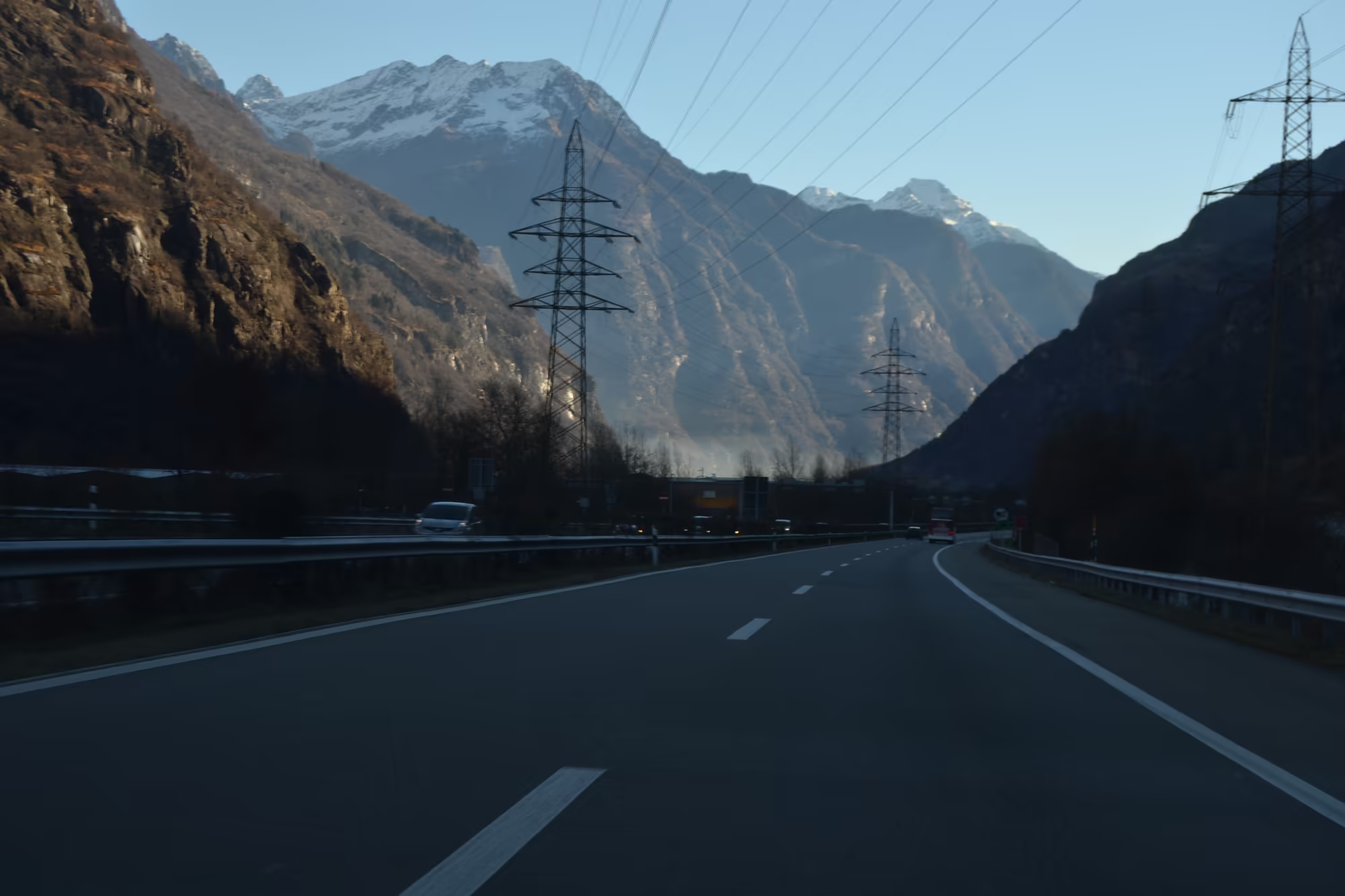
The first thing the day offers is the road itself. A rest area beside a building with a German sign, snow capped peaks in the background and a car park half full of winter traffic is the ordinary beginning of a long drive south, and it is worth stopping for rather than driving past; the same view in better weather is a mountain panorama, and the difference between the two is only the cloud. Driving into the afternoon, the motorway runs through a deep alpine valley flanked by steep rocky walls, with snow beside the carriageway and the rock face close enough to read.
The valleys of the northern side are the second subject. Traffic moves in long lines between the rock walls, tunnels cut through the ridges, galleries protect the road where rockfall is frequent, and the settlements in the valley floors are compact and built close to the road. In winter the light is low and the contrast between the dark forest, the white slopes and the asphalt is at its strongest, which makes the drive itself the sight.
On the southern side the landscape changes within an hour. The snow stops at a certain height, the forests of spruce give way to mixed woodland, then to bare hills, and the towns along the road begin to look Italian: terracotta roofs, church towers, vines and olives on the lower slopes, and the first cypresses. The plain of the Po opens out, the mountains recede into the haze behind, and the road turns into a fast straight line towards the centre of the country, which is where this day ends.
Rome at night is the last part of the album, even when the pictures of it belong to the following morning. The city has a population of about 2.7 million and lies in the central western part of the Italian peninsula along the shores of the Tiber valley; the Vatican City, the smallest country in the world and the headquarters of the Catholic Church, sits inside it. Entering it after a day of mountain road, the change is immediate: the street lighting, the walls, the fountains and the traffic of a capital that has been continuously inhabited for twenty-eight centuries.
References
- Wikipedia contributors (2026). Alpine orogeny. en.wikipedia.org/wiki/Alpine_orogeny
- Wikipedia contributors (2026). Alps. en.wikipedia.org/wiki/Alps
- Wikipedia contributors (2026). Austria. en.wikipedia.org/wiki/Austria
- Wikipedia contributors (2026). Autostrada A1 (Italy). en.wikipedia.org/wiki/Autostrada_A1_(Italy)
- Wikipedia contributors (2026). Brenner Pass. en.wikipedia.org/wiki/Brenner_Pass
- Wikipedia contributors (2026). History of Sicily. en.wikipedia.org/wiki/History_of_Sicily
- Wikipedia contributors (2026). Lazio. en.wikipedia.org/wiki/Lazio
- Wikipedia contributors (2026). Rome. en.wikipedia.org/wiki/Rome
- Wikipedia contributors (2026). Switzerland. en.wikipedia.org/wiki/Switzerland
- Wikipedia contributors (2026). Tiber. en.wikipedia.org/wiki/Tiber
- Wikipedia contributors (2026). UNESCO. en.wikipedia.org/wiki/UNESCO
- Wikipedia contributors (2026). Vatican City. en.wikipedia.org/wiki/Vatican_City