2025 Amalfi 4 - Positano

Journal Notes
General
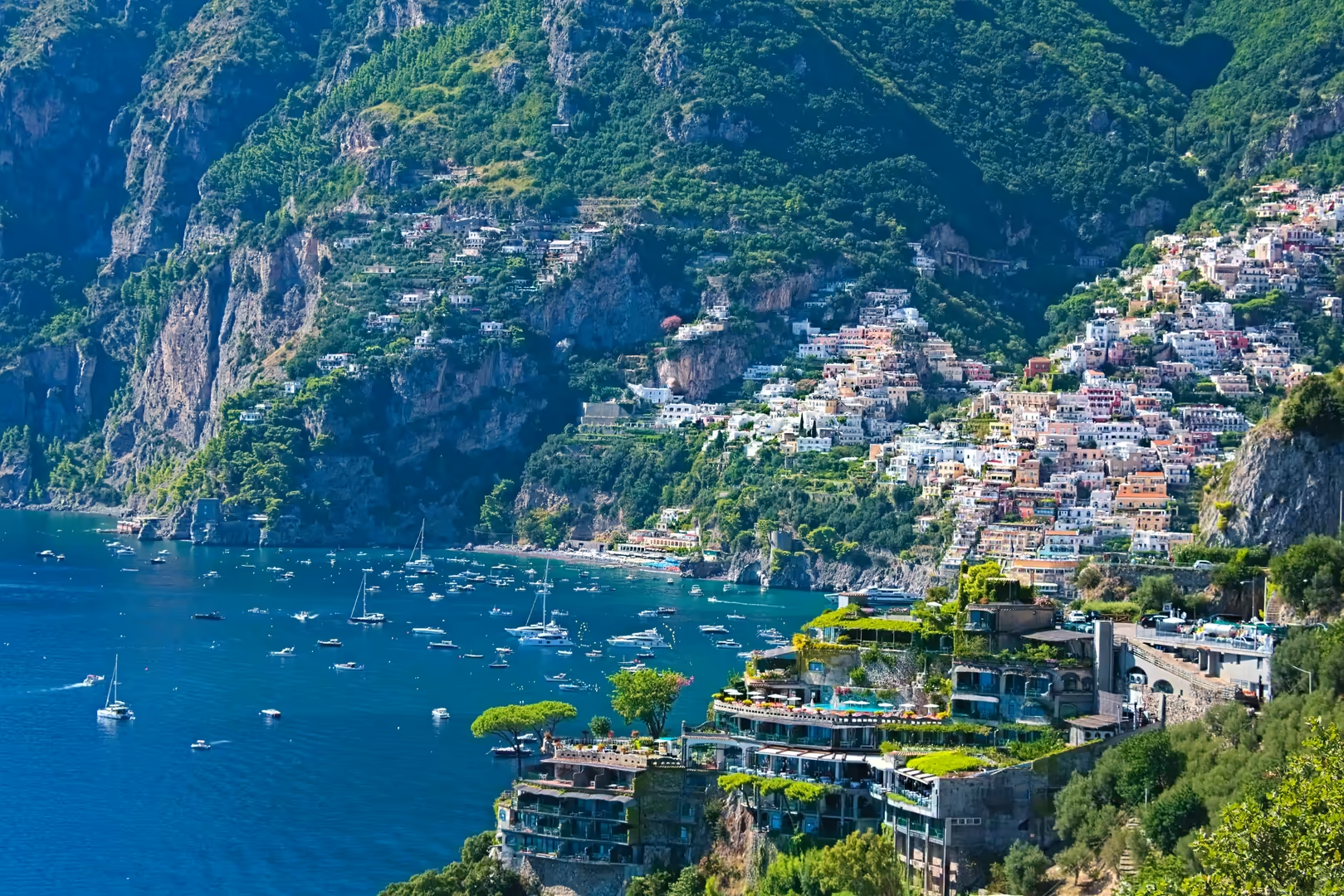
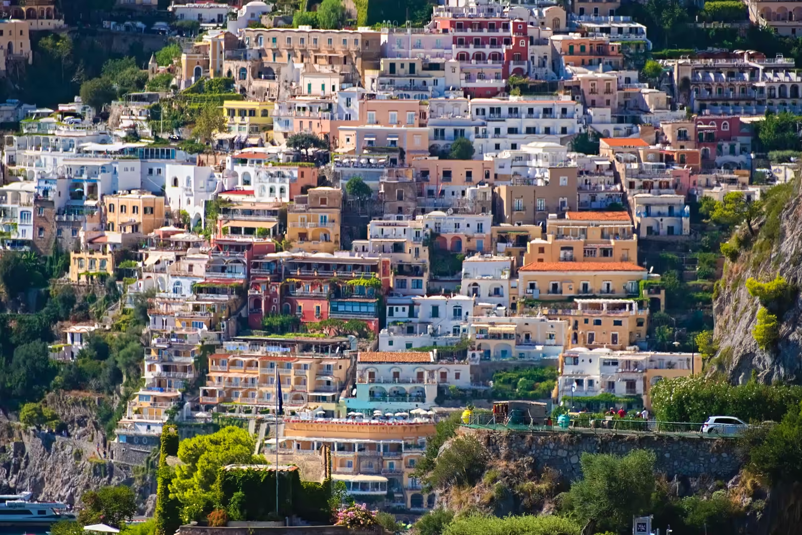
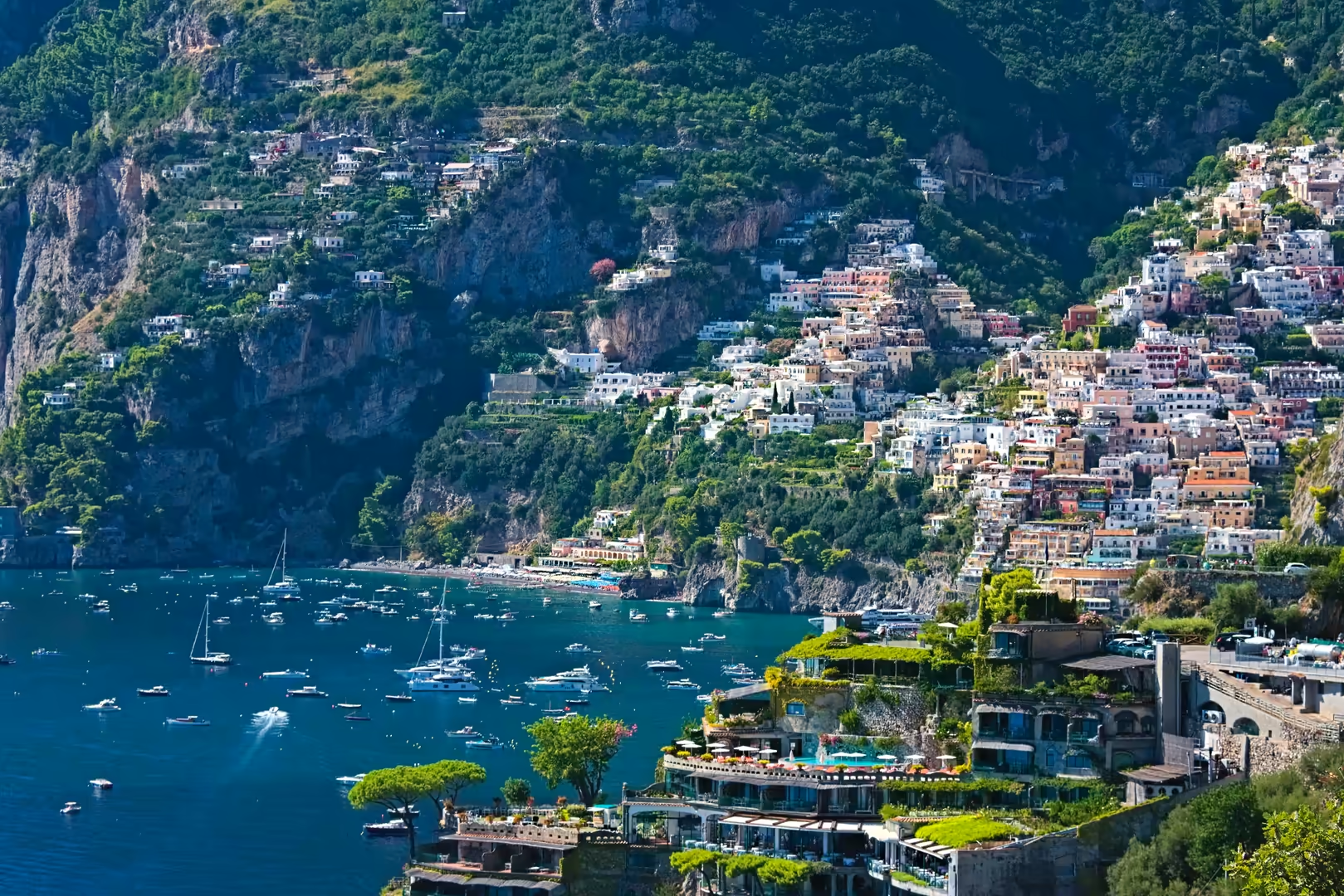
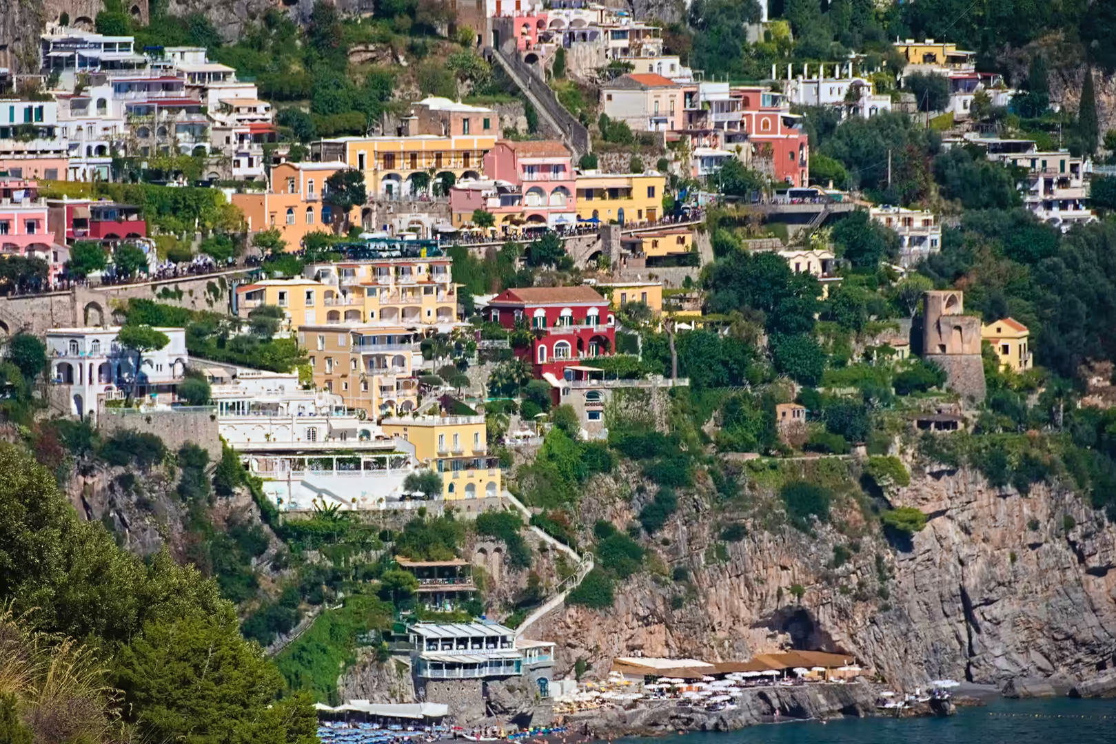
Positano is a town and comune on the western part of the Amalfi Coast, in the province of Salerno, Campania. The settlement occupies a steep amphitheatre of slopes descending from the Monti Lattari to the Tyrrhenian Sea, where its pastel-coloured houses appear to cascade down the mountainside toward two small beaches, the Spiaggia Grande and the Fornillo. The comune covers 8.65 km² and has about 3,600 inhabitants (2026), concentrated in the coastal core and in the two frazioni of Montepertuso and Nocelle, which cling to the mountain above the town. Because of its vertical layout of narrow stairways, terraced houses and hanging gardens, Positano is known as the “vertical city” of the coast.
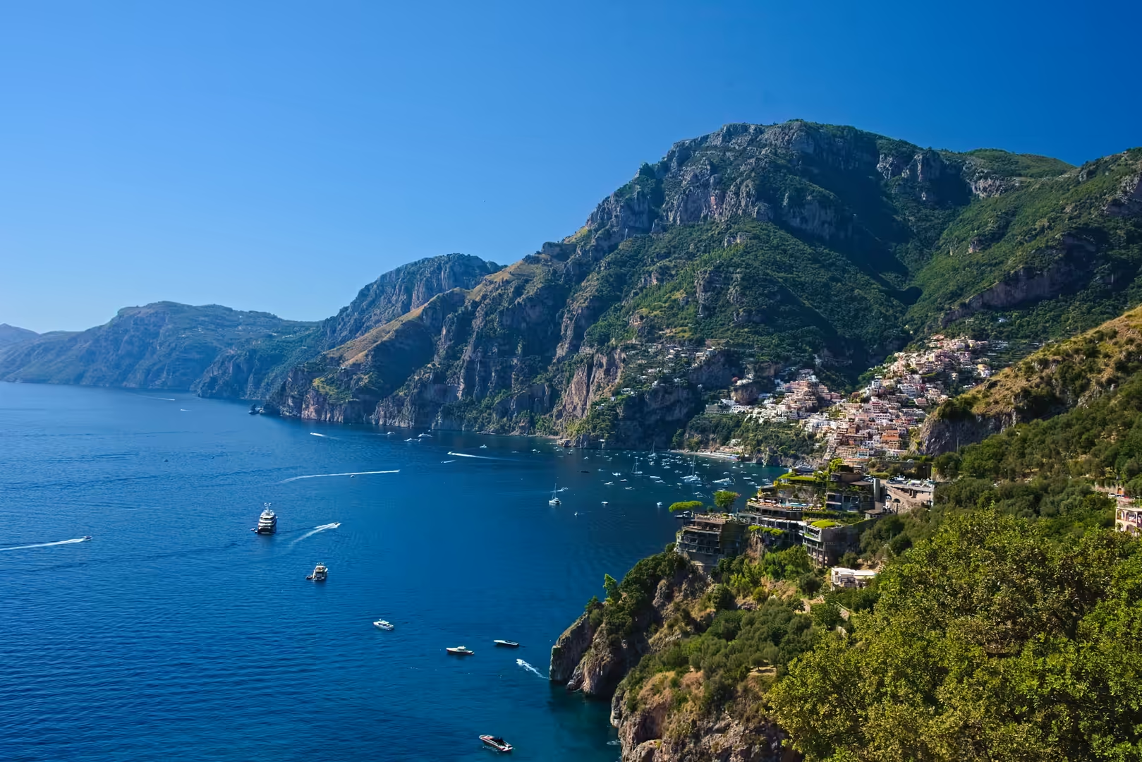
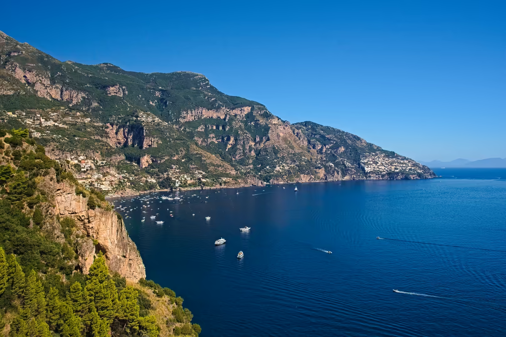
The town lies within the Costiera Amalfitana, the coastal landscape inscribed on the UNESCO World Heritage List in 1997 in recognition of the exceptional interaction between its dramatic topography and its settlement history. The coast of Positano faces south-west across the Tyrrhenian Sea toward the islands of Li Galli, and the town is sheltered by the ridge of the Monti Lattari, which rises steeply behind it to elevations of more than 400 m within a short distance of the shore. The climate is Mediterranean (Csa), with hot, dry summers and mild, humid winters, and the natural vegetation of evergreen maquis, olives, lemons and pines has been shaped by centuries of terracing into the cultivated landscape that defines the setting.
For most of its modern history Positano was a small fishing and agricultural community; its transformation into one of the best-known destinations of the Italian coast began only in the 1950s, after the writer John Steinbeck celebrated the town in an essay of 1953. Today tourism dominates the local economy, and the town is served by the coastal road and by ferries that connect it with Amalfi, Salerno, Capri and the islands of the bay.
History
The earliest traces of human presence in the territory of Positano date from the Upper Palaeolithic: the Grotta La Porta, a small cave at about 120 m above sea level, was frequented by groups of gatherers and hunters, and systematic surveys conducted in the 1950s recovered shells of molluscs together with the bones of wild boar, deer and other fauna, indicating an economy based mainly on the collection of marine resources.
In Roman times the coast of Positano was lined with the maritime villas of the imperial aristocracy. The remains of a large villa of the Claudian period have been identified below the church of Santa Maria Assunta, and further structures of the same dispersed type extended along the bay and onto the island of Li Galli, a pattern that, in the words of the archaeological literature, shows how even the most hidden spaces of this wild coast were used in the first century AD, without respect for the rocks that legend made the home of the Sirens. The villa of Positano, whose original owners are unknown, was provided with the typical apparatus of a Roman seaside residence (terraces, gardens, cisterns and rooms facing the sea) and systematic excavation of the site below the church has been carried out since 2003.
In the Middle Ages Positano belonged to the territory of the maritime republic of Amalfi and served as one of its ports, sharing in the trade of the duchy along the Tyrrhenian routes. After the decline of Amalfi the town prospered independently as a market port from the fifteenth to the seventeenth century, trading fish and the agricultural produce of its hinterland, and its merchant fleet connected the coast with the ports of the Tyrrhenian and beyond.
The prosperity did not survive the eighteenth century. By the middle of the nineteenth century Positano had fallen on hard times: more than half of its population emigrated, above all to the Americas, and the town declined into the condition of a poor fishing village that persisted through the first half of the twentieth century. It was this period of poverty that preserved the urban fabric of the old town from redevelopment, leaving the dense, stair-linked complex of houses that later became the town’s principal attraction.
The modern era of Positano began after the Second World War. The essay that John Steinbeck published in Harper’s Bazaar in May 1953, in which he described Positano as “a dream place that isn’t quite real when you are there and becomes beckoningly real after you have gone”, helped to make the town known to an international public, and during the following decades Positano became a favoured resort of artists, writers and musicians. The town gave its name to a distinctive style of beach fashion, the “Moda Positano”, and in 1997 it was included, with the whole of the Amalfi Coast, in the UNESCO World Heritage List.
Geology
Positano lies on the southern flank of the Monti Lattari, the calcareous ridge of Mesozoic platform carbonates that forms the backbone of the Sorrento Peninsula and the westernmost prolongation of the Campanian Apennines. The relief of the town is among the steepest of the entire coast: from sea level the ground rises over 400 m within little more than a kilometre, and the urbanised slopes are underlain by the same bedded and dolomitic limestones that characterise the whole range. The structural history of the ridge (Neogene Apennine shortening followed by Plio-Quaternary extensional faulting) created the high, steep coastal front and the deeply incised valleys that dissect the mountainside above the town.
The coastline at Positano is shaped by the meeting of the carbonate bedrock with the sea along an active tectonic front. The two beaches of the town, the Spiaggia Grande and the Fornillo, occupy small coves where streams descending from the mountain have cut through the limestone and deposited gravel fans, while the intervening headlands fall to the sea as cliffs. The shoreline itself is a product of the post-glacial marine transgression, which drowned the lower valley floors and produced the embargoed coast of the Amalfi district; the carbonate slopes above the town bear the traces of karst dissolution, rock falls and debris flows that have repeatedly shaped and reshaped the surface on which the city is built.
Below the waterline the same geology continues: the islands of Li Galli, lying some three kilometres off the coast, are the emerged summits of the carbonate ridge, separated from the mainland by the post-glacial rise of sea level. In antiquity these rocks were identified by sailors with the Sirenum scopuli, the islands of the Sirens of the Odyssey, and the name Sirenuse still applies to the group in Italian tradition. The islands thus document both the geological continuity of the range and the long human fascination with this stretch of coast.
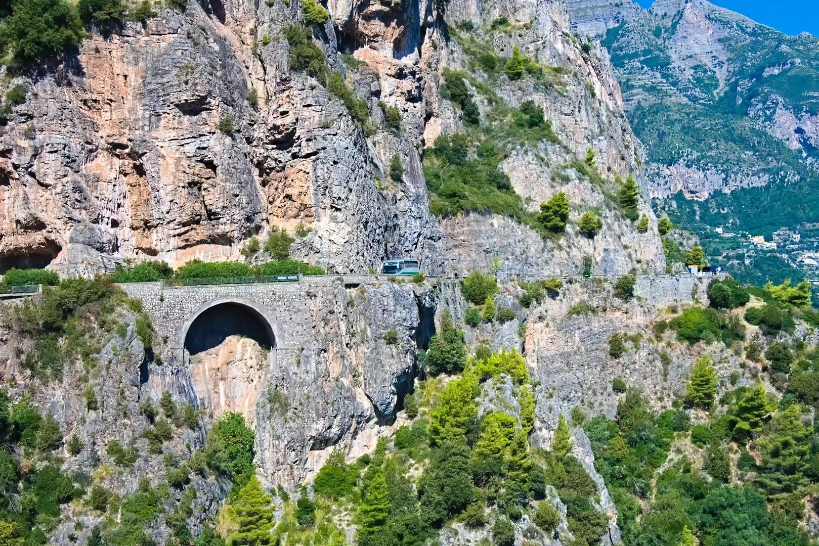
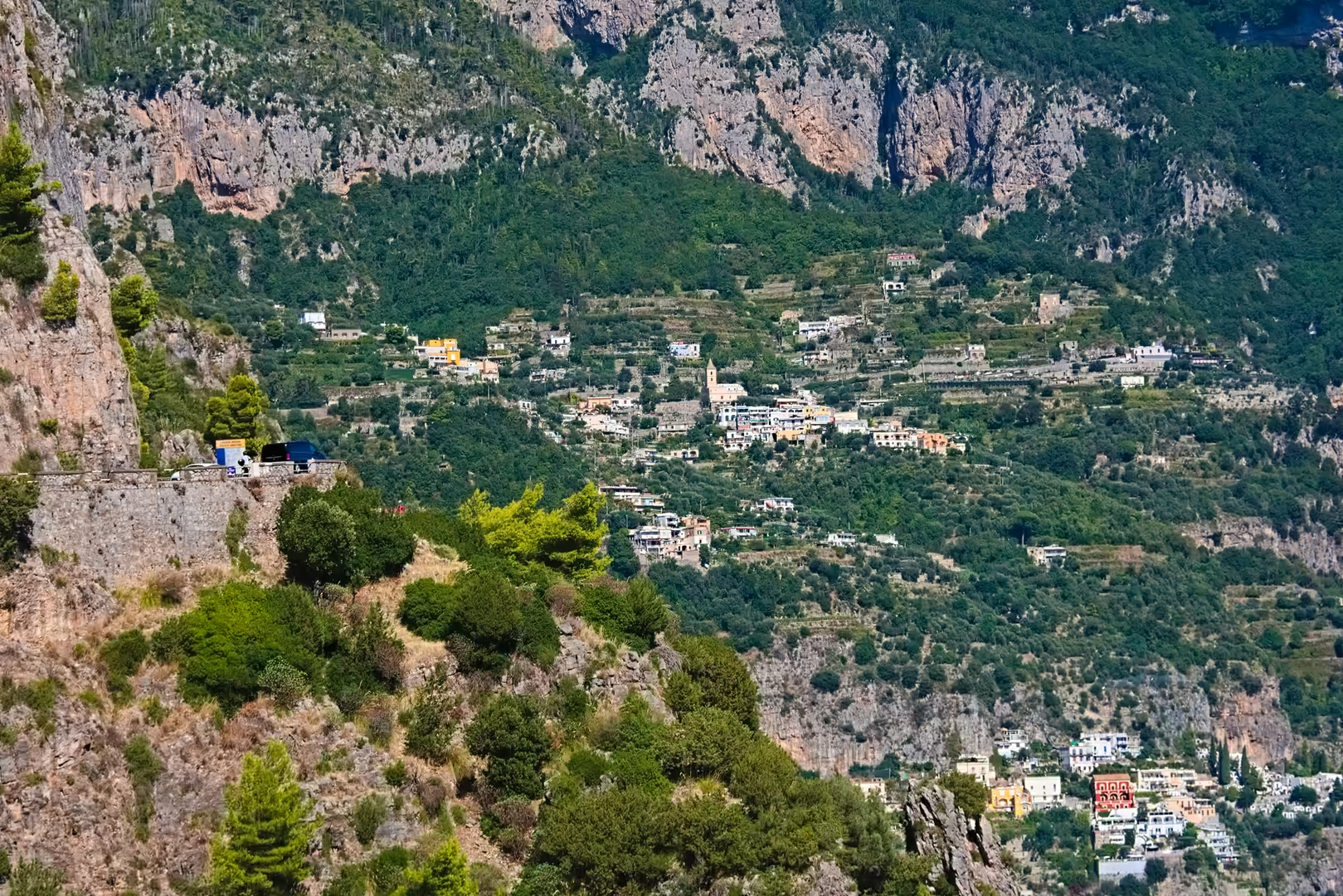
The construction of the town on such terrain has required a continuous struggle against gravity. Houses, churches and gardens are built on artificial terraces retained by dry-stone walls; the stairways that link the quarters follow the lines of the ancient paths; and the drainage of the steep valleys must be constantly maintained against the debris carried down by storms. The coastal road itself, the Strada Statale 163 Amalfitana, is an engineering achievement of the twentieth century that threads the cliffs between Positano and Amalfi through tunnels, over bridges and behind massive retaining walls, repeatedly repaired after rock falls, a visible expression of the geotechnical challenge posed by the Lattari slopes.
For the visitor, the geology of Positano is legible in the landscape: the pale limestone cliffs above the coloured houses, the boulders of the beaches, the terraced lemon groves planted in the thin soils that mantle the rock, and the islands on the horizon are all expressions of the same carbonate edifice whose history reaches back to the Mesozoic platform of the Tethys ocean.
Things to See
The spiritual and architectural centre of Positano is the church of Santa Maria Assunta, whose dome of majolica tiles rises above the old town. The church preserves a celebrated Byzantine icon of a black Madonna, dating from the thirteenth century; according to local tradition the image was being transported by pirates when a storm arose off Positano and a voice from the icon declared that it wished to remain here, whereupon the sailors brought it ashore. Below the church, the MAR (the Roman Archaeological Museum opened in 2018) displays the remains of the Claudian villa excavated beneath the sacred area, with its wall paintings and domestic structures.
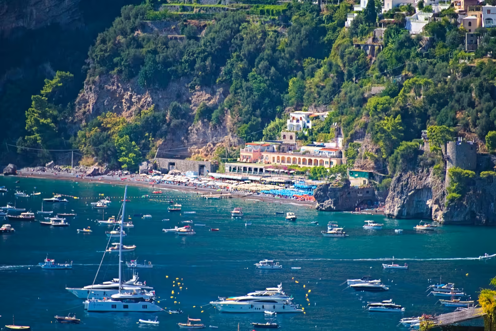
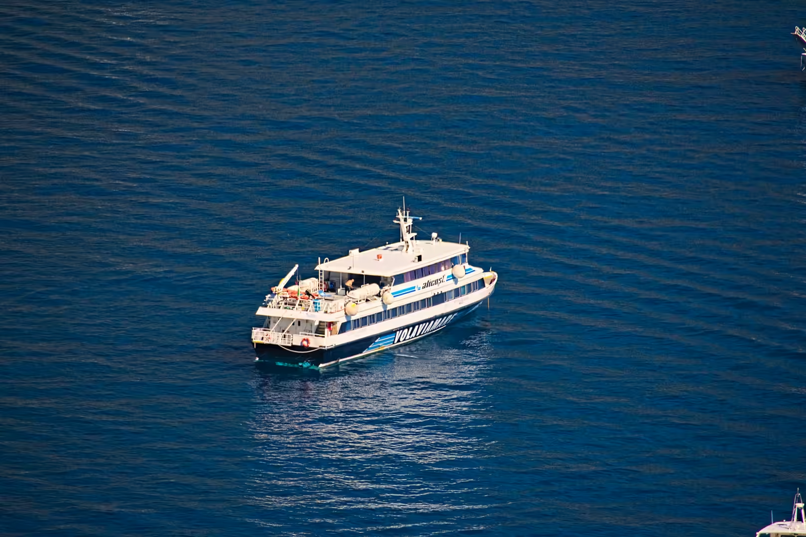
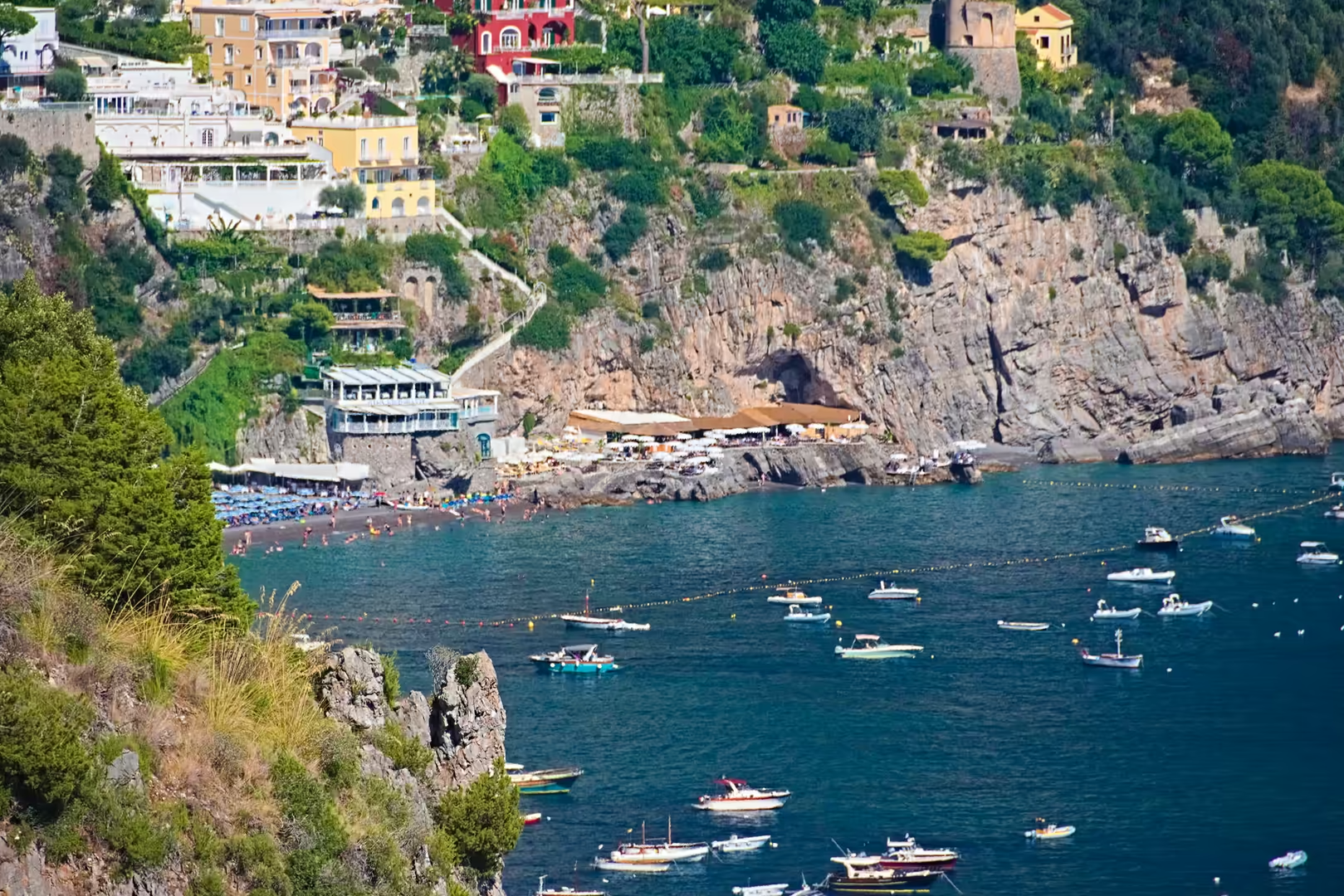
The two beaches define the coastal life of the town. The Spiaggia Grande, the principal beach, lies at the foot of the town beneath the cliff of the church and is lined with the coloured umbrellas that appear in countless views of Positano; the smaller Fornillo beach lies beyond the western headland, reached by footpath or by boat. From the beach the view extends across the bay to the islands of Li Galli, and the passenger ferries that connect Positano with Amalfi, Salerno and Capri depart from the small harbour at the eastern end of the Spiaggia Grande.
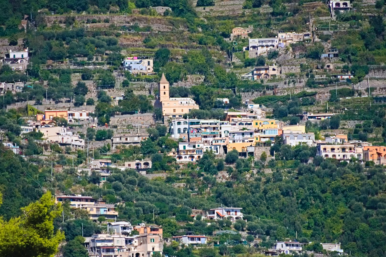
The hinterland of the town offers the other face of Positano. The frazione of Montepertuso, whose name refers to the natural opening in the rock above the village, lies on the mountain road, and beyond it Nocelle, the highest settlement of the comune, commands the panorama of the coast; from Nocelle the celebrated Sentiero degli Dei, the “Path of the Gods”, runs along the crest of the Lattari toward Agerola, offering walkers the most famous views of the entire Amalfi Coast, with Positano and Li Galli far below.
Finally, the approach to Positano is itself an experience: the Strada Statale 163 winds along the cliffs between the coastal towns, through tunnels and past viewpoints that reveal the town in its setting of mountain and sea. Seen from the road, from the sea or from the heights of Montepertuso, Positano presents the same image of a city suspended between the limestone mountain and the Tyrrhenian water: the vertical town that has become the emblem of the Amalfi Coast.
References
- Cinque, A. (2017). Sorrento Peninsula and Amalfi Coast: The Long-Term History of an Enchanting Promontory. In: Soldati, M. & Marchetti, M. (eds), Landscapes and Landforms of Italy. World Geomorphological Landscapes. Cham: Springer.
- Skinner, P. (2013). Medieval Amalfi and its Diaspora, 800-1250. Oxford: Oxford University Press.
- Steinbeck, J. (1953). Positano Bites Deep. Harper’s Bazaar, May 1953.
- UNESCO World Heritage Centre (1997). Costiera Amalfitana. World Heritage List, ref. 830. whc.unesco.org/en/list/830
- UNESCO World Heritage Centre (1997). Nomination documentation for the Costiera Amalfitana. whc.unesco.org/document/154393
- Wikipedia contributors (2026). Positano. en.wikipedia.org/wiki/Positano
- Wikipedia contributors (2026). Amalfi Coast. en.wikipedia.org/wiki/Amalfi_Coast
- Wikipedia contributors (2026). Li Galli. en.wikipedia.org/wiki/Li_Galli
- Wikipedia contributors (2026). Monti Lattari. en.wikipedia.org/wiki/Monti_Lattari
- Wikipedia contributors (2026). Sorrento Peninsula. en.wikipedia.org/wiki/Sorrento_Peninsula
- Wikipedia contributors (2026). Strada statale 163 Amalfitana. en.wikipedia.org/wiki/Strada_statale_163_Amalfitana
- Wikipedia contributors (2026). Sentiero degli Dei. it.wikipedia.org/wiki/Sentiero_degli_Dei
- Wikipedia contributors (2026). Montepertuso. it.wikipedia.org/wiki/Montepertuso
- Wikipedia contributors (2026). Nocelle. it.wikipedia.org/wiki/Nocelle
- Wikipedia contributors (2026). Costiera amalfitana. it.wikipedia.org/wiki/Costiera_amalfitana