2026 South East Europe 1 - Slovakia
6 September 2026






Journal Notes
General
Slovakia, officially the Slovak Republic, is a landlocked country of Central Europe. It is bounded by Austria on the west, the Czech Republic on the north west, Poland on the north, Ukraine on the east and Hungary on the south, and it covers an area of 49,035 square kilometres, which makes it one of the smaller states of the European Union. The country lies at the heart of the continent, and its position on the routes between the Baltic and the Black Sea, and between western and eastern Europe, has shaped its long history as a frontier and a crossroads.
The capital is Bratislava, a city on the Danube in the extreme south west, and the population of the whole country numbered about 5.4 million at the 2021 census. The official language is Slovak, a West Slavic language closely related to Czech, though Hungarian and other tongues are also spoken in the south. Slovakia is a parliamentary republic; it joined the European Union and NATO in 2004, entered the Schengen Area in 2007 and adopted the euro in 2009.
The greater part of the territory is mountainous, rising from the fertile lowlands along the Danube and the Morava in the south and west to the forested ridges of the Carpathians that cross the country from the Little Carpathians in the west to the High Tatras and the eastern ranges in the north east. Slovakia is among the most castle rich lands of Europe, and it preserves a large number of medieval towns, fortified churches and surviving folk architecture, as well as national parks and caves of international significance.
Among the more recent additions to the landscape are the planned towns of the post war era, of which the most complete example is Nová Dubnica in the Ilava Basin of western Slovakia. Lying at the foot of the Strážovské hills beside the river Váh, it was laid out from 1951 as a model socialist town to house the workers of the heavy machinery plant at nearby Dubnica nad Váhom, and its broad avenues, housing blocks and public buildings were designed by the architect Jiří Kroha, a leading figure of the Czech avant garde. The town is now recognised in the Register of modern architecture in Slovakia as an outstanding instance of post war modernist planning.
History
The territory of present day Slovakia was occupied by Slavic tribes in the fifth and sixth centuries and became the heartland of Great Moravia, the first substantial West Slavic state, in the ninth century. The Byzantine missionaries Cyril and Methodius came to the court of the Moravian ruler in 863 and introduced a Christian liturgy and a written Slavonic language, a legacy that still anchors the Slovak and wider Slavonic cultural tradition. Great Moravia collapsed at the beginning of the tenth century, and the land passed under the Kingdom of Hungary, within which it remained for about a thousand years.
Under the Hungarian crown the Slovak towns flourished; the mining centres of the central mountains grew rich on gold, silver and copper and were numbered among the royal free towns, while the valleys carried trade between the Baltic and the Balkans. The thirteenth century brought the Mongol invasion, which ravaged the region, and the following two centuries a striking campaign of urban and Gothic building. When the Ottomans overwhelmed the Hungarian kingdom in the sixteenth century the town of Bratislava, then Pressburg, became the capital of Royal Hungary in 1536 and the seat of the Hungarian diet, and it was raised to a coronation city: between 1563 and 1830 eleven Hungarian kings and eight queens were crowned in its cathedral, Maria Theresa among them in 1740.
The nineteenth century was the age of the Slovak national revival, and in the 1840s Ľudovít Štúr and his fellow scholars codified the standard literary language. After the First World War Slovakia was united with the Czech lands to create Czechoslovakia in 1918; the union endured through the inter war republic and the wartime Slovak state of 1939 to 1945, which allied itself with Nazi Germany, and through the communist era that followed 1948. The Prague Spring of 1968, led by the Slovak Alexander Dubček with its programme of socialism with a human face, was suppressed by the armies of the Warsaw Pact, and the Velvet Revolution of 1989 ended communist rule. On 1 January 1993 Czechoslovakia was dissolved peacefully and Slovakia became an independent state; it joined the European Union and NATO in 2004. In the industrial decades after 1948 the country was rapidly industrialised, and model towns were built for the new works; Nová Dubnica, founded for the workers of the machinery and arms plant at Dubnica nad Váhom, is the most complete of these.
Geology
Slovakia lies almost entirely within the Carpathian mountain system, the eastern continuation of the Alpine orogenic belt, and its subsurface records the collision and folding of the European and Carpathian plates. The northern rim of the country is formed by the High Tatras, the highest range of the whole chain, whose crystalline granite and gneiss cores rise to the summit of Gerlachovský štít at 2,655 metres, the highest peak of the Carpathians. The range is of glacial origin, and its cirques, sharp ridges and mountain lakes are among the most striking natural features of the country.
Southward the mountains descend to the wide Danubian lowlands and the lesser basins of the interior, where gravels, sands and loess overlie older bedrock and provide the fertile soil of the agricultural heartland. Much of Slovakia belongs to the Inner Western Carpathians, a belt of ranges and intermontane basins that includes the Low Tatras, the Slovak Ore Mountains and the volcanic chains of the central region. The country is rich in mineral and thermal springs, and its carbonate rocks have produced an extensive karst, including numerous caves, several of which form part of the natural heritage of the region.
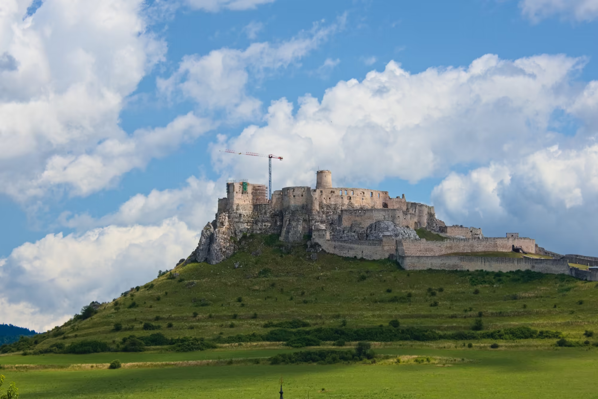
A striking local feature is the travertine that occurs at a number of sites, most famously at the hill beneath Spiš Castle, a raised mound of calcareous spring deposit that forms the natural platform of the fortress and gives the site its dramatic silhouette above the Hornád basin. Volcanic rocks of the Carpathian arc appear in the central and southern ranges, and the present rivers and the glaciers of past ice ages have carved the valleys and gorges that cut through the ridges, leaving a varied landscape of forested slopes, limestone plateaux and river lowlands.
Things to See
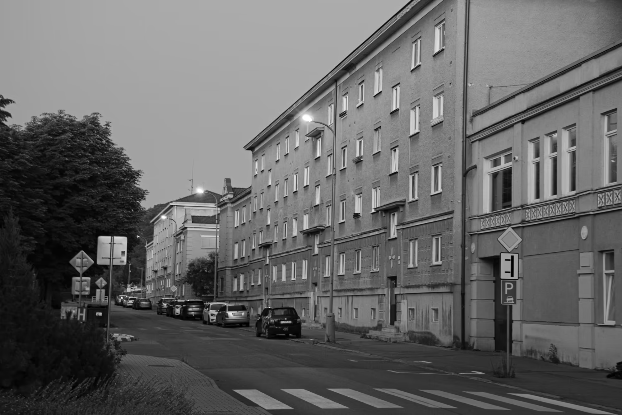
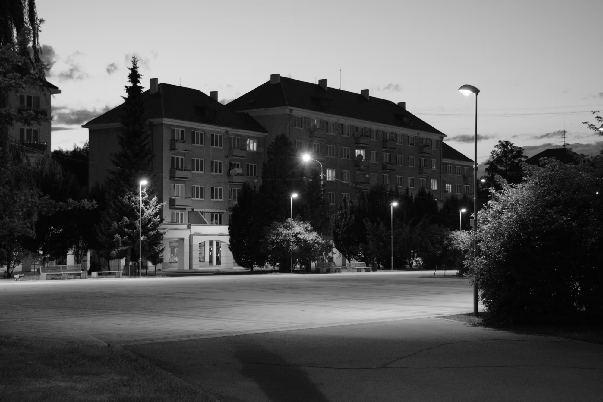
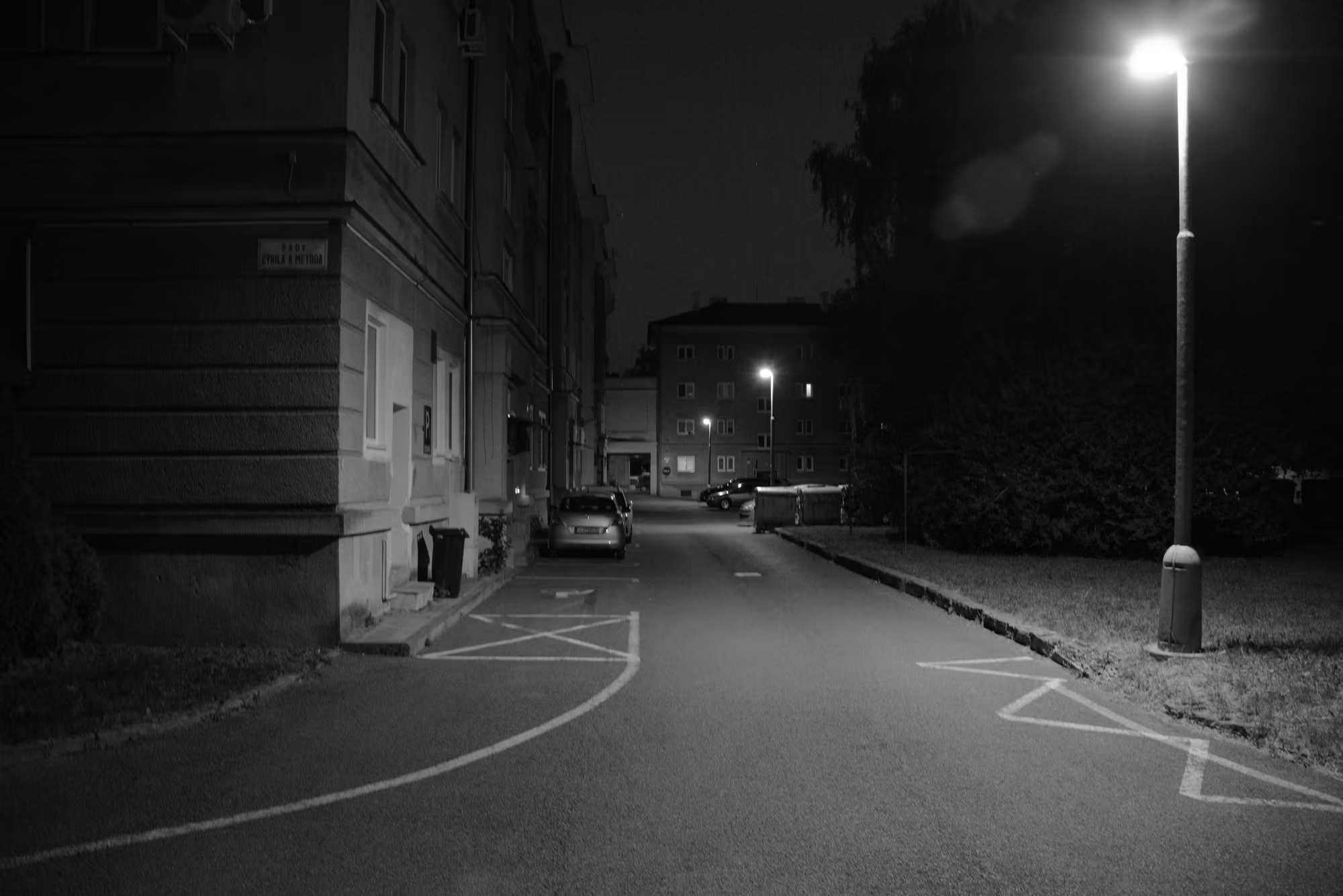
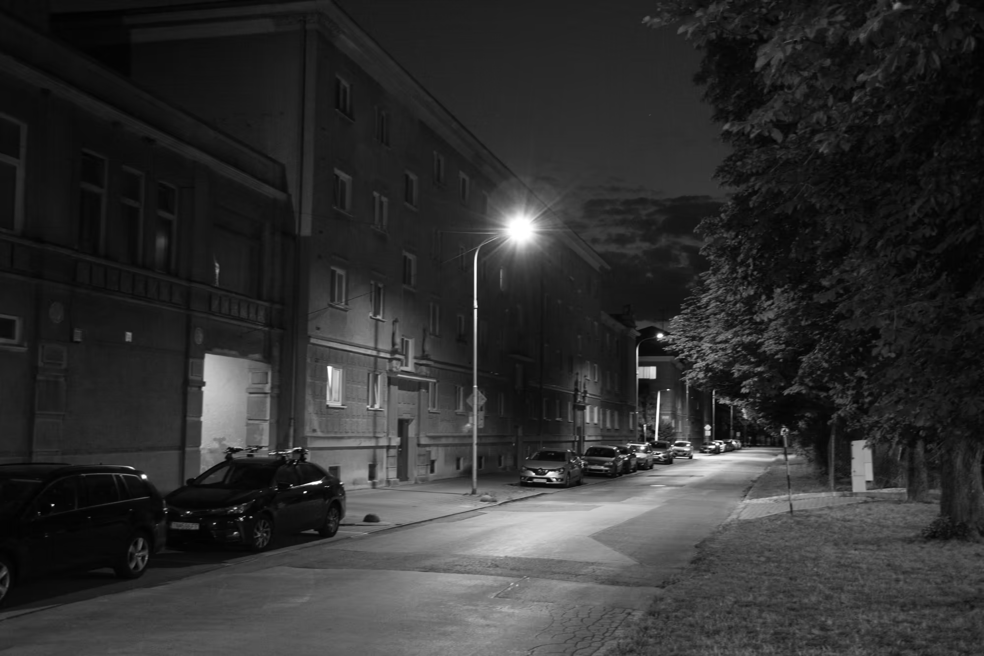
This stage of the journey is centred on the planned town of Nová Dubnica, in the Ilava Basin on the river Váh in western Slovakia. It was conceived from 1951 as a model socialist community for the workers of the heavy machinery works at neighbouring Dubnica nad Váhom, and the urban design and the principal buildings were the work of Jiří Kroha, a leading figure of the Czech avant garde. The result is one of the most complete ensembles of post war modernist planning in the country, preserved with its broad avenues, generous public squares and blocks of flats and listed in the Register of modern architecture in Slovakia. The town stands on the floor of the Ilava Basin between the Strážovské hills and the river Váh, a frame of wooded ridges that sets off the orderly grid of its avenues and squares.
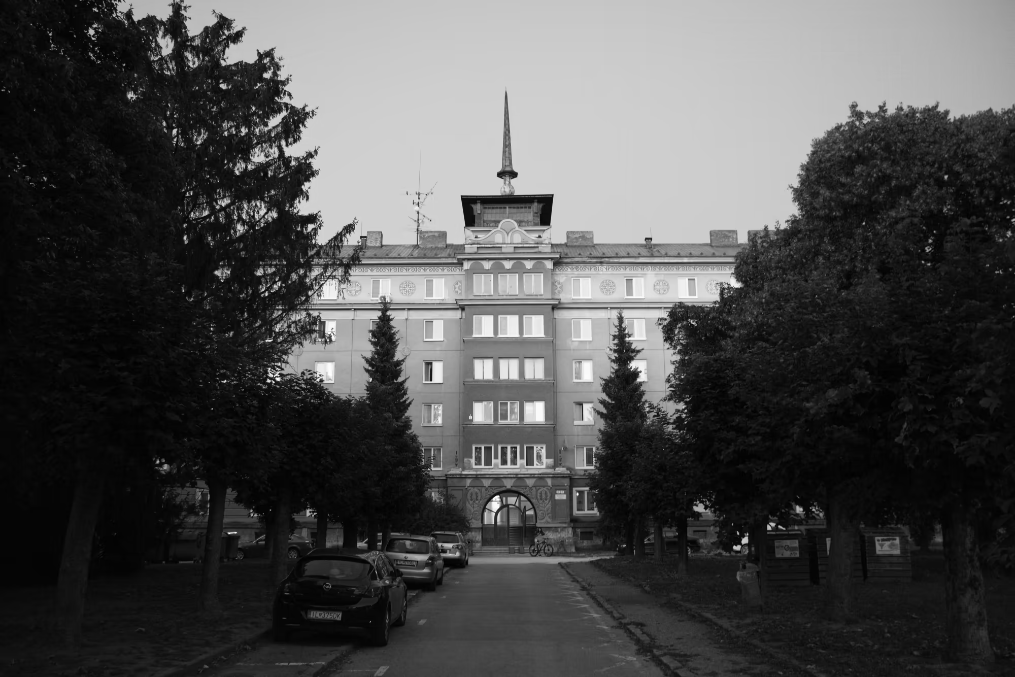
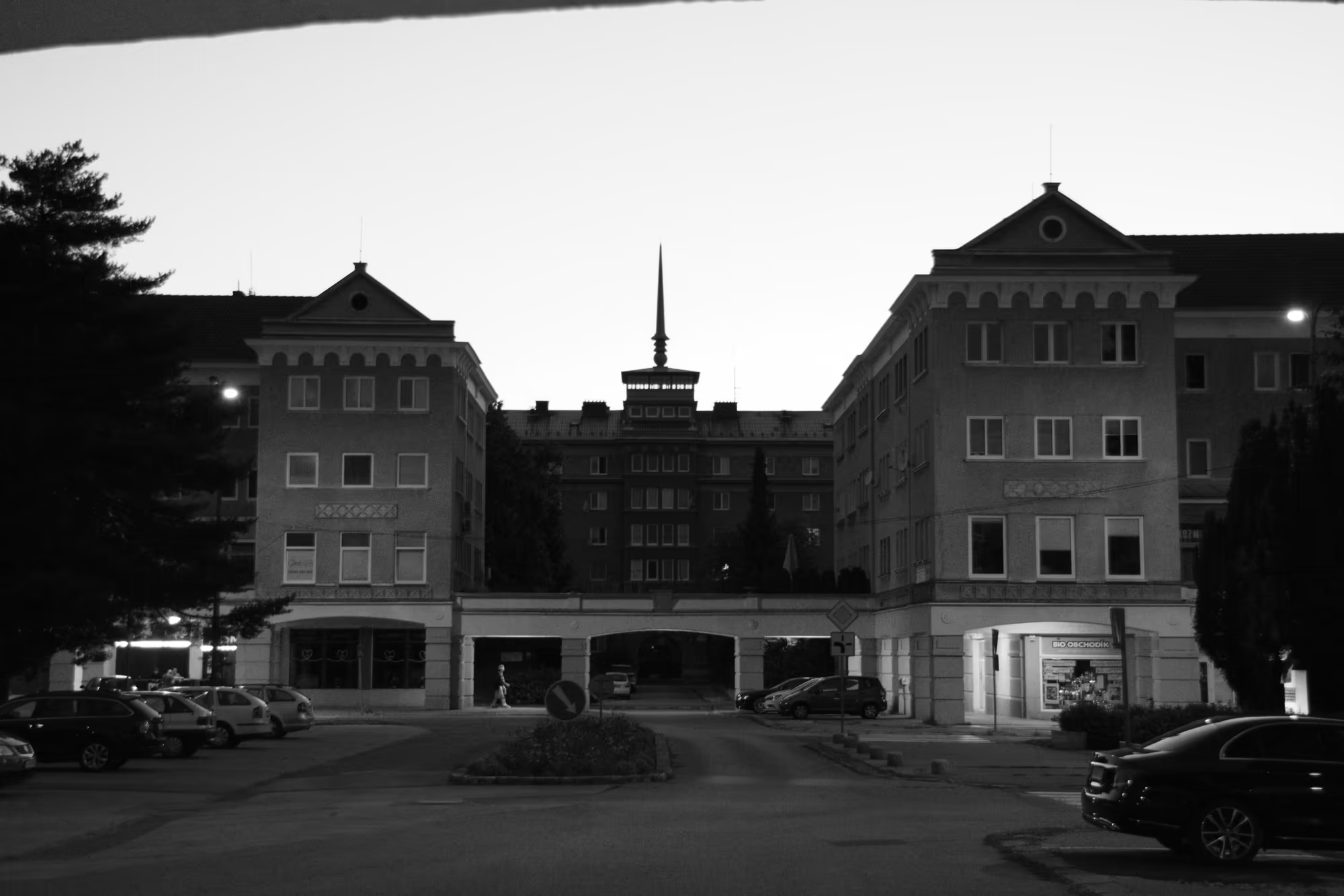
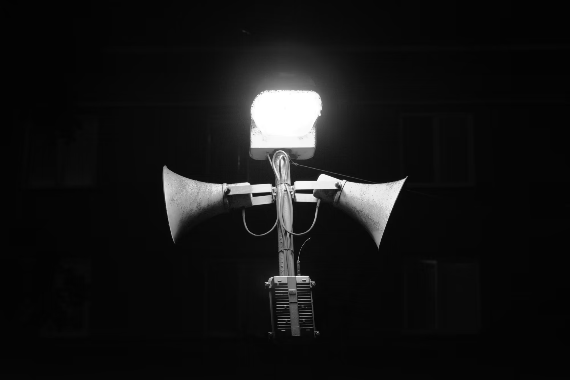
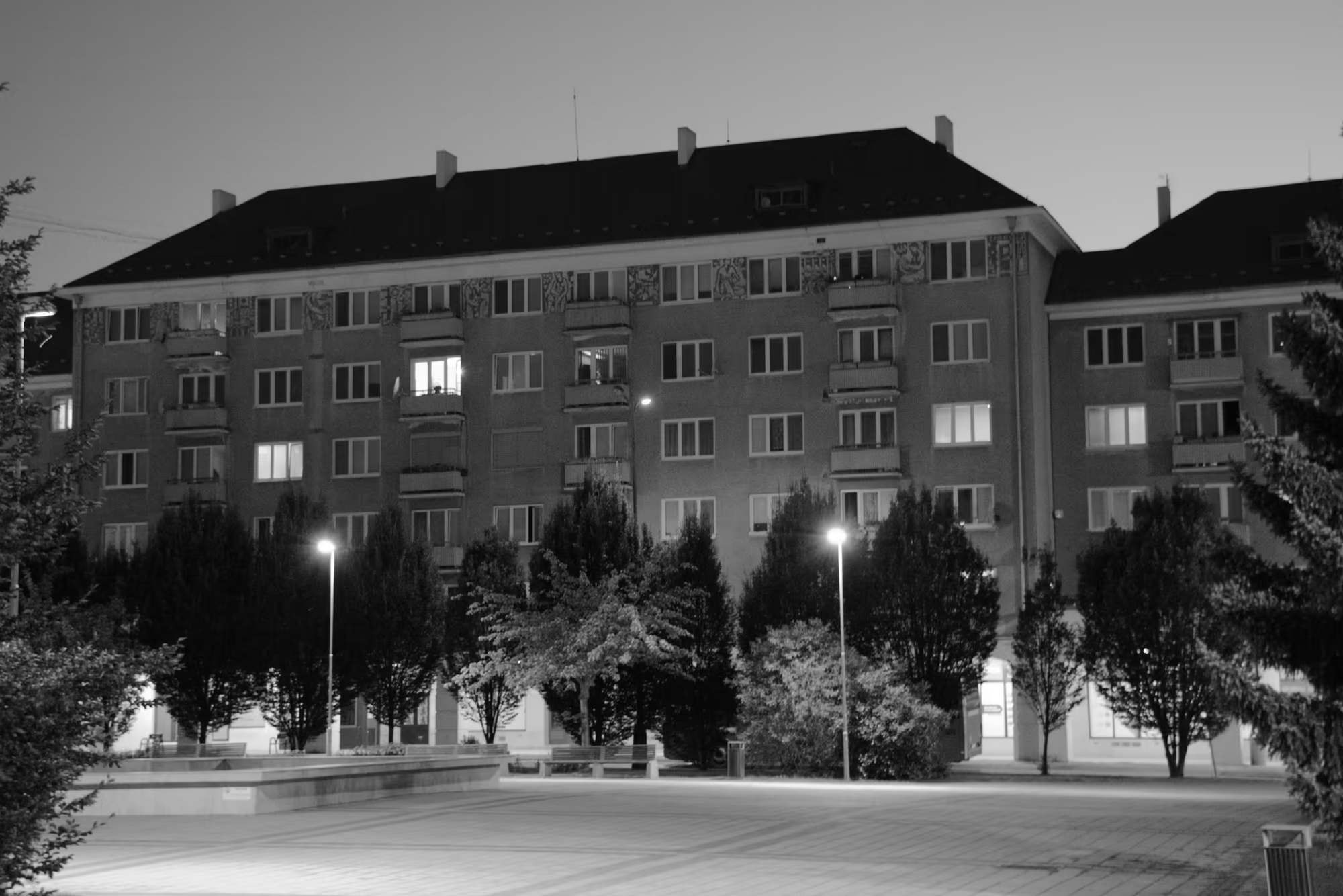
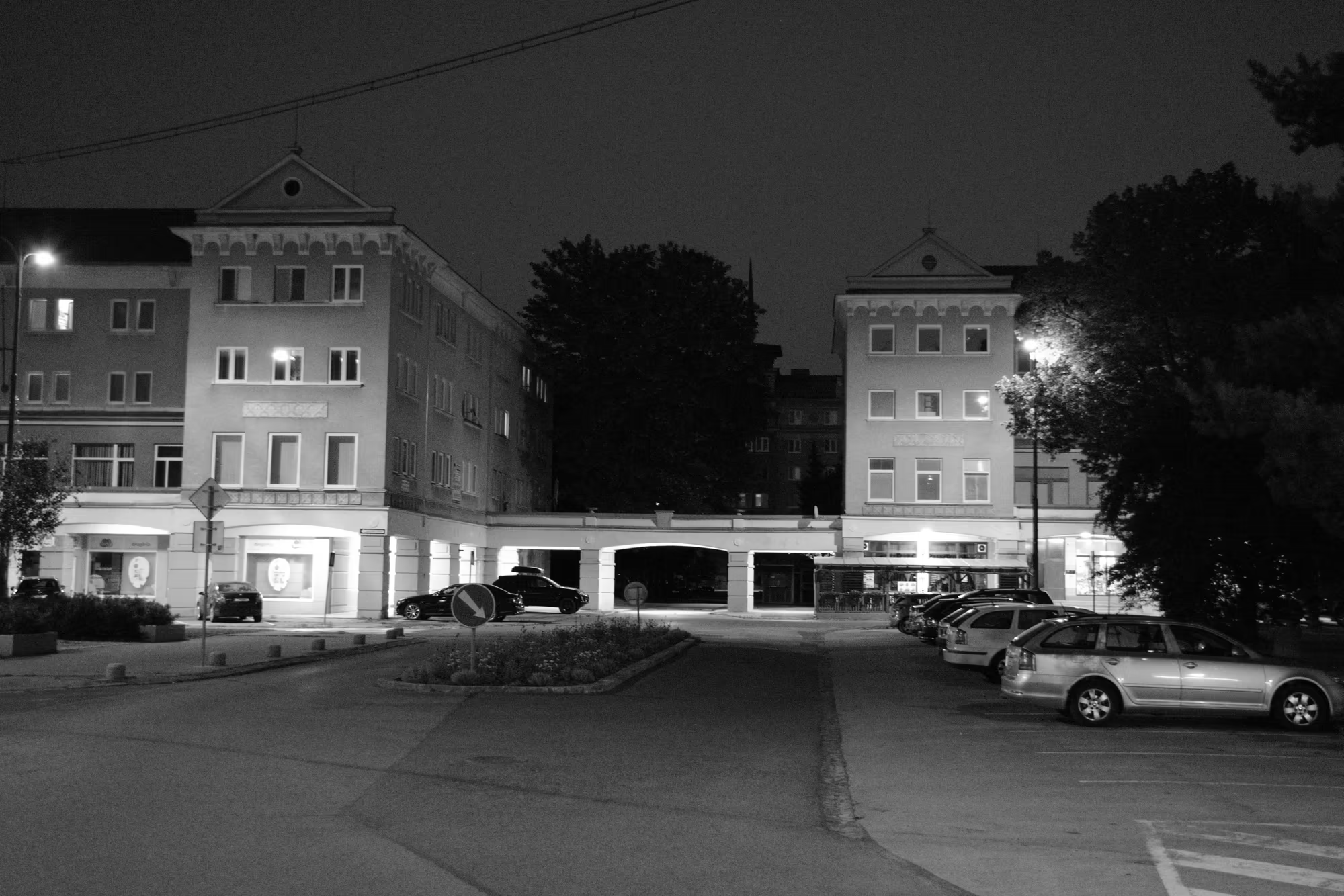
The heart of the town is a formal centre of symmetrical blocks that enclose a square, with an obelisk spire rising at its axis and a monumental civic building with a slender tower standing behind a tree lined approach. The architect set the centre at the crossing of two broad avenues and aligned the towers and spires to close the vistas, so that the plan reads as a series of framed views. Nearby is a circular plaza with a raised round pavilion and a sunken stepped basin, and the whole is lit at night by the twin horned floodlight columns that line the streets. The ensemble is best appreciated after dark, when the lamps and the lit windows bring out the ordered geometry of the plan.
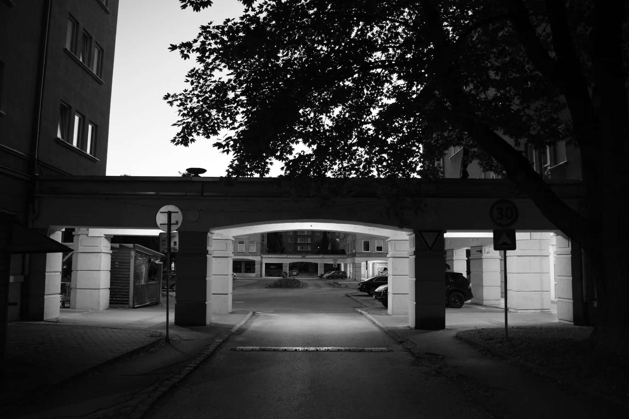
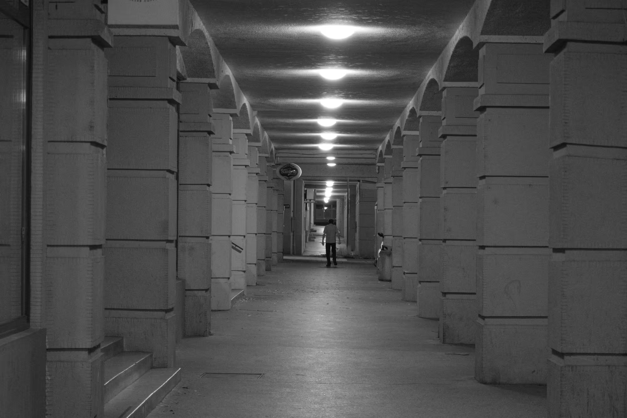
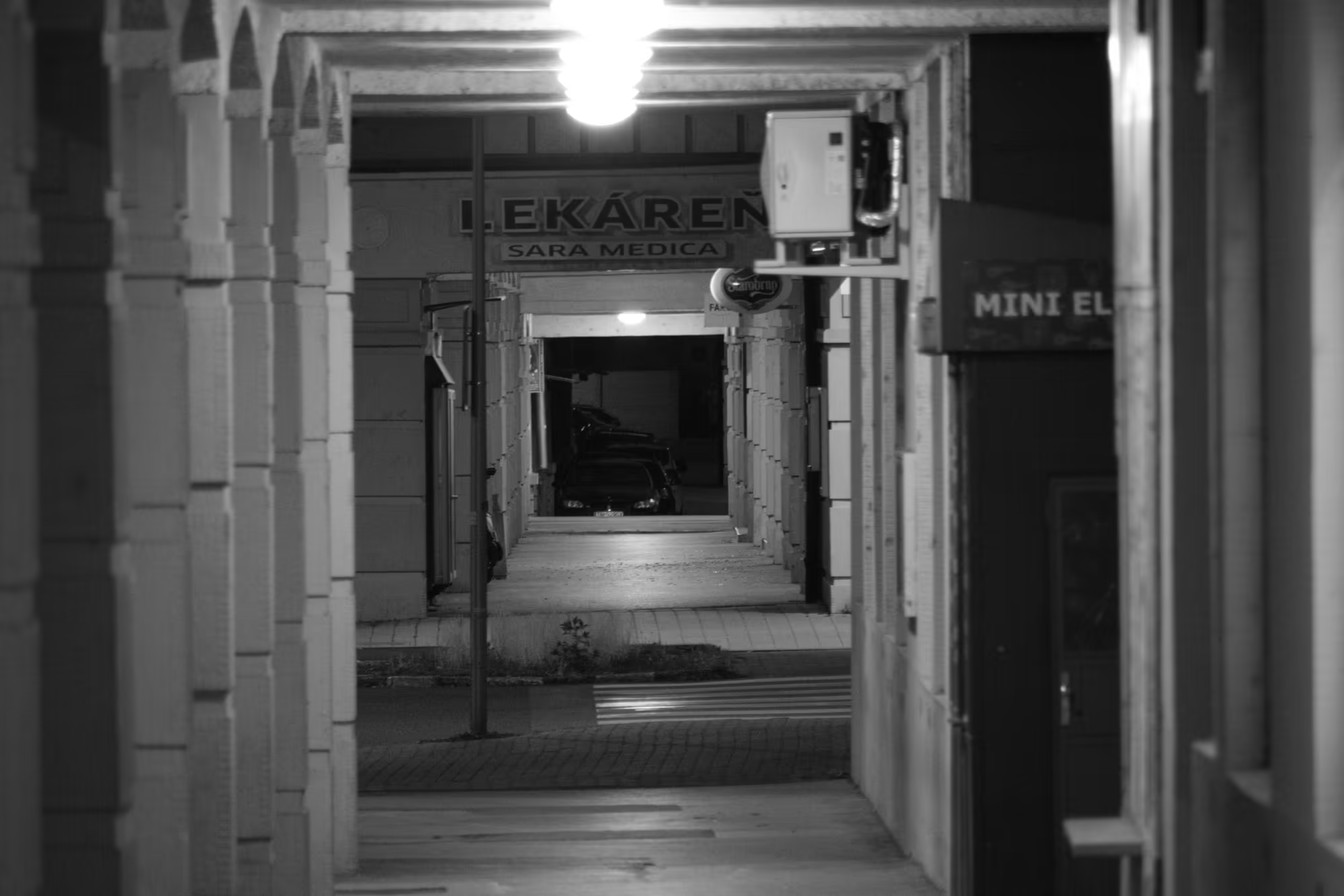
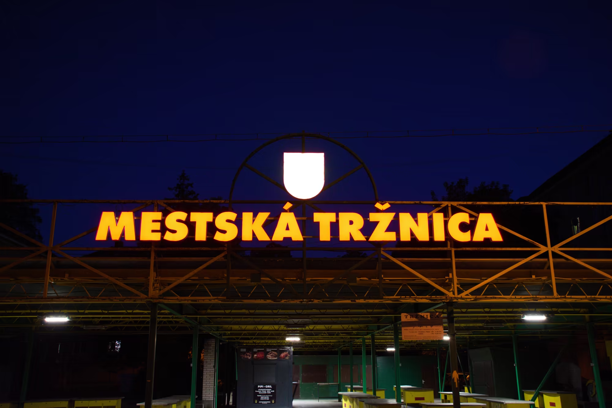
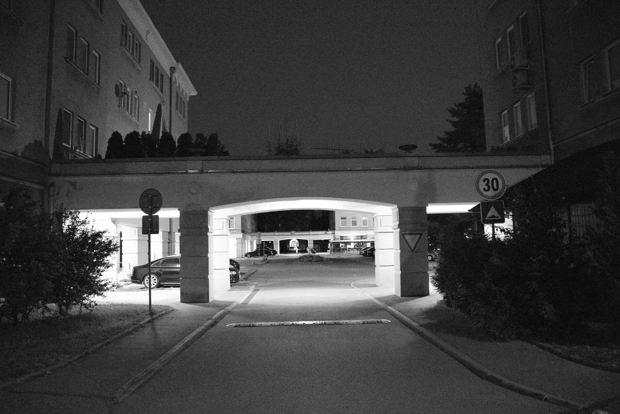
The housing districts consist of long blocks of flats, several of which carry decorative friezes, and the gable ends are decorated with reliefs, among them a stylised family beneath a tree. Covered arcades pass beneath the blocks and are lined with small shops, and the town has its own market hall, the Mestská tržnica, whose letters burn above the entrance at night. These works of ornament and public art belong to a period when the state commissioned art for the new housing districts, and they give the town its particular, and now historic, character.
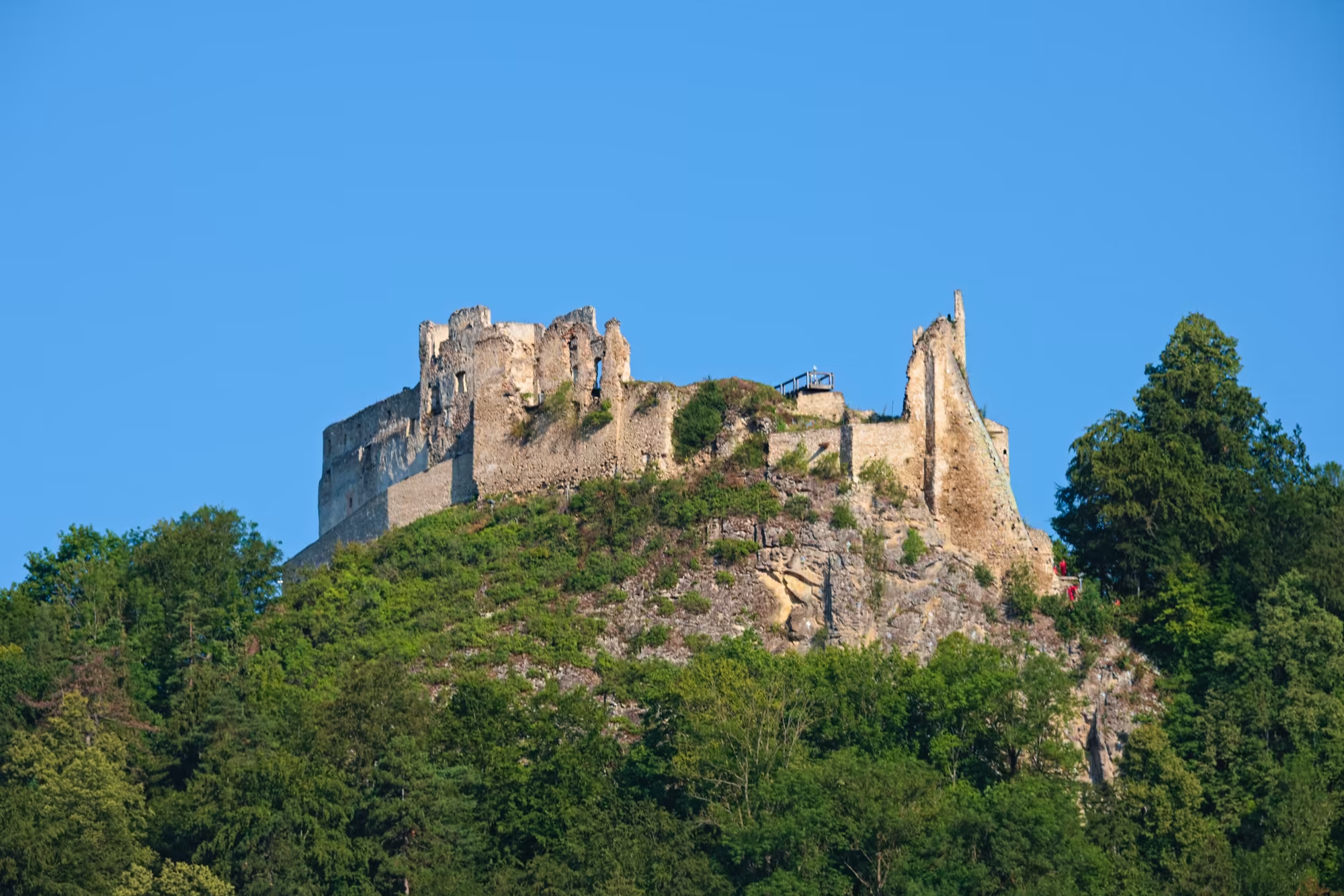
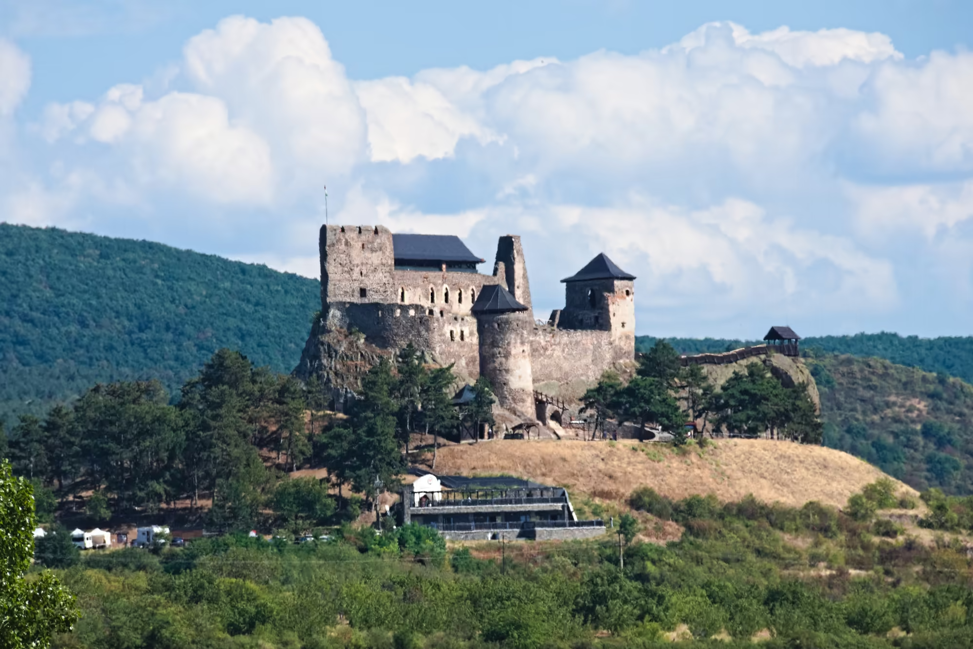
Eastward the landscape opens toward the region of Spiš, whose great monument is Spiš Castle, one of the largest castle sites in Central Europe, standing on a travertine hill above the village of Spišské Podhradie. It originated as a frontier stronghold in the twelfth century and grew into a royal fortress and the seat of the Zápolyai and Csáky families; a fire in 1780 left it a ruin, and its long walls, towers and courtyards now rise over pasture and woodland, commanding a wide view of the Hornád basin. Together with the walled ecclesiastical town of Spišská Kapitula and the old town of Levoča, with its Gothic and Renaissance square and the altar of Master Paul, it was entered on the UNESCO World Heritage List in 1993.
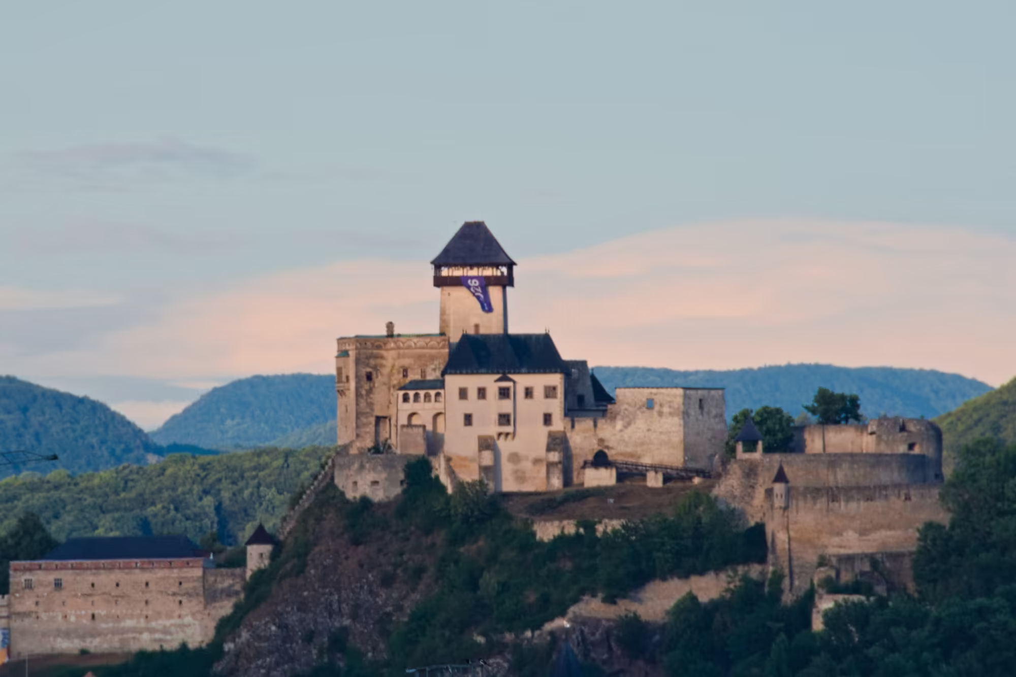
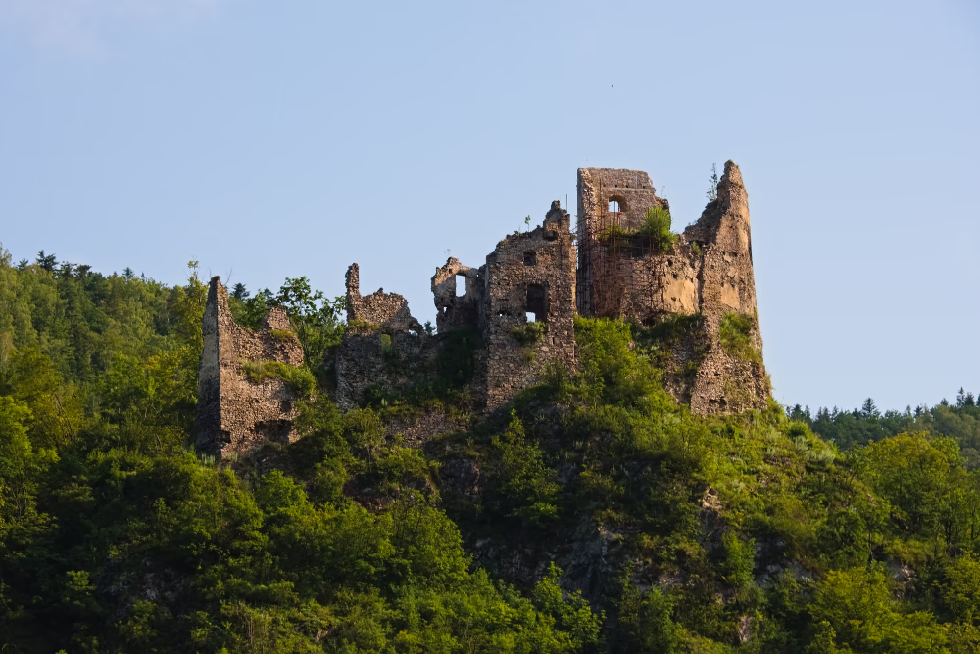
The wider region offers an abundance of further castles, many of them now picturesque ruins among the wooded hills, and the forested and mountainous scenery of the Carpathians. The High Tatras, the highest range of the chain, lie within reach and provide the setting of the loftiest peaks and the glacial lakes that attract walkers and climbers, while the valleys of the Váh and its tributaries carry the historic towns and the quiet countryside of the Slovak interior. Together these places sketch the two faces of the land: the ordered modernist centre of a planned town, and the medieval castles and mountain scenery of the older Slovak countryside.
References
- Wikipedia contributors (2026). Slovakia. en.wikipedia.org/wiki/Slovakia
- Wikipedia contributors (2026). History of Slovakia. en.wikipedia.org/wiki/History_of_Slovakia
- Wikipedia contributors (2026). Nová Dubnica. en.wikipedia.org/wiki/Nová_Dubnica
- Wikipedia contributors (2026). Dubnica nad Váhom. en.wikipedia.org/wiki/Dubnica_nad_Váhom
- Wikipedia contributors (2026). Jiří Kroha. en.wikipedia.org/wiki/Jiří_Kroha
- Register of modern architecture in Slovakia (2026). The New Socialist Town of Nova Dubnica. register-architektury.sk/en/objekt/261-the-new-socialist-town-of-nova-dubnica
- Wikipedia contributors (2026). Ilava. en.wikipedia.org/wiki/Ilava
- Wikipedia contributors (2026). Váh. en.wikipedia.org/wiki/Váh
- Wikipedia contributors (2026). Trenčín Region. en.wikipedia.org/wiki/Trenčín_Region
- Wikipedia contributors (2026). Carpathian Mountains. en.wikipedia.org/wiki/Carpathian_Mountains
- Wikipedia contributors (2026). High Tatras. en.wikipedia.org/wiki/High_Tatras
- Wikipedia contributors (2026). Great Moravia. en.wikipedia.org/wiki/Great_Moravia
- Wikipedia contributors (2026). Dissolution of Czechoslovakia. en.wikipedia.org/wiki/Dissolution_of_Czechoslovakia
- Wikipedia contributors (2026). Spiš Castle. en.wikipedia.org/wiki/Spiš_Castle
- Wikipedia contributors (2026). Levoča. en.wikipedia.org/wiki/Levoča
- UNESCO World Heritage Centre (1993). Levoča, Spiš Castle and the Associated Cultural Monuments. whc.unesco.org/en/list/620/