2026 South East Europe 2 - Hungary
6 September 2026
Journal Notes
General
Hungary is a landlocked country of Central Europe, occupying the greater part of the Carpathian Basin. It is bounded by Slovakia and Ukraine to the north, Romania to the east, Serbia and Croatia to the south, and Slovenia and Austria to the west, and it covers an area of about 93,000 square kilometres. The capital and largest city is Budapest, a city on the Danube, and the population of the whole country numbered about 9.6 million at the 2022 census. The official language is Hungarian, a Finno-Ugric tongue unrelated to the languages of its neighbours, and the country is a parliamentary republic, a member of the European Union since 2004 and of NATO since 1999, though it keeps its own currency, the forint.
The greater part of the land is low and flat, an open plain that falls away from the mountain rims of the Carpathians to the north and east and of the Alps to the west. The Danube crosses the country from north to south and divides it at Budapest, while the Tisza drains the great eastern plain; to the west lies Transdanubia with its rolling hills, its long lake of Balaton and its vineyards. The forests of the northern border country and the reedy lowlands of the south complete a varied but generally gentle landscape.
Although a modern, urbanised state, Hungary keeps a strong rural tradition, and much of the interior is given over to arable farming and to the rearing of cattle and horses on the great plains, and to the cultivation of vines on the hills that rise from the basin. The village street, the farmstead and the vineyard are as much part of the character of the land as the baroque cities and the thermal spas of the capital.
The economy of the country rests on manufacturing, agriculture and a growing service sector, and its industries are concentrated in the capital and in the towns of the northern hills and the Danube. The great plain supplies wheat, maize and sunflowers, and the land is known for its cattle, its horses and its long tradition of wine making, while the cities keep the baroque squares, the gothic churches and the mineral baths of a long urban history.
The towns of the country are for the most part old, and many grew upon the sites of the Roman settlements and the medieval market centres of the plain. Their squares are bordered by the palaces of the nobility and the churches of the orders, the streets are lined with the arcades and the shopfronts of the merchants, and the courtyard houses of the towns preserve the memory of a trading past. Beyond the capital the towns are small and their rhythm is unhurried, and they serve as the market places of the surrounding farmland.
History
The territory of present day Hungary was a province of the Roman Empire, Pannonia, whose frontier guarded the Danube against the peoples of the plain. In the ninth century the basin became the first home of the Hungarian, or Magyar, tribes, who crossed the Carpathians under their leader Árpád and settled the land in 896; Stephen, the first king, was crowned in 1000 or 1001 and adopted Christianity, and the Kingdom of Hungary grew into a substantial power of central Europe, drawing its wealth from the fertile plains. The Golden Bull of 1222 secured the rights of the nobles, and the medieval kingdom prospered on the trade between east and west, its towns, monasteries and churches built in the Romanesque and Gothic styles.
The Mongol invasion of 1241 ravaged the country, and the later Middle Ages were a time of rebuilding before the Ottoman Turks defeated the Hungarian army at Mohács in 1526. The kingdom was broken, and the greater part of Hungary fell to the Ottomans for more than a century, while the northern and western counties passed to the Habsburg crown. In the eighteenth century the Habsburgs reconquered the Turkish lands and the depopulated plain was resettled, and in 1867 the Compromise created the dual monarchy of Austria-Hungary, in which Hungary enjoyed a large measure of self government.
After the First World War Hungary lost about two thirds of its pre war territory under the Treaty of Trianon, and the interwar state was torn between reform and reaction. It sided with the Axis in the Second World War and was occupied and devastated; a communist republic was established in 1949. The revolution of 1956 against the Soviet backed regime was crushed, but the system loosened in the 1980s, and in 1989 Hungary led the peaceful transition away from one party rule, opening its border and easing the way for the collapse of the communist bloc. Hungary entered NATO in 1999 and the European Union in 2004.
The capitals of the country have always looked both east and west, and the history of the plain is written in the village names, the ruined castles and the great churches that mark the line of the old frontier. The memory of the revolution of 1956 and of the border opening of 1989 is held close, for it was here that the division of Europe first began to break.
Geology
Hungary lies at the heart of the Pannonian Basin, a great sedimentary depression enclosed by the arc of the Carpathians and the Alps. The basin formed during the Neogene, when the region subsided and was occupied by a body of water, the Pannonian Sea, which filled the area between roughly ten and five million years ago before it drained away, leaving a wide plain of fine sediment. Since then the basin has been filled by the rivers, by wind blown loess and by lake deposits, so that the surface is largely a flat or gently rolling lowland.
The plains are underlain by thick Quaternary deposits of gravel, sand and silty loess, and in places by alkali soils, while the margins of the basin rise into the hills of the northern mountains and of Transdanubia. The country is rich in geothermal and mineral springs, the legacy of the thin crust and ancient volcanism of the basin, which feed more than a thousand hot springs and give Budapest its fame as a spa city. Thermal pools and cavern baths count among the distinctive natural features of the land.
The hills and volcanic uplands that fringe the plain provide the soils for viticulture, and the pale loess of Transdanubia and the volcanic tuffs of the north east carry the vineyards of the Hungarian wine regions. The lowland is crossed by the Danube and the Tisza, whose meandering courses and old flood plains shape a landscape of river, pasture and reed bed, open and empty beneath a wide sky and marked here and there by the alkali steppe of the sunken plains.
Things to See
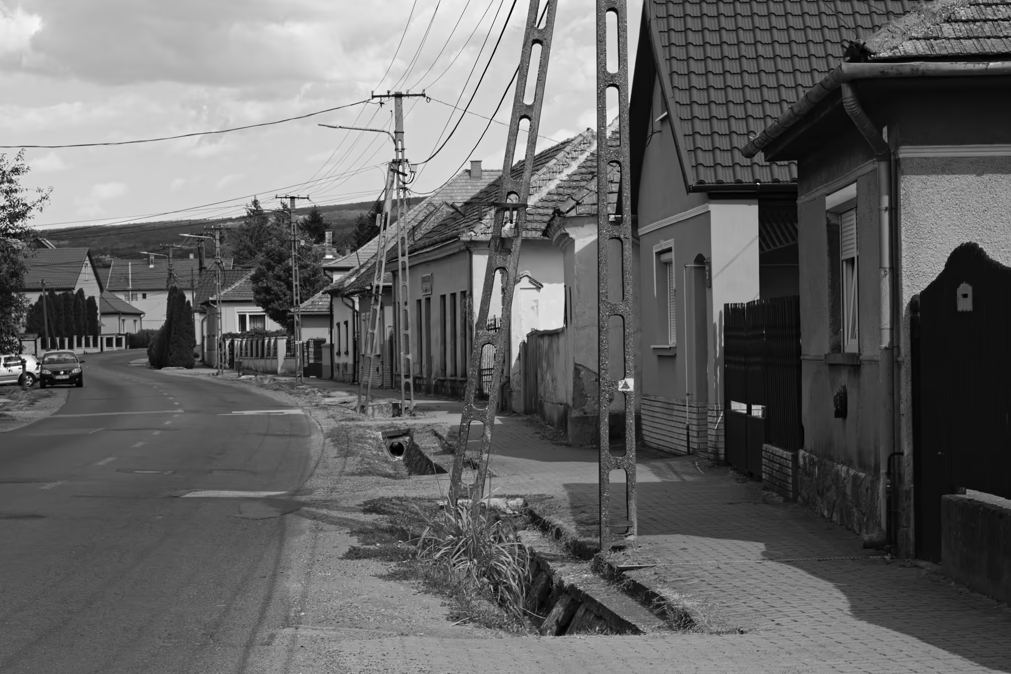
The interior of Hungary is a country of low hills and open plains, and its villages are strung along the quiet roads, the houses of whitewashed render beneath roofs of tile and pantile. The lanes pass between garden plots and sheds, past bus shelters and the poles on which storks nest, and the everyday life of the land is carried on among the parked cars and the small shops of the settlement.
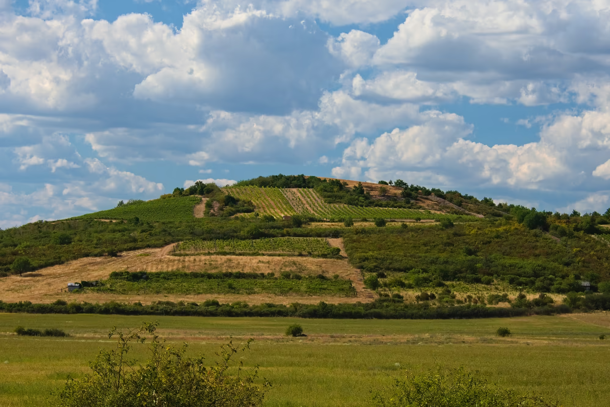
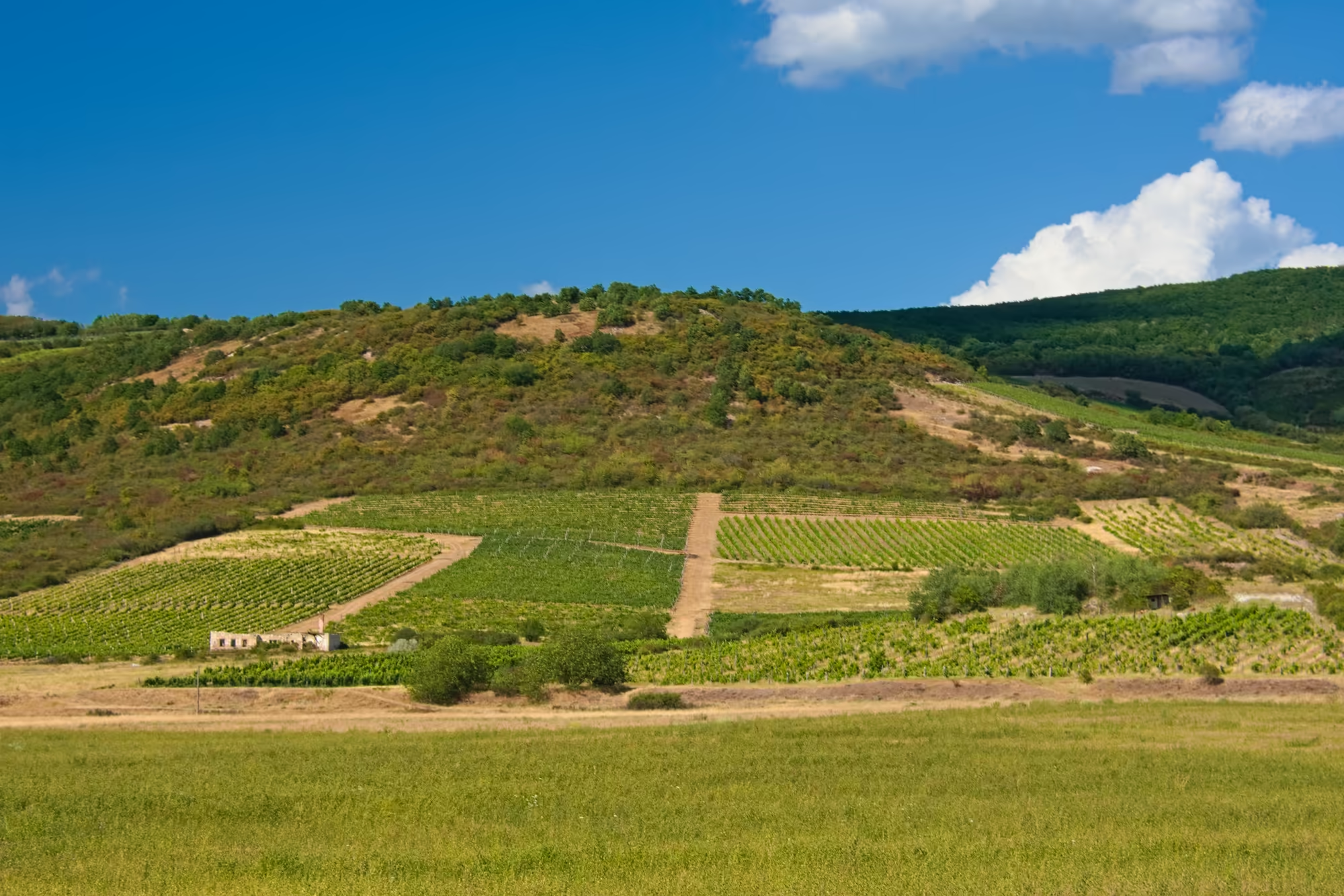
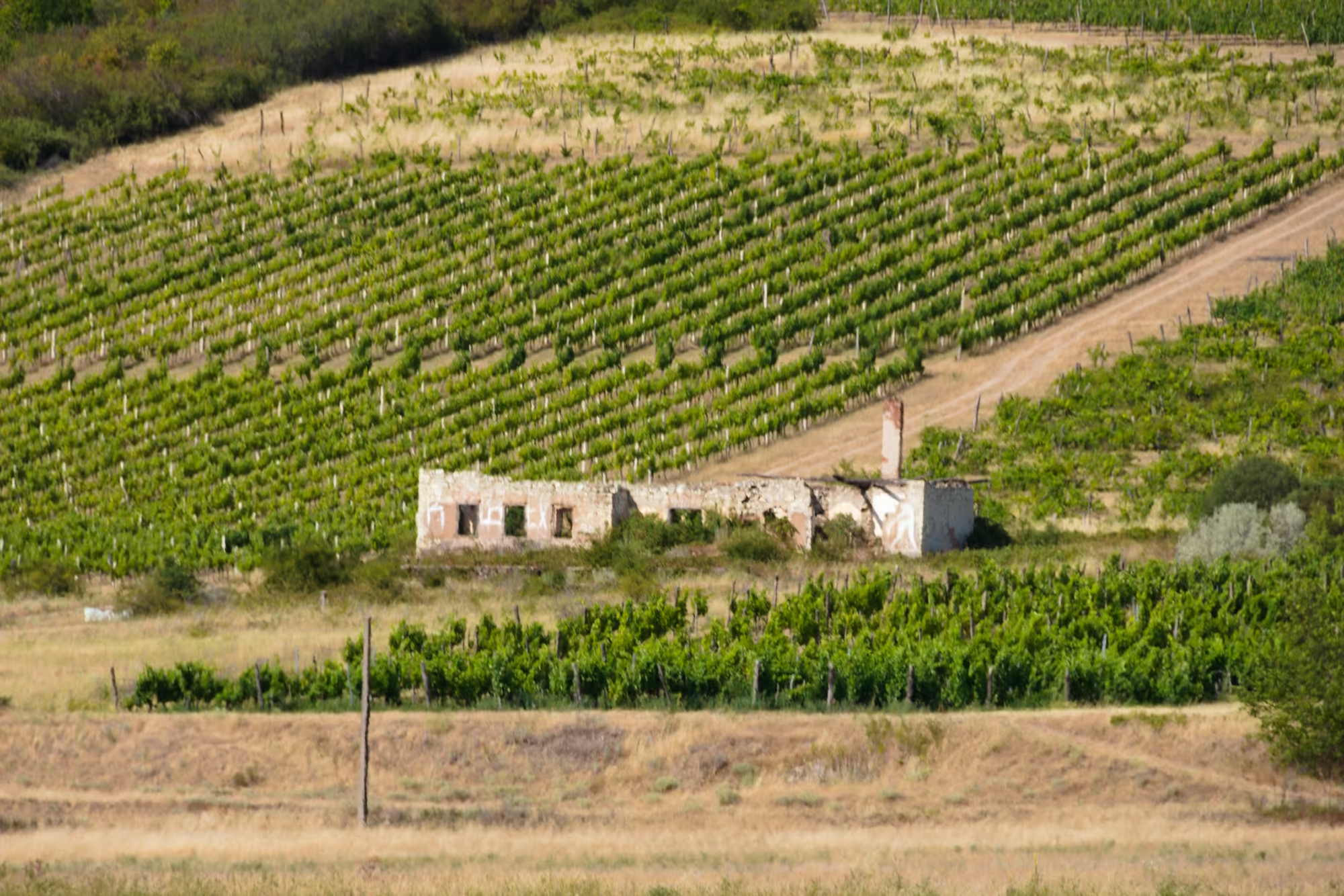
The vine terraces climb the hillsides of the wine growing regions, where the vine has been cultivated since Roman times; the even rows of vines and the narrow tracks between them are a constant of the Hungarian landscape, and the country is among the oldest wine lands of Europe. The cellars hollowed into the tuff and the presses of the old estates are a long part of rural custom, and the autumn grape harvest still brings the villages together.
An older layer of the land survives in the abandoned houses and derelict farm buildings at the edge of the fields, their roofs fallen and their windows dark. They are the remains of a rural way of life that has thinned as the population has moved to the towns, and they stand as quiet monuments to a vanishing countryside, their courtyards gone to grass and their walls given over to the weeds of the field.
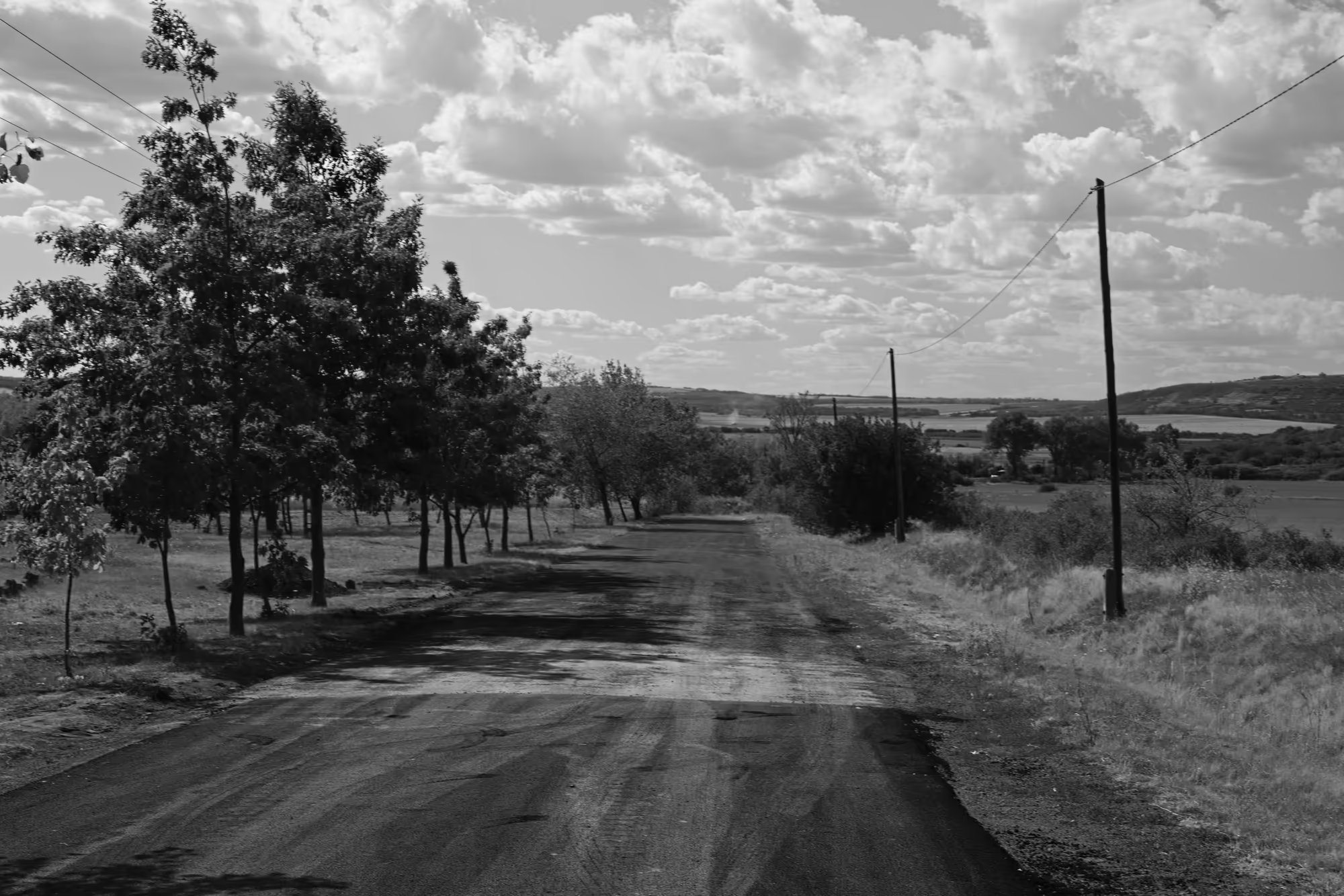
Between the villages the plain offers the wide and empty spectacle of the interior, where the horizon is low and the sky dominates, and the great rivers wind through meadow and reed. To the west the land rises toward the long lake of Balaton and the hills of Transdanubia, and to the north the forested ranges of the border country close the horizon of the basin.
The great plain, the Alföld, is the largest grassland of central Europe and the most characteristic of the Hungarian landscapes, its broad pastures once grazed by the herdsmen on horseback who were the pride of the country. Along the roads that cross it, the small towns with their single storey houses and their market squares carry on the trade of an open, largely agricultural land.
The route through this landscape follows the broad avenues of the plain and the narrow lanes between the vines, and at every turn the land is shaped by the hand of the farmer, turning from the brown of the ploughland to the green of the pasture, the pale gold of the stubble and the dark line of the vineyard rows. Beside the road stand the tall chimneys of the sugar works and the grain elevators of the market towns, and near the rivers the reed beds shelter the herons and the last of the wetland birds of the basin.
The rivers themselves are the great features of this flat land, and the Danube and the Tisza, with their wide flood plains and their meandering courses, give the interior its scale and its sense of distance. The old oxbows and the gravel banks of the rivers are quiet places of willow and reed, and the stillness of the water and the enormous sky together give the plain the character that has always defined the country.
References
- Wikipedia contributors (2026). Hungary. en.wikipedia.org/wiki/Hungary
- Wikipedia contributors (2026). History of Hungary. en.wikipedia.org/wiki/History_of_Hungary
- Wikipedia contributors (2026). Pannonian Basin. en.wikipedia.org/wiki/Pannonian_Basin
- Wikipedia contributors (2026). Great Hungarian Plain. en.wikipedia.org/wiki/Great_Hungarian_Plain
- Wikipedia contributors (2026). Hungarian wine. en.wikipedia.org/wiki/Hungarian_wine
- Wikipedia contributors (2026). Transdanubia. en.wikipedia.org/wiki/Transdanubia
- Wikipedia contributors (2026). Lake Balaton. en.wikipedia.org/wiki/Lake_Balaton
- Wikipedia contributors (2026). Tokaj. en.wikipedia.org/wiki/Tokaj
- Wikipedia contributors (2026). Danube. en.wikipedia.org/wiki/Danube
- Wikipedia contributors (2026). Budapest. en.wikipedia.org/wiki/Budapest
- Wikipedia contributors (2026). Hungarian Revolution of 1956. en.wikipedia.org/wiki/Hungarian_Revolution_of_1956
- Wikipedia contributors (2026). Treaty of Trianon. en.wikipedia.org/wiki/Treaty_of_Trianon
- Wikipedia contributors (2026). Hungarian conquest of the Carpathian Basin. en.wikipedia.org/wiki/Hungarian_conquest_of_the_Carpathian_Basin
- Wikipedia contributors (2026). Kingdom of Hungary. en.wikipedia.org/wiki/Kingdom_of_Hungary
- Wikipedia contributors (2026). Battle of Mohács (1526). en.wikipedia.org/wiki/Battle_of_Mohács_(1526)