Day 2 - Hattusa & Cappadocia
21 July 2023




Journal Notes
General
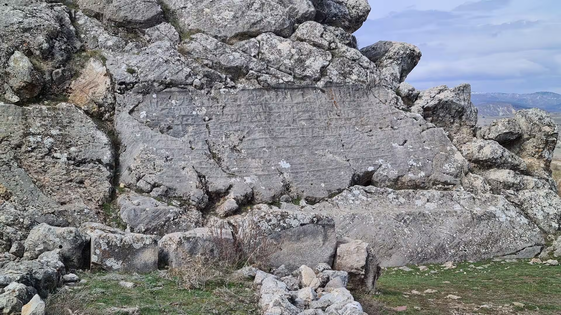
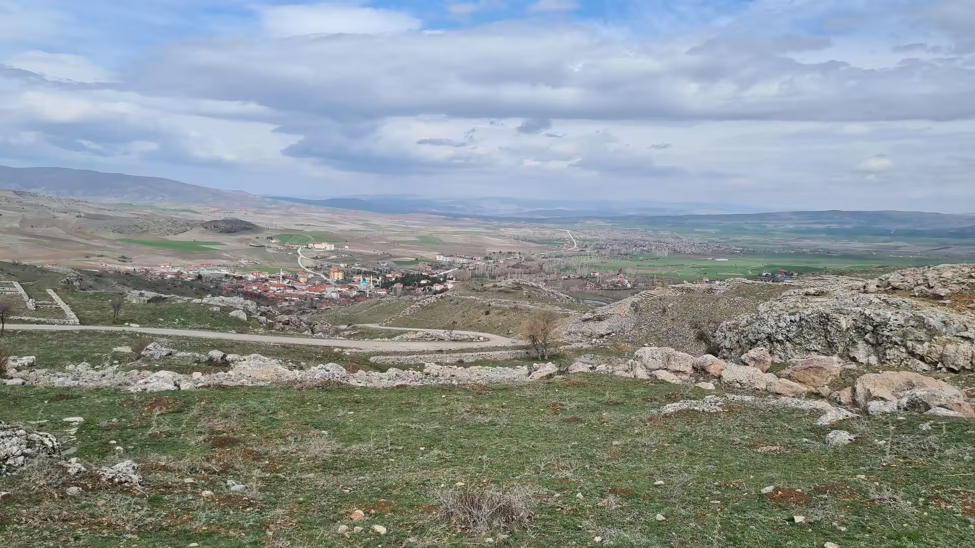
Hattusa was the capital of the Hittite Empire during the Late Bronze Age, and its ruins lie in north-central Turkey beside the small town of Boğazkale, formerly Boğazköy, in Çorum Province. The site stands within the great loop of the Kızılırmak, the river known to the ancients as the Halys, on the rolling northern edge of the Central Anatolian Plateau. Today Hattusa is an archaeological site rather than a living city, yet its ruined gateways, earthen ramparts and grass-grown temple terraces remain among the most important monuments of the ancient Near East, and the site has been listed as a UNESCO World Heritage Site since 1986.
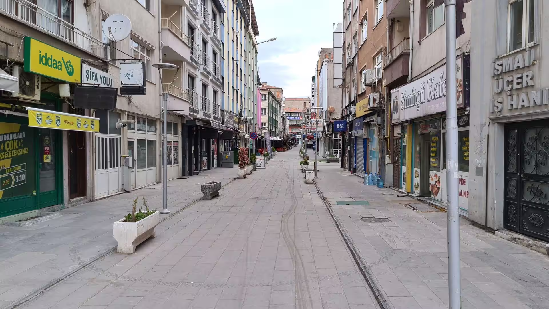
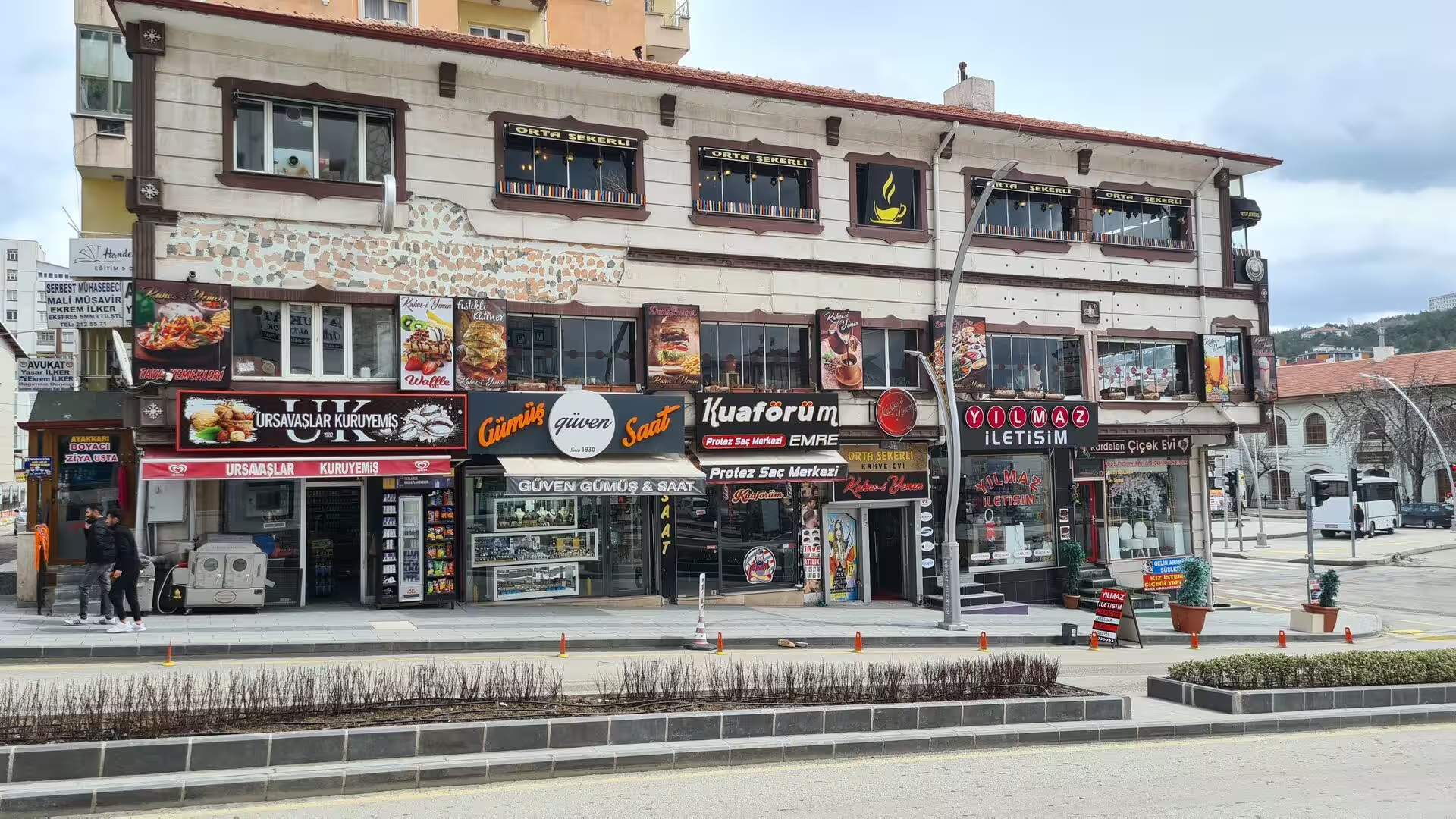
Boğazkale, the seat of a district of the same name, is a quiet country town of about 1,200 people whose single street of shops and offices runs along the road from Çorum to Yozgat. It is an agricultural settlement surrounded by fields and pastures, and it lives largely from the travellers who come to the Hittite capital. A small archaeological museum in the town displays finds from the excavations, including cuneiform tablets and stone sculpture; since 2011 the ancient sphinx figures of the southern gate, long divided between museums in Berlin and Istanbul, have been reunited there.
Cappadocia, the second of the two regions, is a historical region of central Anatolia centred on the volcanic plateau between Kayseri and Aksaray and lying mainly in Nevşehir Province; the modern heartland of its tourism clusters around the towns of Göreme, Ürgüp, Avanos and Uçhisar. The landscape is a high tableland of more than 1,000 metres, overlooked by the great volcano of Mount Erciyes (3,917 metres) near Kayseri and carved into soft volcanic tuff, with cliffs, towers and cones that have been hollowed into dwellings and churches since antiquity. In 1985 the Göreme National Park and the Rock Sites of Cappadocia, a property of nearly 100 square kilometres, were added to the UNESCO list as a mixed natural and cultural heritage site.
The two regions belong to the same plateau world of central Anatolia and are drained by the same river system, the Kızılırmak and its tributaries. Their characters are complementary: Hattusa preserves the monumental masonry of a Bronze Age state, while Cappadocia shows how later centuries turned the same soft volcanic landscape into churches, monasteries and homes. Between them stretch the broad steppe plains of the Anatolian interior.
History
The history of Hattusa reaches back long before the Hittites. Traces of occupation from the Chalcolithic period of the 6th millennium BC have been found on the site, and toward the end of the 3rd millennium BC the Hattian people maintained a settlement there called Hattush. In the 19th and 18th centuries BC merchants from the Old Assyrian colony at Kanesh (modern Kültepe) kept a trading quarter in the lower city and left some of the earliest written records found at the site.
Around 1700 BC the city was captured and burnt by Anitta, king of Kussara, who pronounced a curse on it: whoever resettled Hattush, he declared, would be struck down by the Storm God. Within a generation the curse was ignored. About 1650 BC the Hittite king Labarna moved his seat from Nesa to Hattusa and took the throne name Hattusili, meaning man of Hattusa, making the city the centre of a kingdom that grew into one of the great powers of the ancient world.
The city did not keep its pre-eminence without interruption. Raiders from the Kaska lands to the north twice attacked it, the court withdrew to Sapinuwa under Tudhaliya I and to Tarhuntassa in the south under Muwatalli II, and it was Mursili III who restored the capital to Hattusa in the mid-13th century BC. In the interval the empire reached its widest extent: Suppiluliuma I (reigned between about 1344 and 1322 BC) carried Hittite arms from the Aegean coast to the Euphrates, and at the Battle of Kadesh in about 1274 BC the army of Muwatalli II fought the Egyptians under Ramesses II to a standstill. The peace treaty concluded with Egypt in about 1258 BC, between Hattusili III and Ramesses II, survives in copies from Hattusa and is generally regarded as the earliest international peace treaty known; it is sometimes called the Treaty of Kadesh.
The final great century of the empire was also Hattusa’s most splendid in building. Tudhaliya IV (reigned between about 1245 and 1215 BC) laid out the temples of the southern upper city and enlarged the rock sanctuary of Yazılıkaya. Around 1190 BC the city was burnt and abandoned in the upheavals that ended the great kingdoms of the Late Bronze Age; a modest population lingered into the 10th century BC, but Hattusa never again served as a capital, and its ruins slowly sank under soil and pasture.
The ruins re-entered European awareness in 1834, when the French architect Charles Texier visited the site near the village of Boğazköy and published its monuments. Georges Perrot excavated at Boğazköy and Yazılıkaya in 1861 and was the first to argue that the site was the Hittite capital, and the trial trenches opened by Ernest Chantre in 1893 and 1894 yielded the first cuneiform fragments. In 1906 Hugo Winckler began excavations for the German Oriental Society and recovered thousands of clay tablets that confirmed the identification beyond doubt. Systematic work has continued since 1931 under the German Archaeological Institute, and in 1986 the site entered the World Heritage list.
Cappadocia, the country the Hittites knew as the land of Hatti, followed a different course after the fall of the empire. The plateau passed under Persian rule as a satrapy, and from the late 4th century BC it was governed by the Hellenistic kings of Cappadocia, whose capital stood at Mazaca, later Caesarea, the modern Kayseri at the foot of Mount Erciyes. Rome annexed the kingdom in AD 17, and for the next thousand years the region belonged to the Byzantine world. It was under the Cappadocian Fathers of the 4th century, above all Basil, bishop of Caesarea, that the church in the region was reorganised and ever larger groups of Christians settled in cloistered communities hewn from the rock, and during the Arab raids of the 7th to 9th centuries these communities carved refuges, churches and monasteries into the tuff. Rock-cut churches remained in use and were repainted with frescoes until the Seljuk conquest after 1071 and the later Ottoman centuries, and Greek-speaking Christians of the region left only in the population exchanges of the 1920s.
Geology
The stage for both regions is the Central Anatolian Plateau, a high, semi-arid tableland of more than 1,000 metres set between the Pontic mountains and the Taurus. Geologically the plateau belongs to the Alpine belt of Turkey: as the Arabian plate collided with Eurasia during the Miocene, the Anatolian block was squeezed and is still being pushed westward between the North Anatolian and East Anatolian fault systems, a setting that has produced both the region’s earthquakes and its volcanoes.
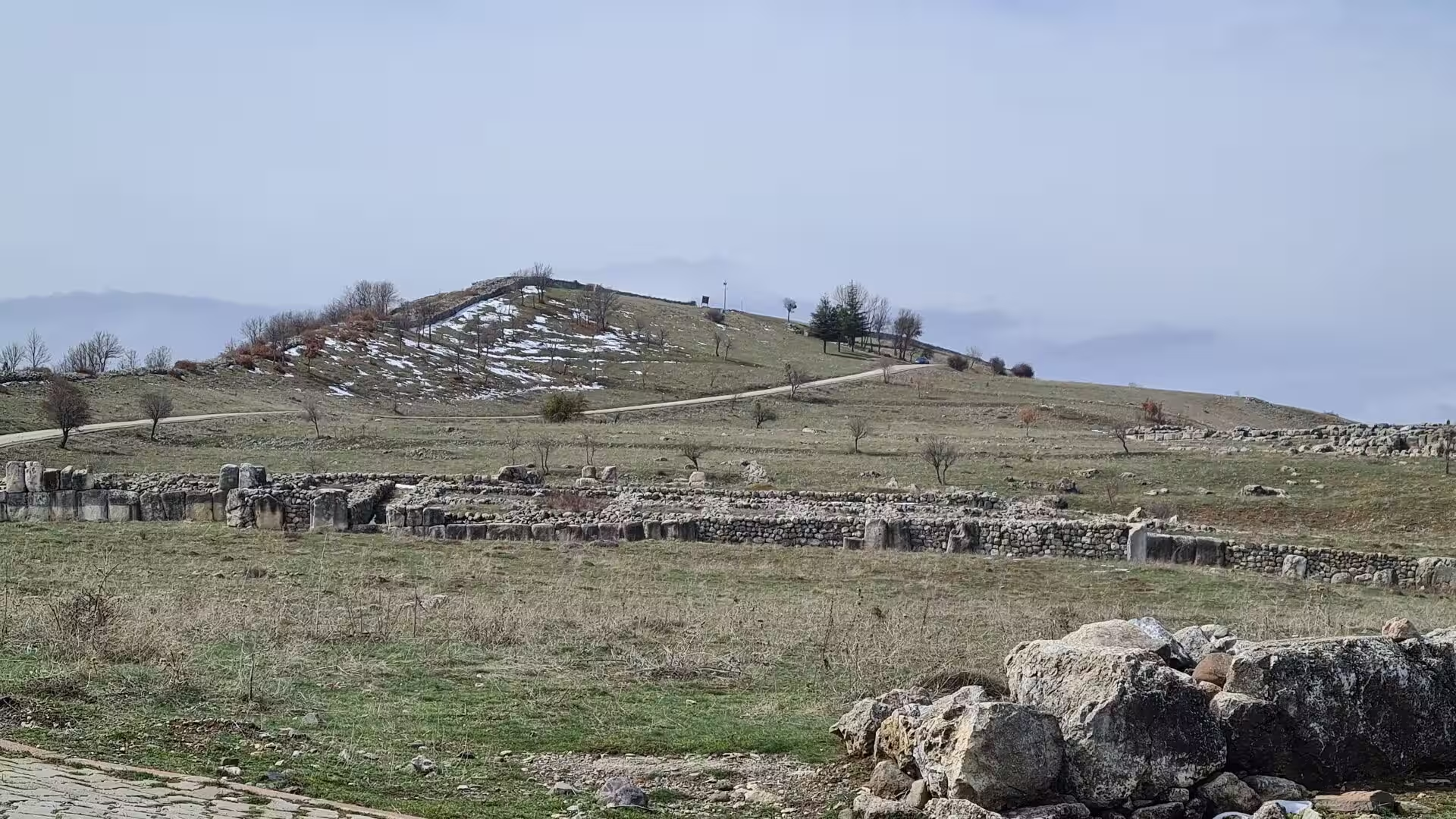
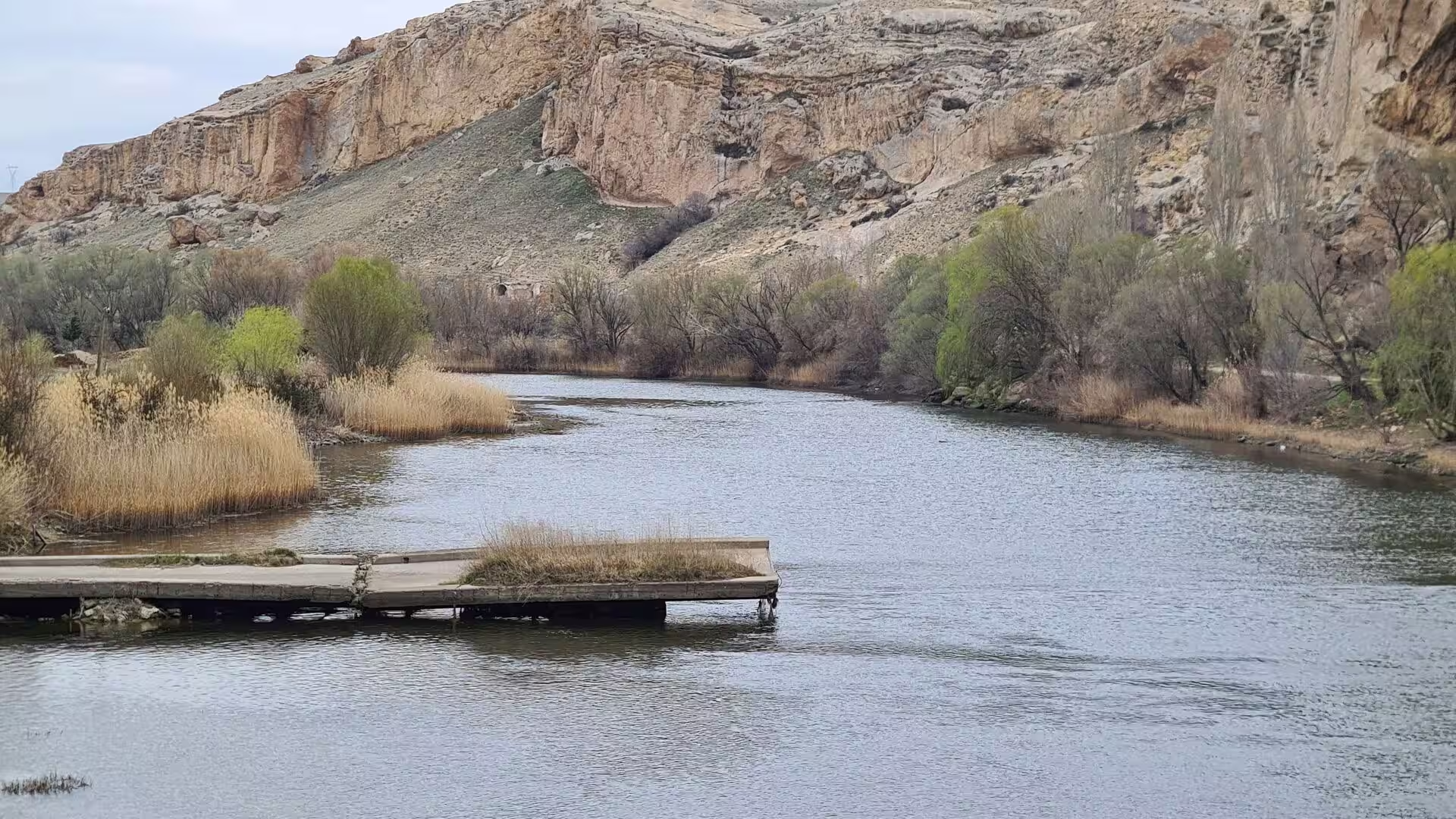
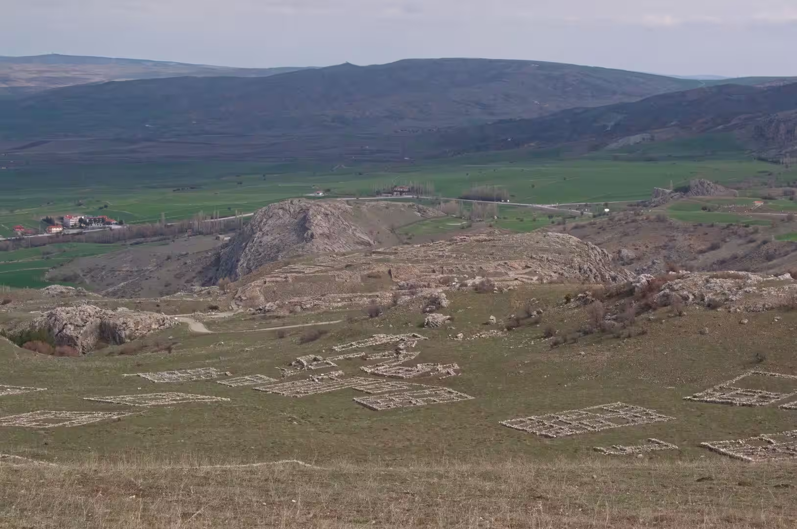
Around Boğazkale the plateau surface is hilly, cut by valleys and drained by streams of the Kızılırmak system, and the Hittites chose a defensible site of ridges and ravines for their capital. The citadel occupied the natural rocky spur of Büyükkale, and the fortifications that survive today are built of massive boulders and limestone blocks. Rising in eastern Anatolia and flowing 1,355 kilometres to the Black Sea, the Kızılırmak, whose name means Red River and which the Greeks called the Halys and the Hittites the Marassantiya, is the longest river that flows entirely within Turkey. It describes the wide arc known as the Halys bend, and for the Hittites it marked the western boundary of the core land of Hatti.
The rocks of Cappadocia are younger and more dramatic. From the Miocene onward, volcanism in the Central Anatolian Volcanic Province built the great stratovolcanoes of Mount Erciyes (3,917 metres), Mount Hasan (3,268 metres) and Göllüdağ, whose eruptions, together with those of many smaller centres, buried the region under enormous sheets of ash and pyroclastic material. The ash consolidated into tuff, a soft, porous rock that is easily cut with simple tools, and into harder welded ignimbrites; in places the sequence was capped by lava flows of basalt. Wind, frost and running water then dissected the deposit, cutting deep, steep-sided valleys, and where a hard capping protected the softer tuff beneath, differential erosion left the cones and pillars known as fairy chimneys standing with their caps in place. Harder outcrops such as those crowned by the rock castles of Uçhisar and Ortahisar rise above the softer surroundings, and in October 2022 the International Union of Geological Sciences included the Miocene Cappadocian ignimbrite sequence in its list of one hundred international geological heritage sites.
The same softness that shaped this scenery invited human use. Caves and refuges were scratched out of the tuff from early times, and the rock keeps an even temperature, warm in the Anatolian winter and cool in summer, a quality noted by Byzantine writers and appreciated by the communities that later hollowed out whole settlements.
Things to See
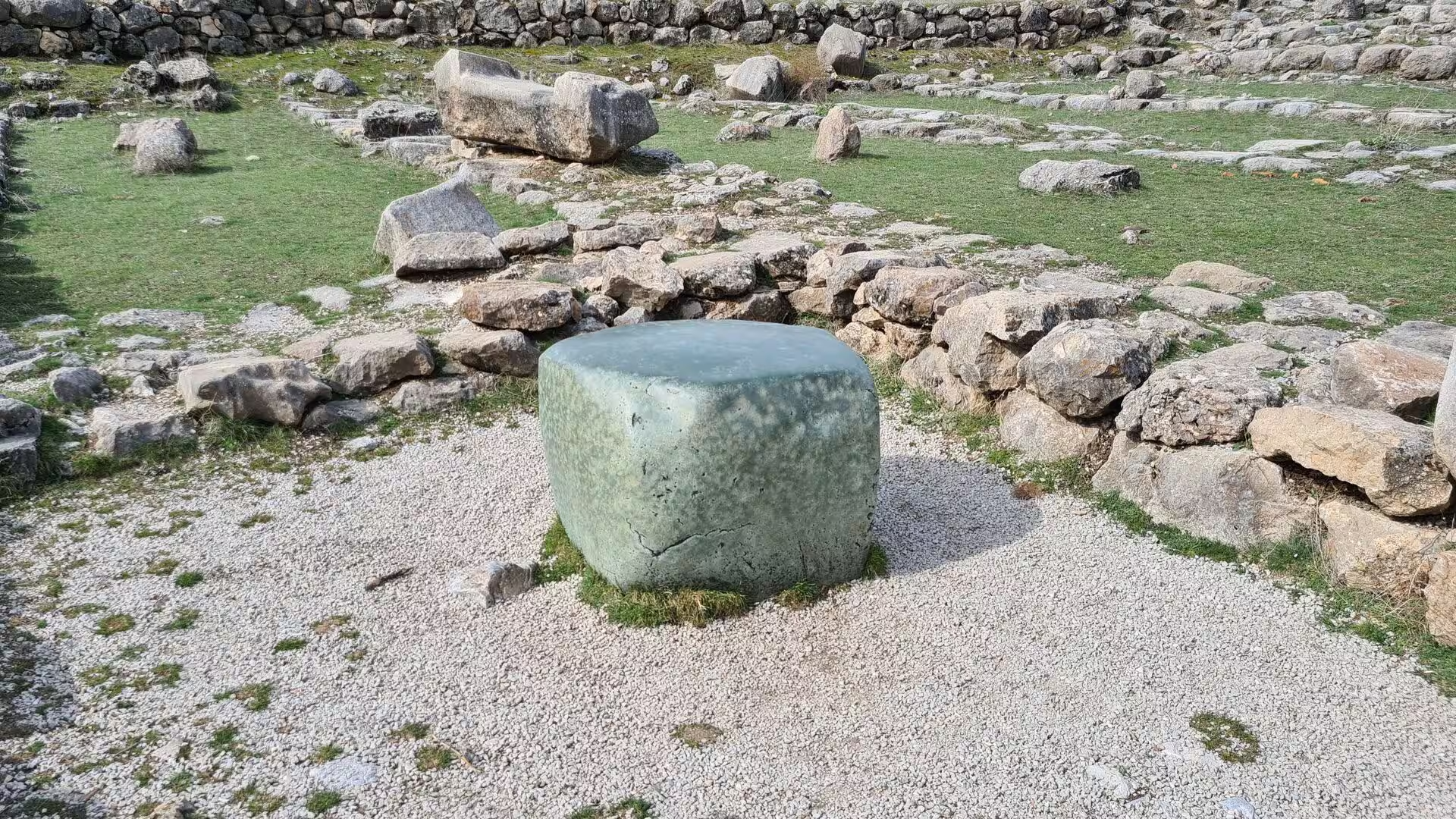
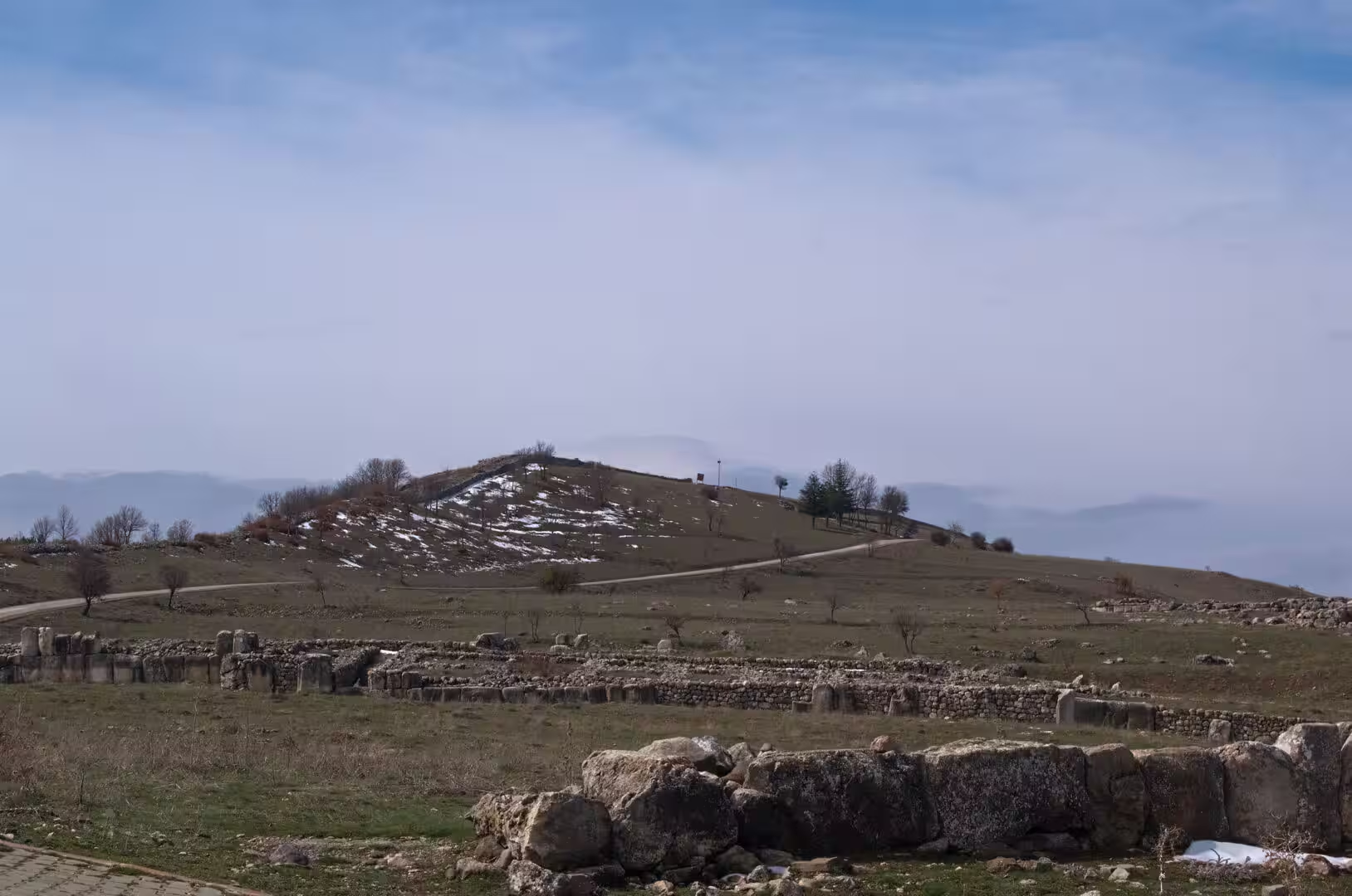
Hattusa spreads across a wide area of pasture and stone-strewn slopes. The ancient city comprised the lower town with its Great Temple district in the north, the rocky citadel ridge of Büyükkale rising above it, and the southern upper city of about one square kilometre, where excavations have uncovered a quarter of temples laid out in the 13th century BC. More than six kilometres of fortification walls enclosed the whole, built in casemate fashion with two parallel faces of stone and a filled space between, and long stretches of the masonry, gates and ramparts can still be traced across the ridges, with far views over the valleys of the Kızılırmak country.
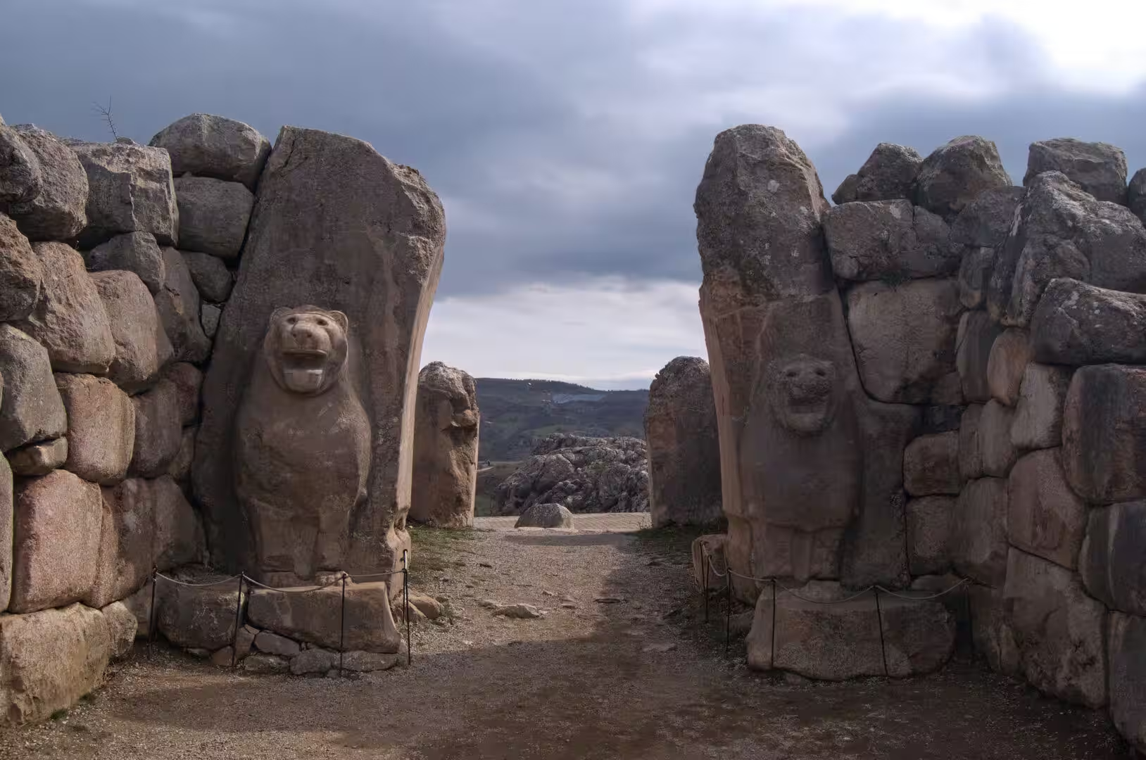
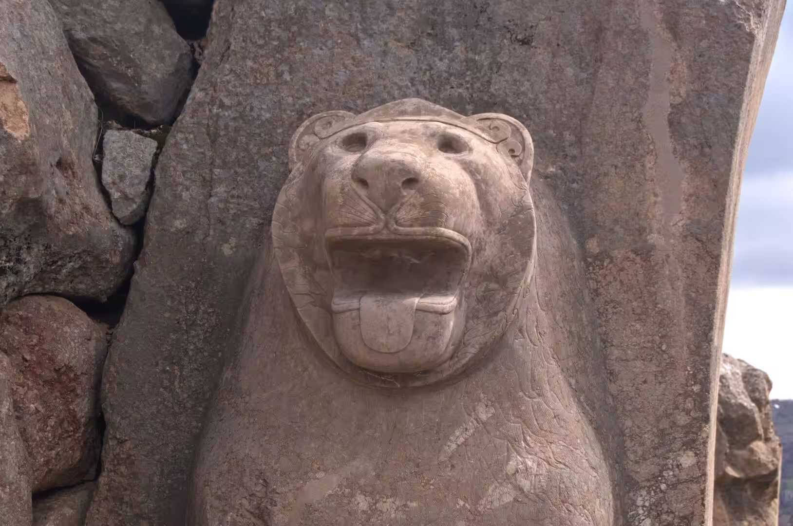
The Lion Gate pierces the walls on the south-western side of the circuit, where the enceinte follows a natural spur. Massive towers of fitted boulders frame the passage, and two colossal lions of weathered grey stone, carved on the inner faces of the jambs, still stand guard; the sculpture, worn smooth by more than three millennia of wind and weather, is among the finest surviving examples of Hittite monumental carving.
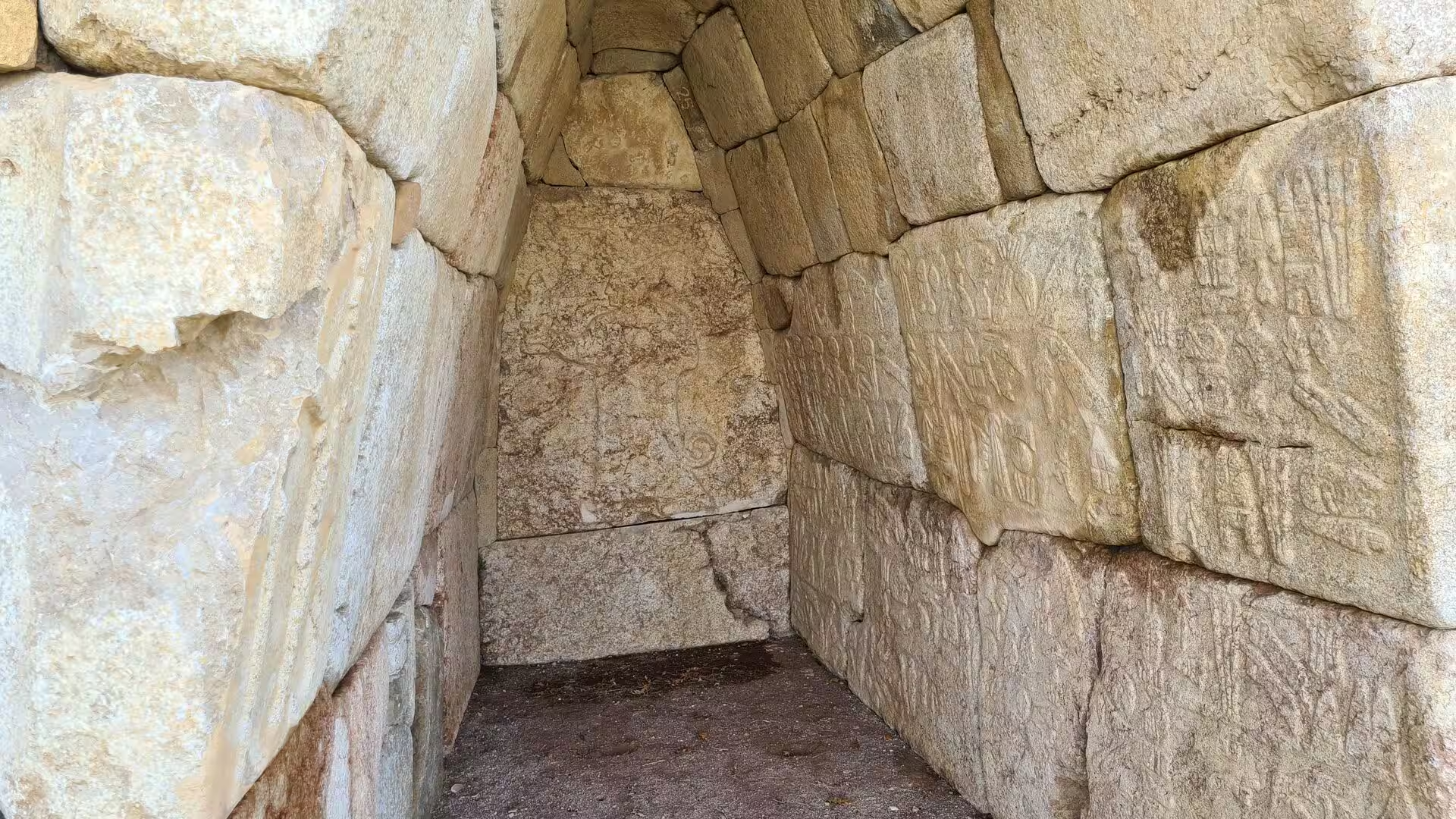
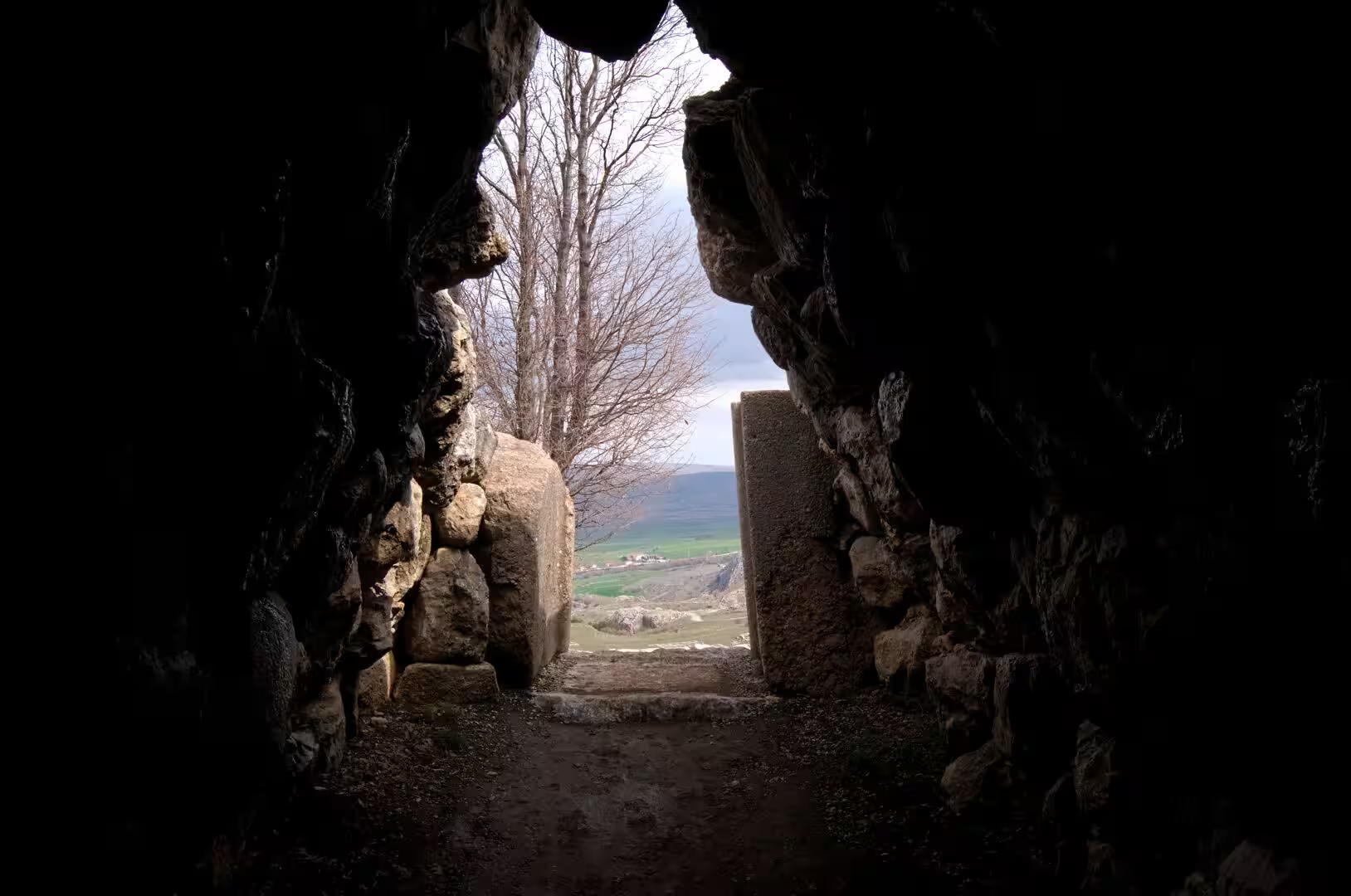
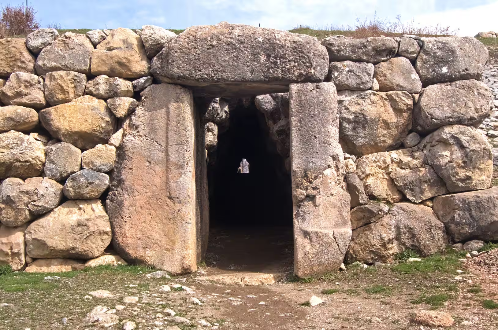
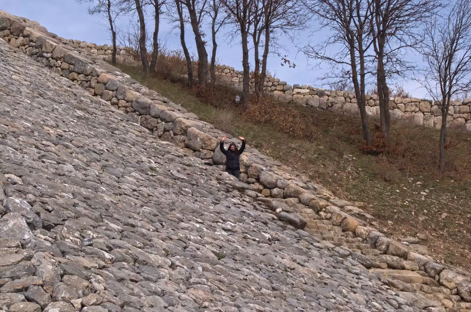
The Sphinx Gate stands at Yerkapı on the southern side, at the highest point of the site, where the Hittites piled up an artificial rampart of earth and stone some 250 metres long, faced with limestone blocks and flanked by stone stairways. The gateway at its crest is named for the sphinx figures carved beside it. Beneath the gate a vaulted postern tunnel, built of massive boulders in corbelled masonry and about 70 metres long, slopes down through the rampart and opens on the outer slope of the embankment; of the twelve such tunnels known beneath the fortifications of Hattusa, this one alone remains passable, and its dark, sloping passage is one of the most atmospheric corners of the site.
Yazılıkaya, whose name means inscribed rock, is an open-air sanctuary a short walk from the ancient city, set among natural rock outcrops in a fold of the hills. Two roofless rock chambers, once closed by gate buildings of which only the foundations survive, carry what is generally regarded as the most important group of Hittite rock reliefs. In the larger chamber the walls are carved with two processions of gods and goddesses, more than sixty figures in all, converging on the central scene of the storm god Teshub and the sun goddess Hebat; the smaller chamber holds fewer but larger figures and is thought to have served as a shrine for King Tudhaliya IV. Most of the carving dates from the late 13th century BC, when the sanctuary was enlarged under Tudhaliya IV and Suppiluliuma II, though the site had been in use since the late 16th century BC.
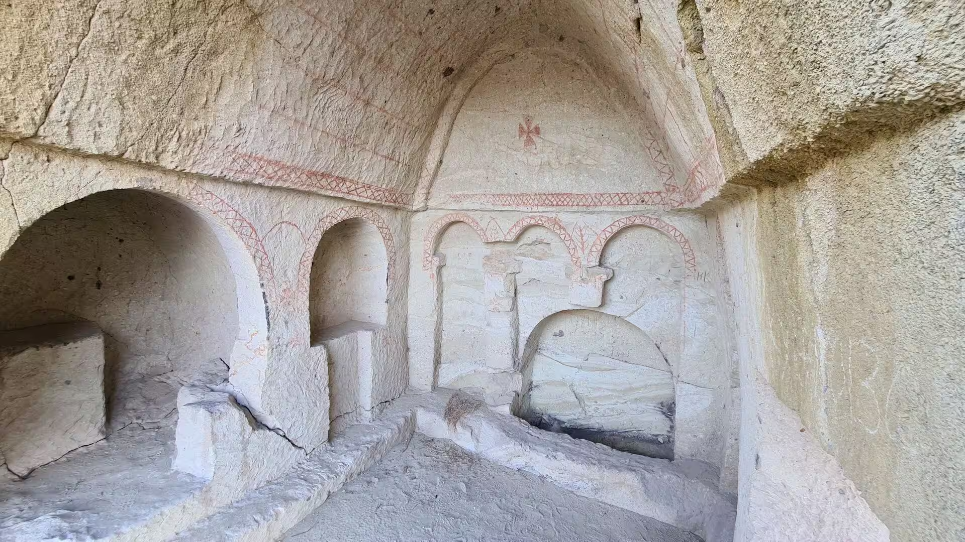
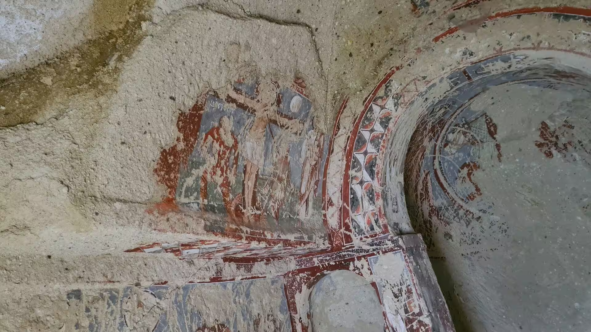
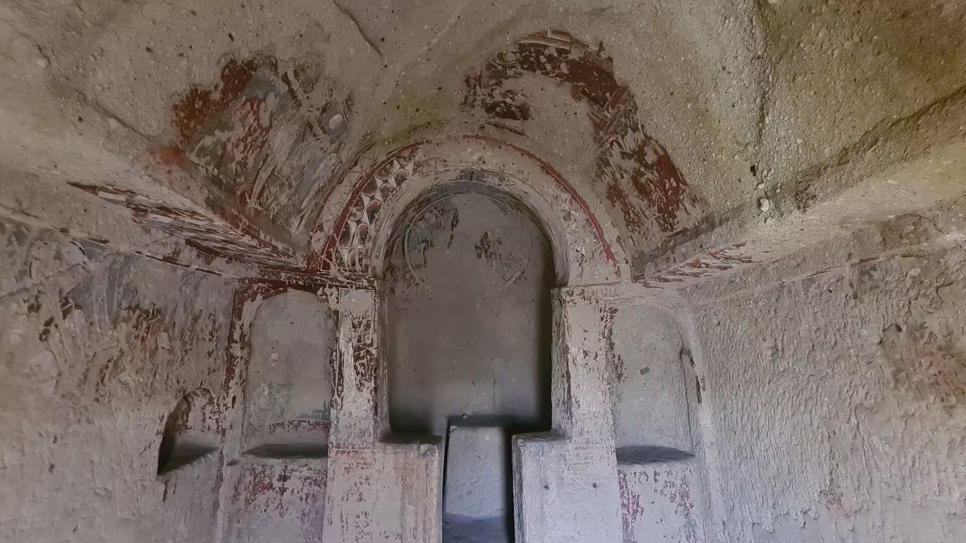
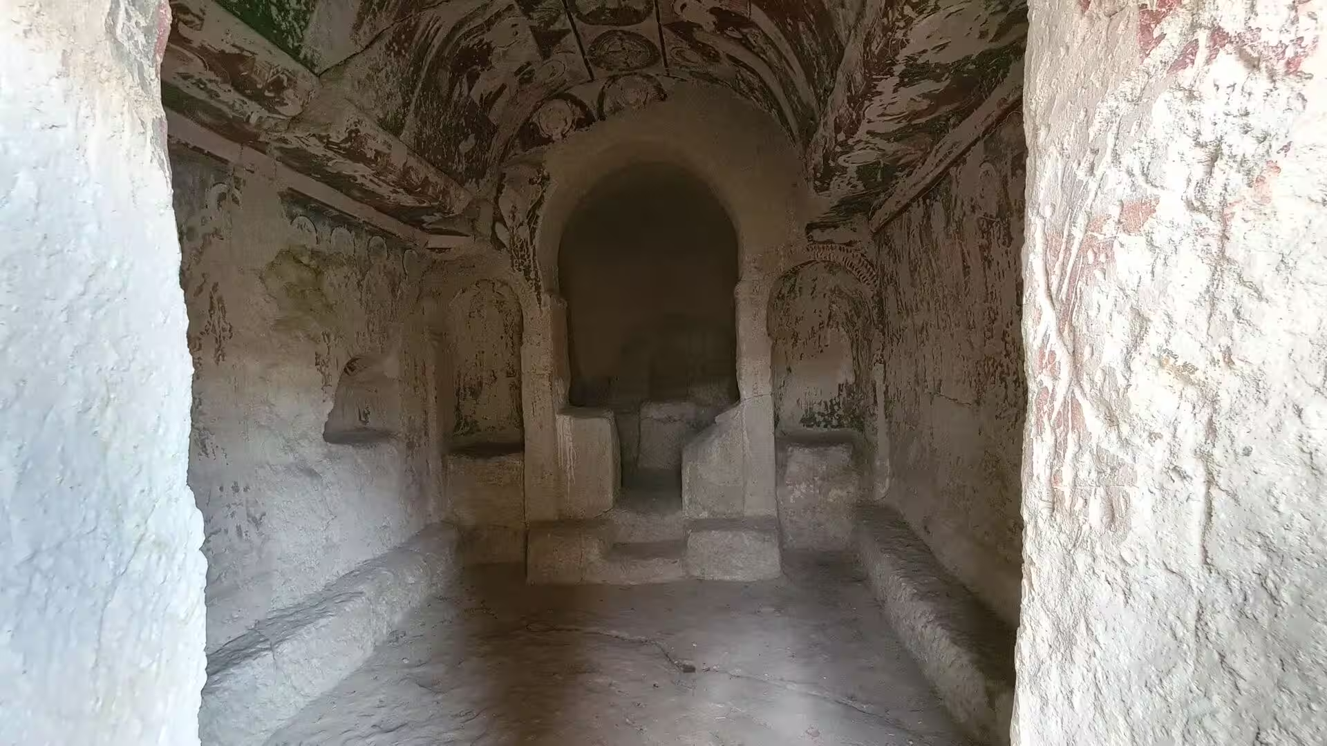
Rock-cut churches are the glory of Cappadocia. Hundreds of churches, chapels and monasteries were hewn from the tuff between the early Christian centuries and the 11th century, when some three thousand churches are said to have stood carved in the rock. Most follow the plan of a single nave with a barrel vault, an apse at the east end and benches cut along the walls; a few reproduce the cross-in-square plan of built Byzantine churches. The simplest interiors were painted only with red crosses, lattice bands, zigzags and rosettes, decoration typical of the 8th and early 9th centuries, the age of Byzantine Iconoclasm, while later churches carry fresher cycles of painted scenes from the life of Christ, often over older layers of paint. Where the plaster has flaked away, both phases of decoration can sometimes be read on the same wall.
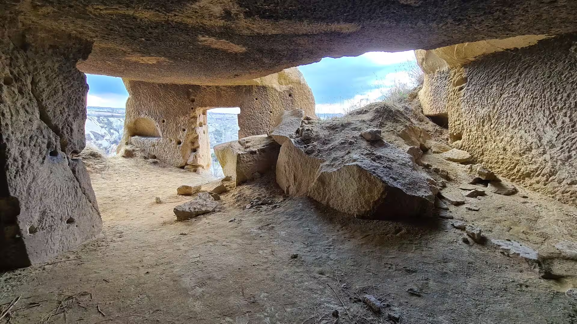
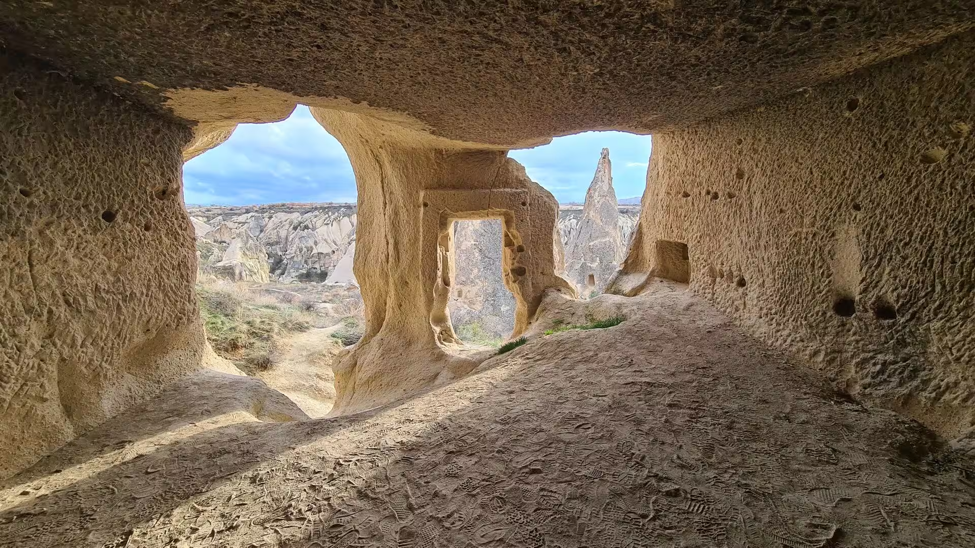
Rock-cut dwellings accompany the churches throughout the region. Door and window openings cut into cliffs and cones give onto rooms and passages hollowed from the living rock, with hearths, benches, sleeping niches and stairways leading between levels, and whole cliff settlements of this kind face the valleys. High on many rock faces sit dovecotes with painted entrances, once kept for their fertiliser. Such dwellings were inhabited well into the 20th century, and many rooms still serve as stables, workshops and storehouses for the villages below.
Fairy chimney valleys complete the picture. In the valleys around the tuff plateau, erosion has left dense fields of cones, pillars and towers, often of warm ochre stone, many of them hollowed and linked by passages from an earlier age. Valleys of this kind open out of the plateau like natural courtyards, with streams, orchards and footpaths on their floors, and from the mouths of the cave rooms the cones rise in every direction against the pale sky, one of the strangest landscapes of Anatolia.
References
- Bryce, Trevor (2005). The Kingdom of the Hittites. Oxford: Oxford University Press.
- Collins, Billie Jean (2007). The Hittites and Their World. Atlanta: Society of Biblical Literature.
- Kostof, Spiro (1972). Caves of God: The Monastic Environment of Byzantine Cappadocia. Cambridge, MA: MIT Press.
- Rodley, Lyn (1985). Cave Monasteries of Byzantine Cappadocia. Cambridge: Cambridge University Press.
- UNESCO World Heritage Centre. Hattusha: the Hittite Capital. whc.unesco.org/en/list/377/
- UNESCO World Heritage Centre. Göreme National Park and the Rock Sites of Cappadocia. whc.unesco.org/en/list/357/
- Hattusa. en.wikipedia.org/wiki/Hattusa
- Yazılıkaya. en.wikipedia.org/wiki/Yazılıkaya
- Boğazkale. en.wikipedia.org/wiki/Boğazkale
- Hittites. en.wikipedia.org/wiki/Hittites
- Cappadocia. en.wikipedia.org/wiki/Cappadocia
- Rock-cut architecture of Cappadocia. en.wikipedia.org/wiki/Rock-cut_architecture_of_Cappadocia
- Mount Erciyes. en.wikipedia.org/wiki/Mount_Erciyes
- Mount Hasan. en.wikipedia.org/wiki/Mount_Hasan
- Kızılırmak River. en.wikipedia.org/wiki/Kızılırmak_River
- Göreme Historical National Park. en.wikipedia.org/wiki/Göreme_Historical_National_Park