Day 1 - Around Santa Clara
Journal Notes
General
Santa Clara is a city in Santa Clara County at the southern end of the San Francisco Bay Area, and it is the base for this first day. It was founded by the Spanish in 1777 with the establishment of Mission Santa Clara de Asís under Junípero Serra, and it sits in the centre of Silicon Valley, bordered by San Jose on almost every side except for Sunnyvale and Cupertino to the west. The 2020 census counted 127,647 residents, the eighth largest population in the Bay Area, and the Census Bureau estimated 133,446 in July 2025. San Jose, not Santa Clara, is the largest city of the valley. The city is home to the headquarters of Intel, AMD and Nvidia, and its streets carry a mix of engineering campuses, bungalow neighbourhoods and the old mission grounds.
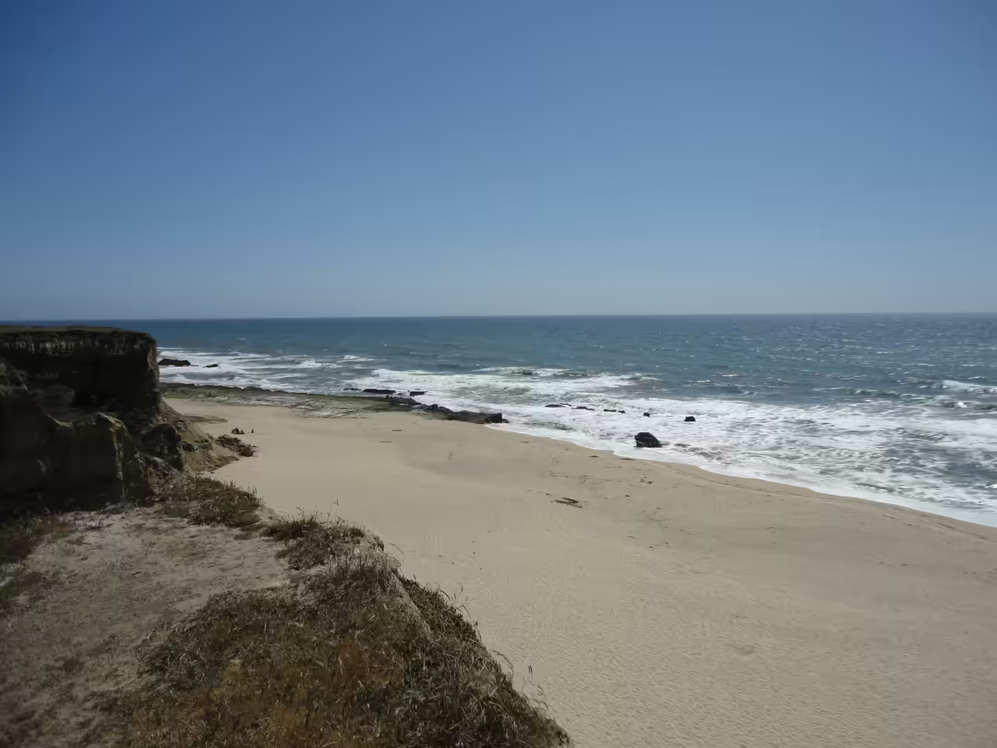
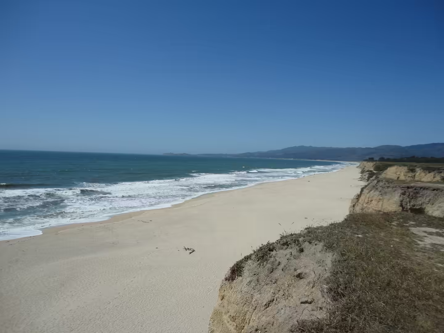
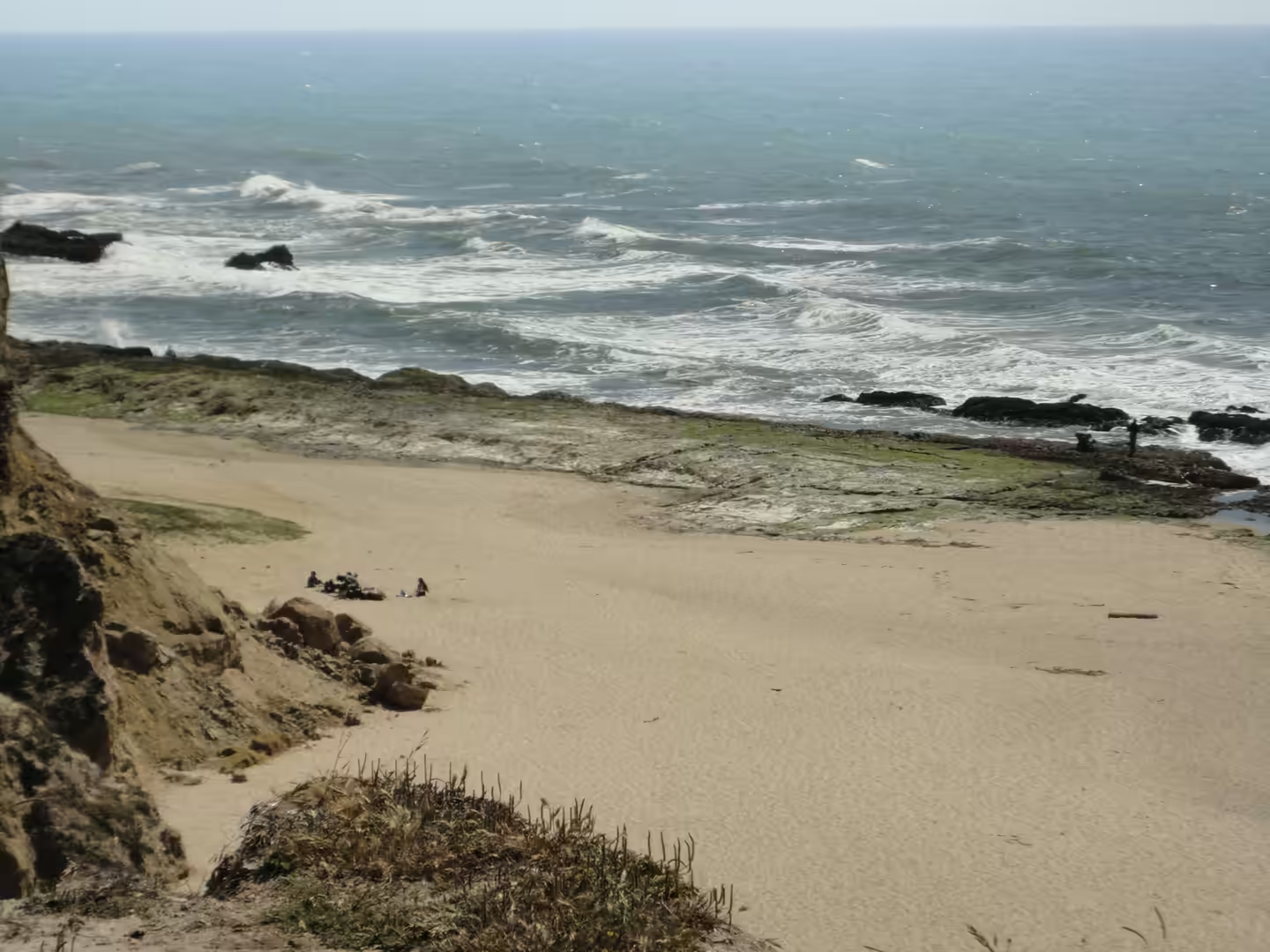
The day itself belongs to the coast. From the southern bay it is a short drive over the Santa Cruz Mountains to the Pacific, where the shoreline is a succession of sandy bays separated by headlands and low cliffs of soft rock. Half Moon Bay is the largest settlement on this stretch, a small city built around a working harbour and a crescent of beach, and south of it the coast road runs along cliff tops above coves that are cut into the rock. Pacifica, closer to San Francisco, has the same character on a smaller scale, with beaches below steep bluffs. Fog is the constant of the summer months here, rolling in during the afternoon and burning off again in the morning.
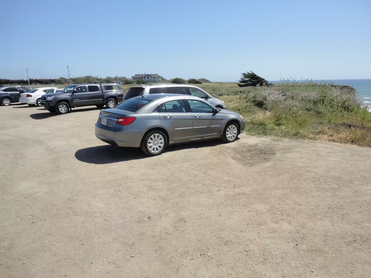
The coast road is California State Route 1, the highway that runs the length of the state and in this section keeps close to the water for most of the way. It was not built as a scenic route but as a practical link between the coastal settlements, and it still carries commuters as well as visitors. Turnouts above the coves look out over stacks, arches and rock platforms, and the beaches below are reached by short paths down the cliff. Parking is limited and the light changes quickly, so the morning and the hour before sunset are the best times to be on this stretch of road.
The valley’s modern identity is a matter of numbers as much as of names. Silicon Valley corresponds roughly to the Santa Clara Valley and is home to the headquarters of more than thirty Fortune 1000 companies as well as thousands of start up firms, and the Bay Area accounts for about one third of all venture capital investment in the United States. In 2015 the San Jose metropolitan area had the third highest GDP per capita in the world, after Zurich and Oslo, and by June 2021 it had the highest share of homes valued at a million dollars or more in the country, at 47 per cent. Santa Clara sits in the middle of all this, and the largest city of the valley is San Jose, which wraps around it on almost every side apart from Sunnyvale and Cupertino to the west.
History
Before the Spanish arrived the coast and the bay were the territory of the Ohlone, a group of Northern California peoples who lived from San Francisco Bay round to Monterey Bay and down the Salinas Valley, speaking a family of related languages. They did not describe themselves as one people: in pre-colonial times they lived in more than fifty distinct landholding groups and interacted freely with one another, hunting, fishing and gathering in the pattern typical of California. Along the bayshore and in the valleys they built dome shaped houses of woven or bundled tule mats between six and twenty feet across, and they practised the Kuksu religion.
The mission era began the change. Mission Santa Clara de Asís was founded on 12 January 1777 as the eighth of the Spanish missions in California, and its registers record 8,536 baptisms, 2,498 marriages and 6,809 burials, with a community of 1,125 neophytes at its height; the native peoples brought into it were Bay Miwok, Tamyen and Coast Yokuts. Between 1769 and 1834 the indigenous population of California fell from about 300,000 to 250,000, and after California entered the Union in 1850 the Ohlone suffered the wider California genocide. The mission was secularised in 1836 and its lands were divided during the Mexican period.
The town that grew beside the mission took its own course. Two colleges were organised in Santa Clara in 1851, in a small agricultural town at the height of the Gold Rush and less than a year after California became a state, and the surviving one is Santa Clara University, the oldest operating institution of higher learning in the state. Santa Clara was incorporated as a town in 1852 and state chartered by 1862. Through the late nineteenth century this was orchard country first, and only in the middle of the twentieth century did the orchards give way to the electronics industry that gave the valley its modern name.
Geology
The land under the city is the Santa Clara Valley, a geologic trough that runs south east from San Francisco to Hollister, bordered on the west by the Santa Cruz Mountains and on the east by the Diablo Range. The valley floor is an alluvial plain laid down in the graben between the San Andreas Fault on the western side and the Hayward and Calaveras faults to the east. The San Andreas Fault itself is a continental transform fault with right lateral strike slip movement, first identified in 1895 by Andrew Lawson of the University of California, and after the 1906 San Francisco earthquake Lawson concluded that it extended the whole length of the state. Its presence is the reason the ground here is measured rather than trusted.
The mountains on both sides are made of older and harder material. Mount Umunhum, the fourth highest peak of the Santa Cruz Mountains after Loma Prieta, Crystal Peak and Mount Chual, consists of the Coast Range Ophiolite, a piece of Middle Jurassic oceanic crust and mantle that was pushed onto the continent and largely converted to serpentinite; the exposure on its north east face is one of the best in the bay area. Umunhum and Loma Prieta are both raised by local collision forces associated with a left bend in the San Andreas Fault. The same ophiolite underlies the rocks of the Great Valley further east, so the mountain and the farmland share a deep foundation.
Earthquakes are part of ordinary life in this valley. The Loma Prieta earthquake struck at 17:04 on 18 October 1989 with a maximum intensity of IX, killed 63 people and injured 3,757, and caused its heaviest damage in Santa Cruz County, with effects reaching north into the Bay Area and across to Oakland; because it happened during the live broadcast of the World Series between two Bay Area teams, the first moments of the shaking were seen by a national audience. The Loma Prieta segment had been comparatively quiet since 1906 and was regarded as a seismic gap before moderate foreshocks in 1988 and 1989.
Water and rock meet in the same valley. The Guadalupe River begins on the valley floor where Los Alamitos Creek leaves Lake Almaden and joins Guadalupe Creek, flows north through San Jose and empties into south San Francisco Bay at the Alviso Slough, forming the eastern boundary of the city of Santa Clara. Its headwater creeks come off the western mountains, and its watershed carries precipitation from the slopes of Loma Prieta and Mount Umunhum. Deer and foxes move along the riparian corridor in the middle of the urban area, and in 2005 the fossil bones of a juvenile Columbian mammoth were found in the lower river bed.
The fault that shapes the valley runs the length of the state. In the north it ends offshore near Eureka at the Mendocino triple junction, where three plates meet, and in the south it terminates near Bombay Beach on the Salton Sea, where the plate boundary changes from strike slip to divergent and the crust is pulling apart in the Salton Trough. Land on the western side is moving north west relative to the land on the eastern side, and the evidence for that movement is the offset of streams, roads and fences along the trace. The Salton Sea lies on the same system in a closed basin, a shallow and strongly saline lake whose shorelines record repeated cycles of filling and drying.
Things to See
The old mission grounds come first in the city itself. The mission church, rebuilt on its present site from 1825 and now the university chapel, stands among buildings in Mission Revival and Spanish Colonial Revival styles, and the campus around it belongs to Santa Clara University, founded in 1851 with 6,484 undergraduates and about 3,151 postgraduate students in the autumn of 2024. The de Saisset Museum on the campus holds art and the local history collection, and the mission cemetery and the reconstructed adobe walls are open to visitors during university hours.
Silicon Valley is not a monument but a district, and it can be read from the road. The cities most often named as its birthplace, Sunnyvale, Mountain View, Palo Alto and Menlo Park, lie to the north west, and the larger centres of San Jose, Santa Clara, Redwood City and Cupertino are spread around the bay. In 2015 the San Jose metropolitan area had the third highest GDP per capita in the world after Zurich and Oslo, and by June 2021 it had the highest share of homes valued at a million dollars or more in the United States, at 47 per cent. Campus architecture, company signs and the occasional orchard remnant sit side by side.
For the coast, the best hours are either side of low tide. Tide pools are shallow basins of sea water trapped on the rocky shore as the water goes out, and they form a habitat of their own: the tidal cycle runs about 25 hours with two high and two low waters, and the pools hold anemones, crabs, limpets and small fish until the water returns. The coves below the cliffs south of Half Moon Bay are cut into soft rock and are safest to visit on a falling tide and with an eye on the swell, since the same waves that shaped them still break over the platforms.
The evening is worth keeping for the coast road. Sunset light on the cliffs and the stacks offshore is the reason this stretch is busy at the end of the day, and the turnouts above the beaches fill quickly. From the coast the return to Santa Clara crosses the mountains on Route 92 or the older mountain roads, with the whole bay and the valley lights below at dusk. A last short detour to Levi’s Stadium or to the Great America park beside it completes the circuit, though both are best seen from outside unless there is a game or a concert on.
References
- Alessio, P. & Keller, E. A. (2020). Short-term patterns and processes of coastal cliff erosion in Santa Barbara, California. Geomorphology 353, 106994. doi.org/10.1016/j.geomorph.2019.106994
- Hay, E. A., Hall, N. T. & Cotton, W. R. (1989). Rapid creep on the San Andreas fault at Bitterwater Valley. In: The San Andreas Transform Belt. doi.org/10.1029/ft309p0036
- Poland, J. F. (1971). Land subsidence in the Santa Clara Valley, Alameda, San Mateo, and Santa Clara counties, California. United States Geological Survey Open-File Report. doi.org/10.3133/ofr71340
- Saxenian, A. (1983). The urban contradictions of Silicon Valley: regional growth and the restructuring of the semiconductor industry. International Journal of Urban and Regional Research 7, 237-262. doi.org/10.1111/j.1468-2427.1983.tb00592.x
- Skowronek, R. K. (1998). Sifting the evidence: perceptions of life at the Ohlone (Costanoan) missions of Alta California. Ethnohistory 45, 675. doi.org/10.2307/483300
- Wikipedia contributors (2026). California State Route 1. en.wikipedia.org/wiki/California_State_Route_1
- Wikipedia contributors (2026). Guadalupe River (California). en.wikipedia.org/wiki/Guadalupe_River_(California)
- Wikipedia contributors (2026). Half Moon Bay, California. en.wikipedia.org/wiki/Half_Moon_Bay,_California
- Wikipedia contributors (2026). Mission Santa Clara de Asís. en.wikipedia.org/wiki/Mission_Santa_Clara_de_As%C3%ADs
- Wikipedia contributors (2026). Mount Umunhum. en.wikipedia.org/wiki/Mount_Umunhum
- Wikipedia contributors (2026). Ohlone. en.wikipedia.org/wiki/Ohlone
- Wikipedia contributors (2026). Pacifica, California. en.wikipedia.org/wiki/Pacifica,_California
- Wikipedia contributors (2026). San Andreas Fault. en.wikipedia.org/wiki/San_Andreas_Fault
- Wikipedia contributors (2026). Santa Clara, California. en.wikipedia.org/wiki/Santa_Clara,_California
- Wikipedia contributors (2026). Santa Clara University. en.wikipedia.org/wiki/Santa_Clara_University
- Wikipedia contributors (2026). Santa Clara Valley. en.wikipedia.org/wiki/Santa_Clara_Valley
- Wikipedia contributors (2026). Silicon Valley. en.wikipedia.org/wiki/Silicon_Valley
- Wikipedia contributors (2026). Tide pool. en.wikipedia.org/wiki/Tide_pool
- Wikipedia contributors (2026). 1989 Loma Prieta earthquake. en.wikipedia.org/wiki/1989_Loma_Prieta_earthquake