Day 4 - Arches National Park Utah



Journal Notes
General
Arches National Park lies in eastern Utah, next to the Colorado River and north of the small city of Moab. It contains more than 2,000 natural sandstone arches, including Delicate Arch, which together make up the highest density of natural arches in the world, as well as fins, spires, balanced rocks and eroded monoliths of every shape. The whole park sits on top of an underground layer of salt, and that salt, rather than any force acting from above, is the reason the arches exist. The park covers high desert on the Colorado Plateau, with the highest ground at Elephant Butte and the lowest at the visitor centre, and it receives on average less than ten inches of rain a year.
The park is small enough to see in a day and large enough to occupy a week. One road runs from the entrance to the Devils Garden at the far end, with short spurs to the Windows section and to the Delicate Arch viewpoints, and almost every feature can be reached from a car park and a walk of less than two hours. That accessibility is the reason for the traffic: the park received more than 1.8 million visitors in 2021, and the entrance station queues in summer are as much a part of the experience as the arches themselves. The area was designated a national monument on 12 April 1929 and redesignated a national park on 12 November 1971.
The town outside the gate is part of the story. Moab is the largest city and the county seat of Grand County, with 5,366 residents at the 2020 census, and it exists largely because of the parks. It is a base for mountain bikers who ride the network of trails that includes the Slickrock Trail, for off roaders who come for the annual Jeep Safari, and for the ordinary visitor who needs a bed and a meal. It also holds one of the nine regional campuses of Utah State University, which is a reminder that this is a working town with a long history rather than a resort built from nothing.
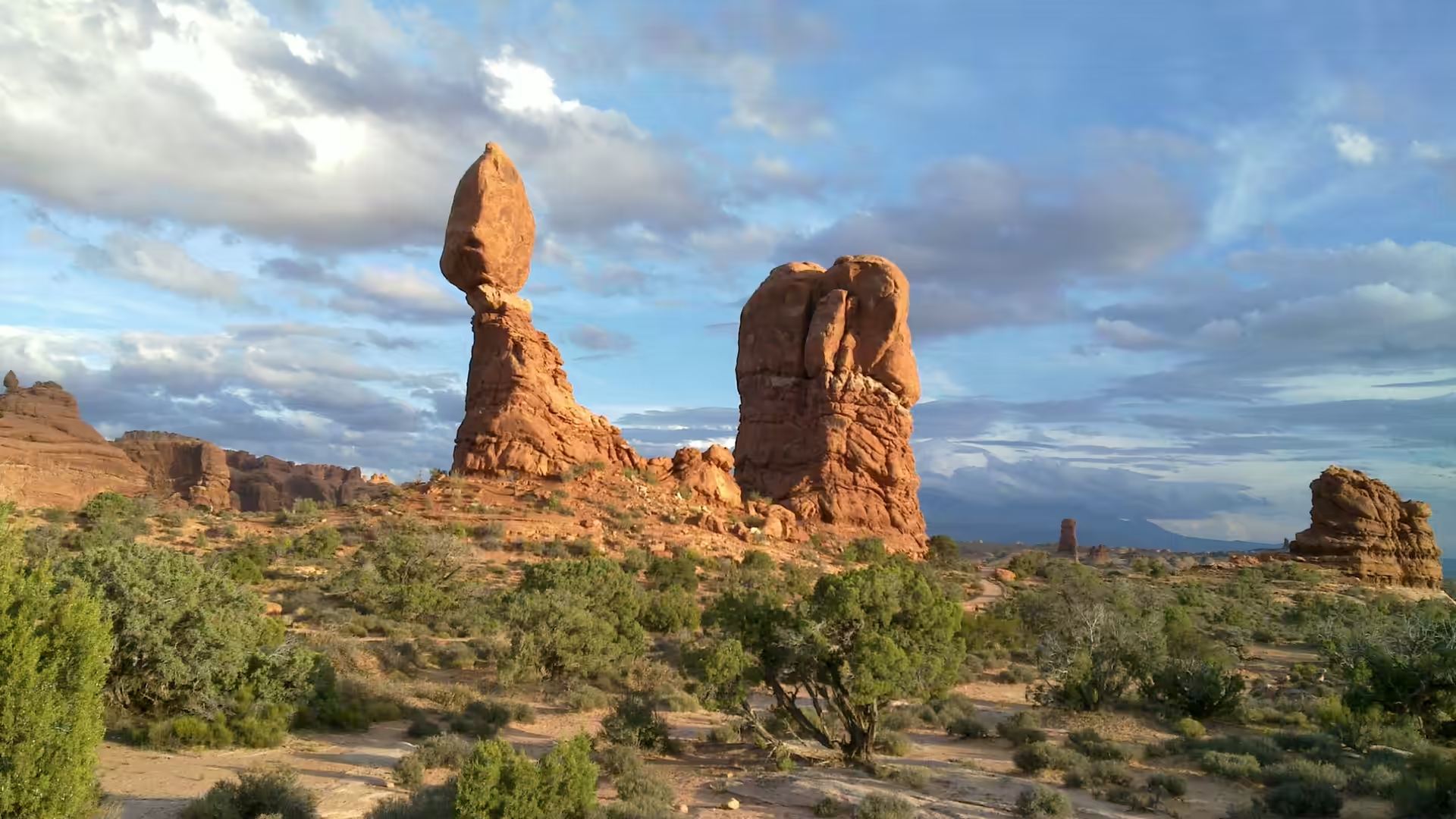
Two names are on everything here: Moab and Arches, Delicate Arch and Balanced Rock. Delicate Arch is the most widely recognised landmark in the park, shown on Utah licence plates and on a postage stamp for the state’s centennial of admission to the Union in 1896, and the Olympic torch relay for the 2002 Winter Olympics passed through it. Balanced Rock stands beside the main road about 9.2 miles from the entrance and is one of the few features clearly visible from a car. Both are landmarks that reward a slow approach, and both are far better seen on foot.
The size of the place is worth holding on to. The park covers 310.31 square kilometres of high desert on the Colorado Plateau, and it begins about four miles north of Moab, so the town and the rock are almost continuous. Inside the boundary the named features run from the well known to the obscure: Delicate Arch standing alone, the Devils Garden with its many arches and columns along a ridge, Double Arch, where two openings share a common end, and the Fiery Furnace, an area of maze like narrow passages and tall columns that can only be entered with a permit or a ranger. On the ground between them, a living soil layer absorbs and stores water, which is what allows more complex plant life to survive on very little rain.
History
People have been coming to this country for a long time. Hunter gatherers moved into the area about 10,000 years ago, at the end of the last ice age, and found pockets of chert and chalcedony in the rock, which they worked into tools. Later groups left petroglyphs, including marks on the trail to Delicate Arch, and the Ute people used the region long before any European saw it. The arches themselves played no part in the original designation of the area as a national monument, which was made for the scenery as a whole rather than for any single feature.
The names given to the arches record the people who explored them. Delicate Arch was known to local cowboys as the Chaps and as the Schoolmarm’s Bloomers, and other names applied to it over the years included Bloomers Arch, Marys Bloomers, Old Maids Bloomers, Pants Crotch, Salt Wash Arch and School Marms Pants. Landscape Arch, in the Devils Garden to the north, was named by Frank Beckwith, who led a scientific expedition into the area in the winter of 1933 and 1934. The names stuck because the features were too distinctive to be described any other way.
Moab grew up around mining, farming and the crossing of the Colorado River. Residents named the town in 1880, taking a biblical name for a country they regarded as remote, and a petition in 1890 asked for it to be renamed Vina instead. Settlement was slow and dangerous; early ranchers were killed in conflicts with the Ute, and the town that survived was built by mixed race cowboys and later by miners. Uranium changed the place in the 1950s, when the mills and the roads came, and tourism changed it again after the parks were established and the trails were built.
One further piece of history is written in the rock itself. Arches is not a place where nothing happens; it is a place where things happen slowly and then suddenly. A large slab fell from Landscape Arch in 1991, followed by two more large rockfalls in 1995, and the arch is now fenced off from below because more of it is expected to come down. Balanced Rock lost a smaller companion called Chip Off the Old Block in the winter of 1975 and 1976, and will eventually collapse itself. Visitors are watching a process, not a monument.
Farming came to this country long before the arches were famous. The hunter gatherers who worked chert and chalcedony in Courthouse Wash and Salt Valley were followed, roughly two thousand years ago, by groups who began to grow crops, and ancestral Puebloan farming in the region peaked between 500 and 1300 AD. Few dwellings have been found in the park itself, because the ground offers little shelter, but the fields and the trails were here, and the Ute left petroglyphs on what is now the trail to Delicate Arch. The rock art is a reminder that the scenery was part of a working landscape for centuries before it became a destination.
Geology
The arches are the work of salt. Beneath the park lies an evaporite layer, a salt bed left by an ancient sea that dried up repeatedly, and it behaves in a way that rock does not: under pressure it flows. As sediment piled up on top of it, the salt moved, rising into domes and ridges and leaving the younger layers above bent, cracked and lifted. Over 5,000 feet of younger sediment was deposited above the salt and has since been mostly eroded away, which is what exposes the arches today. The salt is still moving, and the surface above it is still adjusting.
The rock that forms the fins and arches is the Entrada Sandstone, a Middle Jurassic formation of fluvial mudstone, siltstone and wind blown sandstone that extends across the Colorado Plateau. It was named by James Gilluly and J. B. Reeside in 1928 after Entrada Point in the northern San Rafael Swell, and it is divided into members, of which the Slick Rock Member and the Dewey Bridge Member matter most here. The Entrada overlies the Carmel Formation and is itself overlain by younger units, and its variation from place to place is what makes the scenery so varied in a small area.
Weathering does the rest, and it works from the weak points. The sandstone is jointed in parallel fractures, and water entering the joints freezes and thaws, dissolves the cement between the grains and carries material away, so the rock is cut into long thin walls and fins. Where a fin is pierced, the opening grows from both sides until it becomes an arch; where a softer layer lies under a harder one, the softer rock erodes first and leaves a pedestal. Balanced Rock is the standard example: the hard Slick Rock Member sits above a pedestal of the softer Dewey Bridge Member, which is wearing away faster than the rock it carries.
Size and numbers put the process in proportion. The total height of Balanced Rock is 128 feet, with the balancing block itself rising 55 feet above its base, and it weighs approximately 3,577 tons, which makes it the largest feature of its kind in the park. Landscape Arch, in the north of the park, is considered by the Natural Arch and Bridge Society the fifth longest natural arch in the world, after four arches in China; its span was measured in 2004 at about 290 feet, at a height of 77.5 feet. The society measured the slightly shorter Kolob Arch in Zion National Park at about 287 feet in 2006.
Things to See
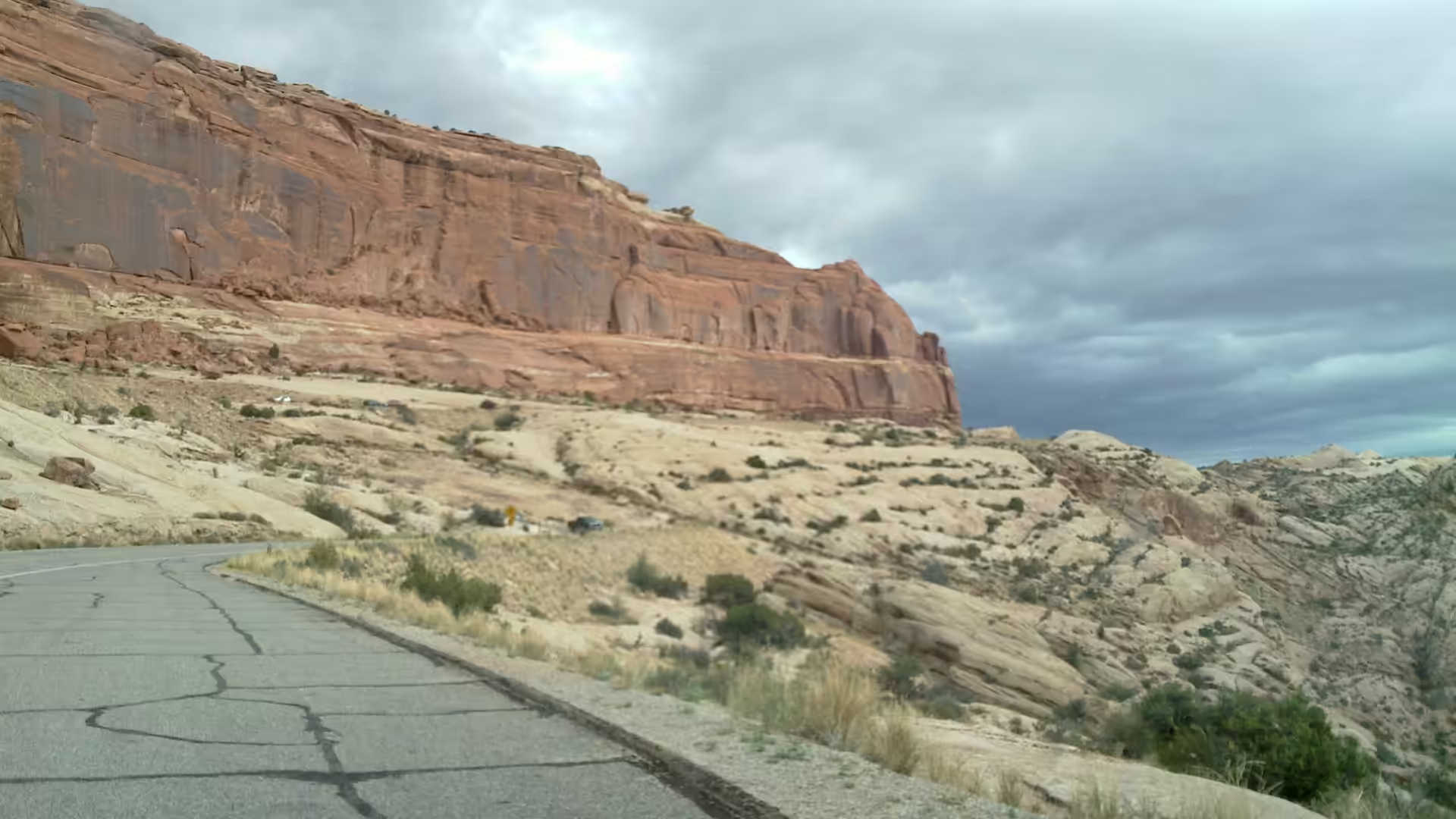
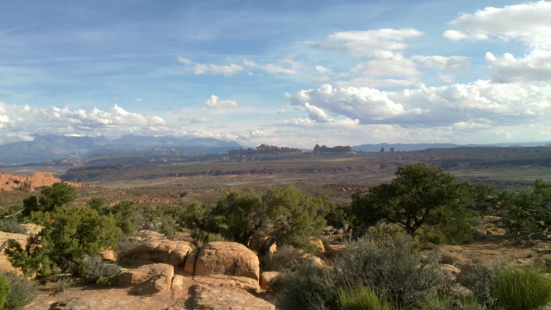
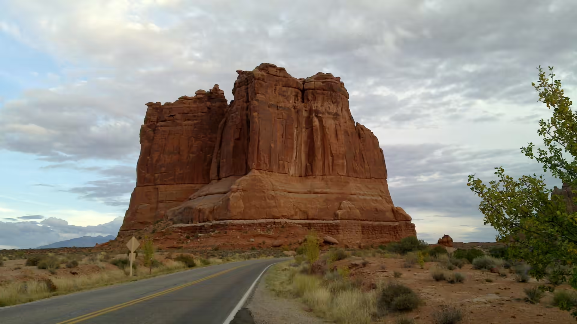
The drive from the entrance is the first thing to do, because it lays out the whole park in order. The road climbs past the visitor centre and the first viewpoints, runs along a ridge with the rock valley opening below, and reaches the Windows section within a few miles. Turnouts give views of a red cliff beside the road, of a desert overlook with juniper and distant mountains, and of the winding highway among the rock formations. The paved surface makes all of this accessible, and the sheer convenience is also the reason to start early: by mid morning the car parks at the popular sections are full.
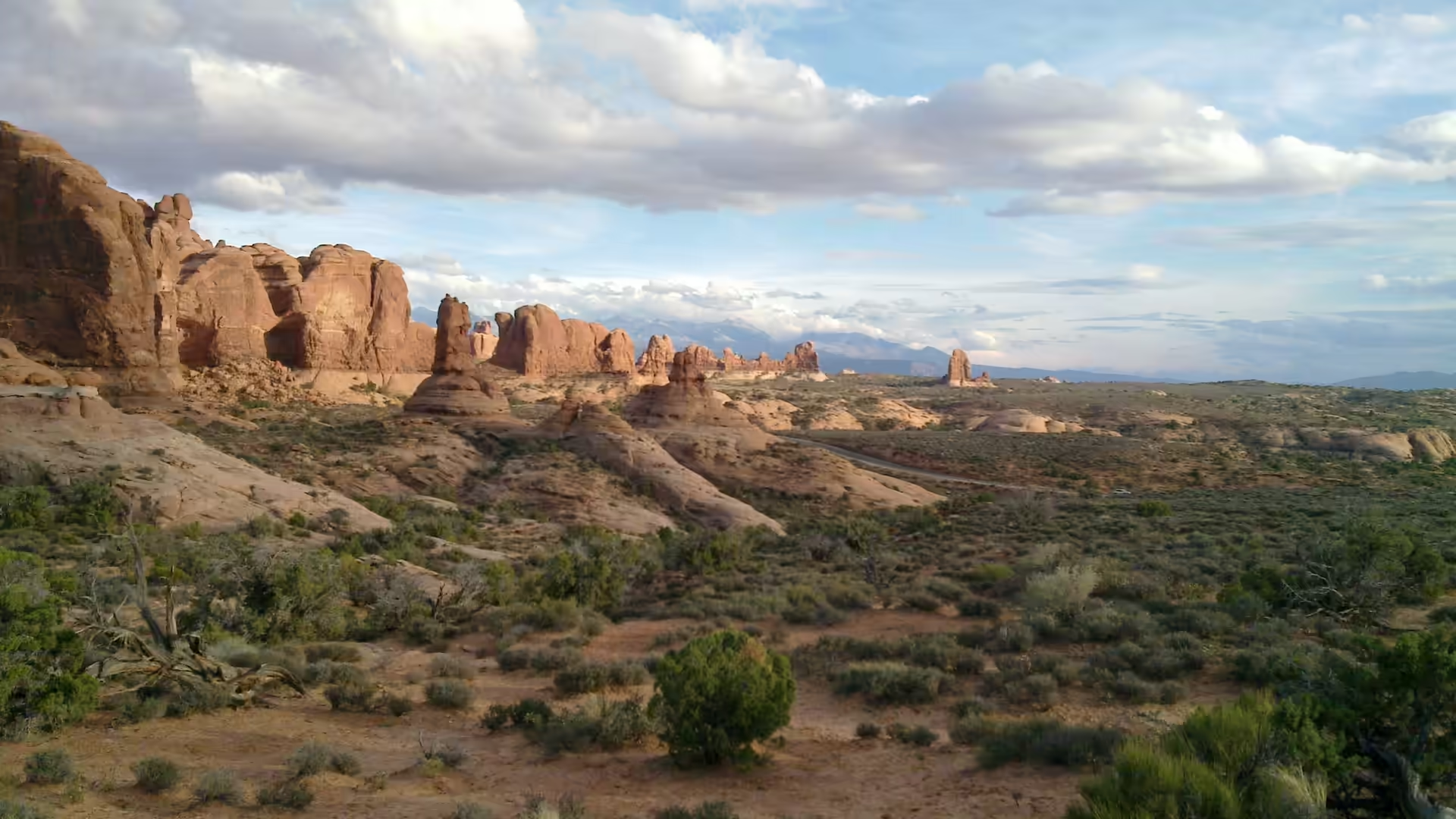
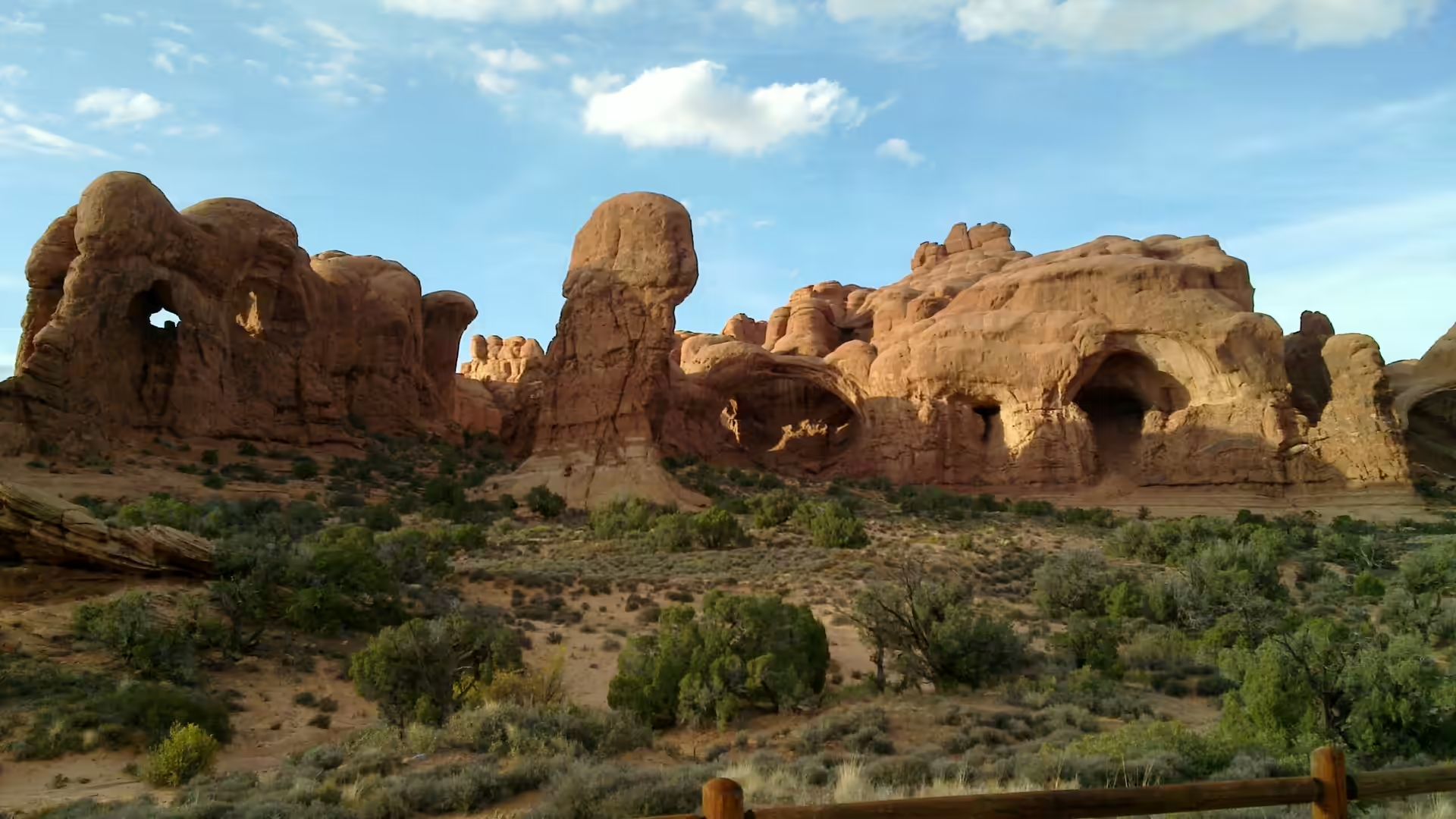
Balanced Rock and the Windows are the next stop. Balanced Rock stands beside the road and can be walked around in twenty minutes on a flat path, which gives a good view of how a hard cap sits on a soft pedestal. The Windows section, further on, holds several arches close together, and the trails there are short and easy. From the parking areas the rock towers and fins fill the middle distance, and the southward view runs across a vast desert plain to a distant rock ridge on the horizon.
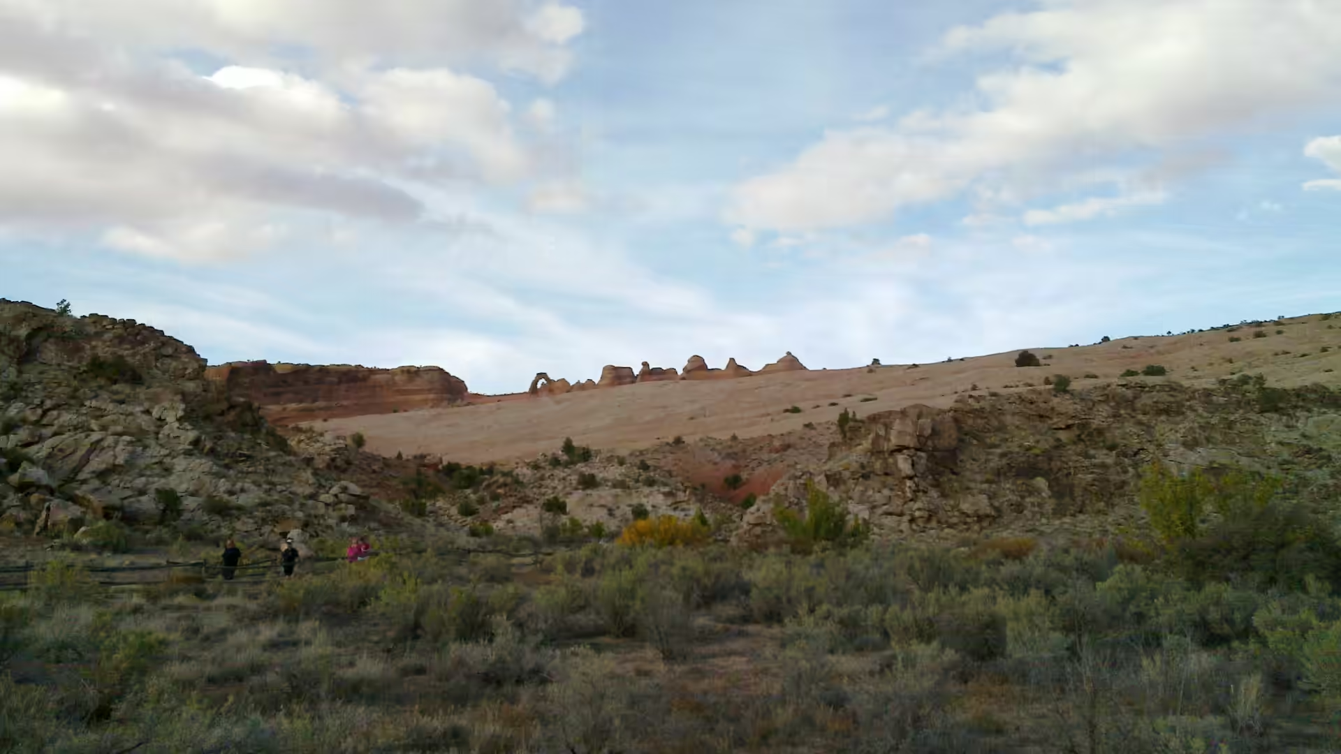
Delicate Arch is the walk to plan the day around. There are two ways to see it: a long, steady climb of about three miles to the arch itself, with little shade and a slickrock section near the top, and a shorter walk from the lower viewpoint to a spot where the arch is seen at a distance across a canyon. The arch stands free on the rim of a bowl of rock, and in the last hour of daylight it turns from pale orange to deep red while a crowd sits along the opposite ledge to watch. Water is essential, and the descent after sunset needs a torch.
The Devils Garden at the far end of the road is the last stop and the quietest of the busy places. Landscape Arch is reached by a graded gravel trail that passes sandstone fins standing like walls on either side, and beyond it the path continues across bare rock toward other arches. A sandstone arch and hoodoos stand behind a wooden rail at one viewpoint, and a huge red butte rises beside the road on the way back. The park is also a dark sky location, so a night drive along the same road gives a second, quite different landscape: the rock disappears, and the sky above the plateau is the attraction.
References
- Cruikshank, K. M. & Aydin, A. (1994). Role of fracture localization in arch formation, Arches National Park, Utah. Geological Society of America Bulletin 106, 879-891. doi.org/10.1130/0016-7606(1994)106<0879:roflia>2.3.co;2
- Cruikshank, K. M. & Aydin, A. (1995). Unweaving the joints in Entrada Sandstone, Arches National Park, Utah, U.S.A.. Journal of Structural Geology 17, 409-421. doi.org/10.1016/0191-8141(94)00061-4
- Scoon, R. N. (2021). Arches National Park and Dinosaur National Monument, Eastern Utah. The Geotraveller: Geology of Famous Geosites and Areas of Historical Interest. doi.org/10.1007/978-3-030-54693-9_2
- Wikipedia contributors (2026). Arches National Park. en.wikipedia.org/wiki/Arches_National_Park
- Wikipedia contributors (2026). Balanced Rock. en.wikipedia.org/wiki/Balanced_Rock
- Wikipedia contributors (2026). Biological soil crust. en.wikipedia.org/wiki/Biological_soil_crust
- Wikipedia contributors (2026). Delicate Arch. en.wikipedia.org/wiki/Delicate_Arch
- Wikipedia contributors (2026). Entrada Sandstone. en.wikipedia.org/wiki/Entrada_Sandstone
- Wikipedia contributors (2026). Fiery Furnace (Arches National Park). en.wikipedia.org/wiki/Fiery_Furnace_(Arches_National_Park)
- Wikipedia contributors (2026). Fin (geology). en.wikipedia.org/wiki/Fin_(geology)
- Wikipedia contributors (2026). Landscape Arch. en.wikipedia.org/wiki/Landscape_Arch
- Wikipedia contributors (2026). Moab, Utah. en.wikipedia.org/wiki/Moab,_Utah
- Wikipedia contributors (2026). Natural arch. en.wikipedia.org/wiki/Natural_arch