Day 6 - Monument Valley
Journal Notes
General
Monument Valley is a region of the Colorado Plateau characterised by a cluster of sandstone buttes, with the largest of them reaching high above the valley floor. The most famous formations stand in north eastern Arizona along the state line with Utah, and the whole area lies within the Navajo Nation, the Native American people whose reservation surrounds it and for whom the valley is sacred. The name is an English rendering of a Navajo phrase meaning valley of the rocks, and the place is administered as a tribal park rather than as a national park, which matters for everything from entry fees to the rules on where a visitor may drive.
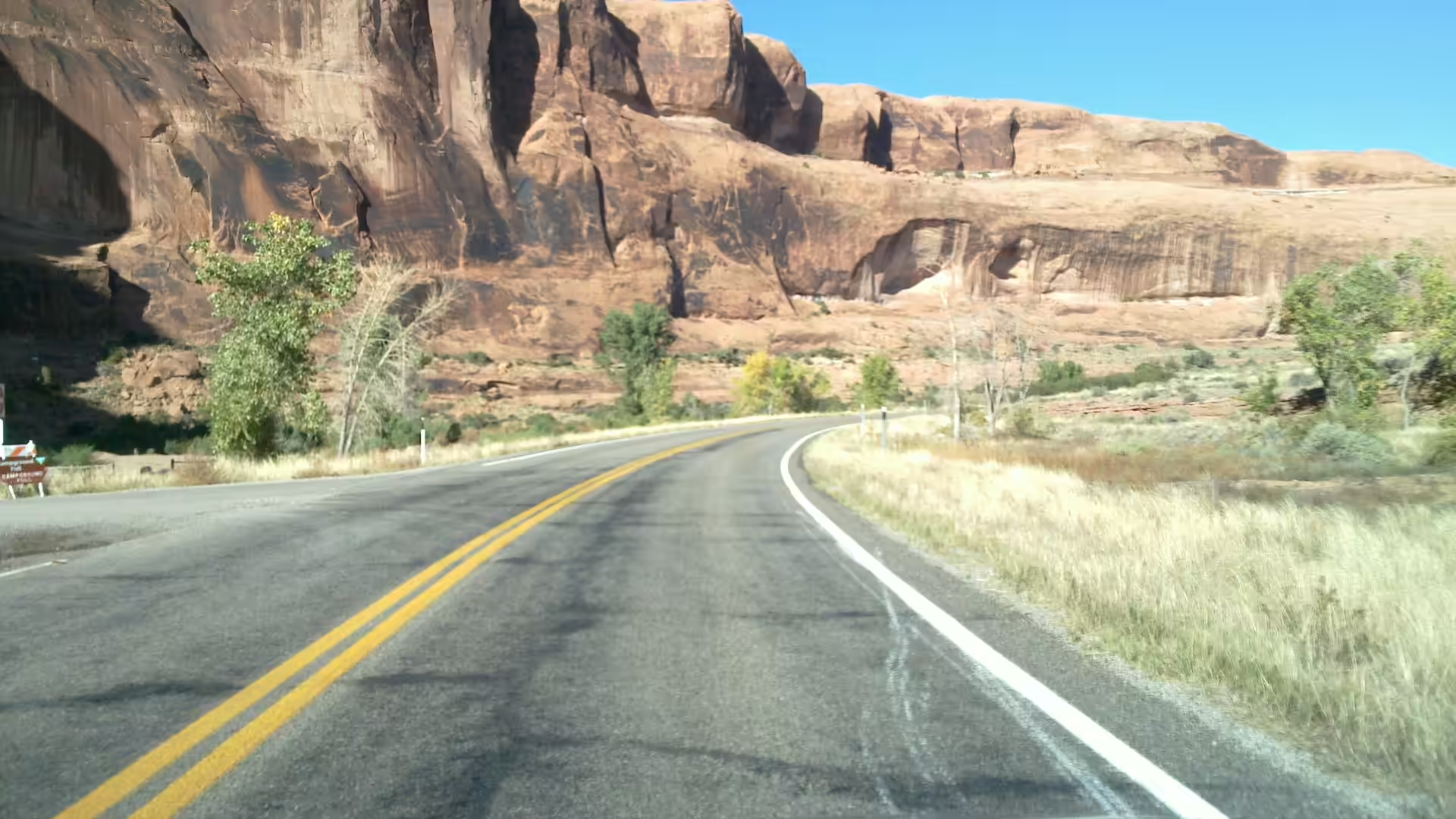
The approach is part of the experience, because the valley announces itself from a distance. Driving north on US Route 163 from Kayenta, or south from Mexican Hat, the buttes appear first as small shapes on the horizon and grow slowly until they fill the view, and the road runs between red sandstone cliffs with roadside trees before the valley floor opens. The state line crosses the view, and the classic composition, a straight road running towards the Mittens and Merrick Butte, is taken from a point inside Utah looking south into Arizona.
Life in the valley is organised around a very small population and a very large landscape. The communities are scattered, the roads are mostly unpaved, and the services available to visitors are concentrated in one place: the visitor centre and hotel at the rim of the valley, where the view faces Mitchell Mesa and the rest of the formations. Permits, guides and Navajo owned tours are the practical way to see the parts of the valley that lie off the public loop, and the tribal park’s rules are the rules of a sovereign nation rather than those of the National Park Service.
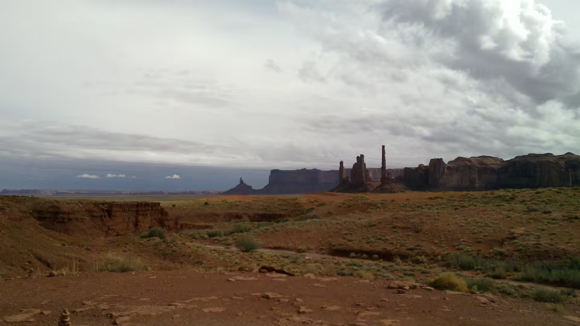
The scale and the light are what people come for. The buttes are separated from one another by open ground, so each stands alone with its own shape, and the red dirt of the valley floor throws a warm colour onto the rock at either end of the day. Because the formations are so distinctive, the valley has become one of the most recognisable landscapes in the world, and the result is a place that feels familiar on a first visit; the task of a traveller here is to look past the image and at the ground.
The Navajo Nation, which surrounds the valley, is the largest Indian reservation in the United States, large enough to exceed the area of ten of the fifty states, and it occupies parts of north eastern Arizona, north western New Mexico and south eastern Utah. Its government sits at Window Rock in Arizona, the reservation was established by treaty on 1 June 1868 and has been expanded several times since, the chapter system was introduced in 1922 and the tribal council in 1923, and it is organised into five agencies and 110 chapters. At the 2010 census, 173,667 of the 332,129 enrolled Navajo lived within the reservation, and the valley is one of the places where that population is most visible to a visitor.
History
The valley has been part of the Navajo world for a long time, and it remains so. The reservation that surrounds it is the largest in the United States, and the valley is one of its most important cultural landscapes, with sites, stories and ceremonies attached to the formations themselves. Visitors are on someone else’s land here, and the practical consequences are visible everywhere: the roads, the guided tours, the craft stalls and the lodge are Navajo enterprises, and the rules about filming, access and behaviour exist for reasons that have nothing to do with tourism.
The modern economy of the valley has passed through several phases. Between 1945 and 1967 the southern extent of the Monument Upwarp, which includes this country, was mined for uranium, which occurs in scattered areas of the Shinarump Conglomerate, with vanadium and copper associated with the uranium in some deposits. Mining left roads, shafts and a generation of workers, and its legacy is still being dealt with across the Navajo Nation. Ranching and weaving continued alongside it, and both remain part of the valley’s working life.
Film made the valley famous far beyond the plateau. From the 1930s onwards it was used for Westerns, above all by John Ford, whose films fixed the image of the American West in the minds of audiences who had never been near it; later directors including Sergio Leone used the same locations. The result was a strange double economy: the valley became a symbol of a country it does not exactly resemble, and the Navajo who lived there became, for a time, extras in other people’s stories about themselves.
The park as visitors know it was created to manage that traffic. The visitor centre and the hotel on the rim, the loop drive through the valley floor and the guided tours into the backcountry all belong to the tribal government rather than to the state or the federal government. That arrangement means the money raised in the valley stays in it, and it also means that a visitor’s experience is shaped by decisions taken locally. Respecting the closures, taking a guide where one is required and buying from Navajo businesses are the ordinary courtesies of a visit.
Two traditional occupations shaped the Navajo economy and are still part of life in the valley: herding and weaving. Navajo families have long raised sheep and goats, in particular the Navajo-Churro breed, and the wool is either sold for cash or spun into yarn and woven into blankets and rugs on vertical or back strap looms. Weaving with wool that still carried its natural lanolin produced water resistant cloth, and the rugs made in this way are now among the best known products of the reservation. The craft stalls along the highway and the workshops in the valley belong to that tradition rather than to the tourist trade alone.
Geology
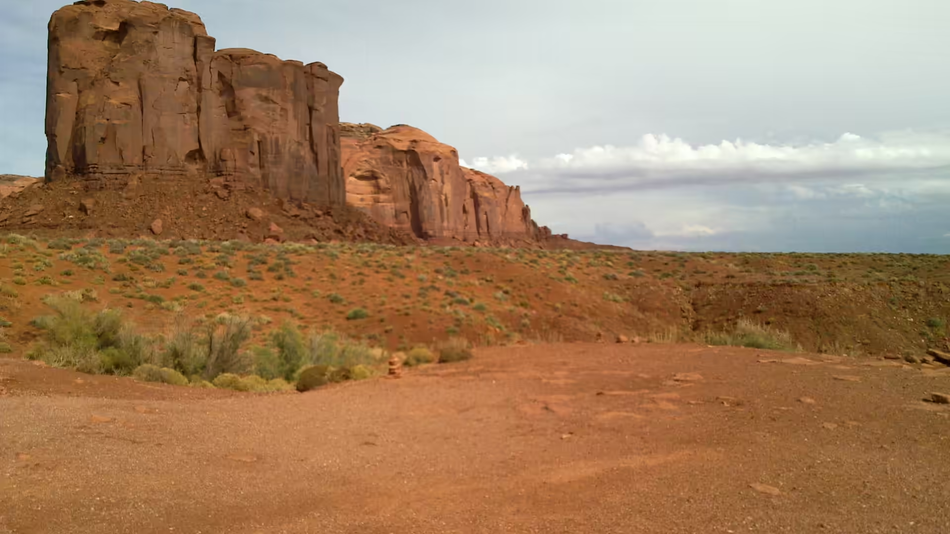
Monument Valley is a plateau landscape of mesas and buttes, and the difference between the two is worth learning before arriving. In geomorphology a butte is an isolated hill with steep, often vertical sides and a small, relatively flat top; mesas and plateaus are the larger forms, and the rule of thumb used by geographers is that a mesa has a top wider than its height while a butte has a top narrower than its height. The word butte comes from the French word for a knoll, and its use is common across the western United States, where the larger landform takes the Spanish name mesa.
The formations here are the survivors of a larger rock body. Buttes form by weathering and erosion, as rivers, wind and frost remove the softer material around a resistant mass and leave the harder rock standing; where the cap rock is flat and strong, the result is a tower with a level top, which is why the shapes of Monument Valley look almost architectural. The layers involved are sedimentary beds of the Colorado Plateau, laid down as sands and muds in rivers and shallow seas and later lifted, and the colours come from iron oxides in the beds.
The wider geology of the area is one of uplift and stripping. The Colorado Plateau was raised as a block, its layers remaining close to horizontal, and the rivers that cross it have cut down through them, so the region presents a series of dissected tablelands rather than folded mountains. The Monument Upwarp is one of the structures produced by that history, and the rocks at the base of the buttes include conglomerates and sandstones of different ages. The valley floor itself is a plain of eroded debris, red with iron and covered with sand that the wind moves from place to place.
Desert weathering then shapes what the rivers and the uplift have exposed. Where the rock is jointed, water enters the cracks, freezes in winter and widens them, and the corners of blocks are rounded off; where the wind carries sand, the bases of cliffs are undercut and the debris is swept away. The results are visible at every scale, from the deep vertical fissures in a cliff face to the small rocks and gravel that lie on the valley floor. Nothing here has been left in the state it was formed in, and the landscape is still being carved.
The same forms occur across the plateau, and comparing them is part of the interest of travelling here. Courthouse Butte near Sedona in Arizona is a butte of the same family, and the Pawnee Buttes stand on the plains of Colorado, each cut from the rock of its own region by the same combination of resistant cap and soft surround. What makes Monument Valley unusual is not the process but the density: dozens of these formations stand close together on an open floor, so that the shapes can be compared side by side and the sequence from mesa to butte read almost at a glance.
Things to See
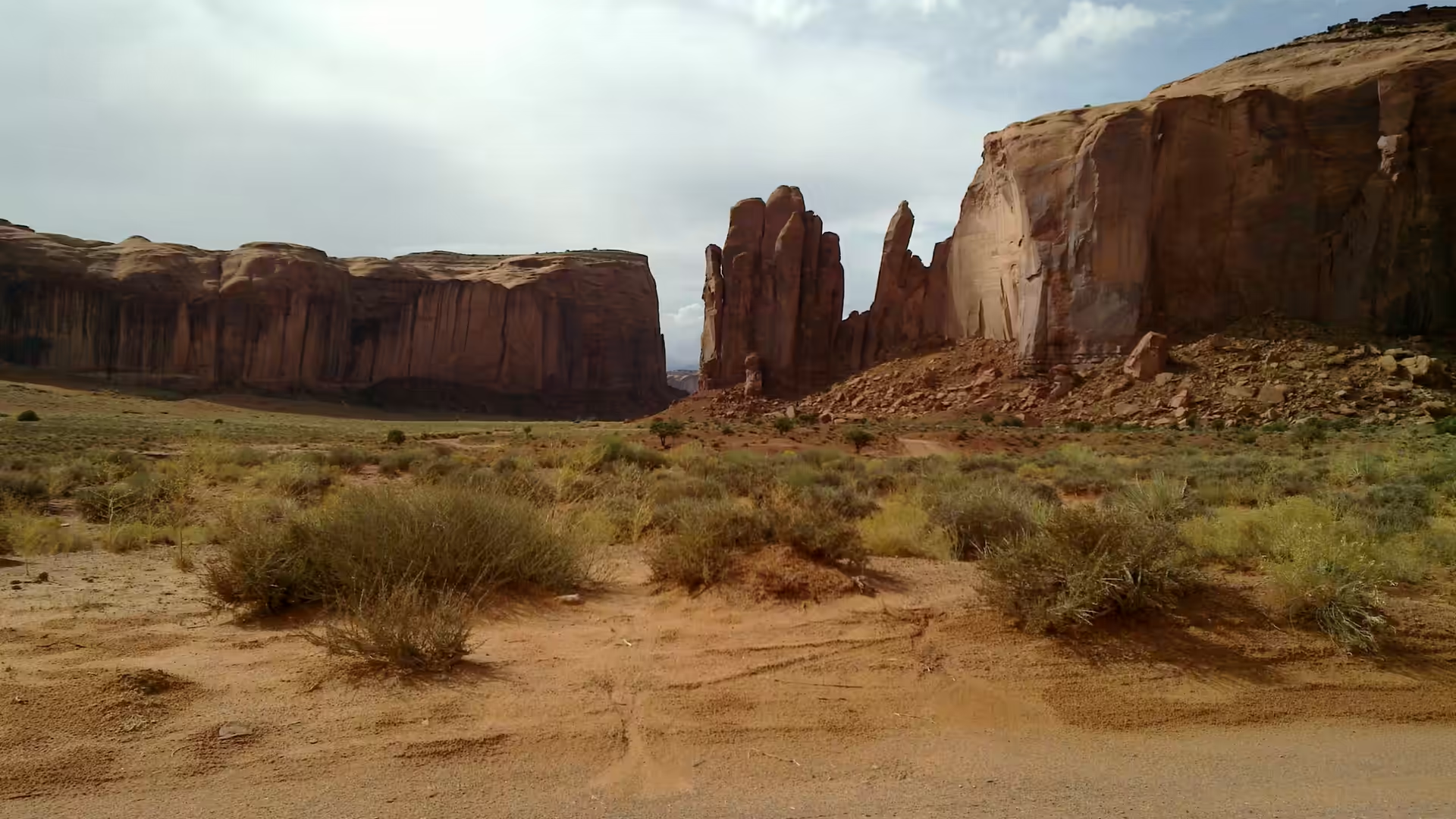
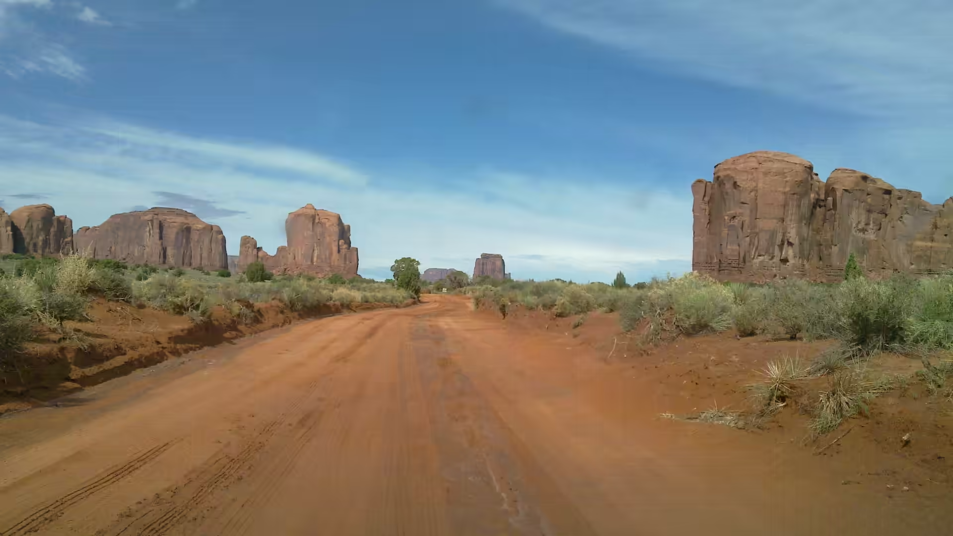
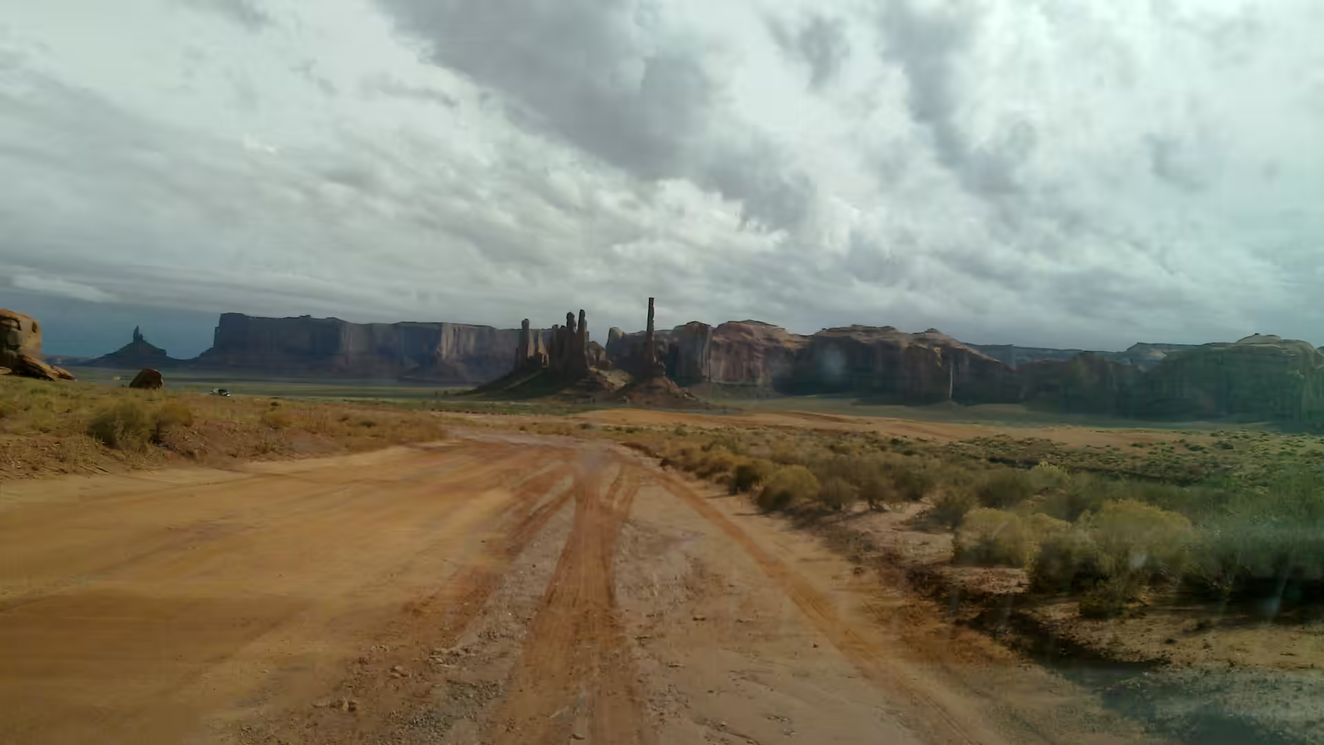
The loop drive is the standard way to see the valley from the ground, and it is a rough dirt road rather than a highway, so it should be driven slowly and only in suitable vehicles. It runs between red buttes and spires, passes through a sandy wash, and takes in viewpoints at the base of the largest formations, some of which are reached by short walks. Several parts of the valley are closed to independent travel and can only be visited with a Navajo guide, and the visitor centre can explain which routes are open on the day.
The classic viewpoints along the highway are the other side of the experience, and they are free. From the pull outs on US Route 163 the formations stand in profile against the sky, and the long straight road running towards them is the image that everyone recognises. The best light is in the afternoon for the eastern faces and at sunrise for the wider views, and the valley is large enough that a single position gives several different compositions as the sun moves.
From the rim above the visitor centre the whole valley is laid out, and this is where the geography becomes clear. Mitchell Mesa stands to one side, the Mittens and Merrick Butte in front, and between and behind them the rest of the cluster, with the plateau beyond. A short walk along the rim gives views that no road reaches, and the hotel and visitor centre both face the same direction, so it is possible to watch the light move across the formations without leaving the building.
The final subject is the valley as a place where people live. The dirt roads that leave the loop lead to scattered homes and grazing land, the craft stalls along the highway sell work made locally, and the tours are run by families and businesses from the reservation. For the traveller heading on, the route continues north or south along a road that runs for hours between settlements, with the buttes visible behind for a long time and the country growing emptier with every mile.
The valley is one stop in a much larger Navajo landscape, and the surrounding reservation offers more of the same country with different histories. Canyon de Chelly National Monument lies to the south east, Navajo National Monument to the west, and Window Rock, the seat of the tribal government, has its own tribal park and museum. Further afield, Hubbell Trading Post National Historic Site preserves a trading store that served the reservation for generations, and Chaco Culture National Historical Park in New Mexico holds the great houses of the Ancestral Puebloan world. Together they make a route of several days rather than a single stop.
References
- Baker, A. A. & others (1936). Geology of the Monument Valley-Navajo Mountain region, San Juan County, Utah. United States Geological Survey Bulletin 865. doi.org/10.3133/b865
- Baker, A. A. (1936). The Monument Valley-Navajo Mountain Country. Geographical Review 26, 592-602. doi.org/10.2307/209072
- Wikipedia contributors (2026). Butte. en.wikipedia.org/wiki/Butte
- Wikipedia contributors (2026). Colorado Plateau. en.wikipedia.org/wiki/Colorado_Plateau
- Wikipedia contributors (2026). Four Corners. en.wikipedia.org/wiki/Four_Corners
- Wikipedia contributors (2026). Mesa. en.wikipedia.org/wiki/Mesa
- Wikipedia contributors (2026). Monument Valley. en.wikipedia.org/wiki/Monument_Valley
- Wikipedia contributors (2026). Navajo Nation. en.wikipedia.org/wiki/Navajo_Nation
- Wikipedia contributors (2026). Uranium mining. en.wikipedia.org/wiki/Uranium_mining
- Witkind, I. J. & others (1963). Geology and uranium-vanadium deposits of the Monument Valley area, Apache and Navajo Counties, Arizona. United States Geological Survey Bulletin 1103. doi.org/10.3133/b1103