2015 USA - Analogue Pictures 7

Journal Notes
General
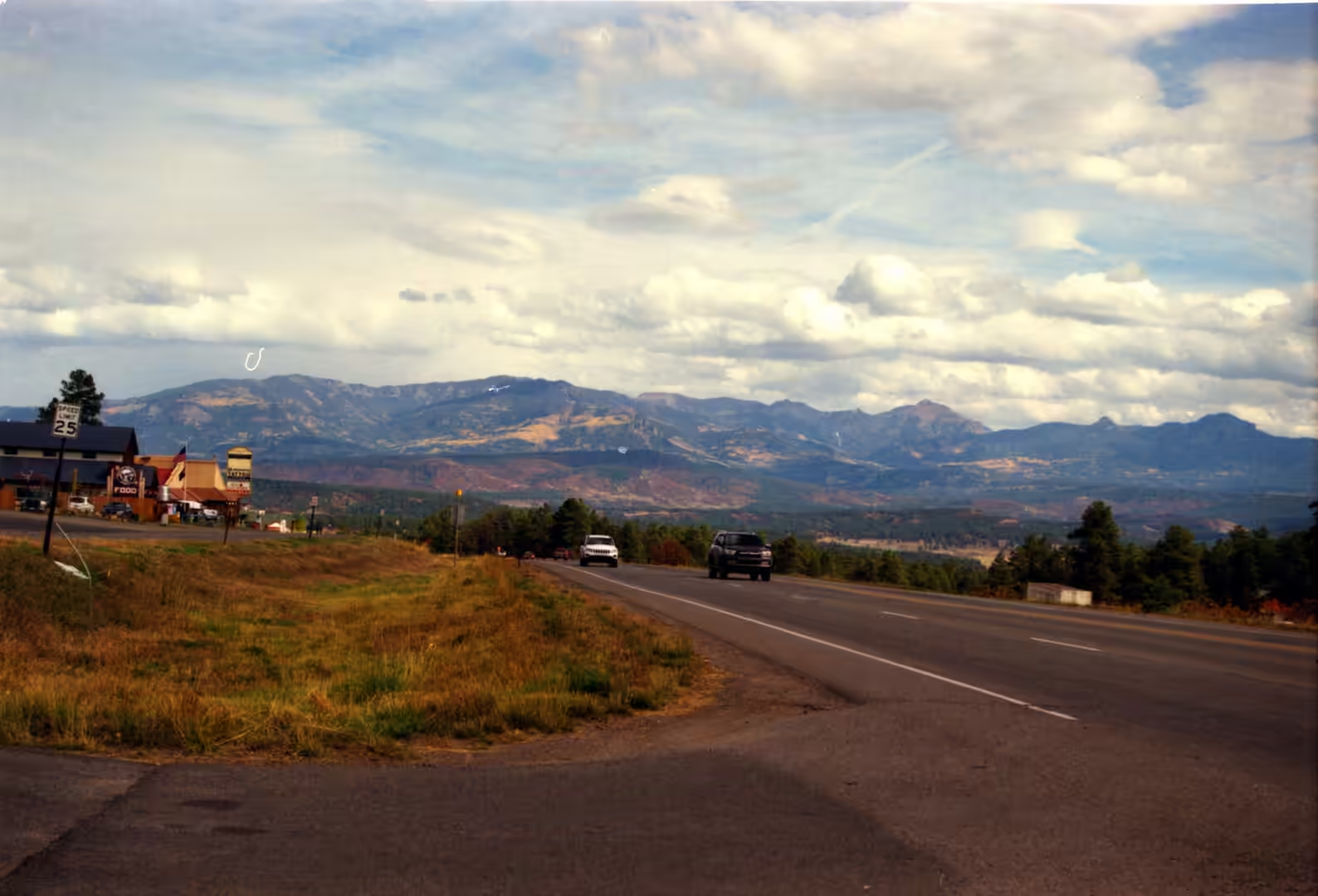
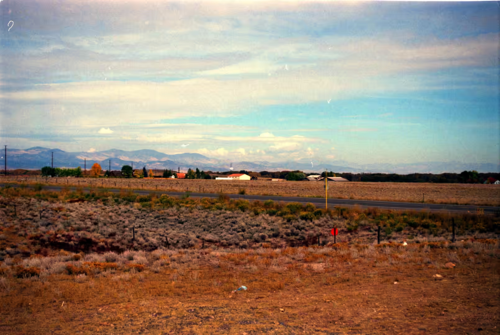
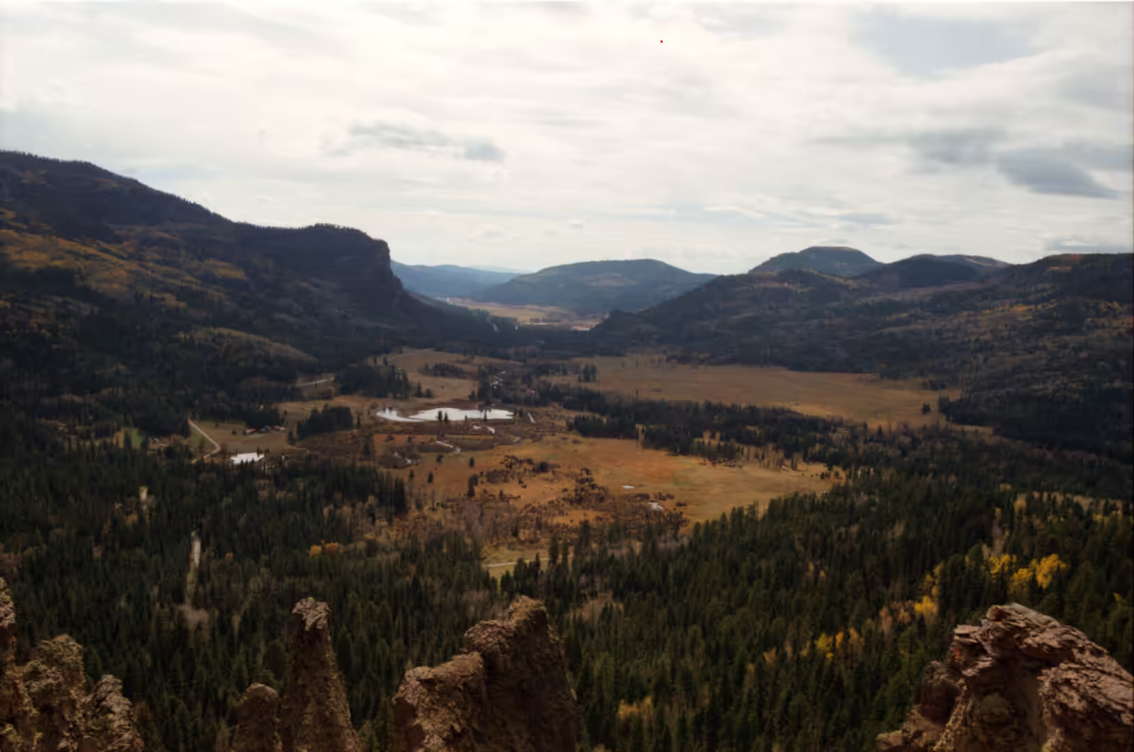
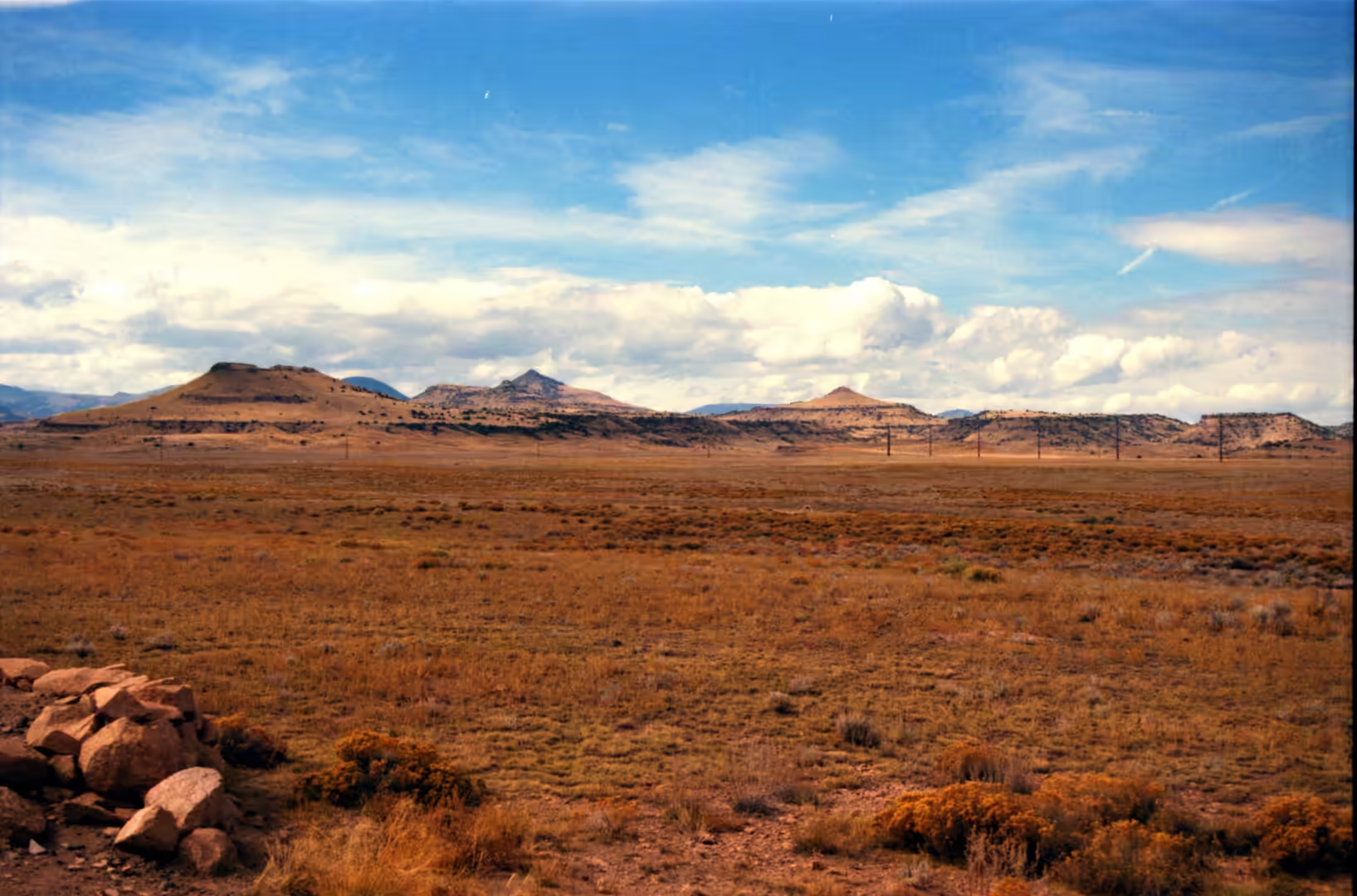
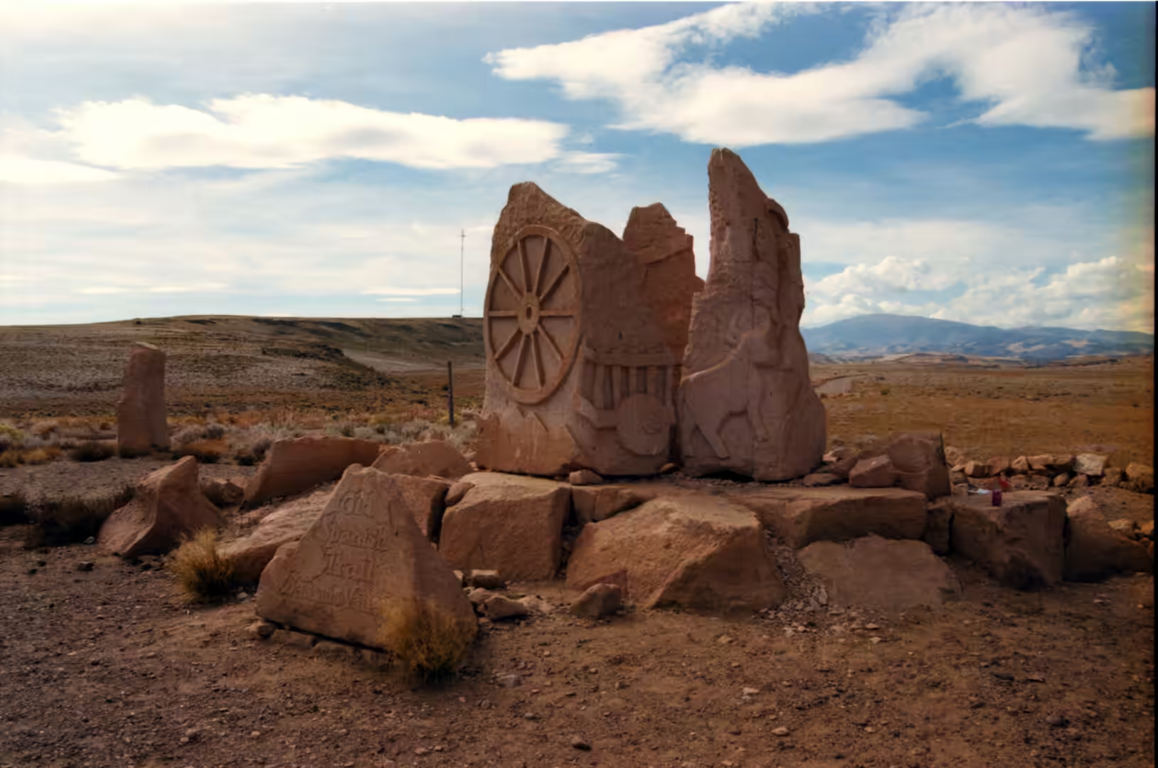
The last album of the journey is the drive home across the plains. Its subjects are a highway running towards a mountain range, open grassland with scattered buildings, a dirt road curving across grassland towards a mountain, a rocky rim overlooking pine forest and a valley, high plains grass with low mesas and a far peak, and a stone monument carved with a wagon wheel on a hill. The country is Colorado, and specifically the transition zone where the Great Plains meet the Rocky Mountains, the part of the state that travellers cross quickly on the way to the mountains and that rewards being crossed slowly on the way out of them.
Colorado is a landlocked state in the Mountain West, part of the south western United States, and it shares the Four Corners region with Arizona, New Mexico and Utah. It is bordered by Wyoming to the north, Nebraska to the north east, Kansas to the east and Oklahoma to the south east. Its landscape runs from mountains and forests to high plains, mesas, canyons, plateaus, rivers and desert land, because the state contains most of the Southern Rocky Mountains together with the north eastern portion of the Colorado Plateau and the western edge of the Great Plains. It is the eighth largest state by area and the twentieth by population, with an estimated 5,957,493 residents in July 2024, an increase of 3.2 per cent over the 2020 census.
The Great Plains are the other half of the state. They form a broad expanse of flatland in North America stretching east of the Rocky Mountains, most of it covered in prairie, steppe and grassland, and they are the western part of the Interior Plains. The western portion, where the land begins to rise towards the mountains, is known as the High Plains, and it is this country that the album records: grass in every direction, a low line of mesas on the horizon, and a single peak standing above the plain. Because the ground is almost level and the distances are long, the weather is visible in a way it is not in the mountains, with cloud shadows moving across the grass.
The Front Range is the arrival. It is a mountain range of the Southern Rocky Mountains running north to south through central Colorado and south eastern Wyoming, between Casper in Wyoming and Pueblo in Colorado, and it is the first range encountered when travelling west across the plains along the fortieth parallel. It rises nearly 3,000 metres above the Great Plains, and its most prominent peaks, Longs Peak, Mount Blue Sky and Pikes Peak, are visible from the Interstate 25 corridor. Millions of years ago the area of the present Front Range contained ancient mountain ranges, deserts, beaches and even oceans, and the rock that remains is the record of all of it.
History
People have lived in this region for a very long time. The area has been inhabited by Native Americans and their Paleo-Indian ancestors for at least 13,500 years and possibly much longer, and the eastern edge of the Rocky Mountains was a major migration route for early peoples spreading through the Americas. The first known contact between Europeans and the peoples of the plains took place in what are now Texas, Kansas and Nebraska between 1540 and 1542, with the arrival of the Spanish conquistador Francisco Vázquez de Coronado, whose expedition was looking for cities that did not exist.
The horse changed the plains more than any other arrival. The real beginning of the plains horse culture came with the Pueblo Revolt of 1680 in New Mexico and the capture of thousands of horses and other livestock, and by 1683 a Spanish expedition into Texas found horses among native people. After 1750, warfare and pressure from the Blackfoot, Crow, Lakota, Cheyenne and Arapaho pushed the Eastern Shoshone south and westward, and some of them moved as far as Texas, emerging as the Comanche by 1700. The mounted peoples of the plains were the product of that period, and the wagon roads that followed were cut through a country that had been crossed on horseback for a century and a half.
The Santa Fe Trail is the reason for the wagon wheel on the monument. It was a nineteenth century route through central North America connecting Franklin, Missouri with Santa Fe, at that time a provincial capital of Mexico, and it was pioneered in 1821 by William Becknell and Joseph R. Walker, who set out from the Boonslick region along the Missouri River. The trail served as a vital commercial highway until 1880, when the railroad reached Santa Fe, and it skirted the northern edge of Comancheria and crossed its north western corner, with the Comanche demanding compensation for passage. In 1846, during the Mexican American War, the United States Army used the trail to invade New Mexico, and parts of the route were later incorporated into the National Old Trails Road and into U.S. Route 66.
The American period arrived in stages. The United States acquired the territorial claim to the eastern Rocky Mountains with the Louisiana Purchase from France in 1803, Zebulon Pike led an expedition into the region in 1806, and under the Adams-Onís Treaty of 1819 the boundary with Spanish territory was defined. In 1848 much of the Nuevo México region was annexed to the United States with the Treaty of Guadalupe Hidalgo. The Pike’s Peak Gold Rush of 1858 to 1862 brought an influx of settlers, and on 28 February 1861 the territory of Colorado was organised. The settlements along the front of the mountains, and the trails and wagon roads that run across the plains towards them, all belong to that sequence of events.
Geology
The front of the mountains is a wall because of the way it was raised. The plains and the range meet along the mountain front, where the flat lying sedimentary rocks of the plains, laid down on the floor of inland seas, are broken and tilted up against the older rock of the range. The uplift that produced the modern Rocky Mountains lifted this material as a block, and the range has been rising and being eroded ever since, so that the plain is built partly of its own debris: gravels, sands and clays washed out and spread across the surface by rivers that no longer exist in that form.
The plains themselves are a study in flatness. Because the beds lie almost horizontal and the surface slopes gently eastward, drainage is slow and rivers run in shallow valleys rather than deep canyons. The soils are formed from the material the mountains shed and from dust blown out of the dry interior, and they support grass rather than forest, which is why the plains are grassland and the mountains forty miles away are forest. The transition is abrupt: the elevation rises, the rainfall increases with it, and the grass gives way to trees within a short distance of the mountain front.
The mesas and the lone peak in the album are the residuum of the same process. Where a hard bed survives above softer material, a flat topped hill stands out from the plain, and these mesas are scattered along the western edge of the plains in exactly the way the geology predicts. A single mountain standing alone above the grass is usually a peak that has been isolated from the main range by erosion, or one standing at the end of a spur, and its isolation makes it visible for an hour of driving in every direction.
The pine forest on the higher ground is the other part of the picture. Pinus ponderosa, the ponderosa pine or western yellow pine, grows in erect forms in sixteen western states as well as British Columbia, and it was first documented in modern science in 1826 in eastern Washington near present day Spokane, when David Douglas misidentified it as red pine. In 1829 Douglas concluded that he had a new pine among his specimens and coined the name Pinus ponderosa for its heavy wood, and in 1836 it was formally named and described by Charles Lawson. It became the official state tree of Montana in 1949, and its egg shaped cones are often found in great numbers under the trees. The smell of the bark in the sun is the most reliable sign that the mountains have been reached.
Things to See
Driving east out of the mountains, the sequence of the album appears in order. The road descends through pine forest onto the high plains, and the first thing to watch is the way the sky expands as the trees fall away. Open grassland with scattered buildings replaces the forest, the mountains behind shrink to a line on the horizon, and the country ahead becomes grass, gravel roads, windbreaks of cottonwood and the low shapes of farm buildings. Because the land is so flat, a single truck on the road can be followed with the eye for several minutes.
The dirt roads are the way to see the plains closely. A gravel or dirt road curving across grassland towards a distant mountain crosses the whole transition in one stretch, from fields to grazing land to the first wooded slopes, and it passes gates, cattle guards, windmills and the occasional abandoned building. Driving them requires attention to the surface, the weather and the gates, and they are the reason a map of the plains is more interesting than it looks from the interstate.
The historic markers along the route are the other subject. Stone monuments carved with a wagon wheel, signs beside the road and small roadside parks mark the line of the Santa Fe Trail, which crossed this country with freight wagons for more than half a century, and similar markers record the routes of the later roads. Standing beside one on a hill with the grass moving in the wind, the scale of the trail becomes clear: the wagons travelled in the open, with no settlement for days, and the markers are placed on the high ground precisely because that is where the route could be seen and defended.
The best part of the day in this country is the end of it. On the plains the sun sets behind the mountains, the range turns dark against a bright sky, and the grass in front of it holds the light after the plain has gone grey. Where a rocky rim overlooks a valley with pine forest below, the last light catches the tops of the trees and the valley fills with shadow before the rim does. The camp and the road into the hills for the night, and the drive out of the mountains in the morning, close a journey that began in the desert and ended among grass, gravel roads and the front of the Rocky Mountains.
References
- Clyatt, K. A. & others (2017). Long-term effects of fuel treatments on aboveground biomass accumulation in ponderosa pine forests. Forest Ecology and Management 400, 550-559. doi.org/10.1016/j.foreco.2017.06.021
- Dary, D. (2012). Santa Fe Trail: Its History, Legends, and Lore. University Press of Kansas. doi.org/10.1353/book46121
- Kellogg, K. S. (2004). The Colorado Front Range: anatomy of a Laramide uplift. GSA Field Guide 5: Field Trips in the Southern Rocky Mountains. doi.org/10.1130/0-8137-0005-1.89
- Kennedy, S. & others (2020). Great Plains Ranchers Managing for Vegetation Heterogeneity: A Multiple Case Study. Great Plains Research 30, 73-88. doi.org/10.1353/gpr.2020.0016
- Wikipedia contributors (2026). American bison. en.wikipedia.org/wiki/American_bison
- Wikipedia contributors (2026). Colorado Territory. en.wikipedia.org/wiki/Colorado_Territory
- Wikipedia contributors (2026). Colorado. en.wikipedia.org/wiki/Colorado
- Wikipedia contributors (2026). Comanche. en.wikipedia.org/wiki/Comanche
- Wikipedia contributors (2026). Front Range. en.wikipedia.org/wiki/Front_Range
- Wikipedia contributors (2026). Great Plains. en.wikipedia.org/wiki/Great_Plains
- Wikipedia contributors (2026). High Plains (United States). en.wikipedia.org/wiki/High_Plains_(United_States)
- Wikipedia contributors (2026). Longs Peak. en.wikipedia.org/wiki/Longs_Peak
- Wikipedia contributors (2026). Louisiana Purchase. en.wikipedia.org/wiki/Louisiana_Purchase
- Wikipedia contributors (2026). Pike%27s Peak Gold Rush. en.wikipedia.org/wiki/Pike%27s_Peak_Gold_Rush
- Wikipedia contributors (2026). Pikes Peak. en.wikipedia.org/wiki/Pikes_Peak
- Wikipedia contributors (2026). Pinus ponderosa. en.wikipedia.org/wiki/Pinus_ponderosa
- Wikipedia contributors (2026). Prairie. en.wikipedia.org/wiki/Prairie
- Wikipedia contributors (2026). Rocky Mountains. en.wikipedia.org/wiki/Rocky_Mountains
- Wikipedia contributors (2026). Santa Fe Trail. en.wikipedia.org/wiki/Santa_Fe_Trail
- Wikipedia contributors (2026). Southern Rocky Mountains. en.wikipedia.org/wiki/Southern_Rocky_Mountains
- Wikipedia contributors (2026). Treaty of Guadalupe Hidalgo. en.wikipedia.org/wiki/Treaty_of_Guadalupe_Hidalgo
- Wikipedia contributors (2026). Zebulon Pike. en.wikipedia.org/wiki/Zebulon_Pike