Day 3 - Giarre
Journal Notes
General
Giarre is a town of the Metropolitan City of Catania on the eastern side of Sicily, and it is the place where this part of the journey settles. It lies north of Catania and south of Taormina, on the coastal strip between the Ionian Sea and the lower slopes of Mount Etna, and it shares its life with the neighbouring town of Riposto to the east, with which it forms a single built up area: the fields of one end where the houses of the other begin. The municipality is bounded by Acireale, Mascali, Milo, Riposto, Sant’Alfio, Santa Venerina and Zafferana Etnea, which means that its neighbours run from the sea to the upper slopes of the volcano in a distance of a few kilometres.
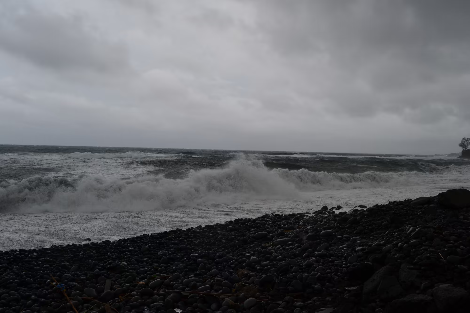
The town itself is small enough to walk, but its position is what makes it useful. From the higher streets the view runs east over the Ionian Sea and north to the mountains of the Peloritani, while to the west the cone of Etna rises behind the roofs with snow on its summit for much of the winter. The coast below is a mixture of dark pebble beaches and low rocky points, and the coastal road runs along it between villas, warehouses and small harbours. In February the sea is cold and the weather unsettled, which is exactly what the pictures of this day show: a grey sky, a rising sea and a wet road.
Above the town the land rises into the agricultural belt that belongs to the volcano. Citrus groves, olive trees, vineyards and vegetable plots are packed into the slopes in terraces, and the gardens between the houses continue the same pattern on a smaller scale, with orange trees, lemon trees and palms growing in the same ground as ornamental shrubs. Because the soil is volcanic it drains quickly and is rich in minerals, and because the sea is close the air is mild in winter, so the combination supports a density of cultivated land that is unusual even in Sicily.
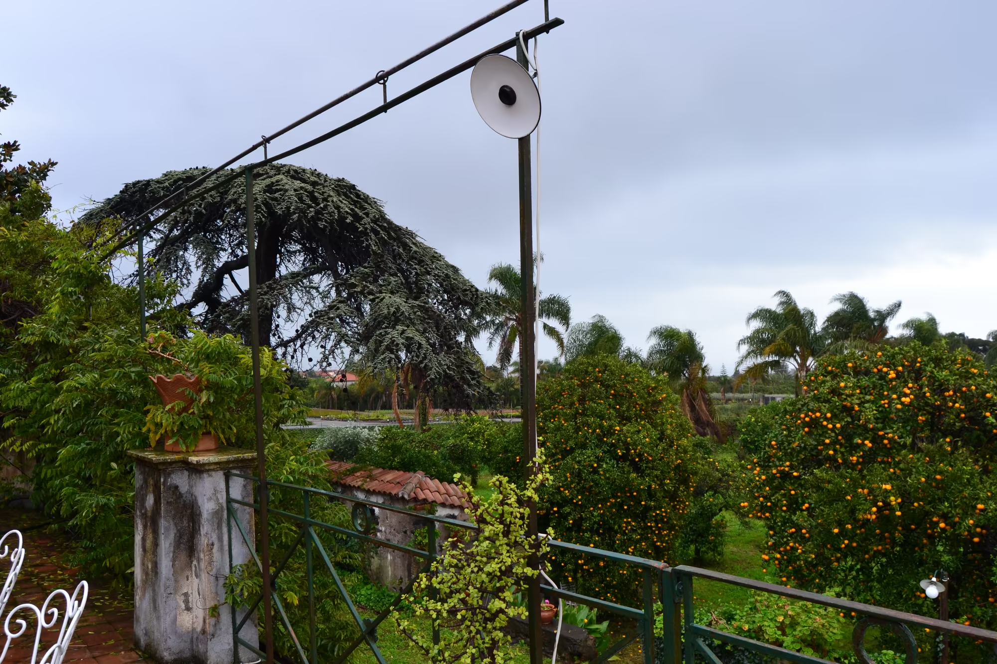
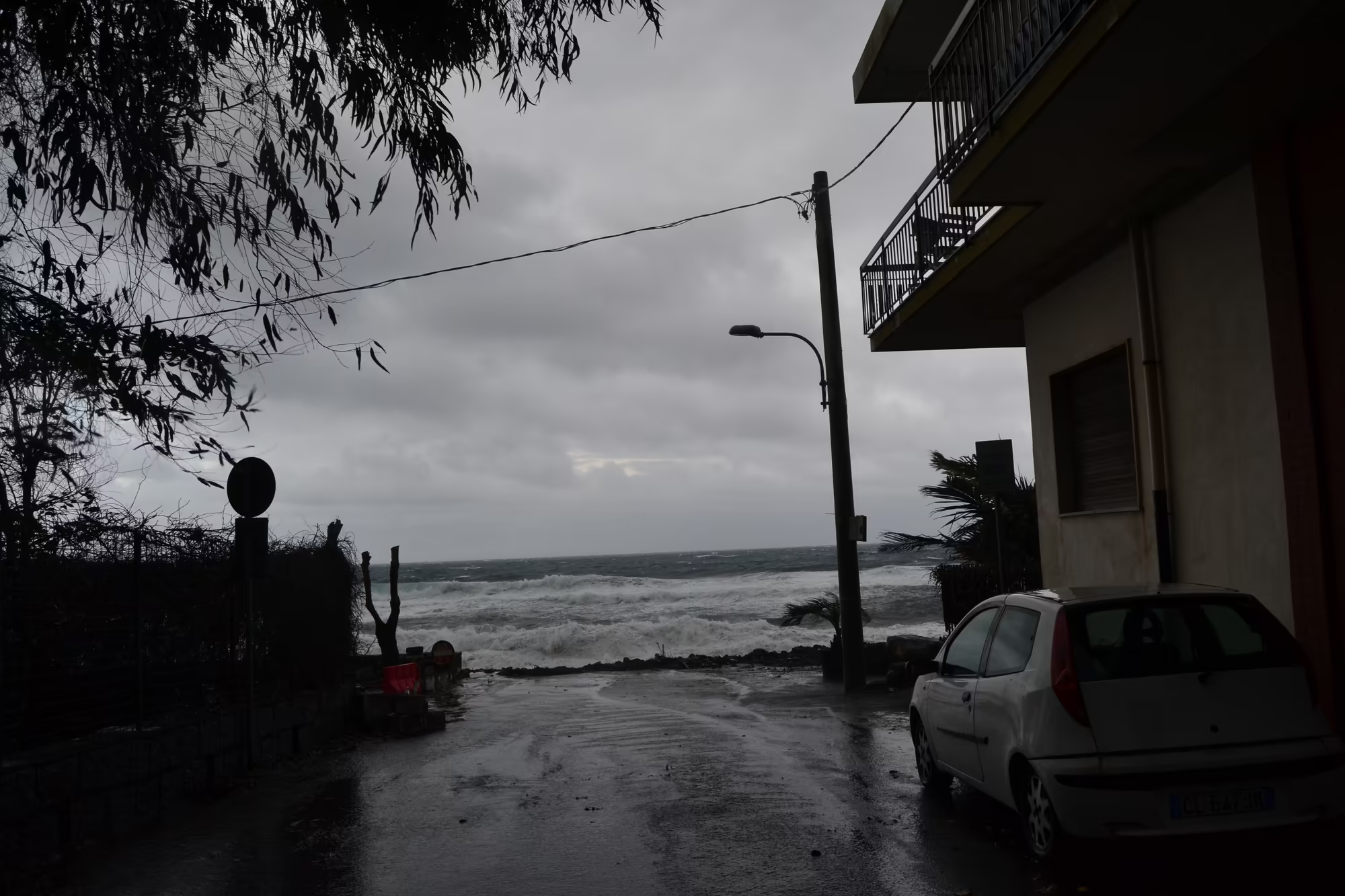
Giarre therefore serves as a base rather than a destination, and this album is the record of that. The day was spent in and around the town: a garden of orange trees on a green hillside, a stretch of coast where the sea was running high, and a damp street in the lower town with a car parked at the kerb. The cathedral stands on its piazza a short walk away, begun in 1794 in the neo classical style and dedicated to the Spaniard Saint Isidore, the patron of Madrid, while the Oratory of Saint Philip Neri from the eighteenth century and a number of palazzi fill the surrounding streets.
The two towns are also administratively linked at the level of everyday services: Giarre has been twinned with Cismon del Grappa since 1969, and the municipality shares schools, a hospital and the harbour economy with Riposto, so that the settlement works as one place in practice and two on paper. Because Mount Etna is both very active and surrounded by people, it has been designated a Decade Volcano by the United Nations, which is a research status rather than a protection status, and the towns at its foot, Giarre among them, are the reason for it.
History
Some historians suppose that the ancient Greek city of Kallipolis stood on the same territory as the present town, but there is no proof of it now, and the identification remains a suggestion rather than a fact. What is documented is more modest and more recent: from the late sixteenth century until 1815 Giarre was a village of the county of Mascali, one of the agricultural estates into which this part of the coast was divided under the old regime, and its growth followed the fortunes of that estate and of the land around it.
The nineteenth and twentieth centuries rearranged the map more than once. During the fascist era Giarre was joined to Riposto under the single name of Jonia, an administrative merger that made one town out of two, and the two were separated again in 1945. The present relationship between them, two municipalities with a single continuous settlement, is the result of that history, and the shared name still appears in local institutions and on signs. The town was also the site of the Giarre murder in 1980, an event that entered the national discussion of crime and civil society in Sicily in those years.
The parish church belongs to the same period of rebuilding. The neo classical cathedral was begun in 1794 and dedicated to Saint Isidore, the Spaniard who is the patron saint of Madrid, whose cult was widespread in the Spanish ruled parts of southern Italy; his festival is still the town’s own, and the piazza in front of the church is the centre of it. The Oratory of Saint Philip Neri, from the eighteenth century, belongs to the same religious landscape, and the two buildings together show how much of the town’s public architecture was put in place in the decades around 1800.
Beyond the town the history is written in lava and in the records of the volcano, because every generation here has had to measure itself against the mountain. Villages on the lower slopes have been destroyed and rebuilt more than once, roads and railways have been cut and buried and cut again, and the terraces above the town are worked on ground that was formed by eruptions and is renewed by them. The practical result for a visitor is that the landscape is extremely young in geological terms and extremely old in agricultural ones: the same slope may have been a lava field three hundred years ago and an orange grove for a hundred and fifty.
The religious calendar is part of that public architecture. The cathedral’s dedication to Saint Isidore, the patron of Madrid, is a reminder of the Spanish centuries of the island’s history, and his feast day is the town’s own; the piazza in front of the church is the setting for it, and the Oratory of Saint Philip Neri nearby serves the confraternities that organised such occasions. In a town of this size the square and the street in front of the church carry almost all of the public life of the year.
Geology
Mount Etna is an active stratovolcano on the east coast of Sicily, in the Metropolitan City of Catania between Messina and Catania, and it stands above the convergent margin where the African Plate meets the Eurasian Plate. Its summit is the highest ground in Italy south of the Alps, currently around 3,403 metres although the figure changes with eruptions, and it is one of the most active volcanoes in the world, in an almost constant state of activity. The town of Giarre lies on its lower north eastern flank, close enough that the summit is visible from the streets and close enough that ash falls on the roofs from time to time.
The reason the land here is so productive is the same reason it is dangerous. The fertile volcanic soils produced by the mountain’s activity support extensive agriculture, with vineyards and orchards spread across the lower slopes and across the broad Plain of Catania to the south. Lava weathers into a soil rich in potassium and other minerals, and where it is broken up and worked it holds water better than the bare rock suggests, so that the slopes carry citrus, olives, vines and vegetables in a pattern that follows the age of the flows rather than any plan.
The mountain itself is the product of a long sequence of building and collapse. It began as submarine fissural activity that produced pillow lavas and a first shield volcano, and it then passed through three main stratovolcano stages known as Monte Calanna, Trifoglietto 1 and Trifoglietto 2 before the present Mongibello system developed in two successive stages from about 15,000 years ago. The activity has gradually shifted towards the north west, and the older centres are now visible as ruins of cones on the flanks rather than as separate mountains.
The flanks carry more than 300 vents, ranging from small holes in the ground to craters hundreds of metres across, and the difference between summit and flank eruptions matters to everyone who lives here. Summit eruptions can be highly explosive and spectacular but rarely threaten inhabited areas; flank eruptions can open at a few hundred metres of altitude, close to or even within the towns, and these are the events that have buried roads, vineyards and houses. On the coast the result is a shoreline of lava platforms, black pebble beaches and rocky points, which is what the beach at the foot of Giarre’s hillside is made of.
In June 2013 the mountain was added to the list of UNESCO World Heritage Sites under the natural criterion that covers geological and physiographic features, an acknowledgement of the same qualities that make the farmland above Giarre productive. Lava and ash weather into a soil rich in minerals which drains quickly and holds moisture in its pores, and where it has been broken up and terraced it supports citrus, olives, vines and vegetables on ground that is steep, recent and renewed.
Things to See
The garden of the farm is the first place to look at, because it is the agricultural belt in miniature. Orange trees stand in rows on a green hillside with fruit on the branches in the middle of winter, palms rise above them, and the ground between the trees is planted with vegetables and flowers; a low stone wall holds the terrace and the sea is somewhere below. In February the oranges are at their best, and a grove in fruit in the middle of the local winter is the single most characteristic sight of this coast.
The sea is the second subject, and in winter it is not a swimming sea. Large stormy waves break on the pebble beach below the town, throwing spray over the rocks while the sky stays grey and low, and the water is dark rather than blue. The beach itself is made of rounded black and grey pebbles and coarse sand, and it shelves steeply, so the waves arrive with little warning. Locals walk along the front in coats, watching the water, and the whole scene has the quality of weather rather than holiday.
The lower town is the third thing to see on a wet day. A damp coastal street with a parked white car, a building with a balcony and a palm tree, puddles on the pavement and shutters closed against the rain is the ordinary face of a Sicilian town out of season, and it is worth more attention than it usually gets. The streets here are not laid out for visitors: they are the working fabric of a place that lives from farming, fishing and the small trades of two joined towns.
The piazza and the cathedral complete the day. The neo classical facade of the cathedral, begun in 1794 and dedicated to Saint Isidore, faces its square a short distance from the shopping streets, and the Oratory of Saint Philip Neri and the older palazzi stand within a few minutes’ walk. From the higher part of the town the view takes in the roofs, the sea, and the snow capped summit of Etna above everything, which is the combination that defines this stretch of coast: a working town between a volcano and the Ionian Sea.
The market and the shopping streets are worth a morning, because they show what the agriculture of the slopes produces. Fruit and vegetables grown on the volcanic soil are sold within a few kilometres of the fields they came from, the fish landed at Riposto is sold on the same stalls, and the local cheese, olives and wine appear beside them. Walking from the cathedral square to the waterfront passes through all of it in about a quarter of an hour.
References
- Behncke, B., Neri, M. & Nagay, A. (2005). Lava flow hazard at Mount Etna (Italy): new data from a GIS-based study. Kinematics and Dynamics of Lava Flows, Geological Society of America. doi.org/10.1130/0-8137-2396-5.189
- Wikipedia contributors (2026). Acireale. en.wikipedia.org/wiki/Acireale
- Wikipedia contributors (2026). Decade Volcano. en.wikipedia.org/wiki/Decade_Volcano
- Wikipedia contributors (2026). Etna DOC. en.wikipedia.org/wiki/Etna_DOC
- Wikipedia contributors (2026). Giarre. en.wikipedia.org/wiki/Giarre
- Wikipedia contributors (2026). Ionian Sea. en.wikipedia.org/wiki/Ionian_Sea
- Wikipedia contributors (2026). Mascali. en.wikipedia.org/wiki/Mascali
- Wikipedia contributors (2026). Metropolitan City of Catania. en.wikipedia.org/wiki/Metropolitan_City_of_Catania
- Wikipedia contributors (2026). Mount Etna. en.wikipedia.org/wiki/Mount_Etna
- Wikipedia contributors (2026). Riposto. en.wikipedia.org/wiki/Riposto
- Wikipedia contributors (2026). Sicily. en.wikipedia.org/wiki/Sicily
- Wikipedia contributors (2026). UNESCO. en.wikipedia.org/wiki/UNESCO
- Zuccarello, F. & others (2023). The new summit hazard map from lava flow inundation at Mt Etna volcano. EGU General Assembly. doi.org/10.5194/egusphere-egu23-9132