Day 6 - Etna Vulcano





Journal Notes
General
This day belongs to the mountain. Mount Etna, or simply Etna, is an active stratovolcano on the east coast of Sicily in the Metropolitan City of Catania, between the cities of Messina and Catania, and it stands above the convergent margin between the African Plate and the Eurasian Plate. It is one of the tallest active volcanoes in Europe and the tallest peak in Italy south of the Alps, with a current height of around 3,403 metres that varies with summit eruptions, and it is one of the most active volcanoes in the world, in an almost constant state of activity.
The mountain is recognised on several registers at once. In June 2013 it was added to the list of UNESCO World Heritage Sites under the natural criterion that covers geological and physiographic features, and because of its history of recent activity together with the population living around it, it has been designated a Decade Volcano by the United Nations, a status reserved for volcanoes that are worth studying in detail for the sake of the people nearby. Both designations describe the same situation: a very active volcano with towns, roads and railways on its flanks.
In winter the mountain changes character without changing behaviour. Snow covers the upper slopes and the summit cone stands above a layer of drifting cloud, while the lower flanks stay green and the orchards continue to bear fruit within sight of the snow line. The result is the landscape in this album: a village street with the white summit at the end of it, a cluster of wooden chalets and flags on the mountain road, dark volcanic rock and scrub below the snow, gardens full of orange trees, and finally the summit itself, white and immense above the clouds.
Access to the high ground runs from the south. The most common route is the road to the Sapienza Refuge, a ski area at about 1,910 metres on the southern side of the summit area, from where a cableway runs uphill to about 2,500 metres and the crater zone at 2,920 metres can be reached on foot. A narrow gauge railway, the Ferrovia Circumetnea, runs around the mountain rather than up it, and the roads that connect the villages on the flanks make a complete circuit possible in a day.
The mountain is also a working landscape. Its fertile soils support extensive agriculture, with vineyards and orchards spread across the lower slopes and the broad Plain of Catania to the south, and the wine of the mountain is sold under its own designation; chestnut woods and higher pastures follow the slopes above the orchards, and the same roads that carry visitors to the refuge in summer carry skiers in winter. Almost every part of the volcano below the snow line is in some kind of use.
History
Etna has been part of the human story of this island since before there was a written history of it. In classical Greek the mountain was called Aitne, a name also given to the city of Catania and to the town originally known as Inessa, and the name itself is thought to come from a Phoenician word meaning furnace or chimney; in Arabic it was called the Mountain of Fire. In both Greek and Roman mythology the forge of Hephaestus, the god of blacksmithing, lay under Mount Etna, and in Greek myth the monster Typhon was trapped beneath the mountain by Zeus. The volcano was explained as the workshop of a god long before it was explained as a geological system.
The written record of eruptions is unusually long. An eruption north of Catania in the area now occupied by the Ognina district was recorded in antiquity, and Rabban Bar Sauma, a Chinese traveller to the West, recorded an eruption on 18 June 1287. The eruption of 1669 was the most destructive since 122 BCE: it began on 11 March 1669, produced lava flows that destroyed at least ten villages on the southern flank, and reached the city walls of Catania five weeks later. The pattern set then has repeated itself whenever the mountain has opened low on its flanks.
The modern record is dense. Since the year 1600 at least 60 flank eruptions and countless summit eruptions have occurred, and nearly half of the flank eruptions have happened since the beginning of the twentieth century. Since 2000 there have been four flank eruptions, in 2001, 2002 to 2003, 2004 to 2005 and 2008 to 2009, together with summit eruptions in 2006, 2007 to 2008, twice in 2012, in December 2018 and again in February 2021. The eruptions of 2011 sent ash columns over the airport of Catania and forced it to close several times, and the July 2011 episode endangered the Sapienza Refuge, the main tourist hub on the mountain, before the lava flow was successfully diverted.
Living with this has produced a working relationship rather than a fatalistic one. A cable car station was destroyed in the 1983 eruption and has been rebuilt, the Rifugio Sapienza stands near the site, and in 1993 the advancing lava was blasted with explosives to change its course away from the town below, after which the eruption’s output declined and the flow never again approached the town. An eruption on 16 March 2017 injured ten people, including a television crew, when magma exploded on contact with snow, and an eruption on 24 December 2018 threw ash into the air and closed the airspace around the mountain; two days later a magnitude 4.9 earthquake shook the town of Fleri and its neighbours. The mountain is monitored continuously, which is the practical result of all of it.
The eruption of 1669 remains the measure of what the mountain can do. It began on 11 March of that year, destroyed at least ten villages on the southern flank, and reached the city walls of Catania five weeks later, which makes it the most destructive event on record since 122 BCE. It was followed by centuries in which the flanks were repeatedly cut by flows, and by a twentieth century in which the villages below grew into towns, so that the same geological process now runs through much more expensive ground.
Geology
The volcano is the product of a plate boundary. Etna sits above the convergent margin between the African and Eurasian plates, and the melting that produces its magma happens at depth in a setting that geologists have argued about for decades, because the mountain is not a simple arc volcano. What matters for the landscape is simpler: the mountain is built of layers of lava and pyroclastic material, it has been built and partly dismantled many times, and its shape is the result of the last few tens of thousands of years rather than of a single construction.
Its growth is usually described in stages. Activity began as submarine fissural eruptions that produced pillow lavas and a first shield volcano, a broad low form built of fluid lava; it then passed through three main stratovolcano stages, Monte Calanna and Trifoglietto 1 and 2, which built steeper cones; and the present Mongibello system has developed in two successive stages from about 15,000 years ago. The centres of activity have gradually moved towards the north west, and the older edifices survive mainly as fragmented cones and caldera rims on the flanks.
Eruptions come in two practical kinds. Summit eruptions can be highly explosive and spectacular, throwing lava fountains and ash high above the cone, but they rarely threaten inhabited areas because they are far from them. Flank eruptions open on the sides of the mountain, sometimes at only a few hundred metres of altitude, and these can occur close to or within settlements; they are usually more effusive, producing lava flows that travel slowly enough to be watched and sometimes diverted, which is why the villages of the lower slopes have walls, channels and evacuation plans. More than 300 vents of various sizes have been counted on the flanks.
The consequences for the ground and the people who work it are visible everywhere. Lava and ash weather into soils rich enough to support vineyards and orchards on the lower slopes and across the Plain of Catania, and the agricultural calendar here is partly a geological one, because a flow that buries a field also renews it. The Valle del Bove, a huge depression on the eastern side of the mountain, is the clearest evidence of how much material has been removed as well as added: it is the scar of a collapse that has since been partly filled by later lava, and it is one of the reasons the mountain is studied as a system rather than as a cone.
The volcano is monitored as a system rather than observed as a spectacle, which is a consequence of both its activity and its neighbours: with towns, roads, railways and airports within a few kilometres of the summit craters, the practical question is not whether lava will flow but where, and how much warning there will be. The installations on the mountain, from the refuge and the cableway to the seismic and gas monitoring networks, exist to answer that, and they are the reason the list of eruptions in the previous section can be given with dates rather than with descriptions.
Things to See
The first thing to see on a winter day is the summit above the clouds. From the lower slopes the snow covered top of the volcano rises above a layer of drifting cloud with its ridges white and its lower flanks dark, and the effect is of a mountain considerably taller than its measured height because the sea and the plain lie immediately below it. The summit cone carries a plume of smoke and gas on most days, and in the evening the snow takes the colour of the sky while the rock stays black.
The villages on the mountain road are the second subject. Wooden chalets in alpine style stand together with flags and signs on a slope of dark volcanic material, a village street runs between houses with the white summit framed at the end of it, and gardens continue up the hill with vegetables, shrubs and fruit trees between the buildings. The mixture of alpine and Mediterranean detail is the character of the place: this is a ski area and an orange growing district within a few kilometres of each other, and both are part of the same volcanic economy.
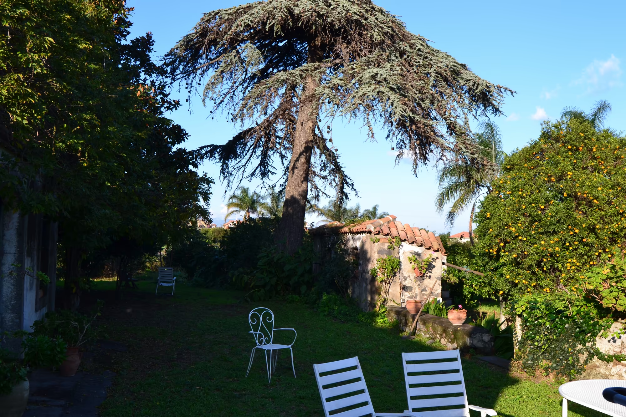
The gardens deserve a walk of their own. Citrus trees hung with bright orange fruit stand against a low stone wall, a large evergreen tree and an orange tree shade a lawn with white metal chairs, and a garden path runs between dense green shrubs and blocks of volcanic stone. In February the fruit is ripe while the mountain above it is white, and the combination of the two in one view is the single most photogenic fact of the season, as well as the basis of the local farming.
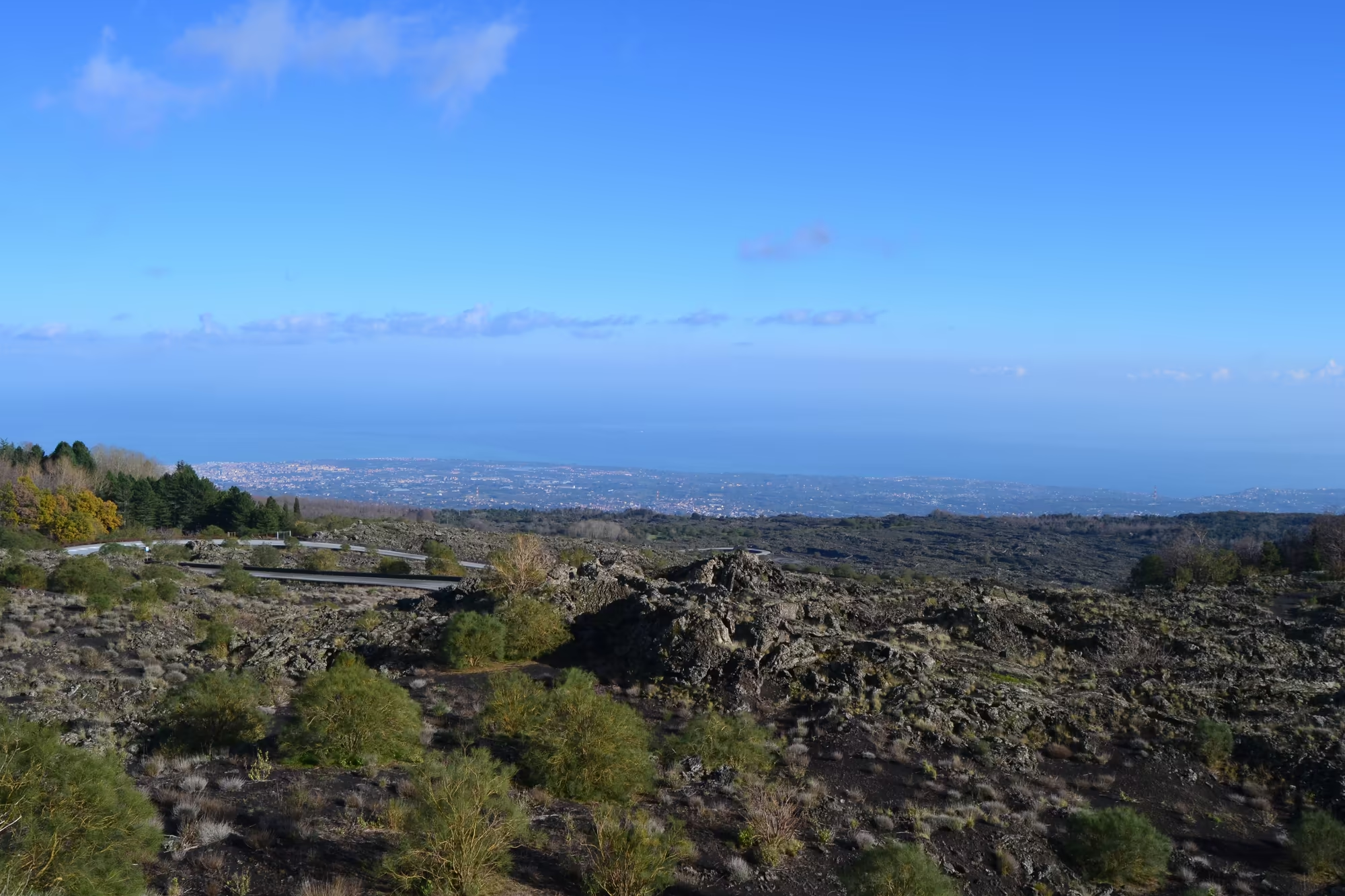
Further up the rock takes over. Views open over rugged dark volcanic material and scrub towards a hazy coast, the ground is loose and sharp underfoot, and the vegetation thins to the plants that can survive on new ground. The refuge at Sapienza, the cableway above it and the crater area beyond are the standard route for visitors in summer; in winter the same road gives access to snow, and the tracks leading out of the ski area are the beginning of the climb to the summit. Anyone going above the refuge should treat the mountain as what it is: an active volcano with weather, altitude and gas to match, where the conditions decide how far it is sensible to go.
The upper slopes are a landscape in their own right. Above the orchards the ground becomes loose, dark and sharp, with old flows crossed by paths and marked by cairns; the vegetation thins to the species that can colonise new ground, and the views open over the coast on one side and the interior on the other. Where snow covers the summit the whole mountain reads as one white shape above the green belt, and the plume from the crater is visible from the coast on most clear days.
References
- Behncke, B. & Neri, M. (2003). The July-August 2001 eruption of Mt. Etna (Sicily). Bulletin of Volcanology 65, 461-476. doi.org/10.1007/s00445-003-0274-1
- Behncke, B., Neri, M. & Nagay, A. (2005). Lava flow hazard at Mount Etna (Italy): new data from a GIS-based study. Kinematics and Dynamics of Lava Flows, Geological Society of America. doi.org/10.1130/0-8137-2396-5.189
- Gerlach, T. M. (1979). Evaluation and restoration of the 1970 volcanic gas analyses from Mount Etna, Sicily. Journal of Volcanology and Geothermal Research 6, 165-178. doi.org/10.1016/0377-0273(79)90052-0
- Minett, S. S. & others (1985). Theoretical considerations of heat flux on Mount Etna, Sicily. Journal of Volcanology and Geothermal Research 25, 17-29. doi.org/10.1016/0377-0273(85)90004-6
- Wikipedia contributors (2026). Basalt. en.wikipedia.org/wiki/Basalt
- Wikipedia contributors (2026). Catania. en.wikipedia.org/wiki/Catania
- Wikipedia contributors (2026). Columnar jointing. en.wikipedia.org/wiki/Columnar_jointing
- Wikipedia contributors (2026). Decade Volcano. en.wikipedia.org/wiki/Decade_Volcano
- Wikipedia contributors (2026). Etna DOC. en.wikipedia.org/wiki/Etna_DOC
- Wikipedia contributors (2026). Ferrovia Circumetnea. en.wikipedia.org/wiki/Ferrovia_Circumetnea
- Wikipedia contributors (2026). Mediterranean Sea. en.wikipedia.org/wiki/Mediterranean_Sea
- Wikipedia contributors (2026). Mount Etna#Geology. en.wikipedia.org/wiki/Mount_Etna#Geology
- Wikipedia contributors (2026). Mount Etna. en.wikipedia.org/wiki/Mount_Etna
- Wikipedia contributors (2026). Sicily. en.wikipedia.org/wiki/Sicily
- Wikipedia contributors (2026). UNESCO. en.wikipedia.org/wiki/UNESCO
- Zuccarello, F. & others (2023). The new summit hazard map from lava flow inundation at Mt Etna volcano. EGU General Assembly. doi.org/10.5194/egusphere-egu23-9132