Day 19 - Leonora

Journal Notes
General
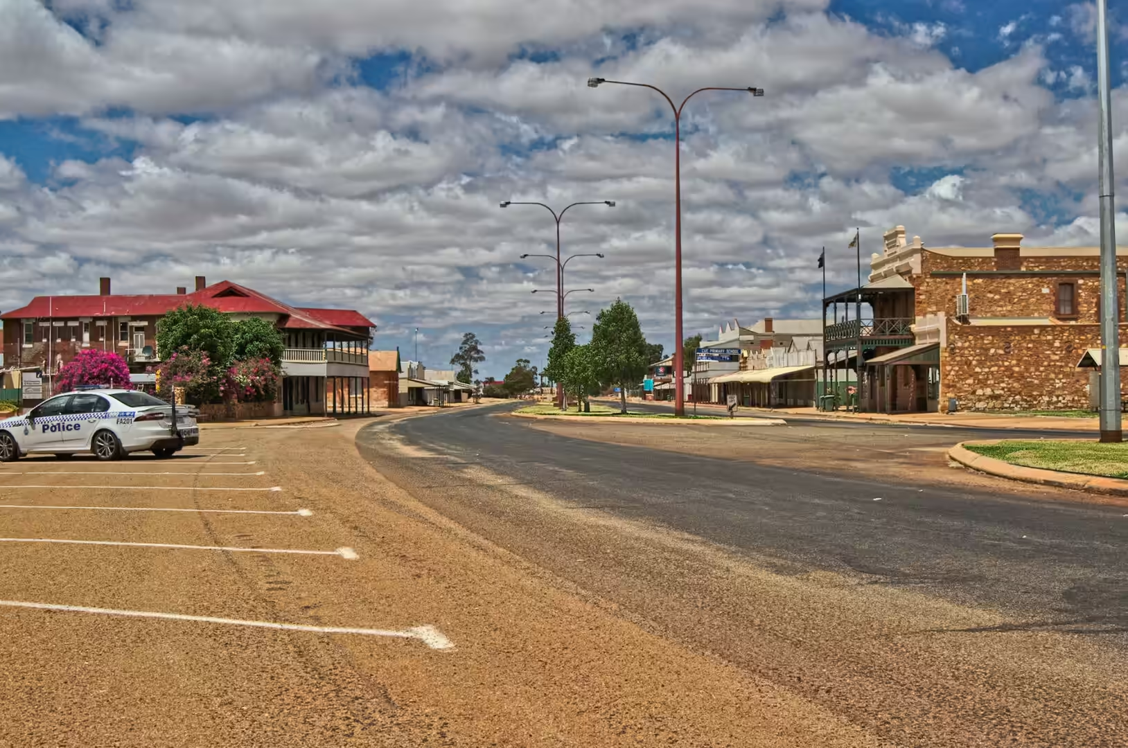
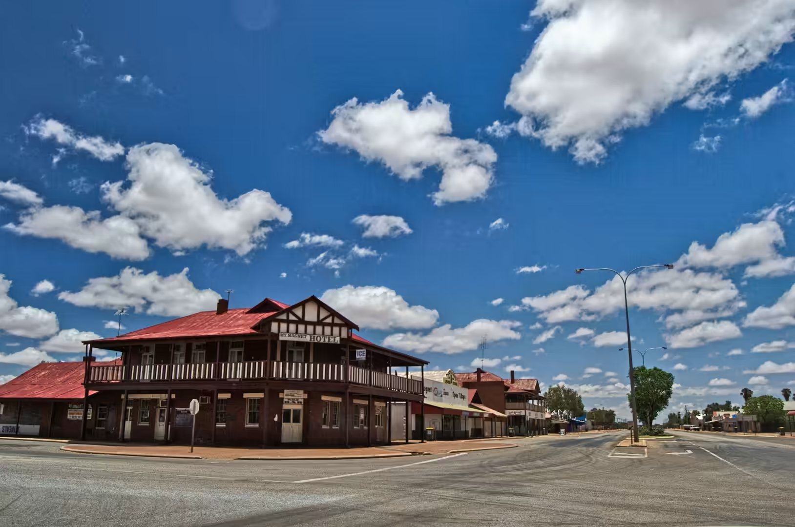
The nineteenth day brought the journey into the goldfields, and it began with a town that has kept its nineteenth century face. Leonora’s main street is wide, lined with verandahed buildings of stone and corrugated iron, and quiet enough that a police car parked outside the station is the only traffic in sight. The orange red sand of the desert shows through every gap between the buildings, and the sky above the rooflines is enormous.
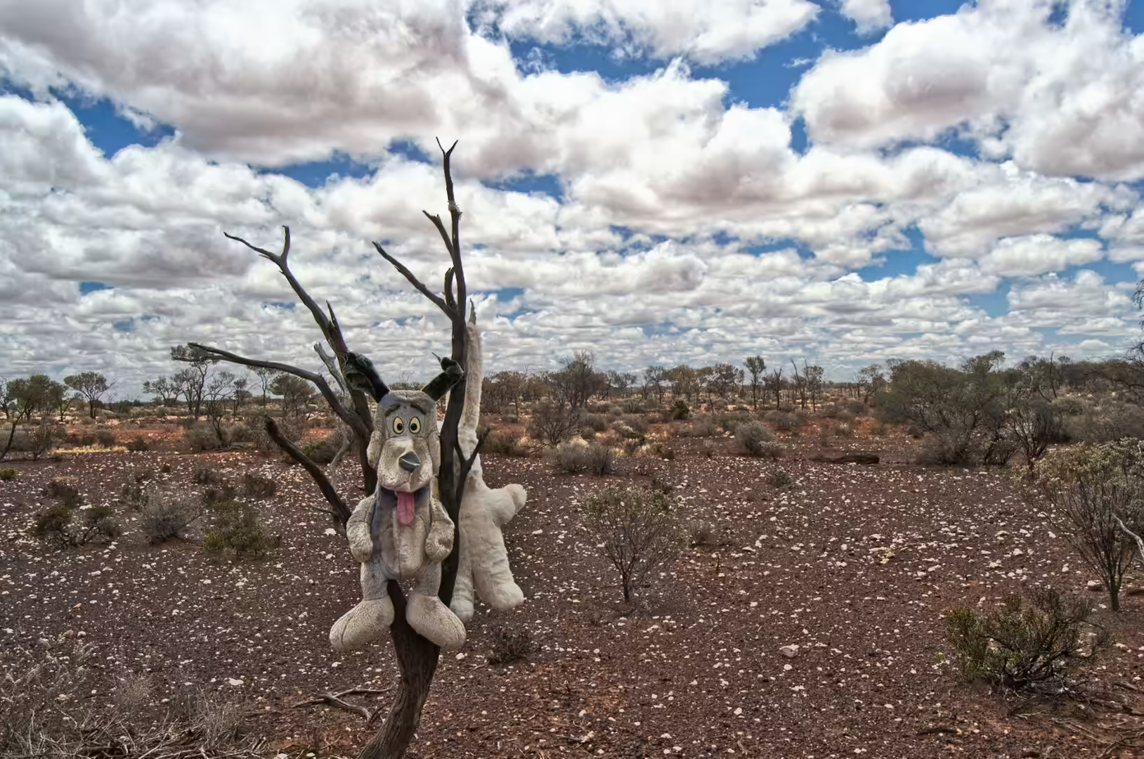
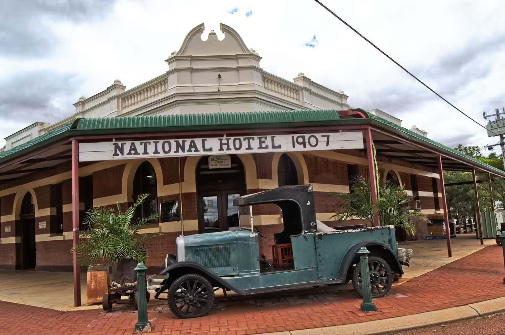
Four kilometres north of the town is Gwalia, which was a mining town and is now a museum. Its streets are lined with the shells of houses, the two storey state hotel still stands with its red roof and white railed verandahs, and a gleaming vintage car is parked outside the old National Hotel as though its owner had just gone inside. In one of the dead trees along the road a scruffy plush toy hangs from a branch, which is the kind of memorial that small towns in the outback specialise in.
In the late afternoon the track up to the rocky rim above the town was followed on foot. From the edge, with green trees and orange rocks framing the view, the plain opened below in a flat sheet of scrub and red earth that ran to the horizon without a single settlement in it. It is the kind of view that makes the distances of the last three weeks comprehensible, and it was the right place to watch the sun go down.
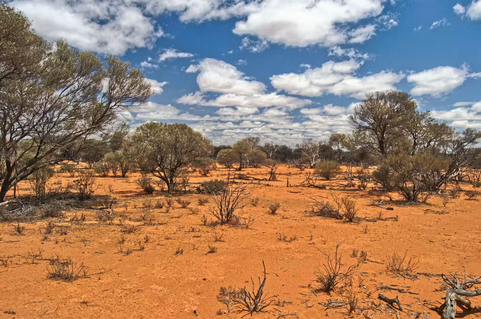
The road into the Goldfields is a study in changing country. North of Leonora the mulga and the saltbush give way to spinifex and red sand, the hills flatten out, and the horizon becomes a straight line in every direction. The roadhouses along the way are spaced at the limit of a comfortable day’s driving, and each one has a signboard with the distances to the next settlement and a warning about the wildlife. Between them there is nothing at all, which is what most travellers have come for and what surprises them anyway.
History
Gwalia exists because of a gold mine. The Sons of Gwalia reef was found in the 1890s, the town grew beside the shaft, and for sixty years it was a working community with shops, a state hotel, a school and a swimming pool in the desert. The mine was deep, wet and dangerous, it changed hands several times, and when it closed in 1963 the town emptied within a few years. What remains is one of the best preserved ghost towns in Australia, and the state has kept it as a museum rather than allowing it to be demolished.
Leonora, four kilometres away, took over the role that Gwalia had played. It became the service centre for the surrounding stations and mines, and it still is: fuel, food, machinery, a hospital, a school and a shire office for a district larger than many European countries with a population of a few thousand people. The town has the institutions of a much larger place because of the distances involved, and the visitor encounters them in the same way the locals do, as the necessary infrastructure of living far from anywhere.
The country around both towns is the traditional land of Aboriginal groups of the Goldfields, and the Wongatha people are among those whose connection to this region has been recognised in native title. The gold rushes brought thousands of prospectors, miners and camel drivers into their country within a few years, and the towns that resulted were built on land that had been walked for tens of thousands of years. The memorials and the interpretive signs in the streets now tell both parts of that story, and the goldfields museums have begun to present the Aboriginal history of the region alongside the mining history that displaced it.
The mining has not stopped. The old shafts around Gwalia and Leonora are surrounded by modern operations working the same reefs with open pits and processing plants, and the trucks on the highway carry the same kind of ore that attracted the prospectors. The machinery has changed, the price of gold has risen and fallen several times over, and the pattern of boom and bust that emptied Gwalia is still the pattern of the region. A visitor who walks through the museum in the morning and past a working mine in the afternoon sees a hundred and twenty years of that cycle in a single day.
The cemeteries of the goldfields are the most honest history of the period and they should be visited. The graves record the diseases, the accidents and the plain bad luck of a mining frontier: men killed underground, children dead in infancy, women dead in childbirth, and a long list of nationalities that shows where the miners came from. The Afghan cameleers who carried the supplies have their own section in several of these cemeteries, and the headstones, where they survive, are the only record of a community that was essential to the inland and is now almost forgotten.
Geology
The goldfields of the Yilgarn and the Murchison are greenstone country, and the term describes the rock that carries the gold. Greenstone belts are ancient volcanic and sedimentary sequences, altered by heat and pressure until their minerals turned green, that were intruded by granites about two and a half to three billion years ago. Gold is concentrated along the structures where the intrusions met the greenstones, in quartz reefs and in the altered rock around them, and the prospectors who pegged the leases in the 1890s were following the outcrops of exactly those reefs.
The landscape above the gold is a plateau of great age. The Yilgarn Craton has been stable for billions of years, its mountains have been worn down to low hills, and the surface is covered in a layer of weathered material and red sand that the wind has moved around for millions of years. The red colour is iron oxide, the same coating that colours the sand of the Pilbara, and the sand itself has been recycled so many times that individual grains may have been through several cycles of erosion and deposition.
The salt lakes of the region are the product of that flatness and that dryness. With no outlet to the sea, the water that falls on the plateau collects in the lowest ground, evaporates, and leaves its dissolved salts behind. Over thousands of years the lakes have become pans of salt and clay, ringed by scrub and often dry for years at a time, and the crusts are thick enough in places to be worked commercially. Their surfaces are among the flattest natural features on Earth, and the light on them at the end of the day turns them pink and silver.
The rocks around Leonora also carry the record of much older events. The region contains some of the oldest minerals and rocks on the planet, including zircons that have survived several billion years of geological history, and the study of them has contributed more to the understanding of the early Earth than almost any other area. Standing on a rocky rim above the plain, looking at country that has been stable for longer than there have been animals, the absence of any obvious drama in the landscape is itself the point.
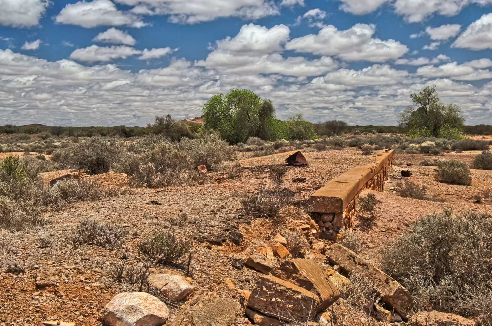
The old workings around the towns are worth a look for anyone interested in how the gold was found. The prospectors followed the outcrops of quartz reefs, the mines that followed went down along the same reefs, and the mullock heaps beside the shafts are the rock that was left when the ore was taken out. Some of the shafts are fenced, many are not, and the general advice about abandoned mine ground is the obvious one: stay out of it. The reef lines are visible on the ground as low ridges of white quartz, and once the eye has learned to see them, the whole district reads as a map of the industry that built it.
Things to See
The Gwalia museum is the first thing to do in the district and it deserves a couple of hours. The state hotel and the mine office are open, the houses along the street are labelled with the names of the families who lived in them, and the displays cover the mine, the town, the unions and the disasters that took lives underground. The machinery on the site, the headframe and the winding gear, are part of the walk, and the combination of a working exhibit and a genuine ruin is what makes the place more affecting than a museum usually is.
Leonora itself rewards a walk. The main street has the hotels, the shire offices and the shops, the old railway station and the miners’ memorial are a short distance away, and the town’s cemetery, like the cemeteries of all the gold towns, is a history lesson in stone: the graves of miners, of children, of people from every part of Europe and of the Afghan cameleers who supplied the inland. There is a bakery and a pub, and the locals are used to travellers and helpful with directions.
The country around the town is worth a day on its own if there is time. The tracks lead to old workings, nickel and gold mines, and views over the salt lakes, and the wildflowers of the Goldfields in spring are as good as anything in the better known districts of the south west. The birdlife is abundant around the waterholes and the station dams, and the kangaroos and the emus are seen most reliably in the hour before dark, when the traffic on the highway thins out and the country returns to its own inhabitants.
The practical side of the Goldfields is straightforward but unforgiving. Distances are long, the fuel stops are far apart, and the heat in summer is severe, with days above forty degrees that make walking in the middle of the day inadvisable. Water has to be carried, a vehicle has to be in good condition, and anyone leaving the highway should tell someone where they are going. The towns along the route are used to giving that advice and to receiving the occasional broken down traveller, and the district’s hospitality is proportional to its isolation.
One practical warning about the district is worth repeating. The tracks that lead off the highway toward the old workings and the lakes are unsealed, unsignposted and often soft, and a vehicle that leaves the bitumen without a full tank, spare water and a plan is taking a real risk. Drivers are advised to tell someone where they are going, to carry more water than the journey requires and to turn back rather than press on. The rewards of the country are considerable, and the price of getting it wrong in summer is measured in days rather than hours.
References
- Wikipedia contributors (2026). Leonora, Western Australia. en.wikipedia.org/wiki/Leonora%2C%20Western%20Australia
- Wikipedia contributors (2026). Gwalia, Western Australia. en.wikipedia.org/wiki/Gwalia%2C%20Western%20Australia
- Wikipedia contributors (2026). Kalgoorlie. en.wikipedia.org/wiki/Kalgoorlie
- Wikipedia contributors (2026). Menzies, Western Australia. en.wikipedia.org/wiki/Menzies%2C%20Western%20Australia
- Wikipedia contributors (2026). Yilgarn Craton. en.wikipedia.org/wiki/Yilgarn%20Craton
- Wikipedia contributors (2026). Great Northern Highway. en.wikipedia.org/wiki/Great%20Northern%20Highway
- Wikipedia contributors (2026). Goldfields-Esperance. en.wikipedia.org/wiki/Goldfields-Esperance
- Wikipedia contributors (2026). Meekatharra. en.wikipedia.org/wiki/Meekatharra
- Wikipedia contributors (2026). Cue, Western Australia. en.wikipedia.org/wiki/Cue%2C%20Western%20Australia
- Wikipedia contributors (2026). Wiluna, Western Australia. en.wikipedia.org/wiki/Wiluna%2C%20Western%20Australia
- Wikipedia contributors (2026). Lake Ballard. en.wikipedia.org/wiki/Lake%20Ballard
- Wikipedia contributors (2026). Super Pit gold mine. en.wikipedia.org/wiki/Super%20Pit%20gold%20mine
- A. H. F. (1908) VII.-Geological Survey, Western Australia. Bulletin No. 28: The Geology and Mineral Resources of Lawlers, Sir Samuel, and Darlot (East Murchison Goldfield), Mount Ida (North Coolgardie Goldfifld), and a Portion of the Mount Margaret Goldfield. By Chas. G. Gibson, Assistant Geologist. 8vo; pp. 73, with 3 maps and 5 mining plans. Perth, W.A. Geological Magazine. 5. 234-234. doi.org/10.1017/s0016756800122022
- Weinberg R.F., van der Borgh P. (2008) Extension and gold mineralization in the Archean Kalgoorlie Terrane, Yilgarn Craton. Precambrian Research. 161. 77-88. doi.org/10.1016/j.precamres.2007.06.013
- McDivitt J.A., Hagemann S.G., Baggott M.S., Perazzo S. (2020) Chapter 12: Geologic Setting and Gold Mineralization of the Kalgoorlie Gold Camp, Yilgarn Craton, Western Australia. Geology of the World’s Major Gold Deposits and Provinces. 251-274. doi.org/10.5382/sp.23.12