Day 19 - Phoenix / AZ
13 June 2022




Journal Notes
General
Phoenix is the capital and the largest city of Arizona, the seat of Maricopa County and the fifth most populous city in the United States. The census of 2020 counted 1,608,139 residents within 517.9 square miles, or 1,341 square kilometres, which makes it the largest city in Arizona by area and one of the least densely built large cities in the country. Maricopa County alone held 4,420,568 people in 2020, about 62 per cent of the population of the state, and the metropolitan area is the most populous in the Mountain states.
The city occupies the Salt River Valley, a broad and almost level basin at a mean elevation of 1,086 feet or 331 metres, known since the 1930s as the Valley of the Sun. Streets follow a precise grid across the valley floor, and low ranges of mountains interrupt it: the McDowell Mountains to the north east, the White Tank Mountains to the west, the Superstition Mountains to the east, and South Mountain and the Sierra Estrella to the south and south west. Camelback Mountain, North Mountain and Piestewa Peak stand inside the built up area.
Growth spread outwards rather than upwards, and the result is a metropolitan area of great extent and low density, about 1,080 people per square kilometre. Since 1979 the city has been divided into fifteen urban villages, each with a planning committee and its own core, and the freeway system holds more than 1,400 lane miles. Retail parks, warehouses and office campuses lie along the loops and the interstate, and the neighbouring cities of Tempe, Mesa, Chandler, Glendale and Scottsdale have their own centres and their own desert edges.
The climate is the daily condition of life here. Phoenix has a hot desert climate with about 300 days of sunshine a year and a mean annual rainfall of 7.22 inches, or 183 millimetres, measured at Sky Harbor. Summer heat is extreme: the average temperature for July 2023 was 102.7 degrees Fahrenheit, and the city recorded thirty one consecutive days above 110 degrees between 30 June and 30 July of that year. The monsoon, which the weather service dates from 15 June to 30 September, brings sudden storms, flash floods and dust.
Water is what made the desert city possible and what limits it. The Salt River runs westwards through Phoenix, but its bed is often dry because the flow is diverted upstream, and the Salt River Project is the largest water provider in the valley. Water also arrives from the Colorado River through the canal of the Central Arizona Project, approved in 1968, and through aqueducts that follow the lines of ancient canals. Since 1 June 2023 the state has stopped approving new housing developments that would rely only on groundwater.
History
The first farmers in the valley were the Hohokam, who occupied the Phoenix basin for two thousand years and built roughly 135 miles, or 217 kilometres, of irrigation canals, the most complex pre contact system in the Western Hemisphere. Their ditches were dug by hand, maintained every season and aligned with the fall of the land, and parts of their routes are still followed by the Arizona Canal, the Hayden Rhodes Aqueduct and the canal of the Central Arizona Project. Drought and floods between 1300 and 1450 emptied the valley.
After the Hohokam left, the valley was used by the Akimel O’odham, whom settlers called the Pima, by the Tohono O’odham and by the Maricopa. The Akimel O’odham lived in villages along the Gila River from Florence west to the Estrella Mountains, growing maize, beans, squash, cotton and tobacco with small irrigation works, while the Tohono O’odham farmed seasonally on rainfall and harvested saguaro fruit, cholla buds and mesquite beans. In 1879 the land that became Papago Park was set aside as a reservation for the Pima and Maricopa.
The modern city grew from a canal. Jack Swilling dug one in 1867 and founded an agricultural settlement on the old Hohokam lines, and irrigation remained the foundation of the valley economy for the next half century. The National Reclamation Act of 1902 allowed the first federal dam in the west: work on Salt River Dam Number One began in 1903, President Theodore Roosevelt dedicated it on 18 May 1911, and it was renamed Roosevelt Dam in 1917. Phoenix remained a farming town of cotton, citrus and alfalfa until the Second World War.
Air conditioning changed the arithmetic of living in the desert. Powered cooling, developed commercially in the early twentieth century, allowed houses and workplaces to ignore the summer, and the valley then grew at a rate that would otherwise have been impossible. Maricopa County went from 186,000 residents in 1940 to 1,509,000 in 1980, an increase of 711 per cent, and historians place refrigerated air beside the motorway, the shopping centre and the subsidised mortgage as a cause of postwar metropolitan growth. Sun City, opened in 1960, set the pattern for retirement communities.
Growth brought a counter movement to keep part of the desert undeveloped. Phoenix Mountain Park, later South Mountain Park, was created in 1924, when President Calvin Coolidge sold 13,000 acres to the city for 17,000 dollars, and most of the remaining municipal preserves were acquired in the early 1970s as development threatened the mountains. The Arizona Cactus and Native Flora Society formed in 1934 and opened the Desert Botanical Garden in 1939. Since 2024 the city has closed some trails between eight in the morning and five in the afternoon during extreme heat.
Geology
Phoenix lies in the Basin and Range Province, the physiographic region of broad valleys and isolated mountain ranges that was formed by stretching of the crust. The Salt River Valley is a basin filled with sediment washed down from the surrounding highlands, and the ranges that ring it expose ancient igneous and metamorphic rocks. The valley floor is almost flat, which is why the street grid runs the way it does, and the mountains rise from it abruptly rather than through foothills that would blur the boundary.
Camelback Mountain, at 2,704 feet the highest peak in the metropolitan area, shows the structure of the region in a single view. Its upper part is Precambrian granite about 1.5 billion years old, and the head of the camel is red sedimentary sandstone of the Chattian stage of the Oligocene, roughly 25 million years old, so the mountain preserves an unconformity between two very different chapters of the record. Two trails climb 1,280 feet to the summit, the Echo Canyon Trail of 1.14 miles and the Cholla Trail of 1.4 miles.
Papago Park is the other instructive piece of geology inside the city. Its red sandstone formations were laid down between six and fifteen million years ago, and weathering has since opened the tafoni, the hollows and windows that make Hole in the Rock a landmark. There is evidence that the Hohokam used the openings and the passage of sunlight through them to mark the solstices. Below the sandstone lies Precambrian granite, covered here by only a thin layer of soil, so the bedrock is close to the surface.
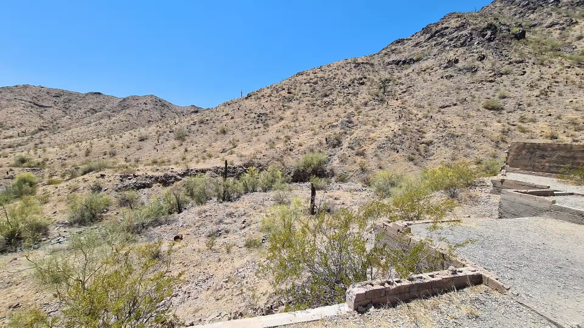
The desert surface is built by rare and violent water. Storms drop rain on the mountain fronts, and the sediment then moves downslope as sheets of mud and debris, building alluvial fans that merge into the gentle slopes known as bajadas. Washes carry the water through the valley for a few hours at a time and then dry out, and plants in them must either survive the flood or re establish themselves before the next one. Smoke tree, desert willow, catclaw and cheesebush grow in these channels, their roots reaching deep for water stored in the gravel.
Wind finishes the work that water begins. It sorts the fine material from the gravel and carries it away, leaving surfaces of closely packed stones, and in dry seasons it lifts dust from bare ground into the air. The valley soils are deep and fertile because they are made of that transported sediment, which is why the first farmers could grow crops here once water was brought to the fields. Seismically the region is quiet, but the fault systems that formed the basin and its ranges are still present beneath the sediment.
Things to See
The Phoenix Mountains Preserve is the collective name for the parks that hold the small ranges inside the city: Piestewa Peak, formerly Squaw Peak, with the Dreamy Draw recreation area at its northern trailhead, Lookout Mountain, North Mountain and Shaw Butte, Camelback Mountain Park, Papago Park and the Phoenix Sonoran Preserve, which is still being assembled. The peaks rise about 600 metres above the desert floor, and the preserves interrupt the grid with rocky slopes, trails, parking areas, ramadas and toilets. Their use is heaviest in the early morning.
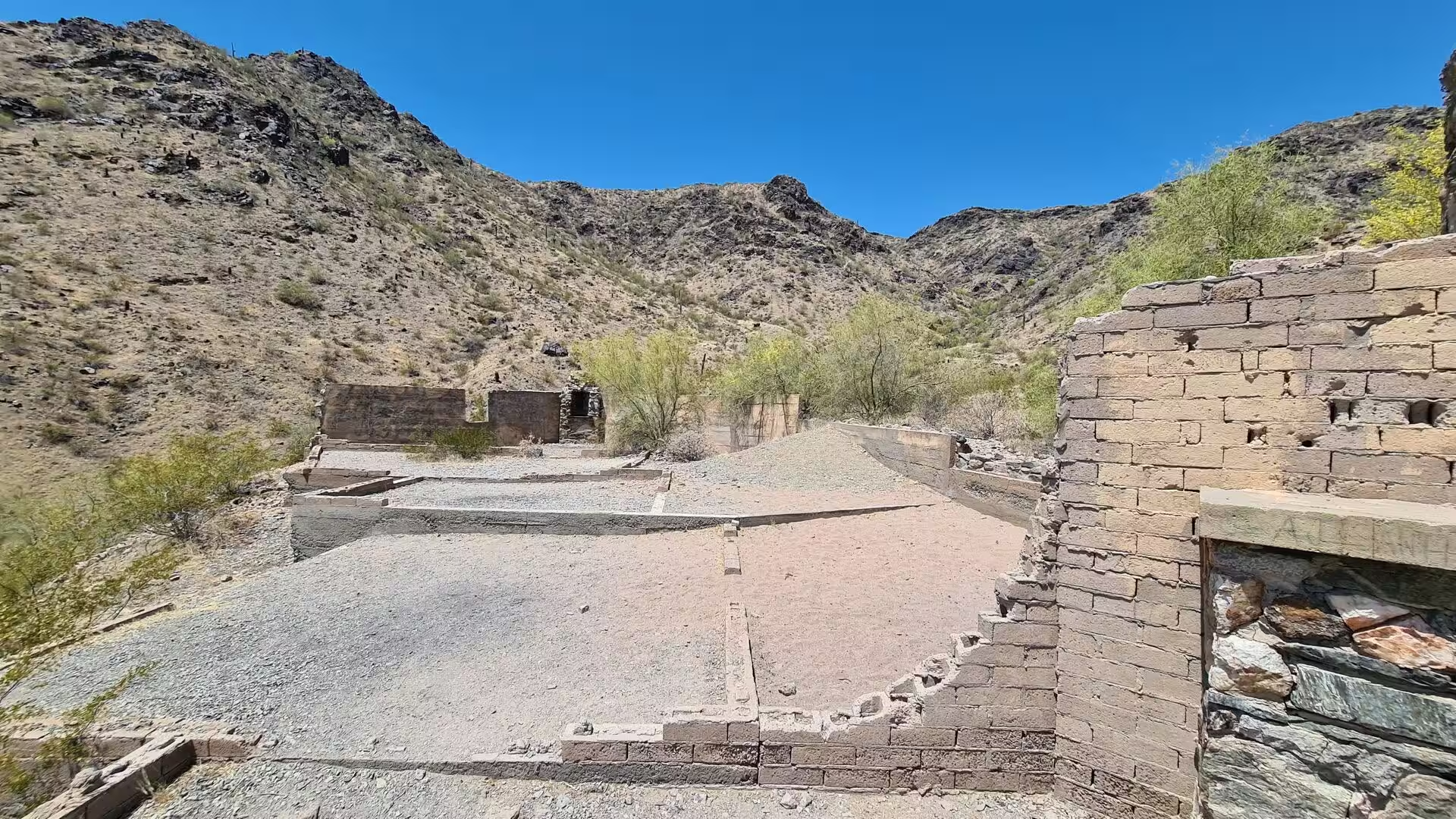
South Mountain Park is the largest municipal park in the United States and covers 16,283 acres, or 25.5 square miles, of native desert vegetation south of the city centre. Its lookout point stands more than 1,000 feet above the desert floor, and 58 miles of trail are open to walkers, cyclists and riders, with roads running to the ramadas and the summit. Much of the original infrastructure, including stone shelters and picnic structures, was built by the Civilian Conservation Corps in the early 1930s. The park is also known for its chuckwallas.
Papago Park lies between Phoenix and Tempe, 1,200 acres in one and 296 in the other, and it is a desert park with small lakes and sandstone knolls as well as a zoo and a botanical garden. Hunt’s Tomb, a white pyramid on a hill above the park, holds Arizona’s first governor, George W. P. Hunt. A bass hatchery built as a public works project in 1932 used the lakes, and during the Second World War the park held a prisoner of war camp for as many as 3,100 men, twenty five of whom escaped through a tunnel in December 1944.
The Desert Botanical Garden occupies 140 acres in Papago Park and is devoted entirely to the plants of dry country. A group of residents formed the Arizona Cactus and Native Flora Society in 1934, and the garden opened in 1939; it now holds more than 50,000 plants in over 4,000 taxa, a third of them native to the region, including 379 species that are rare, threatened or endangered. Its collections of agave and of cacti are among the largest anywhere, and the neighbouring Phoenix Zoo, opened in 1962, is the largest privately owned non profit zoo in the country.
The saguaro grows only in the Sonoran Desert and is the signature plant of the valley’s edge. A mature cactus can pass twelve metres in height and live for 150 to 200 years, and it grows its first arms only after seventy five or a hundred years. It stores rainwater in its ribs, transpires at night, and spreads a root network up to thirty metres wide, and it is a keystone species that provides nectar, fruit and nesting holes for birds, bats and insects. Saguaros in washes and on the lower slopes are protected by state law, and permits are needed to move one.
Summer here is a physical fact rather than a season. Shade, water and air movement organise the day, work on building sites begins before sunrise, and swimming pools, shade sails, misting systems and covered car parks are ordinary equipment rather than luxuries. The city has recorded months with an average temperature above 38 degrees Celsius and streaks of a hundred consecutive days at or above that figure, and heat deaths among people living outdoors have risen with them. The monsoon brings relief and danger at once, since the storms that cool the air can flood a wash within minutes.
Air conditioning is the technology that made the modern city, and it is visible in the ordinary economy. Nearly every home here has it, and appliance shops devote whole aisles to stacked room units, with price signs on the boxes and delivery vans at the loading doors. Engineers, installers and service technicians form a trade of their own, working hardest in the weeks before the heat peaks. Cooling also has a public dimension: estimates attribute about 190,000 avoided heat deaths a year to air conditioning worldwide, and the units consume roughly seven per cent of the world’s electricity.
The everyday economy of the metropolis is one of movement, storage and trade. Sky Harbor International Airport, opened in 1928 and owned by the city since 1935, handles about 45 million passengers a year and more than a thousand flights a day to over a hundred destinations without a change of plane. Nearly 28,000 hotel rooms accommodate some nineteen million visitors, and the valley is the base of companies such as Avnet, Freeport-McMoRan, PetSmart and Republic Services, with an Intel site employing about twelve thousand people. Pickup trucks, warehouses and long freeway loops are the visible machinery of that trade.
References
- Wikipedia contributors (2026). Phoenix, Arizona. en.wikipedia.org/wiki/Phoenix%2C_Arizona
- Wikipedia contributors (2026). Sonoran Desert. en.wikipedia.org/wiki/Sonoran_Desert
- Wikipedia contributors (2026). Saguaro. en.wikipedia.org/wiki/Saguaro
- Wikipedia contributors (2026). Papago Park. en.wikipedia.org/wiki/Papago_Park
- Wikipedia contributors (2026). South Mountain Park. en.wikipedia.org/wiki/South_Mountain_Park
- Wikipedia contributors (2026). Salt River (Arizona). en.wikipedia.org/wiki/Salt_River_%28Arizona%29
- Wikipedia contributors (2026). Arizona. en.wikipedia.org/wiki/Arizona
- Wikipedia contributors (2026). Maricopa County, Arizona. en.wikipedia.org/wiki/Maricopa_County%2C_Arizona
- Wikipedia contributors (2026). Phoenix Sky Harbor International Airport. en.wikipedia.org/wiki/Phoenix_Sky_Harbor_International_Airport
- Wikipedia contributors (2026). Hohokam. en.wikipedia.org/wiki/Hohokam
- Wikipedia contributors (2026). Phoenix Mountains Preserve. en.wikipedia.org/wiki/Phoenix_Mountains_Preserve
- Wikipedia contributors (2026). Tempe, Arizona. en.wikipedia.org/wiki/Tempe%2C_Arizona
- Wikipedia contributors (2026). Desert Botanical Garden. en.wikipedia.org/wiki/Desert_Botanical_Garden
- Wikipedia contributors (2026). Air conditioning. en.wikipedia.org/wiki/Air_conditioning
- Drezner T.D. (2007) Variation in age and height of onset of reproduction in the saguaro cactus (Carnegiea gigantea) in the Sonoran Desert. Plant Ecology. 194. 223-229. doi.org/10.1007/s11258-007-9286-9
- Steenbergh W.F., Lowe C.H. (1969) Critical Factors During the First Years of Life of the Saguaro (Cereus Giganteus) at Saguaro National Monument, Arizona. Ecology. 50. 825-834. doi.org/10.2307/1933696
- Rodriguez-Buritica S., Raichle H., Birt T., Webb R.H., et al. (2013) Population dynamics of Sonoran Desert saguaro cactus (Carnegiea gigantea) at the Desert Laboratory (Tucson, Arizona). Ecology. 94. 1660-1660. doi.org/10.1890/13-0182.1