Day 20 - Saguaro National Park
13 June 2022



Journal Notes
General
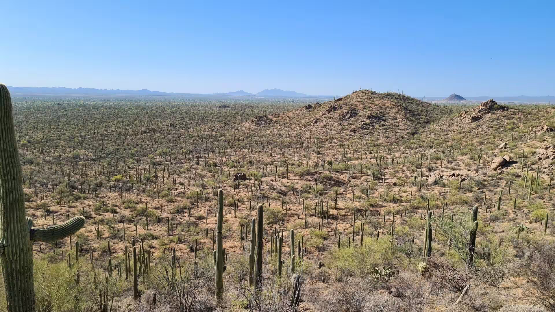
Saguaro National Park lies in south eastern Arizona, in Pima County, and consists of two separate parcels that face each other across the city of Tucson. The Tucson Mountain District occupies the western side of the city and the Rincon Mountain District the eastern side, and each comes within about ten miles, or sixteen kilometres, of the centre of Tucson. The two halves are roughly thirty miles apart by road. The park takes its name from the saguaro, the tall cactus of the Sonoran Desert that grows wild nowhere else on earth.
The two districts together covered 91,716 acres, or about 371 square kilometres, in 2016. The Tucson Mountain District accounts for about 25,000 acres and the much larger Rincon Mountain District for the balance of roughly 67,000 acres. Some 71,000 acres of the park, including large parts of both districts, are designated wilderness, and the National Park Service manages all of it. Congress combined the two tracts as a national park in 1994, and the Consolidated Appropriations Act of 2021 added a further 1,232 acres.
Tucson itself is the county seat of Pima County and the second most populous city in Arizona, with 542,630 residents at the 2020 census and about 1.08 million in the metropolitan area. The city stands at 2,643 feet, or 805 metres, above sea level on an alluvial plain of the Sonoran Desert, and five minor ranges surround it, among them the Tucson Mountains to the west and the Rincons to the east. Tucson was founded as a Spanish presidio in 1775 and lies 108 miles south east of Phoenix, 60 miles north of the Mexican border.
The land of the park rises from desert basins to mountain summits. Elevations in the Tucson Mountain District run from 2,180 to 4,687 feet, or 664 to 1,429 metres, the highest point being Wasson Peak, while the Rincon Mountain District climbs from 2,670 to 8,666 feet at Mica Mountain. More than 165 miles of trails cross the two districts. The western district has twelve miles of paved roads and eight and a half miles of unpaved roads, the Rincon district is served by the 8.3 mile Cactus Forest Loop Drive.
The park has a hot semi-arid climate in the Köppen classification, and it enjoys two rainy seasons rather than one. Winter brings the gentle storms of the Pacific, summer the North American monsoon, whose brief and violent rains arrive with lightning, dust and flash floods. Tucson averages about 10.6 inches, or 269 millimetres, of precipitation a year, and the highest slopes of the Rincons hold snow in winter. Climate records for the park show that its annual mean temperature rose by about 4 degrees Fahrenheit, or 2 degrees Celsius, between 1900 and 2010.
History
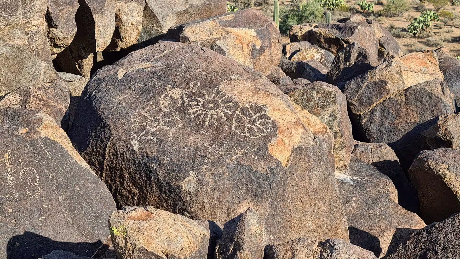
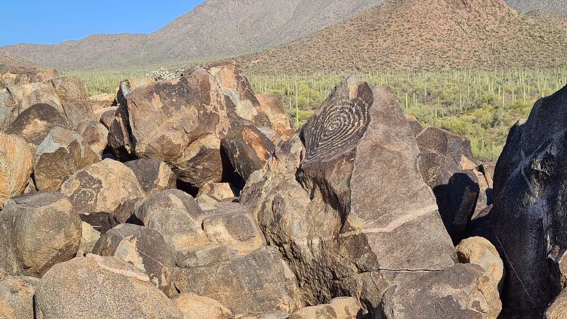
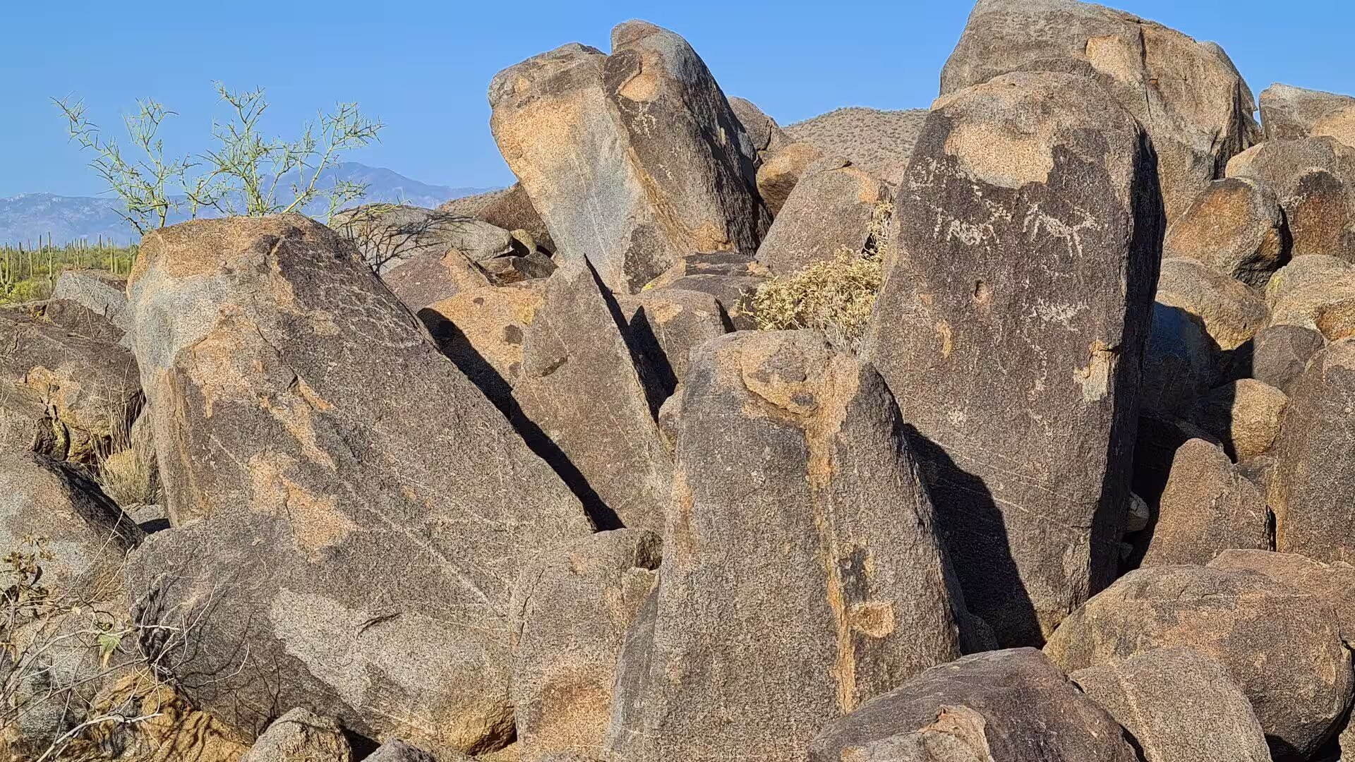
The earliest known residents of the land in and around the park were the Hohokam, who lived in villages there between about AD 200 and 1450. They hunted deer and smaller animals, gathered cholla buds, prickly pear, palo verde pods and saguaro fruit, and grew corn, beans and squash in the desert soil. Petroglyphs pecked into dark boulders and fragments of broken pottery are among the Hohokam objects found in both districts. The Sobaipuri of the Tucson Basin and the Tohono O’odham to the west may be their descendants, though the evidence is not conclusive.
Spanish explorers first entered Arizona in 1539 and 1540, but settlement near the park began only in 1692, when the Jesuit missionary Eusebio Francisco Kino visited the valley of the Santa Cruz River. Mission San Xavier del Bac was founded in 1700, about seven miles upstream from the later town, and in 1775 the Spaniards built the Presidio San Agustín del Tucsón, a military fort raised against Apache raids in what was then part of New Spain. After Mexican independence in 1821 the region belonged to Sonora, and the Gadsden Purchase made it American in 1854.
Modern settlement followed the Homestead Act of 1862, the arrival of the railway in 1880 and the end of the Apache Wars in 1886. Homesteaders and ranchers took up land at the foot of the Rincons from the 1890s to 1930, while miners searched the hills for silver, copper and gold. Mining inside the present park continued intermittently until 1942: the Copper King Mine, later renamed the Mile Wide Mine, yielded 34,000 tons of ore, and the Loma Verde Mine produced a little copper and gold between 1897 and 1907. Ranching lasted until the mid-1970s.
The campaign to protect the saguaro began in 1920, when members of the Natural History Society of the University of Arizona raised the idea, and gathered force in 1928 with the support of Homer L. Shantz, then president of the university. In 1933 the newspaper publisher Frank Harris Hitchcock persuaded President Herbert Hoover to create Saguaro National Monument, which Hoover did by proclamation on 1 March under the Antiquities Act of 1906. President Kennedy added 16,000 acres of cactus land in the Tucson Mountains in 1961, and Congress made the whole a national park in 1994.
Between 1936 and 1939 the Civilian Conservation Corps built the Cactus Forest Loop Drive and much of the early infrastructure of the monument east of Tucson, and its work in the west between 1933 and 1941 left stone ramadas, picnic tables and restrooms that are still in use. The park now contains more than 450 archaeological sites and more than 60 historic structures, among them Manning Cabin, built in 1905 as a summer retreat for the businessman and one term mayor Levi Manning and listed on the National Register of Historic Places in 1975.
Geology
Saguaro National Park lies in the Basin and Range Province, a belt of north to south running mountains and broad basins that stretches from northern Mexico into southern Oregon. The province is young in geological terms, for it formed when the crust of western North America was stretched and thinned until it broke along faults. The oldest rocks of the park, however, are far older than the province. The Pinal Schist, exposed in the Rincon Mountain District along a dry wash beside the Cactus Forest Loop Drive, is about 1.7 billion years old, and granites altered 1.4 billion years ago make up much of Tanque Verde Ridge.
About 600 million years ago shallow seas covered the region around present day Tucson and laid sedimentary rocks over that ancient basement: limestones, sandstones and shales. Limestone still appears in several places in the park, and in the late nineteenth century it was quarried and burned to make mortar. Six lime kilns worked inside what is now the park, two in the Tucson Mountain District and four in the Rincon Mountain District, and three of them survive, two beside the Cactus Forest Trail and one along the Ruiz Trail.
Mountain building came much later. The Laramide orogeny, a period of tectonic pressure that lasted from about 80 million to 50 million years ago, was followed in this region by explosive volcanism. Eruptions built the Tucson Mountains roughly 70 million years ago, and the roof of the volcano at their centre collapsed to form a caldera twelve miles across. Debris flows, lava and the intrusion of a granitic body filled the caldera over the following tens of millions of years, and those volcanic rocks now form the surface of the Tucson Mountain District.
About 30 million years ago movement on the Catalina Fault, a low-angle detachment fault that began to develop six to eight miles below the surface, changed the shape of the country for good. The rocks beneath the fault were carried sixteen to twenty-two miles to the east and north east, then uplifted, domed and eroded into the Santa Catalina and Rincon Mountains. Those deeper rocks, the banded Catalina gneiss, are now the most common rock type of the Rincons and can be seen at Javelina Rocks along the Cactus Forest Loop Drive.
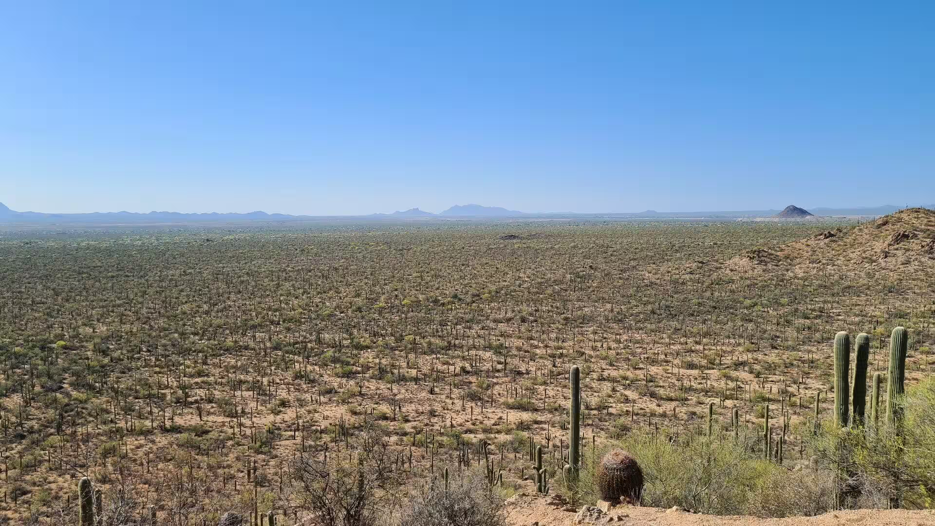
Erosion still moves the mountains. Streams that leave the ranges deposit their load of sand, gravel and boulders in alluvial fans at the mouths of the canyons, and where such fans run together they build the broad slopes known as bajadas, from the Spanish word for a descent. The dry washes of both districts are usually empty, but the summer monsoon can turn them into sudden torrents that carry boulders and spread fresh soil across the valley floors. Elevation, soil and water decide which plants grow where, and the saguaro is the clearest of those signals.
Things to See
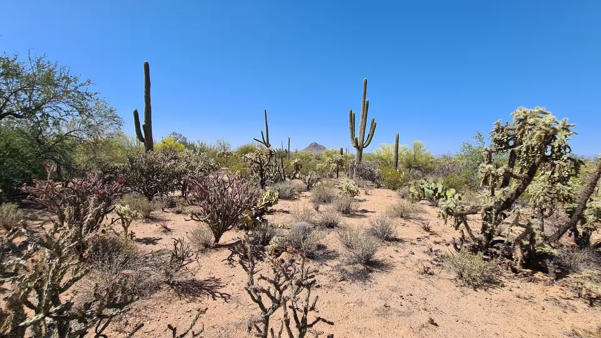
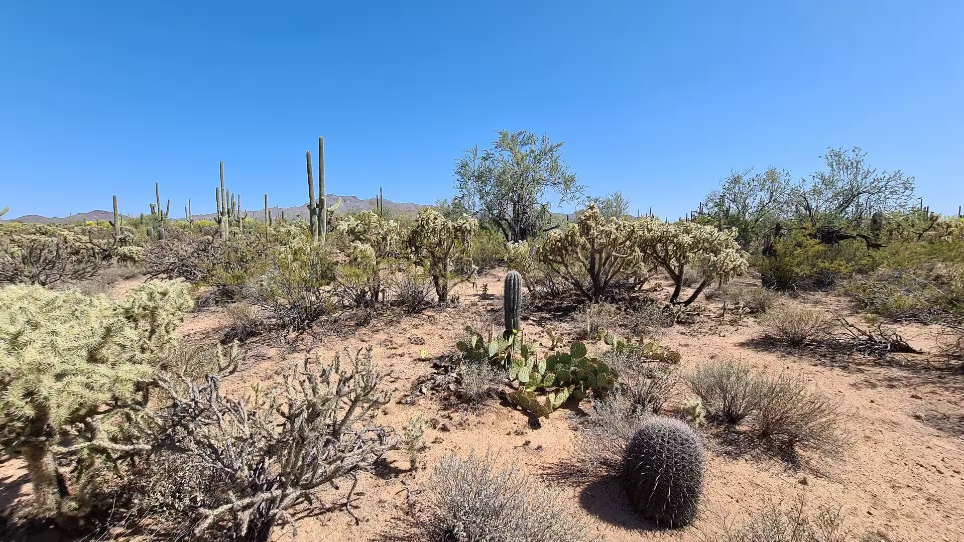
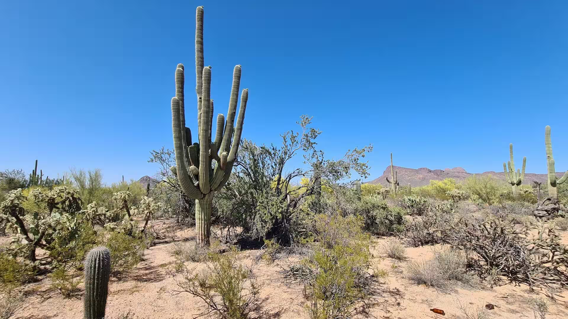
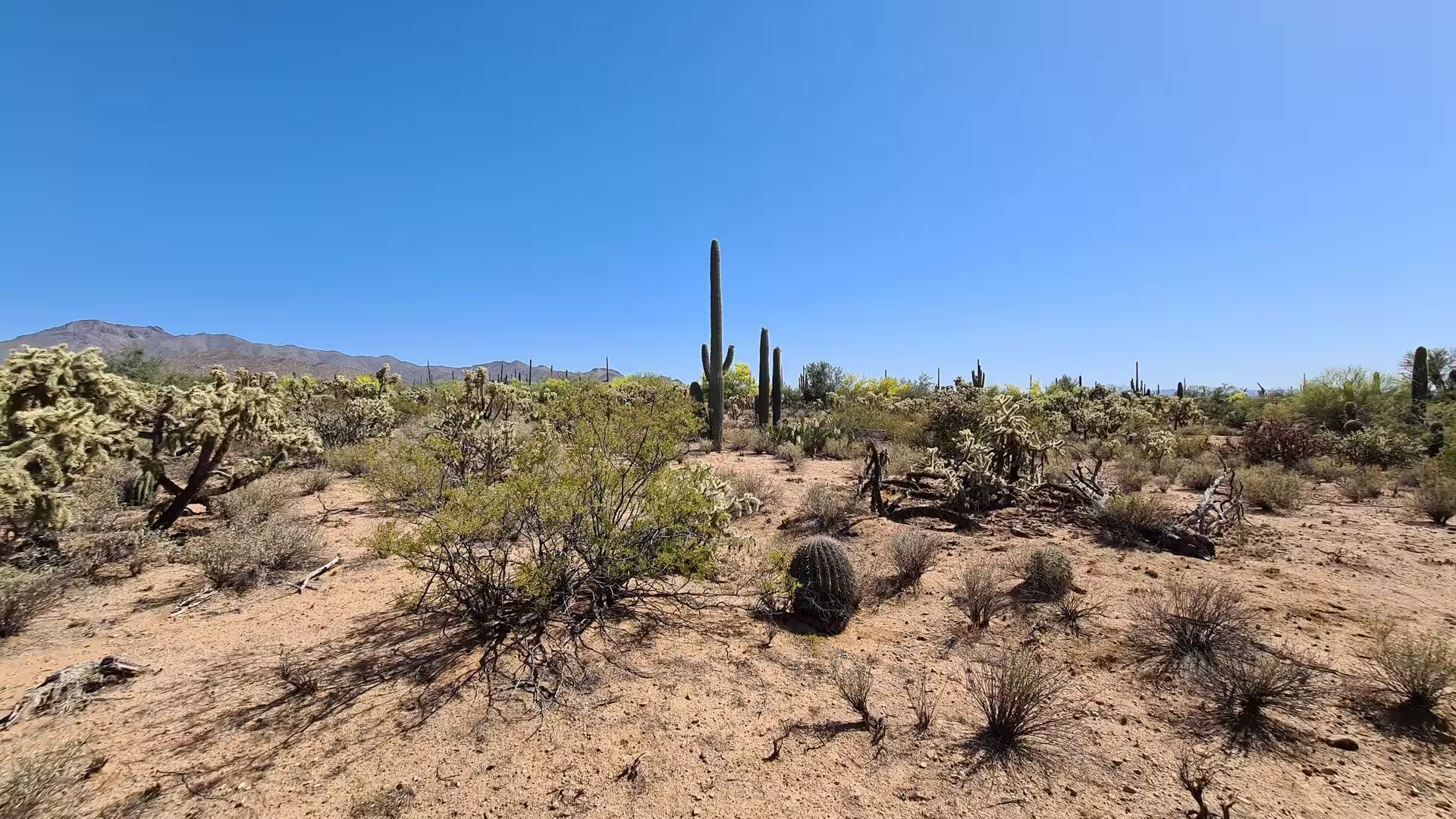
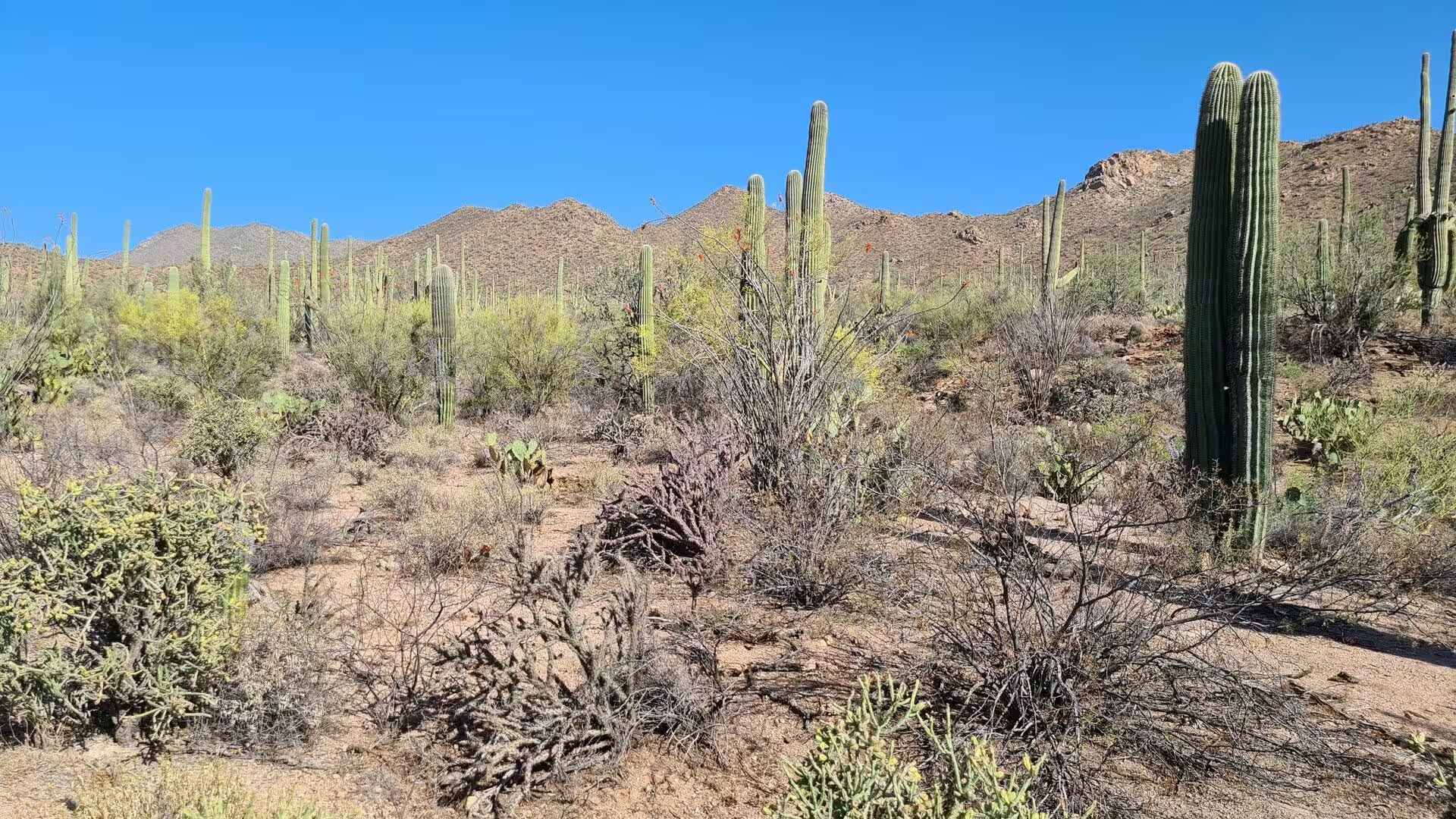
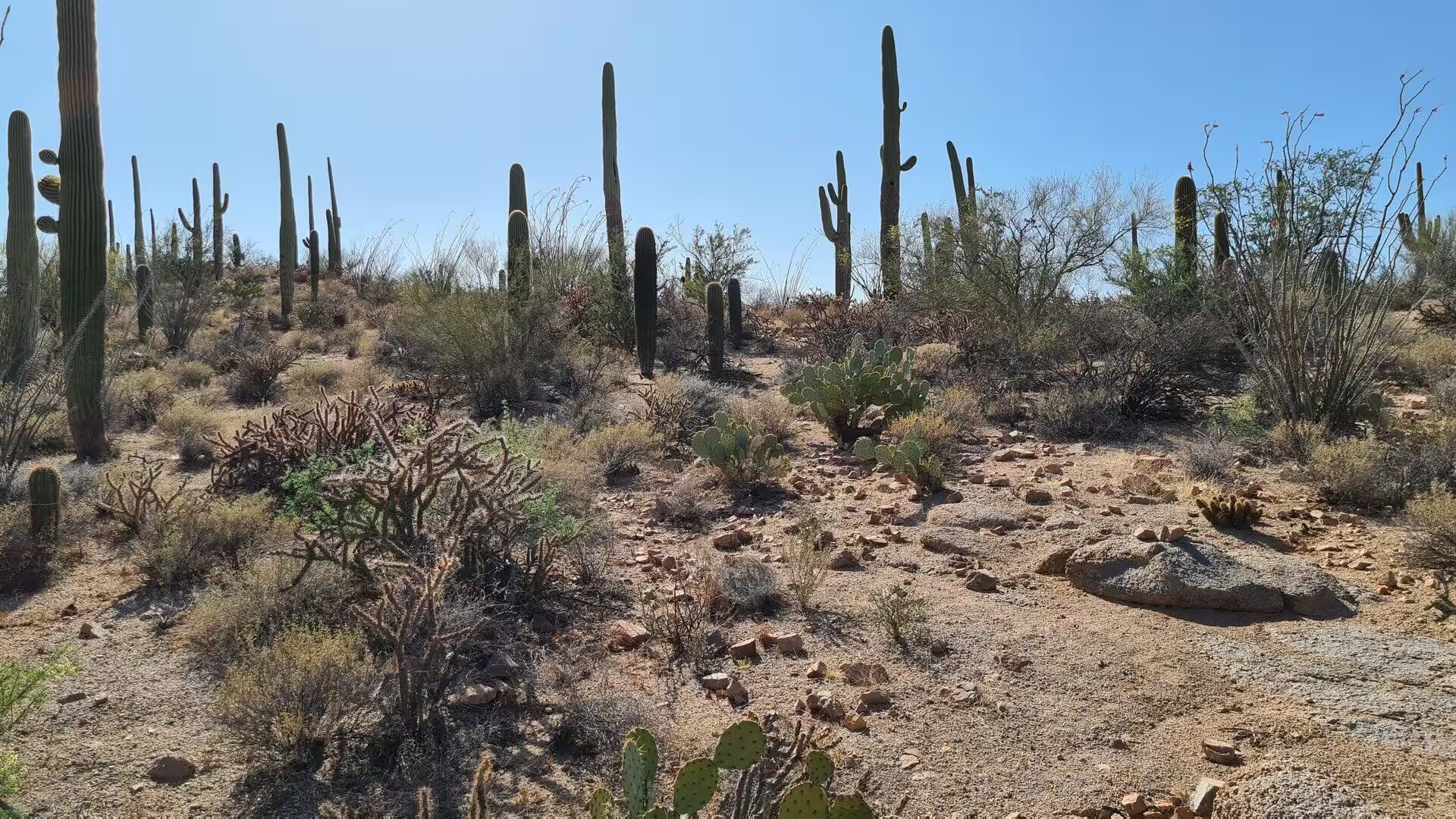
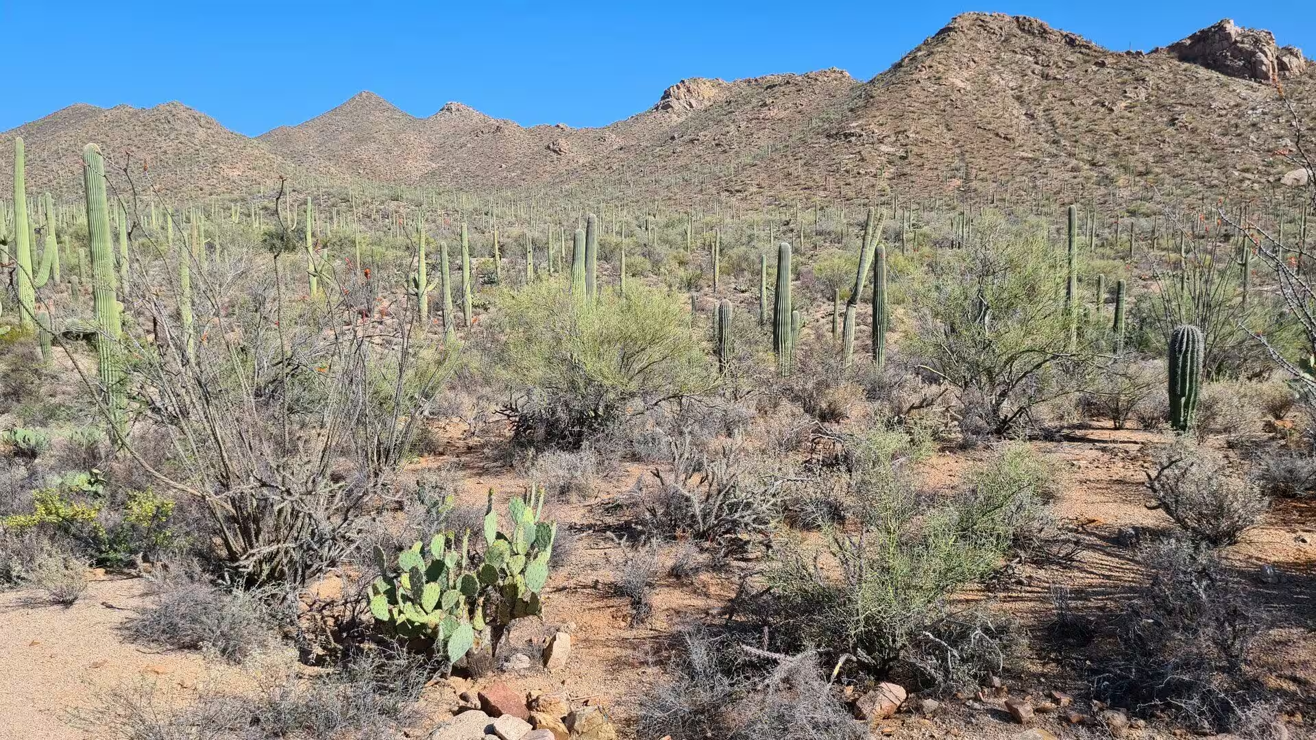
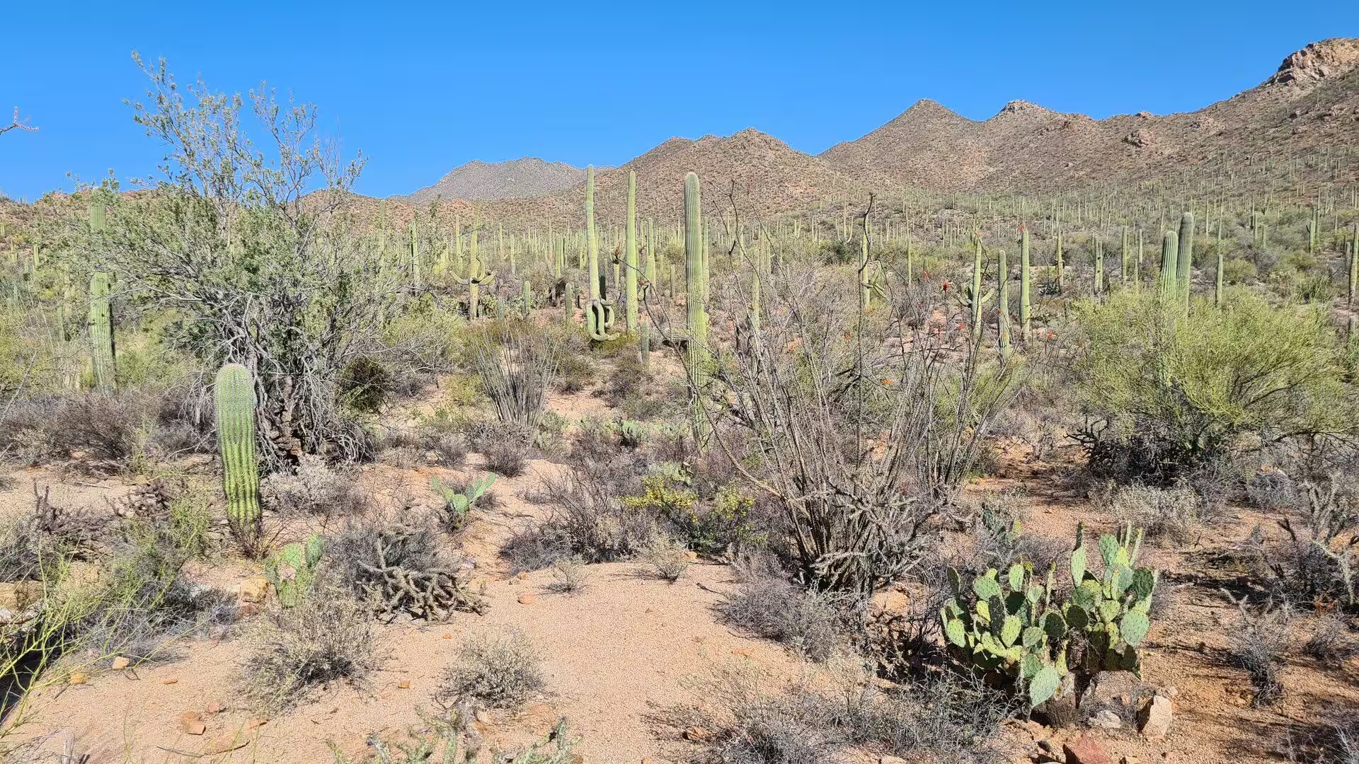
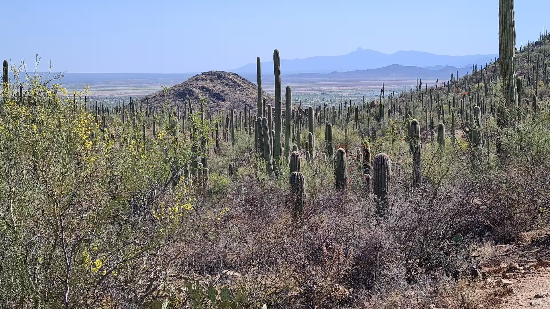
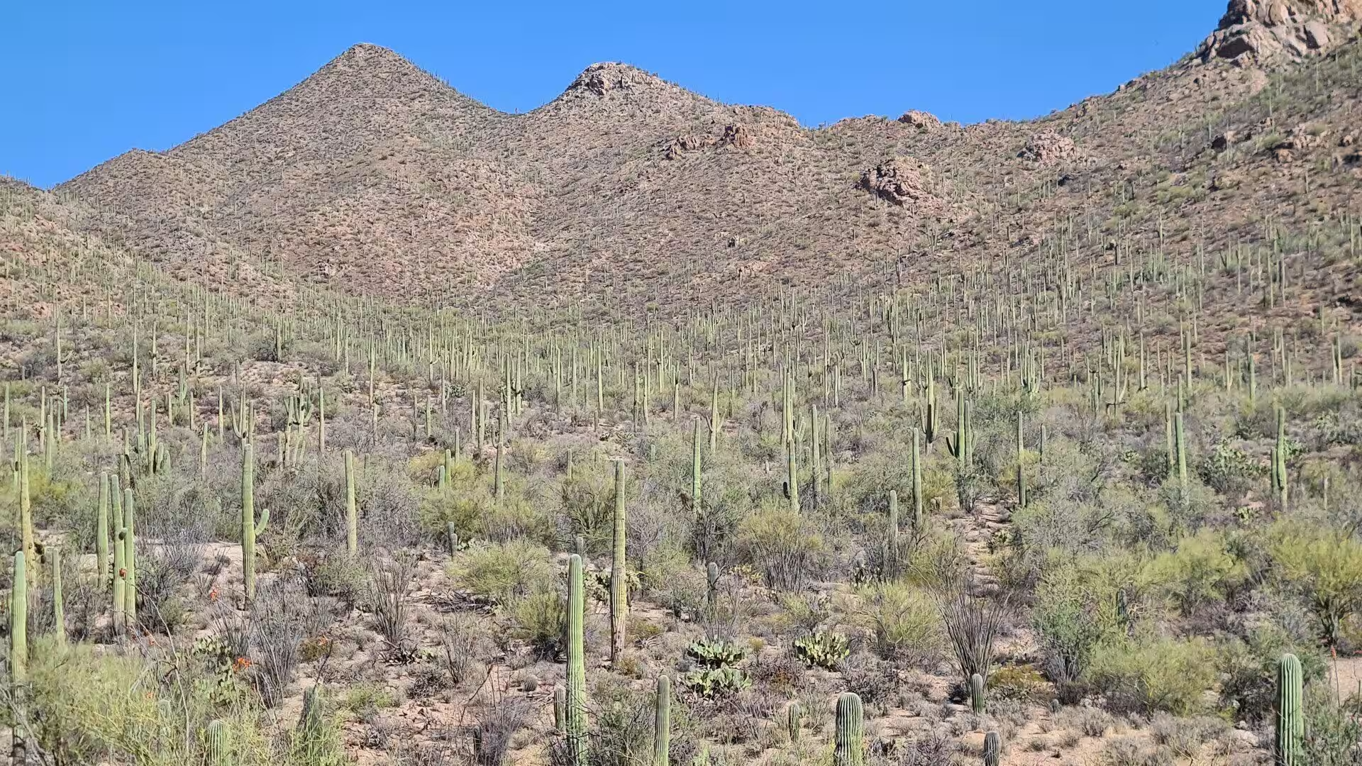
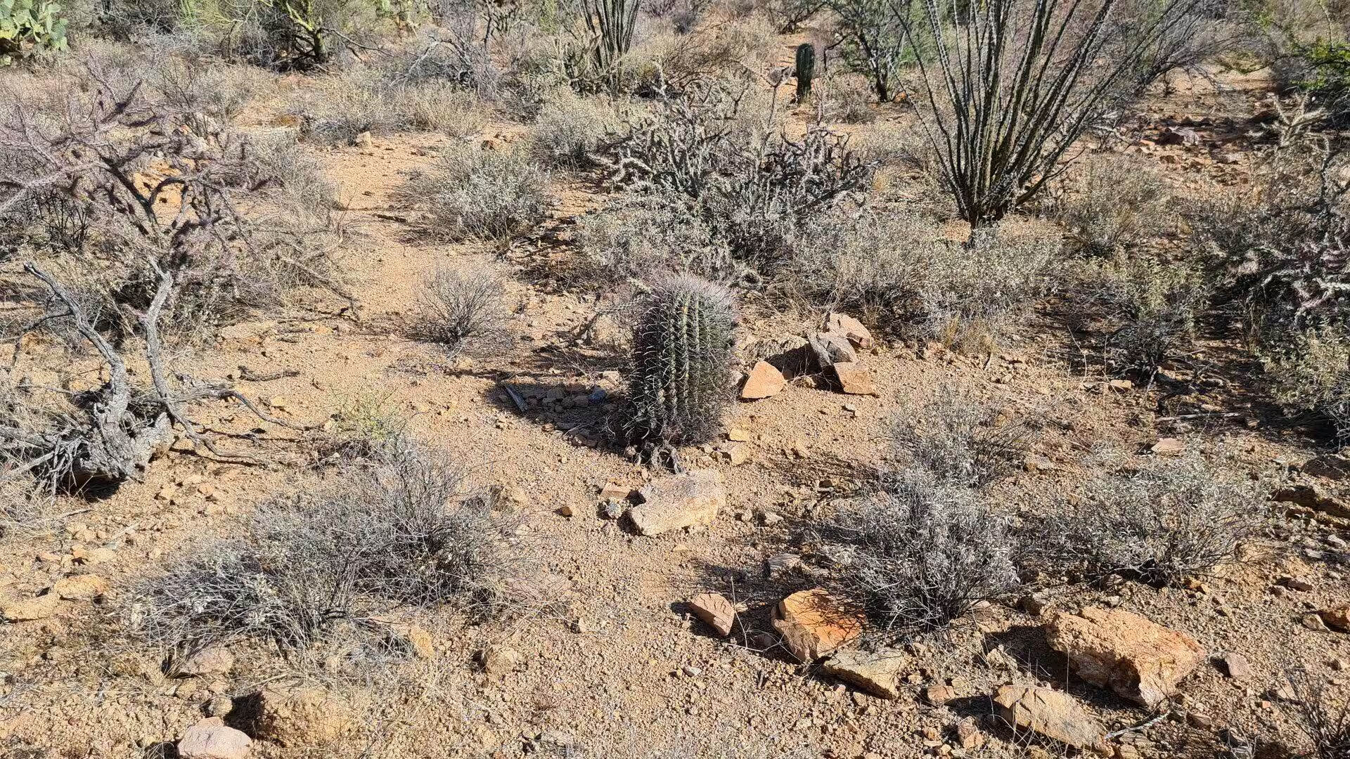
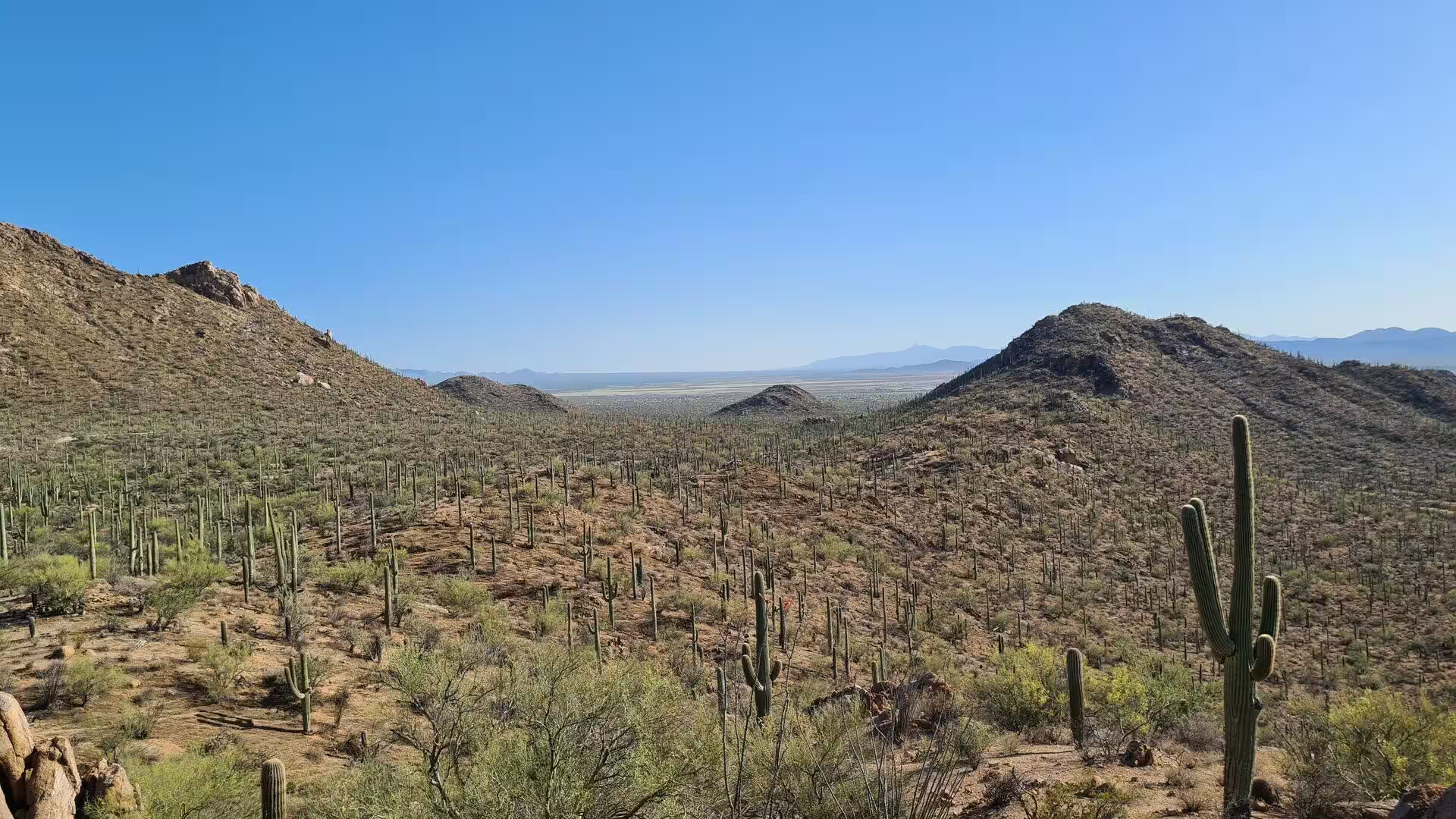
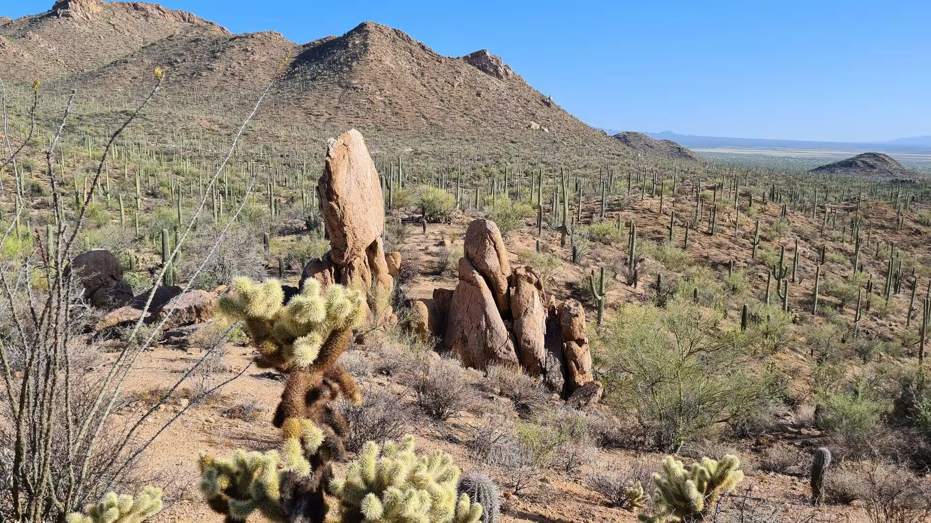
The saguaro is the reason for the park and the defining sight of both districts, where an estimated 1.8 million of them grow. It is a slow plant: the first arm usually appears when the cactus is between fifty and seventy years old, and later than that where rain is scarce, while the plants live as long as 200 years and count as mature at about 125. A hydrated adult may stand sixty feet high and weigh 4,800 pounds. With them grow twenty-four other species of cactus, above all fishhook barrel, staghorn cholla, teddybear cholla and Engelmann’s prickly pear.
The Tucson Mountain District is the smaller and lower of the two, with desert scrub at its lowest ground and desert grassland a little higher. Wasson Peak, at 4,687 feet, gives the district its summit and its best long walk, the Hugh Norris Trail. The Bajada Loop Drive, five unpaved miles, runs through dense cactus country beneath the ridge and is the usual first introduction to the park. The Civilian Conservation Corps built ramadas, tables and stone restrooms here, and coyotes, Gambel’s quail and desert tortoises are common in the county park beside it.
The Rincon Mountain District is larger, higher and wetter, and its plant life changes with the climb. Desert scrub and desert grassland lie at the bottom, oak woodland, pine and oak woodland and pine forest follow, and mixed conifer forest of Douglas fir, ponderosa pine and white fir covers the highest slopes of the Rincons. The Cactus Forest Loop Drive, 8.3 paved miles, was laid out by the Civilian Conservation Corps between 1936 and 1939 and passes Javelina Rocks, where banded gneiss stands in slabs beside the road. A section of the Arizona Trail crosses the district.
Just south of the Tucson Mountain District, along North Kinney Road, the Arizona-Sonora Desert Museum interprets the whole natural history of the region in one place. The non-profit institution was founded in 1952 by William H. Carr with the backing of the conservationist Arthur Newton Pack, and it works as a zoo, botanical garden, aquarium and natural history museum on 98 acres rented from Pima County. Two miles of paths cross 21 acres of desert, and the collection runs to more than 230 animal species and 1,200 kinds of plant.
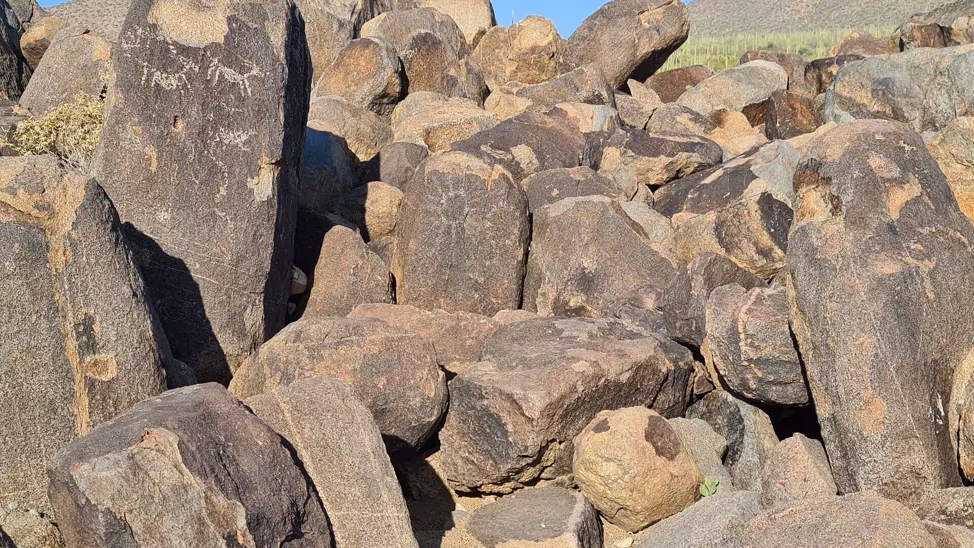
The rock art of the park is the work of the Hohokam and is at its most accessible in the Tucson Mountain District. The Signal Hill Trail, which starts at the Signal Hill Picnic Area on the Bajada Loop Drive, leads in a few minutes to boulders covered with dozens of petroglyphs about 800 years old, among them spirals, sun figures and the shapes of animals pecked through the dark coating of the stone. Work of the same kind is found elsewhere in the park, which holds more than 450 archaeological sites in all.
The ecology of the park is a lesson in the saving of water. Saguaros and other cacti use crassulacean acid metabolism, opening their pores at night so that they lose almost nothing by day, and young saguaros survive only in the shade of nurse plants such as palo verde and triangle bursage, which soften the frost and moderate the heat. Creosote bush and bur sage dominate the valley floors, mesquite and ironwood grow on the bajadas, and fairy duster, brittlebush and fourwing saltbush colour the lower slopes. Inventories in 2011 and 2013 recorded 389 species of vascular plant, 197 fungi and 25 non-vascular plants.
Wildlife in the park is desert wildlife, and most of it is active in the cool hours. Thirty species of medium and large mammal live in the two districts, among them cougars, coyotes, bobcats, javelinas, ringtails, coatis and jackrabbits, while the lesser long-nosed bat spends part of the year here and part of it in Mexico. Of the 107 bird species of the park, the two most closely tied to the saguaro are the cactus wren, the largest wren in the United States and the state bird of Arizona, and the Gila woodpecker, whose nest holes in the cactus stems are later used by elf owls.
Walking is the main business of the park. The 165 miles of trails range from short nature loops such as the Valley View Overlook Trail in the west to long desert routes such as the Douglas Spring Trail in the Rincons, and the Freeman Homestead Trail passes the remains of a homestead filed in 1929 that stands on the state register of historic places. Visitor centres at Red Hills and Rincon Mountain explain the geology, the plants and the rules of the desert, and heat, dehydration and flash floods are the hazards to respect. Camping is permitted only in the east.
References
- Wikipedia contributors (2026). Saguaro National Park. en.wikipedia.org/wiki/Saguaro_National_Park
- Wikipedia contributors (2026). Saguaro. en.wikipedia.org/wiki/Saguaro
- Wikipedia contributors (2026). Tucson, Arizona. en.wikipedia.org/wiki/Tucson%2C_Arizona
- Wikipedia contributors (2026). Sonoran Desert. en.wikipedia.org/wiki/Sonoran_Desert
- Wikipedia contributors (2026). Tucson Mountains. en.wikipedia.org/wiki/Tucson_Mountains
- Wikipedia contributors (2026). Pima County, Arizona. en.wikipedia.org/wiki/Pima_County%2C_Arizona
- Wikipedia contributors (2026). Arizona. en.wikipedia.org/wiki/Arizona
- Wikipedia contributors (2026). Arizona-Sonora Desert Museum. en.wikipedia.org/wiki/Arizona-Sonora_Desert_Museum
- Wikipedia contributors (2026). Cactus wren. en.wikipedia.org/wiki/Cactus_wren
- Wikipedia contributors (2026). Gila woodpecker. en.wikipedia.org/wiki/Gila_woodpecker
- Wikipedia contributors (2026). Bajada (geography). en.wikipedia.org/wiki/Bajada_%28geography%29
- Wikipedia contributors (2026). Rincon Mountains. en.wikipedia.org/wiki/Rincon_Mountains
- Wikipedia contributors (2026). Desert ecology. en.wikipedia.org/wiki/Desert_ecology
- Wikipedia contributors (2026). National Park Service. en.wikipedia.org/wiki/National_Park_Service
- Wikipedia contributors (2026). Desert climate. en.wikipedia.org/wiki/Desert_climate
- Rodriguez-Buritica S., Raichle H., Birt T., Webb R.H., et al. (2013) Population dynamics of Sonoran Desert saguaro cactus (Carnegiea gigantea) at the Desert Laboratory (Tucson, Arizona). Ecology. 94. 1660-1660. doi.org/10.1890/13-0182.1
- Pape R.B., Peachey W.D. (2026) Frugivory and Dispersal of Saguaro Cactus (Carnegiea gigantea) Seeds by the Common Raven in the Arizona Upland Subdivision of the Sonoran Desert at Tucson, Arizona, USA. Cactus and Succulent Journal. 98. doi.org/10.2985/015.098.0207
- Austin G.T. (1974) Nesting Success of the Cactus Wren in Relation to Nest Orientation. The Condor. 76. 216. doi.org/10.2307/1366737