Day 2 - Rotorua & Mount Maunganui
18 July 2023

Journal Notes
General
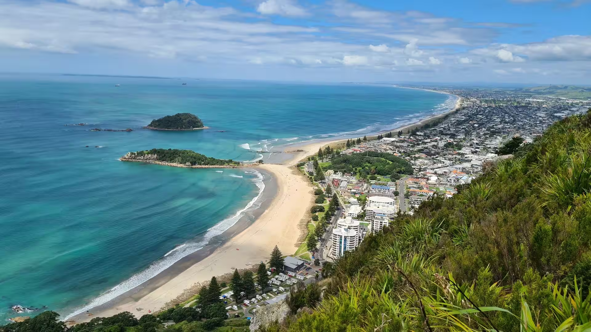
Mount Maunganui is a coastal town and popular seaside resort on the North Island of New Zealand, at the north-eastern corner of the Bay of Plenty. It grew up as a borough in its own right, but it is today a suburb of the city of Tauranga, the fifth-most-populous city in New Zealand, from whose centre it is separated by the waters of Tauranga Harbour. The town occupies a narrow sand peninsula that divides the open Pacific from the harbour, and it crowds around the foot of its landmark, the extinct volcanic cone of Mauao, which rises 232 metres at the peninsula’s outer end. Residents and visitors alike simply call the place the Mount.
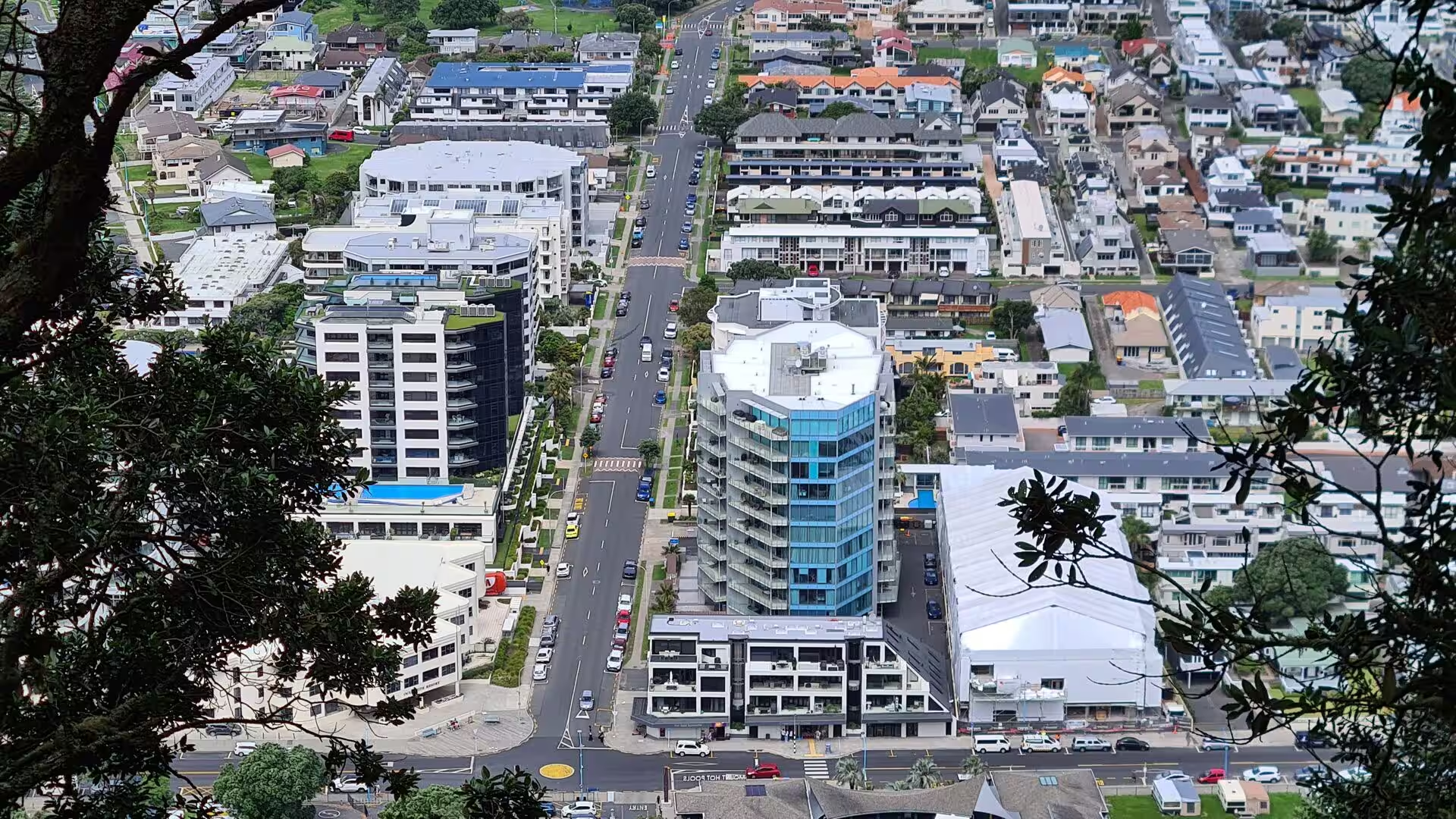
The town owes its character to the contrast between two shores. On the ocean side a long sandy beach, Main Beach, faces the surf of the Pacific; on the harbour side the calm water of Pilot Bay reaches almost to the mountain’s base, so that the two beaches lie only a few blocks apart. A temperate maritime climate with warm summers and high sunshine hours supports an outdoor way of life built on swimming, surfing and walking, and the harbour frontage carries part of the Port of Tauranga, the largest port in New Zealand by cargo volume and container throughput. Since the harbour bridge of 1988 joined the Mount to the Tauranga city centre, the resort has grown rapidly.
Inland from the coast, beyond bush-clad ranges, the second town of this stage, Rotorua, sits on the southern shore of Lake Rotorua, from which it takes its name: in the Māori language roto means lake and rua means second, so Rotorua is the second lake. The city is the seat of the Rotorua Lakes District in the Bay of Plenty Region and the second-largest urban area of the region after Tauranga, with a population of about 55,000 at the 2023 census. Rotorua is known throughout the country as Sulphur City, after the hydrogen-sulphide gases that rise from the ground and give the air its scent of rotten eggs.
Rotorua’s role as New Zealand’s premier thermal resort rests on a volcanic field that steams in parks, on road verges and even in private gardens across the town. Around this geothermal stage the city has built one of the country’s great tourist industries, combining hot pools and thermal reserves with Māori cultural tourism; it is the historical heartland of the Te Arawa people, and close to half of its residents identify as Māori. Together the two towns show the two faces of the Bay of Plenty Region: the sunlit coast of Mount Maunganui and the steaming volcanic plateau of Rotorua.
History
Te Arawa Māori settled the Rotorua lakes in the fourteenth century, after their canoe made landfall on the Bay of Plenty coast at Maketu, and built a thriving fortified village at Ohinemutu on the shore of Lake Rotorua. The people of Ohinemutu came to be known as Ngāti Whakaue, after their ancestor Whakaue Kaipapa. According to tradition the thermal springs are a gift of the gods: Ngātoro-i-rangi, an ancestral priest of the Te Arawa canoe, called down fire from Hawaiki to save himself from cold on the summit of Mount Tongariro, and the fire spirits that answered him surfaced again in the hot pools of Rotorua. In the middle of the lake, Mokoia Island was the setting of the best-known Māori love story, in which Hinemoa swam across the water guided by the flute playing of Tūtānekai when her family forbade the match.
The lakes were drawn into the Musket Wars of the 1820s. After a Ngāpuhi raiding party was killed in Rotorua in 1822, the northern chief Hongi Hika led a coalition of Ngāpuhi and allied tribes inland from Tauranga in February 1823 and defeated the Te Arawa forces, who lost about 170 men in the fighting around Mokoia Island. European contact followed quickly: the trader Phillip Tapsell operated from Maketu on the coast from 1828, missionaries of the Church Missionary Society visited in 1831, and Thomas Chapman established stations at Te Koutu in 1835 and on Mokoia Island in 1838.
The modern resort grew out of the thermal landscape. The Crown obtained control of a block of hot springs and lakeshore at Rotorua under the Fenton Agreement of 1880, by which Ngāti Whakaue leased about fifty acres of land in return for a share of the revenue from 99-year subleases, and the Thermal Springs Districts Act of 1881 extended the government’s powers over lands containing hot springs. Visitors were drawn above all to the Pink and White Terraces on Lake Rotomahana, once advertised as the eighth wonder of the world, until the eruption of Mount Tarawera on 10 June 1886 destroyed the terraces and buried the nearby village of Te Wairoa, killing an estimated 120 people. The opening of the Rotorua branch railway in 1894, with its Rotorua Express service, turned the town into a fashionable spa, and Rotorua became a borough in 1922 and a city in 1962.
Mount Maunganui looks back to an equally old Māori past. Mauao itself was a fortified pā, and terraces, storage pits and shell middens can still be traced on its ridges. The hill was taken from Ngāti Ranginui by Ngāi Te Rangi in a battle about 1700, remembered as the Battle of the Kokowai, and a musket-armed Ngāpuhi war party under Te Morenga stormed the pā in 1820, after which it was never reoccupied. The cone remains sacred to the three iwi of Tauranga Moana, Ngāi Te Rangi, Ngāti Ranginui and Ngāti Pūkenga, who lost the mountain after the land wars of the 1860s and received it back from the Crown on 14 May 2008.
The European town is younger than Rotorua. The first European ship entered Tauranga Harbour in 1826, but the peninsula remained farmland and scrub until the early 1900s, when the first subdivisions were laid out; the pioneer house of J. C. Adams, built in 1906, still stands in Adams Avenue. The official name Rakataura, chosen in 1907, never caught on, and the settlement kept the Māori name of the hill, to which the English Mount was later added. A branch railway reached the coast in 1913, excursion trains brought holidaymakers through the 1920s and 1930s, and a deep-water wharf built in the 1950s made the Mount the port of the Bay of Plenty. The town successfully resisted amalgamation with Tauranga until the harbour bridge of 1988 ended its isolation, and it was absorbed into Tauranga City soon afterwards; the former borough’s Moturiki Island, joined to the beach by a causeway, carried an aquarium called Marineland from 1966 to 1981 and then a water park until 1990.
Geology
Both towns of this stage belong to the young volcanic landscape of the central North Island. Rotorua lies inside the Taupō Volcanic Zone, a band of intense volcanism that runs north-east from the andesite cones of Mount Ruapehu and Tongariro, through the great rhyolite calderas of Taupō, Ōkataina and Rotorua, and offshore into the Bay of Plenty, where it continues in the steaming island of Whakaari, White Island. The zone has been active for more than two million years and is one of the most productive volcanic areas on Earth; the caldera of Taupō produced the largest eruption of the last 70,000 years.
The city of Rotorua and its lake occupy the Rotorua Caldera, formed about 240,000 years ago when a catastrophic eruption expelled more than 340 cubic kilometres of rhyolitic magma as the Mamaku ignimbrite, an event ranked at 7 on the volcanic explosivity index. With the magma chamber emptied, the ground above it collapsed into a broad depression that later filled with water to create Lake Rotorua, which at 79.8 square kilometres is the second-largest lake of the North Island but remarkably shallow, averaging only about 10 metres in depth. The lake is still volcanically restless: Mokoia Island in its centre is a rhyolite dome pushed up through the caldera floor, rising 180 metres above the water and carrying hot springs on its shore, and smaller eruptions have occurred within the caldera in the last 25,000 years. The geothermal field beneath the town, one of many along the zone, is powered by hot rock and circulating groundwater above a cooling magma body, and it surfaces as steaming ground, boiling pools, mud pools and fumaroles across the urban area.
Mauao at Mount Maunganui belongs to an older phase of the same volcanic story. The cone is a rhyolite lava dome, not the basalt peak of popular description, and one of a group of at least seventeen domes of the Minden Rhyolite Subgroup in the Tauranga Volcanic Centre, whose eruptions span about 2.9 to 1.9 million years; the youngest lavas of Mauao itself are dated to about 2.35 million years. At that time volcanism still lay to the north-west, in the line of the older Coromandel arc, and it was only later that activity shifted south-east into the modern Taupō Volcanic Zone. Since it ceased erupting, the dome has been worn into the rounded, grassy cone that gives the town its skyline.
The peninsula on which Mount Maunganui stands is a tombolo, a sand bridge tying the former island of Mauao to the mainland. During the last ice age, when sea level stood as much as 120 metres lower, the whole Tauranga basin was dry land; as the ice melted and the sea rose, the seaward slopes of the dome first became an island, and then, about 4,000 years ago, drifting marine sands joined it to the shore. The same post-glacial flooding drowned the lowland behind the sand barrier, creating the sheltered waters of Tauranga Harbour, while the open coast built the long beaches and dune country of Main Beach and Papamoa. The lava dome of Mauao thus stands at the meeting point of two worlds of rock: ancient rhyolite at its core and young sand at its feet.
Things to See
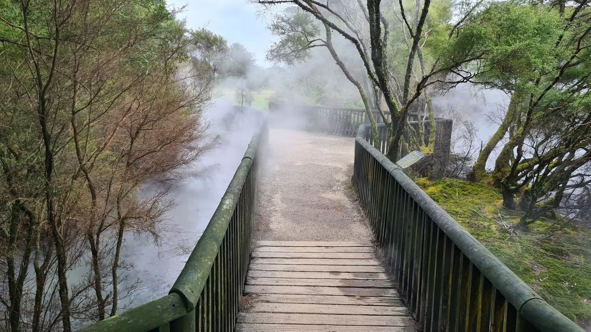
Rotorua’s thermal townscape. In Rotorua the geothermal field breaks the surface inside the town itself, which makes it one of the few cities in the world where visitors can watch the ground steam. Public reserves and parks are threaded with timber boardwalks that cross ground too hot to touch, where vapour pours from vents among mossy trees; shallow pools of pale mineral water lie among the rocks, and mud pools bubble thickly. Steam rises from street drains and road verges, and the air carries the sharp scent of sulphur that gives the town its nickname. Boardwalk circuits of an hour or less allow even a short visit to take in hot pools, fumaroles and mineral-encrusted ground without leaving the built-up area.
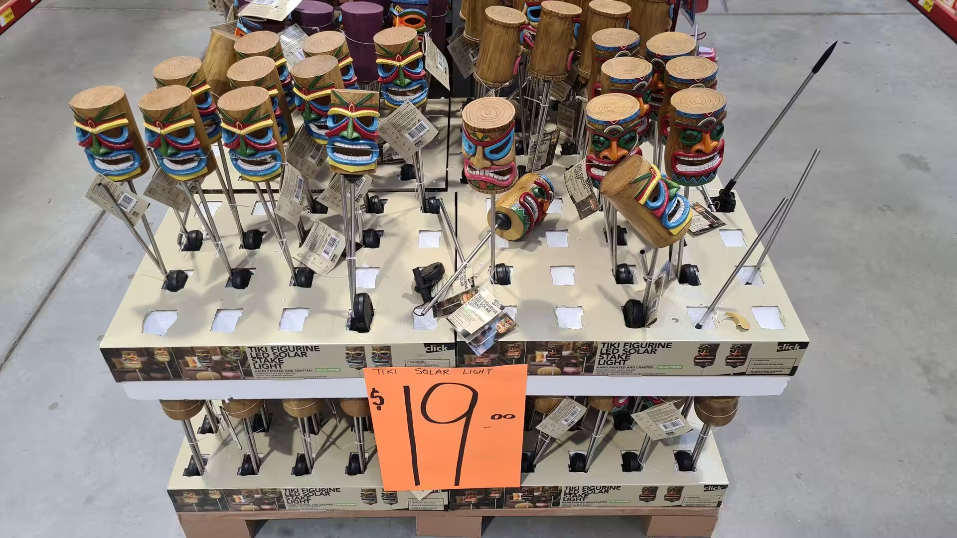
Rotorua’s second great resource is water of a milder kind. The town’s lakefront looks north across Lake Rotorua to the forested dome of Mokoia Island floating in its centre; cruises cross to the island, and the lake and its inflowing streams are among New Zealand’s best-known trout fisheries. Around the shore the town displays its Māori heritage openly: carved meeting houses, cultural performances and craft shops stocked with carved tiki figures and woven flax work, all of it rooted in the Te Arawa traditions that have flourished here since the fourteenth century.
Mauao, the mountain of Mount Maunganui. The cone that gives the resort its name is the reason most people come. A well-formed base track about 3.4 kilometres long circles the mountain at sea level and ranks among the most popular walks in New Zealand, with close to a million visits a year; it leads from the surf of Main Beach around the seaward cliffs, past North West Rock, where a plaque recalls the wreck of the launch Ranui in 1950, and back along the calm water of Pilot Bay. The summit track climbs 232 metres in about an hour, past the terraces and pits of the old pā, and rewards the walker with a panorama over the Bay of Plenty, the harbour entrance between Mauao and Matakana Island, the town below and the bush-clad ranges inland.
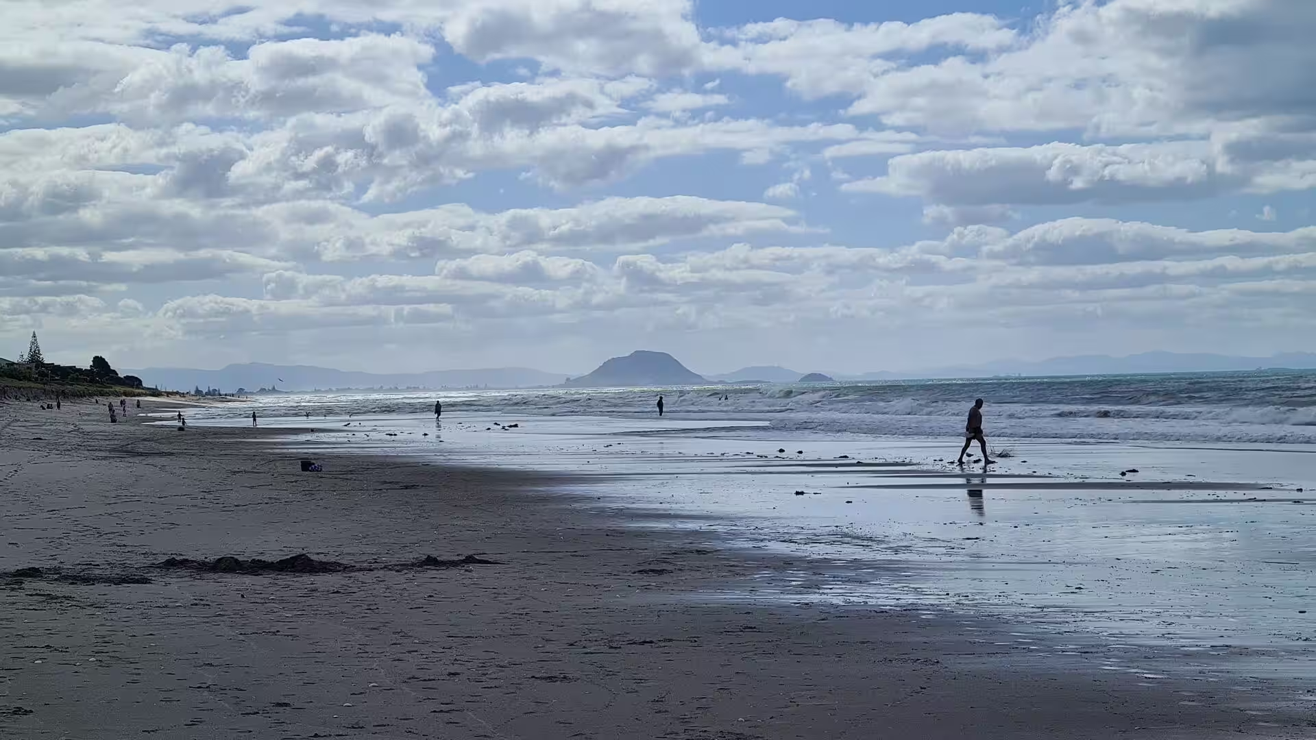
Beaches and hot pools. The two beaches of the peninsula are the heart of the resort. Main Beach on the ocean side is a wide stretch of white sand with dependable surf and lifeguard patrols in summer; at low tide its wet, firm sand mirrors the sky and the shallow water extends far out. Pilot Bay on the harbour side is calm and sheltered, popular with families, paddleboards and dinghies. Between the two, at 9 Adams Avenue, the Mount Hot Pools have offered bathing since January 1966 in water that is unique of its kind: the complex was built after a bore drilled for the town water supply struck naturally hot salt water instead, and the pools are still heated by geothermal water drawn from deep beneath the mountain, which made them, when they opened, then believed to be the only natural hot salt-water pools in the Southern Hemisphere.
Moturiki Island. A short causeway leads from the eastern end of Main Beach to Moturiki, a small uninhabited island of rock and scrub that serves as the town’s offshore playground. Walks circle the island with views back to Mauao and along the coast, and its low cliffs are a local climbing ground; a tide gauge operated by the National Institute of Water and Atmospheric Research records sea level here. The island carried the Marineland aquarium between 1966 and 1981 and later a water park, both since removed.
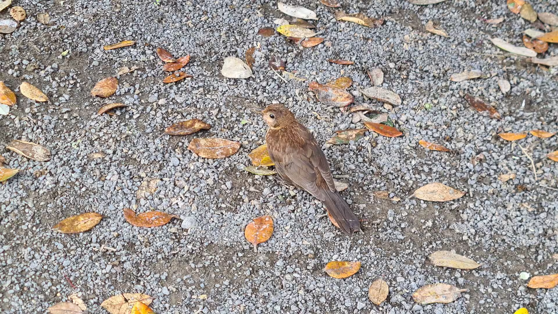
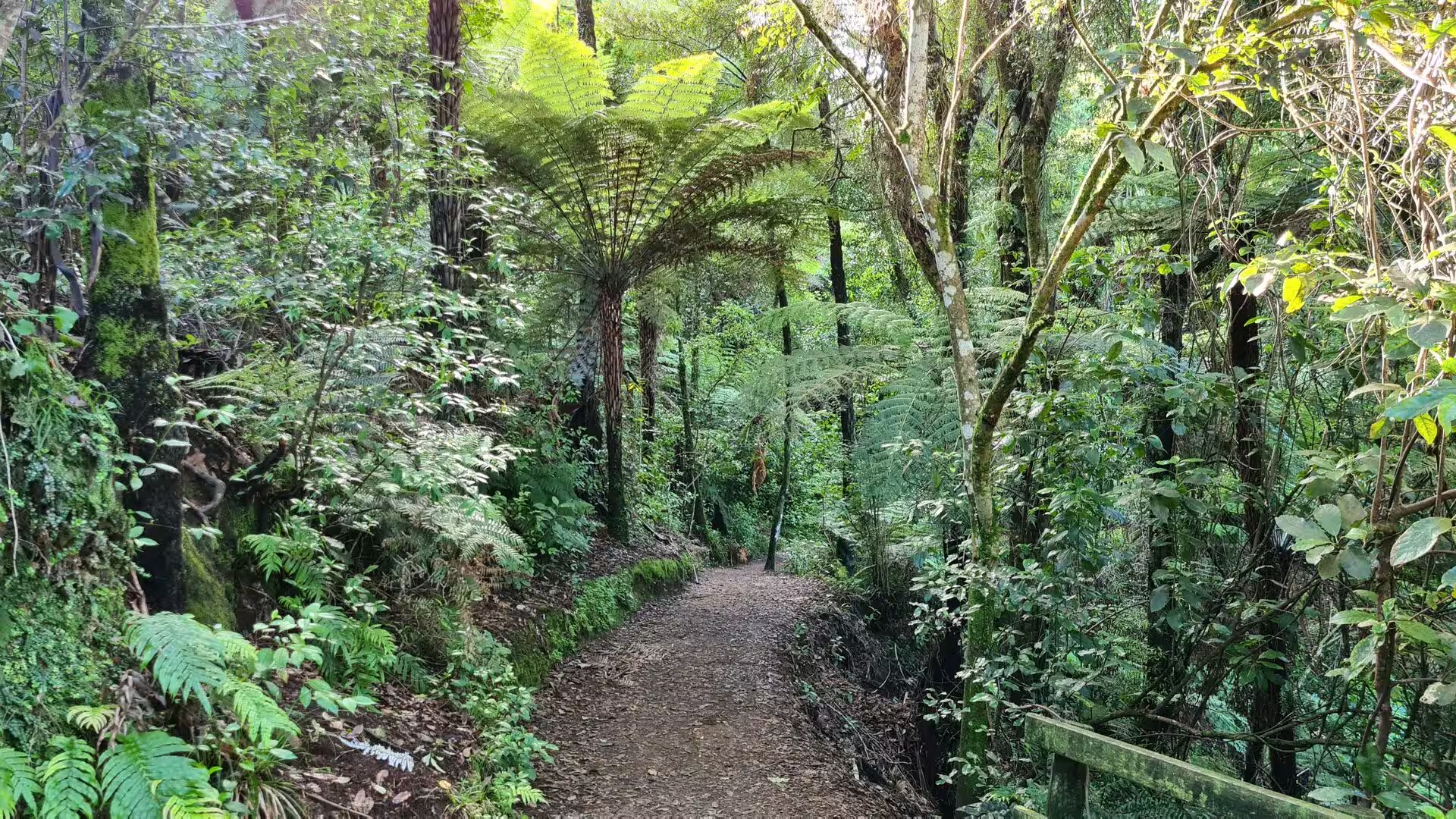
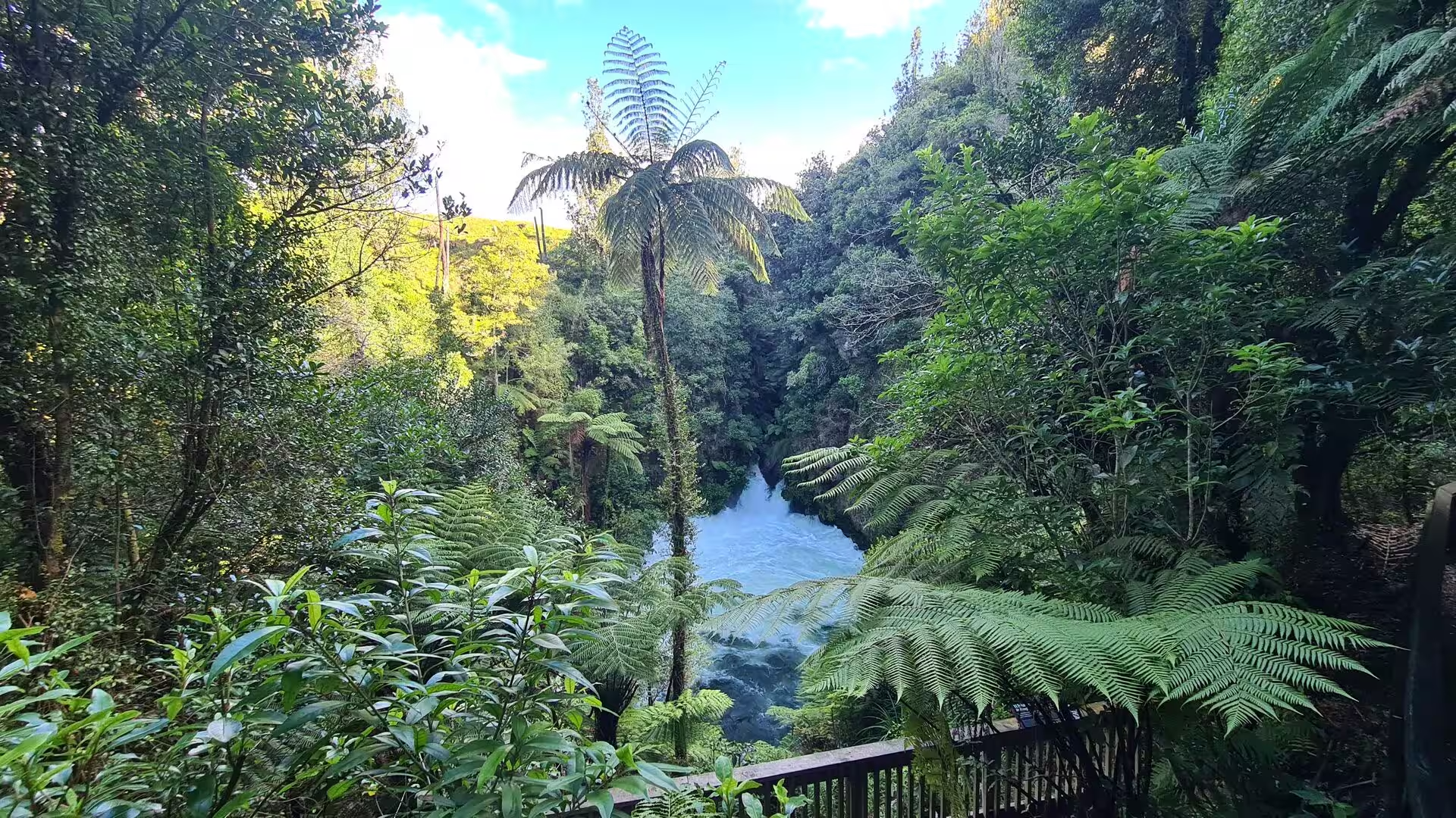
Native forest and tree ferns. Away from the coast the country between Tauranga and Rotorua is covered in dense native forest, the classic bush of the North Island, in which tree ferns crowd the valleys. The black trunks and huge fronds of the mamaku, or black tree fern, rise beside the silver-stemmed ponga, New Zealand’s silver fern, and walks on the ranges follow shaded trails that dip across stream gullies on wooden footbridges and climb to lookouts over deep, fern-lined gorges. Small native birds such as fantails and grey warblers work the undergrowth, and the cooler air of the forest comes as a relief after the coast.
References
- Stafford, Donald M. (1967). Te Arawa: A History of the Arawa People. Wellington: A.H. & A.W. Reed.
- Cunningham, Bruce and Musgrave, Ken (1989). A History of Mount Maunganui. Mount Maunganui: Mount Maunganui Borough Council.
- McCauley, Debbie (2018). Ko Mauao te Maunga: Legend of Mauao. Tauranga: Mauao Publishing.
- Mauao. www.tauranga.govt.nz/parks-and-recreation/parks/mauao
- Mount Hot Pools: History. www.mounthotpools.co.nz/about-us
- Rotorua. en.wikipedia.org/wiki/Rotorua
- Lake Rotorua. en.wikipedia.org/wiki/Lake_Rotorua
- Rotorua Caldera. en.wikipedia.org/wiki/Rotorua_Caldera
- Taupō Volcanic Zone. en.wikipedia.org/wiki/Taupō_Volcanic_Zone
- Mount Maunganui. en.wikipedia.org/wiki/Mount_Maunganui
- Mount Maunganui (mountain). en.wikipedia.org/wiki/Mount_Maunganui_(mountain)
- Tauranga. en.wikipedia.org/wiki/Tauranga
- Port of Tauranga. en.wikipedia.org/wiki/Port_of_Tauranga
- Bay of Plenty. en.wikipedia.org/wiki/Bay_of_Plenty
- Mokoia Island. en.wikipedia.org/wiki/Mokoia_Island
- Moturiki Island. en.wikipedia.org/wiki/Moturiki_Island