Day 15


Journal Notes
General
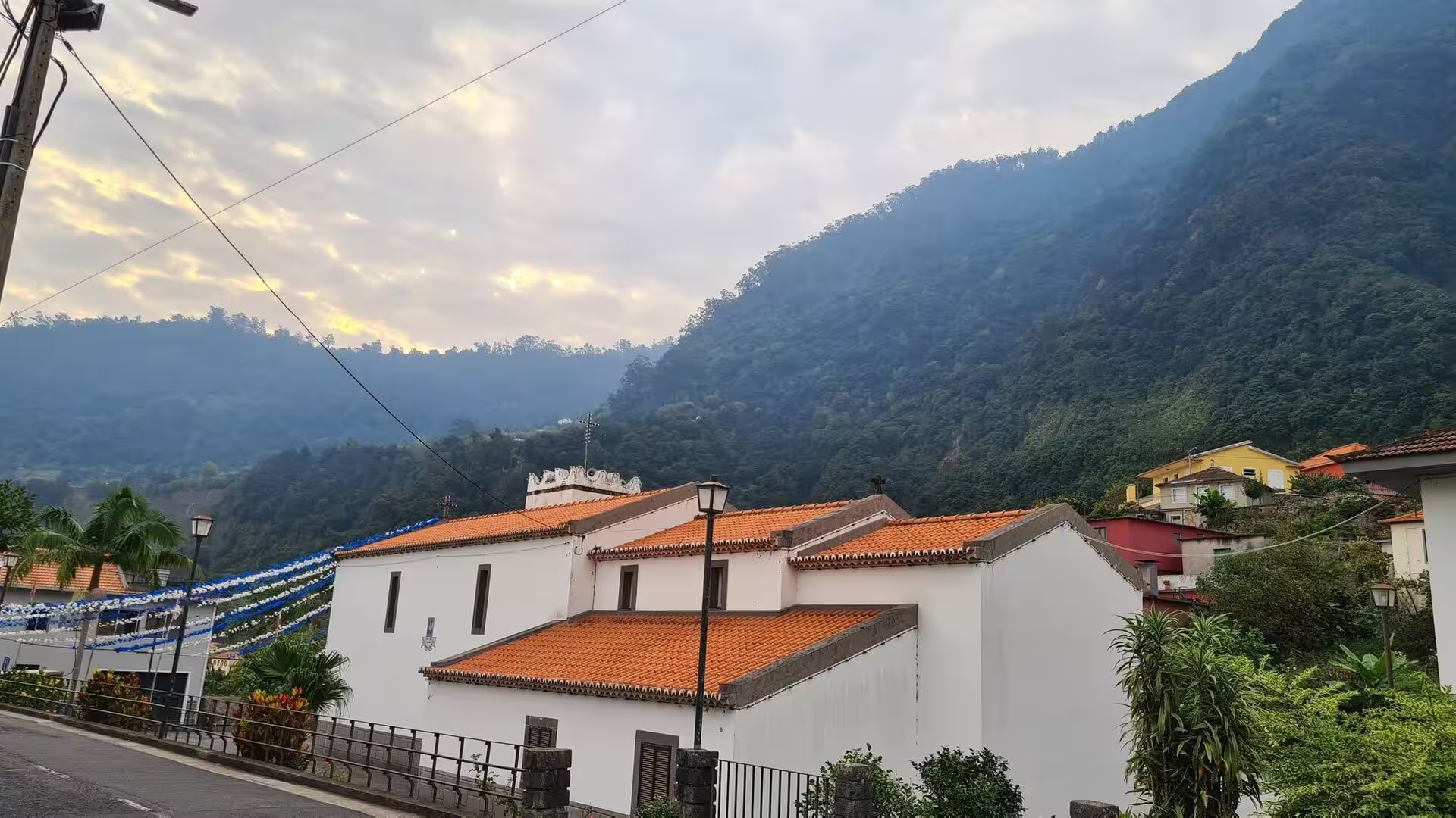
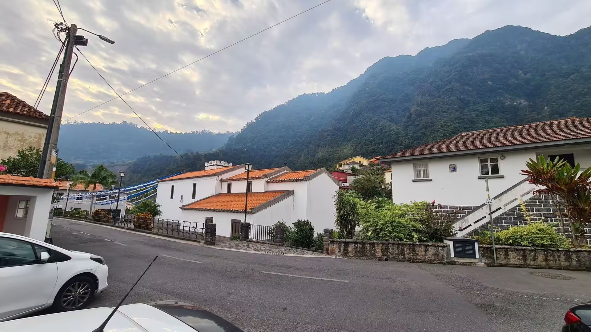
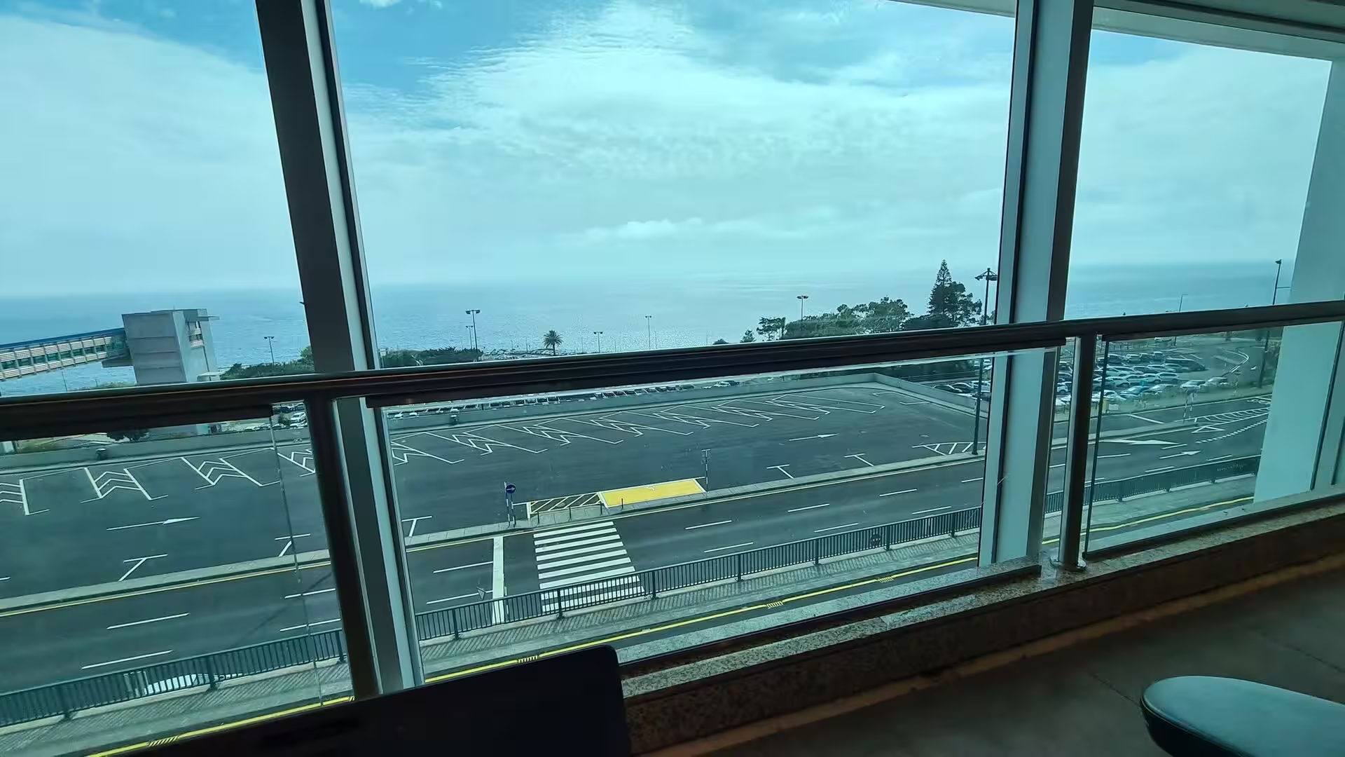
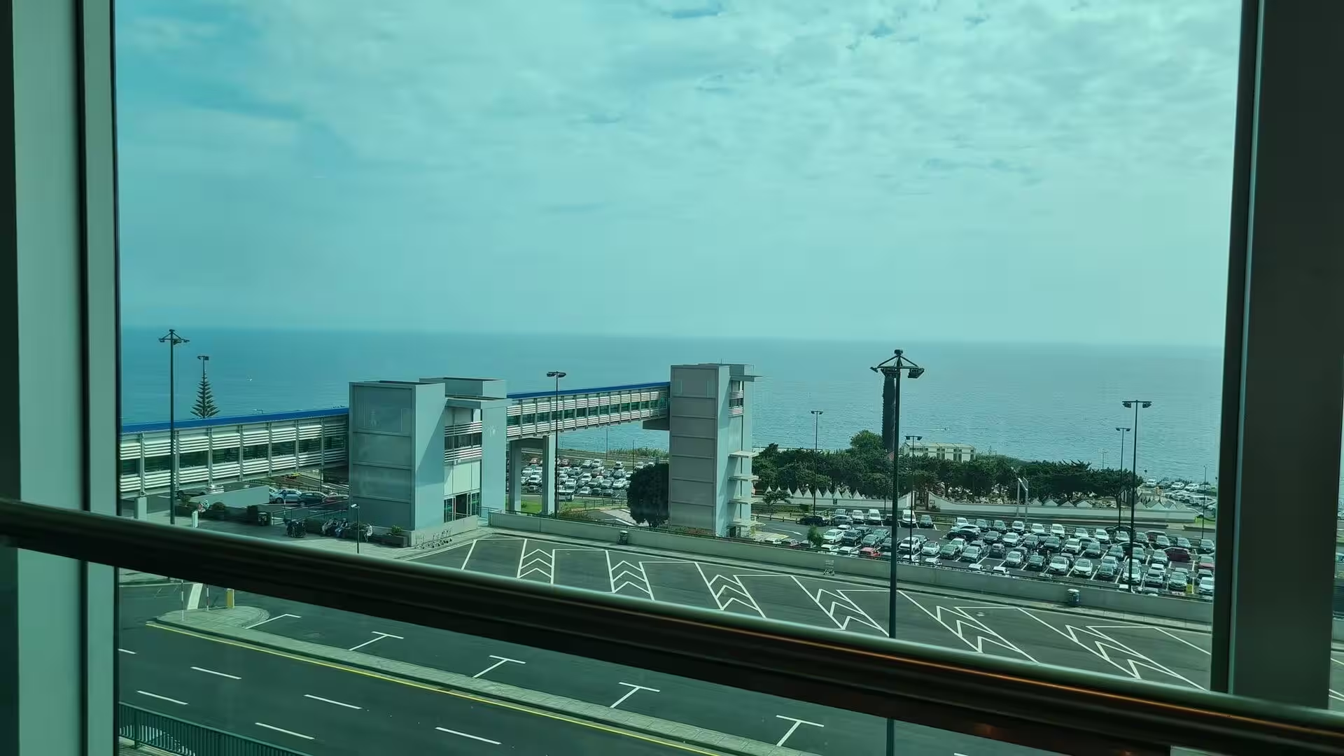
The final morning of the journey belonged to the village that stands beside the island airfield on the south-eastern coast, where whitewashed houses and a small chapel with an orange roof sit beneath a steep, dark mountain. The day unfolded in two movements: a walk through quiet lanes in the early hours, past a church sign and parked cars, and then the short transfer to the airfield, its car park above the sea, the covered walkway, the departure board and finally the long concrete apron pointing toward a town beneath green hills. Departure days turn an island into a summary. Everything seen before is reduced to a coastline, a ridge and a runway above the water.
Madeira is a Portuguese island and the largest and most populous of the Madeira archipelago, an autonomous region of Portugal with its capital at Funchal on the south coast. The archipelago includes Madeira, Porto Santo, the Desertas and the separate Savage Islands, and it lies in Macaronesia in the North Atlantic, on the African tectonic plate, although it is politically and culturally associated with Europe. The region counted 251,060 inhabitants in 2021, and the island itself 245,595 in the same year. Roughly half of the population lives in Funchal, so the districts away from the capital remain thinly settled and the day was spent in a small place.
The climate is mild and moderately subtropical, with Mediterranean summer droughts and winter rain, and it varies so sharply from one location to another that many microclimates occur at different elevations. The south-eastern corner near the airfield has a very mild Mediterranean climate with small differences between the seasons, slightly cooler than Funchal throughout the year and rarely touched by heat waves. Seasonal lag is pronounced enough that October is warmer than June in terms of daily mean temperature, which suits a departure in the middle of the month. Daytime warmth persists while the nights begin to lengthen.
A mountain ridge runs along the centre of the island, high in the west and much lower toward the east. Sea cliffs such as Cabo Girão, deep valleys and ravines descend from this central spine and make the interior largely inaccessible. Daily life has therefore concentrated in villages at the mouths of the ravines, through which the heavy autumn and winter rain reaches the sea. That pattern explains the day entirely: a compact settlement pressed onto a narrow coastal shelf, forested mountains rising immediately behind it, the ocean in front, and almost no level ground between them.
The airfield is the main gateway to the region and the reason the last day has a shape at all. It hosts flights chiefly to European metropolitan destinations and is pivotal for cargo moving in and out of the archipelago. It is the fourth-busiest airport in Portugal. Almost everything the island receives or sends that cannot travel by ship passes along this stretch of coast. On a departure day the machinery becomes visible in sequence: the terminal, the parking levels, the walkway, the screens and finally the aircraft itself, while the landscape that filled the previous two weeks narrows to a strip of concrete between the water and the hills.
History
Recorded history begins in 1419, when two captains of Prince Henry the Navigator, João Gonçalves Zarco and Tristão Vaz Teixeira, were driven off course by a storm and reached an island they named Porto Santo, or holy harbour, in gratitude for their rescue from shipwreck. The following year an expedition was sent to populate the islands, and Madeira was claimed on behalf of the Portuguese crown, with Bartolomeu Perestrello among the captains. Settlement began around 1420 or 1425, the island being uninhabited at the time. The name Ilha da Madeira, island of wood, appears in a document dated 23 September 1433.
The ground of the final day carries the older layer of that story. Portuguese accounts place the first disembarkation on the beach of Machico on 1 July 1419, where Franciscan priests celebrated a Mass of thanksgiving. On 8 May 1440 the Infante Henry the Navigator awarded the Captaincy of Machico to Tristão Vaz Teixeira and his descendants, the first captaincy in the archipelago. Machico was raised to the status of town in 1451, together with Funchal, and grew along the course of its ravine. The town name itself derives from a legend of two English lovers, Robert Machim and Anne d’Arfet, said to have been shipwrecked on the island.
The first settlers lived from wheat, fish and vegetables, and cleared part of the dense laurel forest to gain arable ground, with fires said to have burned for seven years. When wheat production fell in the decade after 1450, sugar cane was introduced at the instance of Henry the Navigator, with Sicilian expertise and Genoese capital. Water driven mills followed, and production rose beyond 6,000 arrobas by 1455. Machico, with abundant water and an excellent climate, became the centre of processing, and the first sugar sold on the island was sold there. The boom peaked about 1506.
Since the seventeenth century the most important product of the island has been wine. English merchants settled in Funchal, controlled the trade and supplied markets in Britain, the West Indies and the North American colonies, where Madeira wine is said to have been raised in a toast to the Declaration of Independence. In the eighteenth and nineteenth centuries visitors arrived as patients, travellers, tourists and scientists, drawn by the supposed healing qualities of the climate. The first tourist guide to Madeira appeared in 1850, and Reid’s Palace opened in 1891. British troops occupied the island amicably in 1801 and again from 1807 to 1814.
The twentieth century brought hardship, revolt and finally autonomy. The Great Depression deepened a long economic crisis, and in April 1931 the island garrison joined a military uprising against the government of the National Dictatorship; Machico became a front line in the Madeira Revolt before forces from the mainland crushed it after seven days of fighting. Emigration to Africa and the Americas accelerated and continues to shape the island. After the Carnation Revolution of 1974, the 1976 Constitution granted Madeira an autonomous administration with its own legislature. Air travel had already changed everything: the airport opened on 8 July 1964 and ended the dependence on slow, weather bound sea routes.
Geology
Madeira is the top of a massive submerged shield volcano that rises from the floor of the Atlantic Ocean. The volcano formed atop an east to west rift in the oceanic crust along the African plate, beginning during the Miocene epoch more than five million years ago and continuing into the Pleistocene until about 700,000 years ago. The result is a high central massif of stacked lava flows and dykes, covered only thinly by younger rock and soil. The dark ridge that closes the horizon behind the morning chapel is the eroded remnant of that pile, and Pico Ruivo is its highest point.
Extensive erosion followed the main eruptive phase and cut two large amphitheatres open to the south in the central part of the island. Volcanic activity later resumed, producing scoria cones and lava flows on top of the older, already eroded shield, and the most recent eruptions occurred in the west-central part of the island only about 6,500 years ago. The eastern end of the island, where this day began and ended, has been quiet for far longer, so its slopes carry deep weathering, mature soils and continuous forest rather than bare young lava. Quiet geology looks green.
The coastline is the sharpest expression of that history. Sea cliffs such as Cabo Girão, valleys and ravines cut back from the central spine, and a short, steep watershed separates the humid north from the drier south. The airfield exploits one of the few flat shelves on the entire coast. It is perched on a foreland jutting out to sea, and hills and cliffs beyond the end of runway 05 prevent a direct instrument approach, so aircraft fly a visual approach with a turn of about 180 degrees before lining up on a very short final. The runway is a tabletop, with steep drops at either end.
Around the morning village the relief is dominated by steep and inclined topography, with one exception: the Machico valley, where the slopes are gentle. Two mountain ranges frame it, Pico do Facho to the east and the Queimada plateau to the west. In the same municipality a group of four cavities, the Furnas do Cavalum, preserves lava tubes that open a view onto the volcanic history of the now inactive island. At least fourteen invertebrates live in these tubes and at least three of them are endemic, one occurring only in that cave.
Water is the other geological actor of the island. The heavy rains of autumn and winter travel down the ravines to the sea, and the speed of that runoff gives the coastal settlements their episodic hazard; heavy rainfall and mass movements in the Funchal area remain the subject of systematic assessment. Because some parts of the island held water in excess while others were scarce, the settlers built an extensive network of canals, the levadas, to carry it to fields and mills. Those channels, cut through volcanic rock and maintained across centuries, are among the most distinctive features of the Madeiran landscape.
Things to See
The white chapel with the orange roof is the first building of the day and stands against the steep, dark mountain. Chapels of this size on the island are parish or devotional foundations rather than great churches, and their forms are remarkably consistent: a rectangular nave, a small bell gable over the entrance, a lime rendered facade renewed at intervals, and a pitched roof of curved clay tiles whose orange colour comes from iron oxides fixed in the firing. Set close against the slope, the building catches the morning sun early and holds the last of it late, because the forested mountain behind it keeps its own shadow.
The two-storey house with dark shutters and an orange tiled roof shows the standard grammar of rural building on the island. The lower floor was traditionally used for storage, tools or wine, and the upper floor for living, which kept the household above damp ground and above the water that runs down the slope in wet weather. Shutters of dark timber or dark green paint close against wind and driving rain, and can be fixed at an angle to shade a room while admitting air. The roof pitch is low, snow being no factor, and the eaves overhang just enough to throw water clear of the walls.
The village street of white houses beneath forested mountains is the settlement pattern of the whole island in miniature. Building ground is scarce, so the houses stand shoulder to shoulder along a single lane that follows the contour and then bends toward the water. The upper slopes carry laurel forest, the humid subtropical woodland of the Macaronesian islands, dense with evergreen broadleaf trees whose glossy leaves shed water. Above the roofs the vegetation is unbroken, and the mountain shifts from a green mass in the morning light to a dark wall once the sun has moved across the valley.
The street of parked cars and white houses with a church sign belongs to the hours when a village does its business. Small shops, a bakery, a post office and the parish church cluster at the widest point of the lane, where a sign identifies the church and its service times. Cars are parked along the walls, since parking is impossible anywhere else in so tight a settlement. This is the point at which the day’s traffic and the day’s people coincide, before the lanes empty and the private work of tidying houses, loading vehicles and closing shutters begins.
The upper parking level of the airfield, seen from within through large panes, opens a wide panorama of the Atlantic and of the coast on both sides. The deck is exposed to the wind that imposes the operational limits of the airfield, and it is largely glazed or screened for that reason. From there the island reads as a thin shelf of built ground between water and mountain, with freight, taxis and shuttle buses moving below. The view is the last complete prospect of the sea before the interior of the terminal closes around a passenger.
The covered walkway crossing the car park near the sea is a small piece of infrastructure answering a specific local problem. Arriving passengers there either walk the short distance to the terminal or are taken by shuttle bus, because the airfield has no air bridges, and the walkway keeps that walk dry when rain arrives from the ocean. It also orders the sequence of a departure: cars and buses on one side, glass doors on the other, wind on the exposed deck in between. Frequent constraints from wind shear are a documented feature of the site.
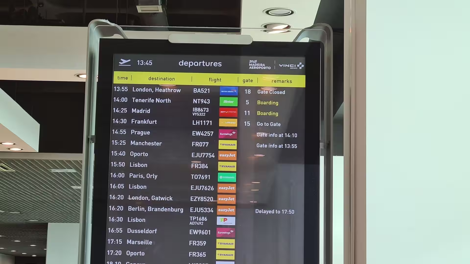
The electronic departure board listing flights to European cities is the airfield’s own weather report. Madeira is a year-round resort whose visitors come principally from Portugal itself and from Britain and Germany, and the airport mostly hosts flights to European metropolitan destinations. That traffic explains its rank as the fourth-busiest airport in Portugal and its capacity, after the terminal and shopping area opened in June 2016, to handle up to 1,400 passengers per hour. The board converts a remote position in the ocean into an ordinary list of familiar city names.
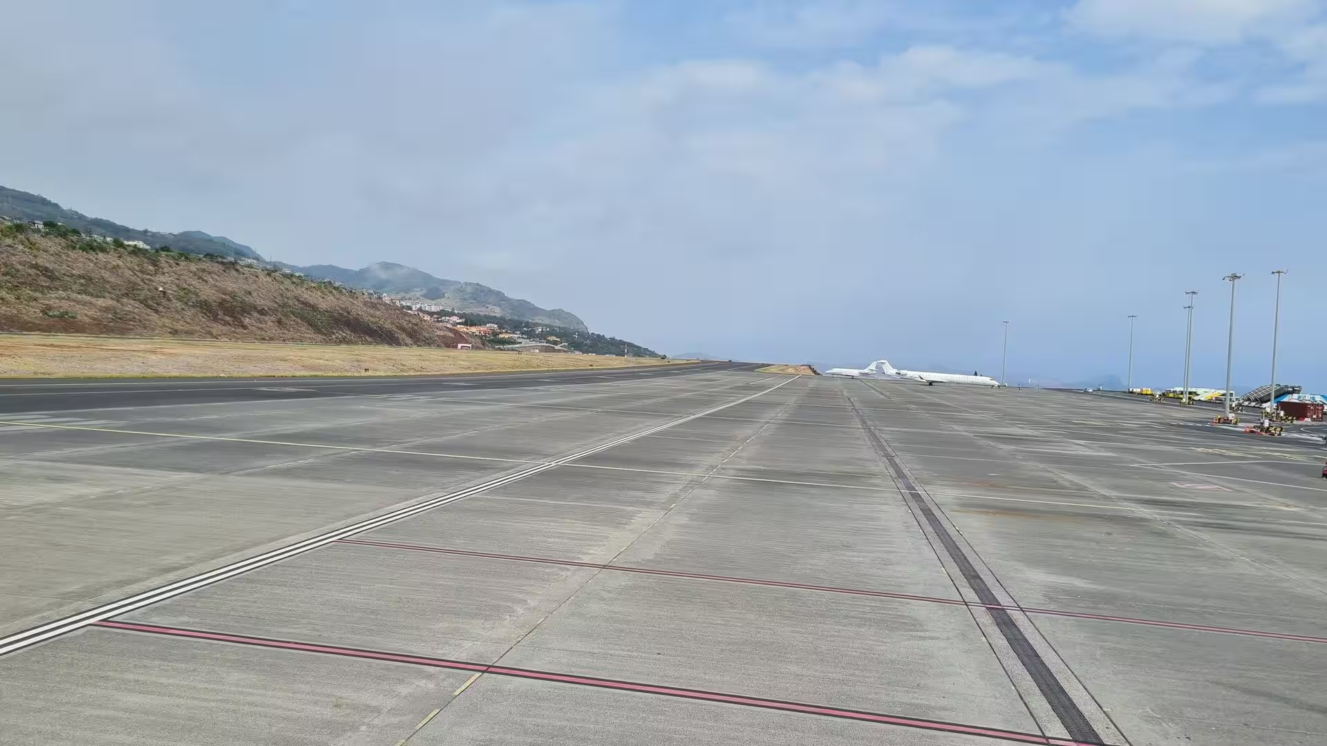
The long concrete apron leading toward the town beneath green mountains is the last view of the island. The runway lies on the water side, partly on a platform supported by 180 reinforced concrete columns, a solution chosen because landfill was not a realistic option on that coast, and the extension was completed on 15 September 2000. The terminal that serves the airfield was inaugurated on 6 October 2002, and to mark the occasion a Boeing 747-200 landed there, a rare event. The engineering solved the absence of flat land, and the aircraft lifts its passengers over the ridge that had blocked the horizon all week.
References
- Wikipedia contributors (2026). Madeira Airport. en.wikipedia.org/wiki/Madeira_Airport
- Wikipedia contributors (2026). Cristiano Ronaldo International Airport. en.wikipedia.org/wiki/Cristiano_Ronaldo_International_Airport
- Wikipedia contributors (2026). Machico. en.wikipedia.org/wiki/Machico
- Wikipedia contributors (2026). Madeira Island. en.wikipedia.org/wiki/Madeira_Island
- Wikipedia contributors (2026). Madeira. en.wikipedia.org/wiki/Madeira
- Wikipedia contributors (2026). Funchal. en.wikipedia.org/wiki/Funchal
- Wikipedia contributors (2026). History of Madeira. en.wikipedia.org/wiki/History_of_Madeira
- Wikipedia contributors (2026). Autonomous Region of Madeira. en.wikipedia.org/wiki/Autonomous_Region_of_Madeira
- Wikipedia contributors (2026). Laurisilva. en.wikipedia.org/wiki/Laurisilva
- Wikipedia contributors (2026). Madeira Nature Reserve. en.wikipedia.org/wiki/Madeira_Nature_Reserve
- Wikipedia contributors (2026). Macaronesia. en.wikipedia.org/wiki/Macaronesia
- Wikipedia contributors (2026). Caniçal. en.wikipedia.org/wiki/Cani%C3%A7al
- Wikipedia contributors (2026). 2010 Madeira floods and mudslides. en.wikipedia.org/wiki/2010_Madeira_floods_and_mudslides
- Branco (2005). A Safety Barrier for Aircraft Accidents: The Madeira Island Airport New Runway. IABSE Symposium, Lisbon 2005: Structures and Extreme Events. 38-44. doi.org/10.2749/222137805796270694
- Ferraz, Martins (2024). Rehabilitation of the VR1 Support Structure, at the Madeira Airport Runway. Lecture Notes in Civil Engineering. 567-574. doi.org/10.1007/978-3-031-80724-4_69
- Ramalho, Winckler, Madeira, Helffrich (2015). Hazard potential of volcanic flank collapses raised by new megatsunami evidence. Science Advances. 1. doi.org/10.1126/sciadv.1500456
- (2019). Laurisilva of Madeira, Portugal. Dictionary of Geotourism. 339-339. doi.org/10.1007/978-981-13-2538-0_1368