Day 7 - Anamur to Antalya
22 July 2023














Journal Notes
General
Anamur, the westernmost district of Mersin Province, lies on a small coastal plain where the western Taurus Mountains finally release the shore after their long run from the east. The cape south of the town, Cape Anamur, is the southernmost point of Anatolia, and the open Mediterranean here is little more than sixty kilometres from Cyprus. From Anamur the coastal highway, the D400, runs west for roughly 260 kilometres to Antalya at the head of the Gulf of Antalya, first beneath the cliffs and headlands of the Taurus and then across the low, fertile plain of Pamphylia.
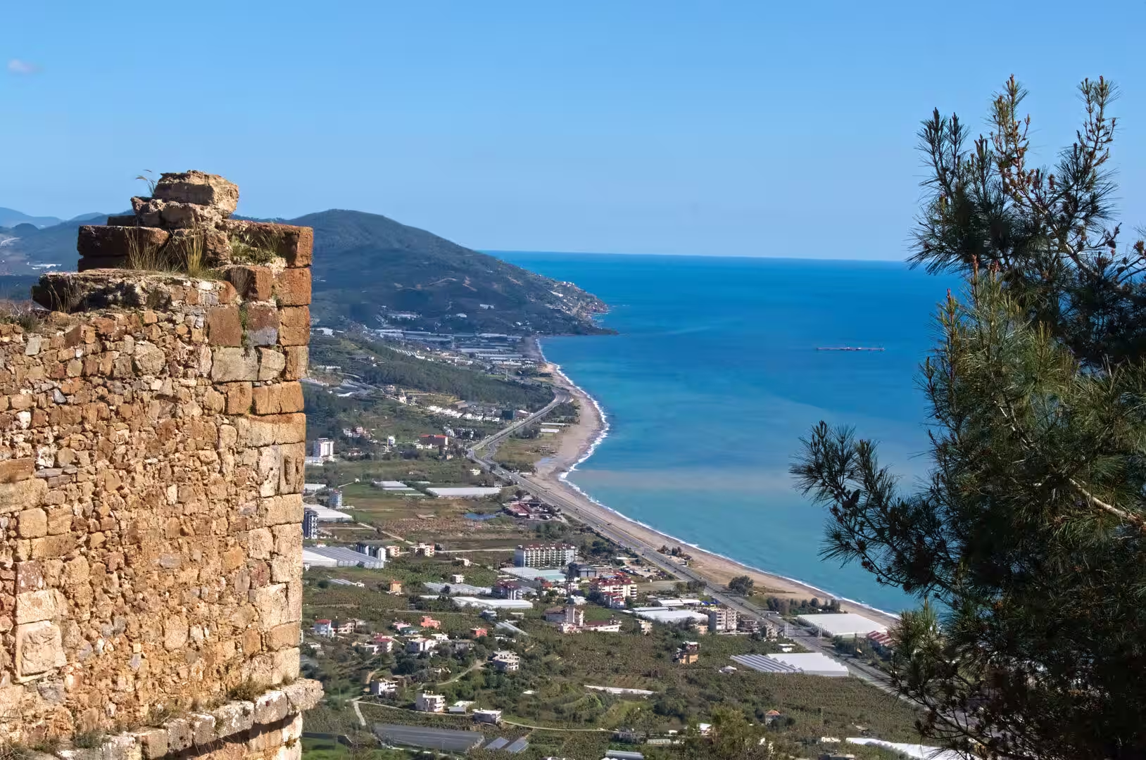
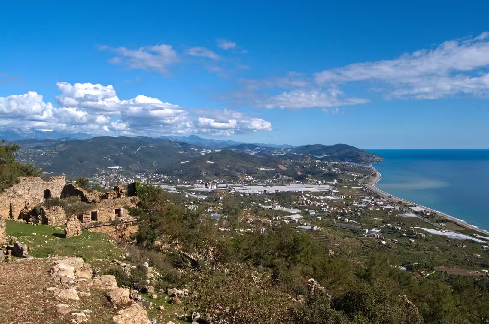
For its first half the road threads a coast of rocky capes, shingle coves and terraced hillsides, passing the district of Gazipaşa before it reaches Alanya, the largest resort town between Anamur and Antalya. At Alanya the mountains step back, and the highway continues across the Pamphylian plain, over the delta of the Manavgat River, through greenhouse country and along the long beaches that line the shore almost to the city. In ancient geography the mountain coast around Anamur formed part of Rough Cilicia, while the low plain from Alanya westward was Pamphylia, a division still written into the landscape: the plain is the traditional land of ancient city-states, while the modern coast itself is a chain of holiday towns.
Administratively the coast falls into two provinces. Anamur is the south-western corner of Mersin Province; everything from Gazipaşa westward belongs to Antalya Province, whose capital, Antalya, is the largest city on the Turkish Mediterranean coast and the centre of the region marketed as the Turkish Riviera. The province counted about 2.7 million inhabitants in 2022, the urban population of the city itself roughly 1.5 million. Antalya has grown from a quiet port into the country’s principal destination for international tourism, served by one of Turkey’s busiest airports and by the coastal highway from the east.
The climate is Mediterranean: hot, dry summers and mild, rainy winters, during which snow often lies on the Taurus peaks. The long growing season sustains the banana groves of Anamur, the only part of Turkey that supports commercial banana cultivation, citrus orchards, and the greenhouses that cover much of the plain, while the beaches and ruins between Alanya and Antalya draw visitors throughout the year.
History
Human occupation of this coast reaches far back beyond written record. At Karain Cave, 27 kilometres north-west of Antalya in the Taurus foothills, excavations have uncovered deposits that record habitation through much of the Palaeolithic and into later periods, among the longest sequences known in Anatolia. In the Bronze and Iron Ages the coast lay within the sphere of the Hittites and their successors, and the castle rock at Korakesion, as Alanya was then called, was probably already occupied. Greek tradition, reported by Herodotus and Strabo, held that the Pamphylians of the plain descended from Greeks who had fought at Troy and sailed east with the seers Calchas and Amphilochus, mingling with the older peoples of the coast. In the fourth century BC the periplus of Pseudo-Scylax listed Korakesion and Anemurium among the places of this shore, and after the campaigns of Alexander the Great the rock of Korakesion was fortified for the first time, while the coast passed in turn through the hands of the Ptolemies and the Seleucids.
In the second century BC the Attalid kings of Pergamon extended their power along the Pamphylian coast, and about 150 BC Attalus II founded the city of Attaleia, the future Antalya, naming it for himself and keeping his fleet there. When his nephew Attalus III bequeathed the kingdom to Rome in 133 BC, Attaleia passed with it. The rocky shore between Korakesion and Anemurium, the district the Greeks called Cilicia Tracheia or Rough Cilicia, had meanwhile become the classic refuge of Mediterranean piracy: headlands and sheltered coves too broken for any large city gave the pirates secure havens, and Korakesion served them as a stronghold. The early Roman expeditions of Marcus Antonius the orator and of Publius Servilius Vatia could not root the pirates out, and it fell to Pompey the Great, acting under the Lex Gabinia in 67 BC, to destroy their fleets; the decisive Battle of Korakesion was fought off the town, after which the coast was organised into the Roman province of Pamphylia.
Under the Pax Romana the cities of the region flourished. Attaleia, visited by the emperor Hadrian in AD 130, received the monumental triple gate that still stands in its old quarter. Anemurium minted its own coins, became a bishopric of the province of Isauria and was equipped with theatres, baths and churches, but it was sacked by the Sasanians in 260 and, after a partial recovery, abandoned in the middle of the seventh century when Arab control of Cyprus made the coast unsafe. Attaleia endured as capital of the Byzantine naval Theme of the Cibyrrhaeots and one of the chief harbours between the Aegean and the Levant; the apostles Paul and Barnabas had already put in there in the first century, sailing on from Pamphylia for Antioch as the Acts of the Apostles record.
The Seljuk conquest of Anatolia after the Battle of Manzikert in 1071 changed the coast for good. The Byzantine recovery of the twelfth century, carried through under John II Komnenos, reopened the land route to Attaleia in 1120, but after the Fourth Crusade weakened Constantinople the Seljuk sultan Kaykhusraw I took the city in 1207, giving the sultanate of Rum its first great Mediterranean port, and built its first mosque; a rebellion supported by Latin knights was put down by Kaykaus I in 1216. In 1221 Sultan Alaeddin Kayqubad I captured Korakesion from an Armenian lord, renamed the town Alaiye, today’s Alanya, and made it the winter capital of his realm, crowning the peninsula with a citadel, walls, the octagonal Red Tower and a vaulted shipyard at the harbour.
Seljuk power collapsed after the Mongol victory at Köse Dağ in 1243, and the coast fell to rival Turkish beyliks. Antalya became the capital of the beylik of Teke between 1321 and 1423, with an interval of Cypriot rule from 1361 to 1373, before the Ottomans took the city in 1423. Alanya passed from the Karamanids to the Mamluks of Egypt in 1427 and was annexed to the Ottoman Empire by Gedik Ahmed Pasha in 1471; from 1571 it was administered from Cyprus, and in 1868 it was attached to the province of Antalya, to which it still belongs. The population exchanges that followed the founding of the Turkish Republic in 1923 reshaped the towns of the coast, and from the 1960s tourism transformed Alanya from a quiet market town into one of the largest resorts of the Turkish Riviera.
Geology
The Taurus Mountains, which shadow the whole coast, belong to the great belt of Alpine folds raised where the African and Eurasian plates collide. Their core is Mesozoic limestone, and in the western Taurus the range rises so abruptly from the sea that between Anamur and Alanya its spurs end in rocky headlands sheltering small coves, the classic landscape of Rough Cilicia; broad plains open only at Anamur, at Alanya and on the Pamphylian lowland farther west.
Limestone governs the region’s water. Rainwater dissolves the rock along joints and bedding planes, opening caves, swallow-holes, called düden in Turkish, underground rivers and great spring systems, and the Taurus contains some of the largest caves in Asia. The Manavgat River gathers at about 1,350 metres on the eastern slopes of the western Taurus, where the outflow of several springs, the largest of them the misty Dumanlı source, joins into a single stream; the river is fed underground from lakes north of the mountains on the Anatolian plateau. In antiquity it was called Melas, and Pliny the Elder treated it as the boundary between Pamphylia and Cilicia; today it crosses the plain and reaches the sea through a wide delta, dropping over a low travertine ledge on the way.
Around Antalya the karst has left an even more distinctive surface. The springs that emerge along the mountain front, among them the great spring groups of Kırkgöz and Düdenbaşı, once carried so much dissolved carbonate that they precipitated broad terraces of soft travertine and tufa across the coastal plain, mainly in the Pliocene and early Pleistocene, when the springs were far more vigorous than they are today. Antalya stands on this plateau, whose seaward edge falls in cliffs, the falez, over which the lower Düden waterfall drops straight into the Mediterranean, while the upper falls lie where the stream crosses the terrace rim inland.
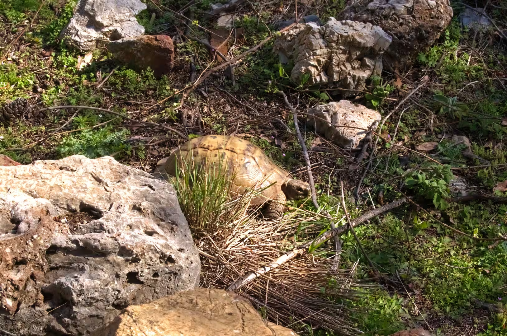
East of Antalya the rocks change character again. The Alanya Massif is a stack of metamorphic nappes, slices of older limestone, marble and schist thrust over one another and locally exposed beneath the younger cover, with bauxite ores worked from its weathered crust. The coastal plains of Anamur and Pamphylia, by contrast, are built of gravels, sands and clays washed down from the mountains, and the shore itself alternates between rock, shingle and long sandy strands such as the beach west of Alanya known as Cleopatra Beach, where scrub and dunes mantle the older deposits. Wherever the rock breaks the surface, low maquis of scrub oak, myrtle and wild olive covers the slopes, and the dry hillsides are home to the land tortoises that wander across the coastal paths. The coast remains tectonically active, the mountains are still rising, and the landscape is young: the rivers, the cliffs and the terraces are all products of processes that continue to shape this shore today.
Things to See
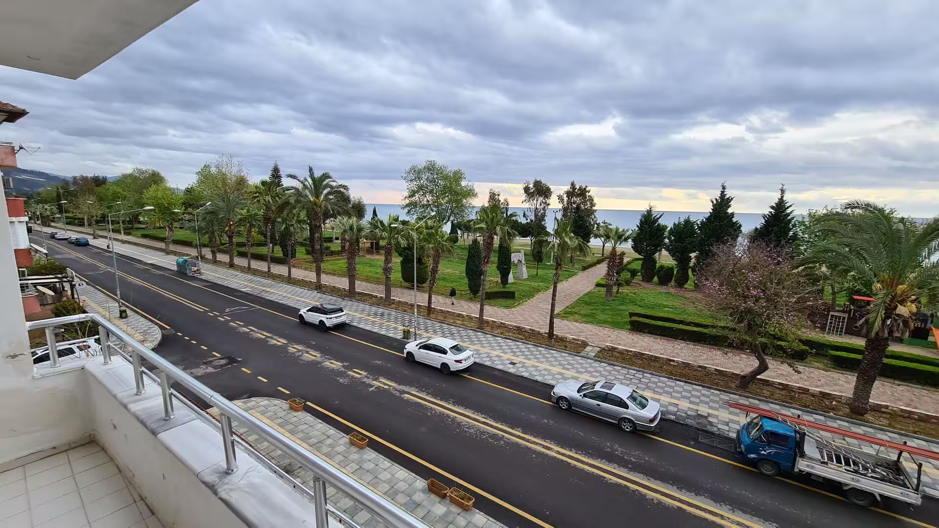
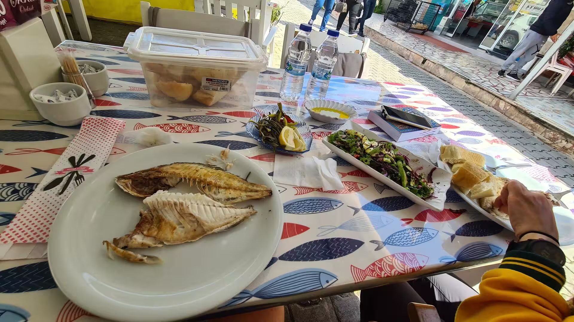
Anamur is a quiet seaside town that lives from its land: banana groves and greenhouses crowd the plain, peanuts and strawberries are grown in the surrounding fields, and the palm-lined seafront boulevard with its long sandy beaches gives the place the air of a modest resort. Cape Anamur, the southernmost point of Anatolia, lies offshore to the south, and simple restaurants along the shore serve grilled fish from the local boats.
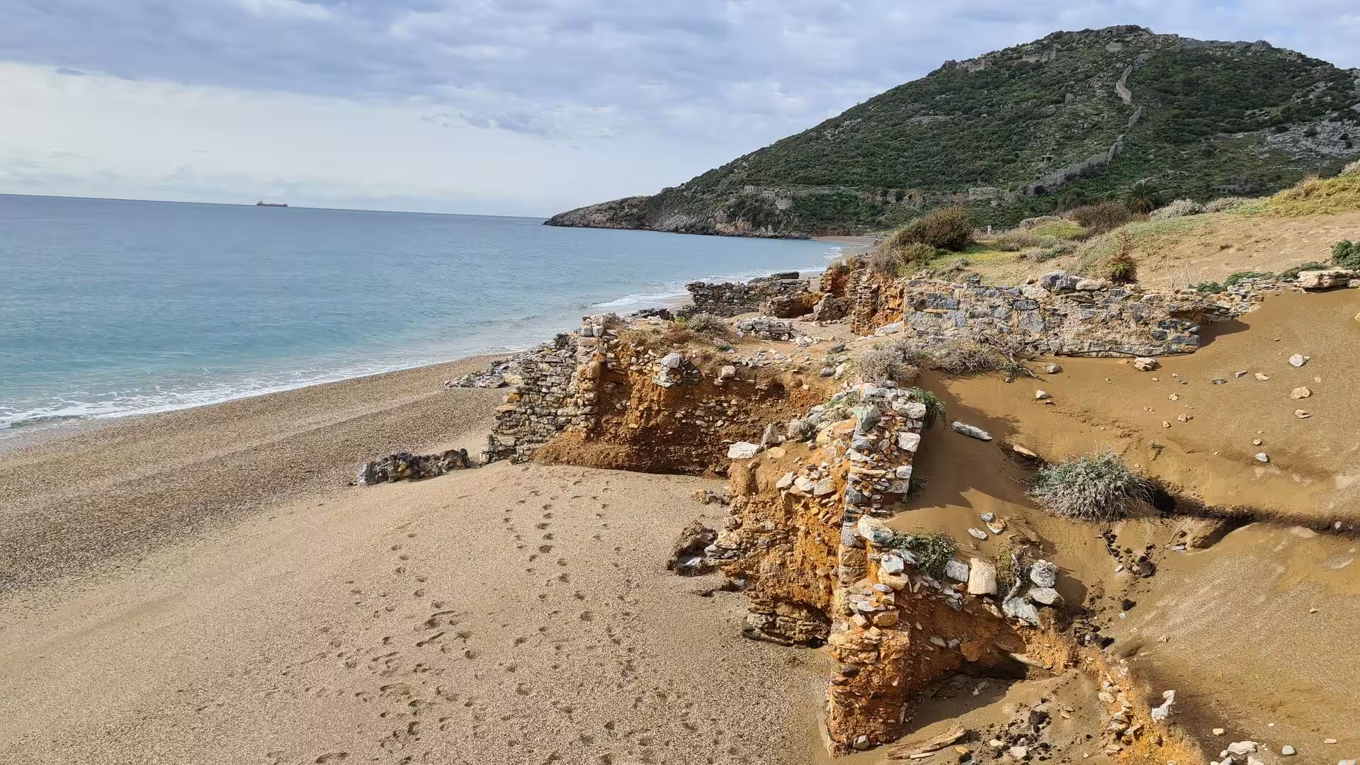
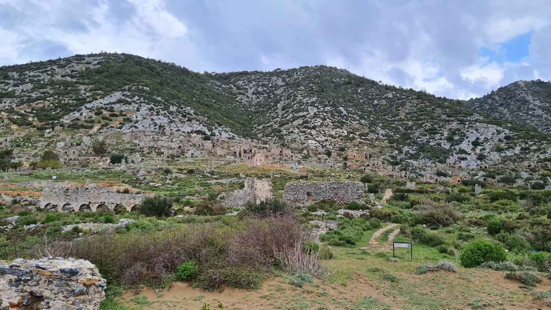
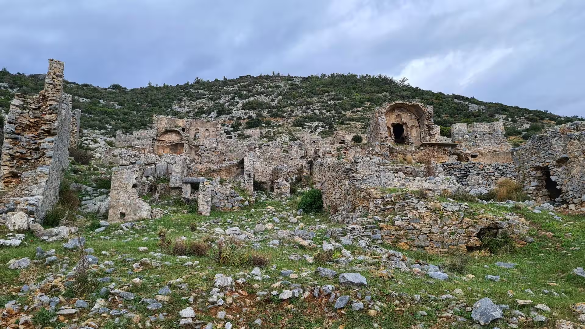
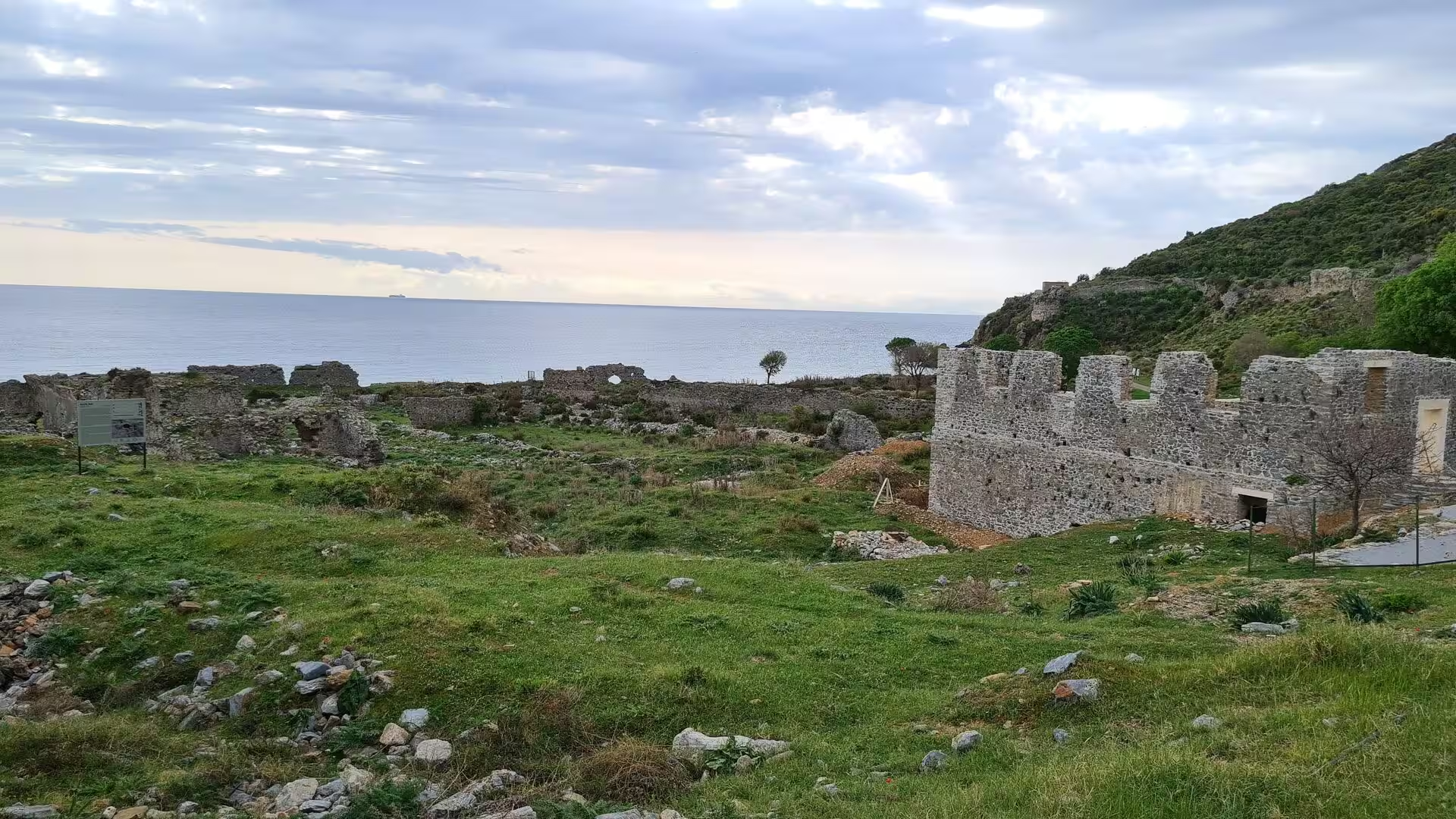
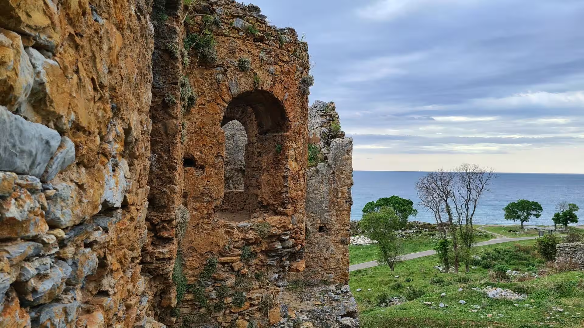
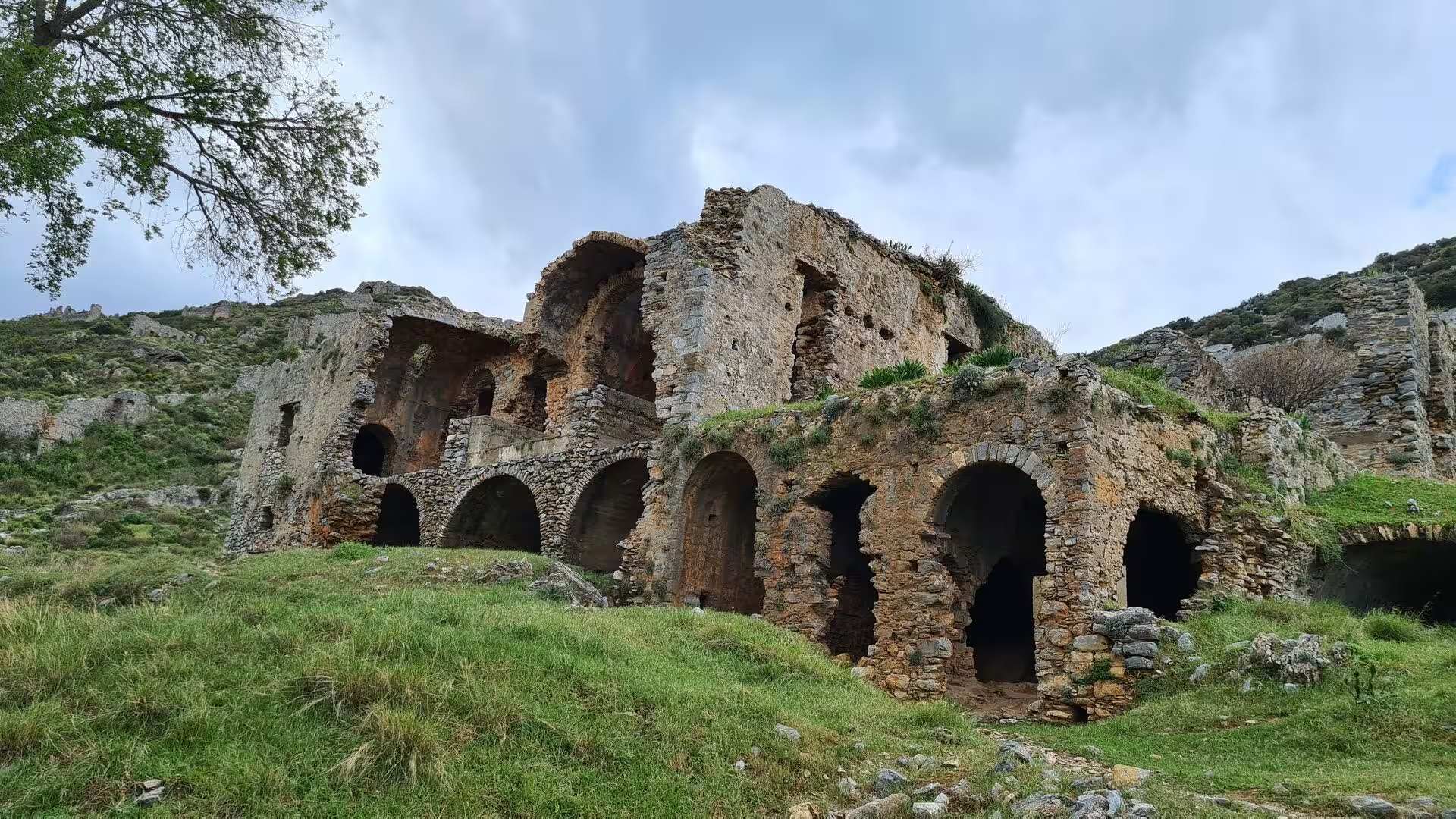
Anemurium, known locally as Eski Anamur, lies on a rocky promontory a few kilometres south-west of the town at the place the Greeks called Anemourion, the windy cape. The ruins are those of a whole Roman and Byzantine city: a large theatre whose upper tiers look out over the sea, a small covered odeion beside it, public baths floored with mosaics, several early Christian churches with geometric mosaic pavements protected behind glass, and the great vaulted, arched halls that dominate the hillside above the shore. A medieval fortification wall with towers crowns the acropolis, an arched gateway opens into the settlement, and the lower town, which stretched a kilometre and a half along the coast, is filled with the shells of roofless stone houses. Outside the walls a necropolis of some 350 tombs lines the approach roads. The city was abandoned in the seventh century; its ruins were surveyed by the naval officer Francis Beaufort in 1811 and 1812 and have been excavated since the 1960s by Canadian teams directed by Elisabeth Alföldi-Rosenbaum and James Russell.
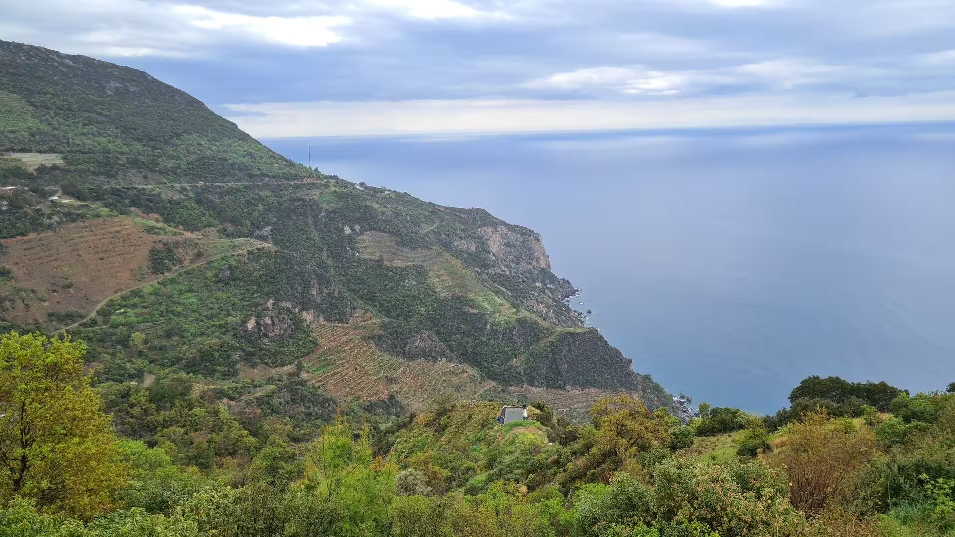
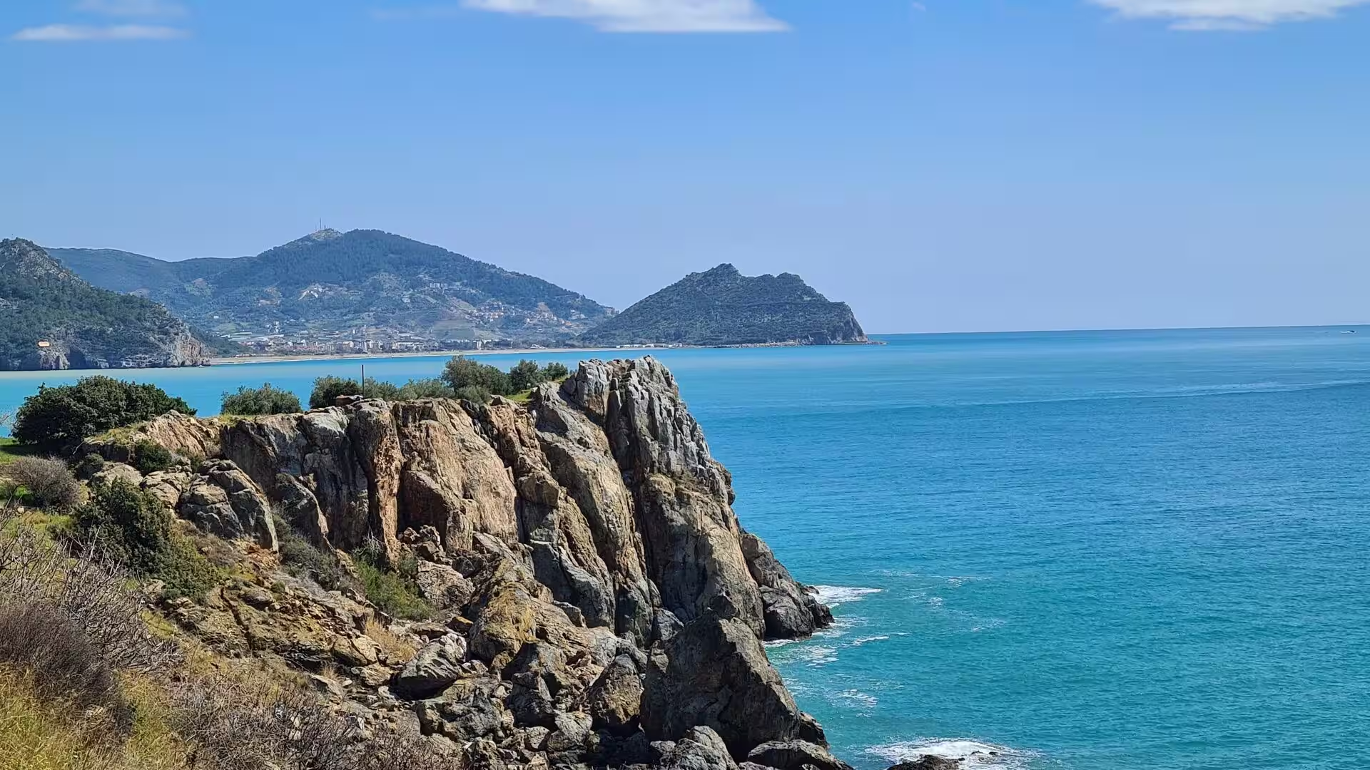
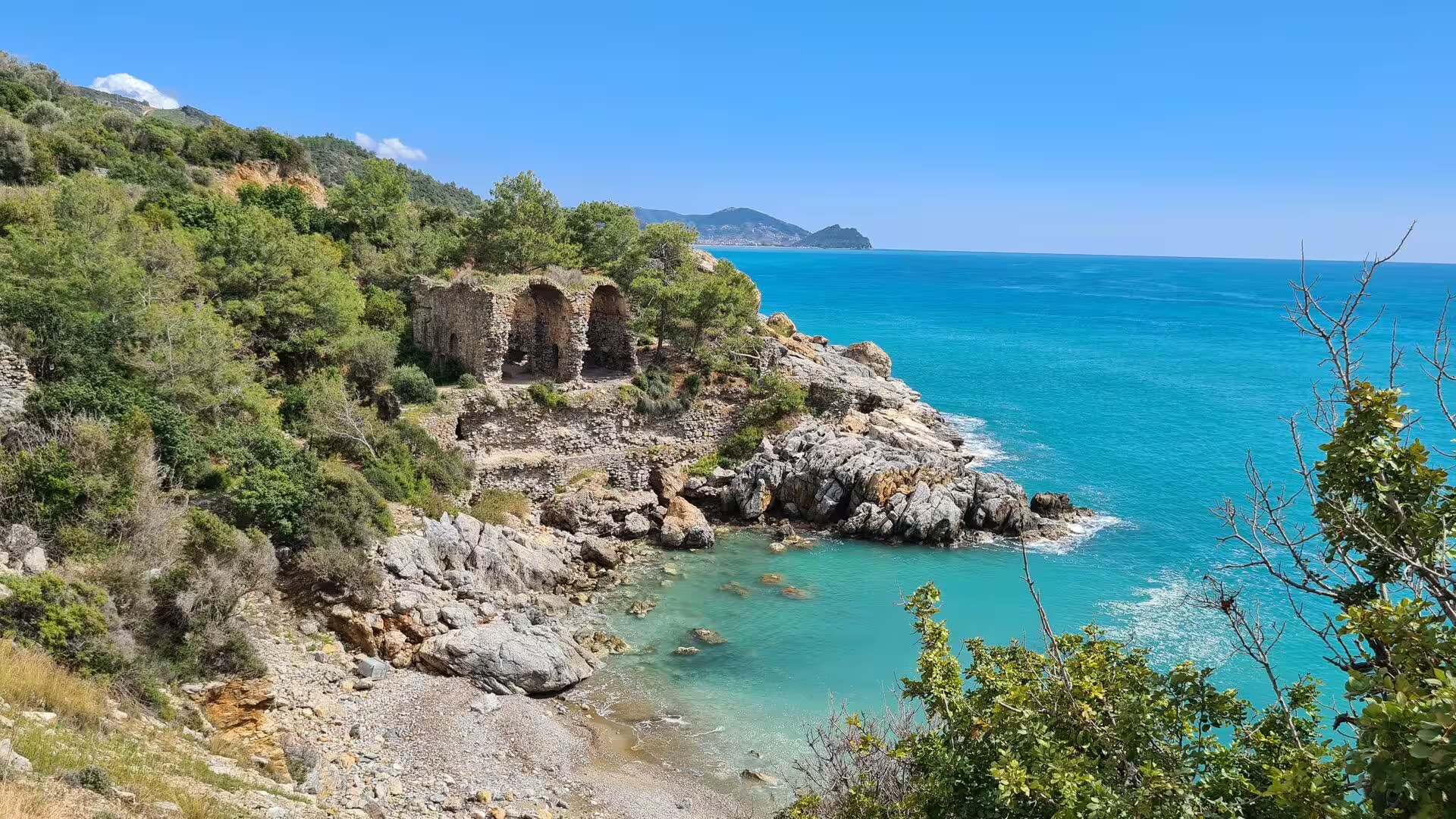
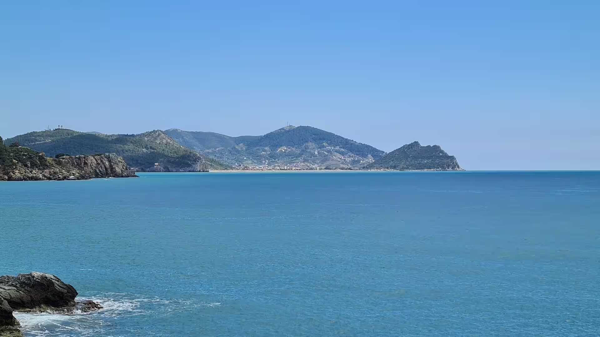
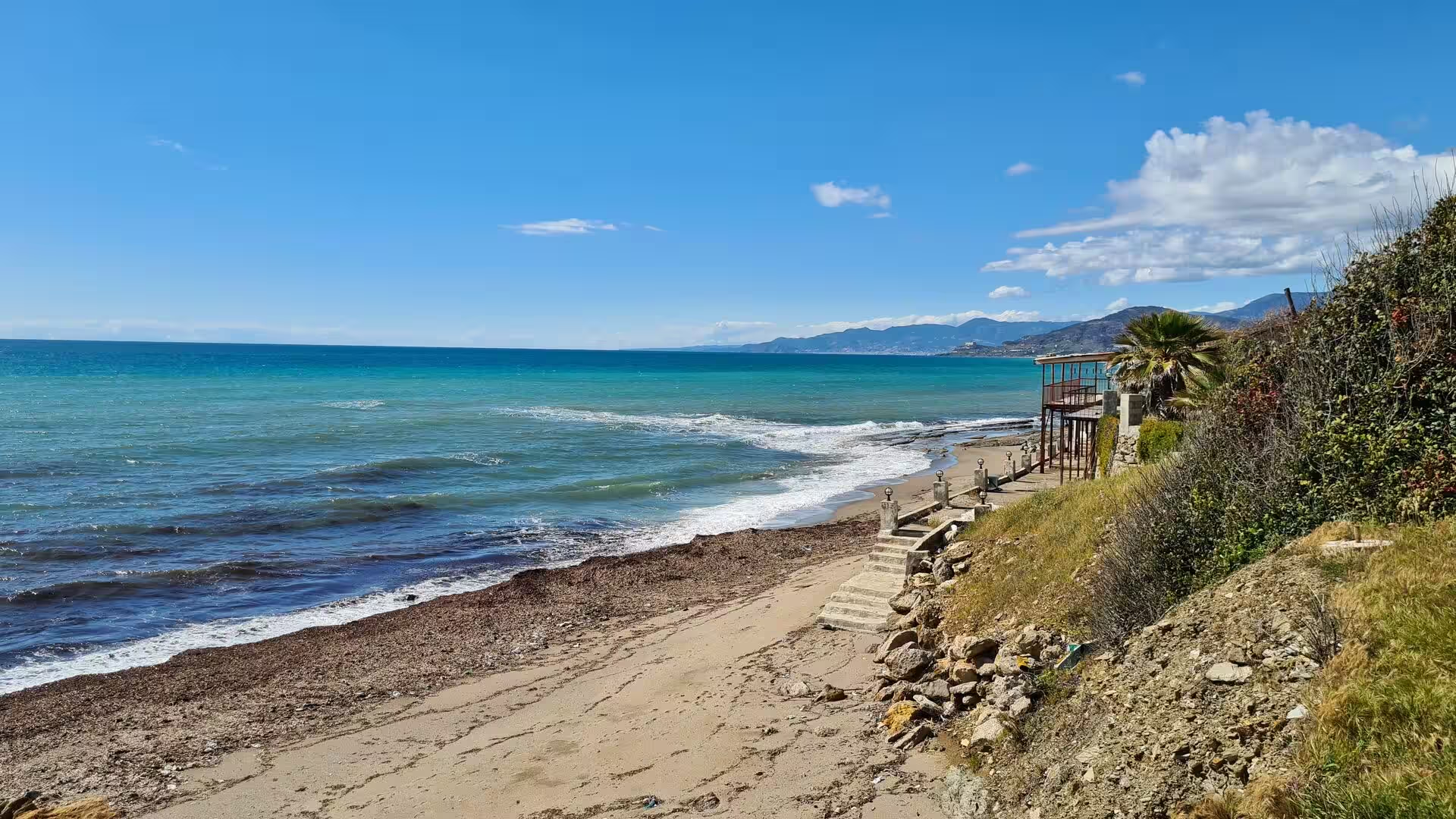
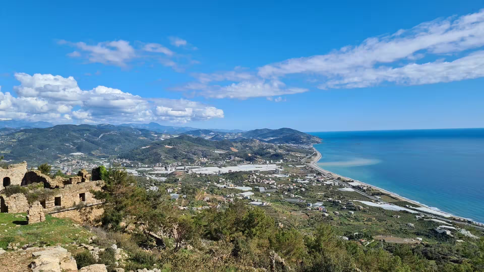
The shore between Anamur and Alanya is itself part of the spectacle. Terraced fields step down steep green hillsides to the water, rocky capes enclose bays of clear turquoise water, and wooden lookout stairways climb the bluffs above pebble beaches. Ruined stone walls and small arched buildings crown many of the headlands, relics of the countless small settlements that once lined this stretch of Rough Cilicia.
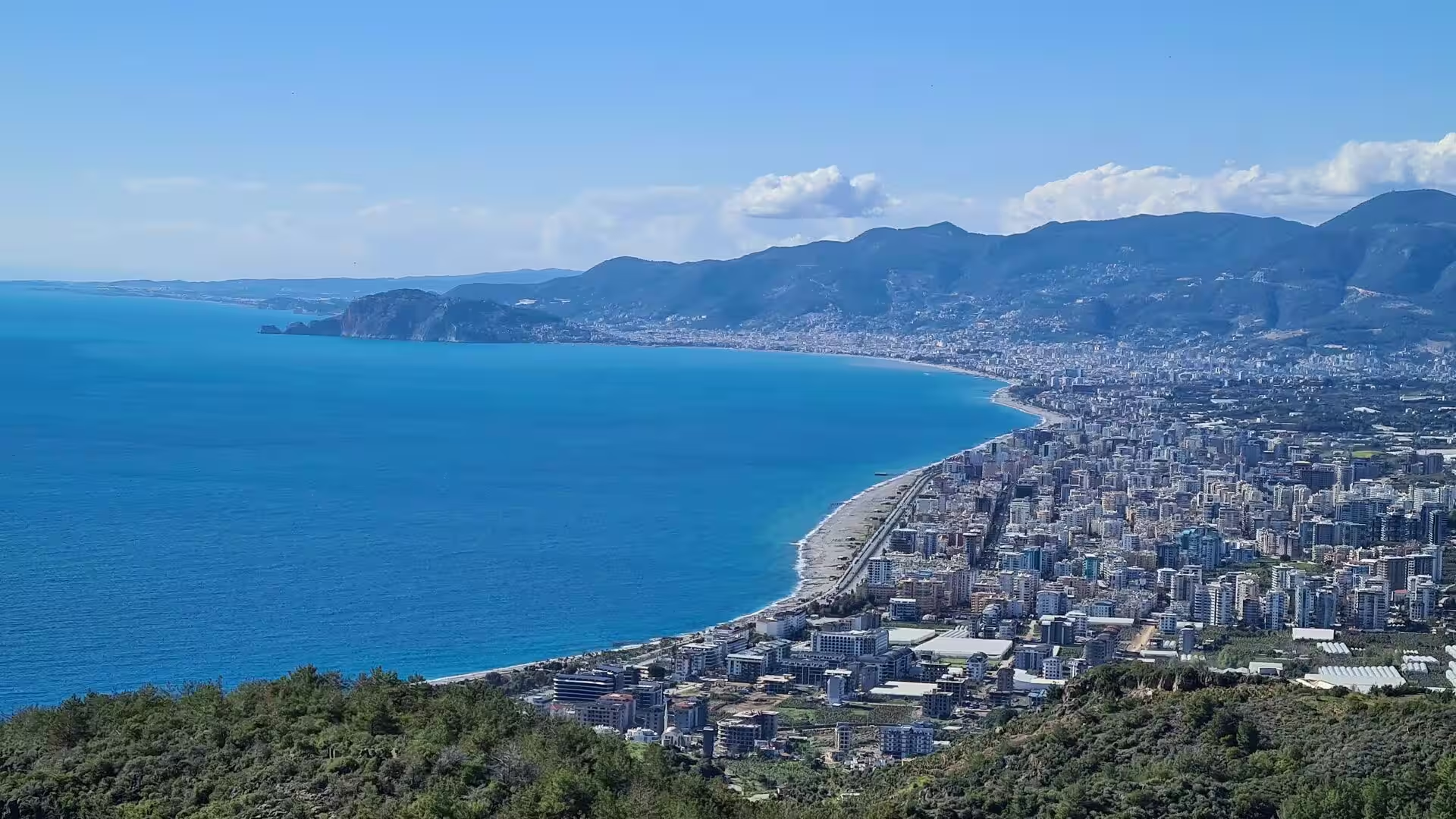
Alanya is built on a peninsula beneath a rock crowned by one of the great fortresses of the Mediterranean. The castle was raised after the Seljuk conquest of 1221 on earlier Roman and Byzantine defences; its circuit of about 6.5 kilometres of wall with 140 towers encloses a citadel, hundreds of cisterns, a small Byzantine church and a quarter of Ottoman timbered villas, and much of the interior now forms an open-air museum. Below the castle the octagonal Kızıl Kule (Red Tower), completed in 1226 to designs of the Aleppan architect Ebu Ali, guards the harbour, and beside it the Tersane, a Seljuk shipyard of five vaulted bays built in the 1220s, survives as the best preserved medieval dockyard of its kind. Damlataş Cave, whose microclimate first drew holidaymakers in the 1960s, opens at the foot of the castle rock. The panorama from the fortress over the town, the curved bay and the long beach below is one of the classic views of the Turkish coast, and the strand west of the peninsula, Cleopatra Beach, is the town’s principal bathing beach. Alanya Castle and the Tersane have stood on the UNESCO Tentative List since 2009, and the resort town below has grown into one of the largest on the southern coast.
Antalya ends the coastal stretch on a grander scale. The walled old quarter, Kaleiçi, crowds the cliffs above the old harbour with narrow streets of Roman, Seljuk and Ottoman buildings; Hadrian’s Gate, erected for the emperor’s visit in AD 130, still stands in the walls, and the fluted minaret of the thirteenth-century Yivli Minare mosque is the symbol of the city. The archaeological museum displays sculpture, sarcophagi and mosaics recovered from the ancient cities of the region, excursion boats leave the old harbour for the coast, and the lower Düden waterfall, where the river drops over the travertine cliffs into the sea, lies a short distance east of the centre. The parks along the seaward cliffs, with the beaches of Konyaaltı and Lara on either side, frame the modern city, whose towers now line the bay.
References
- Alföldi-Rosenbaum, Elisabeth (1967). A Survey of Coastal Cities in Western Cilicia: Preliminary Report. Ankara: Türk Tarih Kurumu.
- Bean, George E. (1968). Turkey’s Southern Shore: An Archaeological Guide. London: Ernest Benn.
- Grainger, John D. (2009). The Cities of Pamphylia. Oxford: Oxbow Books.
- Hoff, Michael C. and Townsend, Rhys F. (2013). Rough Cilicia: New Historical and Archaeological Approaches. Oxford: Oxbow Books.
- Alanya (UNESCO World Heritage Tentative List). whc.unesco.org/en/tentativelists/1405/
- Alanya. en.wikipedia.org/wiki/Alanya
- Alanya Castle. en.wikipedia.org/wiki/Alanya_Castle
- Anamur. en.wikipedia.org/wiki/Anamur
- Anemurium. en.wikipedia.org/wiki/Anemurium
- Antalya. en.wikipedia.org/wiki/Antalya
- Antalya Province. en.wikipedia.org/wiki/Antalya_Province
- Cilicia. en.wikipedia.org/wiki/Cilicia
- Karain Cave. en.wikipedia.org/wiki/Karain_Cave
- Manavgat River. en.wikipedia.org/wiki/Manavgat_River
- Pamphylia. en.wikipedia.org/wiki/Pamphylia
- Taurus Mountains. en.wikipedia.org/wiki/Taurus_Mountains