Stage 1 of 19
Day 1 - Cairo








Journal Notes
General
Cairo is the capital of the Arab Republic of Egypt and the principal city of the Cairo Governorate. The metropolis occupies the east bank of the Nile immediately south of the apex of the Nile Delta, at the point where the river, after crossing the desert of Upper Egypt in a narrow valley, begins to divide into the branches that traverse the low deltaic plain towards the Mediterranean. The site stands at the ancient junction of Upper and Lower Egypt, on the corridor of routes linking North Africa with the Levant, and this position, commanding the river crossing at the head of the Delta, explains the exceptional continuity of settlement in the immediate vicinity, from the Old Kingdom capital of Memphis to the medieval and modern city.
The city proper counts roughly ten million inhabitants; the Greater Cairo agglomeration, which spills across the Nile into the governorates of Giza and Qalyubia, exceeds twenty-two million people and is the largest urban concentration in Africa, in the Arab world and in the Middle East. Cairo was founded in 969 as the palatial capital of the Fatimid Caliphate and was given the name al-Qāhira, “the Vanquisher”, echoing the Arabic name of the planet Mars, which was rising when the walls of the new city were traced. Its historic core, inscribed on the World Heritage List in 1979 as Historic Cairo, preserves one of the densest concentrations of Islamic architecture in existence, and the city is still known as “the city of a thousand minarets”.
The regional climate is the hot desert type (BWh after Köppen), with mild winters, long and hot summers, sparse rainfall confined largely to the winter months and generally very dry air; between March and May the khamsin repeatedly carries Saharan dust over the city, while the summer humidity, conveyed from the Mediterranean, is perceptibly higher than in the desert proper. The narrow irrigated floodplain, densely built over for centuries, contrasts sharply with the bare limestone plateaus that frame the conurbation to east and west.
Cairo remains the political, economic and intellectual centre of Egypt: the seat of government, the headquarters of the Arab League, the home of the oldest university of Egypt, al-Azhar (founded with its mosque in 970-972 and among the oldest in continuous operation anywhere in the world), and of the oldest metro system in Africa, opened in 1987. The city is also the gateway to the great sites of the Memphite region, and its western horizon beyond the Nile is closed by the pyramids of Giza.
History
The ground on which Cairo stands was already ancient when the city was founded. Memphis, the capital of Egypt through the Early Dynastic Period and the Old Kingdom, lay a short distance to the south, at the point where the Nile valley opens into the Delta; its ruins, together with the pyramid fields strung along the western desert edge from Giza to Dahshur, are today inscribed as the World Heritage property “Memphis and its Necropolis”. Heliopolis, one of the great religious centres of ancient Egypt, occupied what are now the north-eastern districts of the metropolis and was sacked by the Persians in the fifth and fourth centuries BC. On the east bank the Romans maintained the fortress of Babylon, raised under the emperor Diocletian at the head of the canal that Trajan had opened towards the Red Sea; around its walls the district of Old Cairo later grew, with its Coptic churches, its museum and the Ben Ezra Synagogue.
The Arab conquest of Egypt in 639-642 brought the foundation of Fustat by the general Amr ibn al-As in 641, a garrison town and new administrative capital built beside Babylon, with the Mosque of Amr, the first mosque of Egypt and of Africa. Fustat remained the seat of government through most of the Umayyad and Abbasid periods, although successive rulers preferred new foundations to the north: al-Askar under the Abbasids from 750, and from 868 al-Qata’i of the Tulunid governor Ahmad ibn Tulun, whose great congregational mosque of 876-879, inspired by the Abbasid architecture of Samarra, survives as the oldest mosque of Egypt still in its original form. When the Tulunids fell in 905, al-Qata’i was razed and the capital returned to Fustat, which under the early Fatimids grew into a populous manufacturing and trading city, famed for its ceramics, glass and textiles.
In 969 the Fatimid general Jawhar al-Siqilli, acting for the Caliph al-Mu’izz, conquered Egypt from Ifriqiya and laid out a new walled city to the north-east of Fustat, initially named al-Mansuriyya, with palaces, barracks and the congregational mosque of al-Azhar (970-972). When al-Mu’izz arrived from Mahdia in 973 he renamed the foundation Qāhirat al-Mu’izz, “the Vanquisher of al-Mu’izz”, whence al-Qāhira (Cairo). For a century the walled city remained a palatial enclave while Fustat continued as the economic capital; under the vizier Badr al-Jamali (1073-1094) the fortifications were rebuilt in stone and the gates of Bab al-Futuh, Bab al-Nasr and Bab Zuweila were erected, all of which still stand. In 1168 the vizier Shawar ordered Fustat to be burned rather than left to the advancing Crusaders, and from that point Cairo itself became the metropolis of Egypt. Saladin enclosed the old and new cities within a single circuit of walls and began the Citadel on a spur of the Mokattam in 1176; under the Mamluks (1250-1517), who after 1261 also hosted the restored Abbasid caliphate, Cairo grew into the largest city of the Arab world and endowed itself with the extraordinary sequence of mosques, madrasas, mausolea and palaces (the ensembles of Qalawun, Sultan Hassan, al-Ghuri and their peers) that still dominate the historic core.
After the Ottoman conquest of 1517, Cairo remained the largest Arab city and a principal commercial hub of the eastern Mediterranean, though its political weight passed to Constantinople. Muhammad Ali (r. 1805-1848) and his successors modernised the administration, the army and the economy, and in the later nineteenth century Khedive Ismail laid out the boulevards, squares and apartment blocks of “Downtown” on ground reclaimed from the former floodplain west of the historic city, in the manner of Haussmann’s Paris. The British occupation (1882-1952), the monarchy and the revolution of 1952 were followed by decades of explosive demographic growth that transformed Cairo into the layered megacity of today; since 2015 a new administrative capital has been under construction on the desert plateau east of the city, an explicit attempt to relieve the pressure on the historic agglomeration.
Geology
Cairo stands on Quaternary alluvium. The floor of the Nile valley at the apex of the Delta is built of unconsolidated silts, clays and sands deposited as the river repeatedly shifted across its floodplain, and the older districts of the city, together with the islands of Gezira, Zamalek and Roda, rest on these young, water-bearing sediments. The historical geography of Cairo is inseparable from this migrating river: the Nile in the vicinity of the city has moved steadily westward, and the ground on which the Fatimid city was laid out in 969 lay under water barely three centuries earlier, when Fustat was founded. New islands appeared within the memory of the medieval city (Geziret al-Fil in 1174, today the district of Shubra, and the island of Zamalek at the turn of the fourteenth century), and only the barrages, levees and dams of the past two centuries finally fixed the river’s course.
The alluvial plain is framed by two plateaus of Middle Eocene limestone: the Giza Plateau on the west bank and the Mokattam Hills on the east, both belonging to the Mokattam Formation, a sequence of nummulitic marine limestones of late Lutetian to Bartonian age (roughly 41-38 million years ago) deposited as a shallow carbonate platform along the southern margin of the Tethys Ocean. The rock consists largely of the disc-shaped tests of Nummulites (giant benthic foraminifera, some reaching the size of coins) set in carbonate mud together with the debris of other shallow-water organisms. In the hills east of Cairo, where the formation is divided into the Building Stone Member and the overlying Giushi Member, it attains a thickness of some 130 m in its type section.
These Eocene limestones are the very material of the Giza monuments. The Great Sphinx was carved directly from the bedrock of the Mokattam Formation, and the pyramids of the plateau were built of nummulitic limestone quarried on the spot. Khufu’s valley temple preserves walls of the same nummulitic stone, while the fine white casing blocks were brought from the Tura quarries on the east bank, a short distance upstream, and ferried across the Nile. The Mokattam Hills likewise supplied stone to the temples and pyramids of ancient Egypt and, through the medieval centuries, to the monuments of Historic Cairo; their scarps remain scored by the galleries of ancient and modern quarrying.
Structurally, north-eastern Egypt lies within the zone of crustal extension that opened the Gulf of Suez, and the Cairo region experiences modest but recurrent seismicity. The most destructive event of modern times was the Dahshur earthquake of 12 October 1992 (magnitude about 5.8, hypocentre 20-25 km deep and roughly 35 km south of the city), which killed more than 500 people, injured over 12,000 and damaged or destroyed some 129,000 buildings across sixteen governorates. Damage in Cairo concentrated in the districts built on alluvium and above all in the historic quarters, where 212 of the 560 registered monuments were affected, their masonry already weakened by rising groundwater and sulphate attack, and loose blocks fell even from the Great Pyramid. The event remains the classic demonstration of site effects in the Egyptian capital: thick, soft, water-saturated alluvium amplifies seismic ground motion far more strongly than the stiff limestone of the plateaus, a contrast that governs both the vulnerability of the old city and the foundations of new construction.
The eastern escarpment also carries part of the human geography of the city. In the quarry caves of the Mokattam, Christian communities have carved churches out of the living rock, among them the great Cave Church of Saint Simon the Tanner, commemorating the legend that the mountain moved for the Coptic pope Abraham and the tanner Simon in the presence of Caliph al-Mu’izz. At the foot of the hills, in Manshiyat Naser, the Zabbaleen (Cairo’s informal waste collectors) process a major share of the metropolis’s refuse against the limestone scarp; the plateau above them is the ground of the city’s newest expansion.
Things to See
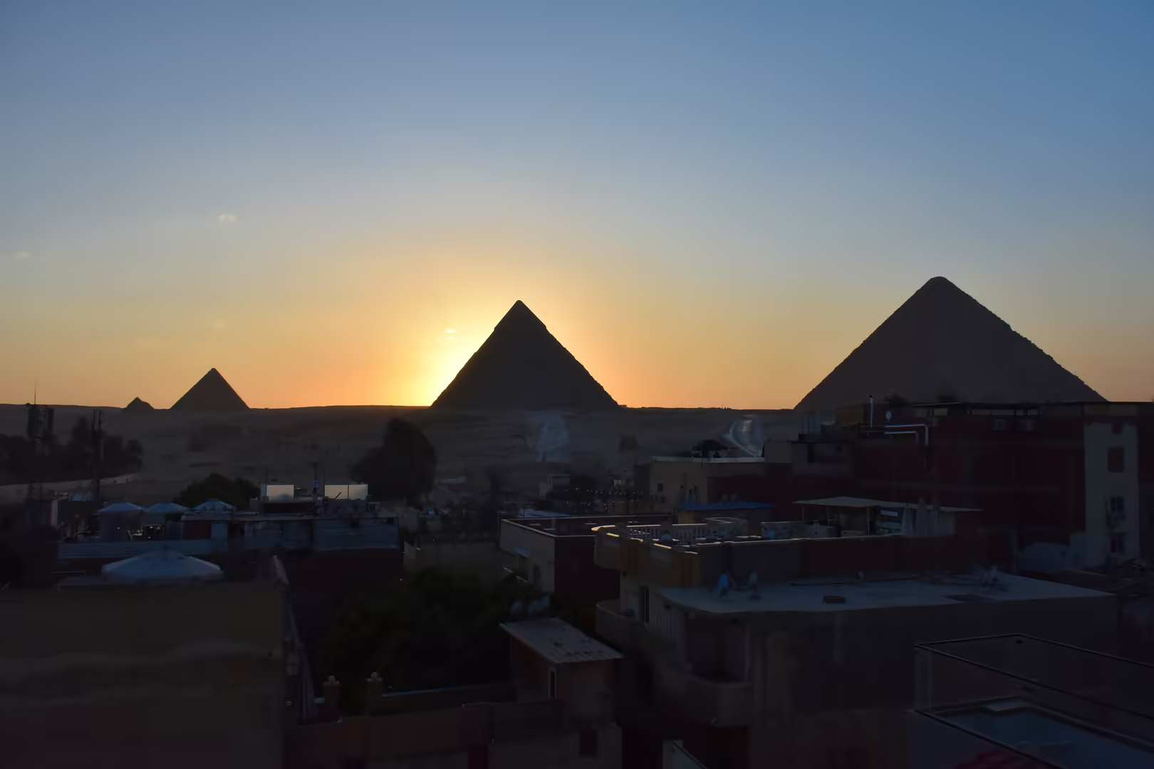
The pyramids of Giza rise at the desert edge of the west bank, immediately beyond the built-up quarters that face the Nile. From the rooftop terraces of the western districts the three monuments close the horizon above the intervening neighbourhoods, seen not from the open desert but across the built city. The complex forms the northernmost group of the Memphite pyramid fields and dates from the Fourth Dynasty of the twenty-sixth century BC. The Great Pyramid of Khufu, originally about 146 m high and assembled from an estimated 5.5 million tonnes of local limestone together with some 8,000 tonnes of granite, remained the tallest structure on earth for more than three and a half millennia; today only its lower courses still carry the fine Tura-limestone casing, the rest stripped for reuse over the centuries. Khafre’s pyramid, slightly smaller, preserves a band of casing near its apex; Menkaure’s is smaller again. To the east stand the Great Sphinx, the oldest known monumental sculpture of Egypt, hewn from the limestone bedrock of the plateau, and the pyramid temples with the boat pits from which the dismantled royal ship of Khufu was recovered, now displayed at the Grand Egyptian Museum.
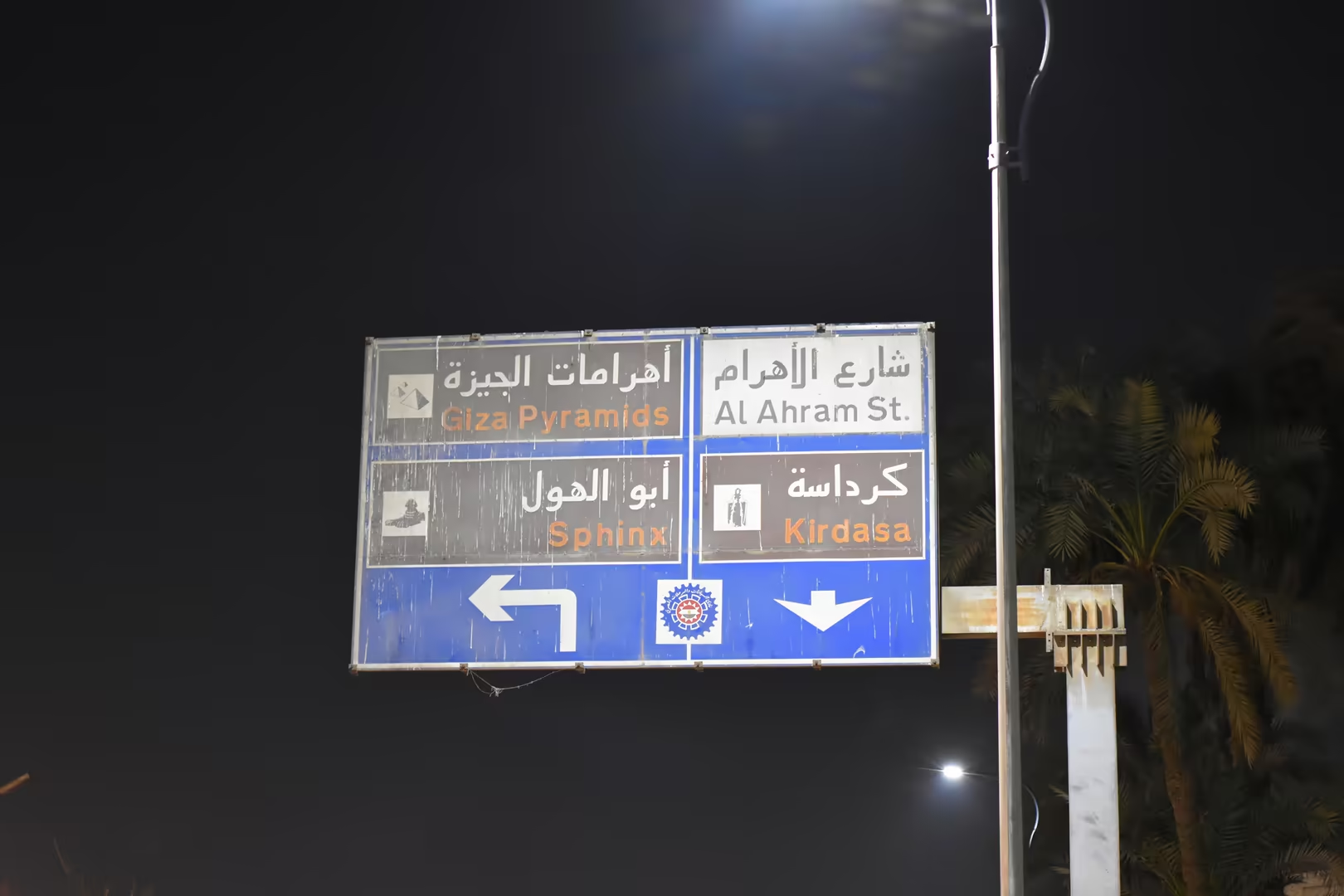
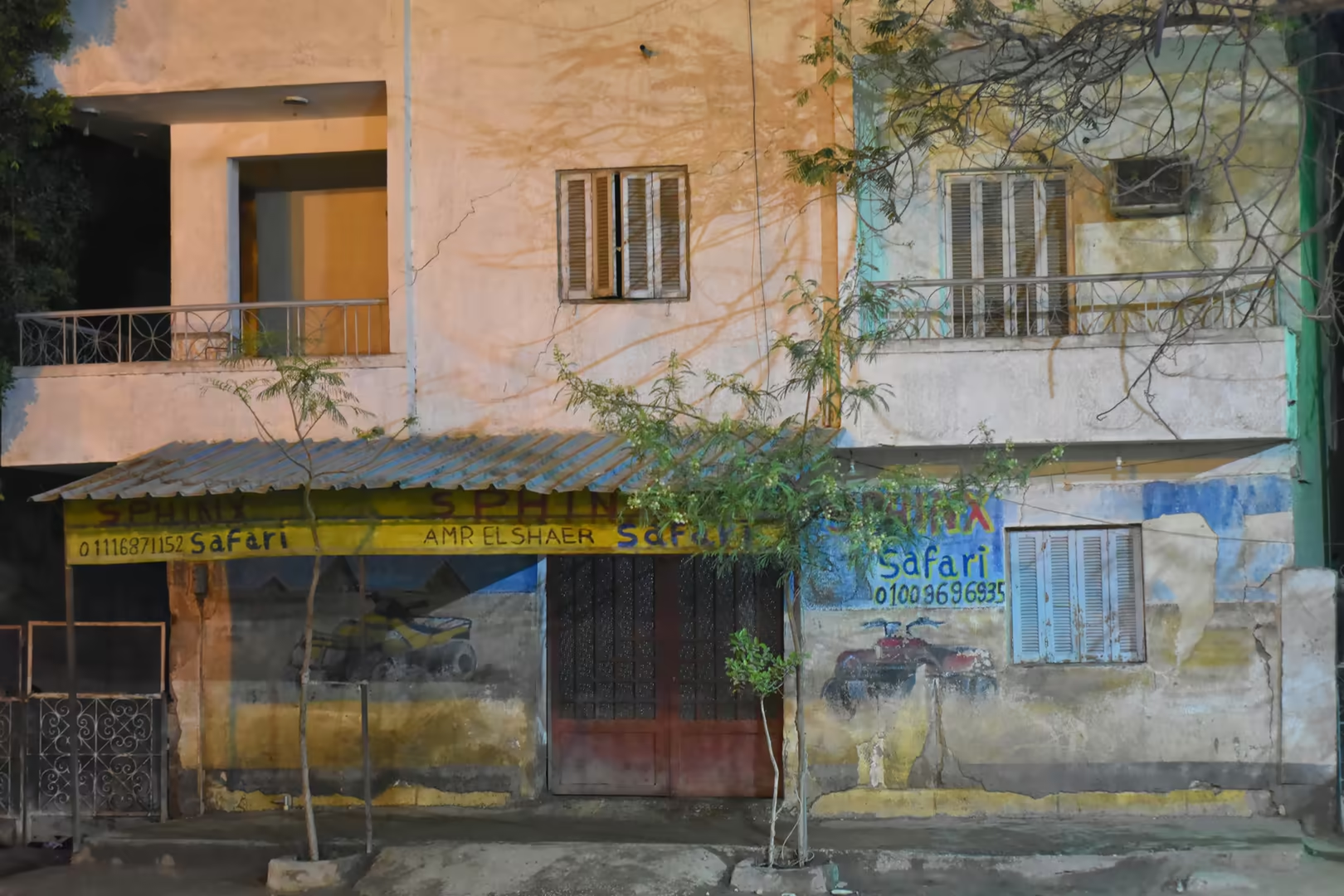
The corridor between the city and the plateau, the Haram road of the Giza district, is itself one of the most animated approaches of Cairo. Ranks of tethered horses and brightly painted, horse-drawn calèches wait along its verges, and their drivers offer carriage rides and riding tours towards the monuments, while the traffic of cars, microbuses and tuk-tuks moves past the stables, restaurants and guesthouses that line the avenue. The pavement commerce of the district is intense: juice stalls hang netted citrus above counters of lemons and metal presses, street kitchens and sandwich counters serve from open fronts, and the shopfronts of papyrus and perfume dealers, emporia of the tourist trade, remain open until late.
Khan el-Khalili, the principal bazaar of the historic city, occupies the district between al-Muizz Street and the mosque of al-Hussein. It originated between 1382 and 1389, when the Mamluk emir Jaharkas al-Khalili built a caravanserai on ground that had served as the burial place of the Fatimid royal family, and the name of the khan now extends to the whole surrounding quarter. The vaulted lanes house the goldsmiths’ souq, which still serves local customers, alongside shops of spices, textiles, lanterns, brassware, papyrus and perfume; the coffeehouse of El-Fishawy, established in 1773, is the most celebrated of the traditional cafés, and the neighbouring mosque of al-Hussein, standing at the edge of the quarter, is one of the most important religious monuments of historic Cairo.
Behind the bazaar rises the walled core of Historic Cairo, inscribed on the World Heritage List in 1979 under criteria (i), (v) and (vi) and covering some 520 hectares of the Fatimid, Ayyubid and Mamluk city. Its principal north-south spine, al-Muizz Street, runs from the northern gates of Bab al-Futuh and Bab al-Nasr to Bab Zuweila in the south, past the mosque and university of al-Azhar, founded in 970-972, and the great Mamluk ensembles of Qalawun, Sultan Hassan and al-Ghuri. West of the walled city, the Mosque of Ibn Tulun of 876-879, the oldest mosque of Egypt still in its original form, stands on the hill of the Tulunid capital al-Qata’i. To the south-east the Citadel, begun by Saladin in 1176 on a spur of the Mokattam, crowns the skyline of the medieval city.
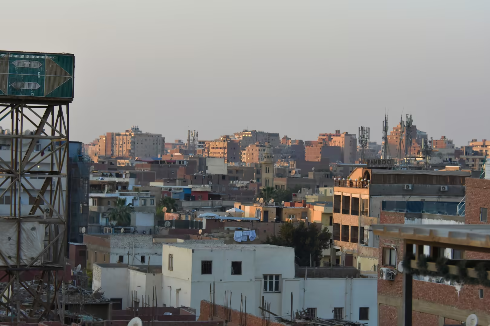
Historic Cairo is a lived-in district rather than an open-air museum. The medieval monuments stand among tenement blocks, workshops and shopfronts, and the lanes behind the great streets retain the dense urban fabric of the old city, brick houses rising directly from the pavement, their balconies and washing lines marking the quarter as an ordinary residential district of the metropolis. At street level the commerce of the quarter continues as it has for centuries, from the goldsmiths and coppersmiths of the bazaar to the juice stalls and street kitchens of the residential lanes.
References
- Abu-Lughod, J. L. (1971). Cairo: 1001 Years of the City Victorious. Princeton, NJ: Princeton University Press.
- Lehner, M. (1997). The Complete Pyramids. London: Thames & Hudson.
- Raymond, A. (2000). Cairo. Translated by W. Wood. Cambridge, MA: Harvard University Press.
- Said, R. (1990). The Geology of Egypt. Rotterdam: A. A. Balkema.
- United States Geological Survey (1993). Reconnaissance report on the 12 October 1992 Dahshur, Egypt, earthquake. Open-File Report 93-181. Reston, VA: USGS. doi.org/10.3133/ofr93181
- UNESCO World Heritage Centre (1979). Historic Cairo. World Heritage List, ref. 89. whc.unesco.org/en/list/89/
- UNESCO World Heritage Centre (1979). Memphis and its Necropolis: the Pyramid Fields from Giza to Dahshur. World Heritage List, ref. 86. whc.unesco.org/en/list/86/
- Wikipedia contributors (2026). Cairo. en.wikipedia.org/wiki/Cairo
- Wikipedia contributors (2026). Fustat. en.wikipedia.org/wiki/Fustat
- Wikipedia contributors (2026). Islamic Cairo. en.wikipedia.org/wiki/Islamic_Cairo
- Wikipedia contributors (2026). Khan el-Khalili. en.wikipedia.org/wiki/Khan_el-Khalili
- Wikipedia contributors (2026). Giza pyramid complex. en.wikipedia.org/wiki/Giza_pyramid_complex
- Wikipedia contributors (2026). Great Pyramid of Giza. en.wikipedia.org/wiki/Great_Pyramid_of_Giza
- Wikipedia contributors (2026). Great Sphinx of Giza. en.wikipedia.org/wiki/Great_Sphinx_of_Giza
- Wikipedia contributors (2026). Mokattam Formation. en.wikipedia.org/wiki/Mokattam_Formation
- Wikipedia contributors (2026). 1992 Cairo earthquake. en.wikipedia.org/wiki/1992_Cairo_earthquake