Day 20 - Suez







Journal Notes
General
Suez lies at the head of the Gulf of Suez, the north-western arm of the Red Sea, where the shore of the Eastern Desert turns northwards into the low, flat tongue of the Isthmus of Suez. The city is the southern terminus of the Suez Canal: the port of Port Tewfik opens directly on to the canal’s southern entrance, and the town itself stretches along the shore of the gulf. Suez is the capital of the Suez Governorate, a province that is effectively coterminous with the city and its desert fringe, and it is the administrative, industrial and maritime centre of Egypt’s principal oil and transit region. Road and railway connect Suez with Cairo, roughly 130 kilometres to the north-west, and with Ismailia and Port Said along the canal.
Most of Suez stands on the African side of the waterway; only the eastern district of El Ganayen extends across the canal into Asia, on the shore of Sinai, so that the city bestrides the conventional boundary between the continents. Its reason for being is maritime. The port complex of Port Tewfik, al-Adabiya and al-Zaytiya, together with the petroleum basins and the fishing harbour, handles general cargo, containers, refined products and the trawler fleet of the gulf; the refineries and the petrochemical, fertiliser and cement works of the shore are among the largest in Egypt, and pipelines carry their products inland to Cairo. The governorate, almost entirely urbanised, had an estimated population of some 788,000 in January 2023, the great majority of it within the city itself.
The setting is severe and handsome. South-west of the city the bare escarpment of Jebel Ataka closes in on the shore; eastwards, across the water and the canal, the plateau of Sinai catches the morning light. The climate is that of the hot deserts (BWh after Köppen): more than 3,300 hours of sunshine a year, rain measured in a few millimetres, and a dust haze that softens the skyline of the gulf. In spring the khamsin, the hot wind of the desert, can raise temperatures abruptly for a day or two.
The interest of Suez is functional and historical rather than monumental. No pharaonic or medieval buildings of the first rank survive in the town; its sights are the works of the nineteenth and twentieth centuries (the canal, the harbour, the industrial shore), set in a landscape of great geological eloquence. The waterfront runs from the bay of the hotel quarter at the head of the gulf, past the port basins, the refineries and the fishing harbour, to the southern margin of the city, where the desert road follows the coast towards the Red Sea proper.
History
Long before the Suez Canal, the isthmus was crossed by water. The pharaonic Canal of the Pharaohs joined the Nile, by way of the Wadi Tumilat and the depression of the Bitter Lakes, to the Red Sea: begun in the Middle Kingdom, attempted by Necho II (610-595 BC) and completed by the Persian king Darius I (522-486 BC), whose granite stelae near Suez, the Suez Inscriptions, record that ships sailed from Egypt to Persia. In antiquity the gulf reached further north than it does today, its head approaching Lake Timsah and the Bitter Lakes, which then communicated with the sea.
At the head of the gulf the Romans maintained the port of Clysma, re-founded by Trajan in the early second century AD in connection with the canal known as the Amnis Traianus, which again linked the Nile to the Red Sea; in late antiquity Clysma was also a celebrated centre of monasticism. After the Arab conquest the port was called al-Kulzum, and the Red Sea itself long bore the name Bahr al-Kulzum, the sea of Clysma. The canal restored by Amr ibn al-As after 641 served the town until Caliph al-Mansur ordered its closure in the eighth century. Modern Suez grew up beside the older site as its successor and had eclipsed the ruined Kolzum by the thirteenth century; the Arabic name as-Suways is traditionally, if uncertainly, derived from a word for liquorice.
Under the Mamluks and the Ottomans, Suez guarded Egypt’s eastern sea. Selman Reis garrisoned the town in 1507 against the Portuguese, whose squadron under Estêvão da Gama raided the roadstead in 1541, and Ottoman galleys based at Suez contested the trade of the Indian Ocean. In the eighteenth century a small annual fleet still sailed from Suez to Jeddah, the port of Mecca and the threshold of the Indian trade, as Carsten Niebuhr recorded. Napoleon’s expedition of 1798 found the town decayed, and fighting in 1800 left it largely in ruins. The French surveyors, seeking a canal, rediscovered the traces of the ancient waterway but concluded from faulty measurements that the Red Sea stood some metres higher than the Mediterranean, a belief that seemed to make a lockless canal impossible and to delay the project for half a century.
The error was corrected only in the 1840s, when the surveys commissioned by the Société d’études du canal de Suez, and above all the levelling of Paul-Adrien Bourdaloue, showed the two seas to stand at essentially the same level. Ferdinand de Lesseps (1805-1894), a French diplomat and friend of the Khedive Sa’id, obtained his first concession in November 1854, and the Compagnie universelle du canal maritime de Suez was constituted in December 1858 with a capital of 200 million francs, of which Egypt subscribed 80 million. Excavation began at Port Said on 25 April 1859 and lasted ten years, employing forced labour until the corvée was abolished in 1864; the death toll is disputed, the estimates ranging from a few thousand to the 120,000 cited by Nasser in 1956. The canal opened on 17 November 1869, the French Empress Eugénie aboard the first vessel; the company had laid out its southern port of Port Tewfik two years earlier, at the entrance where Suez meets the waterway.
The twentieth century made Suez a byword for crisis. The Khedive Isma’il, over-extended by debt, sold Egypt’s 44 per cent holding in the canal to Britain in 1875; Britain occupied Egypt in 1882, and the Convention of Constantinople of 1888 guaranteed free passage in peace and war. On 26 July 1956 President Nasser nationalised the canal company (the word ‘Lesseps’ served as the codeword of the operation), precipitating the Suez Crisis of October and November, when British, French and Israeli forces invaded; the canal, blocked by scuttled ships, stayed shut until the spring of 1957. After the Six-Day War of June 1967 the waterway closed for eight years: Suez was evacuated, shelled through the War of Attrition and largely destroyed in the October War of 1973, when Israeli armour crossed the canal and was repulsed at the city’s edge in the Battle of Suez. The canal reopened on 5 June 1975 and the city was rebuilt; the New Suez Canal of 2014-15 added a 35-kilometre parallel channel and deepened a further 37 kilometres of the old waterway, and in March 2021 the container ship Ever Given ran aground in the single-lane reach south of the city, interrupting world trade for six days.
Geology
Suez stands at the southern end of the Isthmus of Suez, the roughly 125-kilometre-wide land bridge between the Mediterranean and the Red Sea that forms the conventional boundary of Africa and Asia. The ground beneath the city is young: the coastal plain of the gulf head is built of Quaternary sands, gravels and evaporitic flats, the sabkhas of the desert shore, resting on the older folded and faulted sedimentary series of the region. The sea once reached considerably further north, and the depressions of Lake Timsah and the Bitter Lakes, which now interrupt the course of the canal, are relics of that wider gulf; the present shoreline at Suez is the head of a rift-formed basin, not an ancient coast.
That basin is the Gulf of Suez, the north-western arm of the Red Sea rift system, created as the Arabian plate rotated anticlockwise away from Africa. Continental rifting began in the Late Oligocene, some 26 to 28 million years ago, and continued through the Miocene, forming a segmented valley of tilted fault blocks and half-grabens separated by accommodation zones; extension then shifted to the Red Sea spreading axis and the Dead Sea transform, and by about five million years ago rifting in the gulf had ceased. The flooded remnant of that rift is the gulf itself: roughly 300 kilometres long, between 20 and 30 kilometres wide, and on average about 40 metres deep. The escarpments that frame the city (Jebel Ataka to the west, Sinai to the east) are the uplifted shoulders of the rift, and the faults at their feet are the structures along which it opened.
The rift fill records the history of the basin and its wealth. Precambrian basement of the Arabian-Nubian Shield is overlain by Palaeozoic and Mesozoic sediments, among them the sandstones known as the Nubian series, which form the principal reservoir, and the chalky Sudr Formation of the Cretaceous, whose Brown Limestone member is the chief source rock of the region’s petroleum. The syn-rift Miocene sequence passes from marine clastics into thick evaporites (the salts and anhydrites that accumulated as the basin became restricted), and the post-rift Pliocene and Recent deposits reach two kilometres in thickness towards the south. More than 120 hydrocarbon fields have been discovered in the rift since the early finds of the late nineteenth century: the Gemsa field was known by 1869, although it did not produce until 1910; Belayim followed in 1955 and El Morgan in 1964. The oil and gas of the Gulf of Suez remain Egypt’s principal indigenous petroleum province, hence the refineries and storage tanks that line the shore of the city.
The canal itself is a geotechnical work of great simplicity and constant difficulty. Because the two seas stand at essentially the same level and the isthmus is almost flat, the waterway needs no locks: sea water flows freely through it, the current north of the Bitter Lakes setting northwards in winter and southwards in summer, while south of the lakes the stream follows the tide at Suez. The channel crosses the plain by way of the depressions of Lake Timsah and the Bitter Lakes, which lay partly below sea level and flooded as the waterway was opened; its banks are of sand and silt that drift continually, so that dredging is a permanent industry of the canal. The expansion of 2014-15 excavated 35 kilometres of new parallel channel and deepened 37 kilometres of the old, and the southern approach, where the waterway meets the gulf at Suez, remains the reach most exposed to silt and shallow water.
Things to See
The bay of Suez lies at the head of the Gulf of Suez, the northernmost reach of the Red Sea, and the town presents itself to the water along a corniche lined with the modern hotels of its seaside quarter. The landmark of the bay is a hotel in the form of a stepped pyramid, its white tiers rising above the rooftops, and the view from the shore crosses the shallow, clear water to the first high ground of Sinai on the far side of the gulf. Behind the corniche rise the blocks of the town and the chimneys of its industry, for the bay is the threshold of the waterway for which the city exists.
At Suez the Suez Canal meets the sea. The waterway, an artificial sea-level channel of 193.3 kilometres without locks, was opened on 17 November 1869, and its southern entrance at Port Tewfik, laid out by the canal company in 1867, opens directly on to the town. The daily traffic of the canal passes within sight of the city: three convoys, two southbound and one northbound, make the passage in 11 to 16 hours, and since the New Suez Canal of 2014-15 added a 35-kilometre parallel channel, vessels can pass in both directions at once. Beside the entrance the deep-water quays of the port work beneath the gantry cranes of the container terminal, where the cargo of Asia and Europe is handled.
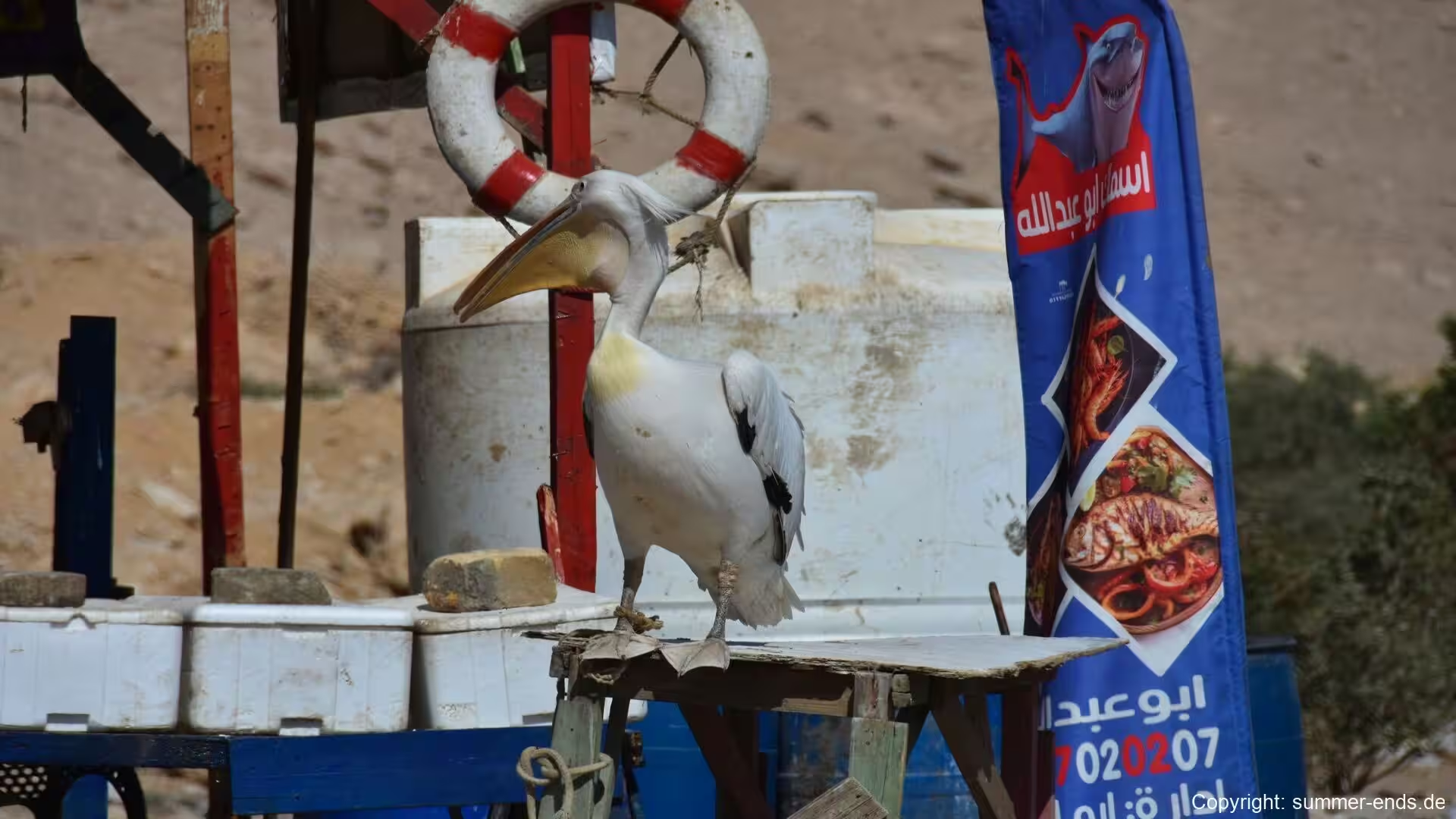
The fishing harbour of Suez lies between the port and the industrial shore, its basins sheltering the trawler fleet that works the fishing grounds of the gulf. Along the quays the gear of the fishery lies stacked beside the boats, nets and floats beneath painted signboards in Arabic, and the catch of the gulf is landed and marketed here for the town. The harbour is a working place, crowded and purposeful, and it shows the sea-borne life on which the city was built at close hand.
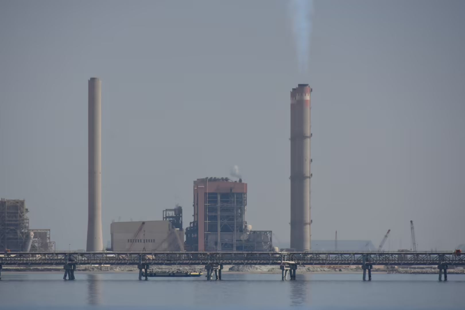
The industrial shore of Suez, immediately south of the centre, is the great working face of the city. Along the water’s edge stand the refineries, the tank farms and the petrochemical and fertiliser works that are among the largest in Egypt; they process the crude oil of the Gulf of Suez, the country’s principal indigenous petroleum province, and pipelines carry the refined products inland to Cairo. A seaside power station raises twin chimneys among the storage tanks, and flare stacks and cooling towers line the quays. Behind the installations the bare escarpment of the Eastern Desert rises within a stone’s throw of the water.
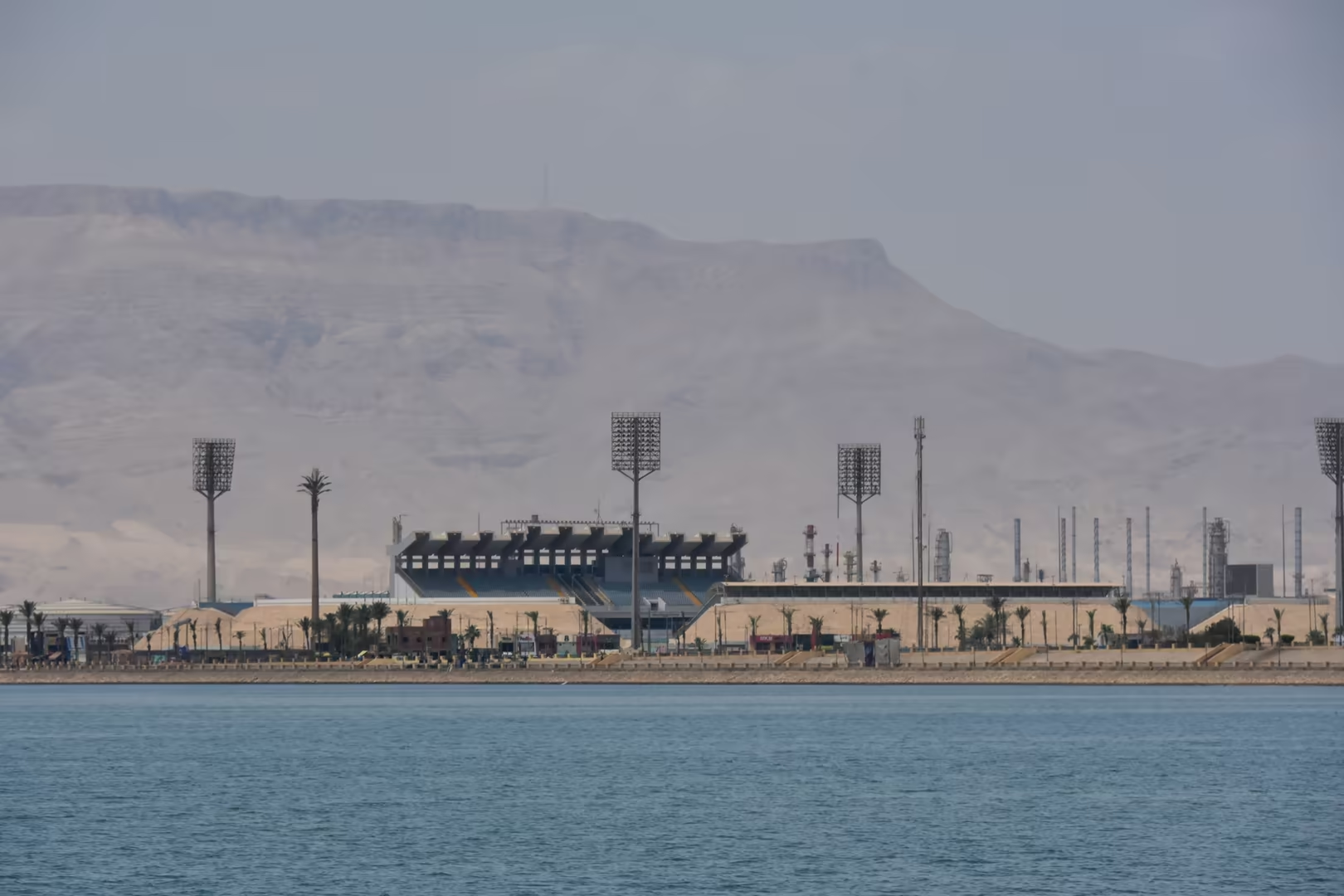
Modern Suez is a city rebuilt, and its townscape is correspondingly young. The town was evacuated during the war of 1967 and largely destroyed in the October War of 1973, and whole districts date from the reconstruction that followed the reopening of the canal in 1975. The housing of those years, tall concrete blocks dense with balconies and satellite dishes, stands over the streets of the centre. The municipal stadium rises close to the water, its floodlight masts above the shore, and in the inner harbour, behind the shelter of a breakwater, coasters and workboats lie moored along the industrial waterfront.
South of the town the built-up shore gives way to the desert. The coast road runs on towards the Red Sea proper between the escarpment of Jebel Ataka and the gulf, past the last works of the city, whose tall chimney stands beside shallow water of a striking turquoise colour. High-voltage transmission towers follow the corridor southwards, stepping across the plain between road and hills, and beyond them the desert closes in upon the margin of the town.
References
- Farnie, D. A. (1969). East and West of Suez: The Suez Canal in History, 1854-1956. Oxford: Clarendon Press.
- Karabell, Z. (2003). Parting the Desert: The Creation of the Suez Canal. New York: Alfred A. Knopf.
- Kyle, K. (1991). Suez: Britain’s End of Empire in the Middle East. London: Weidenfeld & Nicolson.
- Said, R. (1990). The Geology of Egypt. Rotterdam: A. A. Balkema.
- Suez Canal Authority (2026). Official website. www.suezcanal.gov.eg/English/Pages/default.aspx
- Wikipedia contributors (2026). Suez. en.wikipedia.org/wiki/Suez
- Wikipedia contributors (2026). Suez Canal. en.wikipedia.org/wiki/Suez_Canal
- Wikipedia contributors (2026). Gulf of Suez. en.wikipedia.org/wiki/Gulf_of_Suez
- Wikipedia contributors (2026). Gulf of Suez Rift. en.wikipedia.org/wiki/Gulf_of_Suez_Rift
- Wikipedia contributors (2026). Red Sea Rift. en.wikipedia.org/wiki/Red_Sea_Rift
- Wikipedia contributors (2026). Isthmus of Suez. en.wikipedia.org/wiki/Isthmus_of_Suez
- Wikipedia contributors (2026). Suez Crisis. en.wikipedia.org/wiki/Suez_Crisis
- Wikipedia contributors (2026). Suez Canal Area Development Project. en.wikipedia.org/wiki/Suez_Canal_Area_Development_Project
- Wikipedia contributors (2026). Clysma. en.wikipedia.org/wiki/Clysma
- Wikipedia contributors (2026). Ferdinand de Lesseps. en.wikipedia.org/wiki/Ferdinand_de_Lesseps
- Wikipedia contributors (2026). Suez Governorate. en.wikipedia.org/wiki/Suez_Governorate