Day 19 - Red Sea




Journal Notes
General
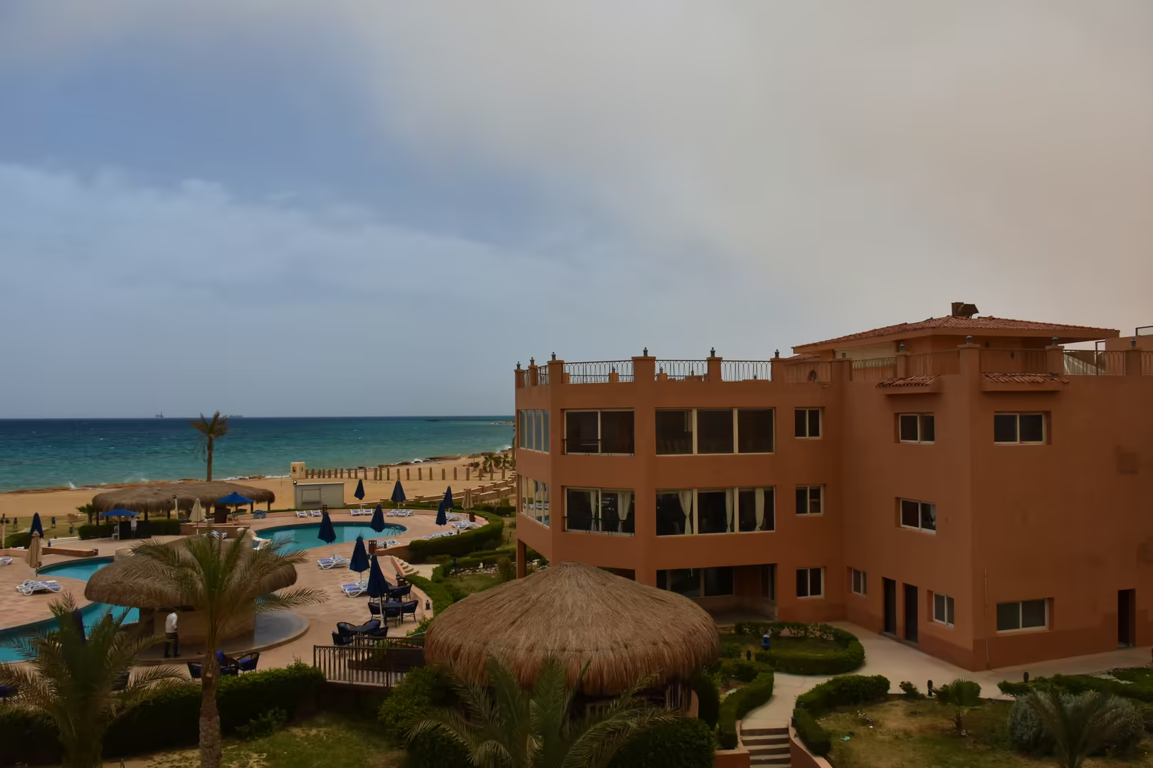
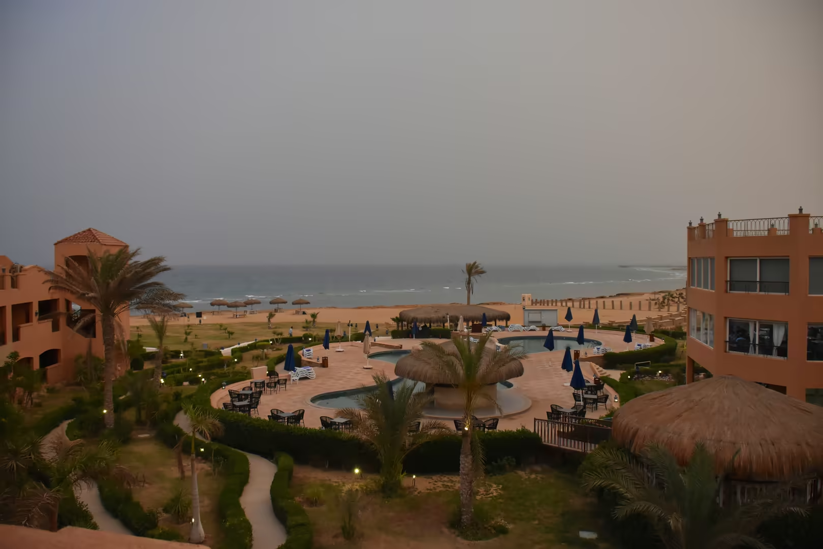
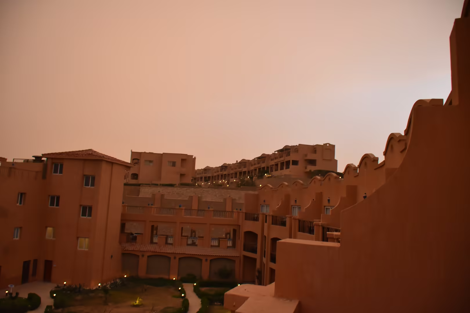
Sahl Hasheesh is a wide, shallow bay on the Red Sea coast of Egypt, some eighteen kilometres south of Hurghada International Airport and within the continuous resort belt that runs between the cities of Hurghada and Safaga. The bay opens towards the sea between rocky headlands of the Eastern Desert, and along its shore stands one of the larger planned resort towns of the Egyptian Red Sea Riviera: the Long Beach Resort, whose terraced, terracotta-painted buildings rise in tiers above palm gardens, swimming pools and a broad private beach. The resort is the centrepiece of the master-planned town of Sahl Hasheesh, developed by the Egyptian Resorts Company from the mid-1990s and still extending southwards along the coast.
The Red Sea is the long, narrow sea between north-eastern Africa and the Arabian Peninsula, an inlet of the Indian Ocean with which it communicates only through the Bab el-Mandeb Strait in the south. Roughly 2,250 kilometres long and up to 355 kilometres wide, it is the world’s northernmost tropical sea: a basin of warm, clear and unusually saline water whose shallow margins carry some of the most extensive coral-reef systems outside the central Indo-Pacific. Along the Egyptian shore these reefs grow close to land, and the fringing reef of Sahl Hasheesh Bay, with the offshore islets such as Abu Hasheesh Island, lies within easy reach of swimmers, snorkellers and the boats of the local dive centres.
The biological richness of the basin is exceptional for a sea of its size: more than a thousand species of invertebrates and some two hundred species of hard and soft corals have been recorded, together with over 1,200 species of fish, of which roughly ten per cent occur nowhere else, and the whole sea is recognised as a Global 200 ecoregion. The Egyptian shore, administered as the Red Sea Governorate with its capital at Hurghada, has grown around this marine inheritance into one of the principal tourism regions of the country.
Climatically the coast belongs to the hyper-arid desert (Köppen BWh): hot, dry summers and mild winters, sunshine almost unbroken, and rain so rare that it arrives mainly as sudden floods in the wadis. The air is pleasantly warm by day and cool after dark, and in winter the sea, standing in the low twenties Celsius, invites a swim; the haze that veils the horizon is the normal evaporative glare of this coast, where the desert meets water that is measurably saltier than the open ocean.
History
For most of its history the Red Sea coast of Egypt was a place of departure rather than of settlement. The narrow coastal plain between the desert mountains and the sea offered no agriculture, and the energies of the region were directed offshore: expeditions sailed from its harbours for the incense lands of southern Arabia, the coasts of East Africa and, in time, the ports of India. The pharaonic state reached the sea through the wadis of the Eastern Desert, and the celebrated reliefs of Hatshepsut’s temple at Deir el-Bahari record one such expedition, to the land of Punt, whose fleet is generally thought to have sailed from a Red Sea port. The desert roads that later carried the trade of the Roman Empire had their predecessors in these pharaonic tracks, marked by quarries, mines and rock inscriptions.
The systematic development of the coast began under the Ptolemies. Ptolemy II Philadelphus founded Berenike in 275 BC, far to the south on a sheltered bay of the African shore, and named the city after his mother; the same king is credited with the foundation of Myos Hormos further north, chosen as the principal harbour of the Indian trade because the head of the Gulf of Suez, where the older port of Arsinoe lay, required a long and difficult navigation. From these ports Hellenistic Egypt reached out towards Arabia and the Horn of Africa, and the traffic was already substantial when Rome inherited the province in 30 BC.
Under the Roman Empire the two ports carried one of the great long-distance trades of antiquity. Myos Hormos has been identified by the excavations of David Peacock and Lucy Blue with the site of Quseir al-Qadim, eight kilometres north of the modern town of El Qoseir; Berenike, excavated since 1994 under Steven Sidebotham, lies some 140 kilometres south of Marsa Alam and was joined to the Nile at Coptos, the modern Qift, by a desert road of eleven days’ journey furnished with watering stations. Strabo records that in the time of Augustus as many as 120 ships a year sailed from Myos Hormos to India, and the anonymous first-century handbook known as the Periplus of the Erythraean Sea describes the trade in pepper, spices, pearls, ivory, textiles and incense. The excavations confirm it: Tamil inscriptions of the first century AD at Myos Hormos attest contact with southern India, while the refuse of Berenike has yielded peppercorns, coconut and teak. The system declined in the course of the third century AD, as the northern route through Clysma and Trajan’s canal drew the traffic away, and the old ports silted up and were abandoned.
The Egyptian shore then slept for more than a millennium. El Qoseir revived in the seventeenth century as a port of the pilgrimage from Cairo to Mecca and of the Red Sea trade, but the coast between Quseir and the Gulf of Suez remained a thinly peopled margin of desert, known to map-makers and oil prospectors rather than to travellers. The opening of the Suez Canal in 1869 made the Red Sea one of the busiest shipping corridors in the world, yet the great fleets passed the Egyptian shore at a distance of a few kilometres of water, and the coast itself slumbered on.
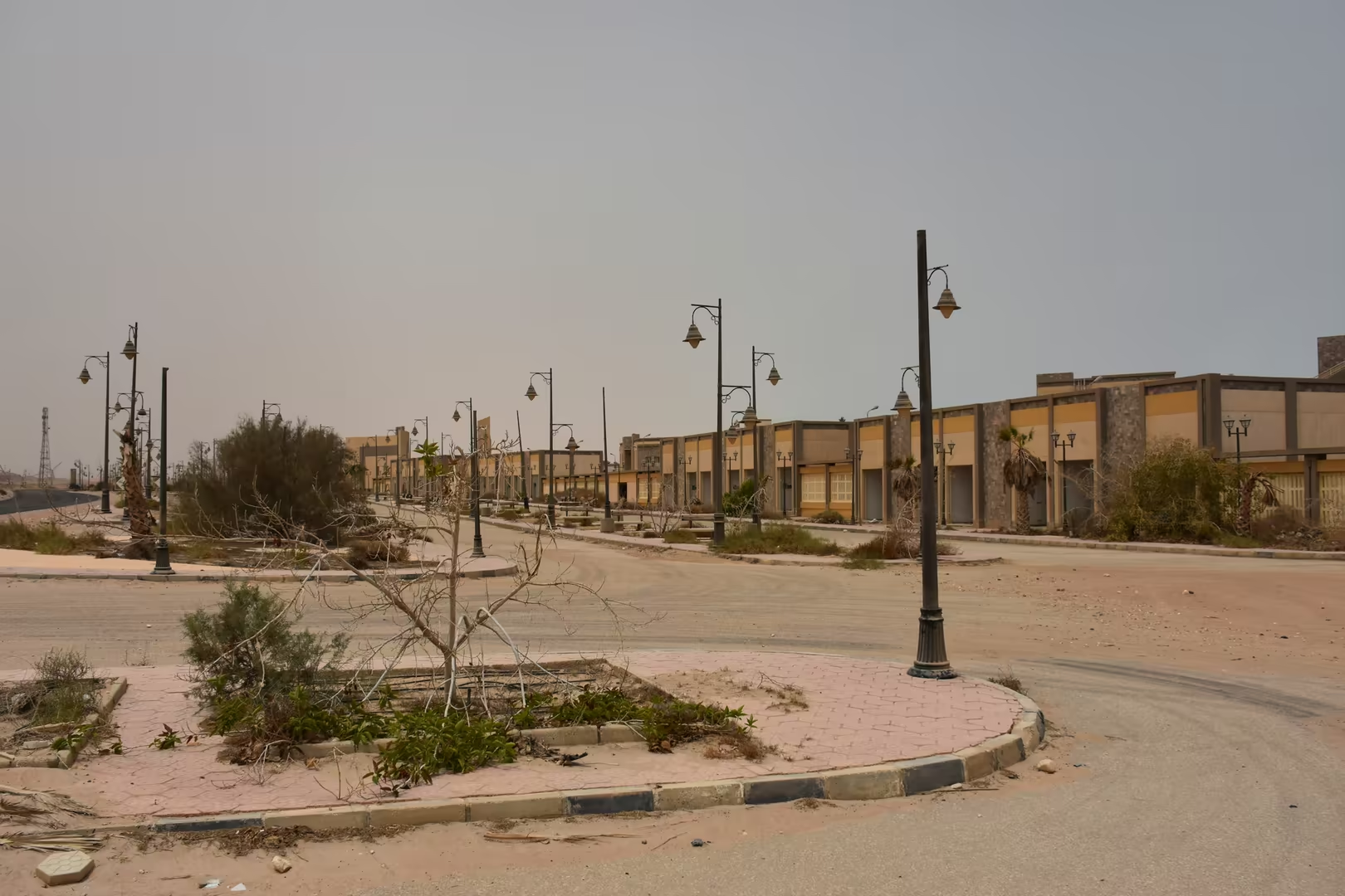
Modern Hurghada is a twentieth-century creation. The town grew from a fishing village of the Ababda people on the natural harbour of Sekalla, was formally established in 1905, and received its first impetus when oil was struck nearby in 1913 by Anglo-Egyptian Oilfields; for decades it remained a small company town, in time the capital of the Red Sea Governorate. The transformation into a resort began in the 1980s, when Egyptian and foreign investment, drawn by the reefs and the year-round sunshine, built the first tourist villages along the shore. El Gouna, the lagoon city created by Samih Sawiris from 1990, carried the model north of Hurghada; Sahl Hasheesh carried it south, where the Egyptian Resorts Company acquired the land in 1995, was publicly listed in 1999 and planned a mixed-use resort city across a site of some twelve square miles, completing its Old Town in 2008. The shuttered shop fronts of the Old Town belong to that recent history: a quarter built ahead of demand, whose empty streets record more plainly than any statistic the boom and pause of the Riviera’s development.
Geology
Geologically the Red Sea is the most instructive young ocean basin on Earth, and its history is written in the hills that stand behind Sahl Hasheesh. The basin overlies the Red Sea Rift, the divergent plate boundary along which the African (Nubian) and Arabian plates are separating: northwards the rift system continues into the Gulf of Suez and the Dead Sea transform, while to the south it meets the Aden Ridge and the East African Rift at the Afar triple junction in the Horn of Africa. The Red Sea is thus a continental rift caught in the act of becoming an ocean, the classic early stage of the Wilson cycle of ocean birth and closure.
The opening proceeded in stages. Continental stretching began in the Eocene, roughly fifty million years ago, and a first phase of true seafloor spreading followed in the late Eocene and Oligocene, as the Arabian plate began to separate from Africa. Spreading then paused for some thirty million years, during which a thick succession of evaporites, salts precipitated as the basin repeatedly dried and refilled, accumulated over the floor of the rift. Renewed extension about five million years ago, in the Pliocene, split these sediments and opened the deep axial trough that runs down the centre of the sea, floored by young oceanic crust whose magnetic stripes record spreading at about a centimetre a year on each flank. The process is not finished: the sea is measurably still widening; an episode of intense seismic activity in 2005 left the rift some eight metres wider after three weeks of movement, and in the deepest troughs hot saline brines and metalliferous muds, discovered in the late 1940s and studied since, mark hydrothermal circulation above an active spreading centre.
The Egyptian coast is the western flank of this system. The mountains behind the shore belong to the Arabian-Nubian Shield, a Precambrian basement of granites, gneisses and volcanic rocks more than half a billion years old, which in Egypt forms the Red Sea Hills; along this stretch of coast the hills approach within a few kilometres of the water. Between them and the sea runs a narrow coastal plain of gravel fans built by the wadis draining the desert, interrupted by rocky headlands and veneered near the shore by raised terraces of fossil coral limestone that record the sea-level changes of the Pleistocene. This structure is clearly visible along the shore: barren brown mountains sloping straight into turquoise water, shingle coves at their feet, terraced red-earth hillsides at the mouths of the wadis.
On the shallow shelf at the foot of these mountains grow the fringing reefs. Coral growth requires clear, warm, well-lit water, and the Red Sea provides an extreme version of these conditions: no river enters it, evaporation is intense, of the order of two metres a year, and salinity rises from about 36 parts per thousand at the southern entrance to more than 40 in the north, against an oceanic average near 35. The reefs nonetheless flourish, because the same aridity keeps the water clear and poor in nutrients, and the corals of the basin, living near the limit of their physiological tolerance, have attracted attention for their resistance to heat. The balance is delicate: studies around Hurghada have recorded a decline of roughly half the living coral cover in three decades, under the combined pressure of coastal construction, sewage, anchor damage and dredging, and conservation organisations, among them the Hurghada Environmental Protection and Conservation Association, now work to protect the reefs and the marine life of the bay, including the shallow protectorate waters around Abu Hasheesh Island.
Things to See
The Long Beach resort occupies the shore of Sahl Hasheesh Bay behind a broad private beach. Its terracotta-painted buildings climb the slope in terraced tiers, each level with terraces overlooking palm gardens, swimming pools and the water, in a style characteristic of the modern Egyptian Riviera. The town of Sahl Hasheesh was planned as a mixed-use resort city across a site of some twelve square miles of coastal desert, and the Long Beach forms its bay-front centre. The bay in front of the resort is wide and shallow, and its calm, clear water makes the beach the natural starting point for swimming; the fringing reef lies only a short distance offshore.
The Old Town of Sahl Hasheesh, completed in 2008 as the commercial heart of the master-planned town, stands between the resort and the coastal road. Around a central plaza, Mediterranean-inspired arcades with ornate lamp posts line streets of low shop fronts, and a long, level esplanade runs from the quarter towards the sea. The pedestrian scale and shaded arcades make the Old Town pleasant to walk through even in the heat of the day.
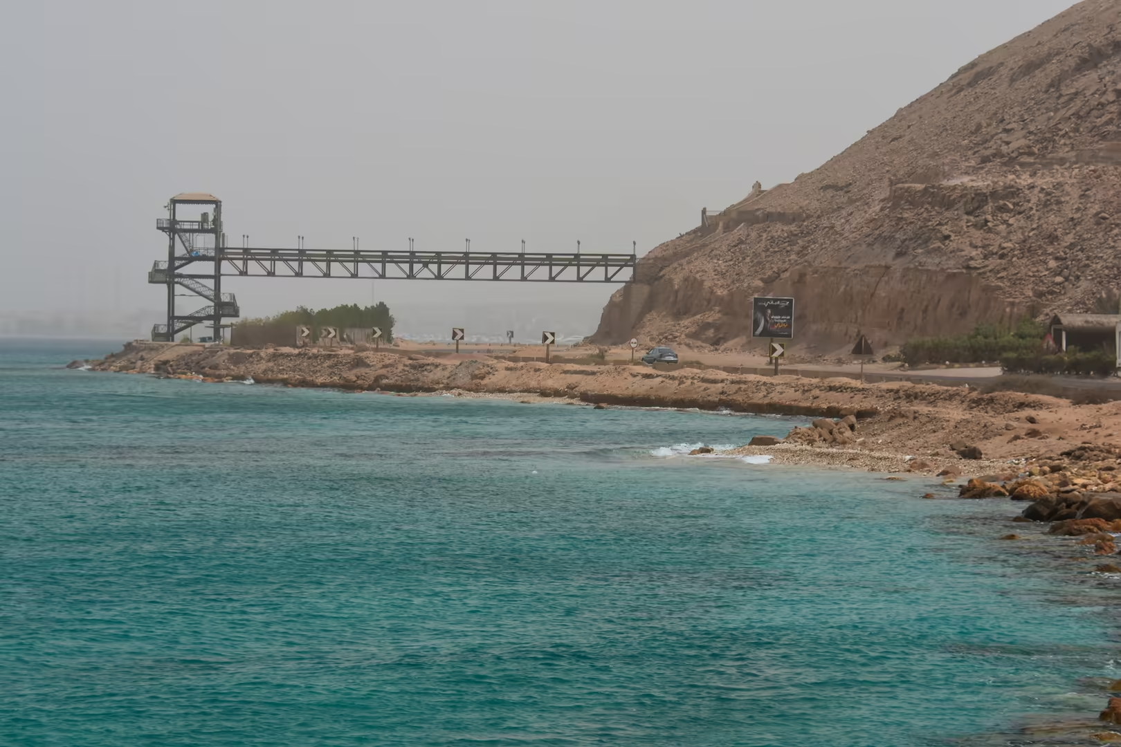
At the southern edge of the bay a metal viewing pier extends over the water beside a rocky headland and the coastal road. The sea beneath the pier is shallow and transparent, and fish are visible from the deck, while the view takes in the fringe of reef and sand close inshore, the deeper blue of the channel beyond and the bare hills of the Eastern Desert rising behind the coast.
Snorkelling is the classic activity of Sahl Hasheesh. Because no river enters this stretch of the Red Sea, the water remains clear and poor in nutrients, and the fringing reef can be reached from the beach without a boat: gardens of hard and soft corals, of which some two hundred species occur in the basin, grow in the shallow, sunlit water, and the fish life of the bay, drawn from a fauna of more than 1,200 recorded species, is easily observed from the surface. Diving is organised by the centres along the shore, whose boats also run excursions to the reef slopes and the waters around the offshore islets of the bay.
South of the resort, between the developed bays, the coast remains largely undeveloped. At the foot of the barren desert hills lie quiet beaches of shingle and sand where the fringing reef is only a short swim out, so that bathing and snorkelling can be combined with the mountain landscape. These strands are typical of the shore between the resort towns: steep, open and exposed, with clear water over the pebbles.
The coastal road connects the bay with Hurghada and its airport to the north and runs southwards through the resort belt towards the quieter shores of the Red Sea Governorate. Along the way the road passes the unfinished construction sites that mark the advancing edge of the Riviera’s growth, where apartment blocks and hotel skeletons stand on terraced hillsides between the desert and the sea.
References
- Bosworth, W., Huchon, P. & McClay, K. (2005). The Red Sea and Gulf of Aden basins. Journal of African Earth Sciences, 43, 334-378.
- Peacock, D. & Blue, L. (eds) (2006). Myos Hormos, Quseir al-Qadim: Roman and Islamic Ports on the Red Sea. Vol. 1: Survey and Excavations 1999-2003. Oxford: Oxbow Books.
- Sheppard, C. R. C., Price, A. R. G. & Roberts, C. J. (1992). Marine Ecology of the Arabian Region: Patterns and Processes in Extreme Tropical Environments. London: Academic Press.
- Sidebotham, S. E. (2011). Berenike and the Ancient Maritime Spice Route. Berkeley: University of California Press.
- PERSGA (2026). Regional Organization for the Conservation of the Environment of the Red Sea and Gulf of Aden. www.persga.org/
- HEPCA (2026). Hurghada Environmental Protection and Conservation Association. www.hepca.org/
- Wikipedia contributors (2026). Sahl Hasheesh. en.wikipedia.org/wiki/Sahl_Hasheesh
- Wikipedia contributors (2026). Hurghada. en.wikipedia.org/wiki/Hurghada
- Wikipedia contributors (2026). Red Sea. en.wikipedia.org/wiki/Red_Sea
- Wikipedia contributors (2026). Red Sea Rift. en.wikipedia.org/wiki/Red_Sea_Rift
- Wikipedia contributors (2026). Coral reef. en.wikipedia.org/wiki/Coral_reef
- Wikipedia contributors (2026). Myos Hormos. en.wikipedia.org/wiki/Myos_Hormos
- Wikipedia contributors (2026). Berenice Troglodytica. en.wikipedia.org/wiki/Berenice_Troglodytica
- Wikipedia contributors (2026). El Qoseir. en.wikipedia.org/wiki/El_Qoseir
- Wikipedia contributors (2026). El Gouna. en.wikipedia.org/wiki/El_Gouna
- Wikipedia contributors (2026). Red Sea Governorate. en.wikipedia.org/wiki/Red_Sea_Governorate