Day 3 - Around Santa Clara
Journal Notes
General
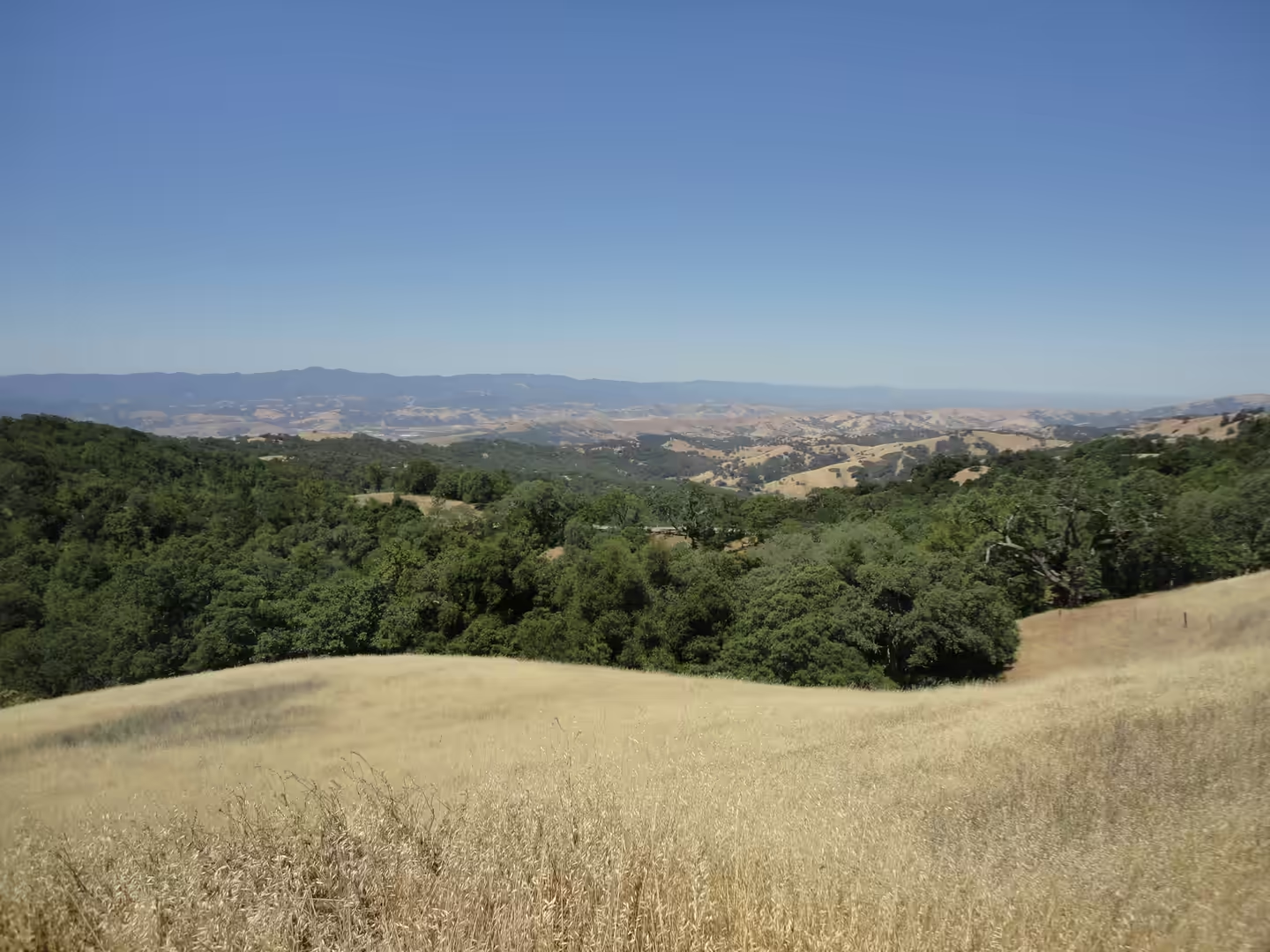
The third day stays in Santa Clara County and goes inland, into the hills that frame the bay. The county sits between two mountain systems, the Santa Cruz Mountains on the western side and the Diablo Range to the east, with the Santa Clara Valley running between them from San Francisco down to Hollister. The hills above the valley carry oak woodland and open grassland, green for a few weeks after the winter rain and golden for the rest of the year, and the small roads that cross them link farms, reservoirs and county parks rather than towns. In spring the grass is high and the cattle are out; by midsummer the same slopes are dry and dusty.
Santa Clara itself remains the base. The city was founded by the Spanish in 1777 with Mission Santa Clara de Asís, and today it lies in the centre of Silicon Valley, with its boundaries running against San Jose on almost every side apart from Sunnyvale and Cupertino to the west. At the 2020 census it had 127,647 residents, the eighth largest population in the Bay Area, and the 2025 estimate is 133,446. Intel, AMD and Nvidia all have their headquarters here, which makes a half-hour drive from a company campus to open hills one of the oddities of the place.
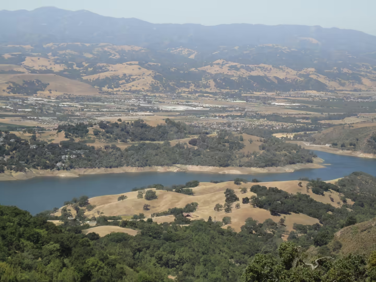
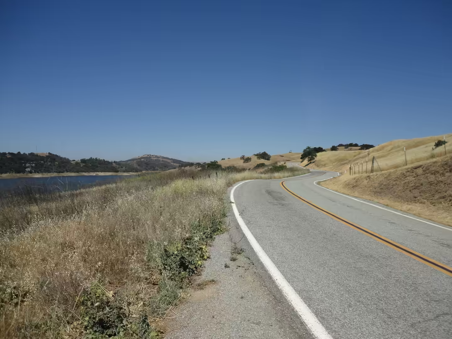
The route for a day of this kind is a loop rather than a line. From the valley floor a road climbs through the foothills, passes a reservoir held behind a dam, and continues onto the ridge with views back over the bay and forward to the next line of hills. Farmland and vineyards appear where the slope allows, and the occasional roadside stand sells fruit in season. Distances are short, but the roads are narrow and winding, so the trip is measured in hours rather than miles, and the best light for the views falls in the late afternoon.
The shape of the modern county was decided in the middle of the last century. Until the 1960s this was the largest fruit producing and packing region in the world, with thirty nine canneries working in the valley, and prunes alone were shipped internationally in such quantity that the valley supplied the majority of California’s crop by 1900. IBM opened its first West Coast manufacturing plant, a card facility, in San Jose in 1943, and the electronics industry moved onto the same land. San Jose grew from 95,000 people in 1950 to 446,000 in 1970 under a city manager whose annexation programme enlarged the city from 17 square miles to 136.7, and the farmland that remains is now mostly at the edges of the county and in the hills.
Santa Clara University is organised into six colleges, covering arts and sciences, education and counselling psychology, business through the Leavey School, engineering, theology and law, and its campus is built around the historic mission in Mission Revival and Spanish Colonial Revival styles. The wider valley is a group of cities rather than one place: Sunnyvale, Mountain View, Palo Alto and Menlo Park are frequently named as the birthplace of Silicon Valley, and the larger centres are San Jose, Santa Clara, Redwood City and Cupertino. The name itself comes from the silicon used in semiconductors, and the region’s output is now measured as much in company formations and house prices as in manufactured goods.
History
The valley was Ohlone country before the Spanish arrived. The Ohlone were a group of Northern California peoples whose territory ran from San Francisco Bay round to Monterey Bay and down the Salinas Valley, and they did not see themselves as one nation: in pre-colonial times they lived in more than fifty distinct landholding groups and moved freely between them, hunting, fishing and gathering. Along the bayshore and in the valleys they built dome shaped houses of bundled tule mats between six and twenty feet across. Between 1769 and 1834 the indigenous population of California fell from about 300,000 to 250,000, and after statehood in 1850 the Ohlone suffered the wider California genocide.
Mission Santa Clara de Asís was founded on 12 January 1777 as the eighth of the Spanish missions, and its registers record 8,536 baptisms, 2,498 marriages and 6,809 burials, with 1,125 neophytes in the community at its height; the peoples brought into it were Bay Miwok, Tamyen and Coast Yokuts. The mission was secularised in 1836 and its lands were distributed in the Mexican period. Santa Clara was incorporated as a town in 1852, and the college founded on the mission grounds in 1851 became Santa Clara University, the oldest operating institution of higher learning in California.
Farming then defined the valley for a century. Until the 1960s this was the largest fruit producing and packing region in the world, with 39 canneries working in the valley, and prunes alone were shipped internationally in such quantity that the valley produced the majority of California’s crop by 1900. IBM opened its first West Coast manufacturing plant, a card facility, in San Jose in 1943, and the electronics industry followed the orchards. San Jose grew from 95,000 people in 1950 to 446,000 in 1970 under a city manager who annexed land on a large scale, and the farmland that survived is now mostly at the edges of the county, in the hills rather than on the plain.
The Miwok, the neighbours of the Ohlone in the interior, were four linguistically related groups whose territories covered the western slope and foothills of the Sierra Nevada, the Sacramento and San Joaquin valleys and the delta, together with the coast north of San Francisco Bay. They lived in small bands without centralised political authority, and they spoke languages of the Utian family. Their numbers collapsed in the century after contact: the 1910 census recorded 671 Miwok, the 1930 census 491, and by 2000 the total had recovered to about 3,500. Eleven tribes of Miwok descent are now recognised by the Bureau of Indian Affairs, including the Southern Sierra Miwuk Nation whose homeland includes the Yosemite country.
Geology
The valley is a geologic trough, a graben that filled with sediment between two sets of faults. On the western side the San Andreas Fault separates the valley from the Santa Cruz Mountains, and on the eastern side the Hayward and Calaveras faults bound it against the Diablo Range; the floor is an alluvial plain built from material washed down off both ranges. The San Andreas is a continental transform fault with right lateral strike slip movement, first identified in 1895 by Andrew Lawson, who after the 1906 San Francisco earthquake concluded that it ran the whole length of the state. Standing on a hillside above the valley, the line of the fault is followed by a chain of elongated valleys and ponds rather than by a single visible crack.
The hills carry older rock. The Santa Cruz Mountains are built in part from the Coast Range Ophiolite, a slab of Middle Jurassic oceanic crust and mantle that was pushed onto the continent and largely altered to serpentinite; Mount Umunhum, the fourth highest peak of that range, exposes one of the best sections of it in the bay area. The Diablo Range on the other side of the valley is larger and drier, and its slopes make up most of the empty country east of the city. Soils derived from serpentinite are thin and chemically hostile to many plants, which is one reason the vegetation on some ridges differs so sharply from the oak woodland beside it.
Seismic history is short but well recorded. The Loma Prieta earthquake of 18 October 1989 struck at 17:04 with maximum intensity IX, killed 63 people and injured 3,757, and caused its worst damage in Santa Cruz County; the Loma Prieta segment of the fault had been comparatively quiet since 1906 and had been considered a seismic gap. Because the shaking began during the live broadcast of the World Series between two Bay Area teams, it was among the first American earthquakes seen in real time by a national audience. Buildings in the valley are now designed for the movement that this fault system will produce again.
Water moves through the same terrain. The Guadalupe River begins on the valley floor where Los Alamitos Creek leaves Lake Almaden and joins Guadalupe Creek, then flows north through San Jose into south San Francisco Bay at the Alviso Slough, forming the eastern boundary of Santa Clara. Its headwaters rise on the slopes of Loma Prieta and Mount Umunhum, and the watershed is the reason the county’s reservoirs sit in the hills rather than on the plain. In 2005 the fossil bones of a juvenile Columbian mammoth were found in the lower river bed, a reminder that the same corridor has been a route for a very long time.
The record of the 1989 earthquake also included ground failure rather than surface rupture. No surface faulting occurred, but there were many ground failures and landslides, particularly in the Summit area of the Santa Cruz Mountains, and the damage in Santa Cruz County was heavier than anything in the valley itself. Earlier work had already established how far the land has moved: in 1953 the geologist Thomas Dibblee concluded that hundreds of miles of lateral movement had taken place along the San Andreas Fault. Water and settlement meet at the same place, and the Guadalupe corridor has been a route since long before the city existed, with Juan Bautista de Anza camping on its banks at Expedition Camp 97 on 30 March 1776, near what later became the Agnews hospital site.
Things to See
The oak woodland is the first thing to look at on the hills. Blue oak and coast live oak stand in open stands over grass, and the trees are spaced rather than closed, which is why the landscape reads as savanna in spring and as dry parkland in autumn. The best roads for this are the county routes that climb from the valley floor, where the gradient is gentle enough to keep the woodland in view. Cattle graze under the trees under long standing leases, and gates, cattle grids and cattle themselves are part of the driving conditions.
The reservoirs above the valley are the quietest places to stop. Water held behind earth and concrete dams lies in narrow valleys, and the shoreline is open to walking where a county park reaches the water, with picnic areas under the oaks and trails that follow the ridge above. Birds work the shallows and the wooded edge, and the road along the western shore gives the standard view of the reservoir between the hills. Swimming and boating are restricted or seasonal at most of these lakes, so the shore paths are the practical option.
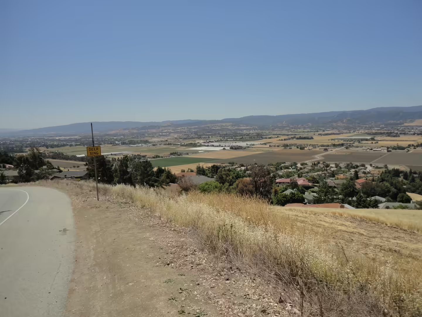
Where the slope flattens, farmland and vineyards take over. The valley’s agricultural past is still visible in the shape of the fields, the windbreaks along their edges and the packing sheds that survive beside the roads, and the remaining orchards and vineyards are worked on a smaller scale than the fruit industry of a century ago. Farm stands sell fruit, nuts and preserves in season, and the hill roads above the fields give the broad view back across the valley that the old postcards of the fruit belt were taken from.
Back in the city, the mission grounds and the university complete the day. The mission church, on its present site since 1825 and now the university chapel, stands among buildings in Mission Revival and Spanish Colonial Revival styles, and Santa Clara University enrolled 6,484 undergraduates and about 3,151 postgraduate students in the autumn of 2024. Levi’s Stadium, home of the San Francisco 49ers, and the Great America park next to it are the other landmarks of the city, though both are best visited on an event day.
References
- Hay, E. A., Hall, N. T. & Cotton, W. R. (1989). Rapid creep on the San Andreas fault at Bitterwater Valley. In: The San Andreas Transform Belt. doi.org/10.1029/ft309p0036
- Poland, J. F. (1971). Land subsidence in the Santa Clara Valley, Alameda, San Mateo, and Santa Clara counties, California. United States Geological Survey Open-File Report. doi.org/10.3133/ofr71340
- Saxenian, A. (1983). The urban contradictions of Silicon Valley: regional growth and the restructuring of the semiconductor industry. International Journal of Urban and Regional Research 7, 237-262. doi.org/10.1111/j.1468-2427.1983.tb00592.x
- Skowronek, R. K. (1998). Sifting the evidence: perceptions of life at the Ohlone (Costanoan) missions of Alta California. Ethnohistory 45, 675. doi.org/10.2307/483300
- Wikipedia contributors (2026). 1989 Loma Prieta earthquake. en.wikipedia.org/wiki/1989_Loma_Prieta_earthquake
- Wikipedia contributors (2026). Diablo Range. en.wikipedia.org/wiki/Diablo_Range
- Wikipedia contributors (2026). Guadalupe River (California). en.wikipedia.org/wiki/Guadalupe_River_(California)
- Wikipedia contributors (2026). Mission Santa Clara de Asís. en.wikipedia.org/wiki/Mission_Santa_Clara_de_As%C3%ADs
- Wikipedia contributors (2026). Miwok. en.wikipedia.org/wiki/Miwok
- Wikipedia contributors (2026). Mount Umunhum. en.wikipedia.org/wiki/Mount_Umunhum
- Wikipedia contributors (2026). Oak woodland. en.wikipedia.org/wiki/Oak_woodland
- Wikipedia contributors (2026). Ohlone. en.wikipedia.org/wiki/Ohlone
- Wikipedia contributors (2026). San Andreas Fault. en.wikipedia.org/wiki/San_Andreas_Fault
- Wikipedia contributors (2026). Santa Clara, California. en.wikipedia.org/wiki/Santa_Clara,_California
- Wikipedia contributors (2026). Santa Clara University. en.wikipedia.org/wiki/Santa_Clara_University
- Wikipedia contributors (2026). Santa Clara Valley. en.wikipedia.org/wiki/Santa_Clara_Valley
- Wikipedia contributors (2026). Santa Cruz Mountains. en.wikipedia.org/wiki/Santa_Cruz_Mountains
- Wikipedia contributors (2026). Silicon Valley. en.wikipedia.org/wiki/Silicon_Valley