Day 4 - Central Valley
Journal Notes
General
The Central Valley is a broad, elongated and almost entirely flat valley that dominates the interior of California. It runs from north west to south east, parallel to the Pacific coast and inland from it, and covers about eleven per cent of the state’s land area, bounded by the Coast Ranges on the west and the Sierra Nevada on the east. It supplies a large share of the food produced in California, and California in turn grows more than half of the fruits, vegetables and nuts produced in the United States. Much of the valley is irrigated from reservoirs and canals, which is why a region with a Mediterranean climate and a dry summer can be farmed on this scale.
The chain of towns along the valley reads like the state’s own history: Sacramento, the capital, then Redding, Chico, Yuba City, Woodland, Davis, Roseville, Elk Grove, Stockton, Modesto, Merced, Fresno, Visalia, Porterville and Bakersfield. Between them the land is worked in long rectangular fields, with packing sheds, silos and irrigation ditches beside the roads, and the highway runs straight for hours at a time. A railway line follows the same corridor, and the two together carry the fruit, nuts, cotton and dairy that leave the valley every day.
The southern half of the valley belongs to the San Joaquin, and it is here that the character of the drive begins to change. This is the part of California best known as a breadbasket, drawing on eight counties and holding four urban centres, Stockton and Modesto in the north, Fresno in the middle, Porterville with Visalia to the south east, and Bakersfield at the southern end. Further south the irrigated ground gives way to dry grazing land and then to desert, and the Tehachapi Mountains mark the boundary, separating the San Joaquin Valley from the Mojave Desert beyond.
The pivot of the whole system is the delta where the two great rivers meet, north east of San Francisco Bay. Water is pumped from there and carried south by aqueduct, and the State Water Project must lift it over the Tehachapi Mountains at the Edmonston pumping plant to reach the cities of southern California. About seventy per cent of the water the project supplies goes to urban users and industry and thirty per cent to irrigation in the valley, and the project has required twenty one dams and many hundreds of miles of canals, pipelines and tunnels since it began in 1960. The Central Valley Project, devised as a federal scheme in 1933, works the same country with twenty dams and more than 2,000 megawatts of hydroelectric capacity, and on the same dependence on snowmelt from the Sierra Nevada.
History
The valley has been inhabited for millennia, and its population before European contact was one of the largest in California. People have lived in the San Joaquin Valley for more than 8,000 years, and the Yokuts, who lived across the Central Valley, were divided into up to sixty tribes speaking several related languages of the proposed Yok-Utian family; one estimate puts their number at about 70,000. They were fishers, hunters and gatherers who used the wetlands of the valley floor, the tule marshes of the delta and the rivers, and their neighbours in the north of the valley were the Maidu and the Miwok.
The destruction of that world was rapid and in part documented. In 1851 the governor of California declared that unless the indigenous population was moved east of the Sierra Nevada a war of extermination would continue, and eighteen treaties negotiated with California tribes were rejected by the United States Senate in a secret vote on 8 July 1852, a result not made public until 1905. Malaria spread among the Yokuts in 1853, what remained of the tribes was moved to the Fort Tejon reservation in 1854, and the Tule River Reservation was established in 1873. Ranching had already begun on Mexican land grants of the 1840s, among them Rancho El Tejon of 1843.
The modern valley was made by water engineering. The Central Valley Project was devised in 1933 as a federal scheme to store water in the wetter north and move it south by canals and pumping plants, and it now operates twenty dams and reservoirs with more than 2,000 megawatts of hydroelectric capacity. The State Water Project added a second system from 1960, providing drinking water for more than 27 million people and generating an average of 6,500 gigawatt hours a year; about seventy per cent of its water goes to cities and industry, and thirty per cent to irrigation in the valley. The cost is visible in the ground: by August 2015 groundwater levels in parts of the San Joaquin had fallen to record lows, up to 100 feet below earlier records, and satellite measurements showed the land itself sinking as the aquifer compacted.
The names of the two rivers are colonial as well as indigenous. The Sacramento was named Rio de los Sacramentos by the Spanish explorer Gabriel Moraga in 1808, a name that was later shortened and anglicised, and the present name of the San Joaquin dates from the same period, when Moraga was surveying east from Mission San José between 1805 and 1808 and looking for possible mission sites. Long before the canals, the valley floor was a different country: the Great Flood of 1862 put parts of it under water, and the marshes and lakes that the Yokuts used have mostly gone.
Geology
The valley is a structural depression between two mountain systems, a filled basin rather than a carved one. Its western edge is formed by the Coast Ranges and its eastern edge by the Sierra Nevada, and the floor is built of sediment washed off both ranges and deposited in the trough, great thicknesses of sand, silt and clay laid down in ancient seas and in lakes and river systems since. The Great Valley Sequence of sedimentary rocks, which underlies much of the valley, sits above the same Coast Range Ophiolite that is exposed in the Santa Cruz Mountains, a slab of Jurassic oceanic crust and mantle pushed up onto the continent.
Two rivers dominate the drainage. The Sacramento is the largest river in California, rising in the Klamath Mountains and flowing south to the delta, draining nineteen counties and once supporting one of the southernmost large runs of chinook salmon in North America. The San Joaquin is the longest river of central California, starting high in the Sierra Nevada and flowing through the northern San Joaquin Valley to Suisun Bay; it is among the most heavily dammed and diverted rivers in the state. The two meet in the Sacramento and San Joaquin River Delta, and the whole valley watershed covers more than a third of California.
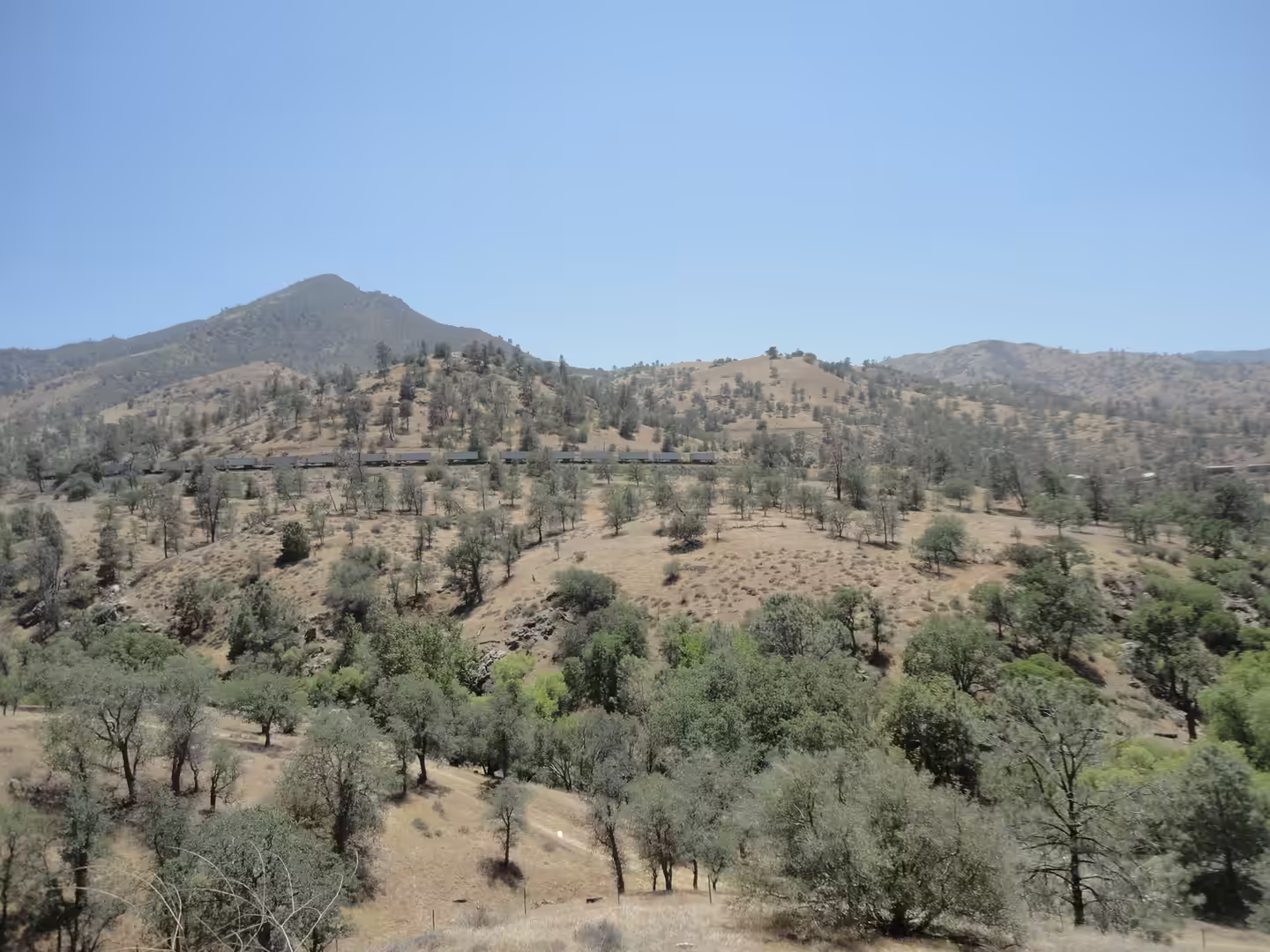
The southern end of the valley is where the structure shows. The Tehachapi Mountains, part of the Transverse Ranges, run south west to north east for about 40 miles and form a geographic, watershed and rain shadow divide between the San Joaquin Valley and the Mojave Desert, with a crest varying in height from roughly 4,000 to 8,000 feet. Interstate 5 climbs the range on its western side, and the road from the valley floor to the summit is the sharpest change of landscape on the whole route. South of the crest the country is desert, and the water that falls on the valley side does not reach it.
Water is also the valley’s own problem. Tulare Lake, once the largest freshwater lake west of the Mississippi, is shown on maps of 1873 as a broad body of water and has since been reduced by diversion and irrigation to a shallow remnant that reappears in wet years. The Great Flood of 1862 was the worst in the valley’s recorded history and put parts of it under water. Because the aquifer has been pumped faster than it refills, parts of the valley floor have subsided, and the canals and aqueducts that carry water south must be maintained against that movement. Drought has strained both the San Joaquin and the Sacramento sides since 2010.
The ground itself has moved in response to the pumping. Because groundwater has been drawn faster than it is replenished, parts of the San Joaquin Valley have subsided, and in August 2015 the director of the state Department of Water Resources said that groundwater levels had reached record lows, up to 100 feet below earlier records; satellite measurements by NASA showed the land surface sinking as the aquifer compacted, and canals, aqueducts and wells have had to be adjusted to the new levels. The valley also holds the memory of water in its own right: the Great Flood of 1862 was the worst in its recorded history, and Tulare Lake, marked on maps of 1873 as a broad body of water, has since been reduced to a shallow remnant that returns only in wet years.
At the southern end of the valley the mountains carry their own history. The Tehachapi range was the only known breeding site of the jaguar in the United States before 1860, and its passes were used by the Kitanemuk, Kawaiisu and Serrano peoples before the Mexican land grants of 1843 and the establishment of Fort Tejon in 1854. The range runs about 40 miles from south west to north east and is crossed by Tejon Pass at its western end, which is the route Interstate 5 now follows. North of the crest the water runs to the San Joaquin, and south of it to the closed basins of the desert.
Things to See
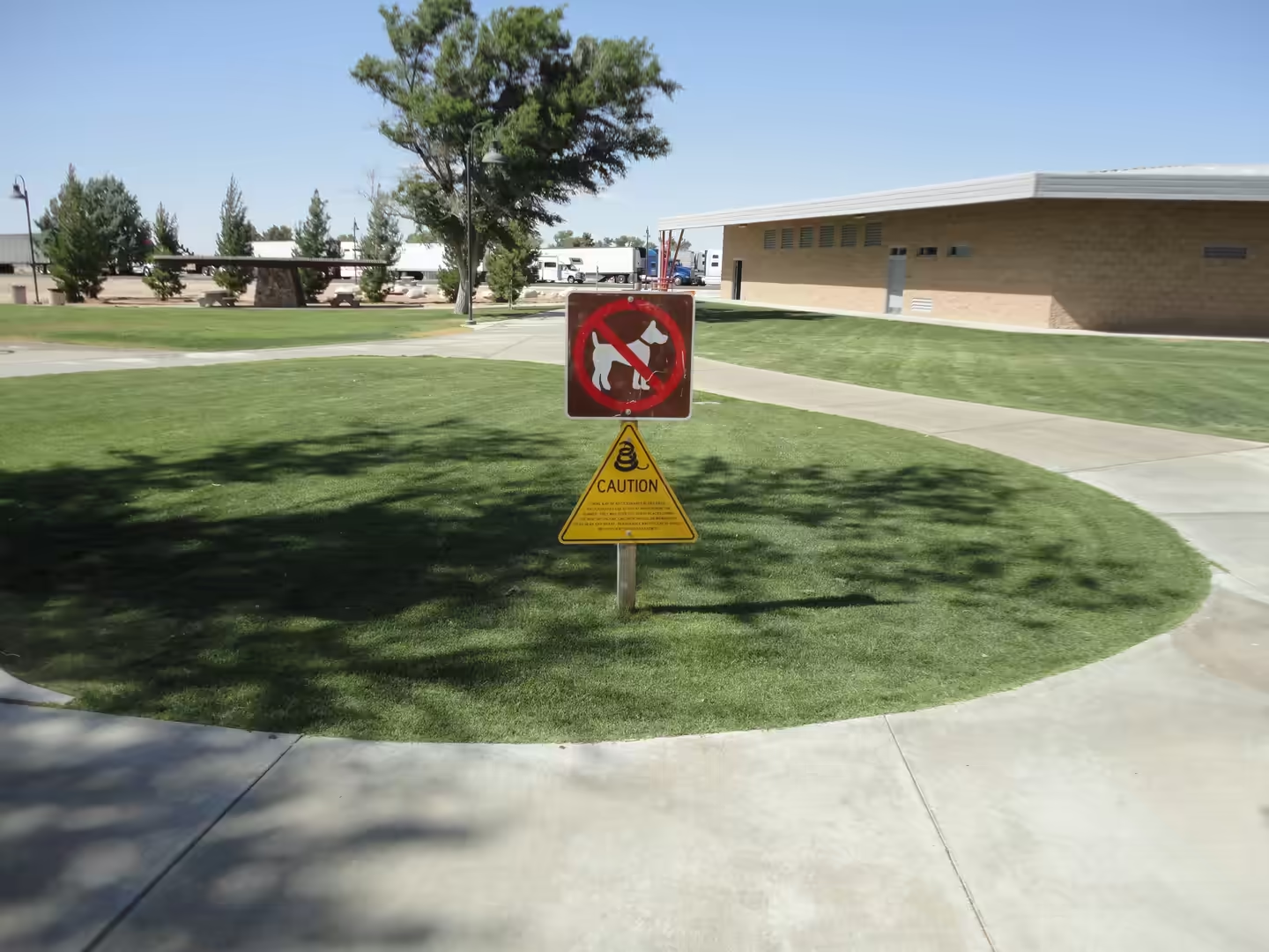
The drive itself is the thing to look at, and it rewards attention to detail rather than to views. Oak woodland stands along the edges of the fields where the soil is too thin to plough, and the freight trains that cross the valley are long enough to be a landscape feature in themselves; the line beside the highway is one of the busiest in the state. Rest areas appear every thirty or forty miles, with signs warning of heat, snakes and the fire risk that comes with the dry grass, and they are worth using, because distances between services are longer than they look on the map.
The agricultural landscape is the second subject, and it is best seen from a side road rather than from the interstate. Fields are laid out in strips of different crops, with windbreaks, ditches and the occasional stand of palms around a farmhouse, and the irrigation channels that feed them come off the canals of the two big projects. In season the roadside stands sell fruit and nuts directly, and the packing houses on the edges of the towns run through the night during the harvest. The scale of the valley becomes clear only from a viewpoint above it.
Wildlife keeps to the water, and the rivers and remaining wetlands are the places to look. The Sacramento and San Joaquin rivers, and the delta where they meet, are important for fish and for migratory birds, and the surviving tule marshes support the same species the Yokuts once hunted. Herons, egrets and hawks work the ditches along the fields, and the winter months bring waterfowl in large numbers to any standing water. Where a river has been left with a natural bank, the cottonwoods and willows along it mark the line of the old floodplain.
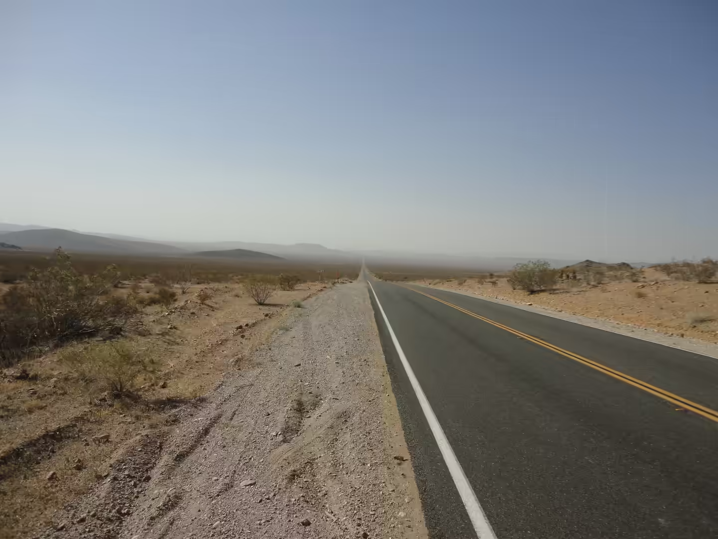
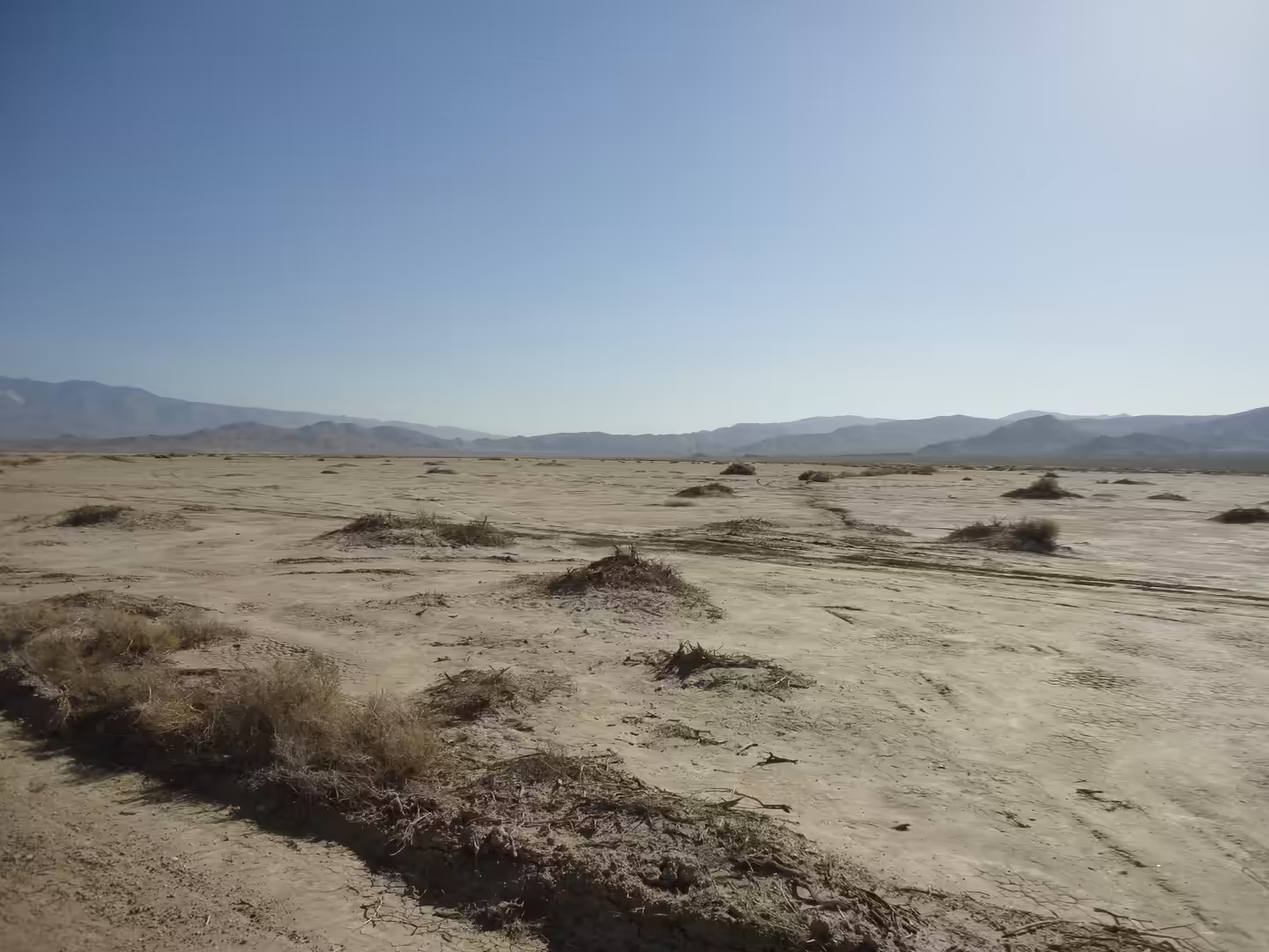
At the southern end of the day the landscape turns arid, and the last stretch before the mountains is the most striking part of the drive. Dry playa surfaces, sparse scrub and the long line of the Tehachapi crest ahead replace the green fields within a few miles. Summer heat here is severe and water, fuel and shade should be planned in advance, since the gaps between towns grow quickly. Beyond the pass the road enters the Mojave, and the next day’s country begins.
References
- Knight, R., Smith, R., Asch, T. and others (2018). Mapping aquifer systems with airborne electromagnetics in the Central Valley of California. Groundwater 56, 893-908. doi.org/10.1111/gwat.12656
- Nicolas, F., Culumber, M., Shahrokhnia, H. and others (2025). Central Valley decision support tool helps predict yield and profitability response to irrigation with saline water. California Agriculture 79. doi.org/10.3733/001c.147883
- Noe, S. J. (2023). Indigenous foodways as persistence in the Alta California mission system. American Antiquity 88, 451-475. doi.org/10.1017/aaq.2023.53
- United States Geological Survey (1983). Development of irrigation in the Central Valley of California. Hydrologic Atlas 649. doi.org/10.3133/ha649
- United States Geological Survey (2009). Groundwater availability of the Central Valley Aquifer, California. Professional Paper 1766. doi.org/10.3133/pp1766
- Wikipedia contributors (2026). California gold rush. en.wikipedia.org/wiki/California_gold_rush
- Wikipedia contributors (2026). California State Water Project. en.wikipedia.org/wiki/California_State_Water_Project
- Wikipedia contributors (2026). Central Valley (California). en.wikipedia.org/wiki/Central_Valley_(California)
- Wikipedia contributors (2026). Central Valley Project. en.wikipedia.org/wiki/Central_Valley_Project
- Wikipedia contributors (2026). Great Basin. en.wikipedia.org/wiki/Great_Basin
- Wikipedia contributors (2026). Miwok. en.wikipedia.org/wiki/Miwok
- Wikipedia contributors (2026). Mojave Desert. en.wikipedia.org/wiki/Mojave_Desert
- Wikipedia contributors (2026). Sacramento River. en.wikipedia.org/wiki/Sacramento_River
- Wikipedia contributors (2026). San Joaquin River. en.wikipedia.org/wiki/San_Joaquin_River
- Wikipedia contributors (2026). San Joaquin Valley. en.wikipedia.org/wiki/San_Joaquin_Valley
- Wikipedia contributors (2026). Tehachapi Mountains. en.wikipedia.org/wiki/Tehachapi_Mountains
- Wikipedia contributors (2026). Yokuts. en.wikipedia.org/wiki/Yokuts