Day 10 - New Plymouth to Whangārei
20 July 2023

Journal Notes
General
New Plymouth and Whangārei stand roughly 500 kilometres apart by road, at the southern and northern ends of a corridor that crosses the western North Island of New Zealand. From the coast of the North Taranaki Bight the highway runs north beside the sea, then cuts inland through the King Country, a region of forested hill country with a warm climate that lies between the Waikato lowlands and the Tasman Sea, before dropping to the farming plains of the Waikato and crossing the narrow Auckland isthmus. North of Auckland the road enters Northland, the long peninsula of the far north that separates the Tasman Sea from the Pacific Ocean.
Whangārei, the goal of the transfer, lies at the head of the harbour of the same name, where the Hātea River enters the sea about 23 kilometres from the harbour mouth. It is the northernmost city in New Zealand and the largest urban centre of the Northland region, with an urban population of about 54,000 at the 2023 census. The city has been the administrative, commercial and service hub of Northland since the early 20th century, serving a hinterland of farms, forests and small coastal settlements, and since the local government reforms of 1989 it has been administered within the wider Whangārei District, created from the former city, county and Hikurangi town councils. Beyond the city the peninsula continues northward past the Bay of Islands toward Cape Reinga, so Whangārei is also the gateway to the far north.
The setting is sheltered and hilly. The town centre climbs the lower slopes of an eroded volcanic cone, Mount Parihaka, and suburbs spread across the ridges and valleys around the harbour, which is heavily tidal and opens to the Pacific between the volcanic headlands of the Whangārei Heads. Deep water at the harbour entrance has made Marsden Point, on the southern shore at Bream Bay, the site of the region’s port and of a large oil refinery, while the upper harbour remains a working waterway of mud flats, mangroves and small craft. The mild coastal climate is often described as subtropical, and the district, which markets itself as the City of 100 Beaches, mixes the amenities of a small city with beaches, islands and bush within a short drive. On the far side of the peninsula the long west-coast beaches face the Tasman Sea with their dark volcanic sand, while the eastern shore, where Whangārei lies, is cut by sheltered drowned-valley harbours.
History
Long before roads existed, the corridor moved people and goods in both directions, and both of its end regions are rich in Māori history. Whangārei Harbour is remembered in tradition as a landing place of migratory canoes, among them Tūnui-ā-rangi and Te Arawa, and as a market place linking the iwi of the far north with the Hauraki Gulf and the Tāmaki region to the south. A portage across the Mangapai River allowed canoes to be hauled overland from the harbour to the Wairoa River and so to the Kaipara Harbour on the west coast. The harbour was long held by Ngāpuhi, whose Te Parawhau hapū lived at its head, and in the 1820s the district suffered repeated raids by Waikato war parties during the Musket Wars. At the southern end of the corridor, the hill country of the King Country was occupied by iwi including Ngāti Maniapoto before European contact. After the invasion of the Waikato in 1863 and the battle of Ōrākau in April 1864, the forces of the Māori King movement withdrew behind a defended boundary known as the aukati, a line of pā along the Puniu River, into territory that became known as the King Country, Te Rohe Pōtae, the area of the hat. King Tāwhiao and his followers remained there in exile, and the district stayed closed to Europeans until 1883.
The railway shaped the modern corridor. The North Island main trunk line reached Te Awamutu in 1880, then halted for five years while the King Country remained closed. After the district opened, construction of the central section began on 15 April 1885, when Wahanui, a principal chief of Ngāti Maniapoto, cut the first sod outside Te Awamutu; the two ends of the line met in 1908 and the trunk was completed in 1909. The railway opened the interior to settlement and created service towns such as Taumarunui, and early visitors to the Waitomo Caves alighted at Hangatiki, where the road to the caves leaves the main line. Whangārei waited longer for its connection: the North Auckland line reached the town in 1925, and between 1911 and 1933 a branch railway crossed the upper harbour to a wharf at Onerahi. Before the railway arrived, shipping was the only dependable link with the rest of the country, and the road south from Auckland was not fit for travel in wet weather until 1934.
State Highway 3, the coastal highway along the Taranaki bight, was the weakest link in the corridor. An account of a coach journey written in 1871 described the road around the coast from New Plymouth as very poor, and as late as the 1890s the stretch between Mokau and Awakino was little more than a horse track. It was widened to a dray road about 1897, when a horse and buggy still needed seventeen and a half hours to cover the distance from New Plymouth to Te Kūiti; the first car to travel from Auckland to New Plymouth did so in 1905, partly by train and partly along the beach between Awakino and Mokau. The opening of the Mokau River bridge in 1927 finally completed a reliable highway between Auckland and Taranaki, and that bridge was replaced in 2001. North of Auckland, State Highway 1 winds through the Brynderwyn Hills before descending to the coast at Ruakākā, and since the late 1970s it has by-passed the centre of Whangārei along Western Hills Drive.
Whangārei itself grew up as a harbour settlement. James Cook sighted the entrance of the harbour on 15 November 1769 and named the bay outside it Bream Bay. The first permanent European settler, the trader William Carruth, arrived in 1839, and in April 1845, during the Flagstaff War, every settler fled the district; most never returned. Farmers and orchardists took up land again in the mid-1850s, and from 1855 a small town developed on the kauri gum trade. The Town Basin on the Hātea River was the original port, exporting gum and native timber and later coal from Whau Valley, Kamo and Hikurangi, while limestone from the harbour shores fed a cement works at Portland. Whangārei became a town district in 1882, a borough in 1896 and a city in 1964; after the Second World War it grew rapidly as an oil refinery and an export port developed at Marsden Point.
Geology
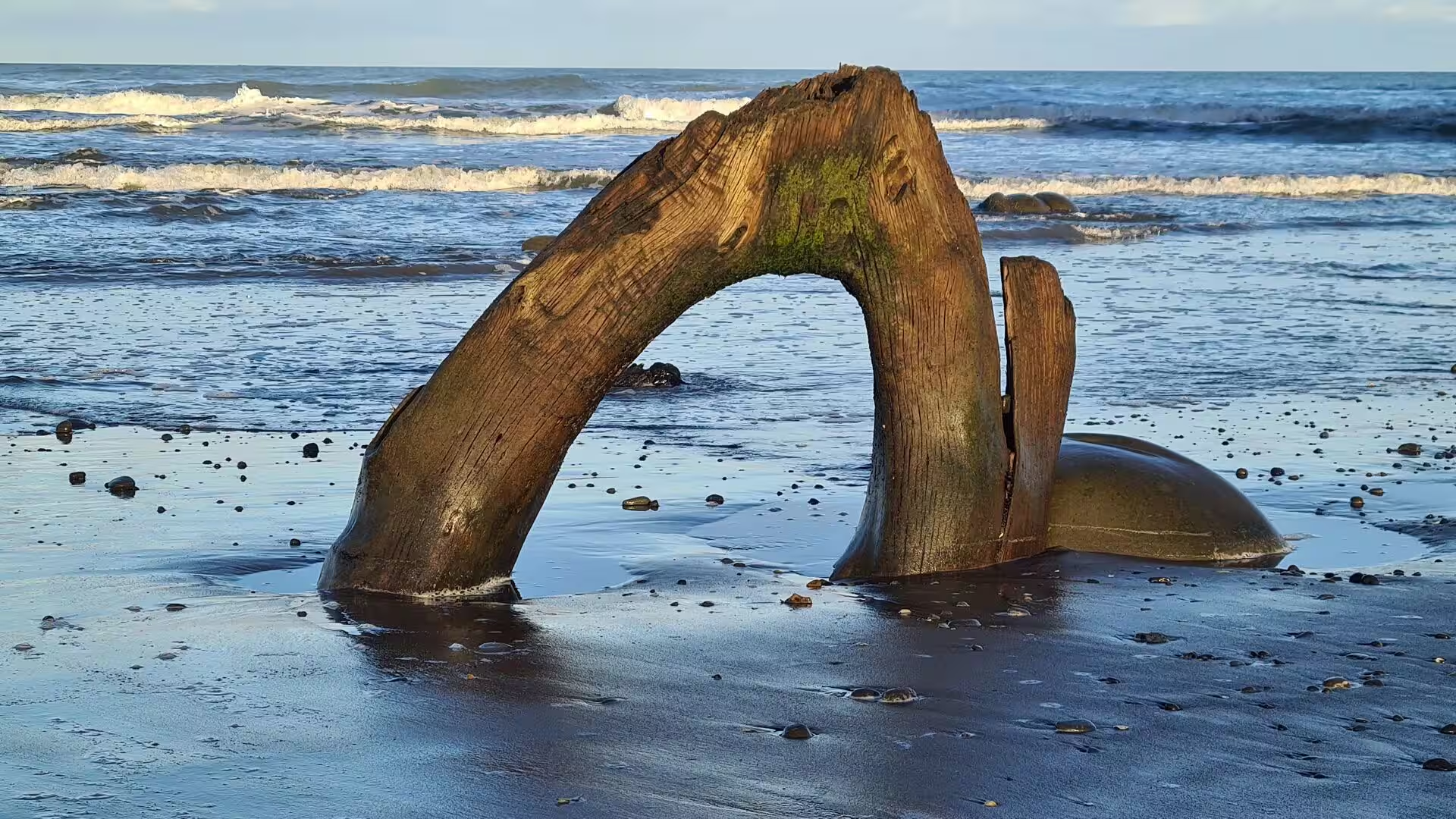
Dark volcanic sand is the signature of the exposed western coast between Taranaki and the far north. The foreshore sands carry heavy grains of titanomagnetite, an iron oxide mineral that also contains titanium, eroded from volcanic rock and sorted by the surf into dense black layers of ironsand on the beach; the dark sand absorbs the sun’s heat and can grow uncomfortably hot underfoot. Driftwood timber piles up along the high-tide line, and where the North Taranaki coast is cliffed, as at Tongaporutu, the road is forced inland over the hills. Farther north, great dune fields, their sand ultimately of volcanic origin, occupy much of the western shore of the peninsula.
Behind the coast, the King Country is hill country built of soft marine sediments. Around Waitomo the rocks include extensive Oligocene limestone, laid down on an ancient sea floor roughly 30 million years ago, in which streams have dissolved a classic karst landscape of caves, sinkholes and underground passages; the place name is said to mean water passing through a hole. North of the limestone country the land falls away to the low flood plains of the Waikato River, and then to the Auckland isthmus, a low neck of land between the Waitematā and Manukau harbours. The isthmus and its shores carry the Auckland volcanic field, some fifty separate volcanoes of basalt, of which the youngest and largest is the island cone of Rangitoto.
The rocks of Northland itself are older and more complex. On the eastern side of the peninsula, basement greywacke and argillite, the indurated sandstones and mudstones that form so much of New Zealand, are exposed at the surface. In early Miocene times, between about 24 and 21 million years ago, great sheets of older sea floor, of Cretaceous to Oligocene age, were thrust over the region from the northeast and now form the Northland allochthon, whose rocks outcrop across the corridor country between Wellsford and Albany; the lavas of its Tangihua complex represent ocean floor obducted onto land and rise into high forested massifs. Along both sides of the peninsula, belts of early Miocene arc volcanoes developed at the same time, and on the eastern side their eroded remnants include the volcanic headlands that guard the mouth of Whangārei Harbour. Since late Miocene times, small intra-plate basaltic eruptions have occurred around Whangārei itself, building the eroded cone of Parihaka above the town and the lava flows over which the Hātea River drops at Whangārei Falls.
The harbour at Whangārei occupies a drowned river valley, the lower course of the Hātea and its tributaries flooded as the sea rose after the last ice age. It is heavily tidal, with a rise and fall of about two metres, so that at low water much of its upper extent is mud flat and exposed sand, while the entrance channel, only a few hundred metres wide, is up to 20 metres deep and scoured by strong currents. The same drowning of river mouths created the Kaipara Harbour to the south-west, one of the largest harbours in the country, whose upper reaches the highway crosses on its way north.
Things to See
New Plymouth is the main city of Taranaki, laid out on the west coast at the foot of Mount Taranaki, the great volcanic cone that dominates the region. It was settled in 1841 as a planned town of the Plymouth Company, which sent emigrants from the west of England, and its seafront is now lined by a long coastal walkway along the Tasman Sea, while the gardens of Pukekura Park lie close to the town centre.
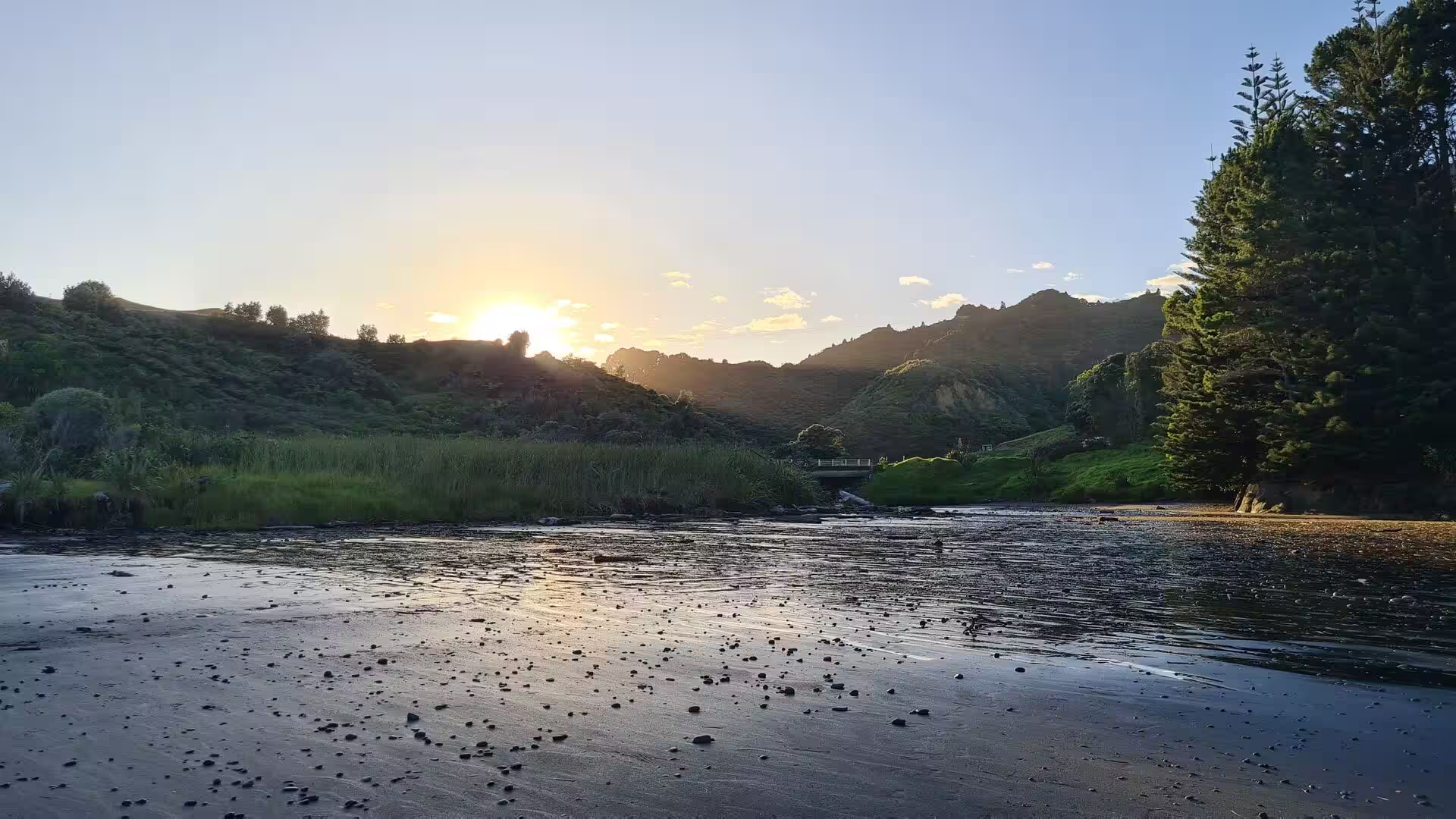
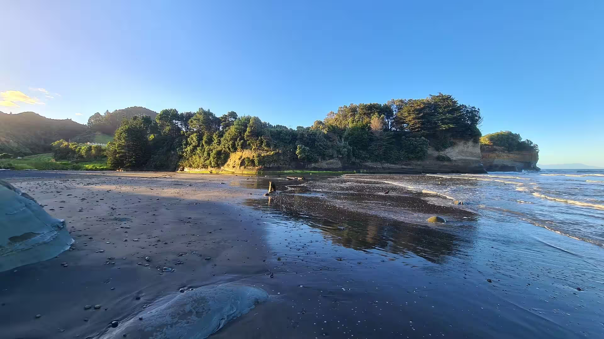
The western surf coast between Taranaki and Northland offers the kind of beach scenery for which the transfer is remembered. Long strands of dark sand face the full force of the Tasman swell, with driftwood timber scattered along the strandline and rounded stones and boulders where cliffs come down to the shore. Layered bluffs and bush-clad headlands run out between the beaches, and the heavy iron-rich grains are washed into rippled bands and glossy sheets of wet sand as the tide falls. Where streams reach the sea, broad tidal flats and shallow lagoons open behind the sand, and the light of a low sun turns the whole expanse of water and wet sand to a single reflecting surface.
Whangārei, the destination, is a working harbour town of about 54,000 people, built where the Hātea River meets the sea 23 kilometres from the harbour mouth. The town centre is compact and walkable, climbing the slopes below Mount Parihaka, and the harbour shore is given over to marinas, parks and cycle ways. The sheltered upper harbour is busy with yachts, launches and kayaks, and the Hātea Loop, a riverside walk, links the waterfront quarters of the inner city.
The Town Basin, the marina quarter on the Hātea River, stands on the site of the original port from which gum, timber and coal were once shipped. Cafés and galleries line the quays beside the boat berths, and the waterfront is anchored by the Hundertwasser Art Centre with the Wairau Māori Art Gallery, opened in February 2022 and built to designs by the artist and architect Friedensreich Hundertwasser, who lived for many years in Northland; its brightly coloured mosaic tower and planted roof rise above the marina, and the gallery is devoted to Māori art.
Otuihau Whangārei Falls lies on the Hātea River at Tikipunga, a few kilometres north of the centre. The river drops 26.3 metres over a cliff of basalt lava in a single wide curtain, and short tracks through native bush lead from the car park, with its lawns and picnic tables, to lookouts above and below the fall.
Mount Parihaka rises 241 metres directly behind the town centre as an eroded volcanic cone wrapped in the bush of the Parihaka Scenic Reserve. Three walking tracks climb through the regenerating forest to a summit viewing platform, and the slopes preserve the remains of one of the largest fortified pā sites in New Zealand, reputedly the largest of all: more than 100 house terraces and 300 kūmara storage pits have been counted along the ridges. A memorial to the fallen of the Second World War stands at the top, and the platform looks out over the city, the Hātea estuary and the harbour to the sea.
Whangārei Heads close the harbour at the seaward end, a line of steep, bush-clad volcanic headlands that shelter small bays and beaches on either shore. Reefs and islands at the entrance are popular with divers, and two marine reserves were gazetted in the harbour in 2006, one in the intertidal area between Onerahi and Waikaraka and one around Motukaroro Island at Reotahi. Beyond the heads, Bream Bay opens southwards toward the low peninsula of Marsden Point, with its refinery and port.
References
- King, Michael (2003). The Penguin History of New Zealand. Auckland: Penguin Books.
- Hayward, Bruce W., Murdoch, Graeme and Maitland, Gordon (2011). Volcanoes of Auckland: The Essential Guide. Auckland: Auckland University Press.
- Atkinson, Neill (2007). Trainland: How Railways Made New Zealand. Auckland: Random House.
- Parihaka Scenic Reserve. Whangārei District Council. www.wdc.govt.nz/Community/Facilities/Parks-and-recreation/Parks-and-reserves/Parihaka
- Otuihau Whangārei Falls. Whangārei District Council. www.wdc.govt.nz/Community/Facilities/Parks-and-recreation/Parks-and-reserves/Otuihau-Whangarei-Falls
- Hundertwasser Art Centre with Wairau Māori Art Gallery. www.hundertwasserartcentre.co.nz/
- Whangārei. en.wikipedia.org/wiki/Whangarei
- Whangārei Harbour. en.wikipedia.org/wiki/Whangarei_Harbour
- New Plymouth. en.wikipedia.org/wiki/New_Plymouth
- King Country. en.wikipedia.org/wiki/King_Country
- North Island Main Trunk. en.wikipedia.org/wiki/North_Island_Main_Trunk
- State Highway 1 (New Zealand). en.wikipedia.org/wiki/State_Highway_1_(New_Zealand)
- State Highway 3 (New Zealand). en.wikipedia.org/wiki/State_Highway_3_(New_Zealand)
- Geology of the Northland Region. en.wikipedia.org/wiki/Geology_of_the_Northland_Region
- Waitomo. en.wikipedia.org/wiki/Waitomo
- Ironsand. en.wikipedia.org/wiki/Ironsand