Day 9 - Around New Plymouth
20 July 2023



Journal Notes
General
New Plymouth is a coastal city on the west coast of New Zealand’s North Island and the principal urban centre of the Taranaki region. Its Māori name is Ngāmotu, and it faces the Tasman Sea across a wide bay ringed by green hills. The New Plymouth urban area had a population of about 58,000 at the 2023 census, while the wider New Plymouth District, a territory of roughly 2,200 square kilometres reaching from the Kaitake Range in the south to the river settlements of the northern bight, is home to about 87,000 people, over half of Taranaki’s 126,000 residents. The city is the region’s administrative, commercial and cultural hub.
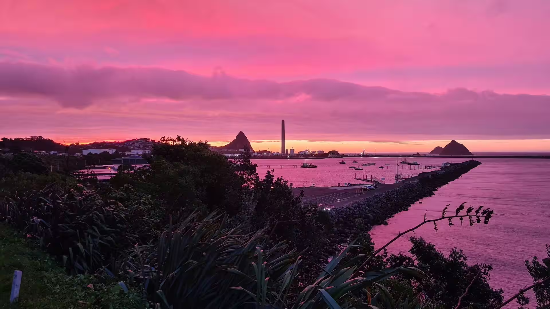
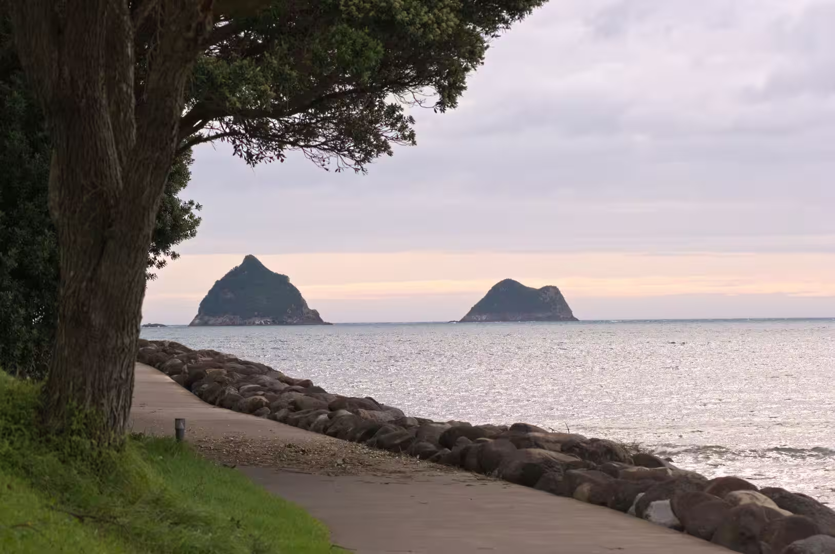
The heart of the city is its harbour at Moturoa, formed by a long breakwater and a reclaimed waterfront and used today by Port Taranaki, the only deep-water port on New Zealand’s west coast. Two reminders of the district’s volcanic past frame the harbour: the conical plug of Paritutu Rock, 156 metres high, and the low green islands of the Sugar Loaf group a short distance offshore. To the south, beyond the garden suburbs and dairy pastures, the near-perfect cone of Mount Taranaki rises to 2,518 metres and dominates the skyline from almost every street; renamed Taranaki Maunga in 2025, it lies about 25 kilometres south of the city.
New Plymouth is laid out on the street grid surveyed in 1841, and its suburbs climb the hills above a 13 kilometre seafront promenade, the Coastal Walkway, which runs from the mouth of the Waiwhakaiho River in the east to Port Taranaki in the west. The climate is moist and temperate, and the city has a well-known garden culture: the 52 hectare Pukekura Park lies in the centre, WOMAD and other festivals draw visitors each year, and New Plymouth ranks consistently among the country’s most liveable places. The economy rests on dairy farming, engineering and the oil and gas industry that makes Taranaki New Zealand’s only producing petroleum province.
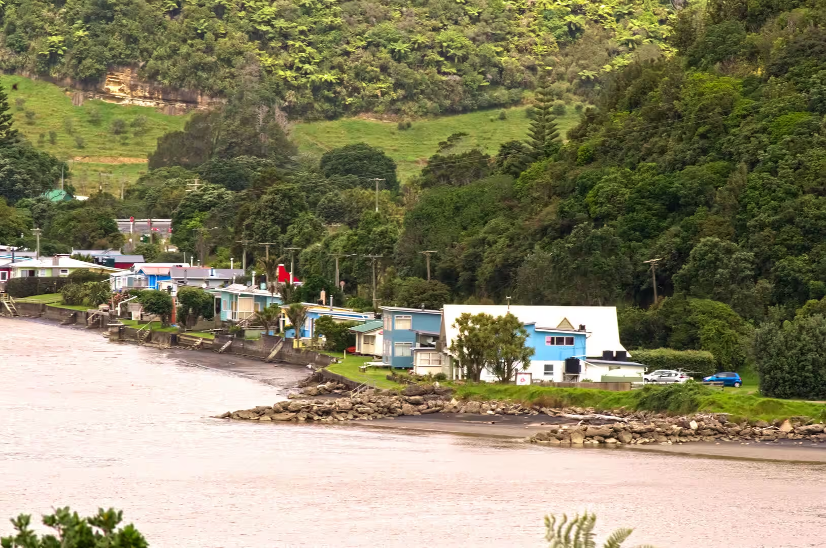
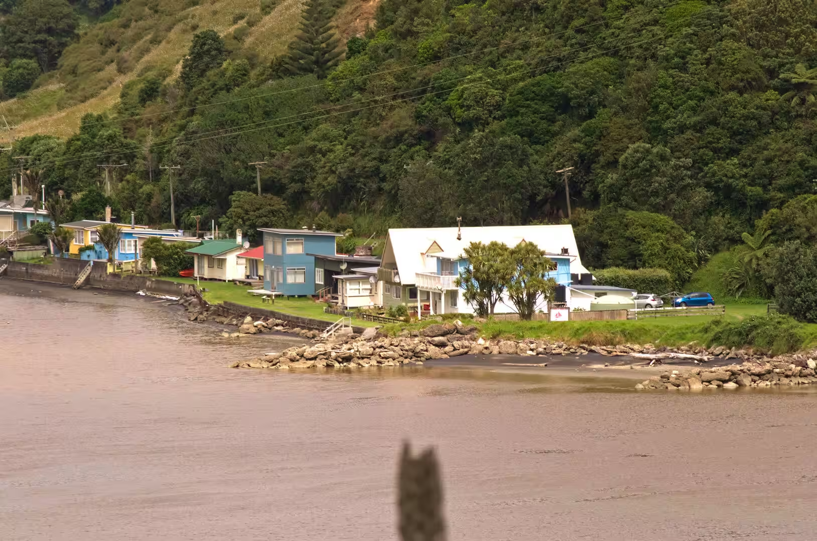
The district around the city offers contrasting coastal scenery within a short drive. North of the Waitara River, State Highway 3 follows the shore of the North Taranaki Bight through dairy country and bush-clad hills, past the small settlements of Ōnaero, Urenui, Mimi and Tongapōrutu. There the rivers reach the sea beneath low bridges, rows of brightly painted holiday cottages, known as baches, line the banks, and the open coast is one of layered sedimentary cliffs, sea stacks, arches and long, dark-sand beaches.
History
The coast around New Plymouth has been settled by Māori for centuries. The islands offshore, today called the Sugar Loaf Islands and known to Māori as Ngā Motu, were named by the Ngāti Te Whiti people of Te Āti Awa and served for generations as fishing grounds, refuges and burial places. Whalers and traders called from about 1823, and in 1828 Richard (Dicky) Barrett opened a trading post at Ngāmotu. In 1832 a Waikato war party besieged Ōtaka Pā on the harbour, and Barrett’s cannon helped drive it off; soon afterwards he and much of the local population, said to number as many as 3,000, migrated south to Cook Strait. The Musket Wars and the invasions of Waikato tribes emptied much of the Taranaki coast in the 1820s and 1830s: Ngāti Mutunga of Urenui and Ngāti Tama joined the southern migration, Ngāti Mutunga sailing on to the Chatham Islands in 1835. Te Āti Awa began returning in the 1840s, and in 1848 Wiremu Kīngi Te Rangitāke led a party back to reclaim ancestral lands around Waitara.
European settlement began with the land purchases of the New Zealand Company; its offshoot, the Plymouth Company, formed to recruit emigrants from Devon and Cornwall, sent out the William Bryan, which anchored off the coast on 31 March 1841. The surveyor Frederic Carrington laid out the grid of the town, named New Plymouth after the English port. Six ships brought more than 1,000 settlers between 1841 and 1843 before the Plymouth Company was absorbed by the New Zealand Company. From 1853 until the provinces were abolished in 1876 the settlement was governed as the New Plymouth Province, renamed Taranaki Province in 1858, and it became a borough in 1876.
Land, not settlement, shaped the district’s first decades. In 1859 a minor Te Āti Awa chief offered the Pekapeka block at Waitara for sale against the wishes of the paramount chief Wiremu Kīngi; Governor Thomas Gore Browne pressed the purchase regardless. After martial law was proclaimed in February 1860 and troops bombarded the Te Kohia pā on 17 March, the First Taranaki War ran until March 1861; more than 3,500 imperial soldiers, volunteers and militia fought Māori forces that rarely exceeded 1,500. New Plymouth became a fortified garrison town and many settlers left. From 1863 the Crown confiscated almost 485,000 hectares of Te Āti Awa land under the New Zealand Settlements Act 1863, and Ngāti Mutunga lands in the north were taken in 1865. The Waitangi Tribunal reported in 1996 that the Crown had acted unlawfully in beginning the war; settlement negotiations have continued since the late 1990s.
The best-known response to the confiscations came from Parihaka, founded about 1866 on the inland side of the mountain by the Te Āti Awa leaders Te Whiti o Rongomai and Tohu Kākahi. As surveyors moved onto the confiscated land in the late 1870s the two organised a campaign of non-violent resistance. From May 1879 ploughmen worked the disputed pastures from Ōakura in the south to Pukearuhe on the northern coast, and in 1880 fencers rebuilt again and again the fences that the armed constabulary pulled down. On 5 November 1881 about 1,600 troops and volunteers invaded Parihaka; Te Whiti and Tohu were arrested and imprisoned without trial, as were hundreds of their followers, many of them held for months. Long forgotten by European New Zealanders, the episode was restored to the national memory by Dick Scott’s history Ask That Mountain (1975); Parihaka remains a living community and a symbol of peaceful resistance.
Prosperity came with the clearing of the ring-plain forest and the spread of dairying from the 1880s, carried by rail (Waitara from 1875, Stratford from 1879) and by harbour works that created the modern port: the Ngāmotu breakwater was finished in 1883 and the Moturoa wharf in 1888. New Zealand’s oil industry began here too: the first wells were drilled at Moturoa in 1865 and 1866, a refinery opened in 1913, and the field produced intermittently until 1972. The modern petroleum era opened with the Kapuni gas field in 1959 and the offshore Maui field, discovered in 1969 and producing from 1979; the New Plymouth Power Station, fuelled by Taranaki gas, ran from 1974 to 2008. In 1989 the city council merged with the surrounding counties to form today’s New Plymouth District Council.
Geology
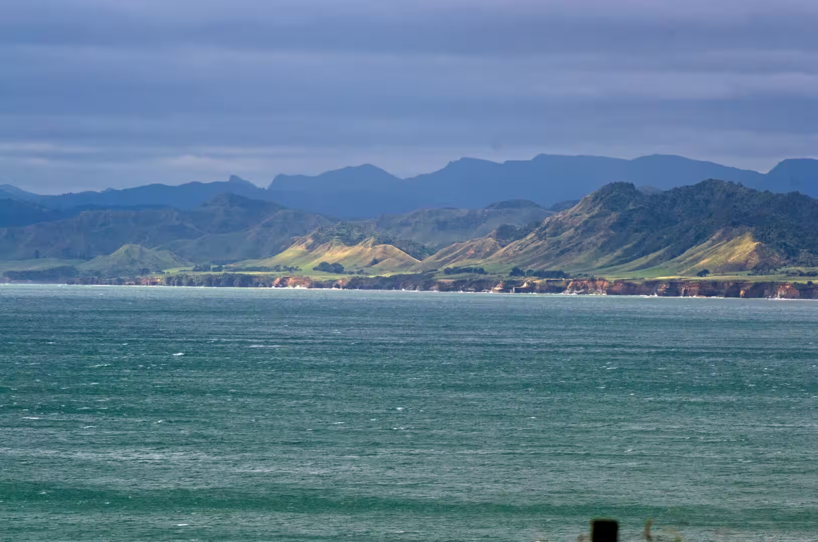
Two very different rock worlds meet in the district around New Plymouth. The city stands at the northern edge of the volcanic ring plain of Mount Taranaki, a gently sloping apron of lava, ash and lahar debris; north of the Waitara River the coast of the North Taranaki Bight is cut into older, soft sedimentary rock that forms the district’s layered sea cliffs and rolling hills.
The volcanoes are the youngest expression of the Taranaki Volcanic Lineament, a chain that has migrated south-east for the last 1.75 million years. Its oldest exposed remnants are the plugs of Paritutu Rock and the Sugar Loaf Islands at the harbour, porphyritic hornblende andesite dated to about 1.75 million years; the islands are also the type locality of the mineral taranakite, formed where seabird guano reacts with the andesite, the first new mineral species ever described from New Zealand. Activity later shifted to the Kaitake Range about 580,000 years ago and to Pouākai about 230,000 years ago before building the young cone of Taranaki itself, which began erupting roughly 200,000 years ago. The cone is now dormant: its last major eruption is dated to about 1655, with smaller ash eruptions following in the mid-1700s, and studies of the past 9,000 years suggest minor eruptions on average every 90 years and major ones every 500 years. Collapse events and lahars have repeatedly swept the flanks, leaving debris that reaches beyond the present coastline; rivers such as the Waitara and the Waiwhakaiho carry the volcanic sand and gravel northward to the sea.
Egmont National Park, created in 1900 as New Zealand’s second national park, protects the cone and the older Kaitake and Pouākai ranges in a near-circular block of native bush ringed by dairy pasture; the park was renamed Te Papa-Kura-o-Taranaki in 2025 and covers about 33,000 hectares. The ring plain’s deep, free-draining volcanic soils are among the most fertile in New Zealand and support the dairy farms that surround the city.
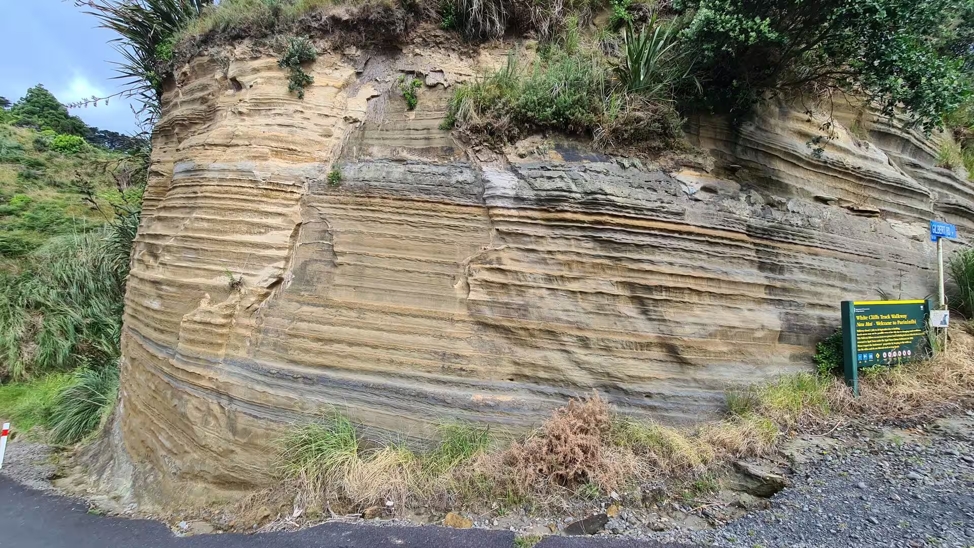
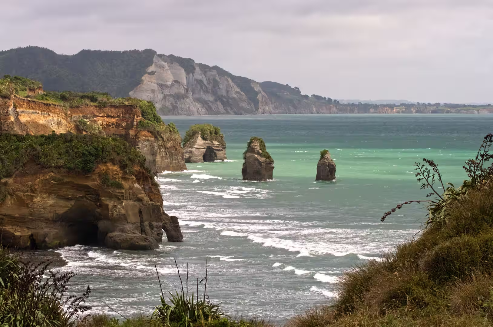
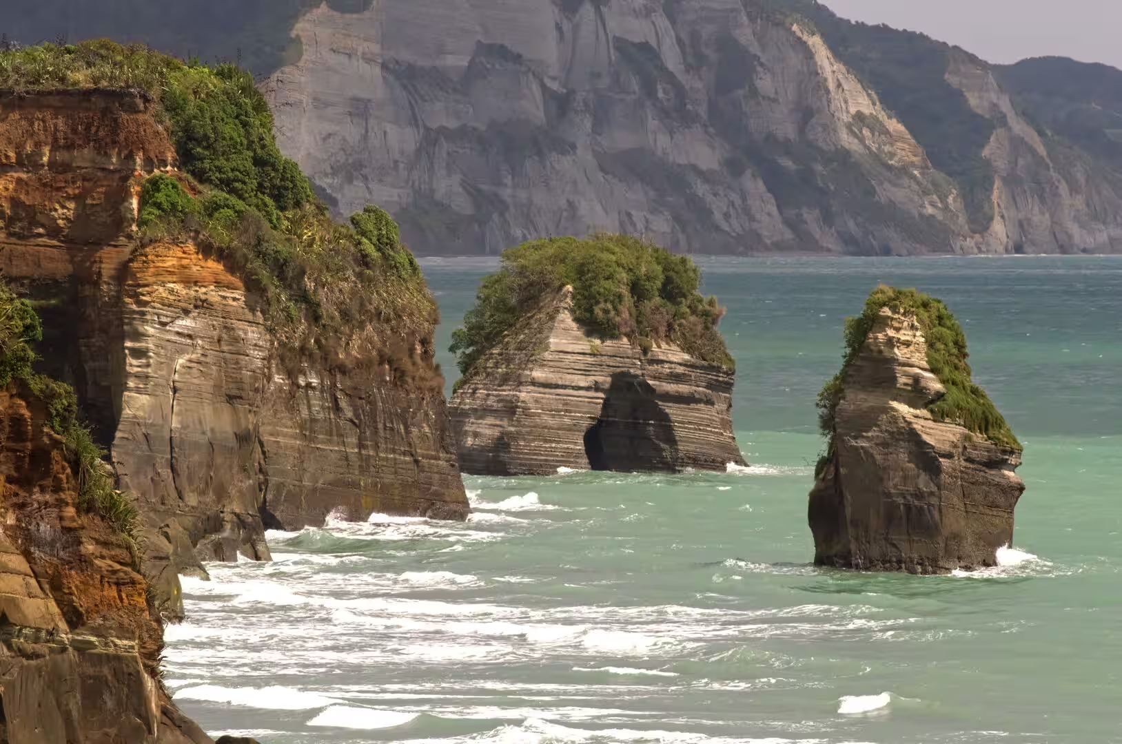
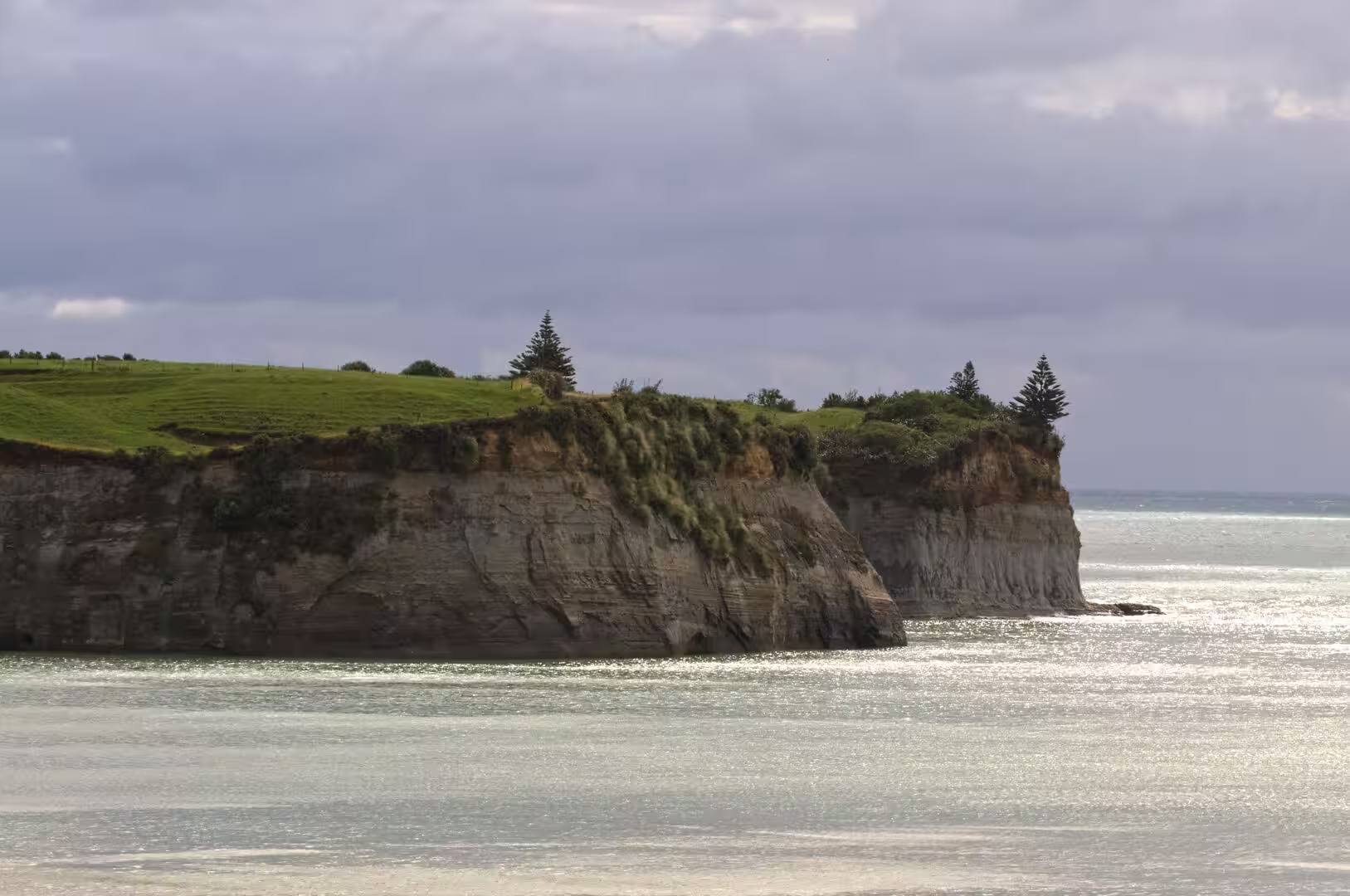
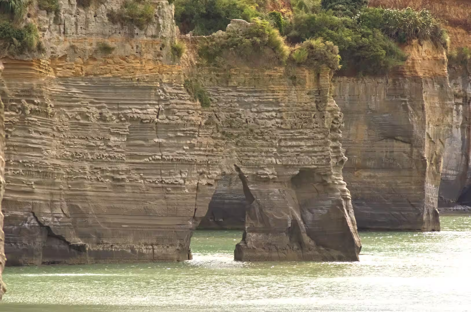
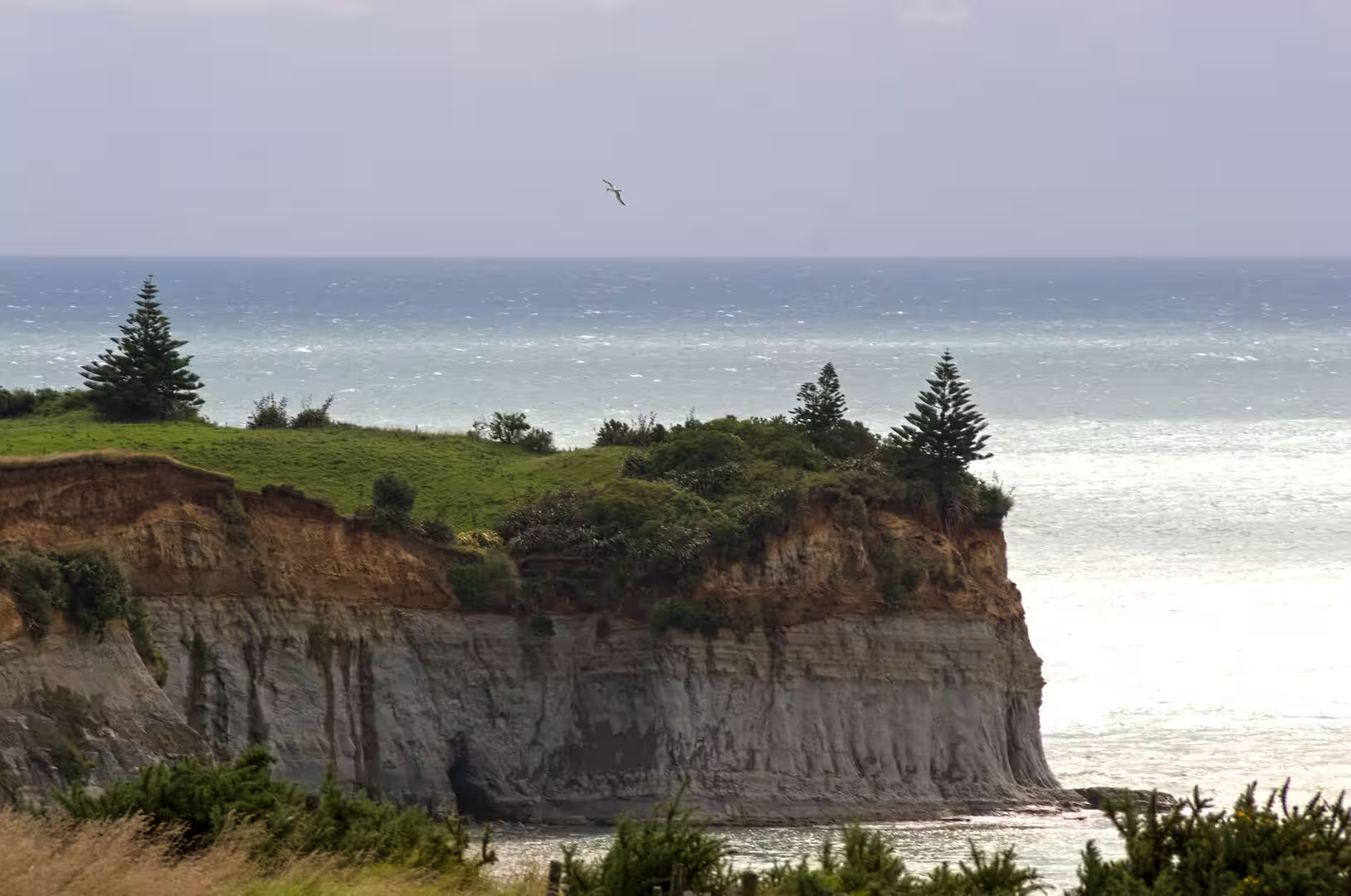
North of Waitara the cliffs and headlands are built of the Mount Messenger Formation, thick beds of grey sandstone alternating with thinner siltstones and mudstones that accumulated between about 9 and 11.5 million years ago as deep-water fans on the margin of the Taranaki Basin; the coastal section around Tongapōrutu is the reference section for the Tongaporutuan stage of the New Zealand geological timescale. The beds are soft and weakly cemented and are cut by countless small faults running parallel to the shore, so the sea erodes them unusually fast: survey work by GNS Science has measured roughly 20 metres of cliff retreat in a decade at some points. Waves quarry the rock along the faults, opening caves that widen into arches and isolating headlands as stacks, which is how the celebrated rock sculptures of the Tongapōrutu coast have formed. A raised marine terrace about 125,000 years old caps parts of the cliffs, recording the slow uplift of this coast, and offshore the same sedimentary succession continues into the Taranaki Basin, where its sandstones hold the oil and gas fields that supply New Zealand.
Things to See
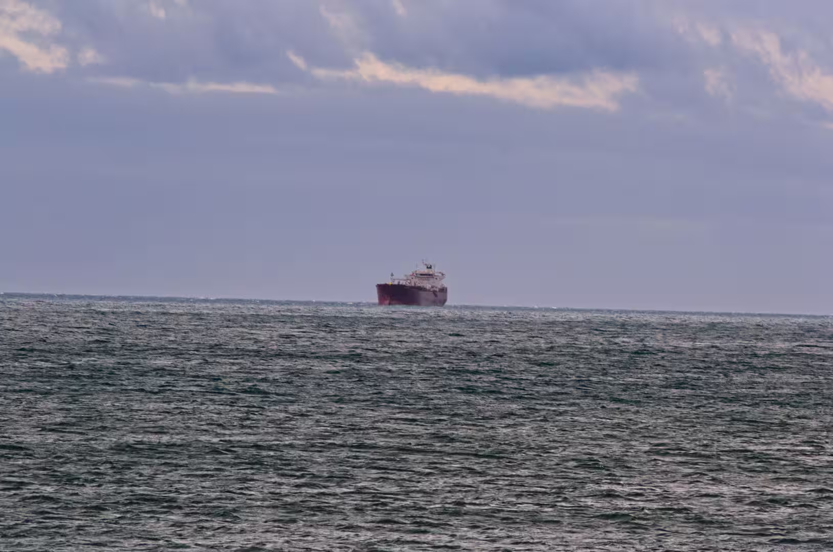
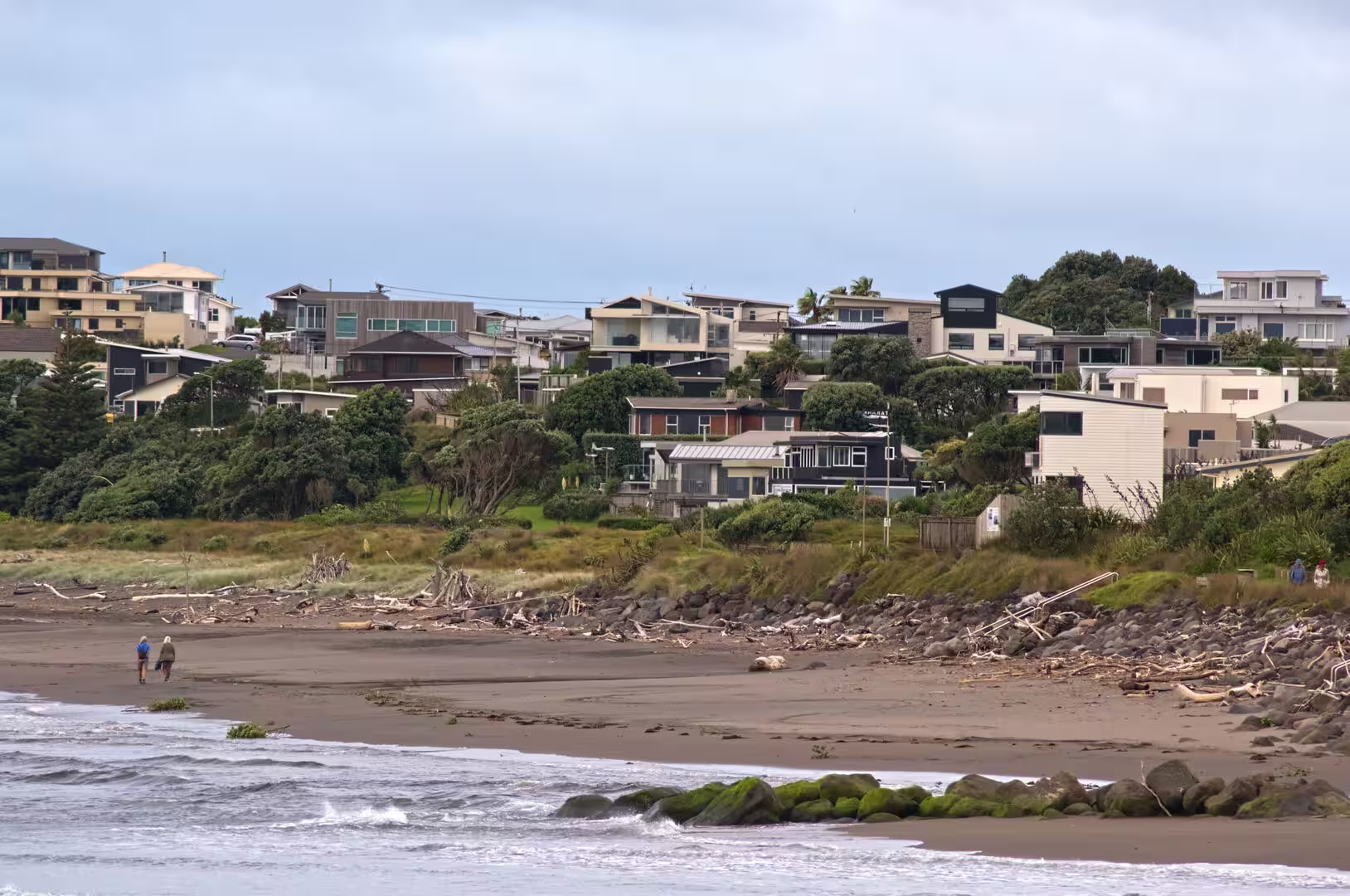
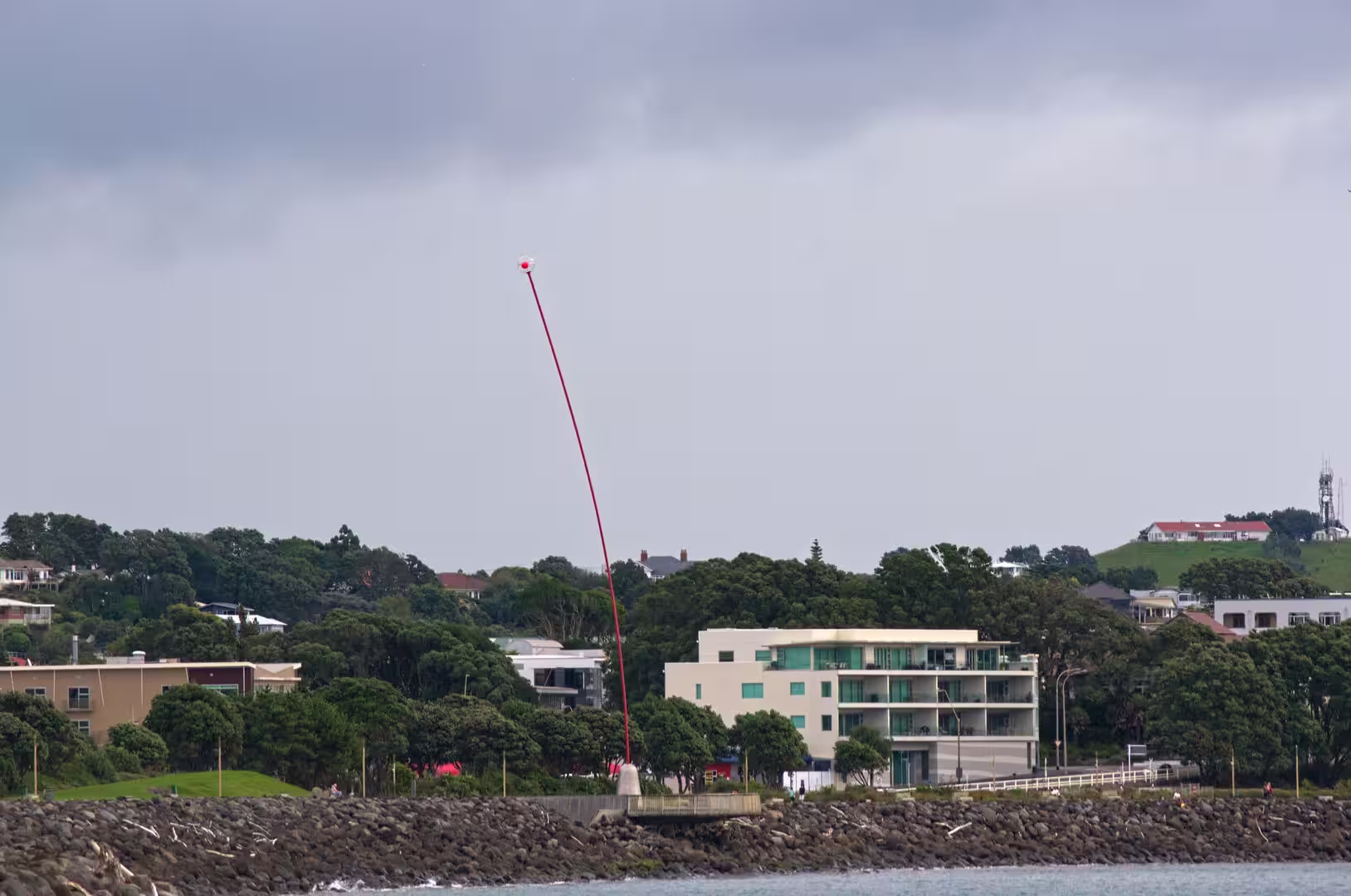
New Plymouth’s harbour and seafront: Port Taranaki at Moturoa was established in 1875, and the breakwater begun in 1881 was the first of the harbour works that made Ngāmotu a safe anchorage; the Moturoa wharf followed in 1888. Today it is New Zealand’s only deep-water harbour on the west coast, shipping dairy products, engineering cargo and petrochemicals from a basin busy with tugs, tankers and gas-field supply vessels. The bayside suburbs above the harbour climb the slope in terraces of houses and apartment blocks, and paths follow the boulder breakwaters along the shore. East of the port the Coastal Walkway, a 13 kilometre promenade, runs along the sea wall past the beaches of Ngāmotu and Fitzroy to the Te Rewa Rewa Bridge at the Waiwhakaiho River mouth.
Paritutu Rock and the Sugar Loaf Islands: Paritutu Rock, the 156 metre volcanic plug at the southern end of the port, carries a marked track that climbs its steep western face by steps and short chains to a trig station with views over city, sea and mountain. Immediately offshore lie the islands of Ngā Motu, or the Sugar Loaf Islands, a group of five small islands and several stacks that are the eroded remains of the same ancient volcano: Moturoa Island is the largest, Motumahanga (Saddleback Island) lies farthest out, and the inner rocks of Mataora and Motuotamatea are linked to the mainland at very low tides. The surrounding waters have been protected since the marine park of 1986, strengthened by the Sugar Loaf Islands Marine Protected Area Act 1991, and today form a nursery for fish and a refuge for little blue penguins, fur seals and seabirds. The islands can be visited only by permit; the sheltered bays are popular for kayaking and small-boat trips, and the neighbouring Tapuae Marine Reserve, created in 2008, extends the protection southward.
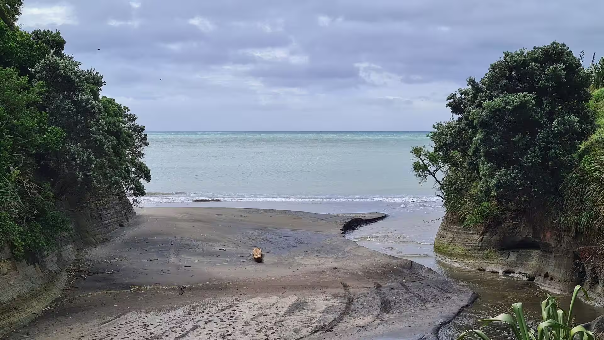
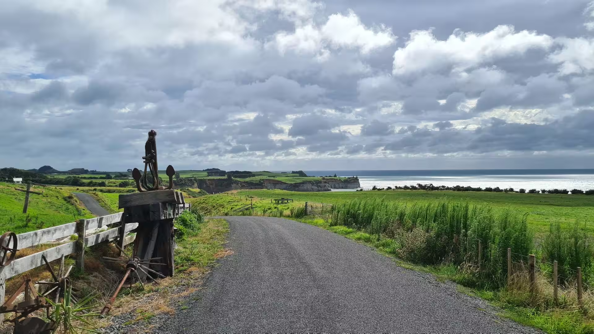
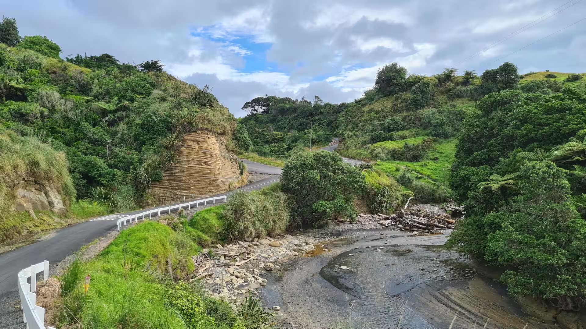
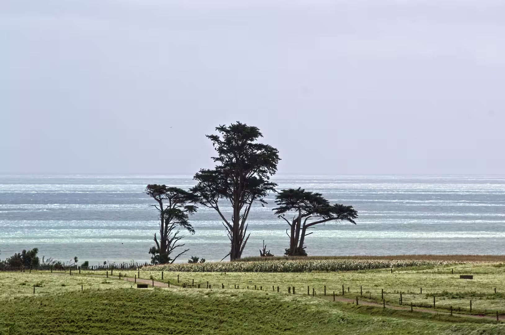
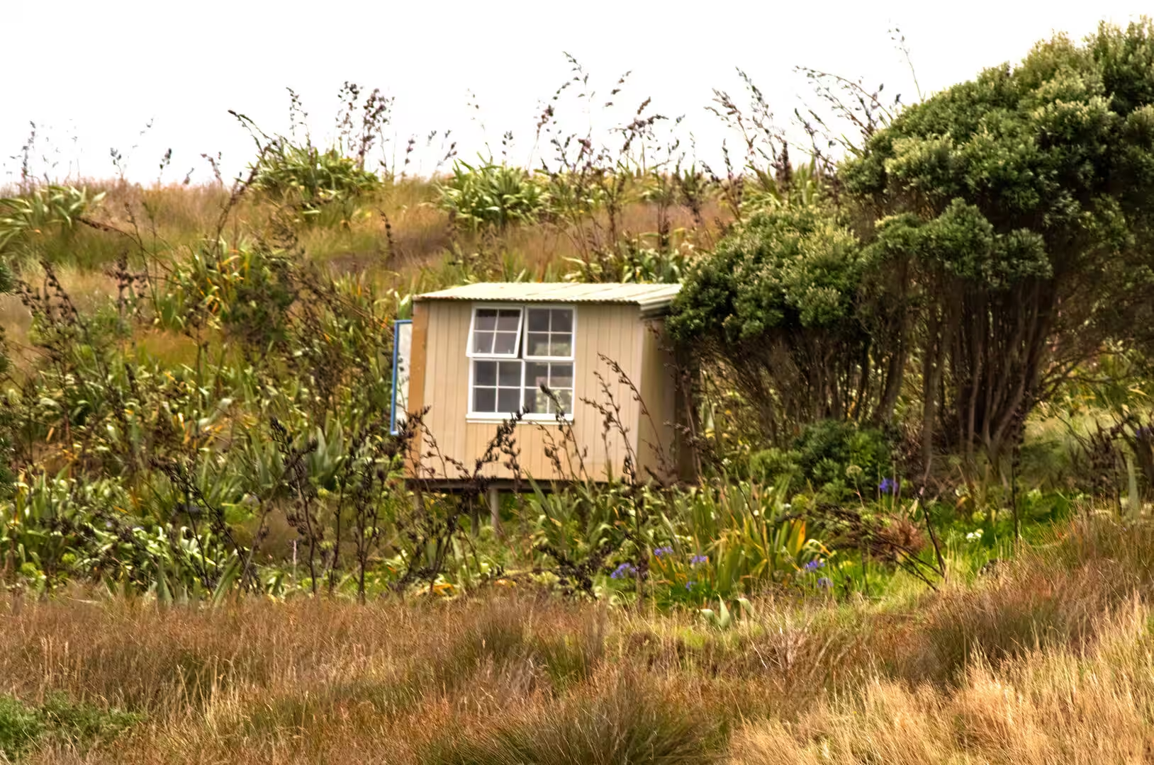
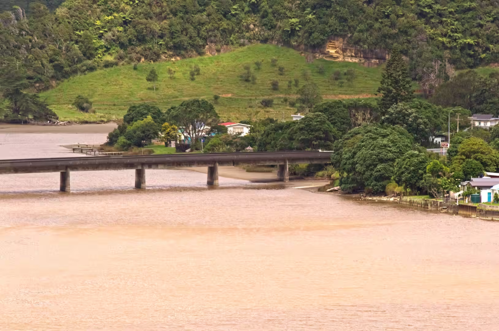
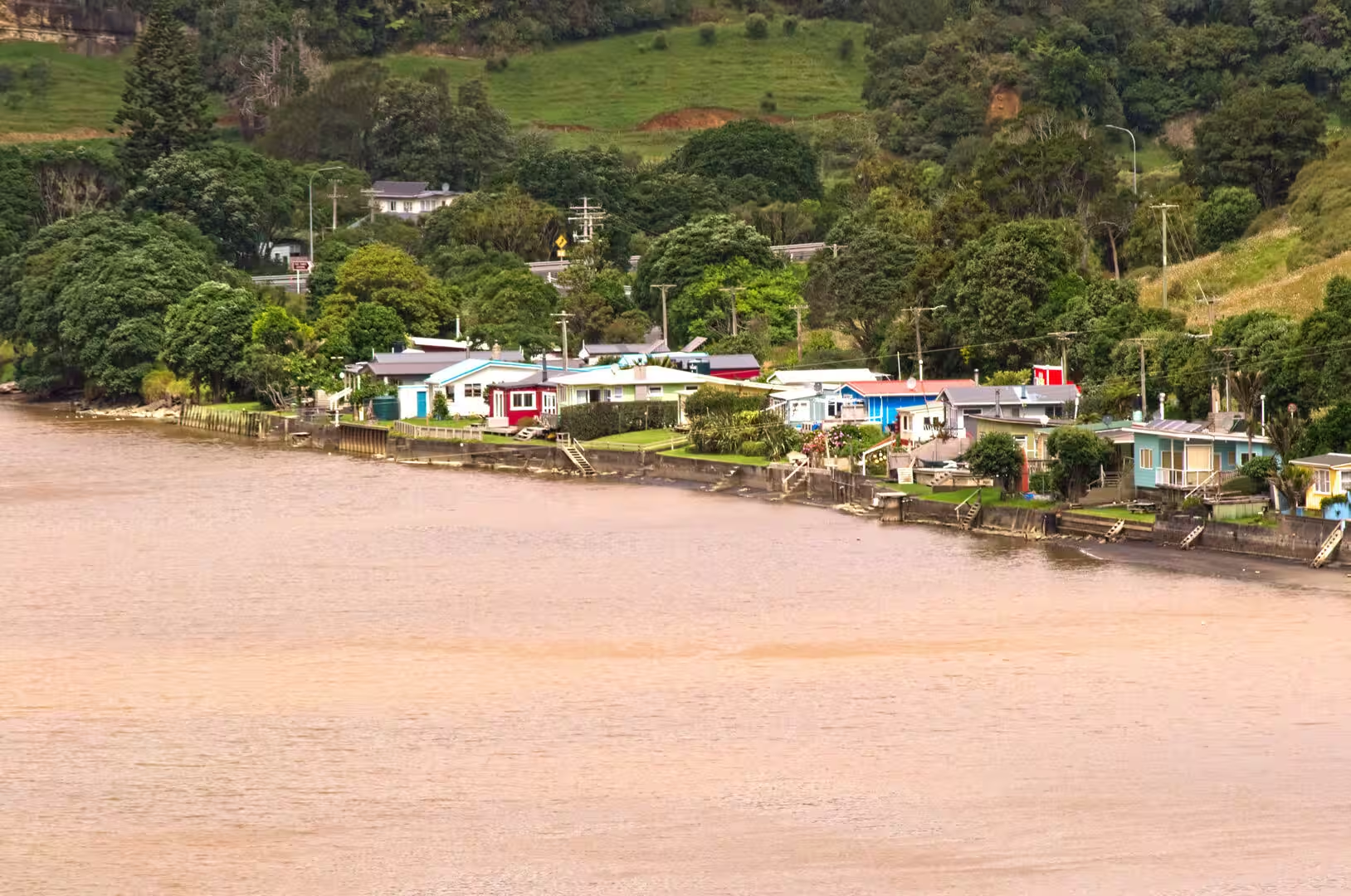
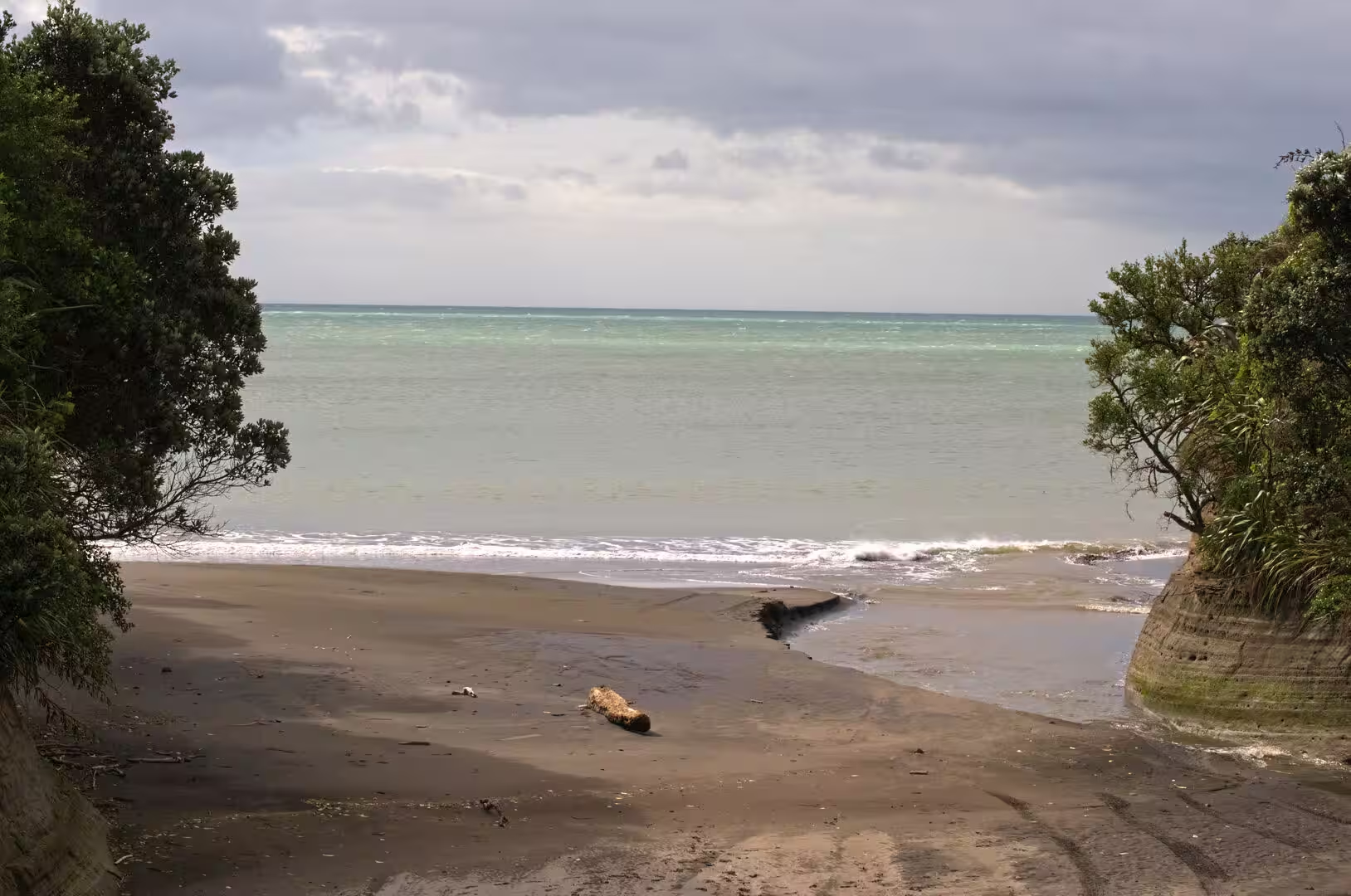
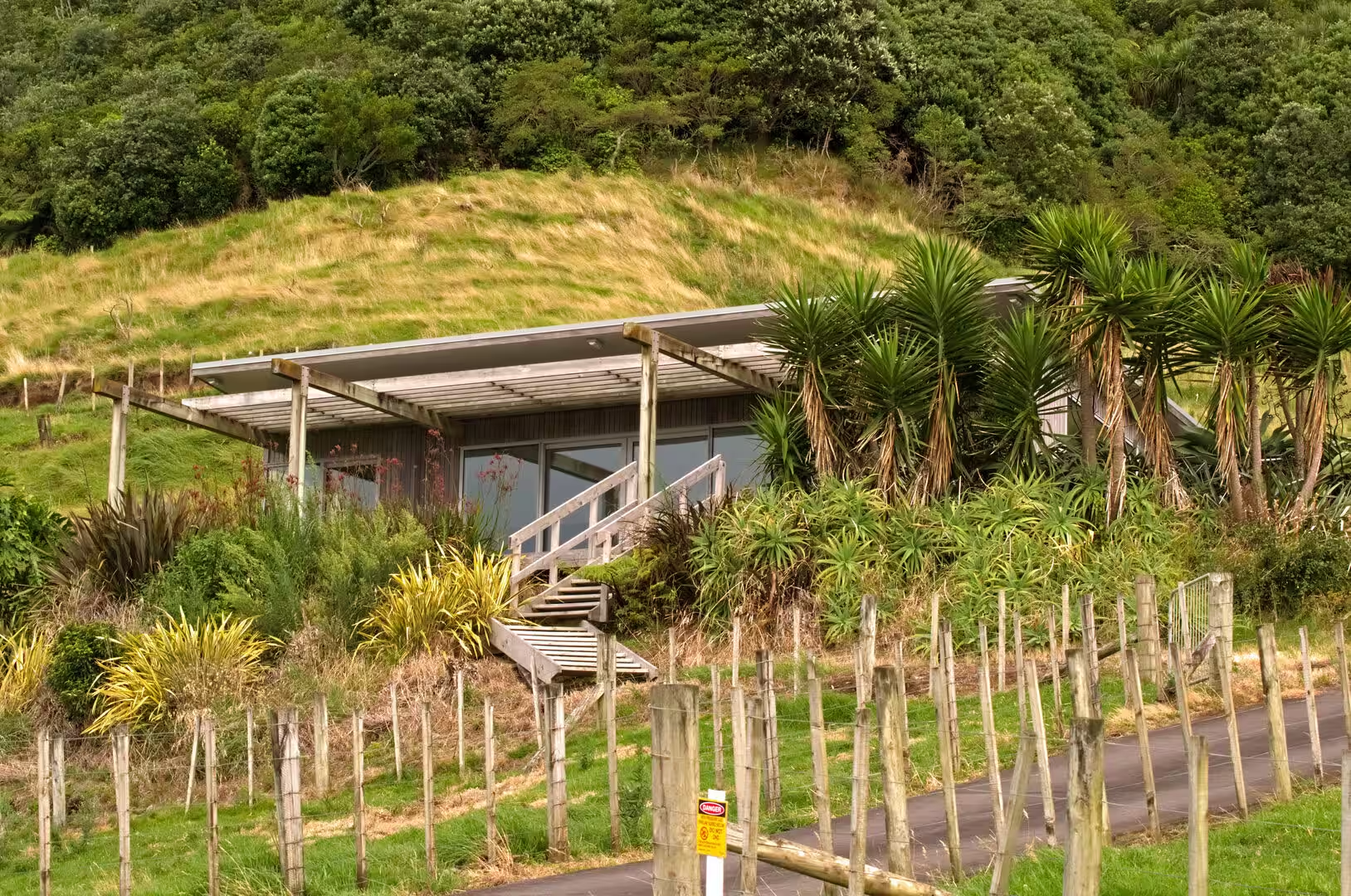
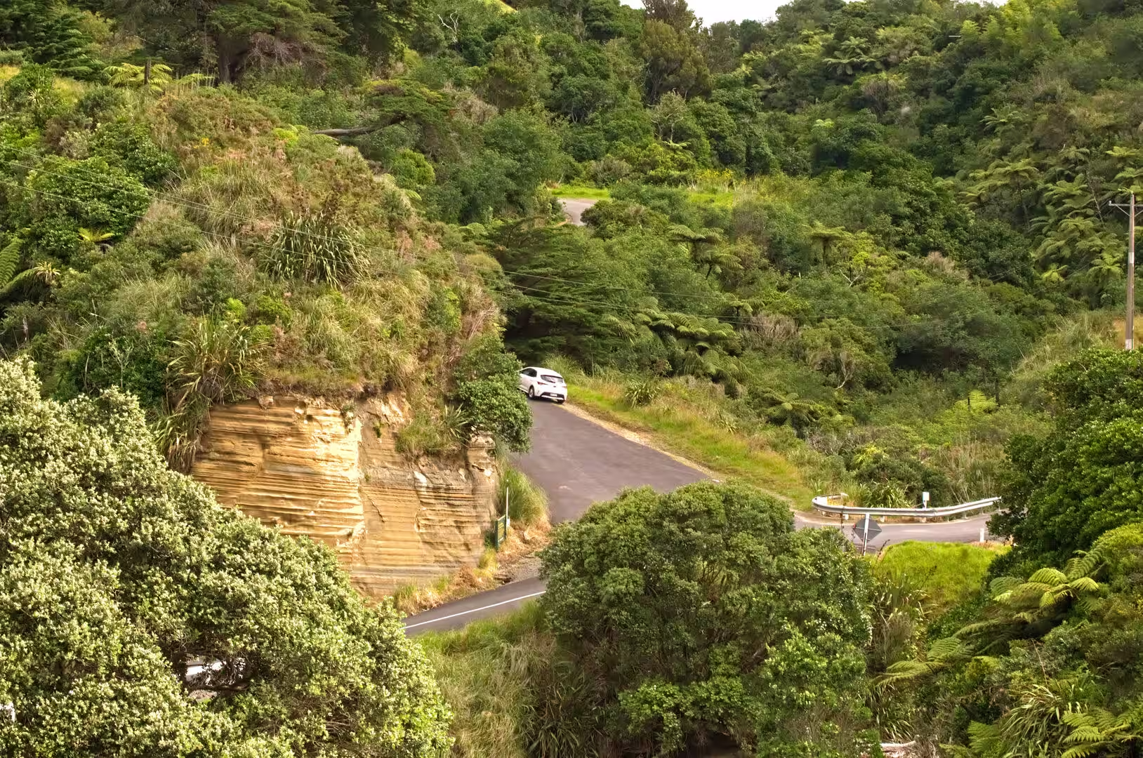
The North Taranaki Bight coast: North of Waitara the coastal road winds through farmland and bush-clad hills where road cuttings expose the same banded sandstones as the sea cliffs. Grassy headlands crowned with wind-shaped trees and Norfolk pines drop to the sea in pale, layered cliff faces, dark-sand beaches lie between rocky points, and on clear days Mount Taranaki closes the view to the south across the bight. Where the road dips to cross the tidal river mouths at Ōnaero, Urenui and Mimi, the settlements are summer places of tiny painted cottages, or baches, set along riprap banks above the water with their own jetties and small bridges. Offshore, shipping bound for the port keeps the horizon busy, while the valleys behind the coast shelter isolated homesteads and timber retreats among cabbage trees.
Urenui: Urenui is the largest of the river-mouth settlements on this stretch of coast, with a population of 447 at the 2023 census. The township and its beach lie on either side of the Urenui River, which the highway crosses by a low bridge below a green headland, and brightly painted baches line the estuary and the long surf beach. About three kilometres inland stands Urenui Marae with its Te Aroha meeting house, today the principal marae of Ngāti Mutunga, whose tribal district centres on this coast. The town was also the birthplace of two prominent Ngāti Mutunga physicians and scholars, Te Rangi Hīroa (Sir Peter Buck) and Māui Pōmare, and its primary school dates from 1876.
Tongapōrutu: Tongapōrutu is the last settlement of any size on the coast before the road runs on to Mōkau, 15 kilometres to the north; it lies at the mouth of the Tongapōrutu River, crossed by the highway bridge beside a scatter of beach houses. Below the bridge the river opens onto a wide beach of dark sand, and the low cliffs of the river mouth hold caves with Māori rock carvings, or petroglyphs, including one of a six-toed foot. Offshore, the coast is famous for its sea stacks and arches: the Three Sisters, a diminishing line of layered rock pillars of which two now stand, and Elephant Rock, a natural arch whose trunk-like pillar collapsed in 2016, are best reached at low tide across the beach from the riverside car park south of the bridge. The island of Pā Tangata at the river mouth was a fortified pā, and the eroding cliffs along this shore still reveal traces of Māori occupation.
References
- Wells, Benjamin (1878). The History of Taranaki: A Standard Work on the History of the Province. New Plymouth: Edmondson and Avery.
- Scott, Dick (1975). Ask That Mountain: The Story of Parihaka. Auckland: Heinemann/Southern Cross.
- Day, Kelvin (ed.) (2010). Contested Ground: The Taranaki Wars, 1860-1881. Wellington: Huia.
- King, Peter R. and Thrasher, Glenn P. (1996). Cretaceous-Cenozoic Geology and Petroleum Systems of the Taranaki Basin, New Zealand. Lower Hutt: Institute of Geological and Nuclear Sciences.
- Ngā Motu/Sugar Loaf Islands Marine Protected Area. www.doc.govt.nz/parks-and-recreation/places-to-go/taranaki/places/nga-motu-sugar-loaf-islands/
- Port Taranaki. www.porttaranaki.co.nz/
- Te Papa-Kura-o-Taranaki (Egmont National Park). www.doc.govt.nz/parks-and-recreation/places-to-go/taranaki/places/te-papa-kura-o-taranaki/
- Elephant Rock, Tongapōrutu. www.geotrips.org.nz/trip.html?id=467
- New Plymouth. en.wikipedia.org/wiki/New_Plymouth
- Taranaki. en.wikipedia.org/wiki/Taranaki
- Mount Taranaki. en.wikipedia.org/wiki/Mount_Taranaki
- Sugar Loaf Islands. en.wikipedia.org/wiki/Sugar_Loaf_Islands
- Parihaka. en.wikipedia.org/wiki/Parihaka
- First Taranaki War. en.wikipedia.org/wiki/First_Taranaki_War
- Te Āti Awa. en.wikipedia.org/wiki/Te_%C4%80ti_Awa
- Three Sisters and Elephant Rock. en.wikipedia.org/wiki/Three_Sisters_and_Elephant_Rock