Day 6 - Gisborne to Himatangi Beach
18 July 2023
Journal Notes
General
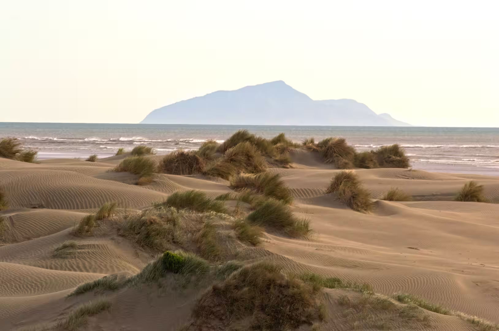
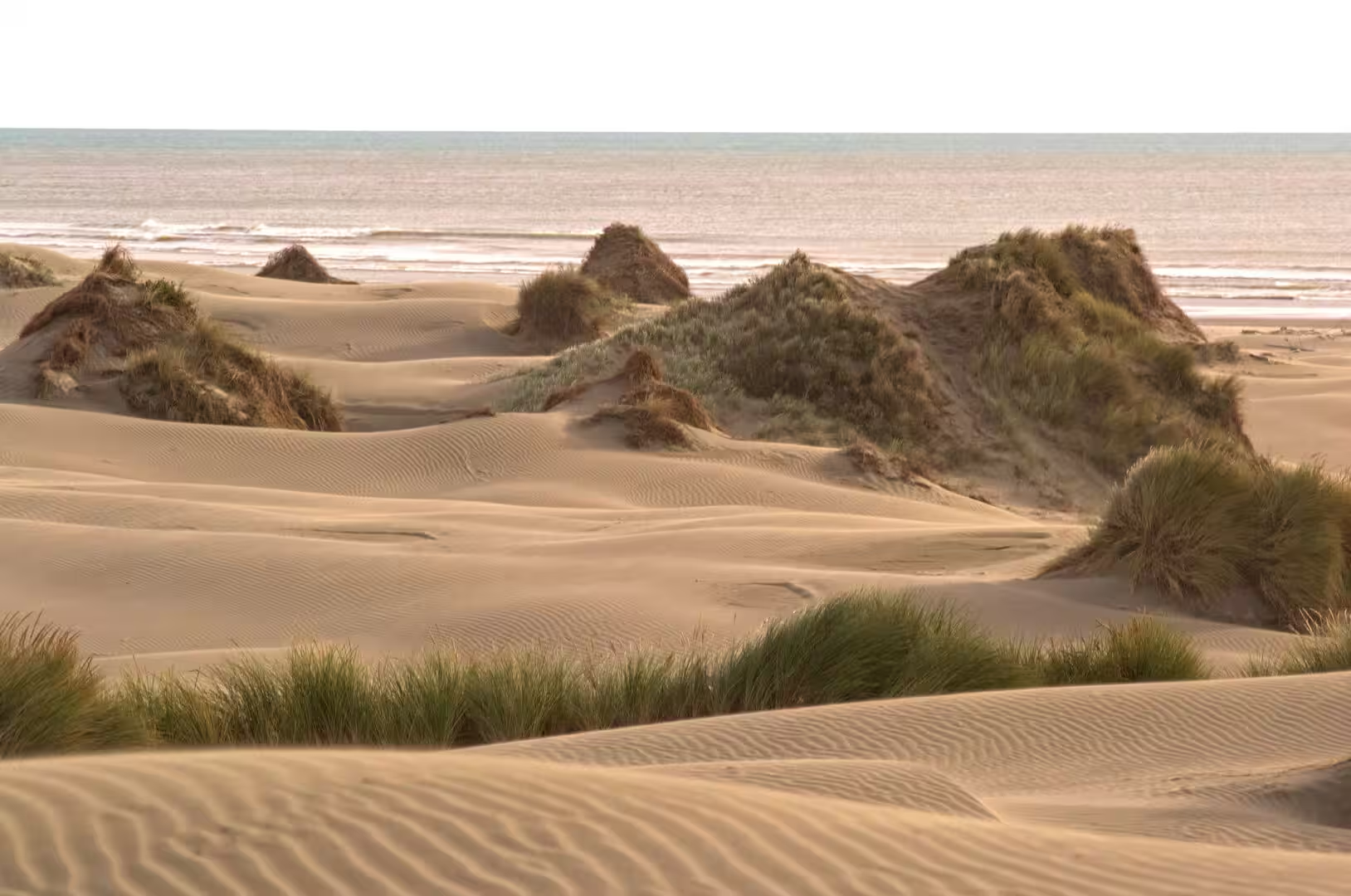
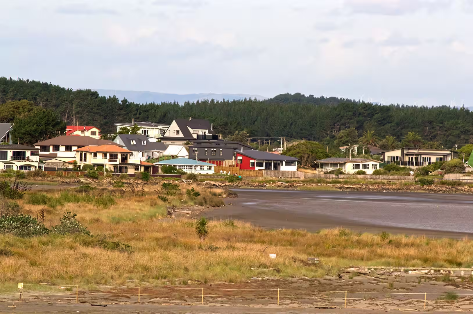
Himatangi Beach is a small coastal community on the west coast of the North Island of New Zealand, in the Manawatū District of the Manawatū-Whanganui region. It lies on the shore of the Tasman Sea, roughly 32 kilometres west of Palmerston North, at the end of a road that crosses a low plain of farmland, pine plantations, wetlands and dunes. The village itself is a loose scatter of houses behind the foredunes, and it is separated from the settled inland district by an extensive belt of sand country, described locally as the largest dune system in New Zealand: pale sand ridges, golden grasslands and wind-carved hollows that reach inland for many kilometres. There is no harbour; the beach runs straight and unbroken along the open coast.
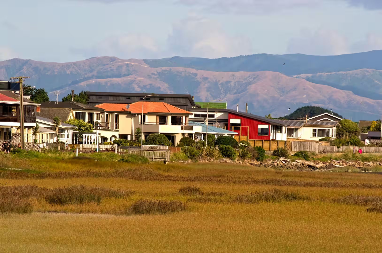
Statistics New Zealand classes Himatangi Beach as a rural settlement. The 2023 census counted 540 residents, up from 429 in 2013, and recorded a median age of 56 years, the profile of a community of retirees, commuters and owners of second homes such as lines much of the New Zealand coast. In summer the population swells to several thousand as holidaymakers fill the beach houses, known in New Zealand English as baches, and the village holiday park. Development has stayed low key: there is no resort strip, and the local economy turns on fishing, holiday letting, small services and the farms of the plain, while many residents commute to Palmerston North. The coastal strip has its own milder climate, with more sunshine and less rain than the inland Manawatū according to local accounts, though the winds off the Tasman are constant.
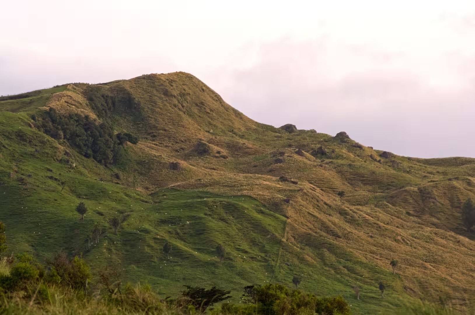
Himatangi Beach is the nearest seaside for the inland Manawatū, and Gisborne, at the eastern end of the same east-west corridor across the island, is its counterpart in almost every way. Gisborne is the chief town of the East Coast, built around the head of Poverty Bay where the Tūranganui River reaches the Pacific; its port, its vineyards, orchards and sheep country give it an economy and a character wholly different from the windblown dune coast of the west. Between the two coasts lie the hill country of the East Coast and the parallel ranges of Ruahine and Tararua; beyond them the land falls away to the straight beaches of the Tasman Sea. Few settlements in New Zealand are as fully shaped by their coast as Himatangi Beach, and few inland districts rely on their nearest beach as the Manawatū relies on this one.
History
The eastern end of the region, around what is now Gisborne, has been settled by Māori for more than 700 years. Traditions tell of the arrival of the Horouta and Tākitimu canoes, and the country around the Tūranganui River became the home of tribes such as Rongowhakaata, Te Aitanga-a-Māhaki, Ngāi Tāmanuhiri and Te Aitanga-a-Hauiti, all descendants of those voyagers. The bay itself was called Tūranganui-a-Kiwa, the long waiting place of the navigator Kiwa. Villages of fishers stood close to the sea while fortified pā crowned the hilltops, and the coastal plain and river mouths supplied fish, shellfish and birds in abundance.
In 1769 Captain James Cook became the first European to set foot in New Zealand when his party came ashore in this bay. Land was first sighted on 6 October, when the boy Nicholas Young picked out the headland that still bears his name, and on 9 October Cook came ashore on the eastern bank of the Tūranganui River. The first encounters went badly: misunderstanding turned to violence, and within four days nine Māori had been killed or wounded, among the first casualties the local man Te Maro. Because the expedition could obtain few of the supplies it needed, Cook called the inlet Poverty Bay, a name it keeps today.
Traders and whalers were working from the river mouth by the 1830s, and the township of Turanga grew into the port town that became Gisborne: the Crown bought the town site in 1868, the streets were laid out in 1870, and the settlement was renamed Gisborne after the colonial secretary, William Gisborne, to avoid confusion with Tauranga. A borough council followed in 1877.
The same district is one of the historic heartlands of Māori carving. In 1842 the Rongowhakaata chief Raharuhi Rukupō began work at Ōrakaiapu pā, near Manutukē to the south of Gisborne, on the meeting house Te Hau ki Tūranga, raised with eighteen other master carvers of the Tūranga school as a memorial to his elder brother; it is generally regarded as the oldest surviving carved meeting house in the country. After the fighting of the 1860s the house was taken in 1867 by the Native Minister, J. C. Richmond, and carried to Wellington, where it later stood in the Dominion Museum and Te Papa. The taking was long contested: the Waitangi Tribunal found the removal wrongful, and in 2011 the Crown signed a deed of settlement with Rongowhakaata at Whakatō Marae in Manutukē, returning ownership of Te Hau ki Tūranga to the iwi.
On the western side of the island, the coast that includes Himatangi Beach is the traditional territory of Rangitāne, whose rohe runs along the shore from the mouth of the Rangitīkei River to the mouth of the Manawatū River, with the Muaūpoko of the Horowhenua and Kāpiti coast to the south. Both iwi trace their origins to Whātonga, the Kurahaupō explorer said to have found the pass through the ranges. Coastal kāinga and marae lined the rivers and the beach, and the dunes, wetlands and river mouths provided fish, eels, waterfowl and flax. In the 1820s the southward migration of Ngāti Toa under Te Rauparaha shattered this order: the island pā of the Muaūpoko on Lake Horowhenua were destroyed and the iwi nearly exterminated, while Rangitāne too lost ground.
European settlement transformed the lowlands from the 1860s. The Crown purchased large areas of the Manawatū from its Māori owners, Palmerston North was founded in 1866 on the bank of the river, and in the 1870s the bush was felled for farms. Before roads and railways the sweep of beach was itself the main highway of the coast, and the port at the river mouth shipped flax, timber and farm produce; three flax booms between 1869 and the early twentieth century filled its warehouses with wool packs, matting and rope. After the railway from Wellington reached the region in 1886 the port declined and the flax trade faded. Clearance of the native plant cover set the dunes drifting inland until marram grass and pines pinned them in the twentieth century. Himatangi Beach itself grew slowly from the mid-twentieth century as a settlement of holiday baches, and its permanent population has climbed only in recent censuses.
Geology
Himatangi Beach lies at the seaward edge of the Manawatū lowlands, the low plain between the coast and the Ruahine and Tararua ranges. The plain is a raised seabed: it lay under the sea until about half a million years ago, and beneath it lie thick marine sediments more than five million years old. As the Australian and Pacific plates converge, the old sea floor has been gently buckled into long low ridges, or anticlines, which run parallel to the mountains and steer the rivers of the region towards the south-west.
The ranges themselves are built of hard greywacke sandstone and mudstone, and they are young: the Tararua Range began to rise only about 10 million years ago. The Manawatū River, which rises on the eastern side of the ranges near Norsewood, is older than the mountains through which it now flows. As the ranges were uplifted, beginning roughly three million years ago, the river cut downwards fast enough to hold its course, and it now crosses the mountains through the steep-sided Manawatū Gorge, a water gap rare in New Zealand and worldwide. Beyond the gorge the river meanders across the plain to the sea, carrying the gravel, sand and silt that have built the lowlands and the great spread of dunes along the coast.
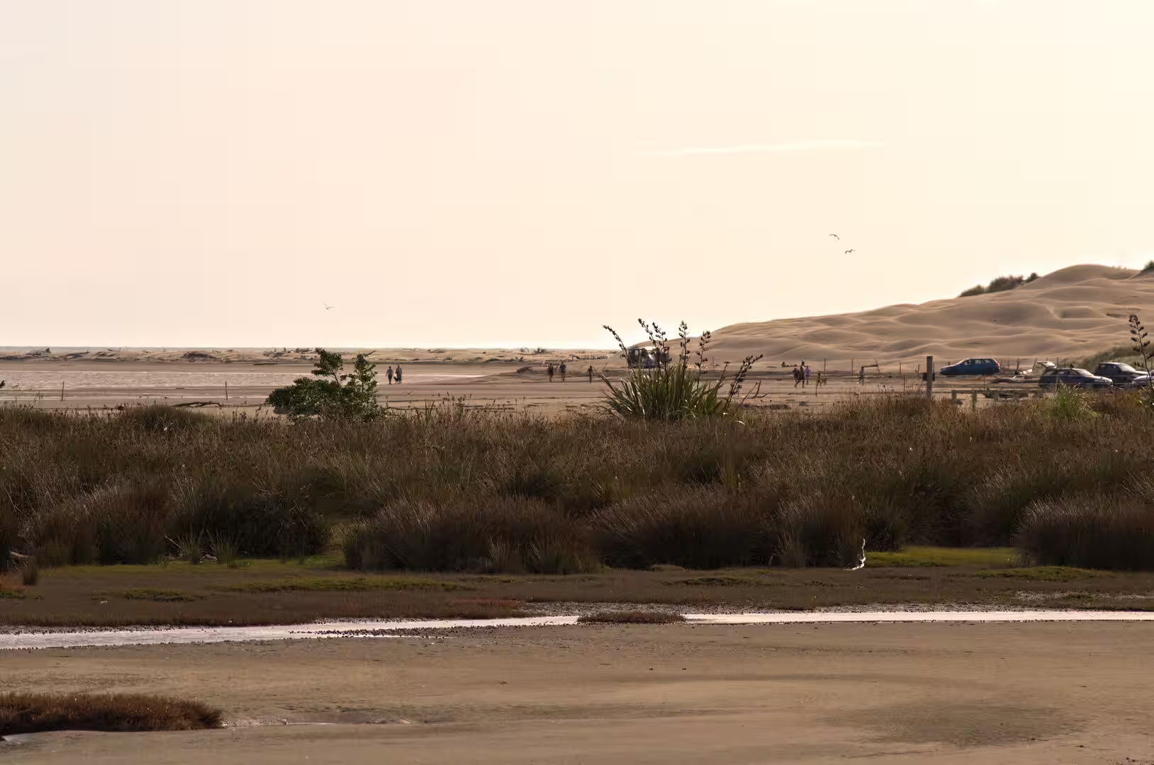
The dunes of the Manawatū coast are among the most extensive in New Zealand. Geologists distinguish several generations of dunes laid down as the coastline built seaward during the last ice age and the Holocene: the oldest belt lies far inland and dates from between about 10,000 and 20,000 years ago, while the youngest began to form less than about 120 years ago and has already buried material of the European era. The pattern of dune building was episodic, with periods of advancing sand alternating with quieter times when plant cover fixed the dunes in place.
The most recent advance was set off by human land use. Grazing and clearance from the mid-nineteenth century destroyed the native dune cover, and in places the bare sand marched inland across grassland and roads; since the early twentieth century marram grass, lupins and plantations of pine have held the dunes, though new blowouts still form where the foredune is disturbed. The shoreline itself has continued to build seaward: the wreck of the sailing ship Hydrabad, cast ashore in 1878, lay at the water’s edge in the 1970s but now stands high above the tide, buried in sand.
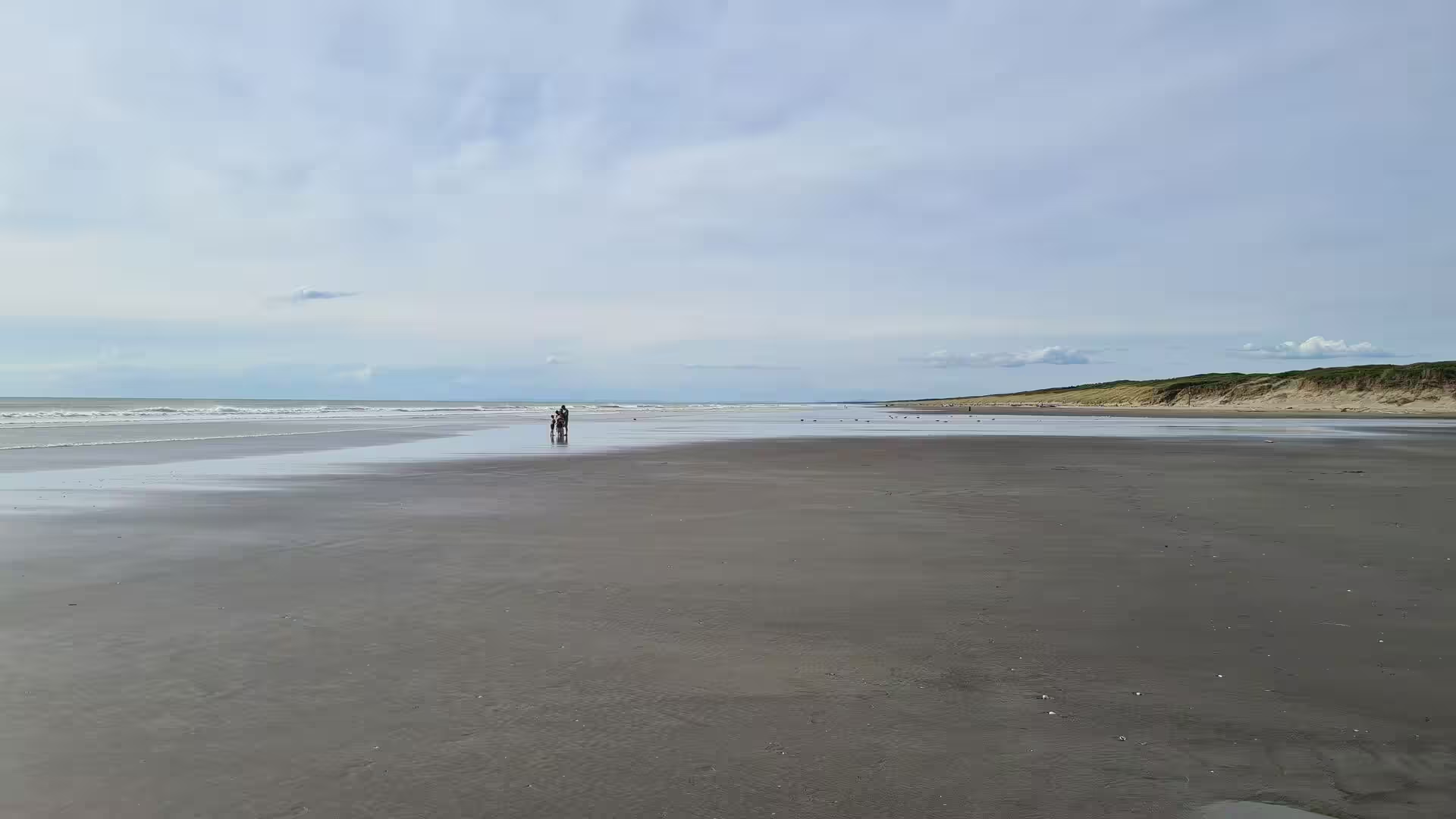
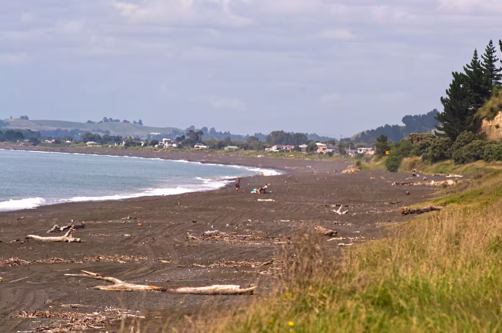
The beach sand itself is dark. Like the other exposed beaches of the North Island west coast it carries dark iron-bearing grains, including titanomagnetite eroded from the volcanic rocks of Taranaki and the central North Island and carried to the sea by rivers, where waves and wind concentrate the heavy black minerals. Wet, the sand takes on a near-black sheen; dry, it is firm grey sand, compact enough to be driven on below the high-tide line.
Things to See
Gisborne stands at the head of Poverty Bay beneath the green bulk of Kaiti Hill, known today as Titirangi Domain. The hill carries a memorial raised in 2019 by Ngāti Oneone in honour of Te Maro, among the first of the local people to die in the encounters with Cook’s party in 1769, and it commands the classic view over the bay, the harbour and the river mouth. Below the hill, Kaiti Beach is the historic landing place, marked since 1906 by a monument to the visit of the Endeavour, and the surrounding land was registered as a national historic reserve in 1990. Because the bay opens towards the east, these beaches catch the sun rising directly out of the Pacific, and the city waterfront, with its working port at the river mouth, keeps the unpolished air of a genuine coastal town.
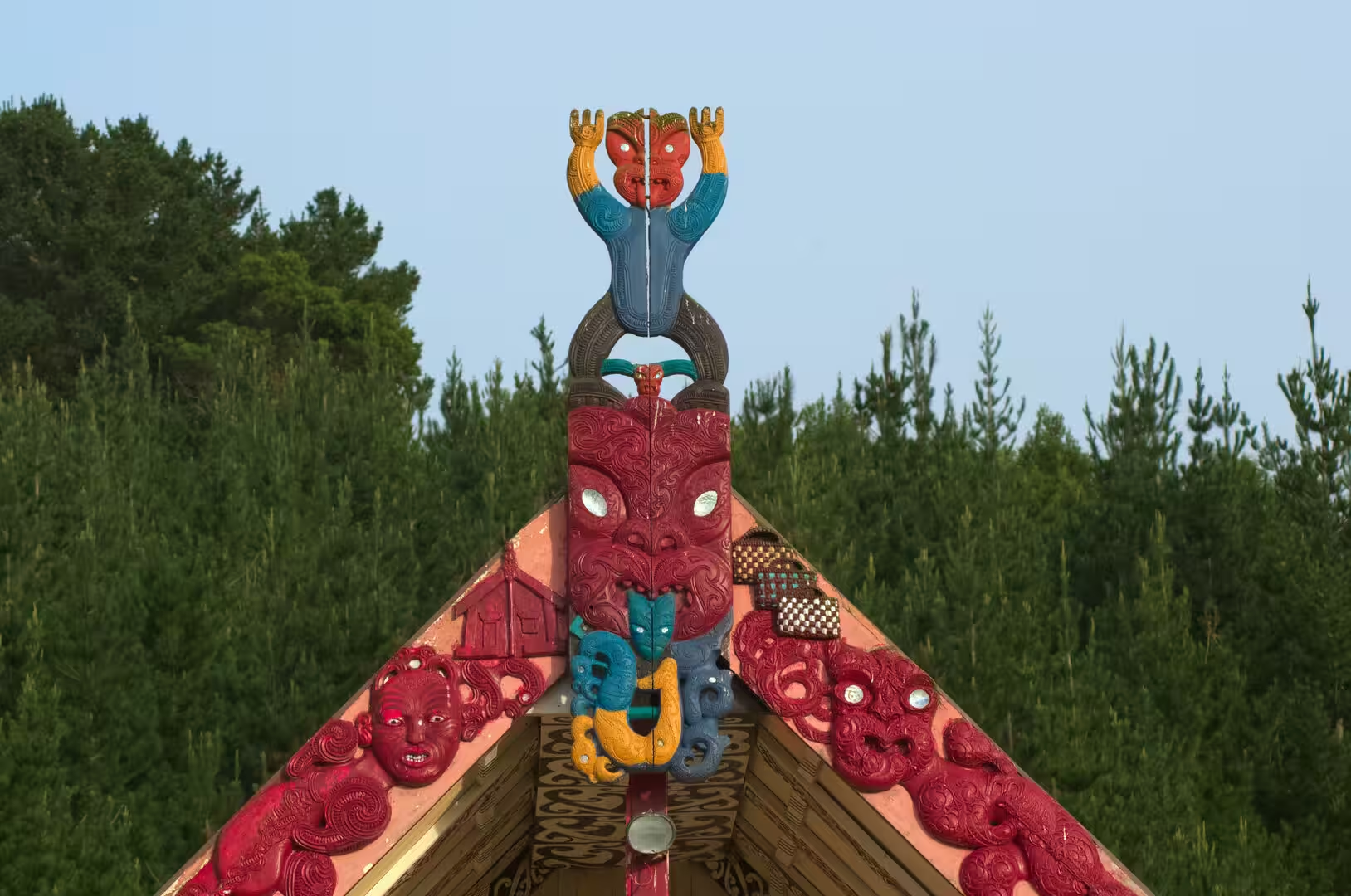
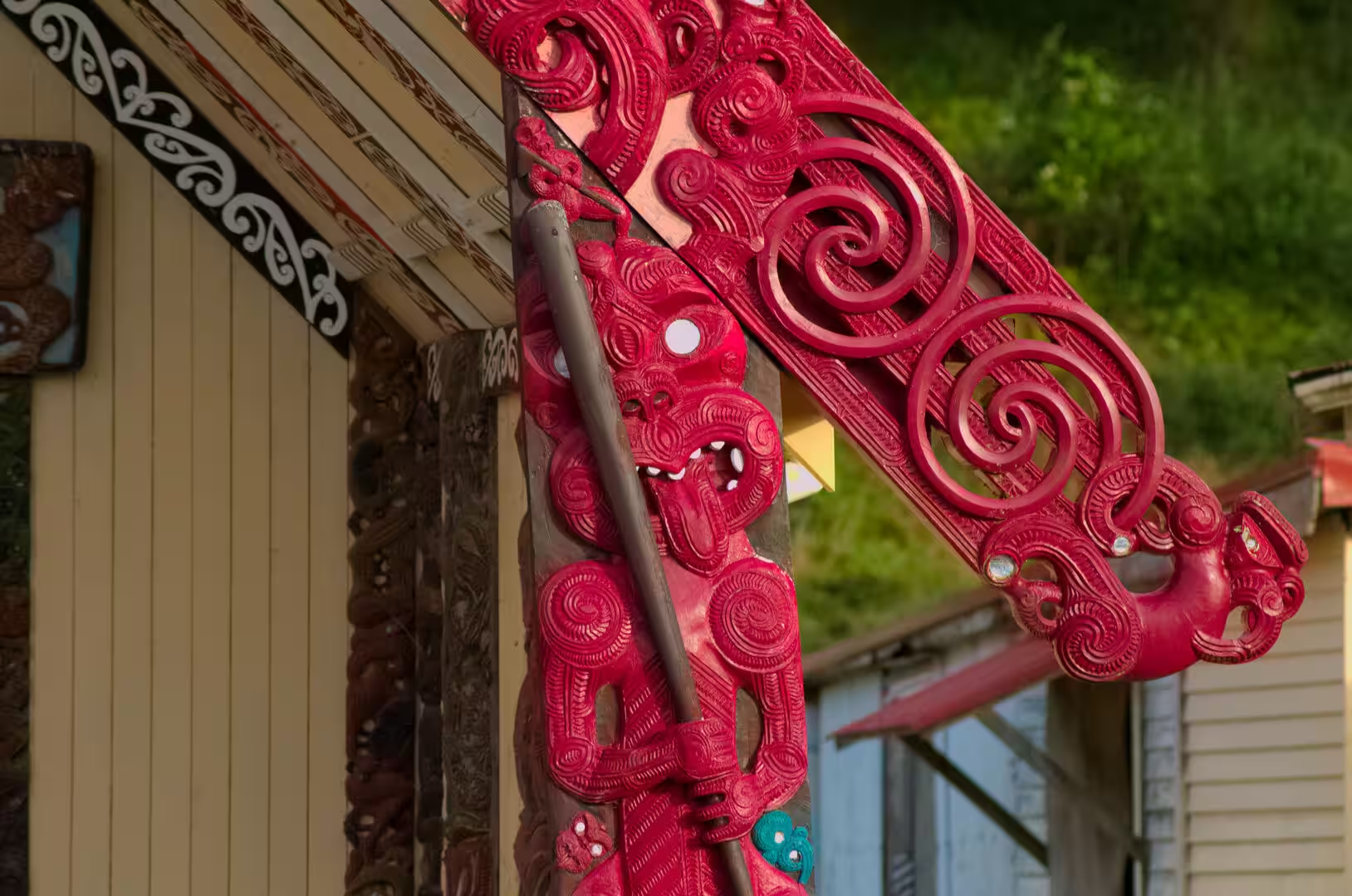
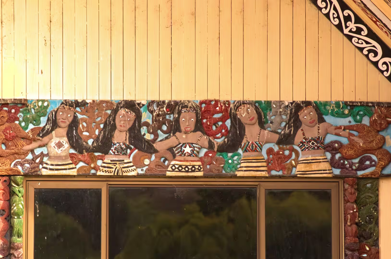
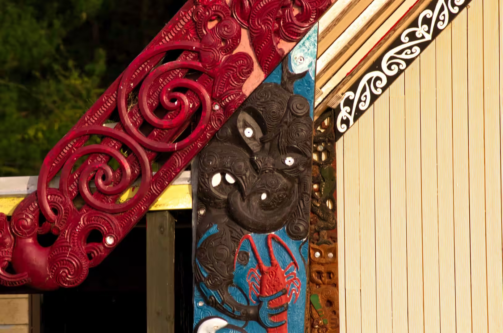
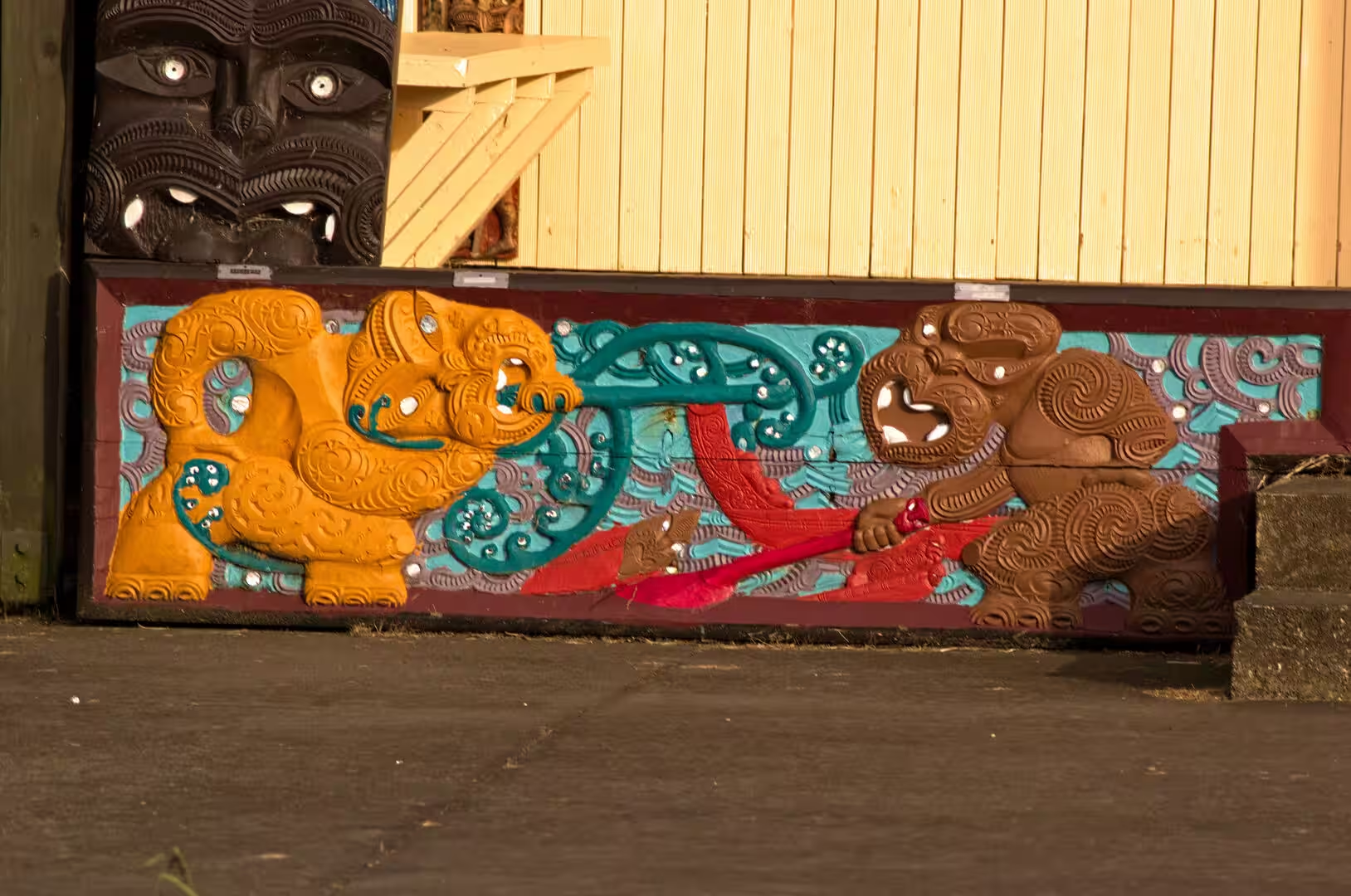
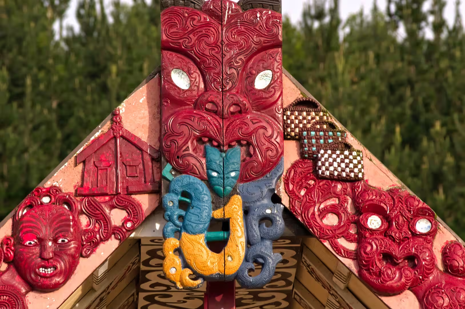
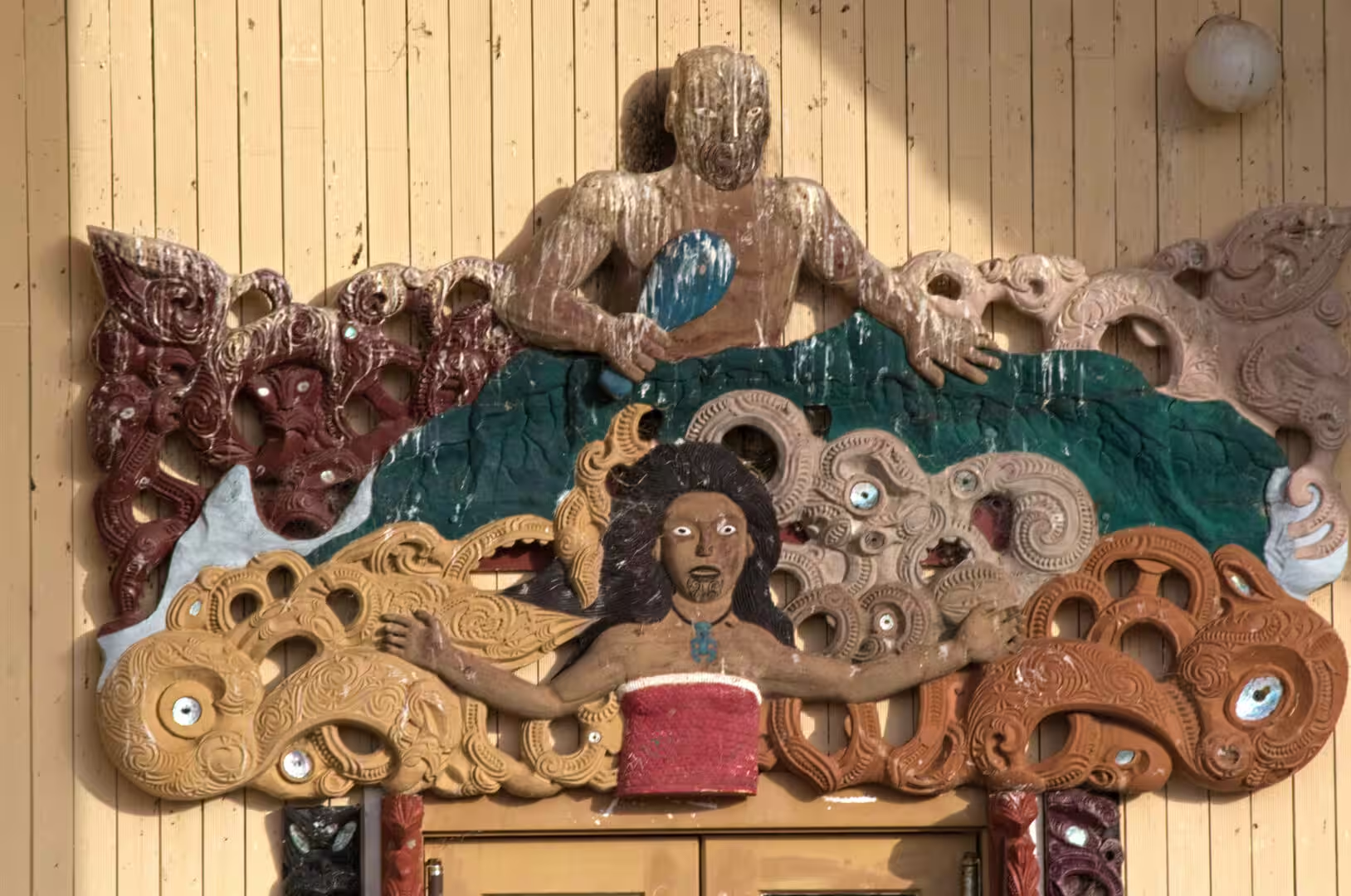
Marae and wharenui are the communal centres of Māori life, and the carved meeting house (wharenui, literally large house) is their heart. A marae is more than a building: on the open courtyard (marae ātea) before the house, visitors are received with the formal welcome of the pōwhiri, while the house itself, a wāhi tapu (sacred place), is where the community meets, celebrates and farewells its dead at tangihanga. The carved meeting house in its modern form developed from the early nineteenth century, and its architecture is read as the body of an ancestor: the ridgepole (tāhuhu) is the backbone, the rafters (heke) the ribs, the angled bargeboards (maihi) the arms, the posts that carry their ends (amo) the legs, and the central pillar (poutokomanawa) the heart post. A carved head (koruru) marks the apex of the gable, often with a small figure (tekoteko) standing above it, and the carved panels (poupou) along the walls portray the ancestors of the tribe. The carving itself (whakairo) records whakapapa and tribal history, and its styles differ from tribe to tribe: around Gisborne the local Tūranga style, associated with the Ngāti Kaipoho hapū of Rongowhakaata, is among the most admired schools. Eyes may be inlaid with pāua shell, rafters are painted with red, black and white scrollwork (kōwhaiwhai), woven lattice panels (tukutuku) fill the spaces between the wall carvings, and the timber is stained with the red ochre known as kōkōwai. Shoes are removed before entering, and food is never taken into the house, meals being served from a separate dining hall (wharekai).
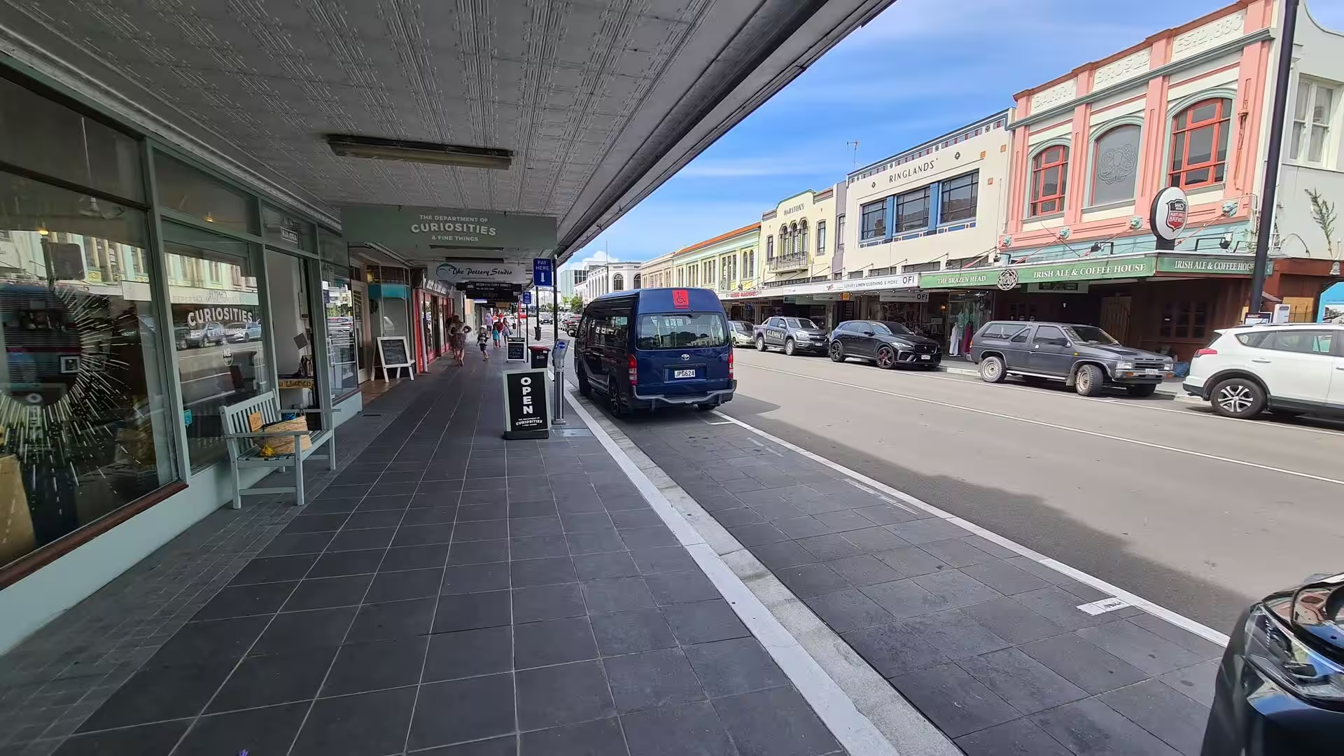
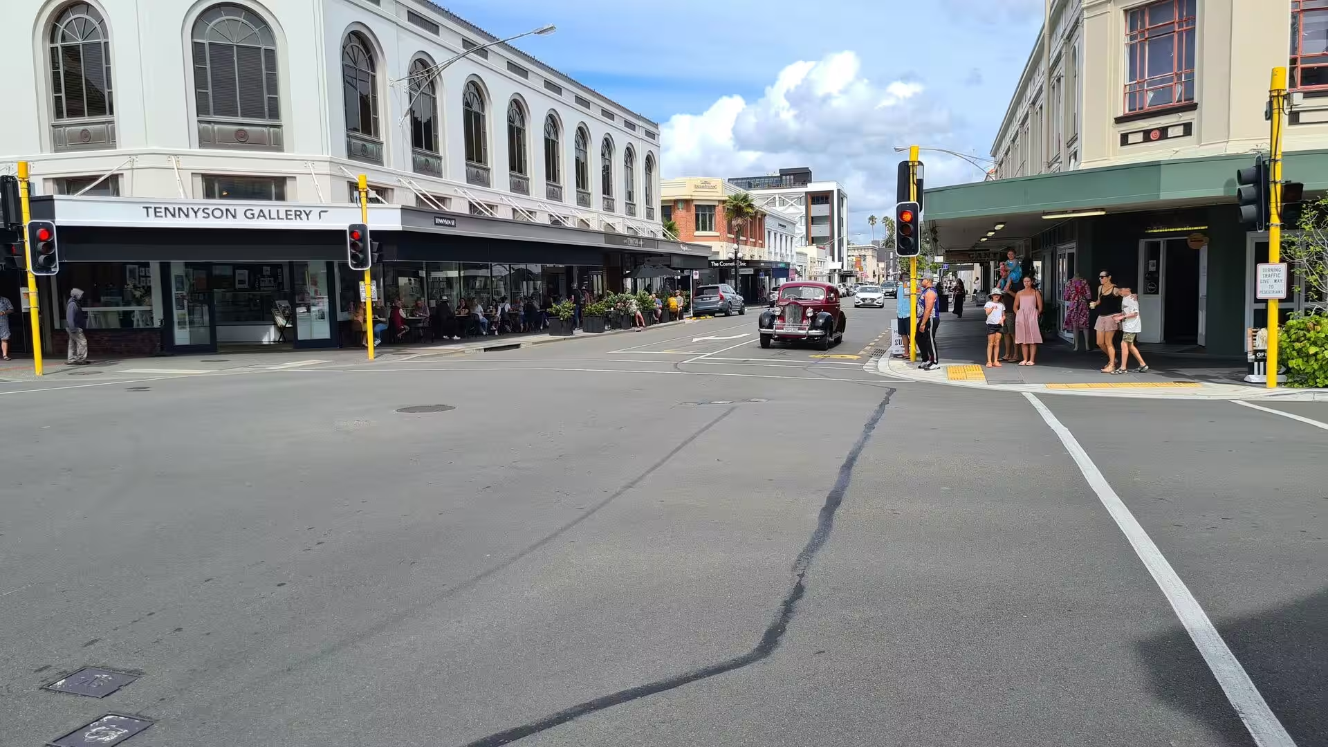
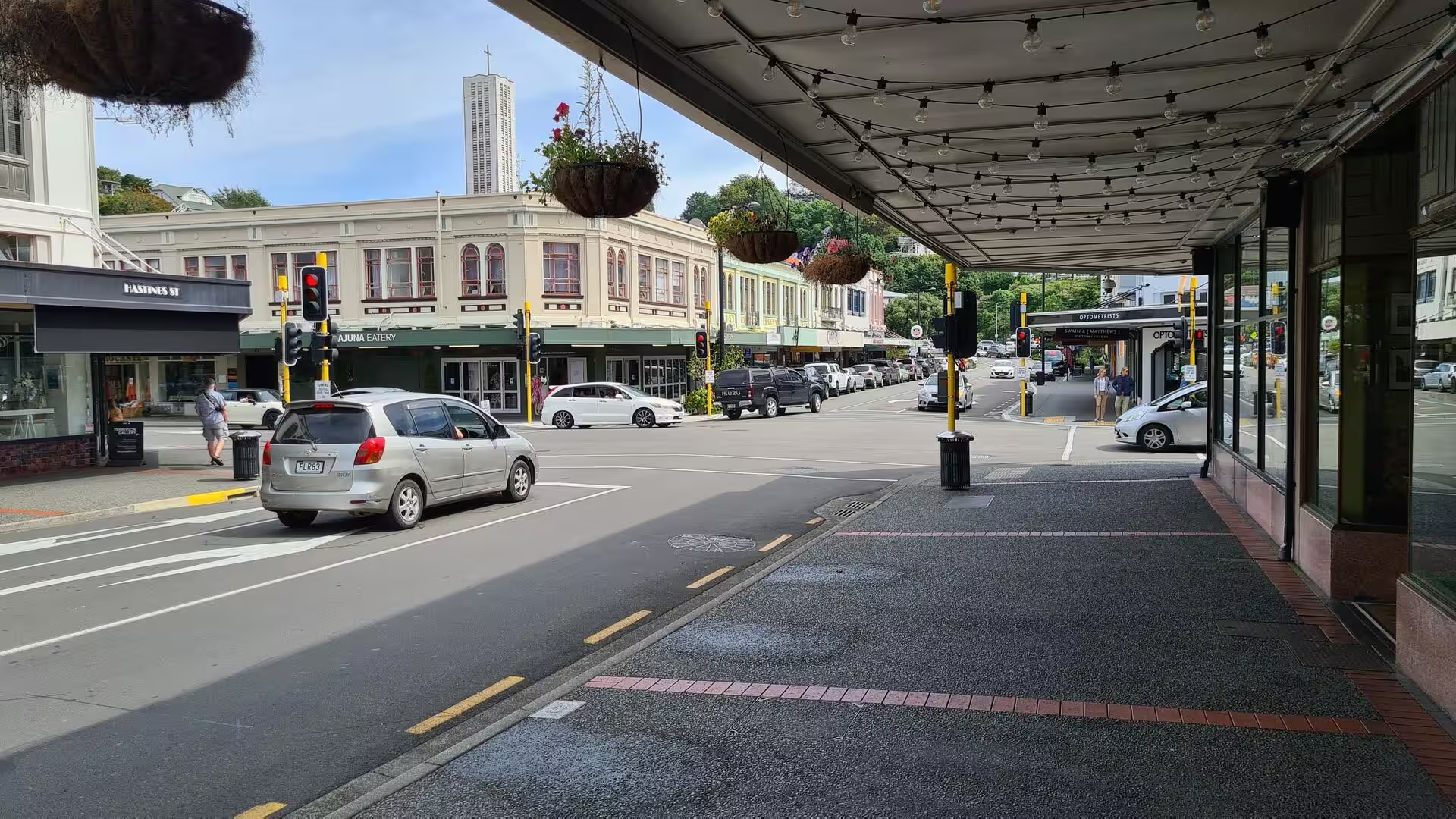
Heritage town streets preserve the look of provincial New Zealand at the turn of the twentieth century. In the high streets of the towns along the main roads of the lower North Island, rows of wooden and masonry shopfronts painted in heritage colours stand behind wide verandahs and canvas awnings that shelter the pavement, and hanging baskets of flowers and strings of lights dress the walkways. Curiosity shops, galleries and cafés occupy the old premises, the occasional classic car parks at the kerb, and above the rooftops a white church spire closes the view. Such streets, with their unhurried air, are among the most characteristic sights of this part of the country.
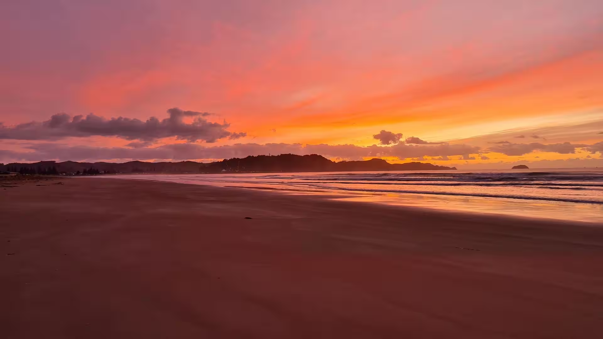
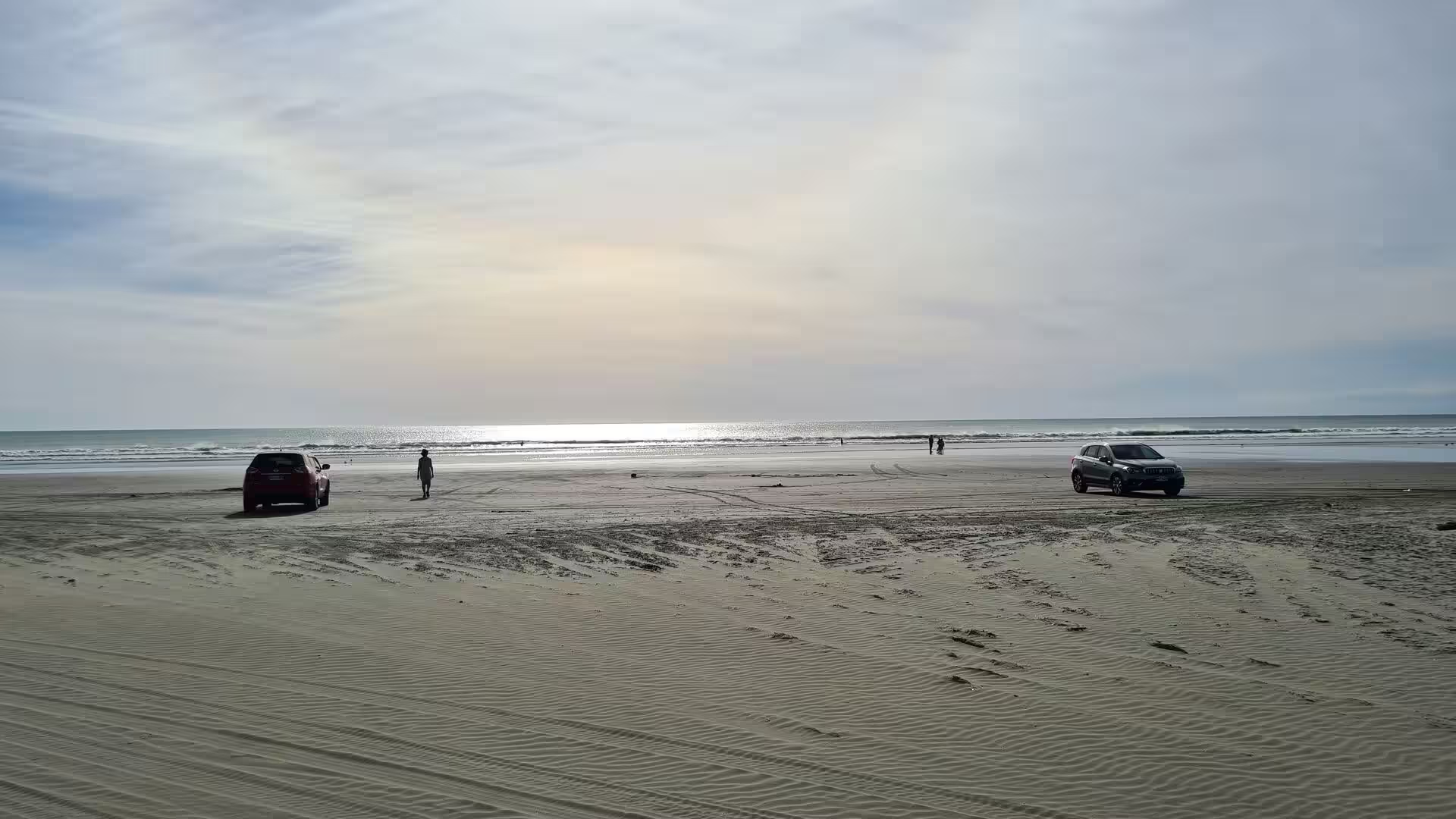
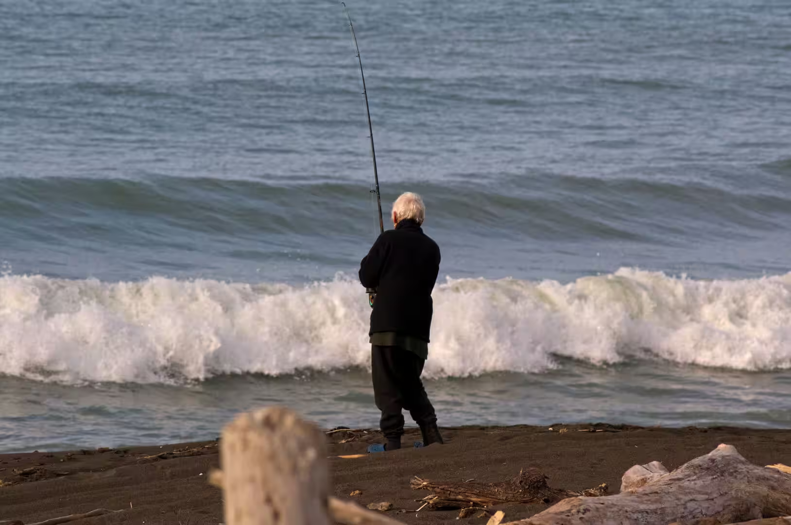
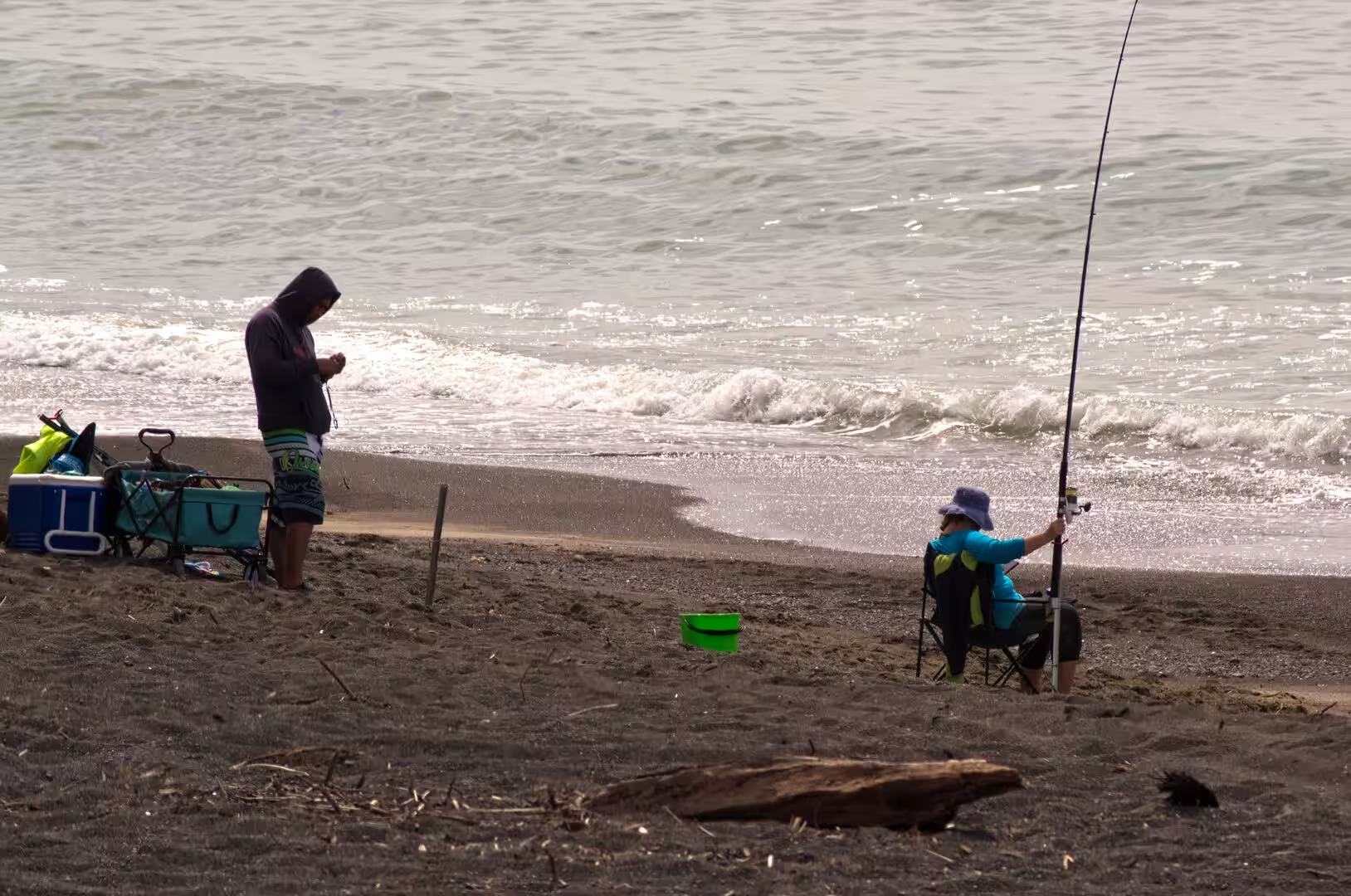
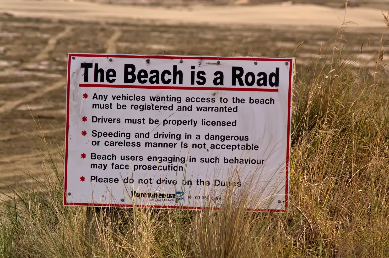
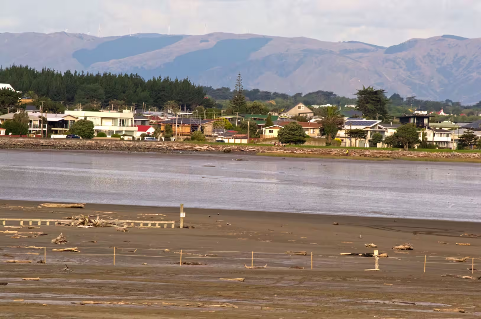
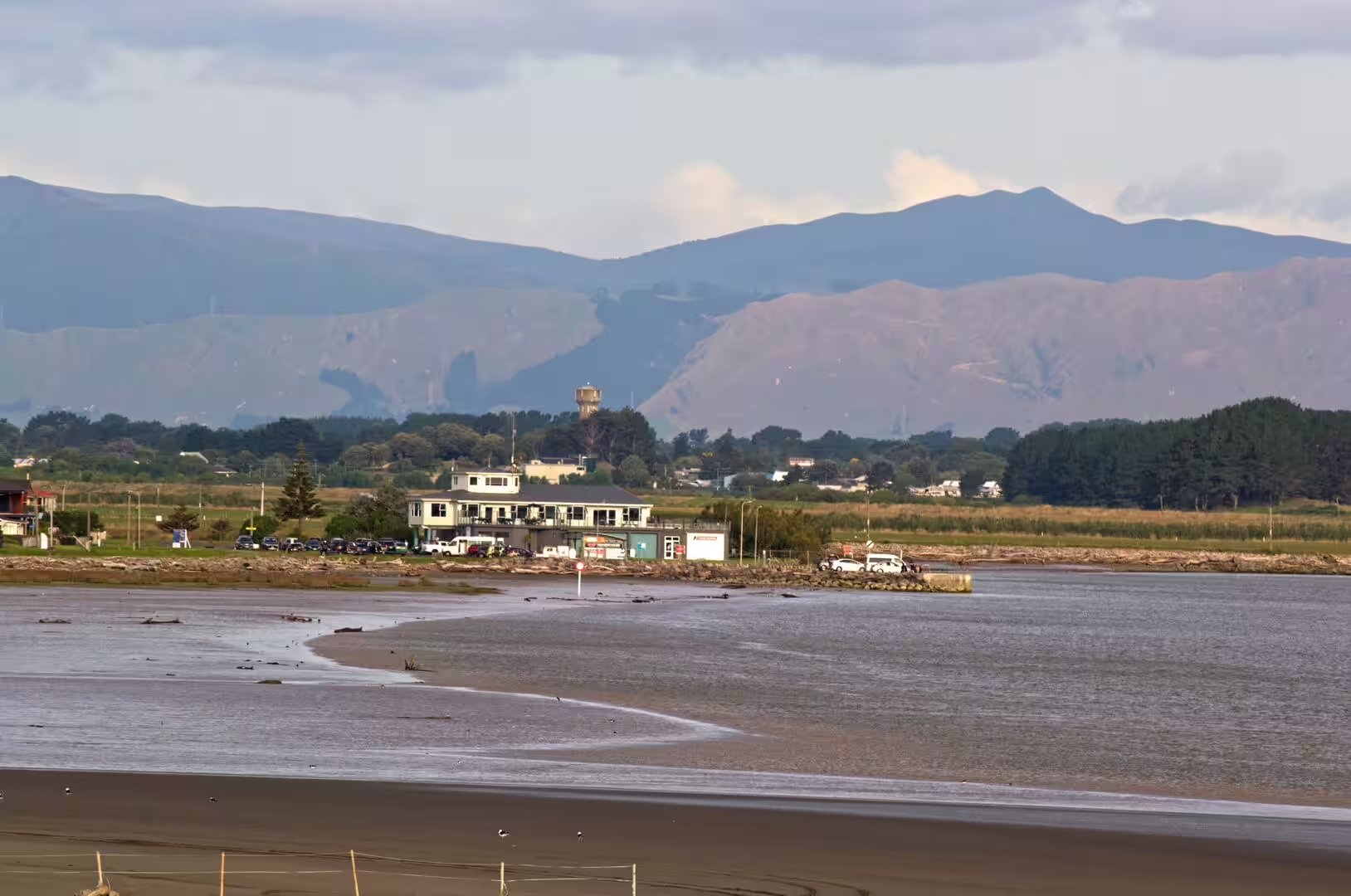
Himatangi Beach is long, straight and open, a broad apron of firm dark sand that runs for kilometres between the dune country and the surf of the Tasman Sea. Vehicles are allowed on the hard sand below the high-tide line, and driving out to a fishing spot is part of the local routine: signs on the coast remind drivers that the beach is a road, and that vehicles must be registered, kept to the sand and kept off the dunes. Surfcasters work the breakers for kahawai and snapper, and at low tide the wide sand flats are shared with walkers and birdwatchers. A few kilometres to the south, the estuary of the Manawatū River spreads its mudflats and its flocks of wading birds across the river mouth, a wetland listed in 2005 under the Ramsar Convention as one of international importance. Landward, the golden grasslands and wetlands give way to the dunes, and on the crests of the ranges inland ranks of turning wind turbines show that this is also wind-farm country. Evenings bring the great west-coast sunsets, the sky colouring over a sea that runs to the western horizon, and the village, with its rows of modest coloured houses, holiday park and unhurried pace, remains a place for beach life rather than a resort.
References
- King, Michael (2003). The Penguin History of New Zealand. Auckland: Penguin Books.
- Salmond, Anne (1975). Hui: A Study of Maori Ceremonial Gatherings. Wellington: A. H. & A. W. Reed.
- Mead, Sidney Moko (1986). Te Toi Whakairo: The Art of Maori Carving. Auckland: Reed.
- Cowie, J. D. (1963). “Dune-building phases in the Manawatu district, New Zealand”. New Zealand Journal of Geology and Geophysics 6 (2): 268-280.
- Foxton and the coast, in Manawatū and Horowhenua places. Te Ara, the Encyclopedia of New Zealand. teara.govt.nz/en/manawatu-and-horowhenua-places/page-8
- Iron, an abundant resource, in Iron and steel. Te Ara, the Encyclopedia of New Zealand. teara.govt.nz/en/iron-and-steel/page-1
- Rongowhakaata. Te Tari Whakatau, Office for Māori Crown Relations, Treaty Settlements. whakatau.govt.nz/te-tira-kurapounamu-treaty-settlements/find-a-treaty-settlement/rongowhakaata
- Himatangi Beach. Wikipedia. en.wikipedia.org/wiki/Himatangi_Beach
- Gisborne, New Zealand. Wikipedia. en.wikipedia.org/wiki/Gisborne,_New_Zealand
- Manawatū River. Wikipedia. en.wikipedia.org/wiki/Manawatū_River
- Manawatu Gorge. Wikipedia. en.wikipedia.org/wiki/Manawatu_Gorge
- Rangitāne. Wikipedia. en.wikipedia.org/wiki/Rangitāne
- Muaūpoko. Wikipedia. en.wikipedia.org/wiki/Muaūpoko
- Rongowhakaata. Wikipedia. en.wikipedia.org/wiki/Rongowhakaata
- Wharenui. Wikipedia. en.wikipedia.org/wiki/Wharenui
- Whakairo. Wikipedia. en.wikipedia.org/wiki/Whakairo