Day 7 - The Forgotten World Highway
20 July 2023













Journal Notes
General
State Highway 43, better known as the Forgotten World Highway, runs for 148 kilometres between Stratford, an inland town of the Taranaki region, and Taumarunui, a small service centre of the southern King Country that stands on the Whanganui River. The highway took its present name in a tourism rebranding of the route in 2002, building on a longer reputation as one of the country’s classic heritage drives, and it is promoted as New Zealand’s oldest heritage trail. For most of the twentieth century much of the road remained a rough metalled back-country route, and a 12 kilometre stretch through the Tangarakau Gorge stayed the last unsealed section on the entire New Zealand state highway network until it was finally surfaced in February 2025.
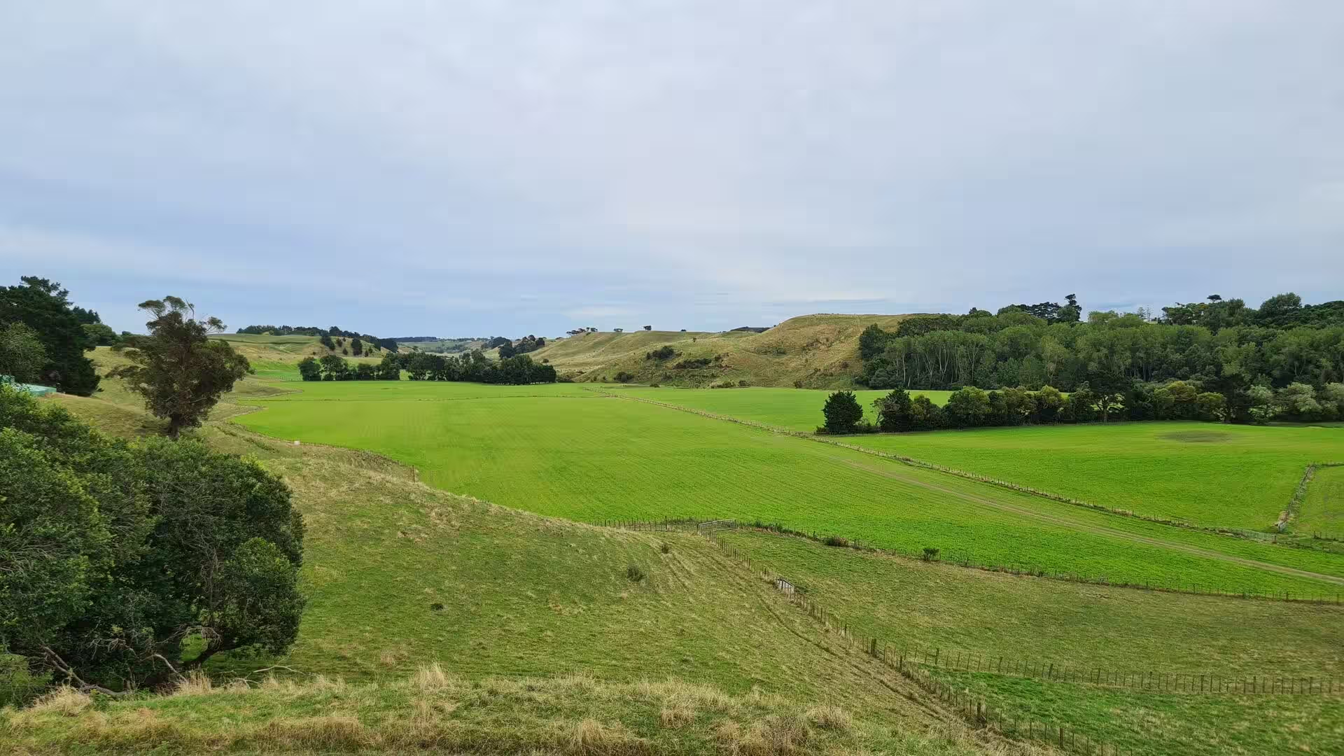
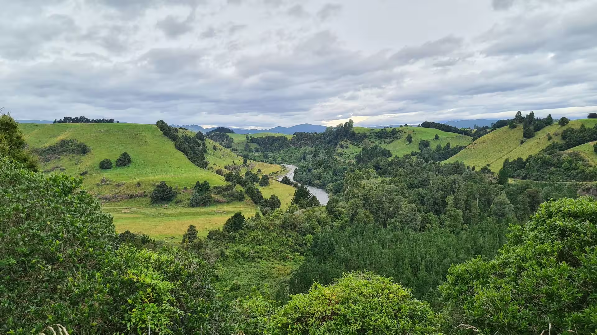
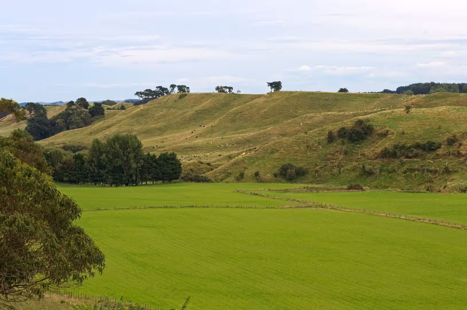
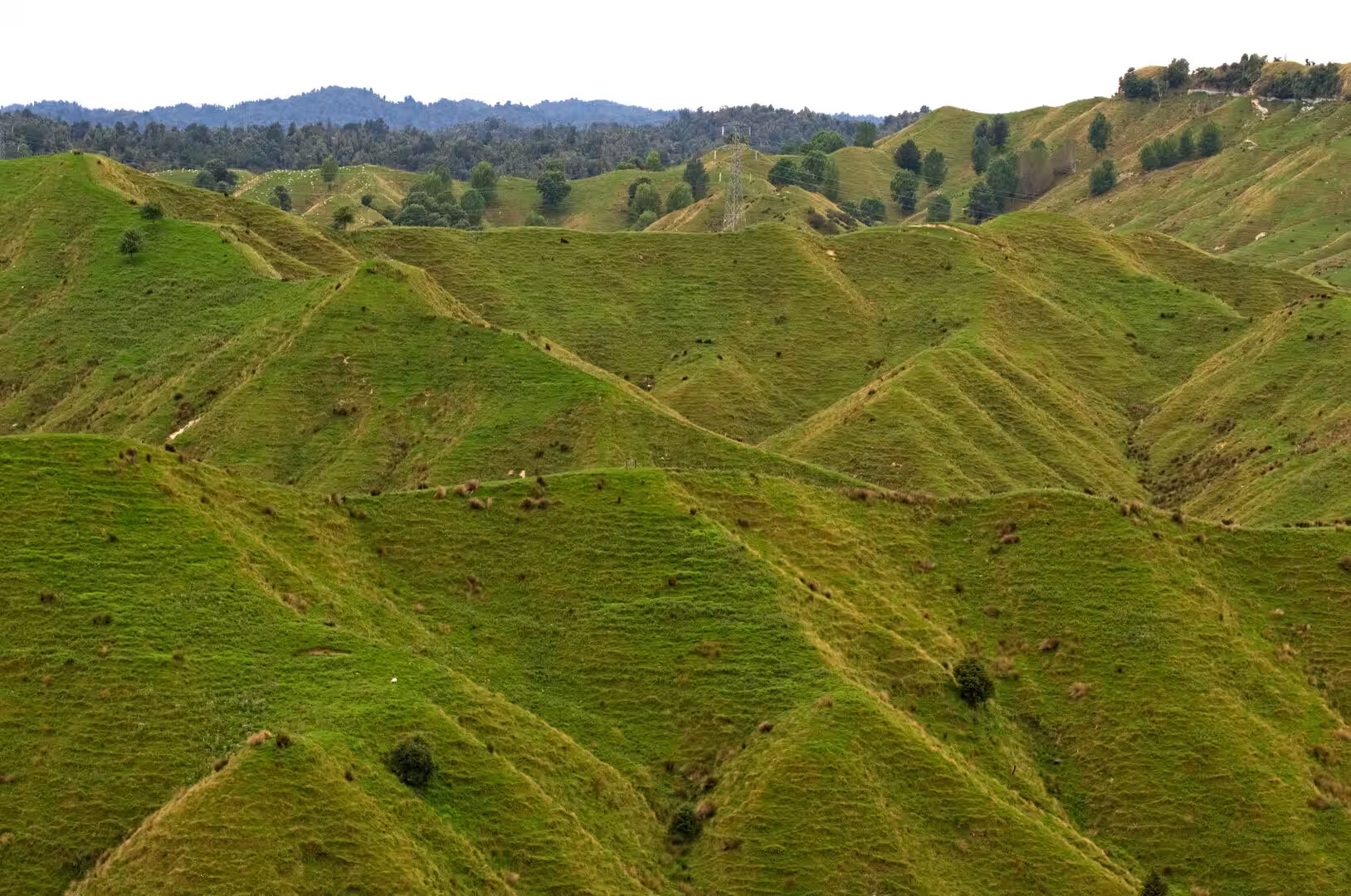
For most of its course the highway winds through the hill country of eastern Taranaki and the southern King Country, climbing over a succession of saddles and ridges and dropping into steep-sided river valleys. Sheep and cattle farmland, divided by hedgerows and fences into tidy paddocks, alternates with blocks of native bush that crowd the gullies and the steeper slopes. Small farming settlements lie along the road, among them Toko, Douglas, Te Wera, Strathmore, Whangamomona, Tahora and Tatu, but between the two end towns there is no settlement of any size, no fuel station and very few services, and a full crossing takes up to three hours of driving on a narrow, winding formation.
At its western end the highway meets State Highway 3 in Stratford, the road that leads on towards New Plymouth and Whanganui; at the eastern end Taumarunui lies on State Highway 4 beside the Whanganui River, a traditional starting point for canoe journeys downriver into Whanganui National Park. Traffic is light and largely local, so the corridor serves as a quiet touring link between the Taranaki coast and the central North Island, and it is often worked into a wider circuit that takes in the volcanoes of the central plateau, the Whanganui valley and the mountain parks of the Taranaki hinterland.
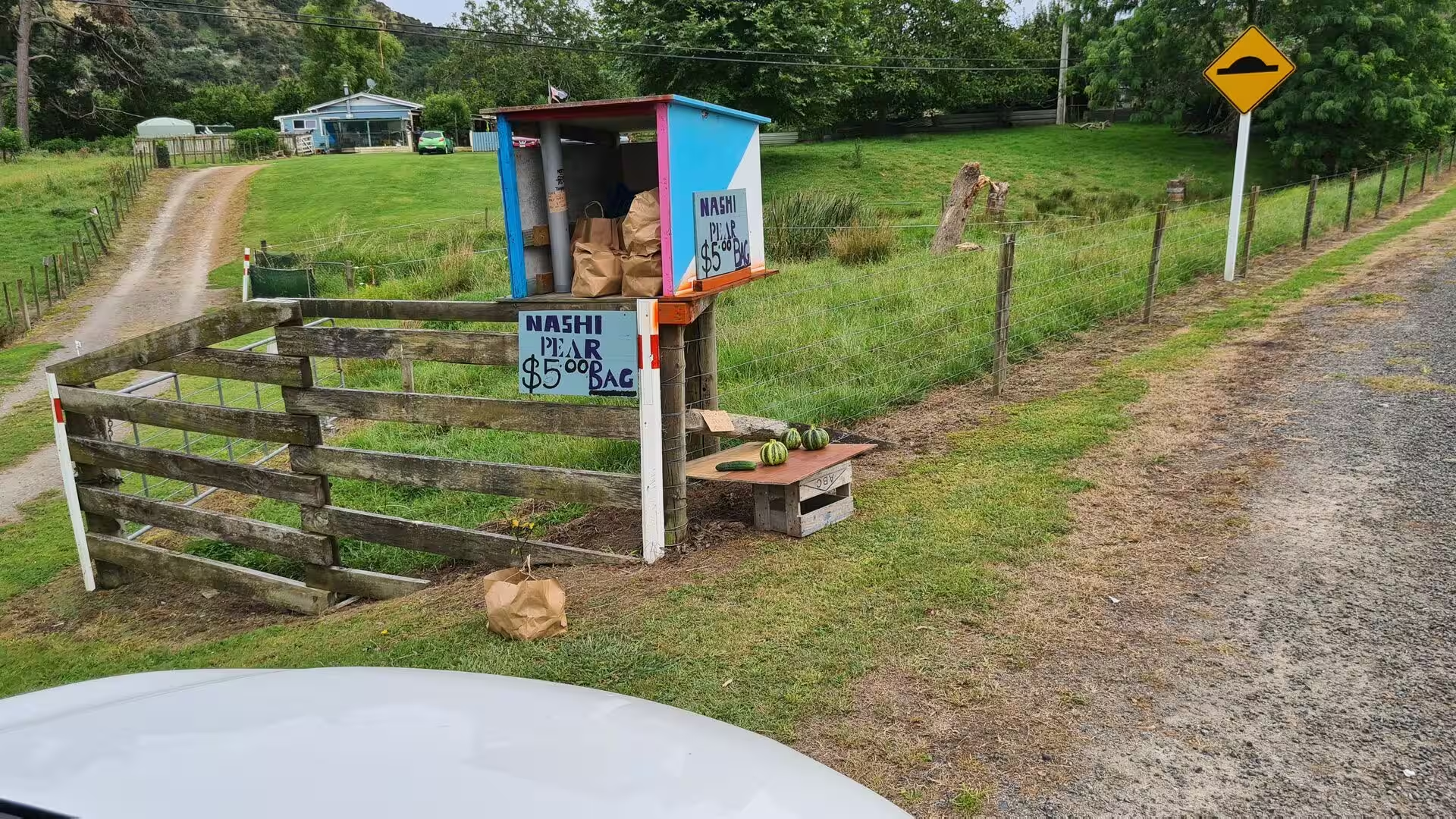
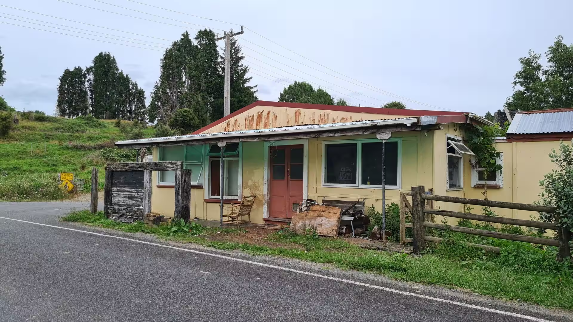
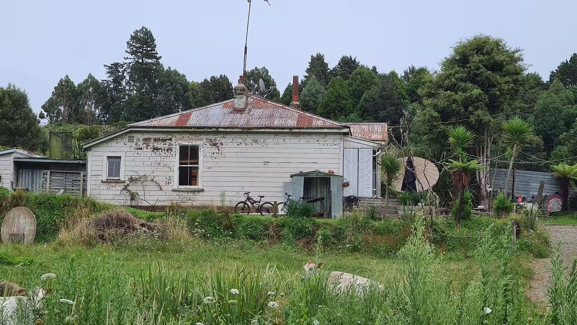
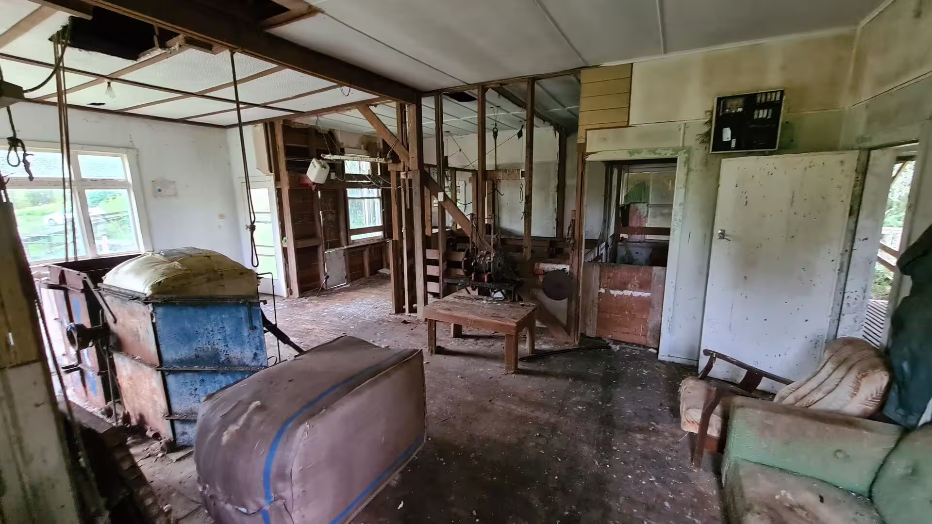
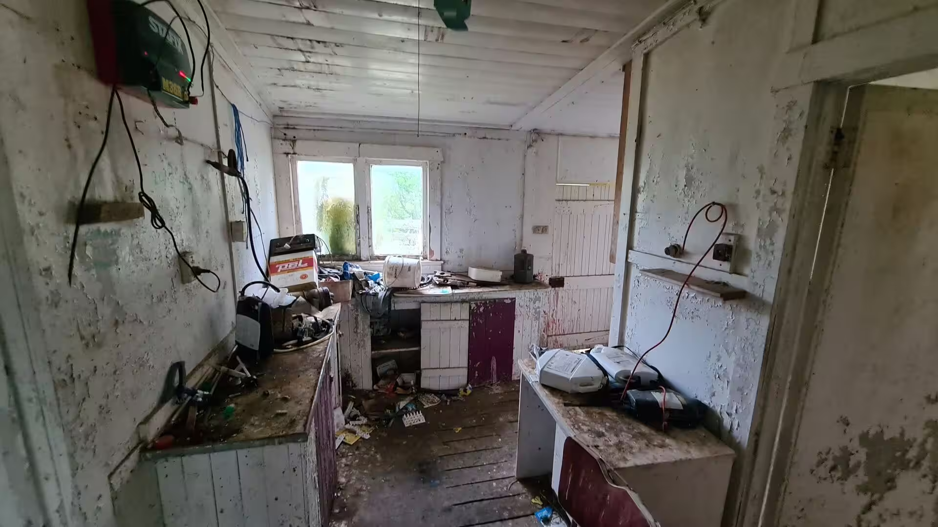
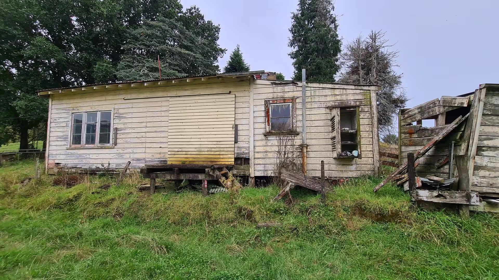
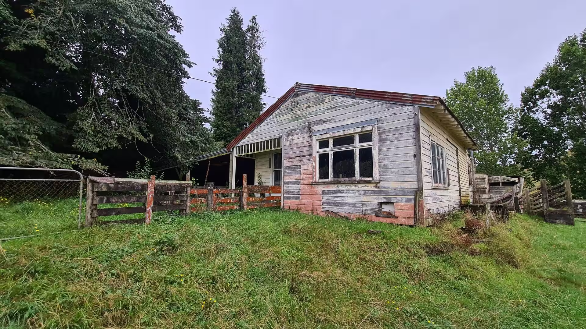
The climate of the district is moist and often overcast, with rain distributed through the year, and the soft light keeps the pasture an intense green. Roadside stalls sell local fruit and vegetables, among them nashi pears, on the honour system, and the farmland is dotted with weatherboard homesteads, some well kept, others abandoned and slowly collapsing, a mix of ages that records the rise and fall of the district’s farming communities.
History
Before roads existed, the Whanganui River was the highway of this hinterland. Taumarunui grew as a Maori settlement at the confluence of the Ongarue River with the Whanganui, a point where important canoe routes linked the interior of the island with the settlements of the lower river valley, and the forested valleys around the later highway were crossed by bush tracks leading towards the Taranaki coast. After the defeat of the Kingitanga forces at Orakau in April 1864 during the Waikato War, supporters of the Maori King movement withdrew south into the lands of the local iwi, and the region became known as the King Country, or Te Rohe Potae, the area of the hat, a name said to recall the second Maori King Tawhiao placing his hat on a map to mark the territory under his authority. For almost two decades the district remained closed to Europeans. Tawhiao came out and laid down arms in 1881, and from 1883 the government was allowed to begin road surveying and railway construction in the region, although the sale of alcohol long remained prohibited there.
European settlement followed the opening of the land. Alexander Bell set up a trading post at Taumarunui in 1874, and from the early 1890s the Crown began buying large areas of the district. The first European settlers reached Whangamomona in 1895 and founded the township two years later, clearing the bush for sheep and dairy farms. Before roads were reliable, the Whanganui remained the main supply route: from the late 1880s the riverboats of Alexander Hatrick’s steamer service carried stores, stock and produce between the coast and the landing at Taumarunui, and the river vessels maintained the service until the late 1920s, when the condition of the river deteriorated. Life in the small inland settlements was hard. The First World War cost the district 51 men, drawn from Whangamomona and the smaller neighbouring settlements such as Tahora and Kohuratahi, and a major flood in 1924 set the township back again.
The railway made and then unmade much of this country. The Stratford-Okahukura line, authorised in 1900, was begun with a ceremonial first sod turned at Stratford on 28 March 1901, and the western section was worked as a branch line from August 1902 while construction crews pushed slowly eastwards. The terrain demanded 24 tunnels and 91 bridges, with gradients as steep as one in fifty. The last spike was driven at Heao in November 1932, goods traffic began the following month, and through passenger trains between Auckland and New Plymouth, completing the run in under twelve hours, started in 1933; Whangamomona station kept refreshment rooms from 1933 until 1965. The government hoped that large-scale coal mining around Tangarakau and Ohura would make the line pay, but the expected traffic never materialised in volume. At Tangarakau a construction town of up to 1,200 railway workers grew up with shops, a post office, a bank, a police station and its own coal-fired power plant, and when the works moved on it faded as quickly as it had risen; the highway still passes several such ghost towns of the railway age.
The motor road gradually took over the role of the railway. Scheduled passenger trains on the line ceased in January 1983, and after a derailment damaged the track the line was mothballed in 2009; since 2012 a 30 year lease has let the tourism operator Forgotten World Adventures run small rail carts over stretches of the closed railway. The highway itself was improved only slowly. Until 1991 the route ended at Ohura on the old State Highway 40; when that road was revoked in 1991, State Highway 43 was rerouted to Taumarunui by way of Aukopae along the stretch known as River Road, beside the Whanganui. As farms were amalgamated from the 1960s the small settlements shrank: Whangamomona’s school closed in 1979 and its post office in 1988.
In 1989 the local government reforms that redrew regional boundaries placed Whangamomona under the Manawatu-Wanganui Regional Council rather than the Taranaki Regional Council, because the Whangamomona River drains to the Whanganui. The residents objected, preferring to remain part of Taranaki, and on 1 November 1989 they responded by declaring themselves the Republic of Whangamomona on the first Republic Day. The celebration is now held every two years in January, complete with a presidential election, and it has made the little village famous; the name of the settlement was officially gazetted with its macron, Whangamōmona, in 2020.
Geology
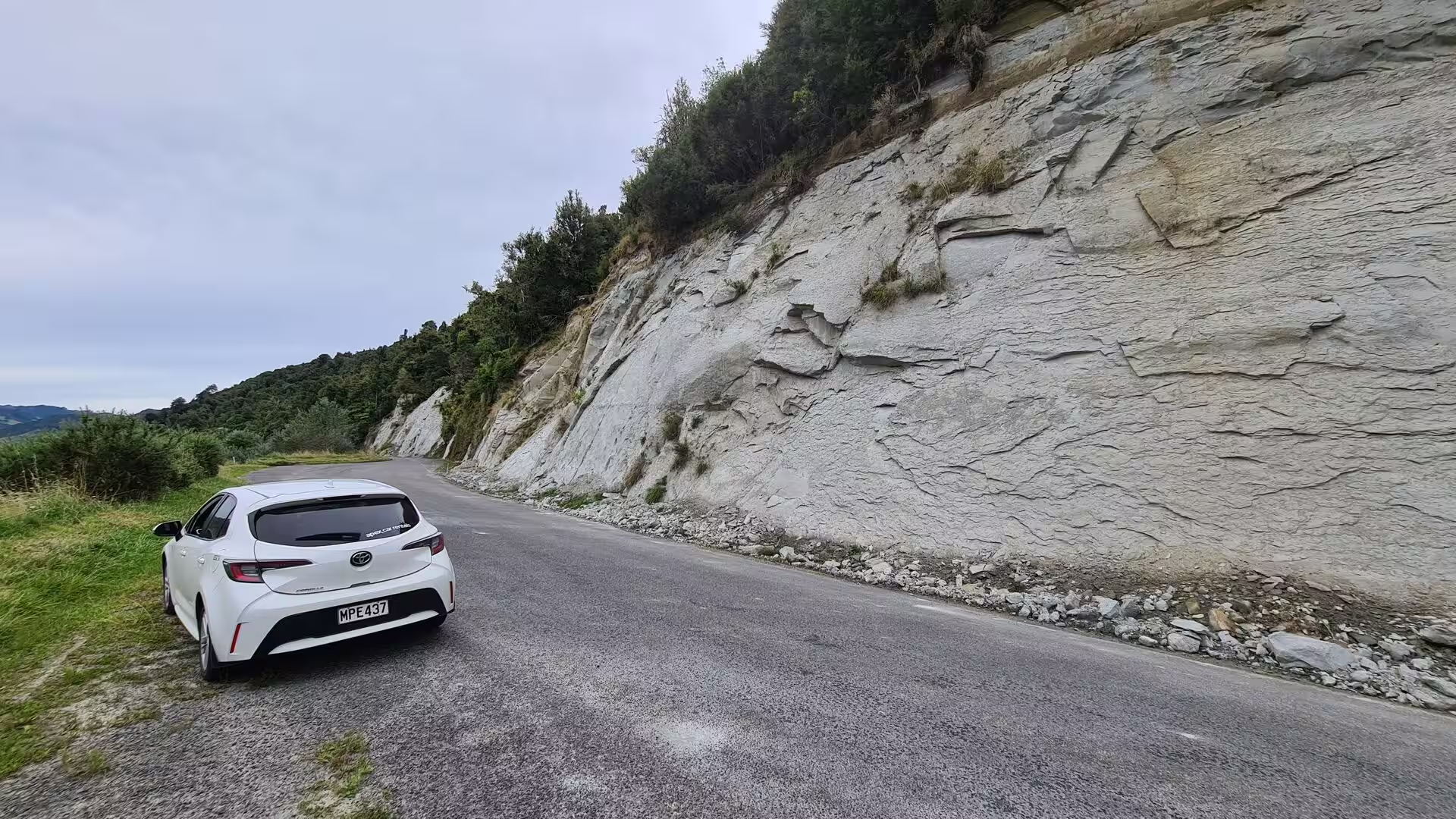
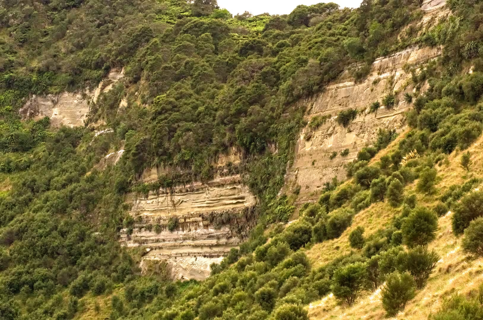
Geologically, the highway crosses the thick cover of soft sedimentary rock that wraps the western side of the North Island. The dissected hill country lying east of the Taranaki peninsula and west of the central volcanic plateau is composed of soft Miocene to Pleistocene sandstones and mudstones, laid down in shallow seas while this part of the island slowly subsided, then uplifted, folded and tilted as the land was squeezed between the Pacific and Australian plates. Road cuttings and riverside cliffs along the Stratford to Taumarunui road expose the layered pale sandstones and grey mudstones of the sequence.
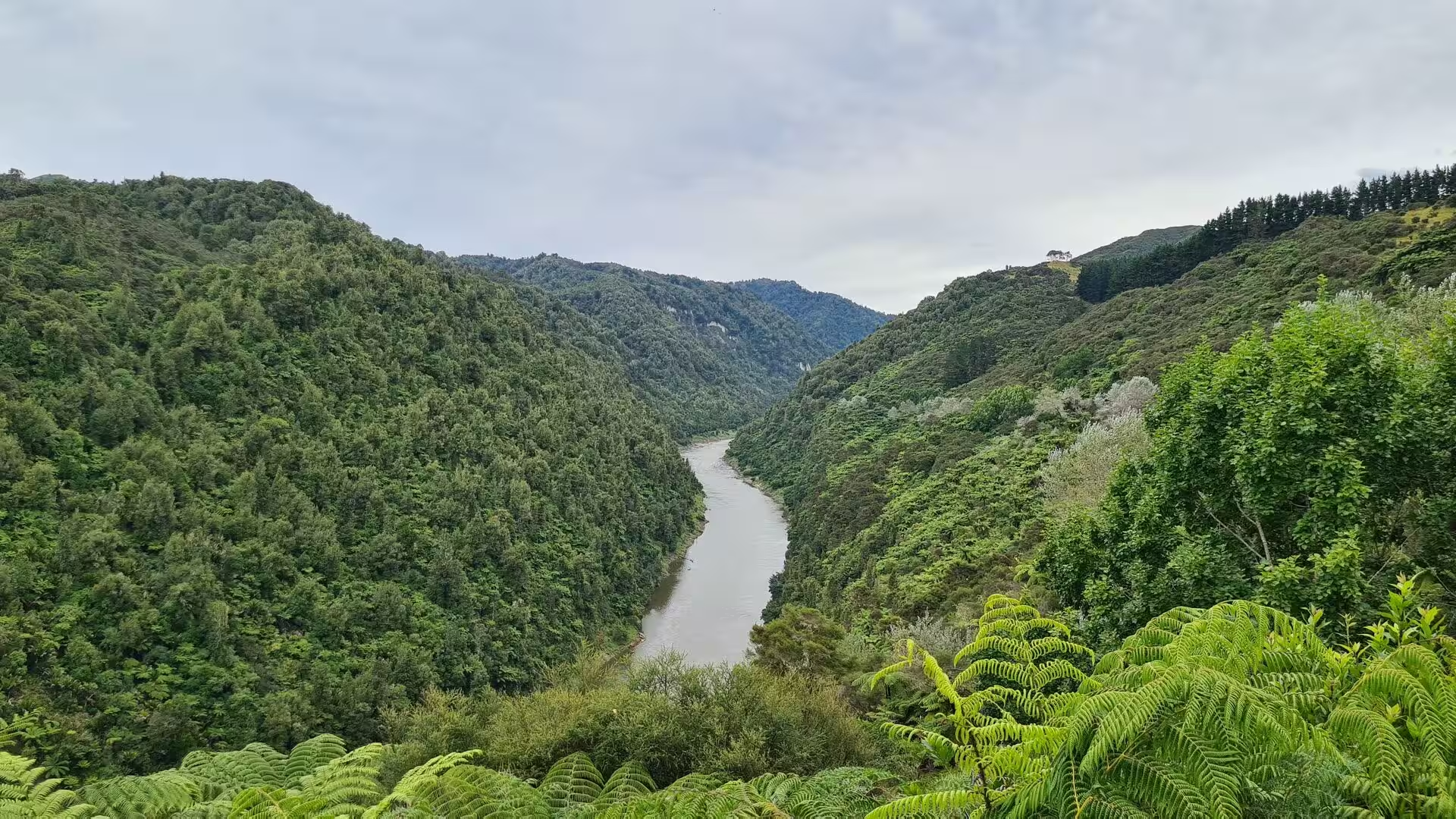
The drainage pattern shows the shape of the country. East of the main divide the streams and rivers belong to the Whanganui catchment: the Whangamomona River, which gives the settlement its name, and the Tangarakau River both join the Whanganui below Taumarunui, while on the western side streams such as those that feed the Tongaporutu River rise close to the same ridges and run down to the Taranaki coast. The saddles crossed by the road are the divides between these catchments, and the country between them is deeply cut. The Tangarakau River has carved a narrow gorge through the soft rock, with walls just under 60 metres high in places, and through this defile both the road and the railway were squeezed. Near the eastern end of the route the highway follows the Whanganui River itself, running beside its broad, brown waters over the fertile flats before climbing into the hills.
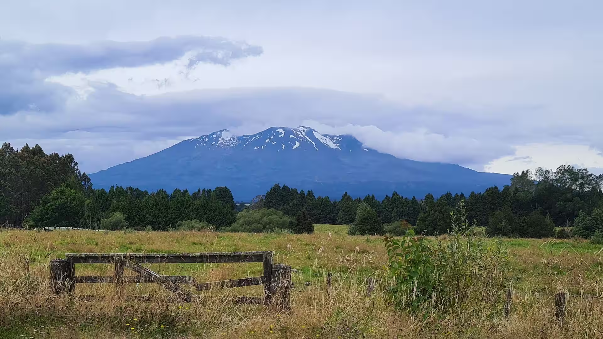
Volcanic Taranaki closes the western horizon. Mount Taranaki, at 2,518 metres the second-highest mountain of the North Island, is a young andesite stratovolcano, the youngest of a line of volcanoes whose activity has migrated southwards over roughly the last two million years; the present cone has been built up only over the last 130,000 years, with the secondary cone of Fanthams Peak on its southern flank. The mountain is dormant, its snowfields and cloud cap visible from the western saddles of the highway, and from Strathmore Saddle the perfect cone suddenly dominates the view ahead for travellers approaching from the east. From Tahora Saddle, near the eastern end of the route, the view carries across to the mountains of the central North Island plateau, a reminder that the whole spine of the island is volcanic.
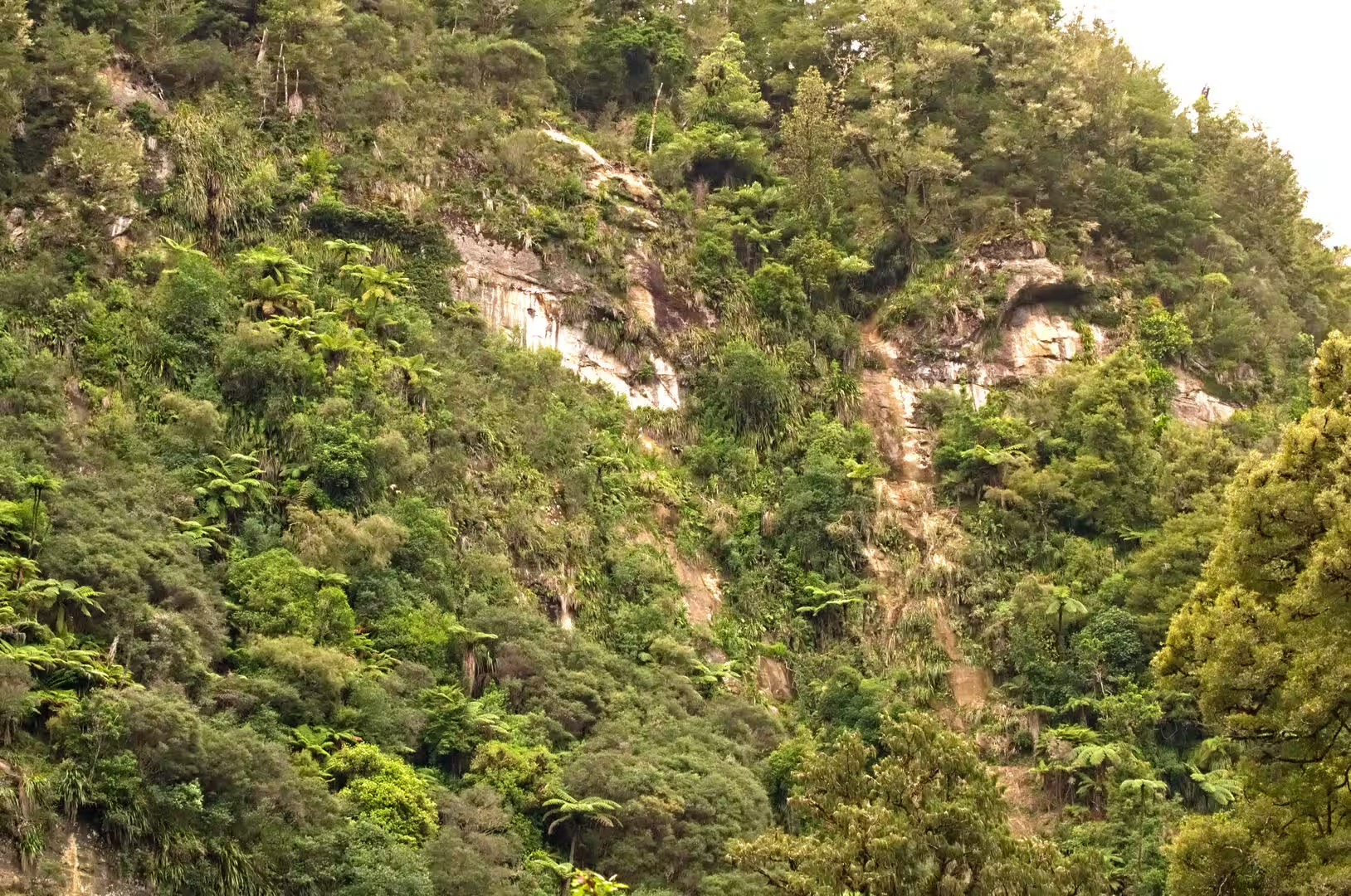
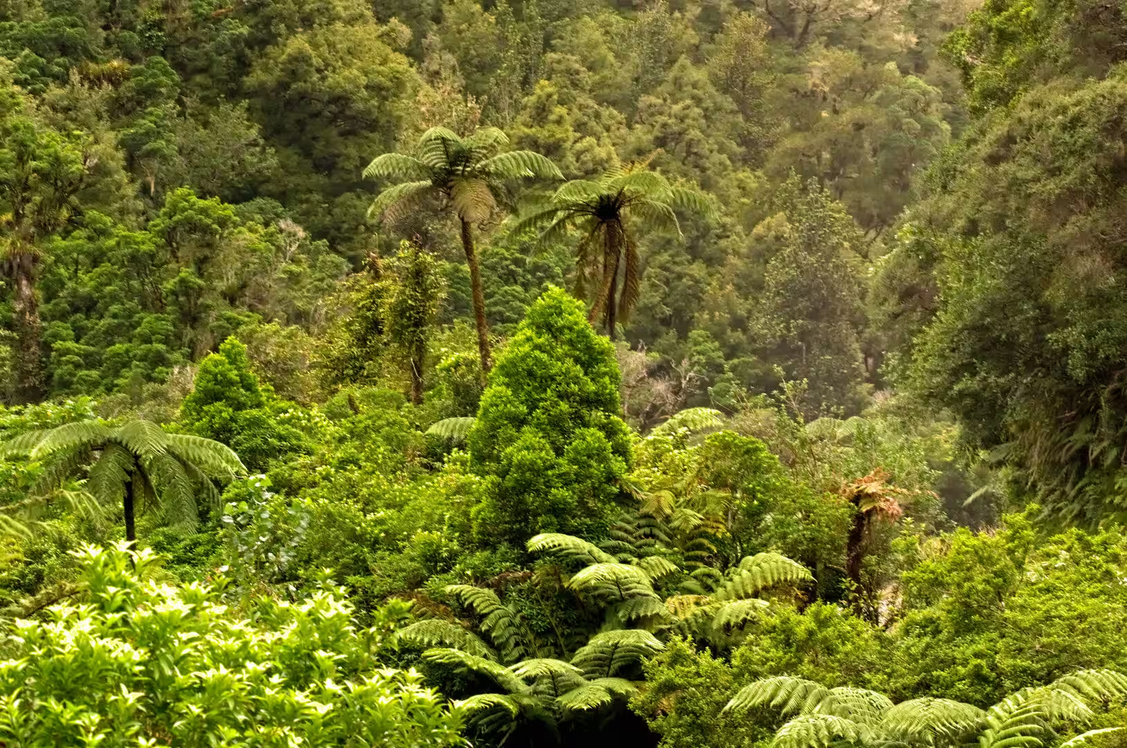
The combination of soft rock, steep slopes and plentiful rain makes this restless country. Streams run brown after wet weather, the gorge road was long plagued by a slippery gravel surface and a poor safety record until it was sealed, and the bush that clothes the steepest ground is dense: podocarp forest in the damper valleys, stands of beech on the higher saddles, and a fern-rich understorey of tree ferns through which the road’s side creeks run.
Things to See
The highway itself is the principal attraction of the district, and its sights are strung along the road rather than gathered in any one place. The route is best taken slowly, and its character changes with every saddle: dairy flats, bush-clad gorges, abandoned homesteads and sudden mountain views succeed one another between the two termini.
Whangamomona is the best-known settlement on the road, a village of weatherboard houses and farm sheds gathered around a hotel that has become the unofficial parliament of the self-declared republic. The township was established in 1897 and grew as a service centre for the surrounding farms and for the road and railway construction gangs, and its historic precinct is registered by Heritage New Zealand. The hotel still operates, and visitors can have their passports stamped with the border mark of the republic, while the rugby club, which wore an all-black strip before the national team adopted the colour, still contests the Dean Cup, the oldest rugby challenge cup in the country, against neighbouring clubs.
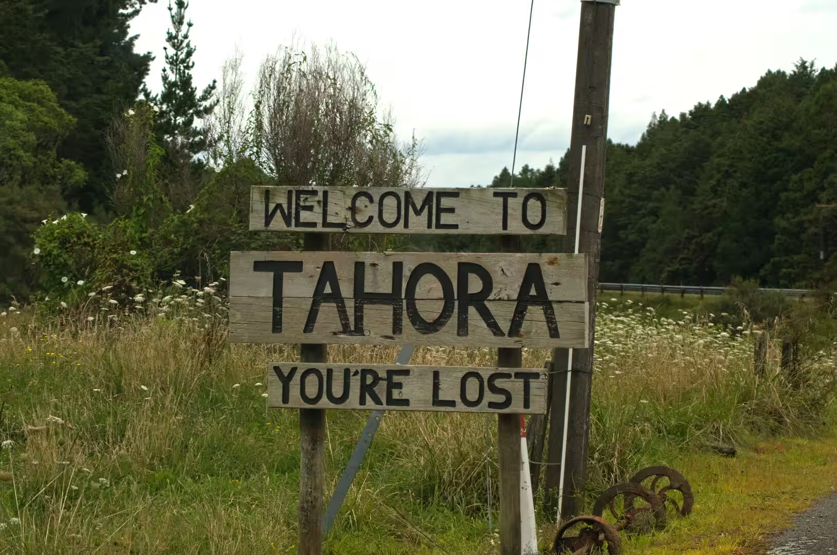
Tahora, on the road between Whangamomona and Taumarunui, is a tiny settlement that greets drivers with a famous weathered wooden sign reading ‘Welcome to Tahora, you’re lost’. Like Whangamomona it grew up beside the railway, and for three decades it hosted an annual folk music festival that drew musicians from across the country. The settlement was officially renamed Tahorapāroa in 2025, when the New Zealand Geographic Board also gave the macron form to the nearby saddle and scenic reserve, but the old name on the roadside sign remains part of the highway’s folklore.
The Moki Tunnel, some 14 kilometres beyond Whangamomona on the way to Taumarunui, is one of the route’s landmarks. The single-lane tunnel was driven through the rock in 1936 and is about 180 metres long, and it is known locally as the Hobbit’s Hole. Its interior keeps a timber gabled roof and hand-carved walls from the original construction, and the floor was lowered in 1985 to give a headroom of seven metres so that triple-decked stock trucks could pass.
Tangarakau Gorge lies beyond the far end of the tunnel, where the road threads a narrow valley between bush-clad walls of sandstone and mudstone. The gorge carries both the highway and the old railway line through magnificent podocarp forest, and its 12 kilometre length of gravel, closed in by the river and the cliffs, was the last unsealed state highway in New Zealand until 2025. The river and the road share the floor of the valley, crossing and recrossing one another, and the bush crowds in from the steep slopes above.
Mount Damper Falls is reached by a marked turn-off near the Moki Tunnel, from which a side road runs to the trackhead. A short Department of Conservation walk of about fifteen minutes leads to viewing platforms above the falls, where Mount Damper Stream drops 74 metres. At that height the falls rank as the fourth-highest in the North Island, behind Wairere, Ananui and Waitakere Falls; they were first noted by Europeans in 1900, when the government surveyor L C Sladden came upon them while surveying the Waro Survey District. The falls form part of the heritage trails associated with the highway.
The saddle viewpoints are among the most rewarding stops on the route. Whangamomona Saddle opens views over beech and podocarp forest towards the surrounding ranges, Strathmore Saddle is where Mount Taranaki first fills the western sky, and Tahora Saddle looks east across the valleys towards the mountains of the central North Island. Each saddle has a small pull-off, and the passing of the road over the ridge lines is one of the clearest ways to read the landscape.
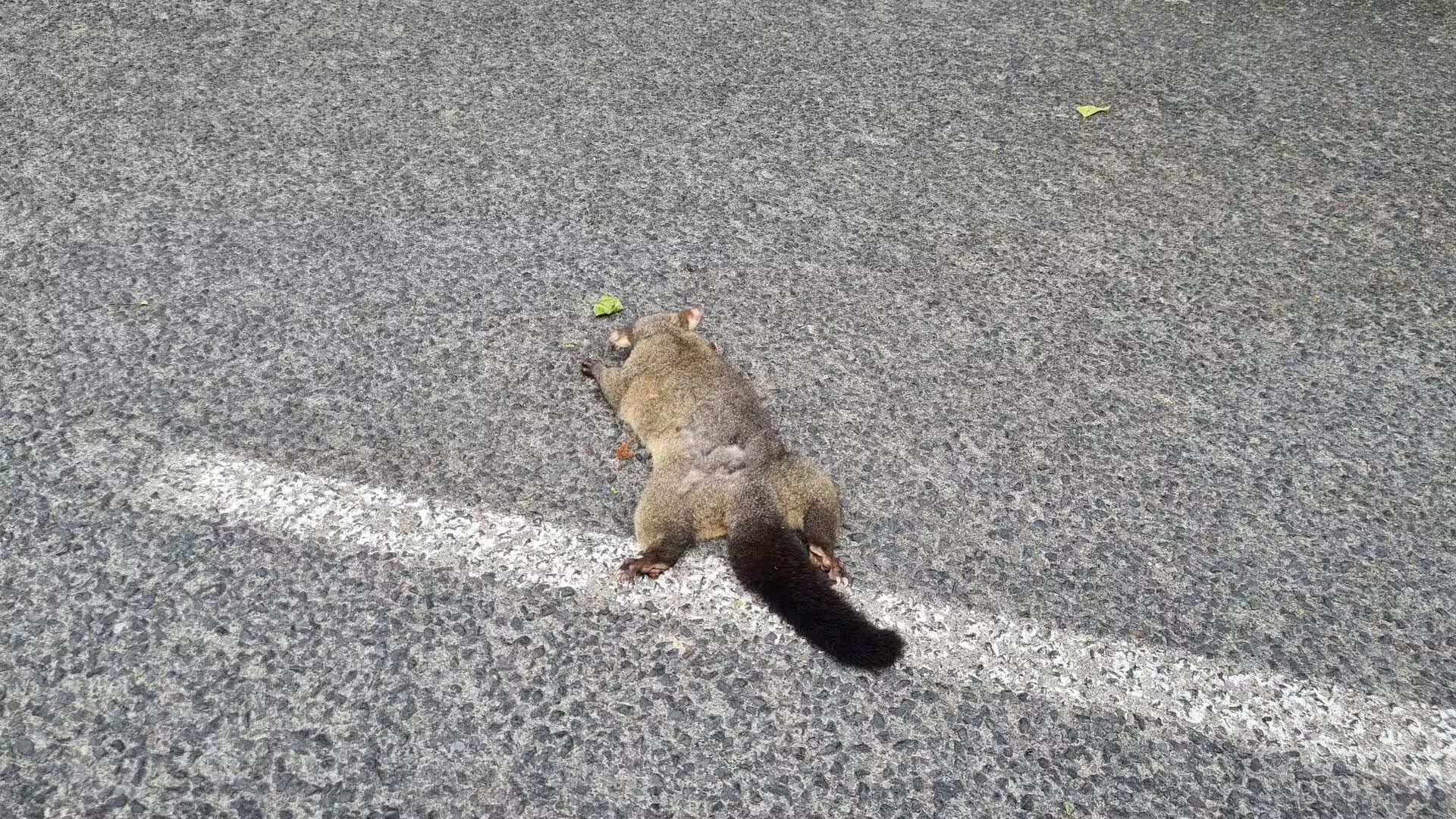
The farmland between the bush blocks has its own quiet attractions. Honesty stalls by the roadside sell nashi pears, marrows and whatever the gardens of the district produce, and the old homesteads, some still inhabited and some derelict, sit among hedgerows and shelter belts of macrocarpa. Fern-filled gullies and stands of tree ferns line the side creeks, and at dusk brushtail possums, introduced from Australia in the nineteenth century to establish a fur trade, are a common sight along the verges.
References
- Alexander, R. B. (1983). The Stratford-Okahukura Line: Fifty Years of Service. Wellington: New Zealand Railway and Locomotive Society.
- Bromby, Robin (2003). Rails That Built a Nation: An Encyclopaedia of New Zealand Railways. Wellington: Grantham House.
- King, Michael (2003). The Penguin History of New Zealand. Auckland: Penguin Books.
- Mount Damper Falls Walk. Department of Conservation. www.doc.govt.nz/parks-and-recreation/places-to-go/taranaki/places/mount-damper-and-waitaanga-conservation-area/things-to-do/mount-damper-falls-walk/
- Forgotten World Highway. Venture Taranaki. www.venture.org.nz/assets/Uploads/Forgottten-World-Highway-Web.pdf
- The Forgotten World Highway. New Zealand Geographic. www.nzgeo.com/stories/the-forgotten-world-highway/
- Forgotten World Highway. Tourism New Zealand. www.newzealand.com/int/feature/forgotten-world-highway/
- State Highway 43 (New Zealand). en.wikipedia.org/wiki/State_Highway_43_(New_Zealand)
- Whangamōmona. en.wikipedia.org/wiki/Whangamōmona
- Stratford-Okahukura Line. en.wikipedia.org/wiki/Stratford%E2%80%93Okahukura_line
- Tahora, Manawatū-Whanganui. en.wikipedia.org/wiki/Tahora,_Manawatū-Whanganui
- Mount Damper Falls. en.wikipedia.org/wiki/Mount_Damper_Falls
- Mount Taranaki. en.wikipedia.org/wiki/Mount_Taranaki
- Geology of Taranaki. en.wikipedia.org/wiki/Geology_of_Taranaki
- Taumarunui. en.wikipedia.org/wiki/Taumarunui
- King Country. en.wikipedia.org/wiki/King_Country