Day 6

Journal Notes
General
The sixth day had three parts: a morning in a mountain valley where water falls through a gorge lined with moist vegetation, an afternoon in the market hall of the capital, among stone counters and globe lamps, and an evening at the shore, where a broad pebble beach lies under cane thatch and palms while the sun sets over a sheltered bay. The day is small in the number of its subjects and generous in detail: the interior above the city, the trade of the market, and the sea front on which the city turns in the evening.
Madeira is a Portuguese island and the largest and most populous of its archipelago. Funchal, the capital, is the sixth largest city in Portugal with 105,795 inhabitants, and about half of the region’s population lives in it. The archipelago includes Porto Santo, the Desertas and the Savage Islands, lies in Macaronesia in the North Atlantic on the African tectonic plate, and remains politically and culturally part of Europe. The region had 251,060 inhabitants in 2021 and the island itself 245,595.
Funchal occupies a natural amphitheatre shaped valley whose slopes rise from the coast to 1,200 metres, which gave the first settlers shelter and a harbour. The name comes from the wild fennel that grew there: funcho is fennel, and the suffix al denotes a plantation of it. The city is the warmest in Portugal, with a subtropical hot summer Mediterranean climate and humidity that stays near seventy per cent all year, and its high northern slopes are often in cloud and rain while the southern quarters have clear skies.
Tourism dominates the modern economy, contributing twenty per cent of regional GDP, and the visitors are chiefly Portuguese, British, German and French; hotels and restaurants add nine per cent of gross value added. The harbour has long been the leading Portuguese port for cruise ship dockings, and the island works as a year round resort. Agriculture persists around the visitor trade: bananas, wine and horticulture on the lower slopes, sugar cane where irrigation allows, and a fishing fleet that still works the deep water beyond the shelf. The market of the afternoon is where the catch and the garden meet on one floor.
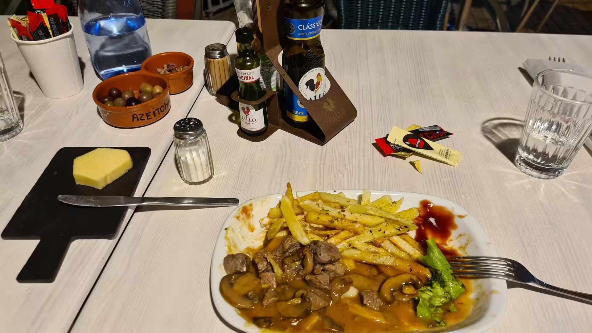
The day’s last subject was the table. Espada, the black scabbardfish, is the most prized fish of the island and is usually fried in batter with fried banana; espetada is beef seasoned with garlic, salt and bay leaf, marinated in Madeira wine, vinegar and olive oil, skewered on a bay laurel stick and grilled over wood chips; bolo do caco is a round flatbread cooked on a flat basalt slab and served with garlic butter; milho frito is firm cornmeal with collard greens, cut into cubes and fried. The meal that ended the evening, a slow cooked beef stew with fried potatoes and green vegetables, belongs to the same household tradition.
History
Recorded history begins in 1419, when João Gonçalves Zarco and Tristão Vaz Teixeira, captains of Prince Henry the Navigator, were driven to Porto Santo by a storm. The following year an expedition took possession of Madeira for the Portuguese crown, with Bartolomeu Perestrello among the captains, and settlement began between 1420 and 1425. The island was uninhabited at the time. Funchal was settled in those years by Zarco, who brought his family with him, and its coastal position was the most productive on the island, so the new town soon surpassed the other settlements in size.
Sugar made the capital. In the second half of the fifteenth century the industry expanded along the southern coast from Machico to Fajã da Ovelha with Funchal as its most important centre, and the town became a mandatory port of call on the European trade routes to the Indies and the New World. Merchants from Genoa, Florence, Valencia and Flanders settled there. Slaves were first brought to Madeira in 1452, Berbers and Guanches, and the island put the plantation system of sugar production into practice on a small scale before it was transferred, much larger, to Brazil and the Caribbean.
In 1508 Funchal was raised to the status of city by King Manuel I, and in 1514, on completion of its cathedral, the bishopric was established there; the church had been begun in 1493, and the buildings of the council and the notaries were finished in 1491. Commerce brought danger as well. In September 1566 a French force of about 1,200 men under Bertrand de Montluc sacked Porto Santo, landed at the beach of Formosa and marched on Funchal, which was taken by land and plundered for fifteen days. The following year the military architect Mateus Fernandes III was sent to revise the defences.
Wine replaced sugar as the leading product in the seventeenth century. English merchants settled in Funchal and controlled the trade, and commercial treaties with England opened markets in Britain, North America and the West Indies. The wine was fortified with grape spirit for long voyages, and the discovery that heat and movement improved it turned a necessity into a style, since a shipment returned after a round trip was found to taste better than when it left. The eighteenth century was the golden age, with the American colonies taking as much as ninety five per cent of production, and the wine is said to have been used to toast the Declaration of Independence.
The nineteenth century brought disease to the vineyards. Powdery mildew appeared in 1851 and the phylloxera epidemic followed, so that by the end of the century most vineyards had been uprooted and many were converted to sugar cane and other crops. British troops occupied the island amicably in 1801 and again from 1807 until 1814, and in the same period Madeira became a health resort for European visitors; the first tourist guide appeared in 1850, and the 1891 census counted 132,223 inhabitants. In 1976 the constitution granted the archipelago an autonomous administration with its own legislature, and on 20 February 2010 an extreme rainfall event struck the south of the island, killing 51 people and injuring 250, and left about 600 homeless, mostly in Funchal.
Geology
The island is the summit of a large submerged shield volcano rising from the ocean floor. It formed on an east to west rift in the oceanic crust along the African plate, from the Miocene more than five million years ago into the Pleistocene until about 700,000 years ago, and activity resumed afterwards with scoria cones and lava flows; the most recent eruptions occurred in the west central part of the island about 6,500 years ago. A mountain ridge runs along the centre of the island, and deep valleys and ravines descend from it, so the interior remains largely inaccessible and settlement is concentrated near the coast.
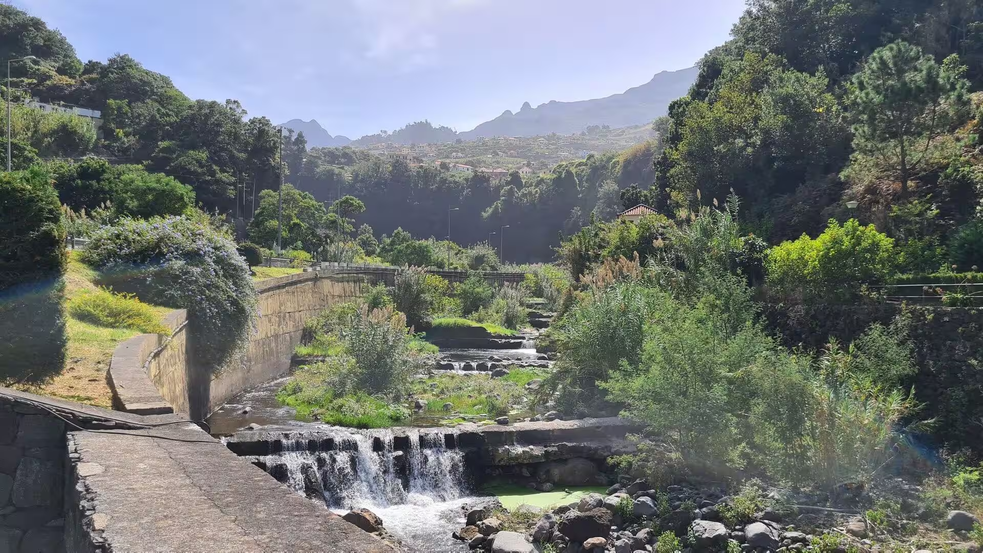
Erosion after the main eruptive phase cut two large amphitheatres open to the south of the central area, and the city sits in one of the sheltered bays that the same process produced. The valley of the morning is one of the ravines that drain those high slopes: short, steep and deeply incised, with walls of layered basalt and dykes cutting through them. Water is plentiful in the upper reaches and scarce at the coast, which is why the channels that carry it were built so early and why their maintenance has remained a public matter for six centuries.
Rainfall is the dominant agent of change in this landscape. Moist air lifted by the ridge delivers intense falls, and the Funchal area has been mapped for the susceptibility of its slopes to mass movements triggered by heavy rain. The event of 20 February 2010 is the reference case: 108 millimetres fell at the Funchal station between six and eleven in the morning and 165 millimetres at Pico do Arieiro, against an average of 88 millimetres for the whole of February in Funchal. Mud and water ran down the streets of the city, bridges were washed away and the airfield closed.
Madeira’s answer to that hydrology is the levada. The early settlers cut channels because water was excessive in one part of the island and scarce in another, and the network now extends for thousands of kilometres, carrying rainwater from the wetter north and the uplands to the south for drinking, irrigation and power. The Socorridos plant runs throughout the year, and in the first half of 2022 a third of the electricity consumed on the archipelago came from renewable sources. The channel followed on this day is a typical section: a concrete thread on a steep slope, more engineering than landscape.
The coastline records the same volcanic history in harder form. Sea cliffs, valleys and ravines descend from the central ridge, and a short, steep watershed separates the humid north from the drier south; the escarpment of Cabo Girão, 580 metres high, lies a short distance west of the city and shows a sheer face of stacked lava flows. Below the cliffs marine abrasion cuts platforms, and the beaches of the south coast are of pebbles and boulders rather than sand. Offshore the volcanic slopes continue under water, shaped by gravitational, erosional, sedimentary and volcanic processes, and the flanks of the edifice have collapsed catastrophically in the past, a failure linked to megatsunami evidence on the neighbouring island of Fogo.
Things to See
The waterfall in the upper valley. In a ravine on the slopes above the city a stream falls in a single thread over a mossy lip into a green basin. The valley is deep and narrow, its walls wet and dark, and the vegetation on them is dense: ferns, moss and small flowering plants that thrive in constant spray. Above the fall the ravine narrows between high banks and the sound of water carries; below it the stream runs on towards the coast, and the channels that tap the high ground keep the flow alive through the dry season.
The mountain above the pebble shore. Where the built quarter ends, a steep green mountain stands directly above a broad beach of dark pebbles, its lower slopes rising almost from the water. The stone at the waterline is rounded and black, and the surf drags at it; above the tide line the beach is backed by a wall and a road. The scale defines the southern coast here: several hundred metres of slope in a single sweep, so that the same place holds a wet mountain and a dry shore.
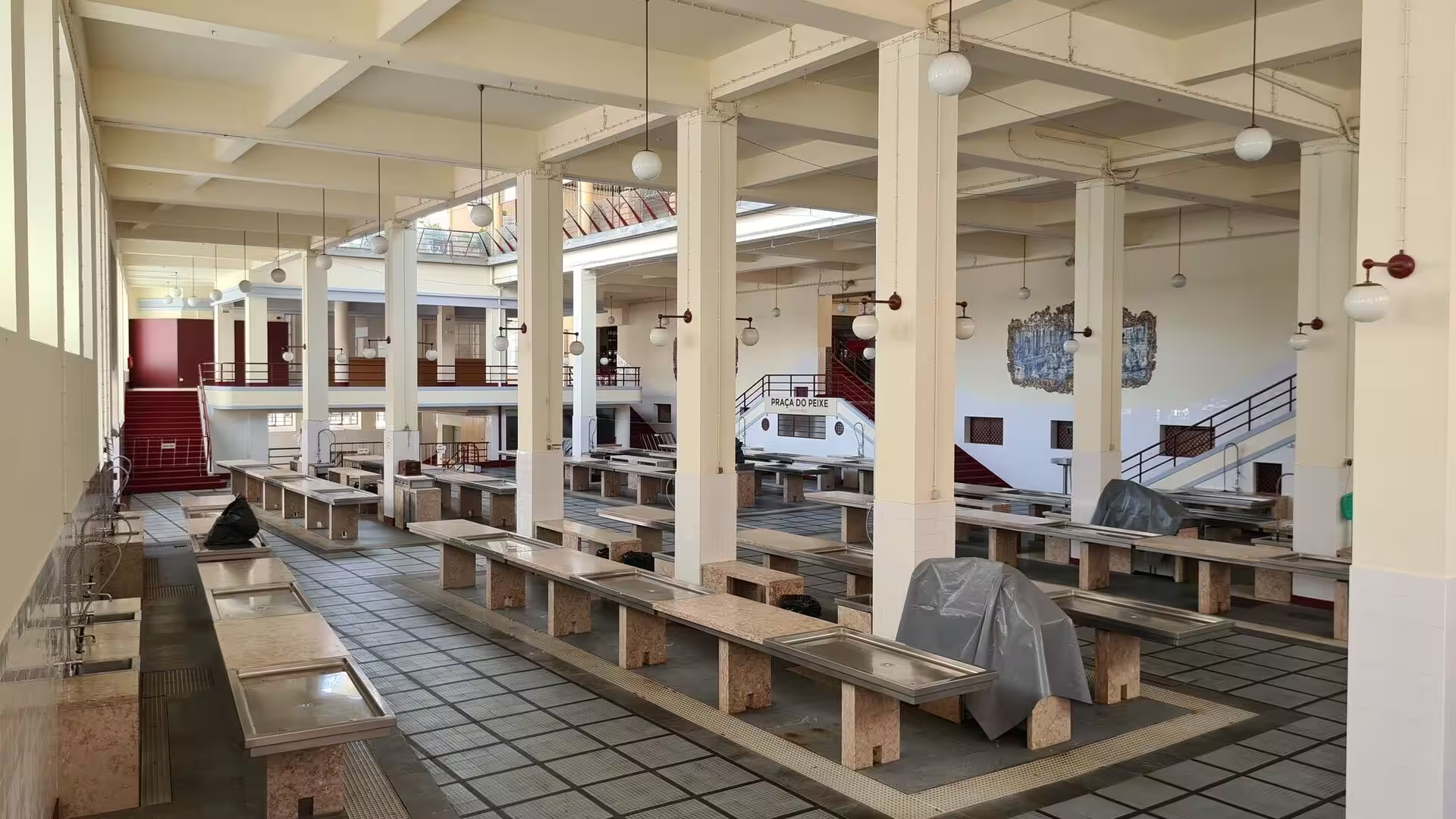
The market hall. The municipal market occupies a two storey building whose upper galleries are filled with fruit and vegetables and whose lower floor is given to fish. Counters of stone run in long rows under globe lamps, and the produce is arranged in named piles: bananas of several sizes, passion fruit, cherimoya, herbs and flowers. The fish section is the sharpest introduction to local waters, above all the black scabbardfish, the long dark species that gives the island its most famous dish and is landed and sold the same day. The building is as much a social institution as a shop.
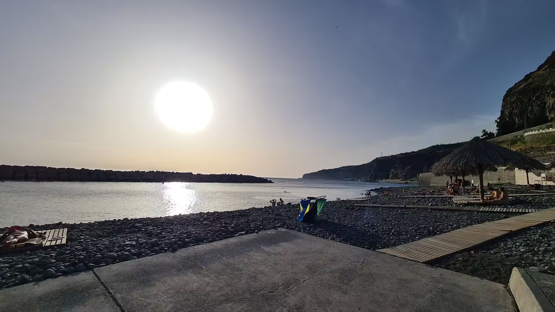
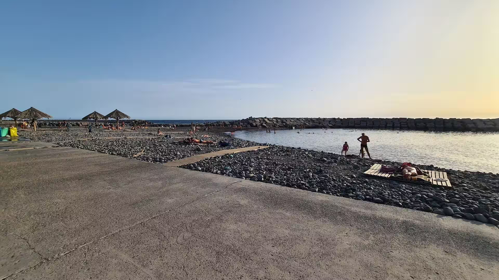
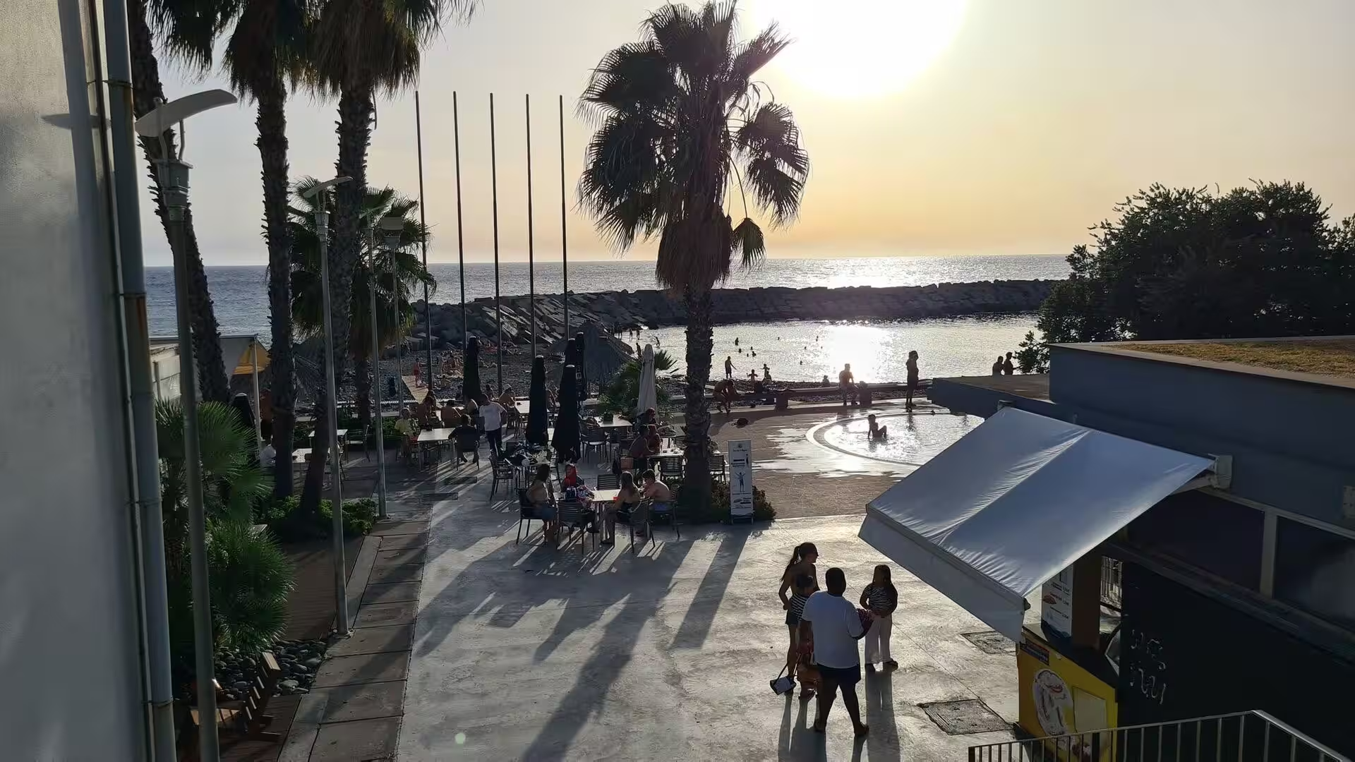
The thatched shelter on the shore. At the western end of the pebble beach a simple canopy of cane thatch on wooden posts stands above the stones, its roof low and wide and its floor raised on a platform. It serves fishing and summer bathing at once, and it gives shade at the hour when the light becomes horizontal. In the evening the shelter frames the sunset: the beach darkens, the pebbles hold the last heat, and the sea beyond the wall glows while the mountains behind it turn grey. The construction is light and can be renewed as the weather takes it.
The bathing beach and its umbrellas. Along the broad shore a line of cane roofed umbrellas stands on the pebbles, each with a table or a lounger beneath it. The beach is made of large rounded stones rather than sand, which keeps it clean and firm underfoot and gives the water its deep colour, and shade therefore matters more than on a sandy shore. The platform of stones extends far into the water at low tide, so that entry is shallow along most of its length, and the wall and the road above it separate the beach from the buildings.
The promenade along the bay. Palms separate the road from a sea front walk where cafe tables stand on the pavement and people take the evening air. The bay is protected on both sides, so the water inside it stays calm when the open sea is rough, and the low sun fills the space between the trees and the facades. The walk is the social room of the city in the evening: the tables face the bay rather than the street, the light on the water is the last thing to go, and the distance to the harbour and the hotel quarter is short.
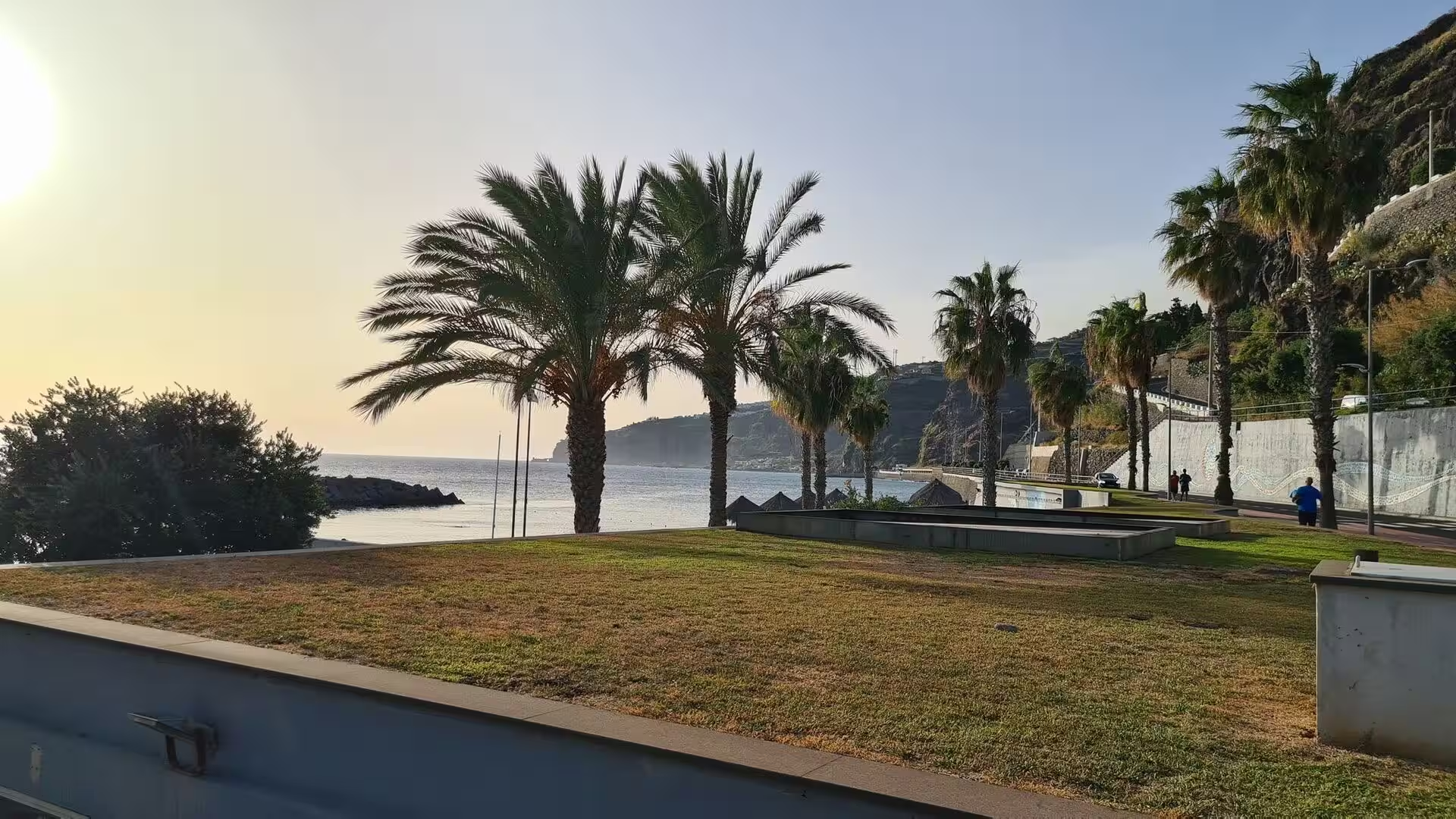
The lawn above the low wall. A stretch of mown lawn runs beside the promenade on a wall above the water, planted with palms and shaded by older trees. It is a public garden in the tropical manner, where the planting is architectural rather than floral: fan palms, wide leaved species and clipped shrubs arranged against the sea. Benches face the water along the wall, and the bay, the harbour and the berths of the cruise ships can be read from this level in a single sweep. On a mild evening the lawn becomes an open air room.
The table at the end of the day. The evening meal belongs to the household kitchen of the island rather than to the restaurant: pieces of beef stewed slowly with vegetables, served with fried potatoes and green broccoli, and eaten with bread. The regional repertoire behind such a plate is well defined, from espetada of beef on a bay laurel stick to milho frito of firm cornmeal fried in cubes, from bolo do caco baked on a basalt slab and served with garlic butter to espada fried in batter with banana. A glass of Madeira wine accompanies it, dry or sweet according to the grape, and the meal ends with molasses cake.
References
- Wikipedia contributors (2026). Funchal. en.wikipedia.org/wiki/Funchal
- Wikipedia contributors (2026). Madeira wine. en.wikipedia.org/wiki/Madeira_wine
- Wikipedia contributors (2026). Espetada. en.wikipedia.org/wiki/Espetada
- Wikipedia contributors (2026). Black scabbardfish. en.wikipedia.org/wiki/Black_scabbardfish
- Wikipedia contributors (2026). Bolo do caco. en.wikipedia.org/wiki/Bolo_do_caco
- Wikipedia contributors (2026). Milho frito. en.wikipedia.org/wiki/Milho_frito
- Wikipedia contributors (2026). Câmara de Lobos. en.wikipedia.org/wiki/C%C3%A2mara_de_Lobos
- Wikipedia contributors (2026). Madeira Island. en.wikipedia.org/wiki/Madeira_Island
- Wikipedia contributors (2026). Madeira. en.wikipedia.org/wiki/Madeira
- Wikipedia contributors (2026). History of Madeira. en.wikipedia.org/wiki/History_of_Madeira
- Wikipedia contributors (2026). Laurisilva. en.wikipedia.org/wiki/Laurisilva
- Wikipedia contributors (2026). Levada. en.wikipedia.org/wiki/Levada
- Wikipedia contributors (2026). Macaronesia. en.wikipedia.org/wiki/Macaronesia
- Wikipedia contributors (2026). Autonomous Region of Madeira. en.wikipedia.org/wiki/Autonomous_Region_of_Madeira
- Wikipedia contributors (2026). 2010 Madeira floods and mudslides. en.wikipedia.org/wiki/2010_Madeira_floods_and_mudslides
- Silveira (2009). Die Kathedrale von Funchal, Madeira. Ein historischer Überblick / The Cathedral of Funchal, Madeira. A Historical Overview. Restoration of Buildings and Monuments. 15. 381-386. doi.org/10.1515/rbm-2009-6328
- Hancock (1998). Commerce and Conversation in the Eighteenth-Century Atlantic: The Invention of Madeira Wine. The Journal of Interdisciplinary History. 29. 197-219. doi.org/10.1162/002219598551670
- Pereira (2010). Oceans of wine: Madeira and the emergence of American trade and taste. Business History. 52. 671-673. doi.org/10.1080/00076791003765016
- Faria (2012). Sugar cane spirits: cachaça and rum production and sensory properties. Alcoholic Beverages. 348-358. doi.org/10.1533/9780857095176.3.348
- Jesus (2023). Madeira tourism, always proactive toward sustainability. Worldwide Hospitality and Tourism Themes. 15. 664-668. doi.org/10.1108/whatt-09-2023-0114