Day 7 - Luxor















Journal Notes
General
Luxor is a city of Upper Egypt on the east bank of the Nile, some 670 kilometres south of Cairo and about 220 kilometres north of Aswan, the capital of the Luxor Governorate; its roughly 285,000 inhabitants (2023 estimate) make it a modest provincial centre by Egyptian standards. The town nevertheless occupies one of the most celebrated archaeological landscapes on earth, for it stands on the site of the ancient Egyptian city of Waset, which the Greeks called Thebes, and it has long been characterised as the world’s greatest open-air museum: the temple complexes of Karnak and Luxor rise within the modern streets, while the tombs of the west bank face them from across the river.
Ancient Thebes was never a single city but a pair of settlements facing one another across the Nile. On the east bank lay the living city with its two great temple domains, linked by the ceremonial avenue of sphinxes, some 2.7 kilometres long, along which the barque of Amun travelled from Karnak to the Luxor Temple during the annual festival of Opet. On the west bank stretched the city of the dead: the royal Valley of the Kings and the Valley of the Queens, the workmen’s village of Deir el-Medina, the terraced temple of Hatshepsut at Deir el-Bahri, the Ramesseum, Medinet Habu and the Colossi of Memnon. In 1979 the entire ensemble was inscribed on the World Heritage List as “Ancient Thebes with its Necropolis” (ref. 87), a serial property of more than 7,000 hectares recognised under criteria (i), (iii) and (vi).
Modern Luxor lives by its monuments. Tourism is the economic base: the white cruise ships moored along the corniche and the hot-air balloons that have risen over the west bank since 1988, when Luxor became the first city in Egypt to offer the rides. Visitor numbers swing violently with the country’s politics, the terrorist attack of 1997 and the revolution of 2011 each emptying the sites for years, but tourism remains the town’s foundation beside the agriculture of the plain, above all the sugar cane. Climatically Luxor is one of the sunniest and driest inhabited places on earth (BWh after Köppen): the sky is clear for about 4,000 hours a year, measurable rain falls in some years not at all, summer heat is fierce and the nights cool sharply. Minarets and church towers rise side by side over the same streets.
History
The history of Luxor is the history of Thebes. The site was inhabited from about 3200 BC and became the seat of the fourth nome of Upper Egypt: Waset, the “city of the sceptre”. In the Old Kingdom it remained a modest provincial town while Memphis was the royal residence, though a statue fragment of the Fifth-Dynasty king Nyuserre found at Karnak hints at an early shrine there. The city rose with the collapse of the Old Kingdom: Mentuhotep II of the Eleventh Dynasty reunified Egypt about 2055 BC and ruled from Thebes, building the first great mortuary temple at Deir el-Bahri. The Twelfth Dynasty governed from the northern capital of Itjtawy, but Thebes throve as the religious centre of Amun, “the hidden one”, whose earliest known temple at Karnak dates from Senusret I (c. 1971-1926 BC).
When the Hyksos kings of the Delta held Lower Egypt in the Second Intermediate Period, the Theban princes of the Seventeenth Dynasty raised the standard of resistance from the south, and Ahmose I completed the expulsion and founded the Eighteenth Dynasty with Thebes as the capital of a reunited, expansionist state. The wealth of the New Kingdom flowed into the temples of Amun: Thutmose III brought the booty of his Asiatic campaigns to Karnak, Hatshepsut reopened the trade routes to Punt, and Amenhotep III (c. 1390-1353 BC) presided over the city’s apogee, building the Luxor Temple, the avenue that joined it to Karnak and, on the west bank, the palace-city of Malqata. Akhenaten’s removal of the court to Amarna and his proscription of Amun interrupted the city’s glory; under Tutankhamun the old gods were restored. The Ramesside kings ruled from the north but enriched Thebes above all others: Seti I and Ramesses II raised the great hypostyle hall at Karnak, Ramesses II added the pylon, court and obelisks of the Luxor Temple, and the kings of the New Kingdom were buried across the river in the Valley of the Kings.
After the New Kingdom Thebes lost political power but never religious authority. In the Third Intermediate Period the High Priests of Amun effectively ruled Upper Egypt, their power balanced against the Delta kings and bound to them by the princesses installed as God’s Wives of Amun. The Kushite kings of the Twenty-Fifth Dynasty made Thebes their capital; in 663 BC the Assyrian king Ashurbanipal sacked the city, whose plundered wealth (including “two obelisks of splendid electrum”) became proverbial for total ruin. Thebes never recovered politically, yet it remained the religious heart of Egypt into the Greek period: Alexander visited for the festival of Opet, and the Ptolemies faced Theban revolts, those of Horwennefer and Ankhmakis being suppressed only in 185 BC and the rising of 91 BC ending in the city’s decline into the village Strabo described a century later. Under Rome it survived as the centre of the province of Thebais Superior; the Luxor Temple, converted into a fortified camp in the late third century AD, received about AD 300 the painted portraits of the emperors of the Tetrarchy, the last state cult celebrated in a pharaonic building.
The Christian and Islamic town grew up among the ruins. Churches were established in the temple enclosures, and after the Arab conquest of 641 the settlement called al-Uqsur, “the palaces”, clustered over the monuments of the east bank; the mosque of the saint Abu al-Haggag rose within the Luxor Temple itself, and by the nineteenth century three quarters of that temple lay buried beneath houses and rubbish. The French Description de l’Égypte (1809) described the Avenue of Sphinxes as 2,000 metres long with more than 600 statues; in 1831 one of the obelisks of Ramesses II was removed as a gift to France and re-erected on the Place de la Concorde in Paris in 1836; and from the 1880s Auguste Mariette and Gaston Maspero began the clearance of the Luxor Temple. Only in recent decades were the last stretches of the avenue freed from the modern town, and the whole processional road was reopened in November 2021. The monuments of Thebes were placed under international protection in 1979, when the site became one of Egypt’s earliest World Heritage properties.
Geology
The plain on which Luxor stands is young ground: the town is built on the floodplain of the Nile, on the silts and clays of the Holocene, and the ancient temples were raised where the alluvium meets the desert, which is why the monuments could be buried so completely by the town above them. Westwards the desert rises abruptly: the Theban Plateau, the local edge of the Libyan plateau, forms a sheer cliff of pale limestone culminating in the pyramidal peak of Gebel al-Qurn, more than 350 metres above the river plain. The cliff is the type locality of the Thebes Formation, a body of Lower Eocene marine limestones about 340 metres thick at its type section at Gebel Gurnah, deposited on a carbonate platform at the margin of the Tethys Ocean between roughly 52.45 and 49.6 million years ago; its nummulite-rich chalks, chert bands and oyster banks record some 2.8 million years of shallow-water deposition. Beneath lie the Esna Shale and the Tarawan Chalk of the Paleocene.
The landscape between cliff and cultivation is itself a geological monument. During the pluvial phases of the Pleistocene, when the Nile ran high and rains cut the desert wadis, the cliff retreated, and the low rounded hills that front it today (at El Asasif, Sheikh Abd el-Qurna and Qurnet Murai) are not outcrops in place but gigantic blocks that slid from the plateau over the incompetent Esna Shale, tilting as they moved. The tombs of the necropolis were cut into the limestones of the Thebes Formation, and where their chambers descend into the shale the builders met swelling clays and fracture systems that still trouble the conservators; the geological study of the tomb strata, known as “necrostratigraphy”, has become essential to preserving the painted burial chambers.
The building stones of the monuments tell the geology of a wider Egypt. The temples of Karnak and Luxor were built almost entirely of Nubian sandstone, the classic building stone of Upper Egypt, quarried at Gebel el-Silsila some 150 kilometres to the south and floated down the Nile. The obelisks and the hardest statuary, by contrast, are of red granite from the Aswan quarries further south: the surviving obelisk of Ramesses II before the Luxor pylon, and the colossal statues beside it, were each cut from a single block of Aswan granite and transported some 160 kilometres downriver. Local limestone and mud brick served for lesser structures and for the houses of the living town, which rose again as the substance of the medieval settlement that buried the temples.
Water is the great enemy of the Theban monuments. The aggradation of the Nile floodplain raised the water table beneath the east bank, and the Avenue of Sphinxes at Luxor could not be excavated for generations because it lay below the groundwater level, a difficulty already reported by Georges Daressy in 1893; modern irrigation keeps the table high, and the salts it carries attack the bases of walls and columns, so that conservation is as much a matter of hydrogeology as of architecture. The dryness of the climate is double-edged: the hyper-arid air has preserved surfaces that a wetter climate would have destroyed, but the rare cloudbursts of the desert send flash floods down the western wadis, dumping debris into the open tombs, while wind-borne sand and salt crystals gnaw the sandstone. The monuments of Thebes are thus caught between the water below and the water above.
Things to See
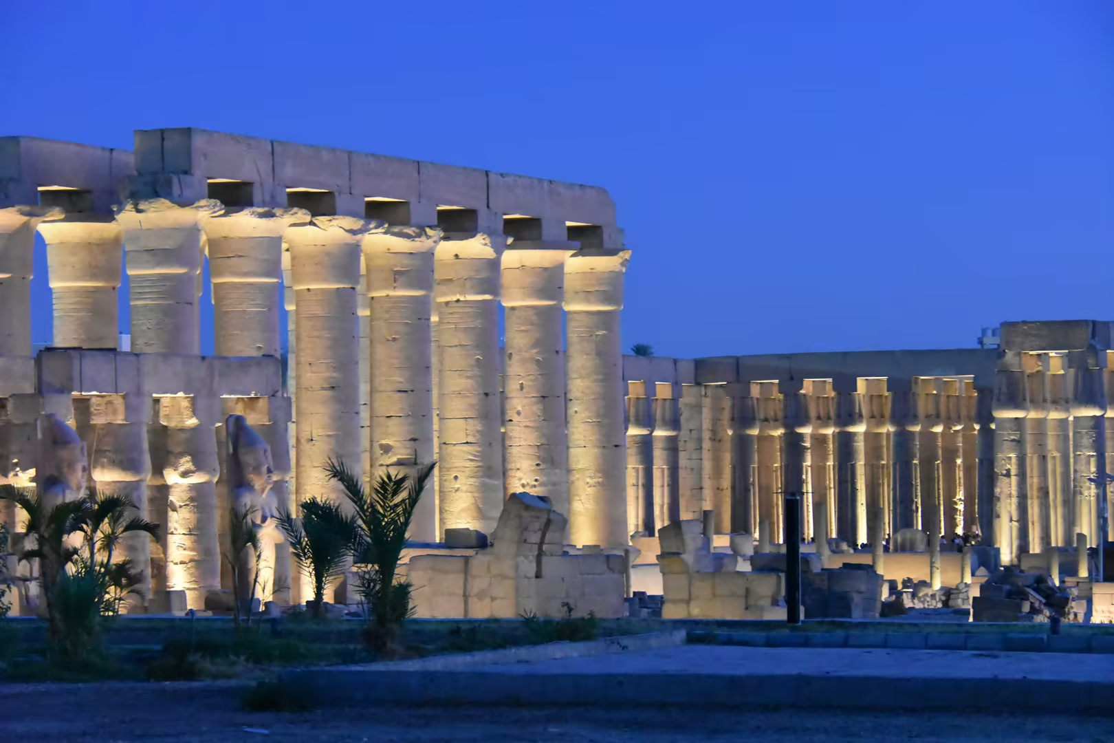
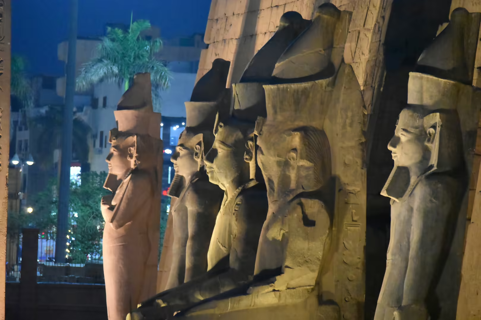
Luxor Temple stands in the centre of the modern town, close to the corniche on the east bank of the Nile, and is the great ancient monument of this side of the river. Amenhotep III began the sanctuary in the fourteenth century BC and the Ramesside kings enlarged it; the complex lies at the southern end of the Avenue of Sphinxes, the processional road some 2.7 kilometres long that links it to Karnak and was reopened in November 2021. The pylon of Ramesses II, 24 metres high and 65 metres wide, towers over the approach, its faces carved with sunken reliefs of the king’s chariot charge at the battle of Kadesh against the Hittites. Two colossal seated statues of Ramesses guard the gateway, and beside the pylon stands the single surviving obelisk of the original pair, a shaft 25 metres tall of pink Aswan granite whose twin was removed in 1831 and re-erected on the Place de la Concorde in Paris in 1836.
Inside the pylon lies the first court, ringed by columns with papyrus capitals and lined with further colossal statues, and beyond it rises the processional colonnade of Amenhotep III: fourteen columns some 16 metres high with open lotus capitals, the walls between them carved with reliefs of the Opet festival, the annual occasion on which the barque of Amun travelled from Karnak to the Luxor Temple. In one corner of the ancient complex the whitewashed mosque of the saint Abu al-Haggag stands on the columns themselves, on ground that served as a church in late antiquity and preserves more than three millennia of continuous worship. The temple is open to visitors by night, when it is floodlit from below and the warm light draws the hieroglyphs out of the sandstone.
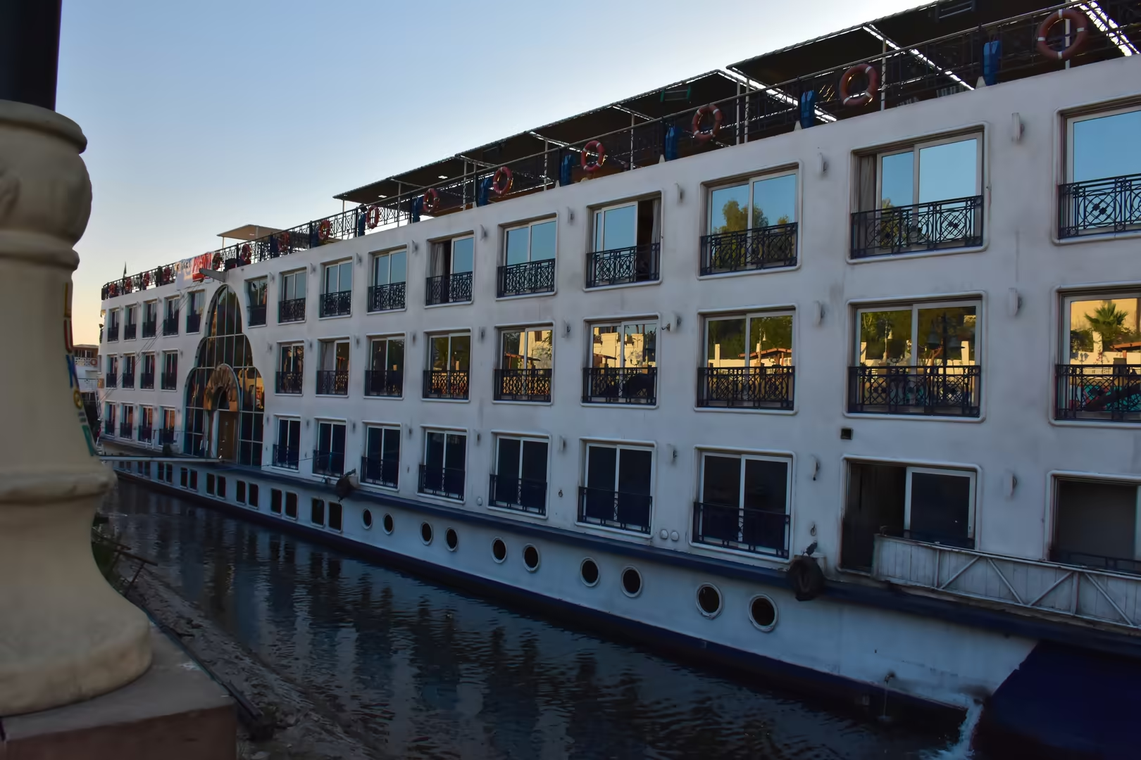
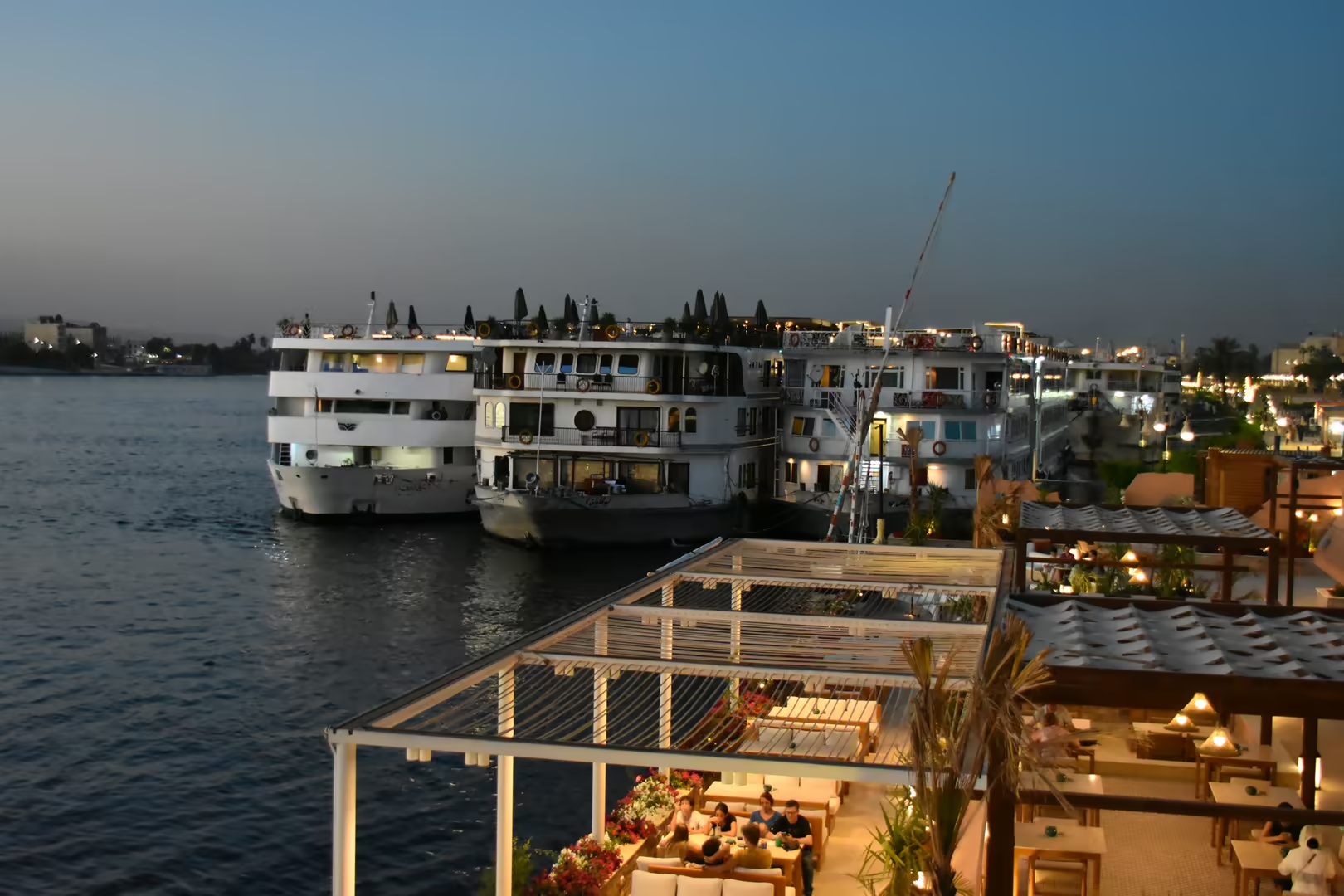
The riverfront is the second great spectacle of Luxor. The corniche promenade curves along the east bank, lined with palms, lawns and lamp standards, with cafés and rooftop terraces looking out over the water. The quay in front of the town is the mooring of the Nile cruise fleet: the white, multi-deck ships of the Luxor-Aswan run lie bow to stern along the bank, their tiers of balconies glowing in the evening light, and at dusk the whole row is strung with lamps and reflected in the calm river. The same quays serve the covered ferry boats and excursion launches that connect the east bank with the west, where the tombs and temples of the necropolis lie a short crossing away.
Feluccas belong to the river scene as much as the temples belong to the land. These traditional lateen-rigged sailing boats glide across the water through the day and gather in numbers towards sunset, when their tall sails move as dark silhouettes against the western sky. Beyond the palm belt on the far shore the escarpment of the Theban plateau closes the view, and behind that cliff lie the great monuments of the west bank: the Valley of the Kings, the terraced temple of Hatshepsut at Deir el-Bahri, the Ramesseum, Medinet Habu and the Colossi of Memnon. The felucca of today descends in a direct line from the sailing craft of the pharaonic Nile, the boats that carried the trade, the armies and the pilgrims of Upper Egypt for thousands of years.
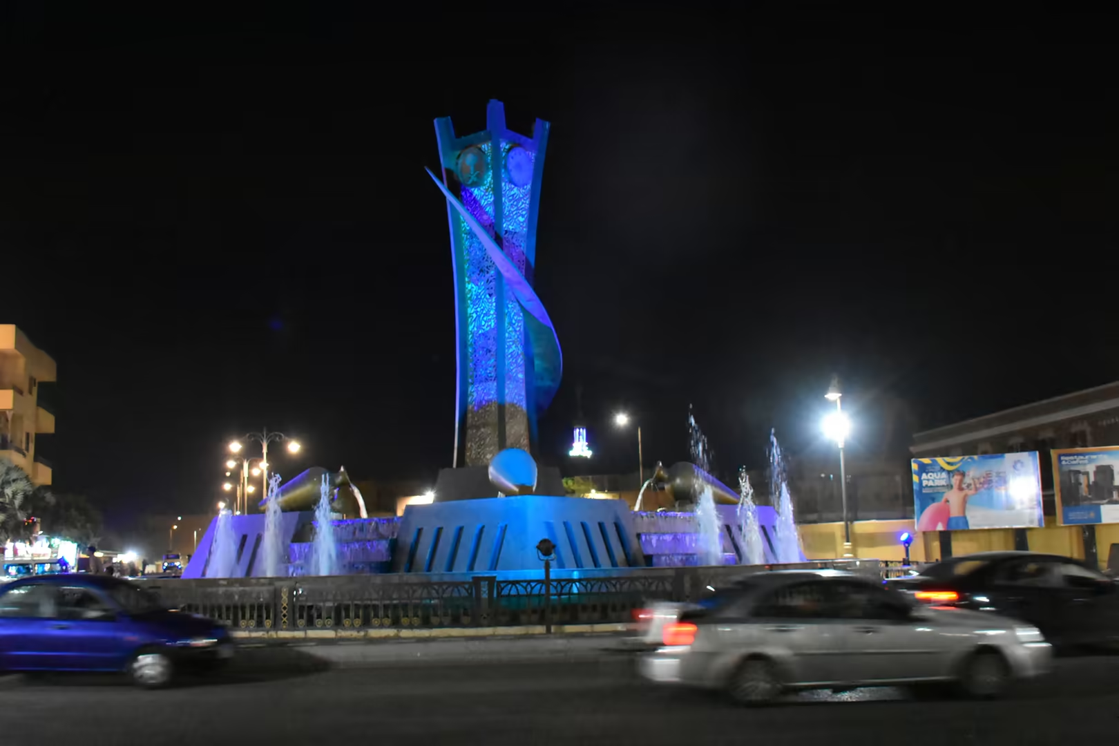
The town that has grown up among the monuments is as characteristic as the ruins. Between the temple and the corniche the evening streets fill with visitors and townspeople: shop fronts and gallery windows glow, cafés spill out onto the pavements, and illuminated signs advertise Nile cruises and excursions to the tombs of the west bank. Mosques and churches stand side by side, their minarets and bell towers rising above the rooftops, some of the minarets outlined in green light at night; the esplanade runs south to a roundabout monument ringed by fountains and bathed in blue light after dark. Luxor is not a museum town but a working provincial capital built on the remains of Thebes, and its daily life continues around the temples rather than apart from them.
References
- Strudwick, N. & Strudwick, H. (1999). Thebes in Egypt: A Guide to the Tombs and Temples of Ancient Luxor. London: British Museum Press.
- Wilkinson, R. H. (2000). The Complete Temples of Ancient Egypt. London: Thames & Hudson.
- Kemp, B. J. (2006). Ancient Egypt: Anatomy of a Civilization (2nd edn). London: Routledge.
- Said, R. (1990). The Geology of Egypt. Rotterdam: A. A. Balkema.
- UNESCO World Heritage Centre (1979). Ancient Thebes with its Necropolis. World Heritage List, ref. 87. whc.unesco.org/en/list/87/
- Wikipedia contributors (2026). Luxor. en.wikipedia.org/wiki/Luxor
- Wikipedia contributors (2026). Thebes, Egypt. en.wikipedia.org/wiki/Thebes,_Egypt
- Wikipedia contributors (2026). Karnak. en.wikipedia.org/wiki/Karnak
- Wikipedia contributors (2026). Luxor Temple. en.wikipedia.org/wiki/Luxor_Temple
- Wikipedia contributors (2026). Avenue of Sphinxes. en.wikipedia.org/wiki/Avenue_of_Sphinxes
- Wikipedia contributors (2026). Opet Festival. en.wikipedia.org/wiki/Opet_Festival
- Wikipedia contributors (2026). Valley of the Kings. en.wikipedia.org/wiki/Valley_of_the_Kings
- Wikipedia contributors (2026). Theban Necropolis. en.wikipedia.org/wiki/Theban_Necropolis
- Wikipedia contributors (2026). Luxor Obelisks. en.wikipedia.org/wiki/Luxor_Obelisks
- Wikipedia contributors (2026). Ramesses II. en.wikipedia.org/wiki/Ramesses_II
- Wikipedia contributors (2026). Nile. en.wikipedia.org/wiki/Nile