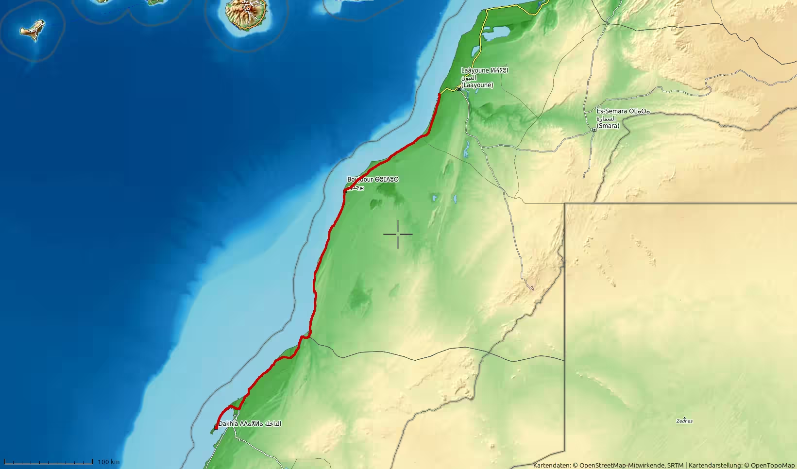
A long northbound road journey from Dakhla to Laayoune along Morocco’s Atlantic Sahara corridor. The route leaves the Dakhla peninsula, crosses more than 500 kilometers of open coastal-desert plains, passes the Boujdour region, and ends near Laayoune. With low elevations, wide horizons, sparse settlements and several pauses along the way, this track captures the vast and exposed character of the road between desert and ocean.
The journey began in Dakhla, at the southern end of one of Morocco’s most distinctive Atlantic landscapes. After reaching the city on the previous long road stage, this track recorded the return north from the Dakhla peninsula toward Laayoune. It was not a new type of landscape, but a new direction through the same vast region: the Atlantic Sahara road, the open desert plains, the low coastal country, the long distances between settlements, and the constant feeling of traveling between ocean and desert.
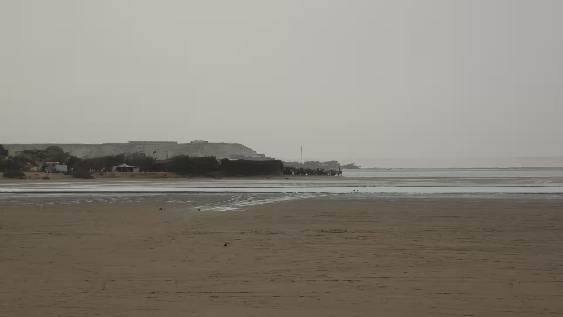
Leaving Dakhla in the morning, the route first moved away from the peninsula and back toward the main north-south road. Dakhla’s geography gives every departure a special character. The city is not simply placed on the coast; it lies on a narrow strip of land between the Atlantic Ocean and the lagoon. Even before the long drive begins, the landscape already feels unusual: water, wind, low land, open sky, and desert-like space all meet in a compact area.
The first kilometers carried the atmosphere of departure. The road left the local urban area and returned to the wider Atlantic corridor. The surroundings quickly became open again. Buildings and city activity gave way to long stretches of road, pale ground, sparse vegetation, and an almost uninterrupted horizon. The journey was now no longer about arrival in Dakhla, but about leaving the peninsula behind and driving north through one of Morocco’s most spacious road landscapes.
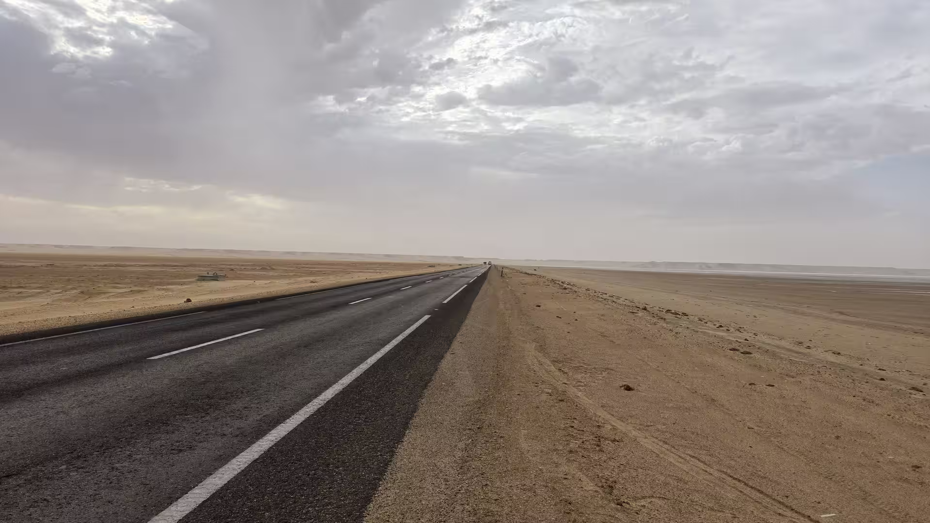
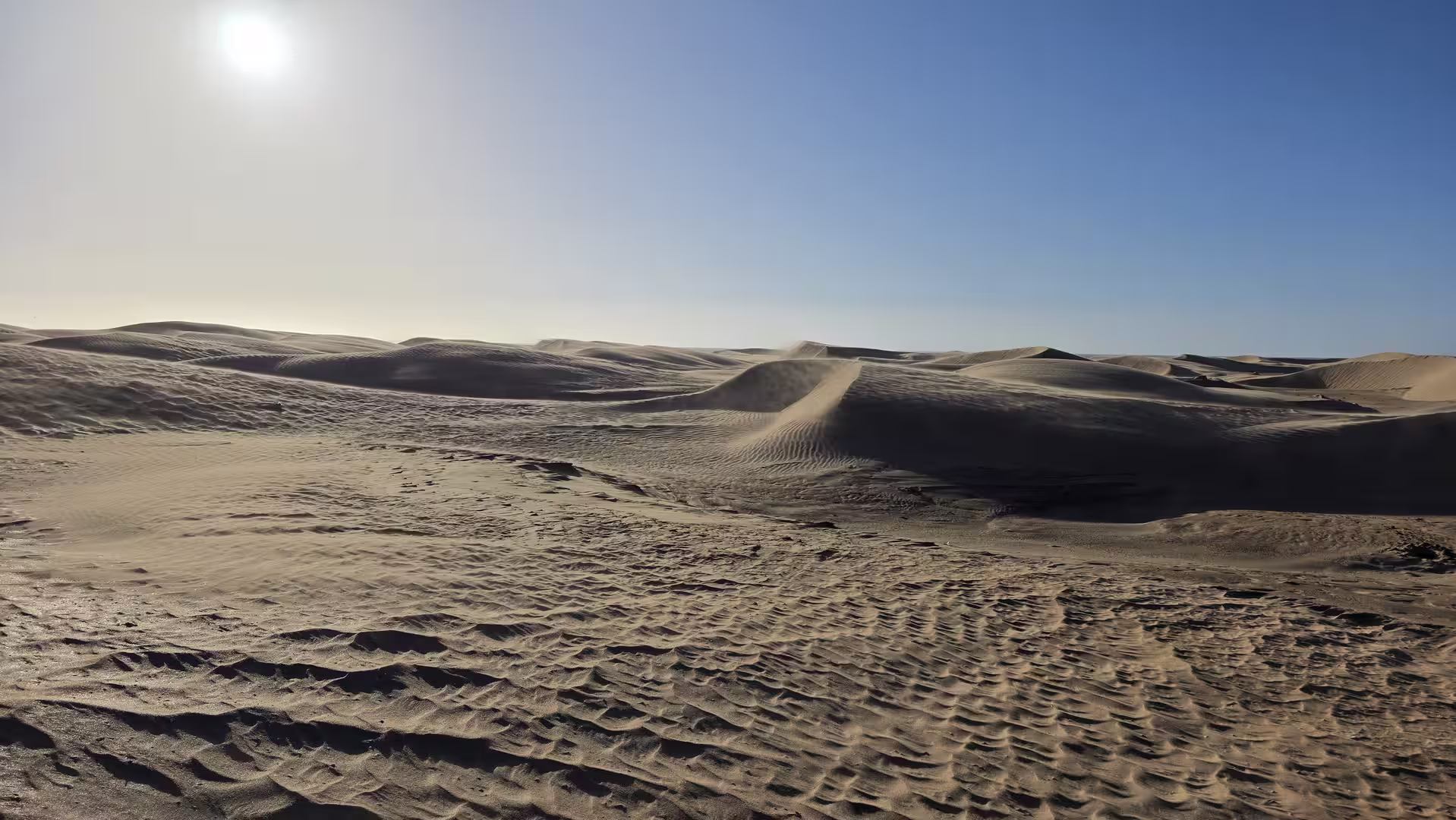
The route remained low in elevation from the beginning. The track started close to sea level and stayed mostly within a coastal-desert elevation range throughout the day. There were no mountain passes, no steep climbs, and no dramatic valleys. Instead, the landscape unfolded horizontally. This is the defining feature of the road between Dakhla and Laayoune: distance, exposure, wind, sky, and the long line of asphalt across dry Atlantic land.
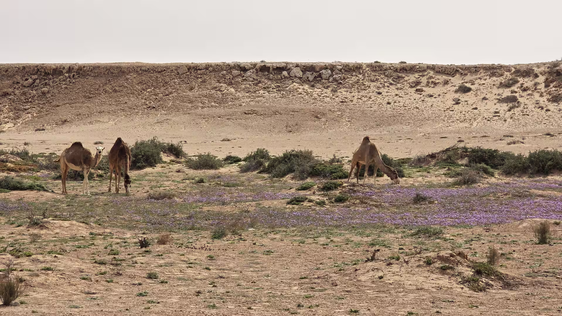
At first, the road ran through the southern section of the Atlantic Sahara corridor north of Dakhla. This part of the route felt remote almost immediately. The scenery was simple, but powerful in its scale. The road crossed low plains and open terrain, sometimes closer to the coast, sometimes slightly inland. The Atlantic was not always visible, but its presence could be felt in the light and the openness of the landscape.
After roughly fifty kilometers, the journey was fully outside the Dakhla area. The city had disappeared behind the road, and the route had entered the long empty stretch northward. This section gave the day its basic rhythm: steady driving, long views, few settlements, and short pauses that became important because of the scale of the surroundings.

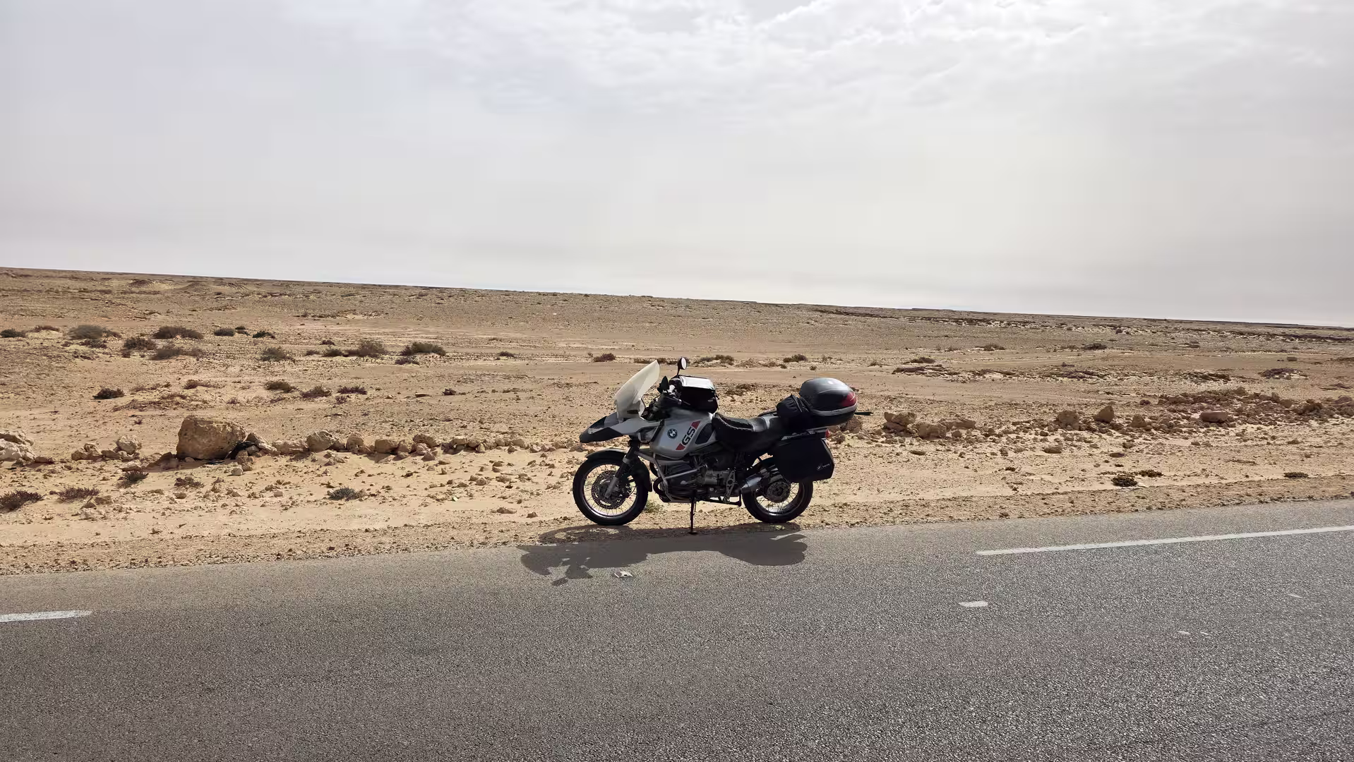
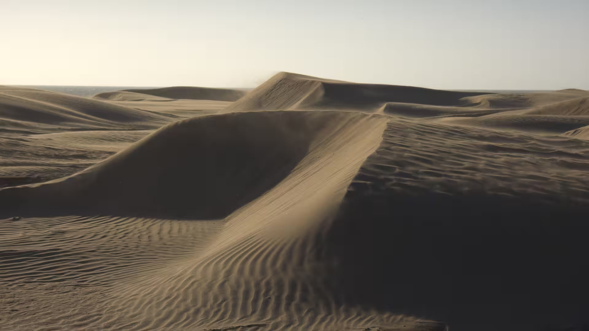
The first longer break came after about one and a half hours on the road. The stop was not in a major town, but in the open corridor north of Dakhla. In this kind of landscape, even a short halt has a strong effect. The constant movement stops, the road noise disappears, and the emptiness becomes more noticeable. The surrounding land feels wide, dry, and exposed. The pause emphasizes how remote this road really is.
Continuing north, the route passed through more of the same broad Atlantic desert landscape. The beauty here was not based on variety in the usual sense. It came from repetition and scale. The colors changed only gradually: pale sand, grey-brown plains, occasional darker ridges, and the wide blue or hazy sky above. The road seemed to run through a landscape reduced to its essential elements.
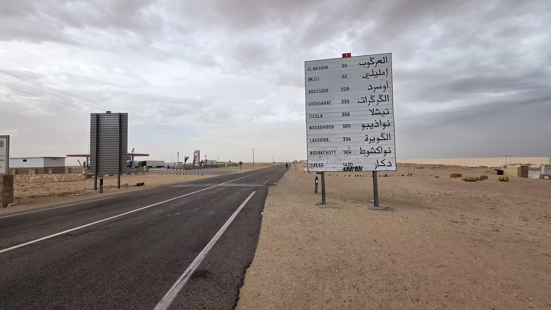
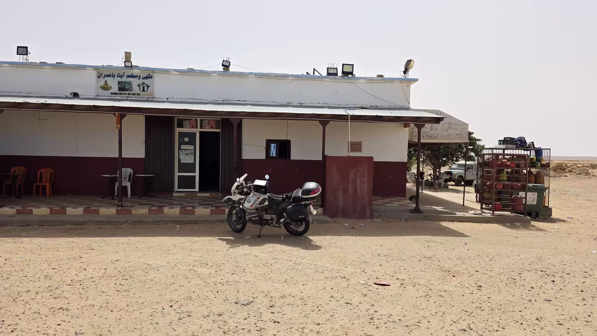
A second short stop followed farther north, again along the remote road corridor. By this point, the journey had already covered a significant distance, but Laayoune was still far away. This is one of the striking aspects of the route: even after hours of travel, the map still shows large gaps between the major points. Dakhla, Boujdour, and Laayoune structure the day, but the real experience lies in the long empty sections between them.
Around the middle of the route, there was a longer pause of more than half an hour. This stop became the main break of the day before reaching the Boujdour region. It came in an open area north of Dakhla, where the road remained surrounded by the Atlantic Sahara’s low, dry terrain. Such a pause is practical on a long drive, but it also gives the journey a clearer structure. The first part of the day had carried the route away from Dakhla; the next part would continue toward Boujdour and the northern section of the road.
After the longer break, the drive resumed across the same vast, exposed country. The road now moved steadily toward Boujdour, the main town between Dakhla and Laayoune. This section of the route had a slightly different feeling from the departure near Dakhla. The destination was still far away, but Boujdour began to give the road a more concrete intermediate goal.
The approach to Boujdour was one of the important chapters of the day. After hundreds of kilometers of open road, the presence of a town becomes meaningful. In southern Morocco, towns along the Atlantic road are more than simple waypoints. They are places where the long scale of the road becomes manageable: fuel, food, rest, orientation, and the feeling of being briefly connected to settlement again.

The track showed a stop around the Boujdour area in the early afternoon. This was a natural moment to pause. The route had already covered roughly 350 kilometers from Dakhla, and the journey had moved from the southern peninsula region into the central part of the Atlantic road corridor. Boujdour marked the transition between the remote southern stretch and the final road north toward Laayoune.
Boujdour also changed the psychological rhythm of the journey. South of the town, the road still felt connected to Dakhla and the long emptiness behind it. North of Boujdour, the route began to feel more clearly like the approach to Laayoune. The distance was still substantial, but the day now had a visible endpoint.
Leaving Boujdour, the road continued north and northeast across low coastal plains. The landscape remained open and arid. There were no sharp changes, but the direction of travel brought the route closer to the Laayoune region. The scenery was still dominated by road, sky, dry ground, and long horizons, but the sense of complete remoteness gradually softened.
Another short stop appeared north of Boujdour, after the route had already turned toward the final section of the day. This pause broke up the last large driving segment. The track then continued toward Laayoune, following the same broad Atlantic Sahara corridor that had defined the entire journey.
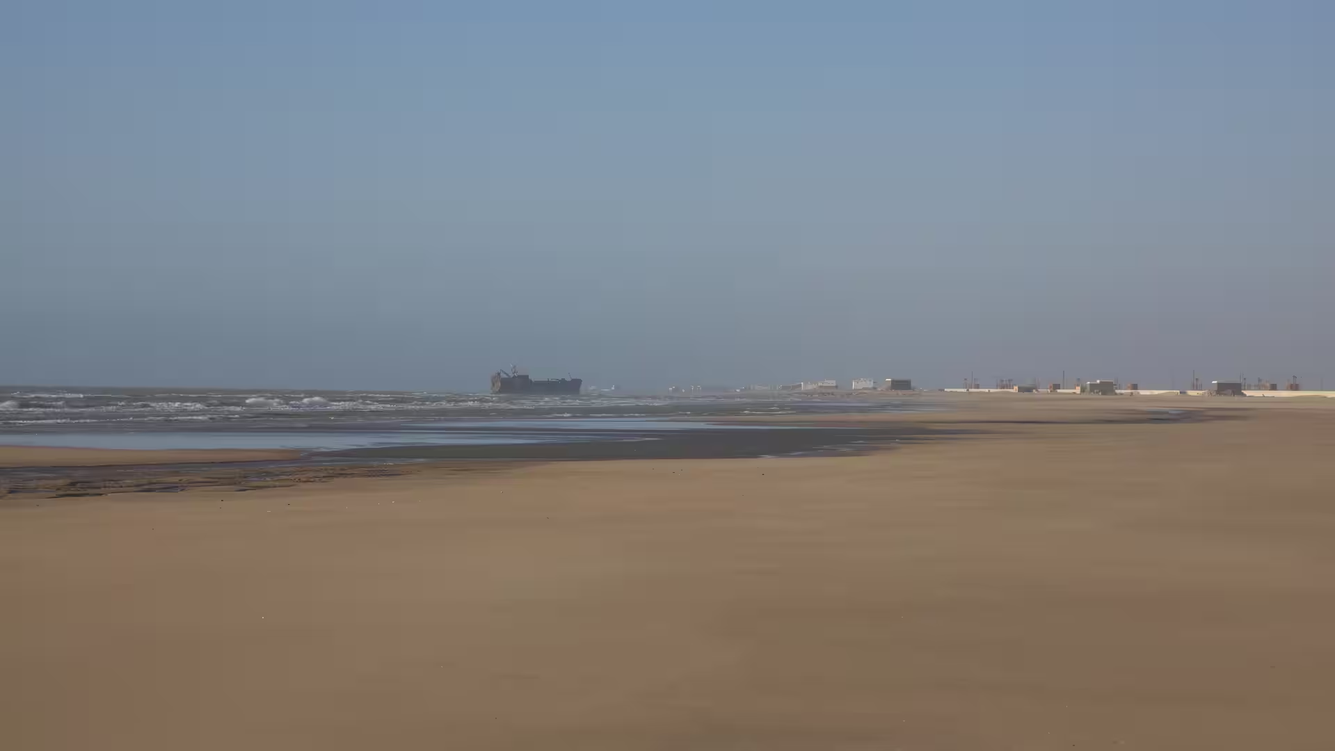
The final approach to Laayoune felt different from the earlier parts of the day. After so many kilometers of sparse settlement and open country, the signs of a larger urban area became more significant. Infrastructure increased, the road environment became less empty, and the destination began to feel close. Laayoune appeared as the northern anchor of the route, just as Dakhla had been the southern anchor at the start.
The track ended near Laayoune in the late afternoon. The journey had covered more than 500 kilometers in less than seven hours of recorded time, including several stops. The moving speed was high, reflecting the long, open character of the road. The elevation remained low throughout the day, with the highest point only around 174 meters above sea level and the route ending close to sea level.
What made this stage memorable was the return perspective. The previous route from Laayoune to Dakhla had felt like a southbound journey deeper into the Atlantic Sahara, ending on the distinctive Dakhla peninsula. This track reversed that movement. It began in Dakhla’s coastal-lagoon world and traveled back north through the long, exposed road corridor toward Laayoune.
The landscape itself may seem minimal, but that is exactly what gives the journey its power. There are few distractions. The route is about space, distance, and the feeling of moving through a vast coastal desert environment. The road does not constantly surprise with dramatic viewpoints. Instead, it creates a long, steady impression of scale.
For travelers, this route is demanding in a specific way. It is not technically difficult like a mountain road, and it does not involve complex navigation. Its challenge is the length, the exposure, the limited number of major stops, and the mental focus required for long-distance driving through open country. Planning fuel, breaks, daylight, and road conditions matters.
From a travel-report perspective, the route works well as a counterpart to the previous day. Together, the two tracks show both directions of the Atlantic Sahara corridor: the southbound journey from Laayoune to Dakhla and the northbound return from Dakhla to Laayoune. In one direction, the road feels like a gradual departure from northern settlement toward a remote peninsula. In the other, it feels like a long return from the edge of the continent toward a larger regional center.
The strongest memory of the day is the openness. The departure from Dakhla, the first long empty stretches, the pauses in the remote corridor, the stop near Boujdour, and the final approach to Laayoune all belong to the same wide landscape. This is Morocco stripped down to road, ocean influence, desert plain, wind, sky, and distance.
By the end of the route, the journey had reconnected Dakhla with Laayoune across more than 500 kilometers of Atlantic Sahara road. It was a stage of repetition, scale, and clarity: a long northbound crossing through one of Morocco’s most open coastal regions.