


Miradouro Ponta do Furado – General Overview
Miradouro Ponta do Furado is located on the northeastern coast of Madeira, within the municipality of Santana. The viewpoint occupies a prominent headland projecting into the Atlantic Ocean and offers unobstructed views of Madeira’s rugged coastline and the open sea. The surrounding area is characterized by a low degree of human modification and forms part of a largely preserved coastal landscape.
Due to its exposed position, the region is subject to strong Atlantic winds and persistent marine influence. These environmental conditions significantly shape both the physical landscape and the biological communities. Vegetation is sparse and dominated by low-growing, salt-tolerant, and wind-resistant plant species adapted to harsh coastal conditions. The area is associated with broader protected natural zones aimed at conserving Madeira’s native coastal environments.
Geology and Coastal Morphology
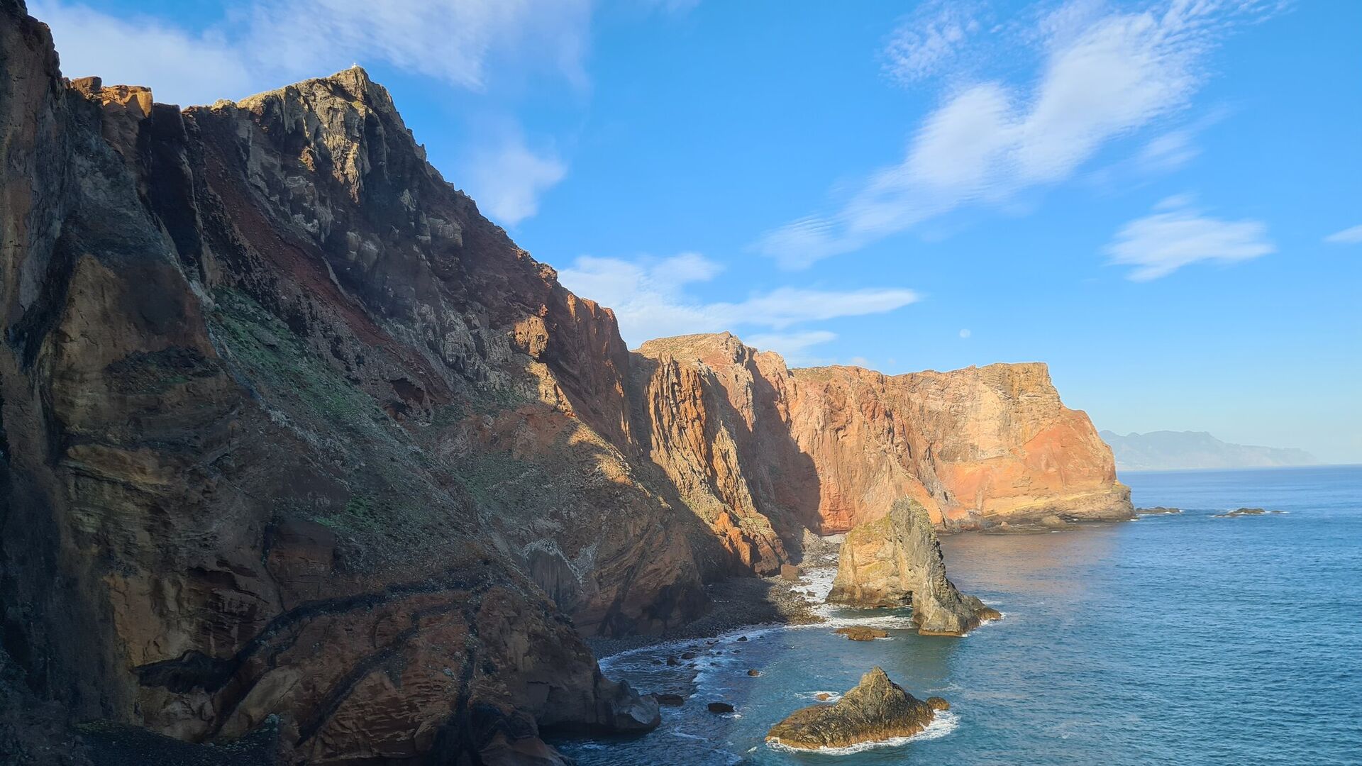
Geologically, the Ponta do Furado region is an integral part of Madeira’s volcanic framework. The coastal cliffs consist predominantly of basaltic rocks formed during successive submarine and subaerial volcanic phases. Exposed lava sequences, layered volcanic deposits, and intrusive structures such as dykes are clearly visible, reflecting former magma pathways within the volcanic edifice.
The present-day coastal morphology is primarily the result of intense marine erosion. Continuous wave action, salt spray, and hydraulic pressure contribute to both mechanical and chemical weathering of the basalt cliffs. Characteristic geomorphological features observed in the area include:
- steep, actively eroding sea cliffs
- undercut cliff bases shaped by wave abrasion
- talus deposits formed by rockfall and mass wasting
The interaction between volcanic structure and coastal erosion processes makes Ponta do Furado a representative example of landscape evolution on oceanic volcanic islands.
Landscape and Ecology
The landscape surrounding Miradouro Ponta do Furado is defined by steep relief, limited soil development, and high exposure to wind and salt. These factors restrict vegetation growth and favor specialized plant communities adapted to nutrient-poor substrates and desiccating conditions. The resulting vegetation cover is open and discontinuous, reinforcing the raw, natural appearance of the coastline.
Ecologically, the area represents a transitional zone between terrestrial and marine ecosystems. The steep cliffs provide suitable nesting and resting habitats for seabirds, while the adjacent marine environment supports diverse coastal and pelagic species. Limited accessibility and minimal infrastructure have helped preserve the ecological integrity of the region.
Scientific and Visitor Significance
Miradouro Ponta do Furado holds both scientific and scenic value. From a scientific perspective, the area offers insights into:
- volcanic island formation
- coastal erosion and geomorphological processes
- interactions between geology, climate, and ecology
For visitors, the viewpoint provides panoramic perspectives of Madeira’s northeastern coastline, the Atlantic Ocean, and the island’s dramatic volcanic relief. As such, it represents an important location for both environmental interpretation and nature-based tourism.