Stage 3 of 4
2025 USA I - 3 - Golden







Journal Notes
General
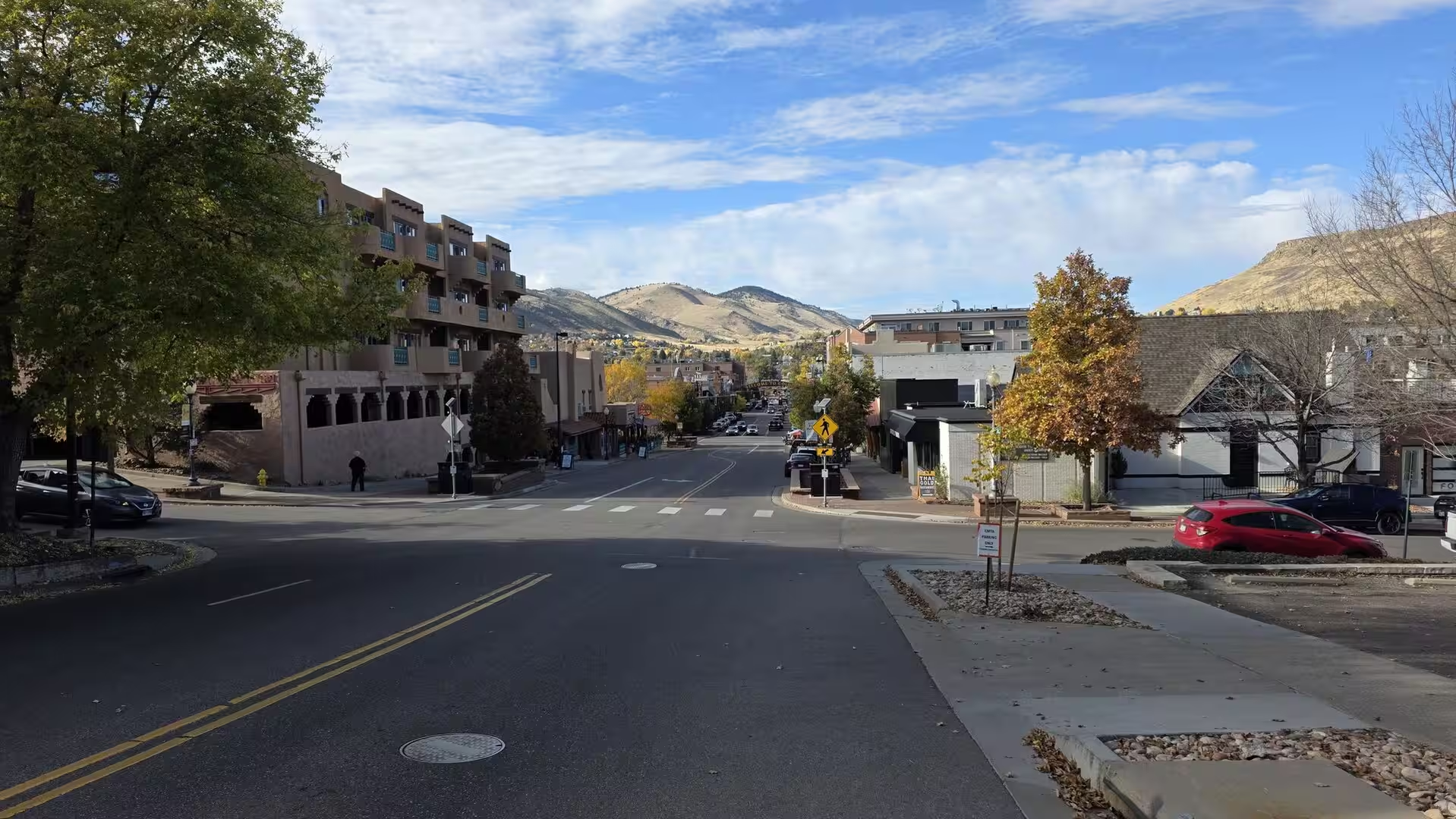
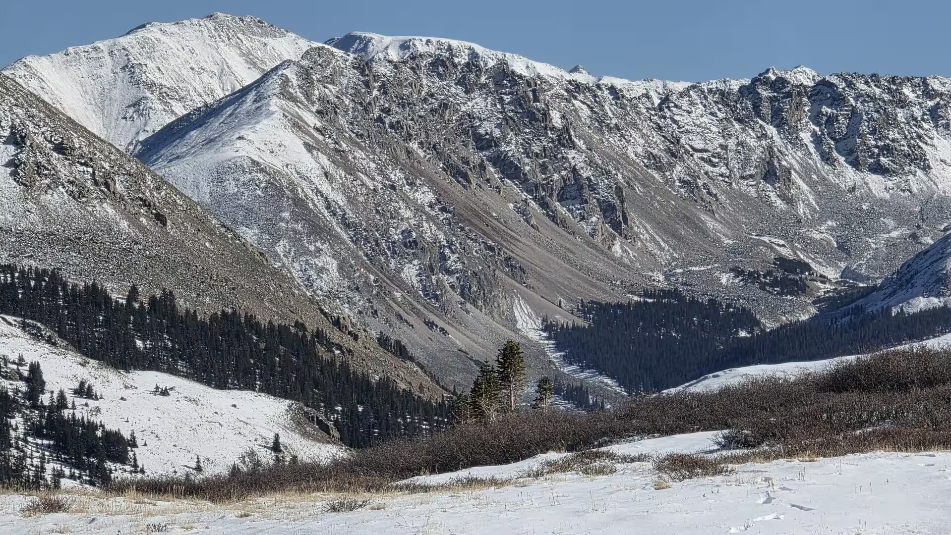
Golden is a home rule city and the county seat of Jefferson County in the US state of Colorado. It lies at the western edge of the Denver metropolitan area, at the foot of the Front Range, the easternmost chain of the Rocky Mountains, where the mountains rise from the Great Plains. Golden belongs to the Denver-Aurora-Centennial metropolitan statistical area, and its downtown is about 15 miles (24 km) west of the centre of Denver. The United States census of 2020 recorded 20,399 inhabitants.
The town occupies a sheltered valley at the point where Clear Creek leaves the mountains. The creek descends from the Continental Divide through Clear Creek Canyon, flows through the centre of Golden and leaves the foothills through the gap between North and South Table Mountain, the two flat-topped mesas that frame the valley to the north and east; to the west rises Lookout Mountain, whose summit reaches 7,377 feet (2,249 m). The municipal area covers 25.19 km2. The historic core lies on the north bank of the creek, the campus of the Colorado School of Mines and most modern districts on the slopes south of the water.
Education, research, brewing and manufacturing sustain the local economy. The Colorado School of Mines, a public research university founded in 1874, enrolled 8,247 students in the autumn of 2025 and is classified among the R1 doctoral universities; the National Earthquake Information Center of the United States Geological Survey is housed on its campus. The Coors Brewing Company has brewed in Golden since 1873, and its plant is the largest single-site brewery in the world; the ceramics firm CoorsTek descends from the same company’s porcelain works. The National Renewable Energy Laboratory, which began at Golden in 1977 as the Solar Energy Research Institute, maintains its principal campus on South Table Mountain, and Spyderco and Yeti Cycles are further local manufacturers.
Golden also serves as the cultural and service centre of the foothills west of Denver. The American Mountaineering Center, installed in 1993 in the former Golden High School, houses the American Alpine Club, the Colorado Mountain Club and Outward Bound together with the world’s largest collection of mountaineering literature. The Colorado Railroad Museum, the Golden History Museum and Park and the Mines Museum of Earth Science present the frontier and industrial past of the region. The town’s calendar includes the Buffalo Bill Days of late July, held since 1946, the Golden Fine Arts Festival of August and the Olde Golden Christmas of December.
Transport connections bind the small city to the metropolitan region. Interstate 70 crosses the southern part of the municipal area, US Highway 6 runs west into Clear Creek Canyon and State Highways 58 and 93 link Golden with Denver, Boulder and the mountain corridor. The W line of Denver’s light rail system, opened in April 2013, terminates at the Jefferson County Government Center in Golden, and local bus routes serve the town.
History
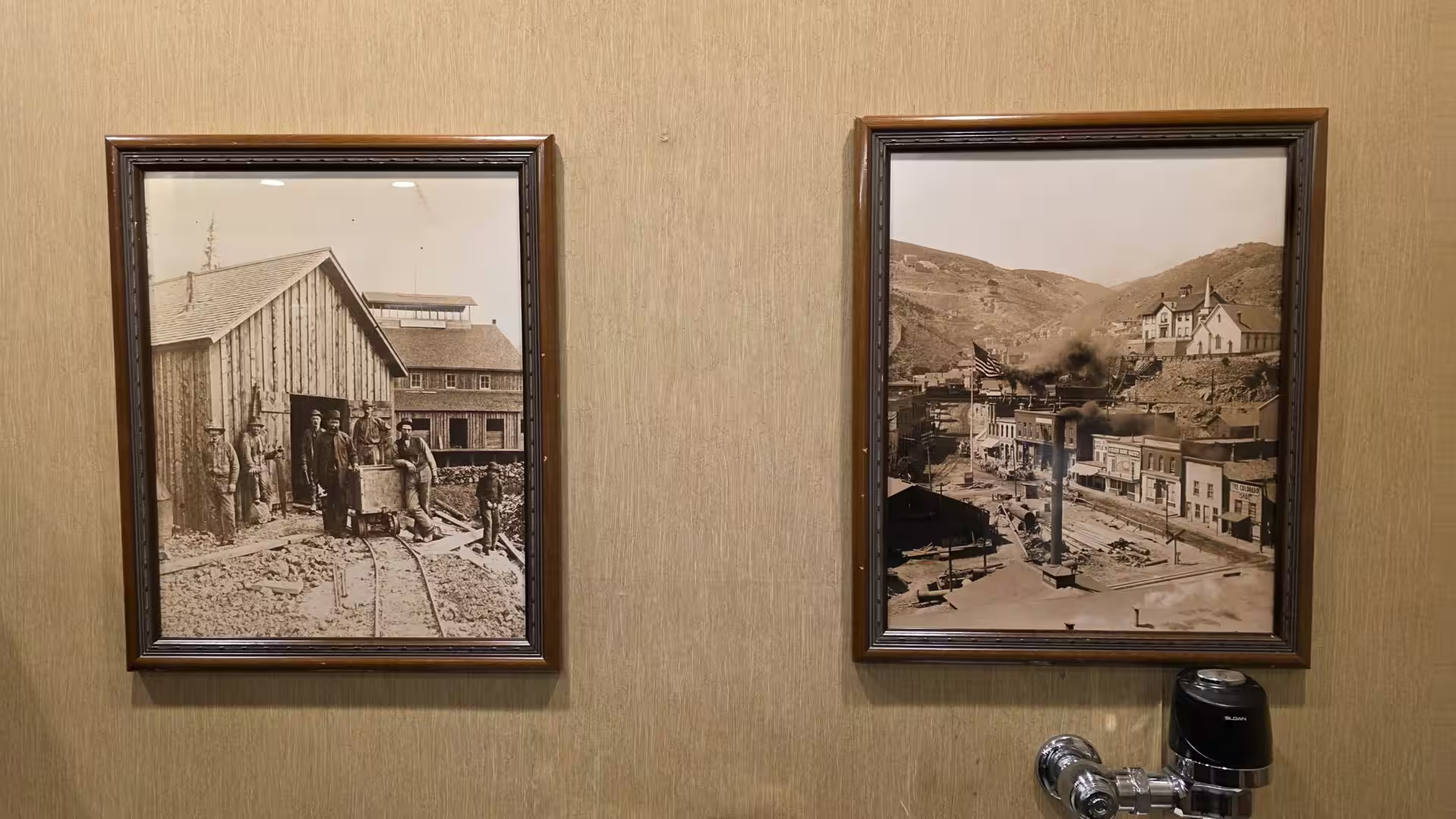
Golden was founded during the Pike’s Peak gold rush of 1858 and 1859. The mining camp of Golden City was laid out on 16 June 1859 on Clear Creek west of Denver and named for Thomas L. Golden, a miner of the Chicago Company who, with George A. Jackson, had climbed South Table Mountain in February of that year. As a supply point between the plains and the diggings the settlement grew quickly: by the end of 1860 it counted about 700 inhabitants and served as capital of the short-lived provisional Jefferson Territory.
From 2 August 1862 until August 1867 Golden was the capital of the federally recognised Colorado Territory, although the town lost population and leading citizens during the Civil War. In 1867 the seat of government moved about 12 miles (19 km) east to Denver City. The rivalry between the two towns was decided by the railroad: William A. H. Loveland of Golden chartered the Colorado and Clear Creek Railroad in February 1865, later renamed the Colorado Central, to push a line up Clear Creek Canyon to the mines and onward toward the transcontinental railroad. The Denver Pacific Railway won the race and reached Cheyenne in June 1870, but the Colorado Central built the first railroad into the Colorado mountains, bringing its narrow-gauge line up the canyon to Black Hawk in December 1872 and linking Golden with Cheyenne in 1877; its shops at Golden produced the first passenger car built in Colorado.
During the 1870s and 1880s Golden was known as the Lowell of the West, a centre of trade and industry that boasted at various times three flour mills, five smelters, brick works, clay and coal mines and the only paper mill west of the Missouri River. An opera house, seven churches and communities of German, Swiss, Swedish, Italian and Chinese immigrants gave the small town its character, and until the early twentieth century it numbered about 2,500 people. Golden survived the silver crash of 1893 and the Great Depression, was linked to Denver by two trolley lines and renewed its downtown from the 1920s onward.
Two institutions founded in the 1870s shaped the modern city. In 1873 the German immigrant Adolph Coors and his partner Jacob Schueler bought the recipe for a Pilsner-style beer and opened a brewery at the foot of the mountains; Coors became sole owner in 1880. During Prohibition the firm survived on near beer and malted milk and through its Herold porcelain works, the ancestor of CoorsTek, and after 1933 it grew into the largest single-site brewery in the world, introducing the first two-piece aluminium beer can in the United States in 1959. The Colorado School of Mines grew from the university plan of the Episcopal bishop George M. Randall, whose Jarvis Hall opened south of Golden in 1870; the school began instruction in 1873, passed to the territorial government in 1874 and became a state institution when Colorado joined the Union in 1876.
The city boomed after the Second World War. In 1959 Golden annexed large tracts to the south and nearly tripled its area overnight; new suburbs, schools and civic buildings followed, and a downtown streetscape renewal of the early 1990s restored its commercial life after the petroleum recession of the 1980s. In 1993 the former high school opened as the American Mountaineering Center. The frontier past remains present on the mountain above the town: William F. Buffalo Bill Cody, the scout and showman, died in Denver on 10 January 1917 and was buried on 3 June 1917 on Lookout Mountain, where his grave overlooks the Great Plains that had made his fortune and his fame.
Geology
Golden stands on the geological boundary between the Great Plains and the Southern Rocky Mountains, a position that exposes one of the most instructive cross-sections of the mountain front in Colorado. The city occupies the valley floor of Clear Creek, yet within a few kilometres the ground rises from the flat plains across the tilted Cretaceous sandstones of the Dakota Hogback to the Precambrian granite and gneiss of the Front Range core, which are exposed in Clear Creek Canyon immediately west of town.
The present relief is the work of the Laramide Orogeny, the mountain-building episode of roughly 70 to 40 million years ago in which rigid blocks of the continental crust were uplifted along deep faults while the sedimentary cover was merely tilted and broken. The crystalline basement, composed of granite, gneiss and schist more than a billion years old, rose to form the range, and renewed uplift about ten million years ago together with the Pleistocene glaciations, which ended some 16,000 years ago, let Clear Creek and its tributaries exhume the hard core of the mountains.
Before the Laramide uplift, shallow seas and coastal plains had covered the region through much of the Mesozoic. The resistant sandstones of the Dakota Formation were laid down about 100 million years ago as the Cretaceous Western Interior Seaway opened, and after the tilting of the mountain front they came to form the Dakota Hogback, the long north-south ridge that marks the first line of foothills and is breached near Golden by Clear Creek and by Interstate 70. Beneath the Dakota lie the Late Jurassic beds of the Morrison Formation, famous for dinosaur remains, while the Denver Formation of the latest Cretaceous and earliest Paleocene has yielded fossils of Tyrannosaurus and Triceratops; an outcrop of the Cretaceous-Paleogene boundary, the extinction horizon of 66 million years ago, is preserved on the slopes of South Table Mountain.
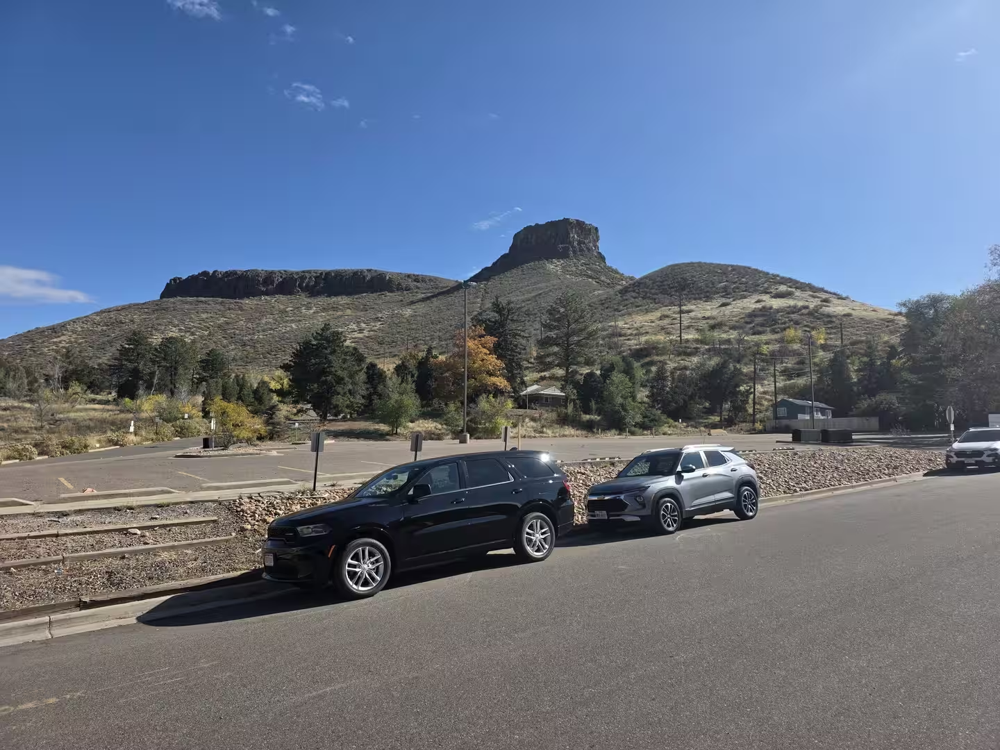
Shortly after that extinction, volcanism reached the Golden area. Radiometric dating places the lava flows that cap the two Table Mountains between about 64 and 62 million years ago; the resistant, columnar-jointed rock, generally described as basaltic but classified as latite or shoshonite, now forms the flat summits of North and South Table Mountain. Castle Rock, the 6,338-foot (1,932 m) summit of South Table Mountain, projects from the north-west end of the mesa, and the Ralston Dike, an intrusive monzonite body about four miles to the northwest, probably marks the vent of the flows. Gas cavities in the lava are lined with zeolite minerals such as analcime and thomsonite.
Clear Creek shaped the valley that the town occupies. The stream rises near the Continental Divide west of the Front Range crest and runs 66 miles (106 km) to join the South Platte; in its lower course it has cut the steep-walled Clear Creek Canyon into the crystalline rocks and, at Golden, passes between the two Table Mountains before spreading across the plains. The alluvial gravels and clays of this foothills belt supplied Golden’s brickworks and, through the porcelain industry, its ceramics trade, and the mineralised mountain districts to the west, opened up during the gold rush of 1859, gave the region the mining history that led to the founding of the School of Mines.
Things to See
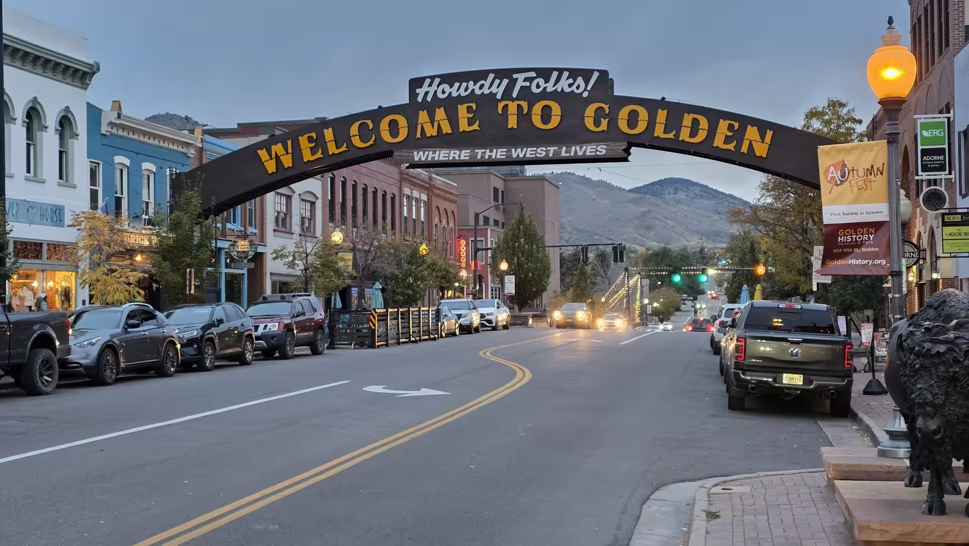
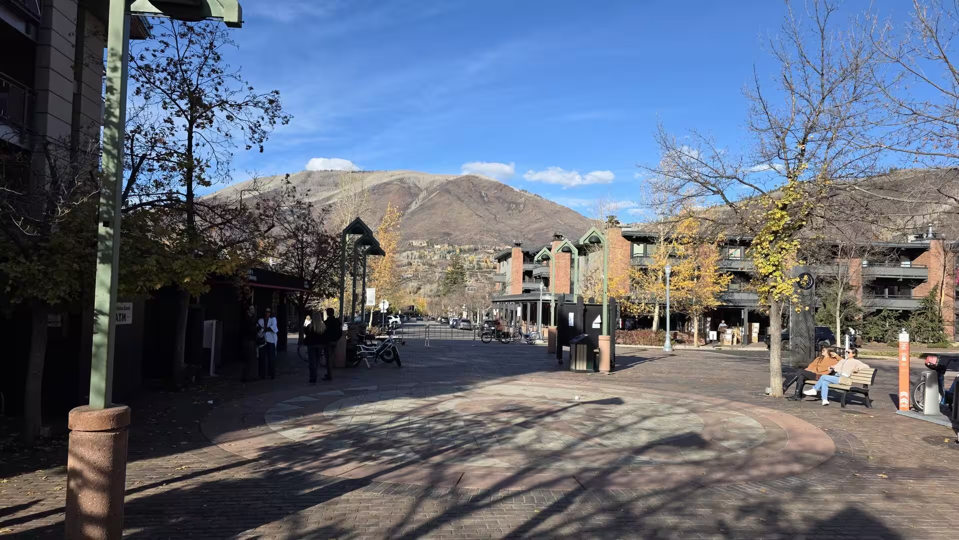
Golden’s historic downtown is a compact grid of brick and stone buildings laid out along Clear Creek. Washington Avenue, the main thoroughfare, is spanned at its entrance by the arch whose greeting Welcome to Golden has become the town’s best-known landmark, and the surrounding blocks hold shops, cafes, restaurants and microbreweries in nineteenth-century storefronts. The Astor House, a stone hotel built in 1867, now houses the Foothills Art Center, while the Buffalo Rose, in business for more than 150 years, is the longest-surviving gold rush-era business in Colorado and still presents live music.
A few blocks south of downtown, the campus of the Colorado School of Mines climbs the hill that overlooks the city. Founded in 1874 as a school of mining and geology, it remains a leading engineering university. The free Mines Museum of Earth Science displays mineral specimens from the Colorado mining districts and from around the world, including zeolites from the Table Mountains and a lunar rock sample brought back by Apollo 17.
The Coors brewery, founded in 1873, occupies a large complex along Clear Creek at the western edge of the centre and is the largest single-site brewery in the world. Its visitor centre offers guided tours through the brewhouse and the packaging lines, and the tour ends with a tasting of the beer. The neighbouring Rocky Mountain Metal Container plant produces the aluminium cans for the brand.
Clear Creek runs through the middle of the city and gives Golden its outdoor character. Creekside parks and walking and cycling paths line both banks between the downtown and the mouth of the canyon, and the whitewater park in the centre of town, whose kayak and canoe course is nationally known, is busy with paddlers in spring and summer.
On the north bank of the creek, the Clear Creek History Park, now officially the Golden History Park, is an open-air museum of pioneer life. The park preserves original buildings of the Pearce Ranch from Golden Gate Canyon, dismantled and moved log by log between 1994 and 1998, together with the one-room Guy Hill schoolhouse of 1876, which came to Golden in 1976; a working blacksmith shop, gardens and a chicken coop complete the homestead scene. Admission is free, as at the nearby Golden History Museum on Tenth Street.
Lookout Mountain rises directly west of Golden and is reached by the Lariat Loop road, opened in 1913, which climbs the steep eastern flank to a summit park with sweeping views over Denver and the plains. Near the top stands the enclosed grave beneath which William F. Cody, Buffalo Bill, was buried in June 1917; beside it, the Buffalo Bill Museum and Grave, opened in the spring of 1921 by Cody’s foster son Johnny Baker and now operated by the City and County of Denver, displays posters, costumes, saddles and firearms of the Wild West show. The Boettcher Mansion of 1917 and the Lookout Mountain Nature Center and Preserve lie on the same mountain road.
The Table Mountains, the flat-topped mesas north and east of town, are the most distinctive landforms of the Golden valley. South Table Mountain is largely preserved as Jefferson County Open Space, and its trails cross the lava-capped summit to Castle Rock, the 6,338-foot butte at the north-west end from which the whole metropolitan area opens to view; North Table Mountain offers similar country beyond the creek. The mesas are also of geological interest, for their Paleocene lava flows and their zeolite minerals are visible along the paths.
Red Rocks Amphitheatre lies a short drive to the south-west, in the hills above the town of Morrison. The natural bowl between the towering monoliths of Ship Rock and Creation Rock, built of the red sandstones and conglomerates of the Pennsylvanian Fountain Formation, seats about 9,525 spectators and is famous for its acoustics; the open-air theatre was constructed by the Civilian Conservation Corps between 1936 and 1941 to the design of the Denver architect Burnham F. Hoyt and dedicated on 15 June 1941. Its season opens each year with the Easter sunrise service.
References
- Baum, D. (2000). Citizen Coors: A Grand Family Saga of Business, Politics, and Beer. New York: HarperCollins.
- Fishman, N. S., et al. (2005). Principal Areas of Oil, Natural Gas, and Coal Production in the Northern Part of the Front Range, Colorado. Geologic Investigations Series I-2750-B. Reston, Virginia: US Geological Survey.
- Golden History Museums (2026). Golden History Park. www.goldenhistory.org/visit/history-park/
- Buffalo Bill Museum and Grave (2026). Museum History. buffalobill.org/about-us/our-history/
- Visit Golden (2026). Golden Chamber of Commerce and City of Golden. www.visitgolden.com/
- Colorado School of Mines (2026). About Mines. www.mines.edu/
- Wikipedia contributors (2026). Golden, Colorado. en.wikipedia.org/wiki/Golden,_Colorado
- Wikipedia contributors (2026). Colorado School of Mines. en.wikipedia.org/wiki/Colorado_School_of_Mines
- Wikipedia contributors (2026). Coors Brewing Company. en.wikipedia.org/wiki/Coors_Brewing_Company
- Wikipedia contributors (2026). Colorado Central Railroad. en.wikipedia.org/wiki/Colorado_Central_Railroad
- Wikipedia contributors (2026). Clear Creek (Colorado). en.wikipedia.org/wiki/Clear_Creek_(Colorado)
- Wikipedia contributors (2026). Lookout Mountain (Colorado). en.wikipedia.org/wiki/Lookout_Mountain_(Colorado)
- Wikipedia contributors (2026). South Table Mountain (Colorado). en.wikipedia.org/wiki/South_Table_Mountain_(Colorado)
- Wikipedia contributors (2026). Red Rocks Amphitheatre. en.wikipedia.org/wiki/Red_Rocks_Amphitheatre
- Wikipedia contributors (2026). Front Range. en.wikipedia.org/wiki/Front_Range
- Wikipedia contributors (2026). Dakota Hogback. en.wikipedia.org/wiki/Dakota_Hogback